This turned out to be the longest and hardest walk I have done in years. I was expecting it to be 10 miles and about 1600ft of ascent but in reality both were exceeded.
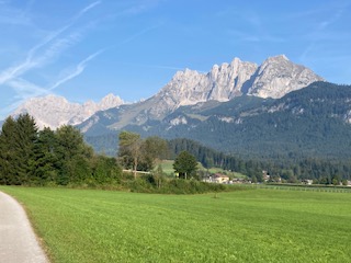
I started out at 8.30am with the intention of finishing the walk between 2-3pm and then taking the Gondola up one or other mountain. It was a warm day and the sun glistened on the river as I walked beside it up to Rettenbach. This lies in a plateau and the surrounding mountains stick out as a fine backdrop every way you turn. The only thing to spoil it at all was the sound of the traffic on the main road.


I reached Rettenbach easily and started looking for the footpaths that would lead uphill. In so doing, I passed a woodturner’s premises with the aptly named business title of Holtzwurm. Outside his premises he displayed some of his wares and fine specimens they were too as you can see in the photo below. Just past his domain was the first waysign to the Schleier Falls and I followed this path a short distance until it turned into a different sign saying Wanderweg, which usually means a contouring path circling an area. Look as I might for the path I wanted and I thought I had found it until this petered out. I made the classic error of not turning back immediately and got myself into real hot water when there was no clear path forward or back, just loads of vegetation and trees. Oops! I managed not to panic, and decided that if I keep the ravine to my right and the sun just to my left, I should ultimately return approximately to where I had started. These navigation skills supported me well, along with some odd black and white posts that I thought must lead somewhere, and after about 40 mins of traipsing aimlessly in the forest I found the original track, and just kept going, even if I was reasonably sure it was not the path I had originally wanted. Phew! I could breathe again.


I eventually I came to a path that did suggest it was going in the right direction and I followed this very successfully, passing lumberjacks clearing some of the forest and an old man resting on a log.
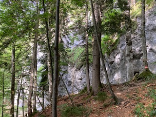
There are many twists and turns and false tracks to avoid on this walk. I did have a landscape map of the footpaths in the area but it wasn’t accurate. Some paths are unmarked on the ground, other paths are named but do not appear on the map, so whether you find your route successfully is rather hit and miss for the tourist. It is all heavily wooded, with no views as you make your way uphill. That is not to say it is unattractive, but it is unrelenting. There are also sections with steep drops and narrow paths, so not for the faint hearted.

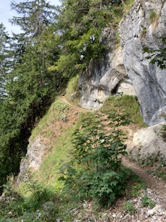
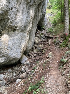
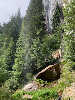
By luck rather than judgement I seemed to find myself on the track I had intended, but what I didn’t know was where it would lead. There is an area called Debils Ofen, which I assume means Devil’s Oven, which is a series of caverns at the base of a massive rockface. The footpath actually passes through these, so I imagine when deluges come in winter this route will be entirely cut off. There were tree trunks and branches strewn along its course, evidence of previous activity.


Beyond this, the path makes its way annoying downhill, when you know that you have to go uphill, and sure enough just when you can hear the rush of water indicating you are getting near the falls, the path diverts uphill. There is a small summit and you can feel open space beyond, and I could hear voices chattering and laughing, so my sense of excitement grew. Be careful though not to get too excited as the path down to the base of the falls is rocky, with some large, and some small stones. Once your eyes adjust you can see the water cascading over the overhanging edge, looking rather like a shower curtain. There are other smaller falls, which no doubt become raging bulls in winter. I stopped temporarily under once such fall and washed my fevered brow. It was another very hot day, and for once I had felt the effects of the high altitude, so I took care to take my time, monitor my breathing and get back on an even keel before continuing.


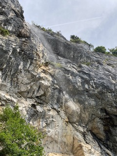
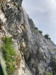
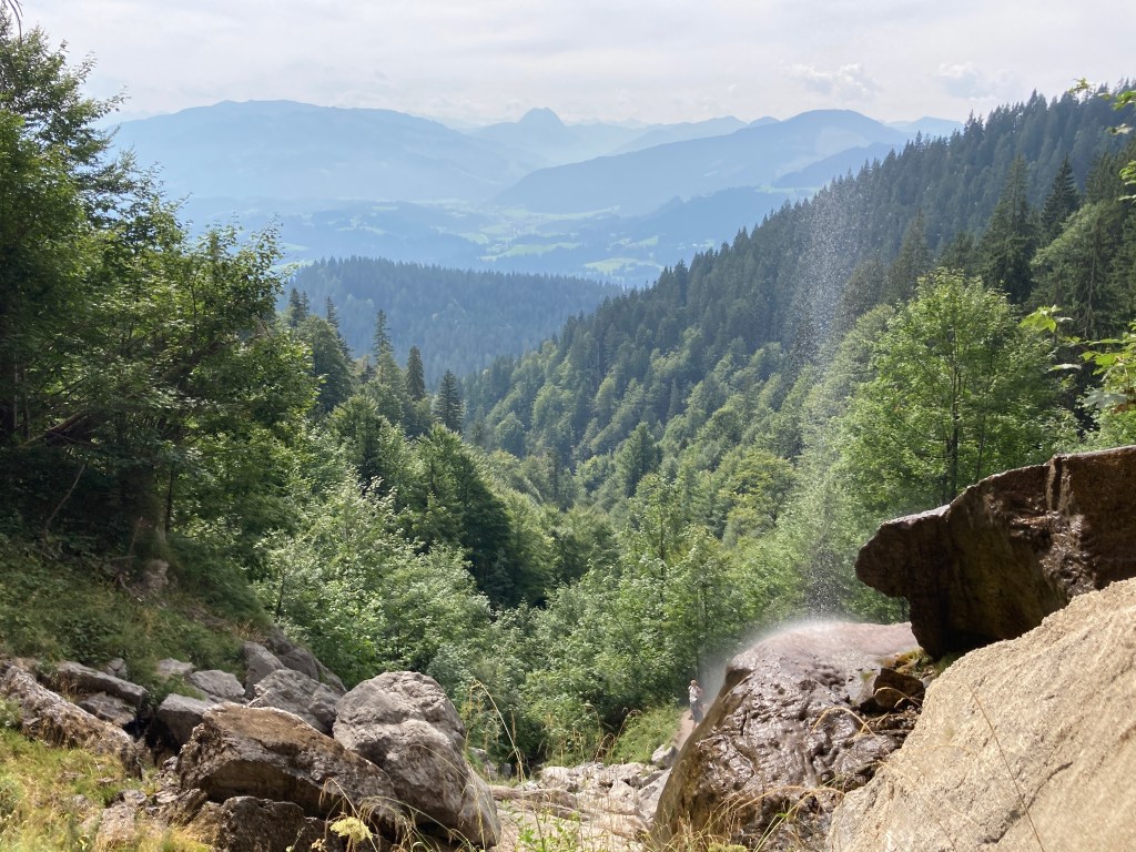
It is much more interesting than it appears here in the photos and it is a very restful place.
The path down is a great deal easier than the path up, mostly on a fairly wide track. At the start, it is clear that my way down was most people’s way up as the stones were shiny and it would be easy to slip. Again, there are few views on the way down. The never ending tree lines are relieved in places by the children’s activity areas, which have been very cleverly designed.

Once back on level ground I decided to take the easiest road route back to St Johann. Having already done 11 miles, I didn’t want any false turns now and wanted to get back.
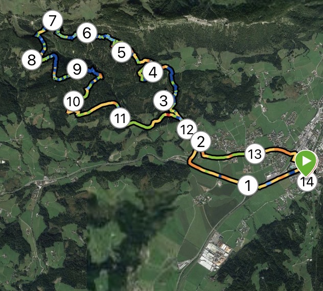
My Garmin watch recorded my route, which bears no resemblance at all to the paths on the tourist map I was given. I would recommend buying the Austrian equivalent of one of our OS maps or visiting the tourist information to get an up to date map and guide for any walk you intend to do. And make allowances for the high altitude, as it is relentlessly uphill for 7 miles.
Distance: 14 miles; Ascent 1988 ft; Descent 1949ft; Minimum Elevation 2224 ft; Maximum Elevation 3817 ft.

You are intrepid!
LikeLike
That’s one word for it. Another is ‘bonkers’!
LikeLiked by 1 person
Phew!! That sounds pretty strenuous! Worth the effort for the stunning scenic vistas though, but I’m sure you were glad to return to base. You must be exhausted! It’s nice to hear of your adventures, but I fear that one sounds beyond my capabilities. Enjoy the rest of your time there. Barbara
Sent from Yahoo Mail on Android
LikeLike
Don’t worry. I’ve no plans to subject you to my mad walks abroad. It is fun, though, doing new things and seeing new sights. I was tired by the end but I bounced back very quickly after a beer and a short rest. No walking today which is good as we had a wonderful thunder and lightning storm in the night and it appears we’ve seen the best of the weather. Going on a boat ride at Zell am See today.
LikeLike
I have just read Day 1, 2 and 3 and love them all but 3 looks like a punishment; that said you tackled lit like a pro and your detailed report means I dont have to trace your steps – thanks Gill
LikeLike
<
div dir=”ltr”>Yes, I don’t think I would get many takers if I offered this as a walk. It could be made simpler by getting a bus, taxi or parking
LikeLike