La Palma, Canaries – January 2020: Day 2 – Cube de la Galga Ravine and Coastal Walk to San Andres

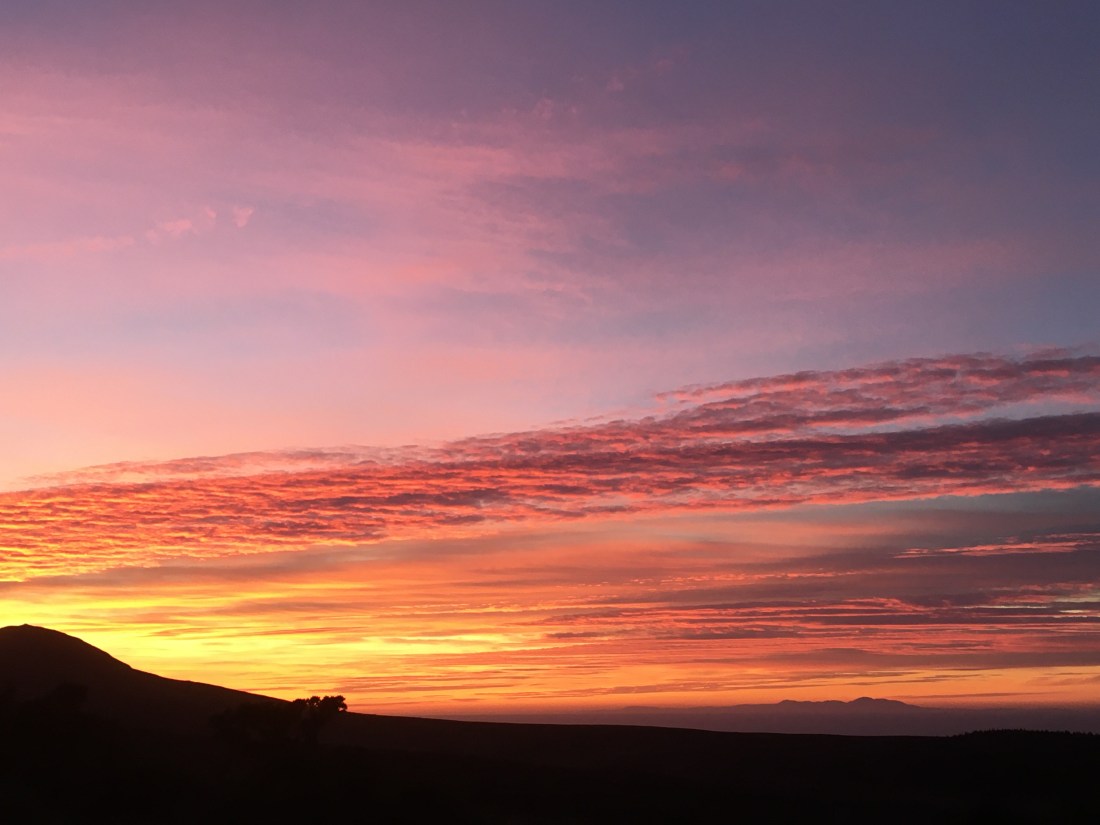
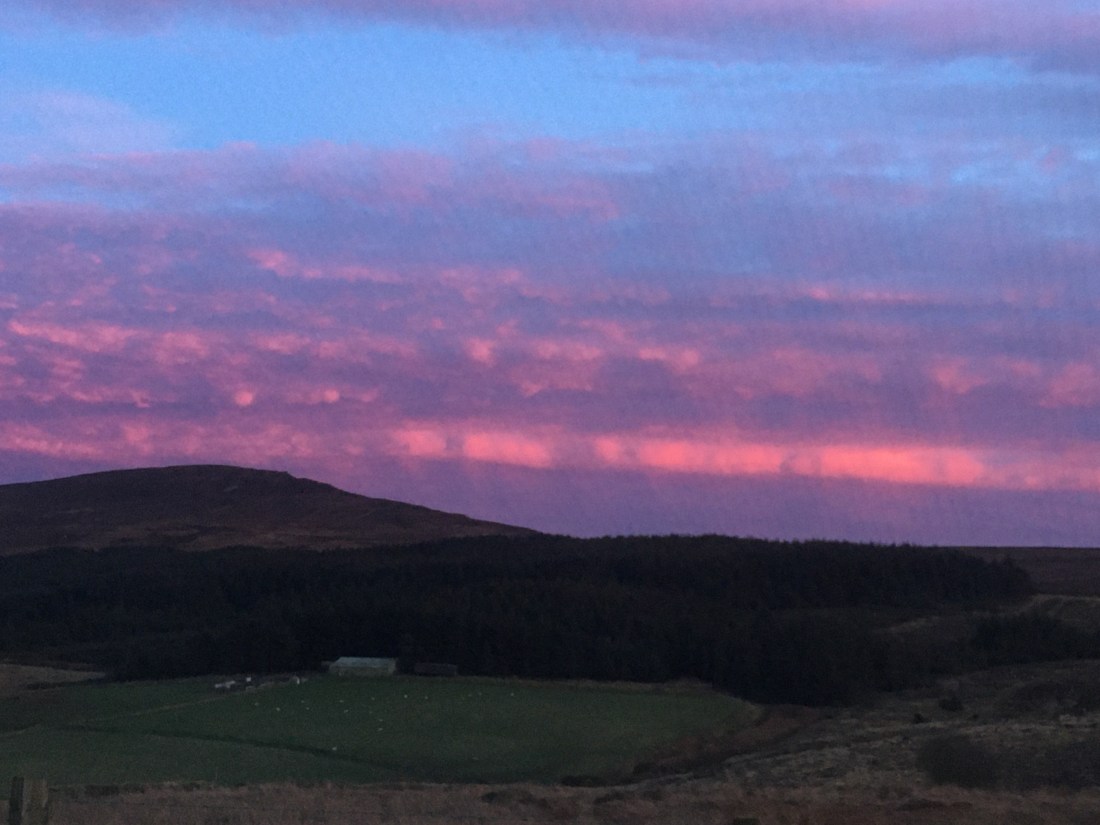
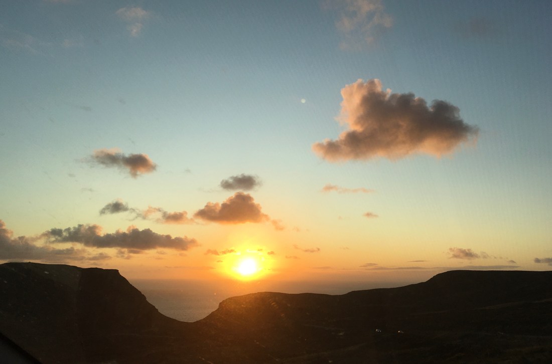
The title makes it sound as if this is an easy walk, but this was the hardest walk of the week. It started with quite a long coach journey before being dropped off in the middle of nowhere in the Parque Naturel de Las Nieves. This time I opted for the ‘harder’ walk and it certainly was harder than yesterday. After a brief level start we then climbed steeply up a rocky path for 400 metres through a most attractive laurel forest. I have been having trouble with a persistent but low-key cough for weeks and the steepness and difficulty of the climb made breathing difficult, especially as some of the walkers insisted on a fast pace, which basically I ignored. I never see the point of walking at speed on a holiday, where the idea is to see the views and imbibe the magic of the region. As yesterday, but for different reasons, the path was often slippery and a tumble was only the next footstep away if care was not taken.


The laurel forest only exists between 500m and 1200m, so that shows the height we started at! It doesn’t lend itself to wonderful photographs except for the specialist, but the sun played around between the trees and there was a cooling draft that was very acceptable. Beneath the laurels are lower ground hugging plants such as tree heathers so the whole forest is a very pleasant mix of greens and where the sun can really break through wild flowers grow near the paths. The forest only exists because of the trade winds, which allow a cloud forest to develop bathing the forest in moist air. We reached the Mirador de Somada Alta,at 790 metres. which is just a viewpoint and a resting stage, then we continued more of less contouring before turnwards eastwards and returning to our starting point. I cannot emphasize enough the beauty of walking through these remote woodlands and they make a fine contrast to the banana plantations below and the bare volcanic rocks above.

From here we followed well made paths down to La Galga, where a platter had been prepared for the walkers in a local restaurant. There is a wonderful viewpoint of the Barranco de la Galaga here at the Mirador de la Galga, tucked behind the local church, and an equally impressive view in the opposite direction down to the sea.

You can see how rugged and tricky the descent and ascent might be into the first ravine. We then followed a local path on the side of a hill which had been terraced for growing crops, such as wines, bananas, avocados, oranges and lemons. The lower terrains are covered with smallholdings.

Terracing
Juicy orange trees
Banana plantations

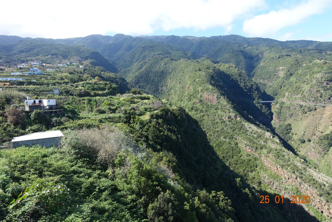
Reaching the coastpath GR-130, the path undulated and made various twists and turns before we encountered our first major Barranco, which are steep-sided ravines, sculpted by water – hard to believe considering the tiny amount of water that falls in La Palma. They would originally have been faults in the lava flows which are then corroded by water.

The first ravine near Los Galguitos (though the village was not visible from the path) was the steeper of the two, with a narrow rocky path to negotiate in  both directions, before we were able to continue contouring all the way to next ravine near Llano de Pino, which looked as if it would be daunting as at this point we reached sea level. But the ascent was much easier with intermittent level sections and with a few rest stops we soon reached our destination of San Andrés. This is a very attractive village with a beautiful central area around its imposing church, and lots of bars.


This was a varied and interesting walk, so different from the day before and different from anything else we would do. It was very exhilerating if demanding and we enjoyed a very welcome drink in the bar before getting the coach home

Distance: 8 miles (13 km); Total ascent 1700 ft (510m); Total ascent: Approximately 3,000 ft.

La Palma, Canaries – January 2020: Walking Day 1 – The Southern Volcanoes

La Palma is a walkers’ and geologists’ paradise. For my first visit to the Canary Islands I didn’t know exactly what to expect. I knew it contained volcanoes and it was billed in the HF brochure as being very green, but in reality this small island – almost the same size of the Isle of Man, is very dramatic, with old and new volcanoes littering and influencing every tiny part of it and hints of all types of natural change occurring over geological time.

Day 1 walks are generally designed to ease walkers into an unknown terrain and to get the feel of what they are capable of achieving. The other walkers all opted for the ‘harder’ route which involved a small amount of ascent contouring around the side of hills with coastal views and a descent into Los Canarios. I opted for the ‘easier’ route, which meant I would have time to explore the small town, but more importantly I would have time to have a good look at the volcano visitor centre and take a walk along the crater rim. From there, both groups would walk through the extensive lava fields and past the latest volcano to erupt down to the sea.

dsc02321.jpg

The view of the volcanic ridge to the north of Los Canarios, adjoining the Cumbre Vieja ridge. Below the small town to Los Canarios viewed from the San Antonio crater.

If anything, although there are other competing highlights, this was my favourite day. I walked along the San Antonio crater rim following the tourist route, but I was also able to explore the other side of the crater and have it entirely to myself. The light was better on this side and there was a greater sense of isolation and wonder at the achievement of the natural world. This volcano erupted in 1677 and therefore few plants and trees have had a chance to colonise the interior. The circumference of the crater is about 1 km, the depth 100 metres, and it’s height is 663 metres (2175 ft), so about the height of Snaefell.

The island is host to tens of volcanoes old and young, maybe more, and according to the Express in Jan 2019 it is already overdue another major volcanic eruption on a massive scale! It also hosts a myriad of astronomical telescopes on the ridges of many of the volcanoes and there is a miniature one at the visitor centre pointing to the Polaris star, which rather amused me.

Once we were all together again it was an continuous walk steeply downhill for over 2000 ft. In some places, the lava fields were tiny grains of pica, in other areas soft ash or small loose rocks and in others we were stepping over cobbles or bigger stones. We passed the Teneguía volcano which was more rugged than the San Antonio volcano with many more boulders; little natural vegetation has had a chance to grow yet, since this volcano only erupted as recently as 1971, following a previous eruption in 1949.

To the west we were able to see how the locals are making use of the new land created by these magnificent lava flows. Although the soil is very thin its temperate climate lends itself to growing grapes and wine is becoming relatively big business. The vineyards are evident all around the south, which also happens to have the sunniest and warmest weather of the island. There are several places where you can sample their wine, even in Los Canarios.


dsc02337
I sat here, alone with my thoughts, relishing the peace and quiet around me.

The descent from San Antonio was very steep and rocky in places, and always interesting. The next photo shows we have descended a few hundred feet and shows the San Antonio volcano standing imperiously in its environment.

We had stopped to look at some hieroglyphs on the rocks at the suitably named Roque Teneguía. This is an outcrop of rock containing phonolite which is pale and contrasts with the surrounding grey basalt gravel (called lapilli).The meaning of the symbols is unclear, and is thought to be ancient artwork; similar patterns are found on the rocks in other places too, so most likely some form of communication. They are usually positioned near a water source. Some say they resemble Celtic hieroglyphs, other says they resemble water or fertility, but in truth, no-one knows. We do know that they are at least 500 years old, so were there long before the volcanoes in this region.

Ancient Rock Art

From here the terrain changes as we walk along the eastern side of the Teneguía volcano. Large lumps of rock and awkward looking shapes were abundant and the descent here was arduous in places. The paths look deceptively easy, and they have been thoughtfully designed and maintained, but often the rocks are very loose and it was easy to lose one’s footing any day of the week.


Compare this with the lunar landscape on the eastern side as we descend further towards at Fuencaliente in the coast, which of course is all  new land.

You can just see the salt pans in the photograph above. It is possible to walk around them, or visit the lighthouse, or have a beer in the cafe. For those who don’t want to walk you can get a bus from Los Canarios and save your knees! Not that I had a problem with knees; my problem was toes, but I will tell you all about that another time.

None of the other walks we did have such a sense of spaciousness. Every walk was beautiful in its own way, but maybe because I am an islander myself and spend a lot of time looking up at the sky and out across the sea, this day will remain in my memory for ever. And of course, we finished at the sea.

Distance – my full day was about 8 miles, much of which was messing about around the volcano; ascent: 600ft; descent 2400ft

To follow: Day 2 was a testing walk in the hills north of Santa Cruz, with a lot of steep ascent and descent with lovely wooded valleys and steep ravines to cross, but well worth the effort. A memorable day.

After the rain, the sun 19/01/20

What is more uplifting than watching the sun set on hills and coast? I was travelling back from Peel, a journey that usually only takes 25 minutes, but I was so mesmerised by the colours and shapes on the skyline it took me over an hour to get home. Here are some of the photos taken with my mobile, often from the car. The hills across the water are the Mountains of Mourne in Ireland, the distant cliffs and hills are from Niarbyl to the Sound, Cronk Ny Arrey Laa, and the pinker sky on other photos is mostly over South Barrule.


A Shapely Walk Around Douglas and Summerhill Glen- 4 miles

img_7881

The natural entrance to Summerhill Glen

Douglas is a surprisingly attractive town to walk around as long as you turn a blind eye to the less appealing aspects of its make-up and areas that look lost and forlorn or where some car park or development has emerged from nowhere and taken away all the character of the area. The Isle of Man does itself no favours by not caring enough about its heritage and there are too many derelict buildings or hideous erections that should never have seen the light of day, not even in an architect’s mind let alone in practice. It is too quick to destroy what history it has, as in the pending doom of the lone 18th century cottage which is being demolished to make way for a new ”by-pass” in Ballasalla, only approved by short-sighted politicians because Dandara promised to fund it as long as they could build xxx number of houses at the same time. But I digress…

You might say Douglas is much like any town. But look up, out, about and around the many old buildings  of the later 19th and early 20th centuries and you will see interesting shapes and objects that will surprise you. Roadnames with fingers pointing you in the right direction, canopies over shops that look as if they belong in Tunbridge Wells Pantiles area, attractive iron railings separating the Edwardian properties, squares of parkland and a crescent of housing reminiscent of Bath (though not as grand). Lots and lots of substantial Edwardian properties built to last, reminding us of the Isle of Man’s heyday when B &B’s sprung up in abundance to cater for the wild tourism that would swarm in on the ferry in the summer months.

I had been to the dentist on Woodburn Square and instead of walking back to the bus stop I went in the opposite direction, down roads I have never walked before, around the back of Nobles Park to the top of Summerhill Glen. The house styles are very varied and many are attractive with double fronts or bay windows, a row of chocolate box houses, one with a monkey puzzle tree in the front garden and sometimes very unusual houses. There were two houses side by side with windows in the upper elevations that looked as if they belonged in the 16th century as their small windows protruded out above the main house. There are many established trees in this area and it feels quite luxurious in places. There must have been a large country seat where Laureston Manor remains, now afflicted by the ever terminal illness of living apartments, but it still has its grounds and other houses have been built around the edge of its land, so the pathwork of land still retains its rich flavour.

I reached an area where most of the roads bear the name Victoria or similar, signs of anticipated grandeur and nobility – Victoria Road, Victoria Crescent, Victoria Avenue, Dukes Road, Upper Duke’s Road, Palace Road, Castle Hill – you get my drift, and here the roads are at the top of the wonderful cliff that skirts the whole of Douglas Bay and from where if you could only see through the trees there must be a wonderful view of the Bay. There are several very large buildings around here, many now converted for business use, again indicating that Douglas has at times been very wealthy.

All this was unexpected. This was not a planned trip but an idle walk through Douglas to get some fresh air with the idea of walking in daylight down Summerhill Glen. My first visit to this Glen was just two week’s ago when my son Matthew stayed with me for Christmas and we went to enjoy the illuminations which we did thoroughly enjoy in spite of the rain.

img_7885

Reaching the top of the Glen I followed the path down to discover a second more interesting path that enters the glen from the other side of the stream. I know most people are very happy with the modernisation of the paths in the glens but for me wide tarmac paths lose all the natural feel and magic of walking down a forested glen, so I was very happy to wander along the section that had not been tarmacked and watch the water meandering its way across the flat and boggy terrain, creating new rivulets here and there as it jumped over minor hazards on their way to join the main stream.

img_7883

The glen itself is very natural at the top and I found several interesting shapes in the stream and in the vegetation that sparked my interest. The stream is pretty with minor waterfalls along its ever downward and slightly winding trajectory. In the centre there is a flat area with wooden seats neatly positioned to enjoy the display the children (and adults) have created. It is not possible to follow the stream all the way to the sea as it goes underground whilst still quite elevated, but when I reached the shore to see where it finally entered the sea, I could hear a rush of water where it comes out behind the houses on Strathallan Crescent.

img_7899

img_7901

The tide was out so I walked out into the bay and again I looked up at the lovely aforementioned cliffs and noticed houses half way up holding tightly on to the side of the cliffs, a pink house I had never noticed before with a curtain of trees behind it. Looking in the other direction out to sea, I walked out as far as the sand would allow me and came across boulders and seaweed that were as tall as me. I walked the mile or so back into town, and if you wished you could make a full circle of this walk.

img_7906


img_7907

img_7905-1

img_7908

So, if you come to Douglas, take a bit of time to venture into those parts you don’t usually go and I’m sure you will find hidden treasures.

Below:  A slideshow of some shapes in Summerhill Glen

This slideshow requires JavaScript.

I regret to say I did not take photos of the interesting properties I saw, but I will retrace those steps another time when I am armed with my camera and not just my mobile phone.

img_7913

Port Soderick to Douglas along Marine Drive – 2nd November 2019

DSC02192This week saw the last of the steam train journeys until next spring, so what better way to go into Douglas than to hop aboard at Port Erin and disembark at Port Soderick to walk the 5 miles into Douglas.

DSC02177Here is the Kissack, no 13, waiting to leave Port Sorderick.  As I walked down the lane I encountered a convivial lady sportingly cleaning up the road for vehicles as all the drains were blocked by the autumn leaves and the excessive rainfall of recent days, leaving great puddles. That’s what I call neighbourliness.

I walked through the glen which was a little on the muddy side. I never known the Crogga stream to be so loud as it made its way downhill and then softened as it gained the lower reaches, just every now and again bubbling over the rocks.

Reaching Port Soderick Bay, I never cease to amazed how this area was once a bustling pleasure beach, with all kinds of attractions and businesses – outdoor games, a camera obscura, Thomas the ‘novelty card’ printer, roundabouts and such time as well as  the now defunct and removed Falcon Cliff lift that enable to tourists to have a leisurely (if ugly) route to the top of marine drive, where they could get the horse tram all the way to Douglas. It seems like another world. I do remember the hotel which was always good for a coffee but that has also long since gone. They are always talks of renovating this area. If so, maybe they could reintroduce the story of the Enchanted Isle off Port Soderick, which was sunk beneath the seas by the magician Finn McCool along with its inhabitants which were turned to granite pillars; the island rises out of the sea every seven years for just 30 minutes, when the inhabitants will be restored to life if they can place a Bible on the island in that time.

I followed the muddy path alongside the road to the top of the hill where I took the cover photo. These hills are steeper and higher than they look here at about 300 ft high. They are mostly the typical Manx group of rocks comprising mudstone, siltstones and sandstones of the Lonan formation. They form the standard thin and craggy beds of slate that were distorted by the uplift of mountain formation in the Silurian and Devonian period, and in places these are very dramatic. At Keristal, close to Port Soderick,  and towards Douglas you will find large slabs of paler sandstone giving a softer landscape.

In places the rocks are quite architechtural, as here, close to Douglas Head gate house.

DSC02216

Marine Drive was constructed and the tramway opened in 1896 and was not the wide roadway as it appears today. In places an overhanging iron roadway was made to get around some of the tricky rocks and this section was suitably named ‘Horses Leap’. However, it was all dismantled between 1947 and 1949 partly due to rock falls. It was converted into a roadway in 1956 and over time it became a walkers’ paradise and the central section closed to vehicles. It is easy to see why when you walk the route.

DSC02198

DSC02218

Having had only coastal views and wonderful skies, including an enticing rainbow as I reached the Whing (the steepest and most contorted of the rocks), it is all over too soon and soon the path starts sloping making its descent into Douglas. Looking at the clouds over the mountains I had time my walk just right.

DSC02221

A very pleasant walk of 5 miles and about 733 ft of ascent, but it is very easy after the intial ascent and just little ups and downs along the way.

unnamed

Loweswater – 12th October 2019

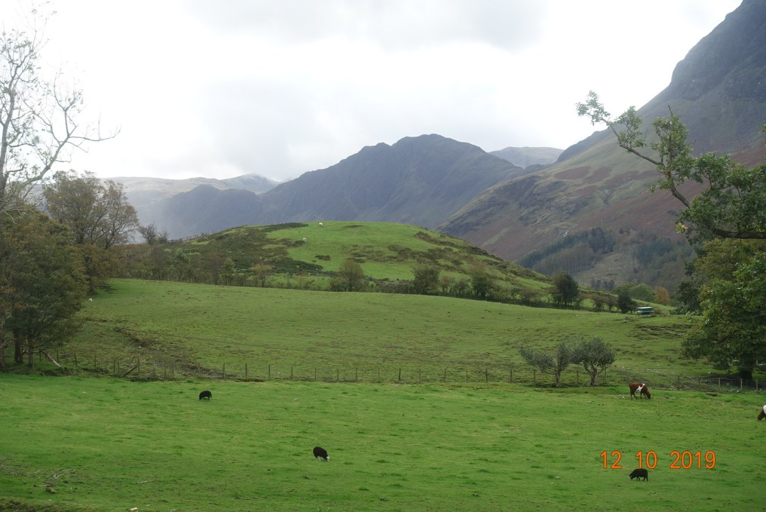
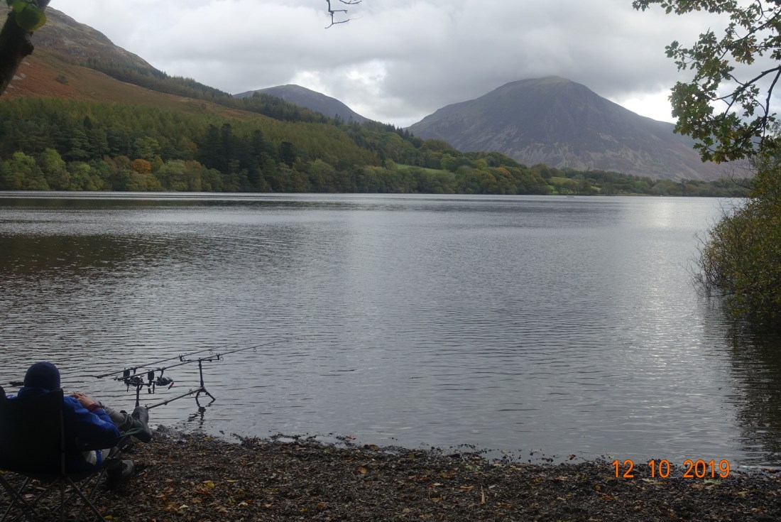
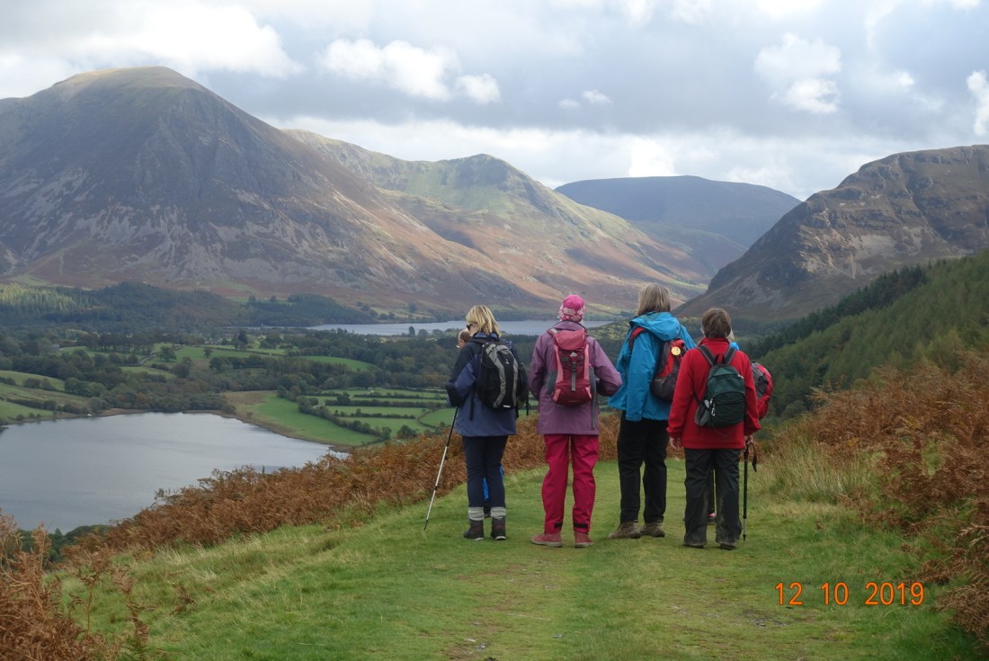
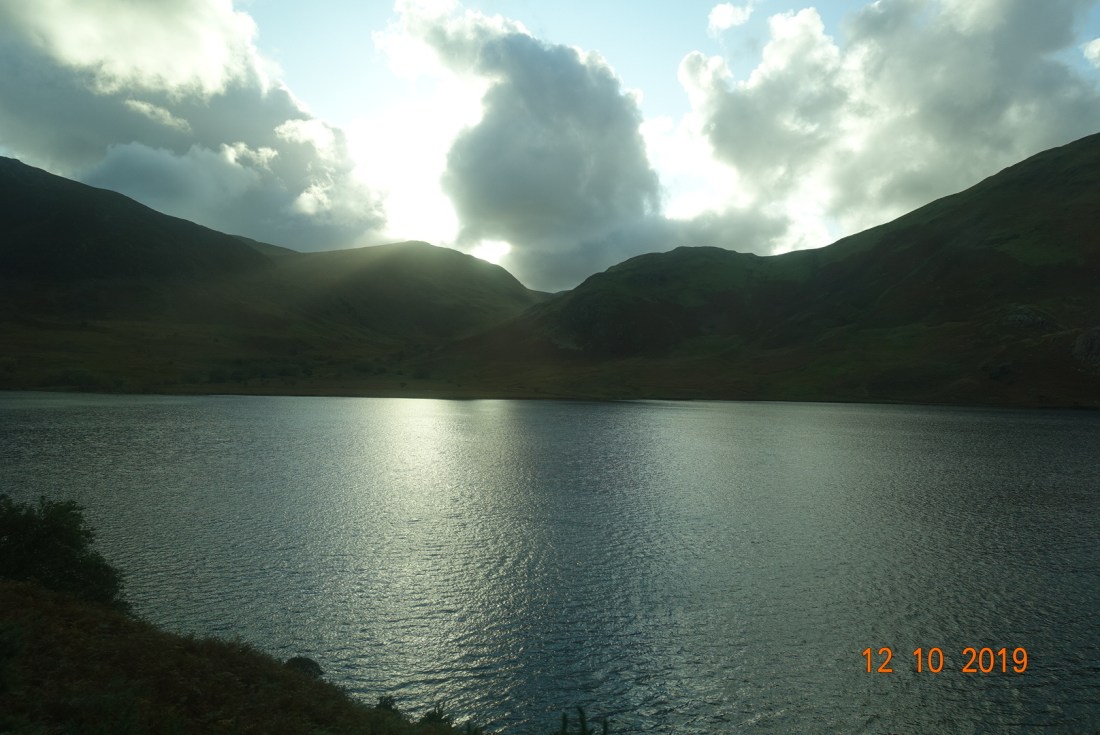
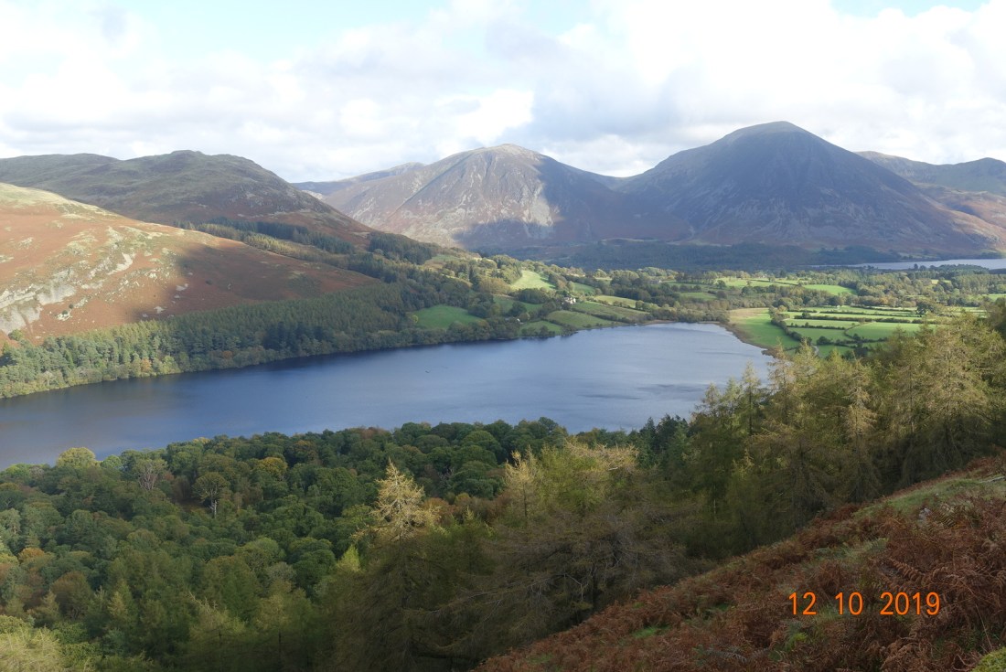
Time to put Loweswater on the map. Hurrah – at last, I made it out with the group, my one and only walk not on my tod. What’s more the weather was fine, even a little sunny, so off we went on our ‘school’ trip to Buttermere and Loweswater.

Our first stop was Buttermere, where we did some sightseeing. Our first port of call was the village church of St.James, set above the village and facing Fleetwith Pike and Haystacks. This unassuming church is charming in its simplicity and has some original features such as an antique organ dating from 1820 and a stone tablet dedicated to Alfred Wainwright positioned just below a window with views to his favourite mountain, Haystacks. From here, we had a short meander to Buttermere lake, before remounting our bus to take us to Loweswater, where our leader recounted the infamous story of the Maid of Buttermere and the Fish Inn. I will leave you to look that up yourself.

The view of Haystacks from the church

This area is slightly off the beaten track with Crummockwater and Buttermere glacial lakes and valley taking pride of place in this section of the Lakes. But it is not a lake or an area to be dismissed easily. Indeed it is featured in an article by the Guardian describing the top 20 lakes in Europe, and beer lovers and those fond of antiquities will enjoy the natural homeliness of the Kirkstile Inn and its Loweswater Gold brew.

Buttermere

The walk starts from this point. Loweswater is slightly higher than Crummockwater at 128m but is only a shallow lake of about 10 metres compared with Crummockwater with depths of 40 metres and Buttermere 20 metres, and it is dammed by terminal moraine at its southeasterly point, where its waters sneak through a small rivulet into Crummockwater. The Loweswater fells of Darling Fell and Low Fell (423 metres) are dissected by a stream feeding into Loweswater from Sourfoot Fell. It is easy to imagine how this ridge continues across to the Isle of Man as these lesser hills bear resemblance to the Snaefell range. As with most of the central fells, this area mostly comprises sedimentary slates of sandstone, grits and mudstones, as does Snaefell.

The Loweswater Fells

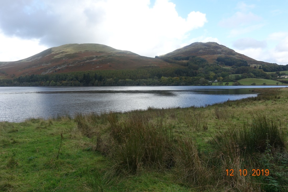
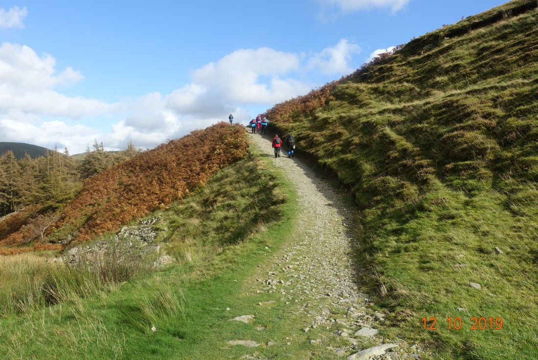
We followed the lake footpath to the west of the lake, through Holme Wood and up to Hudson Place, which looks like a farm building and which had its own coat of arms dating to 1741 according to the plaque above the front door. Research shows that it was granted to John Wilkinson in 1910. It is a grade 2 listed building and was a yeoman’s farmhouse.

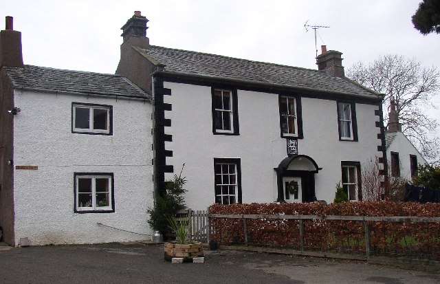
Hudson Place – courtesy of geograph.org.uk

The path then veers to the left and around the lower northerly edge of Burnbank Fell before climbing and contouring south, reaching the grand height of approximately 300 metres as we passed over the stream. From here, we followed a wall beside the top of the wood, spotting a small anonymous tarn in the distance, which I was not able to capture on film and which we named High Nook Tarn. As we descended we retraced our steps back to the Kirkstile Inn, where we imbibed the traditional Loweswater Gold as people have been doing since Tudor times, though perhaps a different form of liquor in those days, while we awaited our transport.

The Loweswater Fells above, and looking towards Grasmoor and Whiteless Pike below. Photo 3 Grasmoor to the right and Whiteside to the left. The bottom photo shows Melbreak above Crummockwater.

Distance: 7 miles: Ascent 1100 ft.

We then went back to collect the other parties and had a most amusing journey as the bus driver complained endlessly about the lack of driving skills of the tourists on these very narrow roads, and the slow journey enabled me to get this final photo of Melbreak to the right and the Saddle to the left with Scale Force in the dip as the sun began to set.

………..

My final day in the Lakes (13th October] was spent in the Keswick area – in the pouring rain and soggy fields of the river valley. Here are my last photos to say goodbye to the Lakes for now.

Easedale Tarn – 11th 0ctober 2019

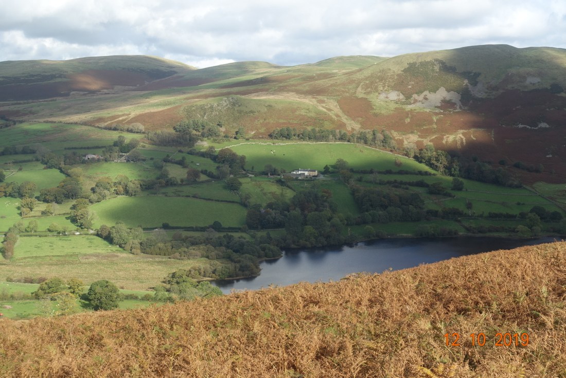
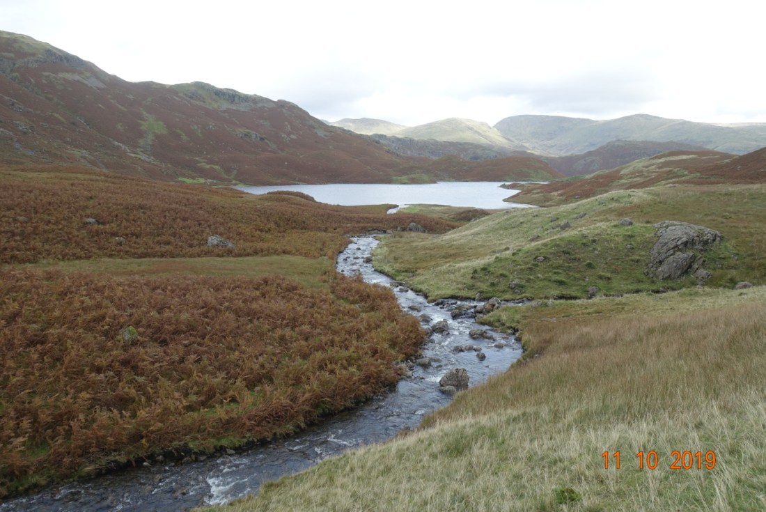
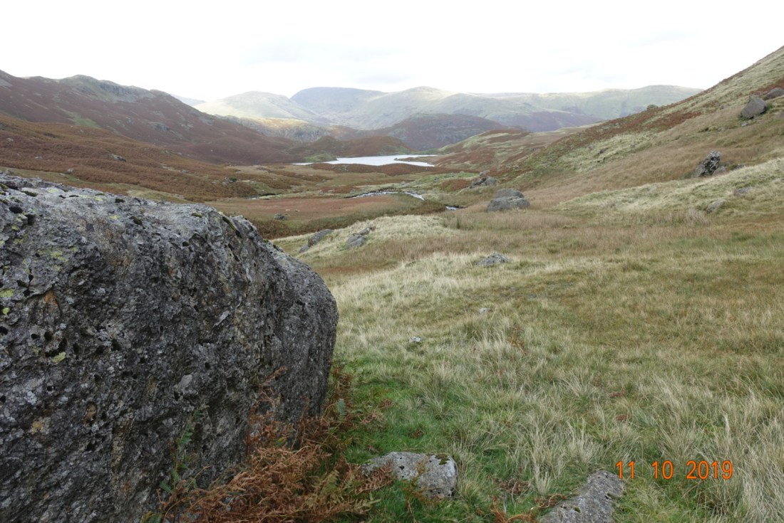
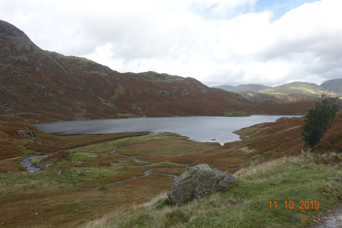
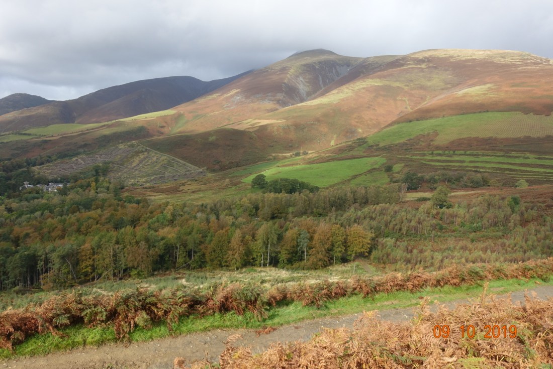
Today, I went on an adventure. I walked into Keswick and caught the 555 bus to Grasmere. I wandered aimlessly through Grasmere looking for the tourist information only to discover there wasn’t one! Then I took a path that leads around the northern edge of Grasmere to Allan Bank, a NT house, walking through the meadows to join the Easedale Road that unsurprisingly will take me to Easedale Tarn or Helm Crag, if only I could decide which I wanted to do.

I found myself turning naturally off the road into the fields beside the river and the decision was made. In the distance you can see a waterfall that lures you on. The views of the range to the south of Hellvelyn are spectacular and softer than the craggy nature of the rocks immediately in front of me, mostly due to the effect of the flows of water from glaciers over 11000 years ago as they are all comprised of the same type of rock. Helm Crag (photo 2) is a favourite with many, but it would be too far to include this on my journey today.

The Easedale path following Sourmilk Ghyll is very straightforward and has clearly been upgraded over the years. Having said that, it is not a fast walk. On the lower reaches over marshy land slates have been laid out in a vertical fashion so that you have to watch where you put your feet.

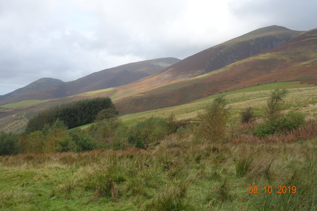
As you begin your ascent the path changes to stone steps made to look like a natural hillside path. In other places, higher up, stones have been strategically and well positioned to enable walkers to make their way through the deeper boggier areas and these are very effective. Just don’t expect to rush up as if it is a stone and soil path, even on the flat. There is one bonus to having to watch every step – you become aware of all the fossils hidden in the stones, which implies these particular rocks were shipped in from other areas of the Lake District as this area all falls within the volcanic granite, lava and ashes. The Windermere area contains slate, sandstones and siltstones, and that is only a stone’s throw away, and the Penrith rocks are limestone.
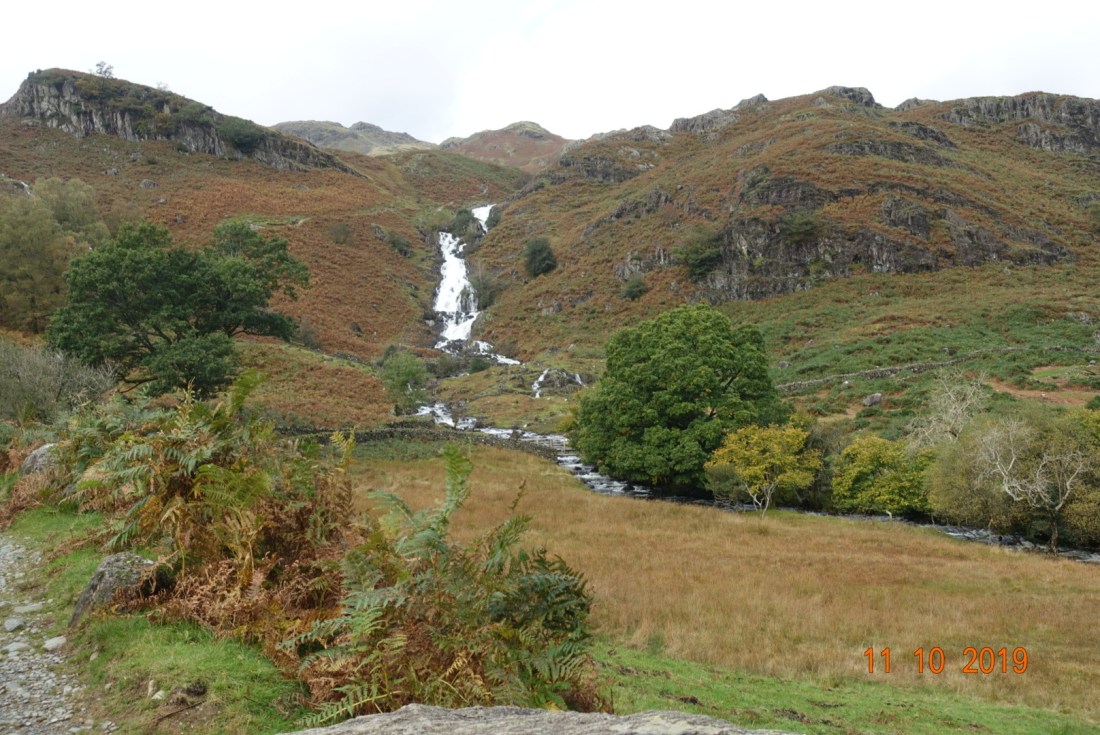
The waterfall looked magnificent, cutting its way through the craggy rocks. We have had so much rain this autumn that even the smaller waterfalls look and sound happy. The colours of the bracken against the slate rocks was striking too.

n

As you look up towards the first waterfall you could be forgiven for expecting the water to be flowing directly from Easedale Tarn, but instead you reach a plateau of small glacial humps, up to the next lesser waterfall. This viewpoint affords and extensive view of the valley.

They view between the waterfalls

A few steps more and you arrive at the stepping stones at the easterly edge of the tarn, allowing one to do a circular route and return to Grasmere via a different route – but not today. The stones were covered in a foot of water that was rushing out of the tarn and even the foolhardy did not succeed to cross. Instead, it is possible to walk around the tarn to return to this very point in the other side, so on I went. It should be easier to cross the minor tributaries flowing into the tarn in the westerly side. Or so I thought, but sadly I could not find a suitable crossing point. It was quite blustery so I reached the foot of Eagle crag where the streams from Codale Tarn filter into the tarn and had my lunch out of the wind. Slightly to the north is the pinnacle of Belles Knott, keeping guard over the tarn.

The crags on the northerly edge of the tarn as seen in the first photo above and the seconds below are Tarn Crag (the steep headwall of the former glacier), Greathead Crag, Stenners Crag, and immediately above the stepping stones, Cockley Crag. Tarn Crag of volcanic lapilli-tuff and volcaniclasic sandstones would have been the top end of the glacier, and the terrain around the stepping stones are hummocky moraine. If you are walking up there, you might see some mounds of craggy rocks on the one side and a smooth surface on the other. These are known as ‘Roche’s Moutonnée’. Every now and again you come across erratics left by the glaciers as in the photo below:

The tarn itself is a result of a small corrie glacier. It is 480 metres (1570 ft) long, 300 metres (980 ft wide) and 280 metres (910 ft) above sea level.

Returning to the valley the light became softer and the river became gentler and I returned to another kind of world.

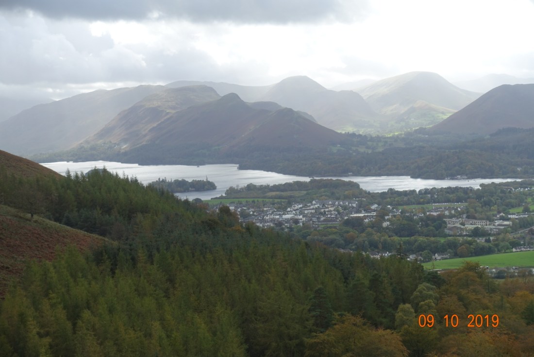
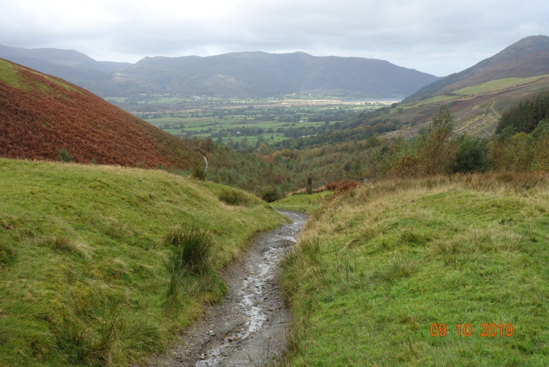
I finished the day with a bus trip using my explorer ticket, doing a round trip from Keswick to Buttermere via the Honister Pass.

Distance: 6.39 miles; Ascent: 892 ft.

Lattrigg – 9th October 2019

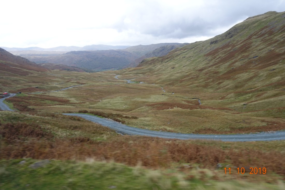
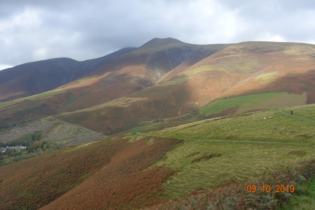
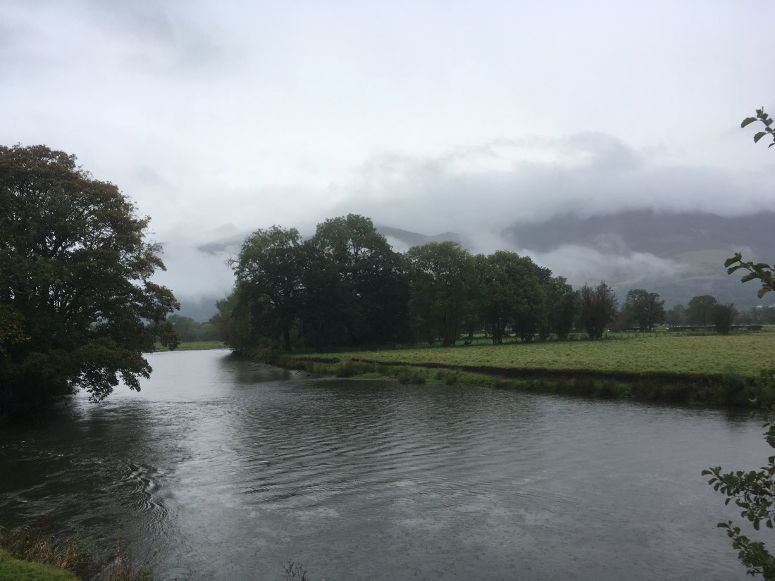
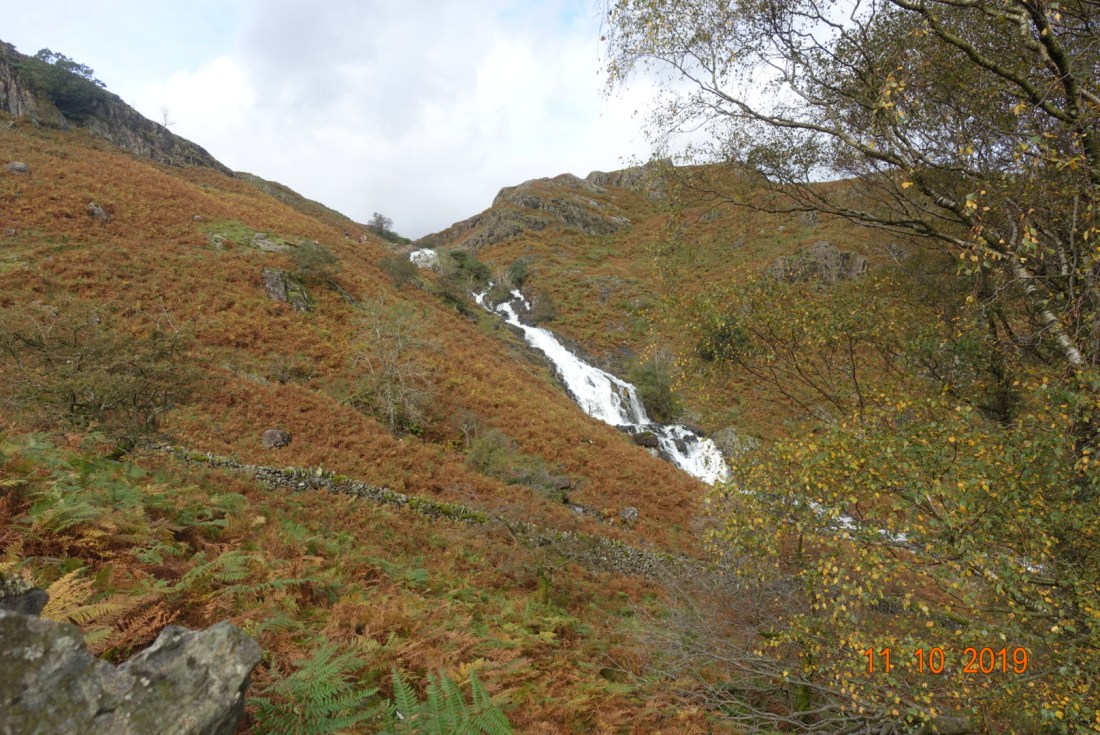
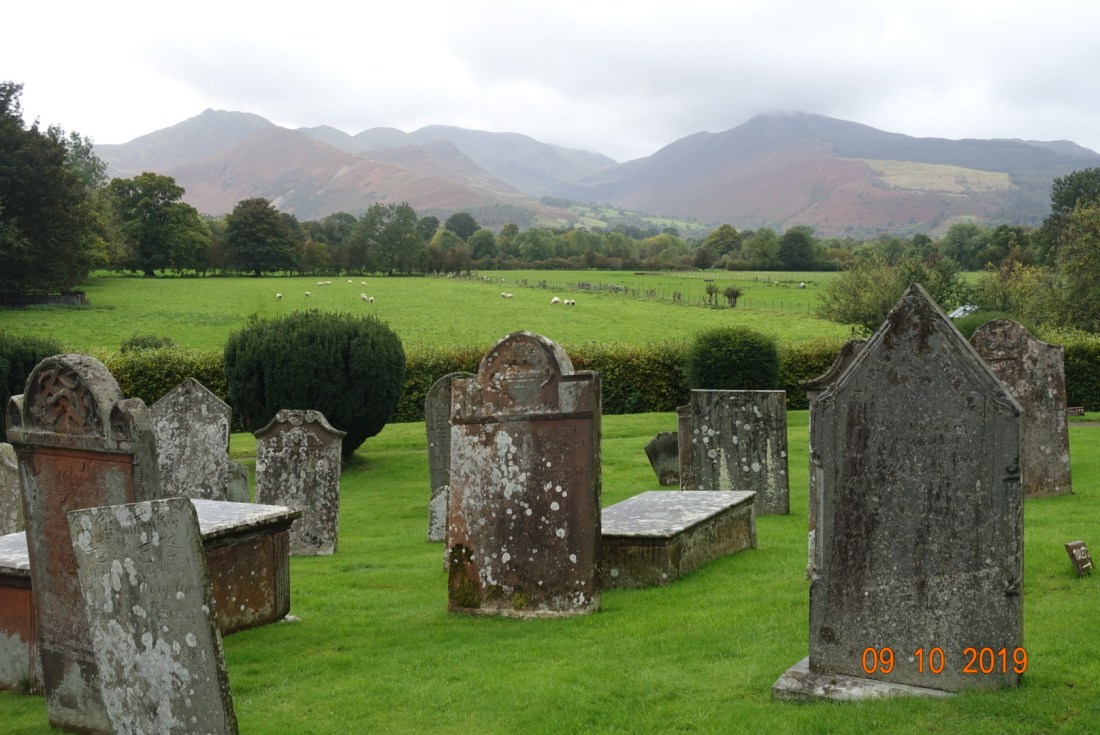
This varied walk starts at Portinscale, where I couldn’t help but notice the number of different species of bird in the grounds of our accommodation, including a tree creeper. It was one of those days when the weather sets out to play with you, so that you never quite know when to put on your raincoat or whether you will have time to get it out of your rucksack before the next brief but very soaking shower.

Undaunted, I set out through the outskirts of Keswick, crossing the B5289 to the village of Crosthwaite, which is quite unceremoniously marked on the map. The church stands on a mini roundabout going nowhere, with large trees in the centre, giving the impression it belongs to a time long past. The church has a very long history, dating back to the 6th century, although none of the early church remains. It was founded in 553 AD by St. Kentigern. The foundations of the 12th century church are still visible – why is it that most old churches have remnants from the 11th/12th century? Perhaps the very early churches were made of wood that decays and the later churches used stone?

The poet Robert Southey is buried in the churchyard and there is a memorial to him inside the church with an inscription with words of Wordsworth – only just realised how apt his name is! Another famous man buried here is the Reverend Hardwicke Rawnsley, one of the co-founders of the National Trust.

Crossing the main A66, I continued through wet fields to Applethwaite (meaning ‘clearing in a forest with apples’, a very attractive village of just a few houses. I was very surprised to see some stocks here. There is also a former mill.

The walk over the meadows provided excellent views of the Skiddaw range. I then followed minor roads which were relatively busy for the size of the road as it takes you to the main car park where people commence their amble to the top of Skiddaw, not on my plan for today.

On the map it is easy to miss the amount if ascent on this road as it circumvents the lower reaches of Skiddaw with it bronze ferns and grasses. By contrast, on the other side of the road were managed green fields and a steep wooded gully, every now and then broken by tiny rivulets insisting on joining the main stream. The steepest section covered a distance of about 1/3 mile (1/2 km) with a climb of 328 ft (100 metres), the steepest section being just before the car park. I must admit I huffed and puffed up that bit, but then I am full of cold/flu so perhaps that’s not surprising.

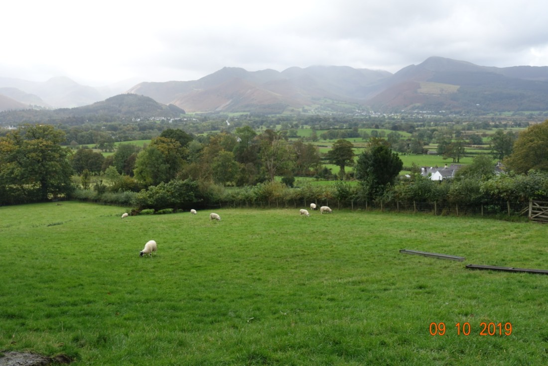
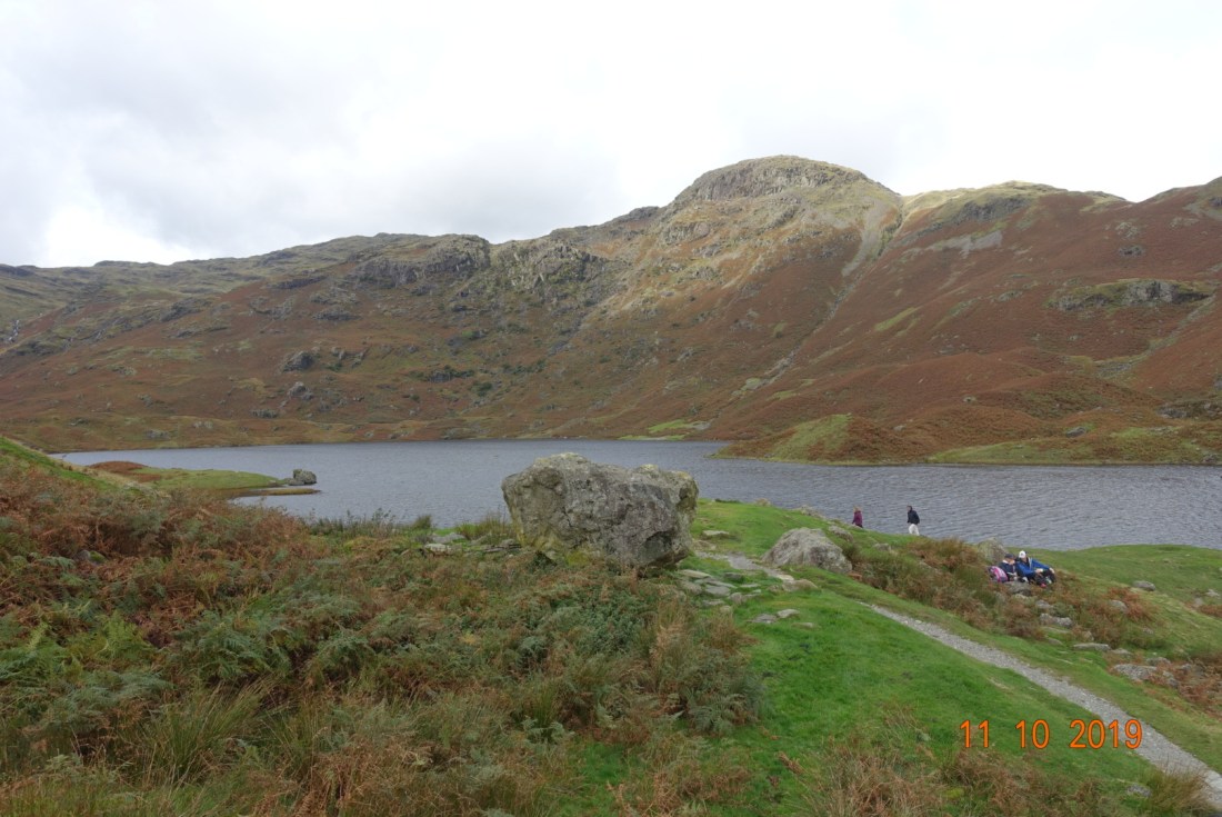
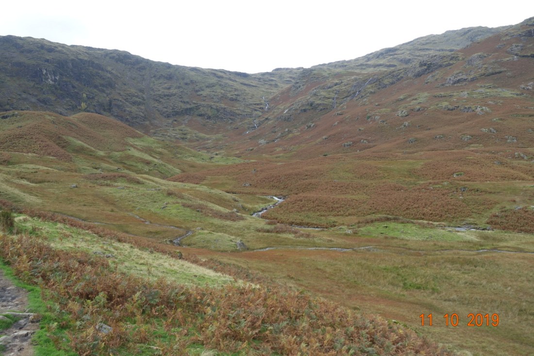
I turned to the right, where the path initially sets off downhill, but then there is soon an escape route that takes you to the top of Lattrigg at 368 metres. My goodness, it was windy on that exposed hill. Someone has thoughtfully placed a bench for people to linger and enjoy the distant views through the lesser mountains to Scafell, I thought I caught a glimpse of it at one point but with the fickle weather it was difficult to tell.

I followed the same path down a little way then took a green, steep and slightly slippery path towards Gale Forest where this path met the Cumbria Way all the way through the forest. Once at the bottom, it is a simply walk over a footbridge into Keswick. I finished my walk at the Pencil Museum cafe, and then made my final 1.5 mile walk back to Portinscale, but as this is the same as yesterday’s walk I have not included a description of that.

I finish with my favourite photo of the day:

Distance: 7.1 miles to Keswick, 8.5 miles to Portinscale. Ascent 1131 ft to Keswick.

No walking today, so no post tomorrow.