Port Erin Circular Coast route – 7th Feb – 10 miles, variable

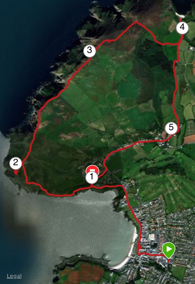
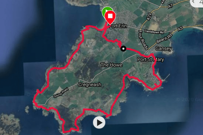
With Storm Ciara threatening to curtail activities in the next few days and a free day, I decided to catch up on my old favourite and walk from home around the coast, taking in the Sound.

I started from the beach at Port Erin. It was not a particularly nice day, overcast and rather gloomy and a little chilly, but it is always good to get outside and dust off the old cobwebs.

DSC02620
Bradda Head and Milner tower from St Catherine’s Well

I walked up Ballfurt Lane to St Mary’s Lane and turned left to walk along the top road to Port St Mary. At this point I decided to call in home (!) and pick up a woolly hat, and as the day progressed I was so glad I did. The sun wanted to come out but it wasn’t trying very hard and it became very blowy, giving me a taster of what was the follow at the weekend.

DSC02639

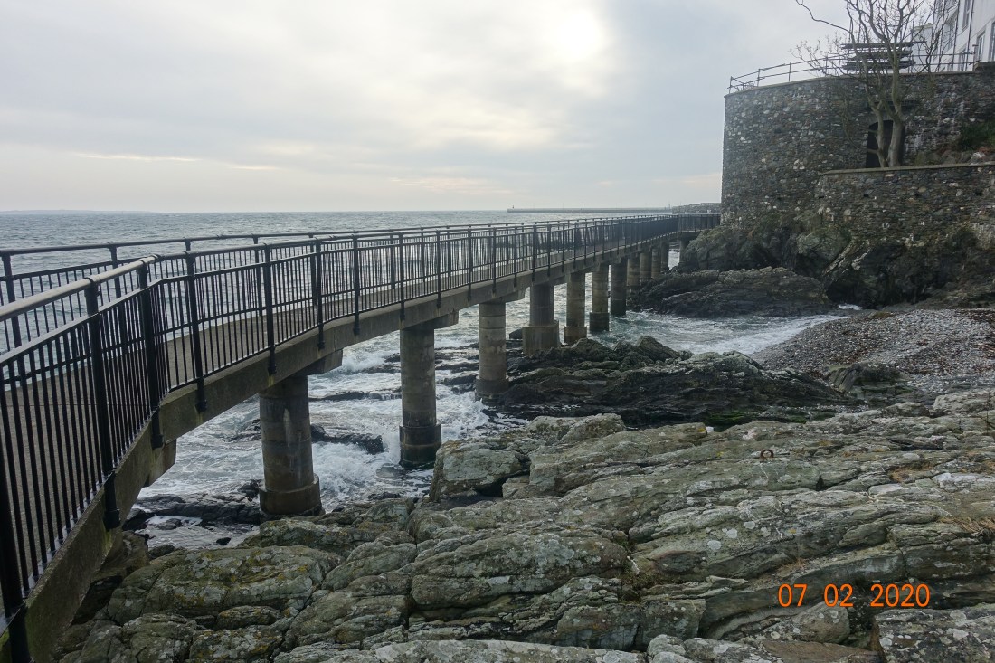
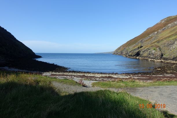
When I reached Port St Mary I followed the Underway which is always spectacular when the tide is in as it was today. The seabirds were having a field day as the wind must have whipped up fish close to the shore and they were competing for the best catch.

DSC02638
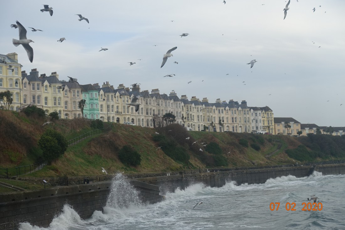
At the harbour where one is no longer protected from the southeasterly wind the seas were swelling, fast and furious. I had walked about 2.5 miles at this point and had planned to call in at the Golf Course cafe for a coffee, but this was closed for refurbishment so I carried out on the path.

Dappled light at PSM
The calm side of the harbour

PSM Lightbhouse

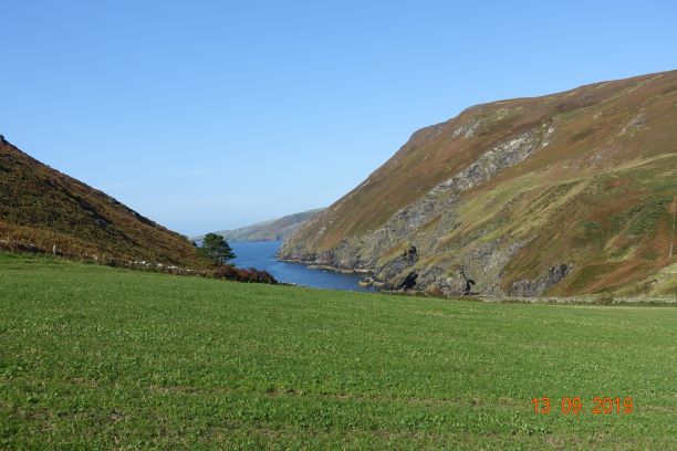
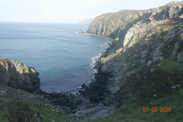
Going round Perwick Bay I bumped into a friend who was monitoring the birds for a survey, today mostly shelducks and oystercatchers on that bit of the coast. I followed the route down the road to Glen Chass which ultimately leads to the Raad Ny Fooillan and grassy footpaths, which one has to share with sheep. There is an alternative route that takes you up higher and on to the Chasms, but I always like the low route as it gives wonderful views of the rocks around the Sugar Loaf and the opportunity for a tiny bit of scrambling.

DSC02673
The steep cliffs of the Chasms
DSC02676
The coastline around the Chasms, looking towards Black Head

By this time, the wind had really got going and I didn’t want to venture too close to edge once I was past the Chasms on Spanish Head. It reminded me of a time several years when I was following this route and the wind was so powerful I had to give up at this point and head to Cregneash as I could barely stand upright. It wasn’t like that today.

Chasms
The deep chasms

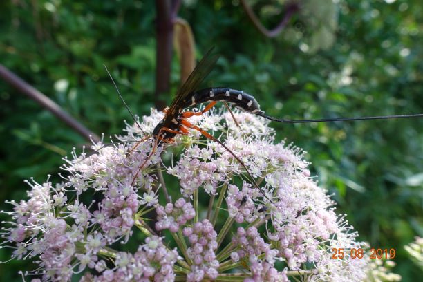
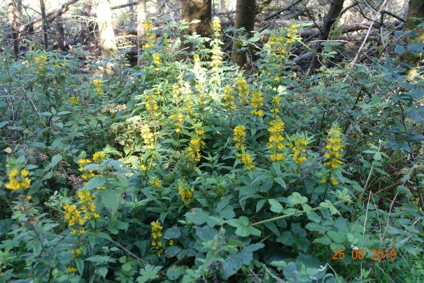
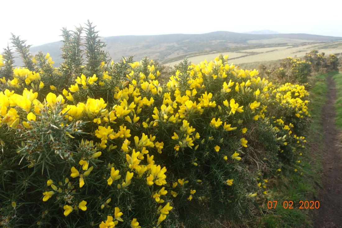
The day might be dull but the mountain gorse brightened up the walk significantly. It truly was this yellow and it was delightful.

DSC02686

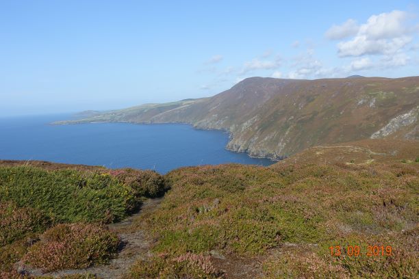
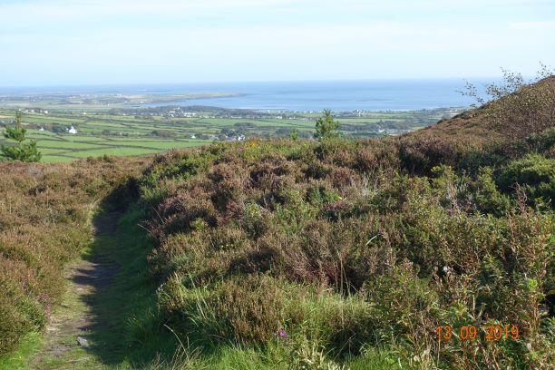
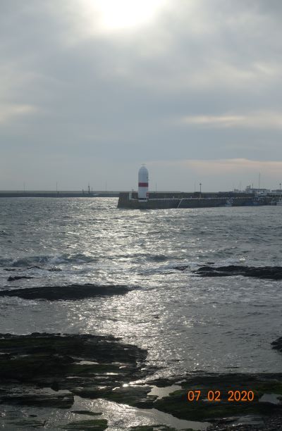
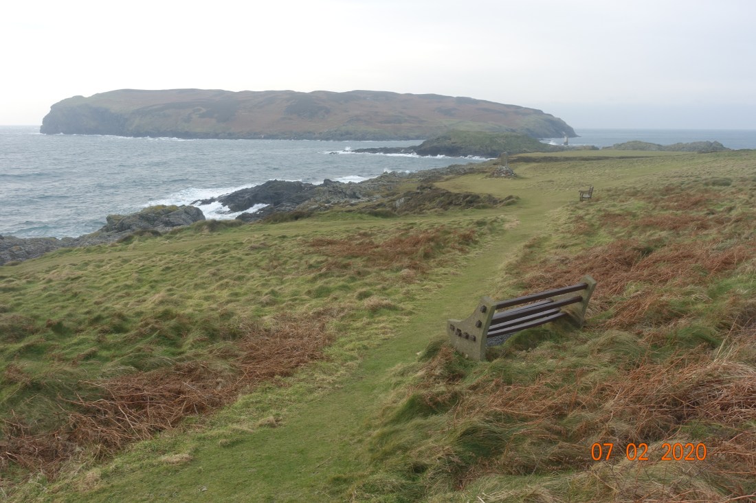
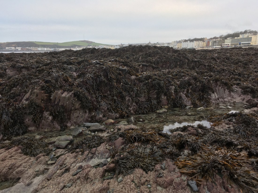
Ascending the slopes to Black Head I followed the deviating route that hugs the coast. This gives on the first look at the Calf of Man, the small island detached from the Sound. Chicken Rock lighthouse looked cold and forbidding today.  I am including a photo to give you a flavour but it’s not one of my best as it is out of focus though it does create a chilling mystical feel. Even the Drinking Dragon’s head is right down.

Chicken Rock
Chicken Rock Lighthouse on a cold, windy day


DSC02706
Resting places at the Sound, with the Calf of Man in the background and Kitterlands in between. The cafe (and bus stop) is to the right, out of shot.

7 miles and it was lunchtime when I reached the Sound Cafe. It was reasonably busy. It is always a welcome sight on rough days, knowing that however cold or wet you might be, a warm coffee and hot food awaits (as well as toilets). For those not wanting to continue on, it is possible to catch a bus back to Port Erin, but they are not especially frequent.

For those of you who are new to my blog and I have quite a few new followers recently, thank you, I have a chronic condition which leaves me depleted of energy, and breathing and moving my legs can be a little tricky right now. The sensible part of me considered stopping here, but the outdoor and nature lover in me won the day and I carried on, it has to be said with some considerable difficulty along the cliffs to Port Erin. The weather perked up at this point, and although still windy the sun managed to creep through the clouds occasionally and I was well rewarded for my efforts.

CoastlineKamikaze sheep

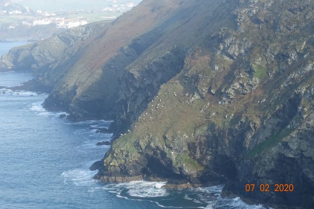
Notice the Kamikaze sheep on the photo above. You feel if the first one jumps the rest would follow… like sheep! Quite why or how they had got themselves in that position I will never know. It wouldn’t be the most sheltered position.

t

Looking Back
The view back. The Calf is the final cliff in the distance.
Port Erin in the mist
Port Erin emerging from the mist.

Once back at Port Erin I went to the Health Food shop and had a pot of camomile tea before walking home. I was back at 2.15pm having had fish and chips at the Sound as well! The full distance was 10 miles, but that includes lots of ins and outs that you don’t need to do, such as calling in at my house. 8-9 miles is more common for this route. You can also get the bus or train to Port St Mary, which avoids almost all the walking through villages and allows you to concentrate on the footpaths. And you can escape off the cliffs at the Chasms and go to the lovely hamlet of Cregneash where you can get a bus back, or follow a shorter walk over Meayll Hill/The Howe to Port Erin. So, there are lots of options if you want shorter walks.

Port Erin Circular

Distance: 10 miles

Ascent: 1732 ft

Descent: 1572 ft

Maximum elevation 1,028ft.

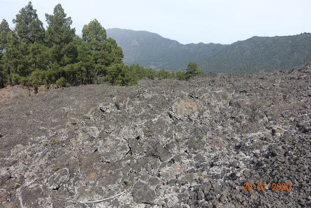
Saturday’s ‘walk’ (yesterday) was a wander over the Snaefell Hills taking measurements of the peat. I am just awaiting some photos then I will tell you about that. Meanwhile, keep safe and warm and well away from Storm Ciara.


La Palma, Canaries, January 2020: Day 6, Final Walking Day – Cumbre Nueva

The final day promised to be interesting. We would start on the eastern side of the Cumbre Nueva, in the hills behind our hotel, scramble up some heady paths through the oldest volcanic rocks, reach a open green picnic area, and then descend on the other side walking across more recent lava flows, finishing in El Paso, the terrrain on the west and east escarpments being wildly different.

We were following what would originally have been an ancient path linking one side of the island to the other, rather like you find in the passes above Coniston in the Lake District. You could sense the spirits of bygone fellows leading their donkeys carrying their wares on their backs up and down these steep and narrow paths.

The Cumbre Nueva (translates as New Summit) contains the sharp spine of hills that we could see yesterday leading off to the south from Caldera Taburiente to the Cumbre Veija (Old Summit). The harder walk were heading off on the ‘volcano route’ of the Cumbre Vieuja, which sounds like a child’s paradise: lots of craters in a small area to play around in. A part of me wanted to do that walk, but I knew they would set off fast and I want to enjoy the scenery and not be on a forced route march. Cumbre Nueva being slightly smaller than its neighbouring friends with a maximum height of 2100m is rather softer in appearance than the other craggy volcanos surrounding it. and maintains a steady transpiration rate as it is mostly within the cloud forest height range, so it is lush and green. There are many pines on the eastward side whose lines are only broken where the lava has had its strongest grip. On the eastern side  the vegetation is more varied and more abundant – tree heathers can grown to 4 metres in height., whereas on the western side they are more stunted in growth due to the lava flows and also to the strong winds which buffet that side of the mountains.

Cumbre Nueva

At the bottom of this map is a marker point called Montana de los Tomillos at 1522 metres. That is the point where you change over from east to west. If you enlarge the photo you will see a green path to the right saying Pared Vieja on the east side. We started somewhere along that path, walking continuously uphill for an hour and a half.

Then we reached El Pilar which is an area that has been cleared to some extent to allow locals and tourists to make the most of the wonderful countryside. You can drive up to this point, there is a small visitor centre, toilets and a snack bar in season. It is very pleasant and cool, although the sun can still creep through the trees. One remarkable thing about this island is its taxi service. Every now and again where a path meets a track you will come across a green sign saying TAXI with several taxi numbers and prices to different places. They are very geared up for walkers and try to discourage vehicles by offering this service, and they are not expensive. The Refugio de La Pilar is a wonderful starting point for a walk. You can do at least six different walks from this starting point and I would have loved to have been able to spend time messing around exploring all of them. Maybe that will be for another visit.

As you leave El Pilar you cannot fail to notice the Volcano Montano Quemada of Tacande, which erupted as recently as 1470-1490, similar to other volcanic eruptions in the south, and indeed the terrain is very similar. You can see the black ash sliding down the hillsides and there are only a few loose boulders here. This ‘sand’ was procured by the locals over the years to make paths and gardens, but that practice has now been forbidden. This tiny loose rock was created when magma was thrust into the air, forming shiny black granules cooling rapidly as it hits the ground. This is called obsidian and it looks like glass. Everywhere we looked you could see it glistening up at us, but try to pick one up and it would mysteriously disappear. I did finally manage to bring a couple of tiny pieces home, along with some volcanic pumice!

Tacande
Volcano Tacande

This was a very pleasant walk down, with some open areas and lovely shaded areas in the pines. This was the first time there was evidence of water, admittedly not flowing right now, but there were channels in the lava which would allow the water to flow freely when it does rain. The rainy season is meant to be between November and February but as everywhere, the climate is changing and they have had little rain this winter. The annual rainfall is about 327mm p.a, compared with the Isle of Man that has 1139mm p.a, so you can see that if is dries up here they will be in serious trouble.

Water channels
Water channels in the lava

Throughout this holiday we had come across all kinds of lichen, which of course only grow in healthy terrains. They hung from the trees and where they fell off, it felt quite hard and leathery. The photo below shows such a lichen dripping from a tree, with the backdrop of the Punta de les Roques which is the last part of the volcanic ridge and the first part of the Caldera de Taburiente.

Lichen on trees and Punta de La Roques

The further down we went we lost the sandy rocks and found ourselves walking over a very craggy lava flow that went all the way down to El Paso. This had been incorporated into the gardens of the local houses

Changing terrain

And here we could hear the sound of birds as we went through more pine forests, casting their magical spell on us all as we passed through them.

Pine forest

Nearly at El Paso, we had our final trek over some tricky lava and a few minutes later we were at the Visitor Centre and the bar, where we sat and waited for the harder walkers who were not so far away. The fact that the lava continues right down to the road makes one very much aware that this is a living landscape and that it will always have the final say over mankind.

In this last photo, you can see the whole of our route on the eastern side and reminisce about all the wonderful things we saw.

End

Distance: 6 miles

Ascent: 948 ft (all in the morning)

Descent: 2041ft

So ends a truly memorable holiday, so inspiring that I have already booked to go walking on one of the other Canary Islands this time next year. For now, I shall resume normal service and report on walks on the Isle of Man, starting this coming Saturday with a report on Peat Monitoring which we plan to do if the weather is suitable.

Thank you for following this blog, and keep in touch.


La Palma, Canaries, January 2020 – Days 3 and 4: Santa Cruz, Breña Alta, Los Llanos

For a small island, it sure does pack a punch. The volcanoes in themselves are enough to take one’s breath away but it also has its calmer, more serene side where most people live scattered across the hillsides.

I took a day off instead of walking as my poor (big) toes were throbbing, I had blood blisters under both nails, the toes were swollen and painful and the thought of another long descent was not appealing. You will be pleased to know I don’t have a photo of my feet! On Day 3 I had a leisurely morning, caught up on some sleep and watched some of the Australian Tennis Open. Our hotel was magnificent. We were staying at the Parador de la Palma in Breña Baja, an ancient ‘suburb’ of Santa Cruz where they grow tobacco, apparently on a par for quality with Cuban tobacco. The hotel is relatively modern with extensive grounds which have been landscaped beautifully. It has a pool and a gym, neither of which I frequented, a lounge and a bar and a lovely enclosed patio area where one could sit and listen to the sound of water as one drank one’s wine, read one’s book or engage in mindless chatter.  And of course a restaurant. The food was out of this world and there was so much to eat I am glad to be home, otherwise I would end up a big fatty! So, all in all, a day off was very appealing.

In the afternoon, having written some postcards, I thought I should venture out to post them and explore the local community, wearing comfortable pumps which would not put any pressure on my toes. It is impossible to avoid uphill but at least I was on tarmac. Off I went, expecting a gentle ramble, which indeed it was. I found myself turning this way and that and two and half miles and a 1000ft later, I decided it was time to turn back. I was already in the foothills of the Cumbre Veija by this point where the cloud forest begins and it was trying to drizzle. It was a happy ramble in that I was able to nose into people’s gardens, which were generally large houses or smallholdings. It is noticeable that most of the houses are two storey. No large tower blocks here.  As I turned onto the top road I felt I could almost have been in the wild west. Imagine those big doors on the photo below are saloon doors and imagine horses tethered up in front – imagination can run away with you here :-). The variety of vegetation on the hillsides was remarkable and so many wild flowers were out, many of which we only see in late summer, if at all. Most noticeable were the ‘dying swans’ of Echium which grow all over the island.


The next day was the scheduled day off. I knew I had to get some new footwear if I was to continue with the organised walks so I go the bus into Santa Cruz and bought a pair of HiTec walking trainers that were a full size bigger than I usually buy. They were cheap, costing me 50 Euros which included 3 pairs of socks. I had a walk around Santa Cruz which has some nice alleys , squares and drinking places such as the Calle Real, the main cobbled street, but I was not in the mood for exploring.

Santa Cruz is the capital of the island but not the largest city which is Los LLanos on the western side. It is positioned on an old lava flow that emanated from the volcano easily visible to the south of the city. It only has a population of 15,674 in 2018, so about 2/3rds the size of Douglas. The total population is 81,863, which is slightly surprising given that so much of the terrain is inhospitable. Santa Cruz does have one very strange claim to fame. Every 5 years it holds an event called The Descent of the Virgin of the Nieves, when there is a peculiar dance performed, called the Dance of the Dwarfs. Grown men over 6ft tall assume costumes of bishops then go into a shed and come out as dwarfs, with enormous triangular hats, and do a polka!! They don’t just do it once, but over and over again, all through the night. There is another annual tradition called Los Indianos, where all the locals dress up in white, men in posh suits and ladies with their parasols and straw hats, and talcum powder is thrown all over the place. Quite how or why these traditions have emerged is a deeply kept secret, but it does make one wonder what other plants might be growing on the island. If you are interested in visiting Santa Cruz there is a Naval Museum, churches with fine architecture and some interesting houses on the front.

I had wanted to visit Los Llanos as it has an archaeological musuem, so I boarded the no 300 bus, paid the driver 2,60 Euros and off we went up and over the hills and through the tunnel to the other side of the island. I hadn’t a clue where to get off the bus, but I was fortunate in that I spotted a road sign to the museum so hopped off at the next opportunity. This is definitely worth a visit. I think it cost 4 Euros, but I could have had a pass for only a little more which would have given me access to other museums elsewhere. Of course, it explained about the volcanic construction of the island, but it also talked about the shepherding way of life and there were various artefacts and a few old bones to examine. I spent about an hour there before wandering around the rest of the town.

The west of the island has a totally different feel to the east which is more humid. As you come down the long windy hill into Los Llanos you cannot help but notice the vast number of cream-coloured greenhouses that look very much like low level warehouses from above, and it lends it a commercial feel. The greenhouses protect the bananas which have become a large part of the island economy. They are very dense bananas and relatively small, compared with the ones that are imported to the UK. Formerly the main product was sugar cane.


Los Llanos itself contains several roads that stretch uphill like boulevards, with established trees in the centre. It is quite a bustling town and has a happy feel to it, with cafes in the centre where tourists and local mingle. In one of the streets there are 11 Indian Laurel and Royal Palm Trees that were imported from Cuba, and indeed these are the symbol of the city. They are very dramatic and beautiful. Although not the capital city which is Santa Cruz, Los Llanos is bigger, with a population of 20,171 in 2018. It appears to be a sprawling city as other smaller towns are very close, such as El Paso, but each has its own identity. Los Llanos is unlikely to claim the capital spot as it lies 325 metres above sea level so cannot compete with Santa Cruz for trade in quite the same way.

Having done my city tours, I got the 300 bus back, but managed to get off at the hospital and change to the no 35 which stops outside the Parador. I had enjoyed my day. I managed to wear in my new boots without causing any more problems to my toes and I was all set then for out Day 5 Walk which was to be an absolute treat, walking about the largest and highest volcanic crater on the island – and I shall tell you about that, tomorrow.

A Shapely Walk Around Douglas and Summerhill Glen- 4 miles

img_7881

The natural entrance to Summerhill Glen

Douglas is a surprisingly attractive town to walk around as long as you turn a blind eye to the less appealing aspects of its make-up and areas that look lost and forlorn or where some car park or development has emerged from nowhere and taken away all the character of the area. The Isle of Man does itself no favours by not caring enough about its heritage and there are too many derelict buildings or hideous erections that should never have seen the light of day, not even in an architect’s mind let alone in practice. It is too quick to destroy what history it has, as in the pending doom of the lone 18th century cottage which is being demolished to make way for a new ”by-pass” in Ballasalla, only approved by short-sighted politicians because Dandara promised to fund it as long as they could build xxx number of houses at the same time. But I digress…

You might say Douglas is much like any town. But look up, out, about and around the many old buildings  of the later 19th and early 20th centuries and you will see interesting shapes and objects that will surprise you. Roadnames with fingers pointing you in the right direction, canopies over shops that look as if they belong in Tunbridge Wells Pantiles area, attractive iron railings separating the Edwardian properties, squares of parkland and a crescent of housing reminiscent of Bath (though not as grand). Lots and lots of substantial Edwardian properties built to last, reminding us of the Isle of Man’s heyday when B &B’s sprung up in abundance to cater for the wild tourism that would swarm in on the ferry in the summer months.

I had been to the dentist on Woodburn Square and instead of walking back to the bus stop I went in the opposite direction, down roads I have never walked before, around the back of Nobles Park to the top of Summerhill Glen. The house styles are very varied and many are attractive with double fronts or bay windows, a row of chocolate box houses, one with a monkey puzzle tree in the front garden and sometimes very unusual houses. There were two houses side by side with windows in the upper elevations that looked as if they belonged in the 16th century as their small windows protruded out above the main house. There are many established trees in this area and it feels quite luxurious in places. There must have been a large country seat where Laureston Manor remains, now afflicted by the ever terminal illness of living apartments, but it still has its grounds and other houses have been built around the edge of its land, so the pathwork of land still retains its rich flavour.

I reached an area where most of the roads bear the name Victoria or similar, signs of anticipated grandeur and nobility – Victoria Road, Victoria Crescent, Victoria Avenue, Dukes Road, Upper Duke’s Road, Palace Road, Castle Hill – you get my drift, and here the roads are at the top of the wonderful cliff that skirts the whole of Douglas Bay and from where if you could only see through the trees there must be a wonderful view of the Bay. There are several very large buildings around here, many now converted for business use, again indicating that Douglas has at times been very wealthy.

All this was unexpected. This was not a planned trip but an idle walk through Douglas to get some fresh air with the idea of walking in daylight down Summerhill Glen. My first visit to this Glen was just two week’s ago when my son Matthew stayed with me for Christmas and we went to enjoy the illuminations which we did thoroughly enjoy in spite of the rain.

img_7885

Reaching the top of the Glen I followed the path down to discover a second more interesting path that enters the glen from the other side of the stream. I know most people are very happy with the modernisation of the paths in the glens but for me wide tarmac paths lose all the natural feel and magic of walking down a forested glen, so I was very happy to wander along the section that had not been tarmacked and watch the water meandering its way across the flat and boggy terrain, creating new rivulets here and there as it jumped over minor hazards on their way to join the main stream.

img_7883

The glen itself is very natural at the top and I found several interesting shapes in the stream and in the vegetation that sparked my interest. The stream is pretty with minor waterfalls along its ever downward and slightly winding trajectory. In the centre there is a flat area with wooden seats neatly positioned to enjoy the display the children (and adults) have created. It is not possible to follow the stream all the way to the sea as it goes underground whilst still quite elevated, but when I reached the shore to see where it finally entered the sea, I could hear a rush of water where it comes out behind the houses on Strathallan Crescent.

img_7899

img_7901

The tide was out so I walked out into the bay and again I looked up at the lovely aforementioned cliffs and noticed houses half way up holding tightly on to the side of the cliffs, a pink house I had never noticed before with a curtain of trees behind it. Looking in the other direction out to sea, I walked out as far as the sand would allow me and came across boulders and seaweed that were as tall as me. I walked the mile or so back into town, and if you wished you could make a full circle of this walk.

img_7906


img_7907

img_7905-1

img_7908

So, if you come to Douglas, take a bit of time to venture into those parts you don’t usually go and I’m sure you will find hidden treasures.

Below:  A slideshow of some shapes in Summerhill Glen

This slideshow requires JavaScript.

I regret to say I did not take photos of the interesting properties I saw, but I will retrace those steps another time when I am armed with my camera and not just my mobile phone.

img_7913

Port Soderick to Douglas along Marine Drive – 2nd November 2019

DSC02192This week saw the last of the steam train journeys until next spring, so what better way to go into Douglas than to hop aboard at Port Erin and disembark at Port Soderick to walk the 5 miles into Douglas.

DSC02177Here is the Kissack, no 13, waiting to leave Port Sorderick.  As I walked down the lane I encountered a convivial lady sportingly cleaning up the road for vehicles as all the drains were blocked by the autumn leaves and the excessive rainfall of recent days, leaving great puddles. That’s what I call neighbourliness.

I walked through the glen which was a little on the muddy side. I never known the Crogga stream to be so loud as it made its way downhill and then softened as it gained the lower reaches, just every now and again bubbling over the rocks.

Reaching Port Soderick Bay, I never cease to amazed how this area was once a bustling pleasure beach, with all kinds of attractions and businesses – outdoor games, a camera obscura, Thomas the ‘novelty card’ printer, roundabouts and such time as well as  the now defunct and removed Falcon Cliff lift that enable to tourists to have a leisurely (if ugly) route to the top of marine drive, where they could get the horse tram all the way to Douglas. It seems like another world. I do remember the hotel which was always good for a coffee but that has also long since gone. They are always talks of renovating this area. If so, maybe they could reintroduce the story of the Enchanted Isle off Port Soderick, which was sunk beneath the seas by the magician Finn McCool along with its inhabitants which were turned to granite pillars; the island rises out of the sea every seven years for just 30 minutes, when the inhabitants will be restored to life if they can place a Bible on the island in that time.

I followed the muddy path alongside the road to the top of the hill where I took the cover photo. These hills are steeper and higher than they look here at about 300 ft high. They are mostly the typical Manx group of rocks comprising mudstone, siltstones and sandstones of the Lonan formation. They form the standard thin and craggy beds of slate that were distorted by the uplift of mountain formation in the Silurian and Devonian period, and in places these are very dramatic. At Keristal, close to Port Soderick,  and towards Douglas you will find large slabs of paler sandstone giving a softer landscape.

In places the rocks are quite architechtural, as here, close to Douglas Head gate house.

DSC02216

Marine Drive was constructed and the tramway opened in 1896 and was not the wide roadway as it appears today. In places an overhanging iron roadway was made to get around some of the tricky rocks and this section was suitably named ‘Horses Leap’. However, it was all dismantled between 1947 and 1949 partly due to rock falls. It was converted into a roadway in 1956 and over time it became a walkers’ paradise and the central section closed to vehicles. It is easy to see why when you walk the route.

DSC02198

DSC02218

Having had only coastal views and wonderful skies, including an enticing rainbow as I reached the Whing (the steepest and most contorted of the rocks), it is all over too soon and soon the path starts sloping making its descent into Douglas. Looking at the clouds over the mountains I had time my walk just right.

DSC02221

A very pleasant walk of 5 miles and about 733 ft of ascent, but it is very easy after the intial ascent and just little ups and downs along the way.

unnamed

A short walk around Peel and Glen Maye

I had been to Peel Cathedral for Evensong. It was a very special evensong, with the very musical group Voces Insulae providing the choral repertoire. It was absolutely beautiful and the bible readings too stood out above the norm for some inexplicable reason. The cathedral was particularly resonant today.  I guess some days are like that.

Having started out as an inconveniently wet night and morning, it had now brightened up, so I strolled down to Peel beach where the wind had whipped up froth that looked like candyfloss. I then did the circuit of the exterior of Peel Castle, passed the spot on the point where my grandchildren, son and I had had a memorable picnic about this time last year. As I came round to Fenella Beach you could imagine St Patrick’s island cut off from Peel as great swathes of sand seem to almost continue seamlessly from one side of the harbour to the other.

I then traversed the low route contouring around the east side of Peel Hill back to my car, intending to get home in good time to cook my tea before the ‘Strictly’ results show,. Peel look very colourful and appealing in the soft late afternoon light.

I just had to pop in to my favourite glen on the way back for a bit of magic. And I was not disappointed. As you can see the fairies had made their ring to dance around, though they hid in the undergrowth when I turned up.

Fairy Ring

I could hear the waterfall well before I could see it. It was spewing out copper and peat coloured water and although there was quite a torrent it was nothing like I had witnessed a month or two ago.

On one side of the ravine, the water was dripping down the side of the rocks looking life hanging vines.

Rain drops
Rain drops looking like hanging vines

I managed to watch Strictly – no surprise as to who was sent home there then – then settled down to watch ‘Millionaire’ as well, when I decided to make some fruit cake to take out tomorrow on my first walk with the Island Walking Festival’s Weeks’ Walks, so I dodged out in the intervals and I now have a full stock of food to take with me tomorrow.

I shall be walking from Snaefell along the tops to Ramsey, and on Wednesday doing a circular route taking in Greeba Mountatin, before I leave the island for a little while to visit family and have a week’s holiday with HF in the Lake District. I will try and write a blog about each of these walks that I haven’t ever done before!

Bradda Head – 13th September 2019

You know what they say – you can’t keep a good dog, or in my case, woman down. Two consecutive days of walking. What a treat. Today, I had relatives visiting so what an opportunity to show them some of the outstanding scenery on our doorstep. On Thursday I headed south, yesterday I headed north from Port Erin.

We met at Bradda Glen restaurant, which is an excellent starting point for this walk if you don’t want to walk the extra mile from Port Erin. We followed the Coronation footpath to Milner Tower,  stopping at various points to describe the scenery, tell tales or just to enjoy each others’ company in the balmy autumn wind and sun. It was our warmest day for a while, and the sky was very blue.

The top

We didn’t pass a soul on our way to Fleshwick. The path down from the Bradda cairn was a little slippery and uneven, surprising considering the lack of rain, but by the time we reached the steep descent the path was dry and easier to conquer. We did meet a lady blackberrying with her dog and a group of holiday makers on a walk and a drone, i.e. a mechanical instrument, not a humble bee or rude name for a boring person!! The drone did rather spoil the ambience.

On the tops we had the splendid views towards Peel. I could stay up here for hours, with views of England, Scotland, Ireland and Wales on a good day. It is just perfect, well maybe a couple of weeks earlier would have been even better as the colour of the heather would have given the senses a real boost. But you can still imagine what it looks like in its rich colour, can’t you?

Towards Cronk Ny Arrey Laa

Our return route contoured around the base of the Bradda group on an easy footpath then joined the road through East Bradda back to Bradda Glen. This was followed by a lovely evening together at The Shore Hotel. The food was magnificent and rounded off a super day with friends.

Fleshwick Bay.JPG

Fleshwick Beach

And the start of the route down, which drops off steeply at this point:

What goes up must go down.JPG

Most of my photos were of my friends, so I can’t include many today.

Distance: 4.71 miles (Bradda Glen circular); ascent 1092 ft; descent 1060ft. Maximum elevation 732ft – not bad for cliffs.

68235

Conrhenny Plantation 25th August 2019

The view

What a glorious day for a wildflower walk, away from Port Erin that was bathed in Mananan’s Cloak for most of the day. Being Bank Holiday Sunday we were a small group but this only added to the enjoyment. I have walked through Conrhenny Plantation before with the U3A but I have never stopped and stared at the vegetation or wondered at the myriad of butterflies happily darting from Buddleia bush to another. We were also fortunate to see a most amazing insect, rather like an overgrown mosquito feeding on Angelica. Just look at that tail! One of my erudite and expert friends informs me that it is an Ichneumon Parasitic Wasp. If you want to know more about this not-so-angelic-as-it-looks creature take a look at this Youtube video: https://www.youtube.com/watch?v=KxHckvpbopQ

Mosquito

Insect 2

We started out from the car park having dowsed ourselves in sun cream to protect ourselves from the unrelenting sun. Just a few metres along and we had our first encounter with wildlife, looking at the tiny but well-formed Mouseear, so named because its petals are duple and each one looks like… you guessed it, a mouse’s ear. We also saw pearlwort, another tiny flower that you would walk over time and time again without noticing it.

We made our way through puddles and streams towards the man-made ponds – wish I had worn my wellies. I didn’t even know there were ponds here, and we saw some rare species, including Cape Pondweed. The yellow lesser spearwort and blue water forget-me-nots gave even more colour to the ponds. As summer turns into autumn there are fewer flowers and more seedheads, so colour turns from yellows blues and reds into more sombre browns and dull greens.

View 3

Water Forget-Me-Not

As we continued along the edge of the ponds, we came across a host of peacock butterflies, a few painted ladies and red admiral on the Buddleia. These are the first peacock butterflies I have seen all summer. The painted ladies were not looking their best compared with a few weeks ago when they all rushed in from abroad.

Peacock Butterfly

Simon, our fount of all flower knowledge, showed us some Japanese Hogweed – sorry, Japanese Knotweed – in flower and pointed out that its bad reputation is really not deserved and if left in peace it would spread, but so much more slowly than when the demolition team try to dig it up and scatter roots and stems in all directions.

Japanese Hogweed in Flower

The views are tremendous looking out toward the sea between Douglas and Laxey, especially when the grasses, sedges and wild flowers are allowed to dictate the scene, as in the photo below where the hogweed seed heads look as tall as trees against the distant horizon.


Majestic Hogweed

The pendulous sedge looked very proud along the forest edge, and in another view the willowherbs were the centre of attention against their backdrop of fields and hills.

Sedge


Amongst all this finery, I think my favourite species of the day was the humble Spear-leaved Thistle, looking showy with its nest of furry seeds. Following close on its heels was the equally humble Horsetail with it sporophtye standing proudly erect amongst the fronds of its plant.

Spear Thistle

Horsetail

And finally to add some colour to the late warm afternoon, here is some Yellow Loosestrife, often seen in gardens.

Yellow Loosestrife

Conrhenny Plantation 2


Postcard from Port Erin, 15th August 2019

Boat2

I shall be off island for a few days visiting my lovely daughter, Sarah, and her husband, so I thought I would send you a postcard to remind you just how beautiful our skies are here in Port Erin.

This wasn’t an intentional evening walk, but then they often aren’t with me :-).  I was forced to have an impromptu visit to Shoprite as earlier in the day I had bought a scratchcard and hey presto, I won a very welcome windfall of £100! How’s that for serendipity as it is one of those months when my cash flow is not flowing so well. I walked up to Bradda Glen Restaurant to book an evening meal for myself and two friends at the end of the month. The restaurant (set in a wonderful location overlooking the bay for those who don’t know the island) is under new management, so we absolutely must give it a try. It does look a little barren inside at the moment. It could do with some colour and character, but there were quite a few people there enjoying their meals, which is what really matters.

I walked back along the coast path. The tide was well out. It had been a warm day with a light, perhaps cool breeze, perfect for me at the moment. My doctor today informed me that it is possible I may have an autoimmune illness as well as a parathyroid problem, which together are messing about with my metabolism so I get very hot at the moment, and I have ‘sticky blood’ making everything I do very tiring. The breeze though was just lovely and cooled me down and I am always happy when I am out and about, as you well know. It’s always good to walk along the beach when the tide is almost fully out. You never quite know what creatures or shells you will come across. Tonight, there were a lot of lion’s mane jellyfish on the beach.

Walking past Spaldrick, the light was quite enticing, so I captured the bay for you.

View

Then I walked along the beach out to the end of the breakwater on the southern side that you can see in this photo, and back along the prom home, a total distance of about 3-4 miles. I feel so blessed to be able to live on this island and enjoy evening walks like this from my doorstep.

And now I must check my emails from my psychology and sociology students as it A Level results day, and then pack for my weekend away. See you on the other side of the weekend.

Dhoon Glen 11th August 2019

I was expecting great things and I wasn’t disappointed. BBC’s Julia Bradbury, in her recent programme on walks on the Isle of Man, had made me aware that I still had never visited Dhoon Glen. This was the perfect opportunity to make amends. I had been on my regular wildflower quest, this time at the Ayres with Simon Smart and 15 other windswept people, and I was on my way home travelling along the coast road towards Laxey when I noticed a sign for a picnic area beside the train entrance to Dhoon Glen.

This week has seen so much heavy rain on the Isle of Man I thought there was a good chance that the waterfall would have some substance to it, but of course I didn’t know whether to expect a fairly small drop or a broad waterfall, and I had no idea whether or not it was continuous for the full length of the valley or would peter out into nothing. Such is the joy of doing new unplanned walks.

This one is an extremely short walk of less than 3/4 mile from the electric train station to the sea, but you will both descend and ascend an impressive 485 feet in that short distance. It is a mostly unrelenting climb with several steep steps, but there are a couple of patches where the terrain is more even and level and there are lots of bridges to rest on and a few seats to perch on.

Entrance to Dhoon Glen

Entrance to the Glen

Tree on path

An even part of the footpath but remember to duck!

It didn’t start out as impressive. The entrance looks like any one of our numerous glens. This one was very muddy and potentially slippery in places and the ground was uneven. The stream is barely visible at the outset, but after only a few steps it begins to follow alongside the path. I had only walked a stone’s throw when the path went round a bend and into a tunnel under a bridge,  which was covered in concrete on one side with greenery growing over the top of it. It looked as if the tunnel contained at least two structures passing as former bridges and the concrete seemed to be keeping one side upright. Not promising, especially as the stream shortly went through a massive drain under another bridge. I was beginning to doubt Julia’s exuberant account of Dhoon Glen, but this would be to be short-sighted (which I am, as it happens!)

After this, I encountered a very large stone structure which had clearly housed some form of industry. There was no obvious place to take a photo of this, so you will just have to visit for yourself. It had a tall chimney and a space for a very large wheel, on a much grander scale than the one in Groudle Glen (which has now been entirely removed for renovation). The Dhoon Glen mine was only worked for a short time as it was not profitable and produced very little tin or lead.

Just around the bend from here, you start to hear and see water flowing fast and freely. The valley is extremely steep sided and it drops away very quickly. It provides tantalising glimpses of the waterfall through the trees and with each step I descended I felt I would be in for something special when I reached the base of the waterfall. And what a treat it was. The waterfall was gushing over a small but steep and deep amphitheatre and at the top it had divided itself into two, rather like hair falling down the side of a face. At the top, it struck some rocks, sending off explosive droplets of water in all directions. It was mesmorising.

It continues in a series of small cascades  and the path dodges over well constructed bridges before the stream has its final fling off the rocks as it reaches the beach.


On the beach I was struck by the size of the slabs of rock forming the cliffs on the northern side. You could imagine them creating their own waterfall in torrential rain. There is an alternative path on the southern side of the Glen, but this would avoid the waterfall, so I took the same path up, watching a pair of grey wagtails hopping up and down the stream in front of me. As I reached the waterfall (called Big Girl) I stopped and stared to imprint the impression of the waterfall on my memory for ever.

We may moan about the weather, too hot, too cold, too windy, too wet, but it is this very variation that brings such moments of joy – and Dhoon Glen today was exactly that.