Molly Quirk Glen & Groudle Glen – 27th July. Approx 7 miles.

This walk began rather inauspiciously as I took a recognised short cut to the start of Molly Quirk Glen and promptly slid banana-skin like down the wet and slippery path ending up on my backside. Being accustomed to such actions I know not to brace myself with my hands  so I only have a few scratches on my hands and my wrists remain intact!

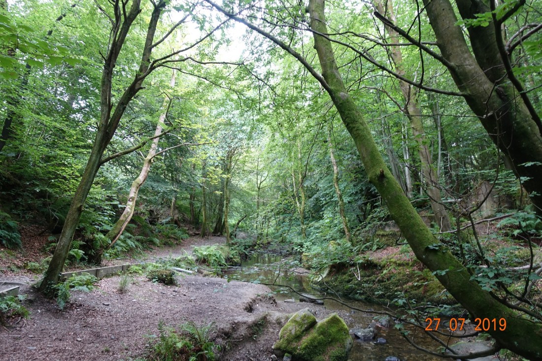
It was all rather excellent after that. Molly Quirk Glen (currently under repair but mostly completed) is an unspoilt and pretty glen, with good footpaths. It has a quietness that makes it special. It eventually merges into Groudle Glen. You can tell when you are nearing the join as you can hear traffic on the high road and I was lucky enough to see the Ramsey tram going over the viaduct as I passed underneath. Groudle Glen is entirely manufactured, created by Richard Maltby Broadbent in 1893, making the most of a very small natural canyon.

Images of Molly Quirk Glen

Beyond this, entering Groudle Glen ‘proper’ this has a different feel, and different geology too. There are some small waterfalls and some big slabs of slate bordering the stream. The Mill wheel is under repair and the building has been removed and is surrounded by scaffolding. The paths are really good, and although if you start from the high road and walk down to the Glen it is a little steep, it is accessible for most people, and if you parked down at the beach you would be able to take a wheelchair along part of it and pay a visit to the Groudle Glen Wizard!

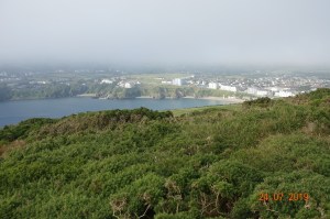
The main features of Groudle Glen

A glen is a glen is a glen so the photos look pretty much the same, though it was noticeable that this glen has a lot of beech trees, many of which had massive roots and some had toppled and been allowed to stay lodged over the stream.

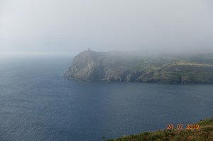
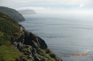
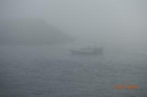
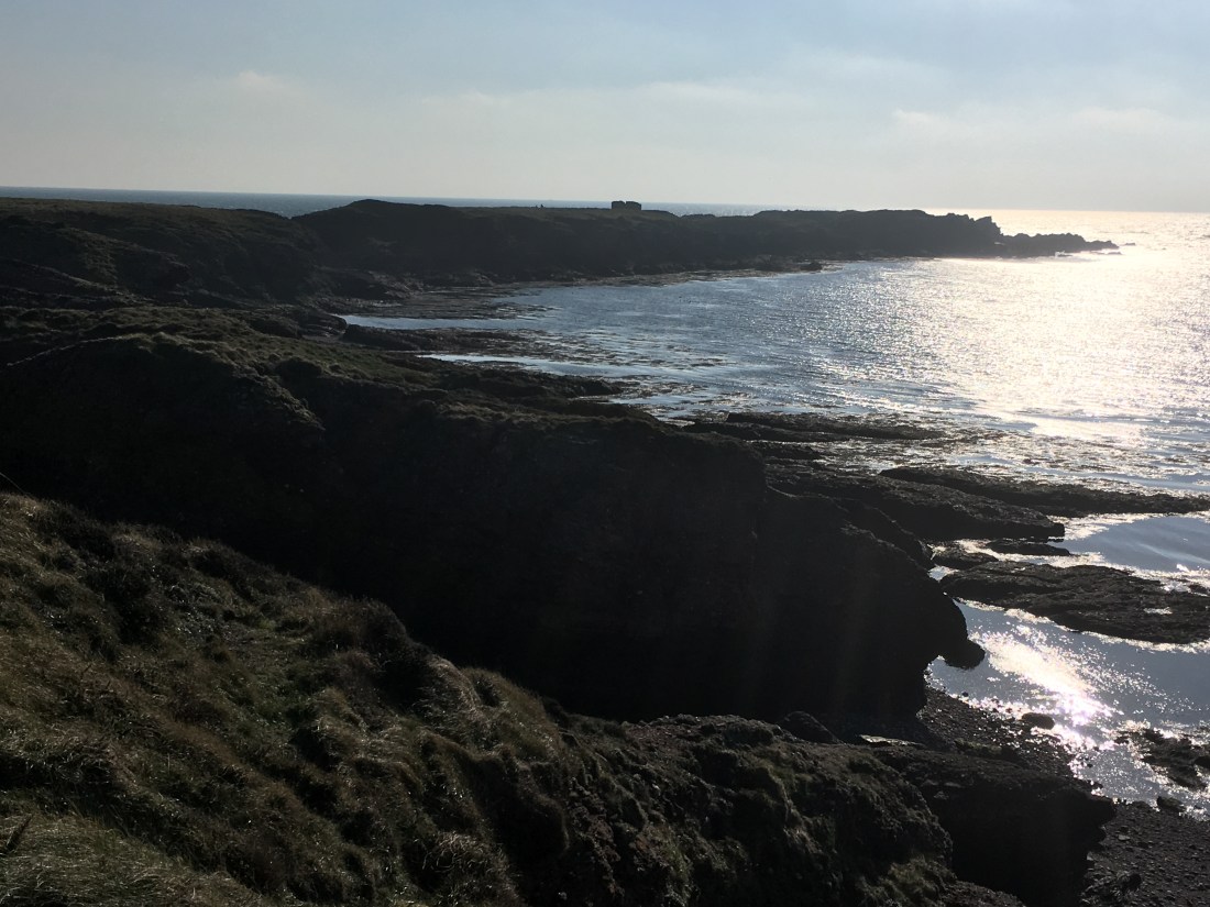
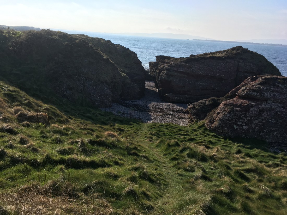
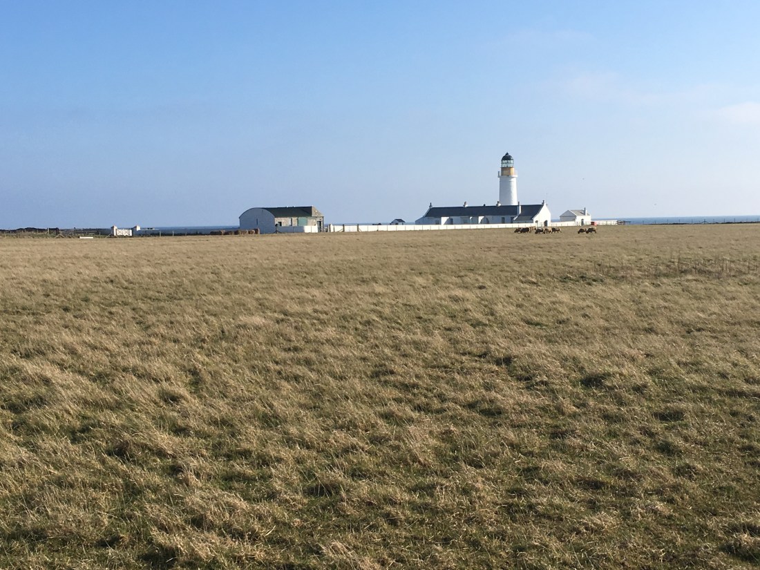
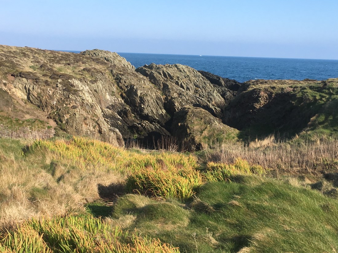
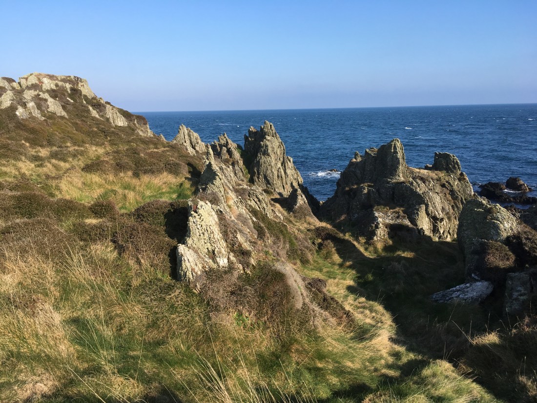
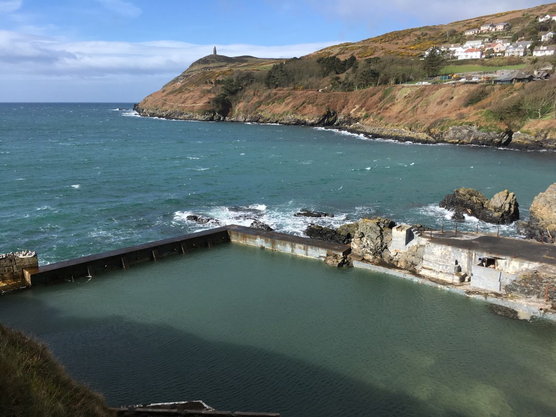
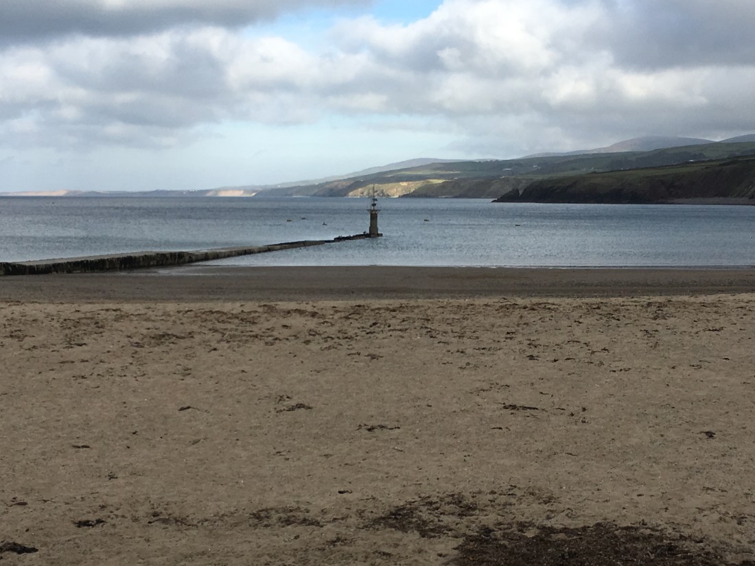
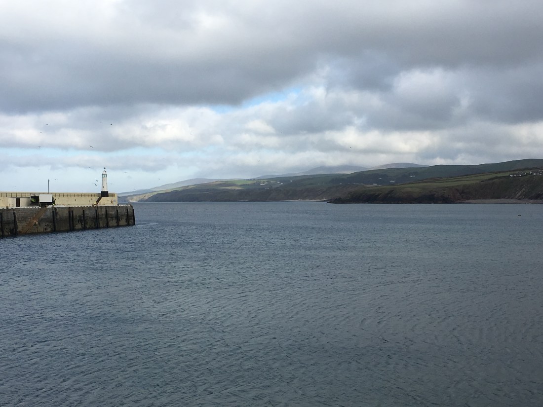
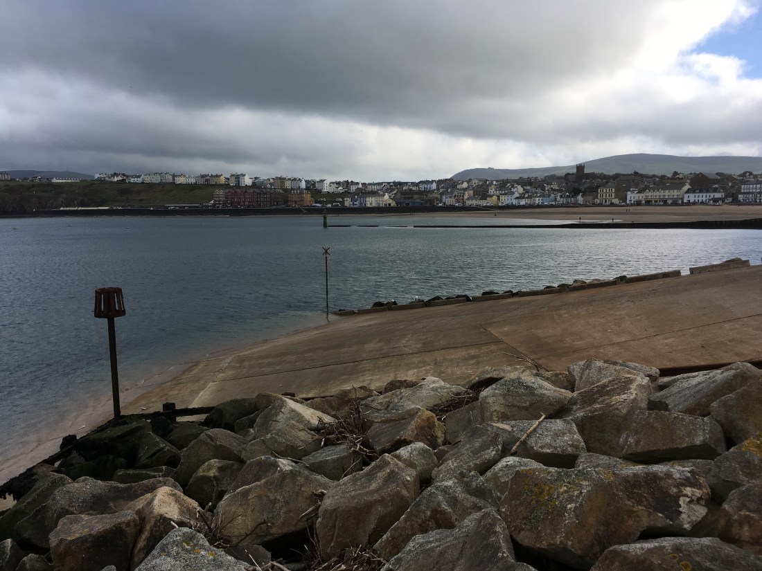
I reached the pebble beach just as it began to rain. The rocks and cliffs form very unusual shapes as if standing on end. I followed the coast path up to the Seal Rocks cafe, where the tiny steam train line ends. This would be about 2.5 miles from the start of Molly Quirk Glen if you don’t do any detours. There is a cafe here that sells drinks and sandwiches, but only when the train is running. This miniature railway was originally opened in 1896 to take people to view the attractions in the water zoo which included seals and polar bears, but is now just a pleasant trip for adults and children alike. The views from here are lovely and on a nice day it would be a nice spot to stop for a picnic. You can just make out the cafe in one of the photos.

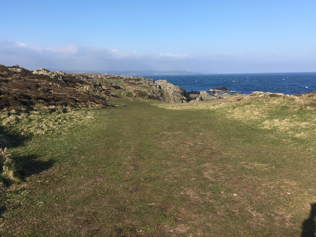
It is not possible to walk along the coast past this point. Rather than walk back exactly the same way, I followed the redirected coast path and walked up to a quiet road and walked along the top of the hill, turning left at the main road. There was another entrance into Groudle Glen so I ventured inside partly to get out of the rain and wandered happily about for a while before retracing my steps on the road to Groudle Glen tram station.

At this point, I descended back into Groudle Glen near to the viaduct. I was amazed how much extra water there was on my return visit. On the outward stretch I had watched a fish trying to get over an obstacle and failing, whereas it would have had no trouble now. The rain brought out all the scents of the flowers, especially the Meadowsweet as brushed past them on the path.

I had no choice but the follow the same route back beside the stream, but there was an upper path, which afforded slightly different views and kept me reasonably dry.

The total distance was just under 7 miles, with 511ft of ascent and 508ft of descent. It is a very very easy walk and very nice for a quiet afternoon stroll. One for all ages.

Groudle Glen


Dalby Mountain and Kerrow-Dhoo Plantation – 25th July 4 miles

It was a lovely afternoon for a bog exploration. I was out with Manx Wildlife Trust on Dalby Mountain, the only peat bog owned by MWT near Eary Cushlin. I have been here before and knew what to expect: bouncing bogs, heathers, bog cotton, bog asphodel and rushes from which lights were made in times gone by. The orchids were over, but the heathers were abundant as well as deer grass and the wonderful tiny sundew hiding in the spagnum moss.

After this I had planned a short walk as I had never been into the Kerrow-Dhoo plantation. It was hot day by Isle of Man standards and a woodland walk would be refreshing. I was not disappointed. My walk downhill mostly meandered beside a steep and enclosed valley with enticing views through the trees to the upland hills. There was just a wiff of breeze to cool the air and the tall trees masked the sunlight. The path was easy to follow and delightful. However, a word of warning: this may be only a short walk of 1.5 miles, 589 ft downhill, but it is very steep in places necessitating some grabbing on to branches or roots at times. I wasn’t wearing the best footwear but it is all manageable. And of course, what goes down must go up again to return to the car. The ascent was 663 ft in 1.65 miles.

Having had glimpses of the stream I was following I was thrilled when the path crossed over it from one hillside to another, and even with my trainers on I could not resist scrambling up the stream a bit to see what it was like around the bend and beyond the overhanging trees. Once on the other hillside it is not far until Barrane, a tiny hamlet tucked out of sight just south of Dalby, a place where you feel no-one notices or cares as time goes by.

DSC01531

It was here that I found myself in someone’s back garden as the footpath seemed to want me to go that way. At that point two dogs started barking and a man called out “Who goes there? Fee Fi Fo Fum….” – no, not really,  but he came to see what was going on and showed me where the path really went! And then offered me a cup of tea in his lovely cottage – don’t ever let it be said that Manx people are not friendly.

DSC01542Thru keyholeI had intended to take a different path – the one shown on the OS map – to return back through the plantation, but Tim persuaded me that I should go the coast route, which I did for a short time but I then returned to the main track and watching the butterflies perusing the brambles I made my way back to the car. There are some wonderful views on this section of the walk but be prepared for the uphill! It doesn’t go on for long, but you will notice it.

The final photos are of Cronk My Arrey Laa and South Barrule, along with one of the entrances into the plantation.

Maps:


The Sound as you don’t normally see it – 24th July 2019 – 6 miles

It started out so well. Wall to wall sunshine, not quite as blisteringly hot as the UK but lovely none the same, with a very slight breeze. I wore a light t-shirt and walking trousers and armed with sun lotion and an assortment of refreshments I set out on my evening walk.

As I reached the old breakwater in Port Erin where the men were fishing, I noticed some wispy clouds stretched out over the sea and a little mist fluffing in and out intermittently over Milner Tower.

I set out on the coast path behind the marine biological station above which some bright orange tortoiseshell butterflies were poking their noses into the limestone wall, dipping in and out the length of the wall.

Up and over the short climb taking me level with Nigel Mansell’s former property, I stopped to watch the misty clouds building up over the ocean, as the sunlight became dimmed and disappeared only to reappear seconds later.

DSC01468

Looking back, I could see the cotton wool clouds coating Bradda and closer to hand some dark grey clouds were looming to the west. As the wind gathered, I wondered if it might rain given the thunder and lightening forecast for the UK. I was feeling very weary today; my legs were heavy and every step a difficult plod – don’t ask me why – and I considered whether to call it a very short walk and return home, but as you know I rarely give in so on I went, but not before I spent a good few minutes watching a young seagull insistently complain to its mum that all was not well with the world.

Shortly after this I was engulfed in cloud, which presented a very mystical appearance on the land reminiscent of many a Jane Austen novel. I could have been anywhere as the sea and the cliffs were no longer visible; it was like walking on a path in the Derbyshire Peak District or across the North York Moors in the autumn. The colours were wonderful, the purple of the heather and the yellow of the wood sage blended perfectly with the light grey background.


As I neared our ‘Valley of the Rocks” I could hear an awful racket going on but could not see a thing. Climbing the stile I saw the cause of all the fracas –  a flock of sheep yelling at each other. They soon moved as I scampered down the path and they took flight over the hill.

Reaching the Sound was a strange encounter as not only could I not see The Calf Of Man, neither could I even see Kitterlands. I could barely even see the visitor centre. It was as if I had never been here before. It was remarkably peaceful and beautiful. And then out of the mist came a ghostly boat with a pinpoint light atop that never quite came into focus. Closer to the shore, a sole seal displayed for me as I ate my refreshments. I was glad I had brought a fleece and a waterproof – it was chilly sitting there.

DSC01483

So back home along the road to Cregneash  provided less interest. I met a lone foreign traveller walking down to the Sound and as I bade him farewell I wished the sun would break through the clouds for him as I feared he might not relish the view when he arrived otherwise.

DSC01490

An interesting evening. I wonder if I will ever see the Sound quite like that every again?

Nature Walk including Colby and Glen Chass – 5.65 miles, 432 ft of ascent

I make no apologies for describing today’s walk as a nature ramble. That was what I set out to do. I haven’t visited my haven so far this year and the orange tips won’t be around much longer. I always draw such warmth from my hidden nature reserve – hidden to all but locals walking their dogs, walkers and children escaping from their parents. It is not shown on a map and as far as I know, it doesn’t have a name – and long may it stay that way and let nature run wild.

I took the bus to Colby, then took the path beside the Colby river. There is so much to see in this first third of a mile. They were butterflies flitting, but above all numerous wild flowers abutting the water course, oblivious to the fact that there are houses on the other side of the river.


Above: The start of the walk from Colby.

Below: Nature in all its glory in the first mile of the walk


This slideshow requires JavaScript.

Crossing the railway line, I interrupted the sheep’s pleasure and seemed to cause some dismay as a few of them started coughing violently. This is pasture land where sheep share the territory with birds rather than wild flowers. I soon cross back over the river and enter into my little paradise. It isn’t much to look at, but if you listen you can hear the birds chirping to each other trees, and if you stop and stare, you can watch the butterflies chattering with their companion as they move incessantly on the path. The plants in flower offer their shade and their nectar to the local inhabitants and everything is in harmony.

Passing out of the nature reserve I make my way along the road to the Shore Inn. I debated with myself whether to stop and have a cider but decided against it, and instead I sat on the beach, drank my water and ate an odd selection of banana, raw carrot, cucumber and a very small chocolate bar. The birds surrounding me were mainly herring gulls and blackbacked gulls, with a few oystercatchers at the sea edge and a solitary shag perched on a rock. The tide is way out, further than I have ever seen it. It is almost that time of year when the intrepid venture out into Douglas Bay and slip and slide their way to the Tower of Refuge.

I walked around the coast to Port St Mary, along the Underway and out towards the outer harbour before turning westwards towards Fistard. Here I had a choice of direction and not having walked along Glenn Chass stream since I moved here five years ago, I took this route uphill. It didn’t disappoint. The bluebells are still out and are vibrant dark blue. There are still smattering of wild garlic too. As that conjures smells, I am reminded that as I went round Gansey Point. the meadowsweet was in full bloom and the scent was quite overpowering.

Above: The meadowsweet at Gansey Point; the extended beach at Chapel Bay; different types of footprints;  stranded boats at Port St. Mary.

From Glen Chass I followed one of the higher paths across meadows back towards Port Erin. I am particularly pleased with the photograph I took of the Milner Tower on Bradda Head standing on top of a stile just before I descended down the Golden Road, which right now is blue from head to toe.

The final stretch: photos of the gorgeous Glenn Chass,

and home…. altogether, I saw at least 5 of our 19 species of butterfly: red admiral, wall brown, green-veined white, orange tip and speckled wood.

DSC00327

A most enjoyable three hours. My next walk is planned for Sunday or Monday, when I hope to walk from Douglas to Castletown.


Catching Up – 15th May 2019

I may not have added to my blog lately, but I have been out walking. A couple of weeks ago I walked from Port Erin, along the coast to Fleshwick, up and over the Carnanes and then back via Sulby. It was a glorious walk but I have been struggling to upload my photos, and as any regular reader of my blogs will know my iphone consistently runs out of battery when I am out walking, so that walk is not recorded here. 😦

I have finally bought a camera, the Sony RX100 M3, and I have been out and about trying to figure out how to take photos with it. Initially, my photos were huge files but I think I have overcome that. Now, I am trying to work out how to get the exposure right and the colour of nearby objects.

On Saturday, I went along to Marine Drive in Douglas – these were the extra big files, but I have found a way to reduce them, thankfully, so I can include some here.

Yesterday, I pottered down to the bay, trying out the zoom lens and the amended file size. Perhaps a slight improvement. In the evening, I was lucky enough to spot a large white butterfly on my apple tree, which had presumably just emerged from its chrysalis as it stayed there for a good few hours sunning itself in the warm evening sun. Apparently, when they first emerge, butterflies are unable to fly as their bodies dry out to become strong enough to make their initial flight. It had gone by the time I got up this morning.

On my outing on Saturday I had met a traveller from England who was visiting the island for the first time and we arranged to meet up for a walk before he returned to England. So today, we walked from Derbyhaven, along the coast, contouring around the west side of the golf course up to Langness, passing by Dreswick Point and ‘Jeremy Clarkson’s lighthouse’, past the Herring Tower, veering round the eastern edge of the golf course to drop in for a cup of tea at No. 19. My guest very politely waited at various junctures on the route whilst I took more photographs. It was very pleasant showing the island to a stranger, who also turned out to be a very nice companion for afternoon.

The wild flowers were spectacular, as were the highland cattle. I was not quite so successful at capturing the birds. I did think the knots? looked rather good hustled together on the rock but my photo does not do them or the heron justice. I shall keep practising!

This slideshow requires JavaScript.


Ps. The birds on the rocks may be sanderlings or plovers, but definitely not knots which have a red underside. Shame I couldn’t see them better.

Cliffs and Athol Glen Park 8th April 2019

I was up on the cliffs yesterday and noticed the amount of erosion that has occurred over the winter months.  It appears that no action is being taken but I wonder how long it can continue its course without parts of it finally plummeting into the sea? This will impact the cliff walk to Bradda Glen, just as the closure of the lower route has done, but having the higher route at least has always meant an alternative route.


The coast path to the south is closed behind the marine biological station for slippage up until May 27th, reopening just in time for TT.

It has been quite a wild winter over here. Not that it has been cold, wet or snowy. Just windy. It is noticeable the number of trees in the glens that were demolished by the winds and what were quite leafy glades are now more exposed to the sky, though this will change as they come into leaf. It does enable to ground-loving plants to come into their own, so there is always an upside to this kind of destruction.

I stopped at my usual hotspot on the beach and watched the tide come in until it lapped against my feet, then I walked home via Athol Park Glen. This must be one of the smallest glens anywhere. It takes less than 5 mins to walk end to end, unless like me you amble slightly off the footpath to take in its hidden gems. Even so, at its widest it can only be 200 yards or so! The bluebells and white bells looked almost more effective there being only a few of them, and the light cast wonderful shadows of the trees.

This slideshow requires JavaScript.

Langness March 31 2019

Always a good spot for a bit of fresh sea air and distant views. This is a very easy level walk of no more than 3 miles, so great for an afternoon stroll to walk off the Sunday carvery.  My friend Janet and I started out by the over-sized bird table on the western side of the island that commemorates the Manx ornithologist Henry Madoc, who just happened to be the Chief Constable of the island. I can’t help but think that the birds have plenty of water in these parts but it is a landmark none the same.  It was a hazy day,

IMG-6781 (1)

which didn’t lend itself to good views but it is good to stretch the eyes.

From there we walked round the southern tip, past the foghorn at Dreswick point, which incidentally I have as a night-time view of the Milky Way as a screensaver, past the gun emplacements up to the Herring Tower. We continued a little further but have to foreshorten our walk due to other commitments. On other occasions, we would walk up along the eastern side of the golf course and pop in to No 19 for coffee or lunch.

IMG-6784IMG-6786IMG-6783IMG-6790IMG-6791IMG-6792IMG-6795IMG-6797IMG-6796

If you would like more information about Langness, read here:

https://www.culturevannin.im/qr_page_386169.html

Anyone for a swim? Tuesday 5th March 2019

It is rare the see old swimming pool at Port Erin brim full of sea water, and how much pleasanter it is when we can’t see all the debris and mess on the bottom. I was only out for a short walk today to post a parcel, but the weather was so lovely I could not resist a walk around the cliffs towards Bradda Head in my lunch break.

It was high tide and there was a stiff breeze blowing, which meant the white horses were skipping over the rocks, pushing them backwards and forwards and grinding them down. It was quite noisy down at the bay where I sat for some 20 mins just watching and listening. I adore high tide and often plans my walks around the tide table!

There is little to add verbally to this post. These walks are about views and not words, about experiences rather than in depth analysis. In many ways, the fewer words the better. So, I shall leave you to enjoy the views, while I get back to writing sample questions and answers for the new GCSE Psychology course.

Mad Dogs and English(wo)men – Saturday 2nd March 2019

… go out in the mid-day mist, wind and rain for fun. Apologies to Noel Coward for adulterating his song, not that he refers to the Manx in his ditty so perhaps he just assumed anyone living on this island is only very slightly barmy. Unsurprisingly, I saw no walkers on this 6 mile walk, not even the intrepid dog walkers who generally stop for nothing and no-one. I was initially protected from the south westerly gales that would eventually batter me as I skirted around Meayll Hill and Cregneash towards the Chasms by happening be on the lea side of the hill. Once I hit the tops, I knew about it. It was hard to stand up at all at times and the persistent winds seemed to be trying to push me back the way I had come.

But, not to be outdone, I carried on quite aware that other options seemed much more enticing, like catching the bus back to Port Erin, but that would signify failure and being boring, and where was the fun in that? Then the rains came. It was just possible to make out the Calf of Man and to see the white horses galloping over the waves at the foot of the cliffs.  It was pretty pointless really, but there is still joy to be had in these extremes of weather and some pleasure in being the only idiot anywhere to be seen.

I sat in the old ‘Cafe’ at the Chasms, ate my banana, and contemplated how well I am feeling. Quite remarkable only five days after an operation and having had next to no sleep last night, but I was very happy watching the driving rain from my temporary place of safety and wondering where to go next.

As I descended toward the Sugar Loaf, the rains subsided, so I followed the lower route to Port St Mary, passing by Glenn Chass before encountering the wrath of the winds again on the southern section of coastline going towards the harbour. Turning northwards through the village, everything became calm and dull. I walked along the main street in PSM, then followed the main roads back to Port Erin, with only one thing on my mind – a nice cup of coffee and home made egg custard tart at the Whistlestop, the cafe next to the railway station.

If you were to follow this route, starting at the railway station – follow the main road up to the Methodist church and then turn right into Drogadfayle Road. Follow this over the railway line and continue up the hill, round the dog leg bend and you will immediately see the footpath going up the hill (about 1/2 mile from the station). This footpath is colloquially known as the Golden Road. When you look at the photos you will see why.

The quality of the photos is somewhat lacking due to the weather and it being impossible to stand still most of the time, but this is what is was like – just wonderful 🙂

This slideshow requires JavaScript.

2019-03-02 Circular route

Onwards and upwards – Friday 1st March 2019

It seems fitting that it is the first day of Spring, and that this is my first 10,000 steps for some time. Health issues, deaths and funerals have made their mark over the last five months, and quite frankly I am glad to see the back of them. Monday was D day when I had the left lobe of my thyroid and parathyroid glands removed, and that surgery was the easiest and almost the most pain-free day I have had for a long time as my leg pain was also blunted by the anaesthetic – and indeed, this remain the case several days after, bizarrely.  So, I am feeling most optimistic and looking forward to getting out treading the paths as I love to do, breathing the air and looking up towards the sky and out towards the horizon.

Today, my friend and I decided to visit Close Leece Farm Shop and Cafe, which has just opened between Patrick and St Johns. This cafe / farm only stocks local produce and we were keen to try out their menu. We had scrambled eggs with chives and creme fraiche, and I had smoked salmon with mine (sourced from Port St Mary). It was all delicious… but not cheap. Mine was £10.50 and the coffee is very expensive, £2.75 for a fairly small cup with no free refills. The location is very attractive, an old stone barn with a log burning fire. There is a shop stocking all the produce that they cook, and more. The cafe is at the back and there is room to sit outside. The atmosphere was slightly spoiled by canned music playing inside and out. We commented to the staff that it would more appropriate to play Manx music, and I wouldn’t want music playing outside at any time, especially in such lovely surroundings.

After this, Janet and I decided to stretch our legs and we had a wander around Peel, first of all going around the outside of the castle, along the prom and then into Peel itself. We tucked into a number of antique shops and browsed our way around the quaint streets before returning back to the car at Fenella beach.

This evening, I took myself down to the beach at Port Erin. I am not quite sure what they are doing with the sand. It was dark and raining as I walked towards the sea, and I kept tripping over ridges of sand made with what looked like caterpillar tracks. I shall have another look tomorrow to see what they are up to.

So, stitches come out on Monday and I get my histology report towards the end of the week with any luck, and hopefully then we can draw a line under that, and if not, we just carry on and deal with whatever life throws at me. I am getting used to it. Whatever, my plan is to get out walking between 5-10 miles at least twice a week now, so there should be more updates to this blog from now on, and more photos to inspire you to visit this wonderful island, or if you live here, to get out and enjoy it 🙂

Peel 1Peel 3Peel 2Peel 5