Douglas and Laxey Sat 22/9/18 – The Tourist Route

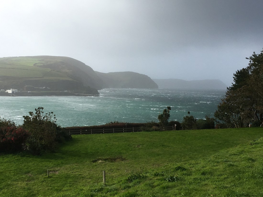
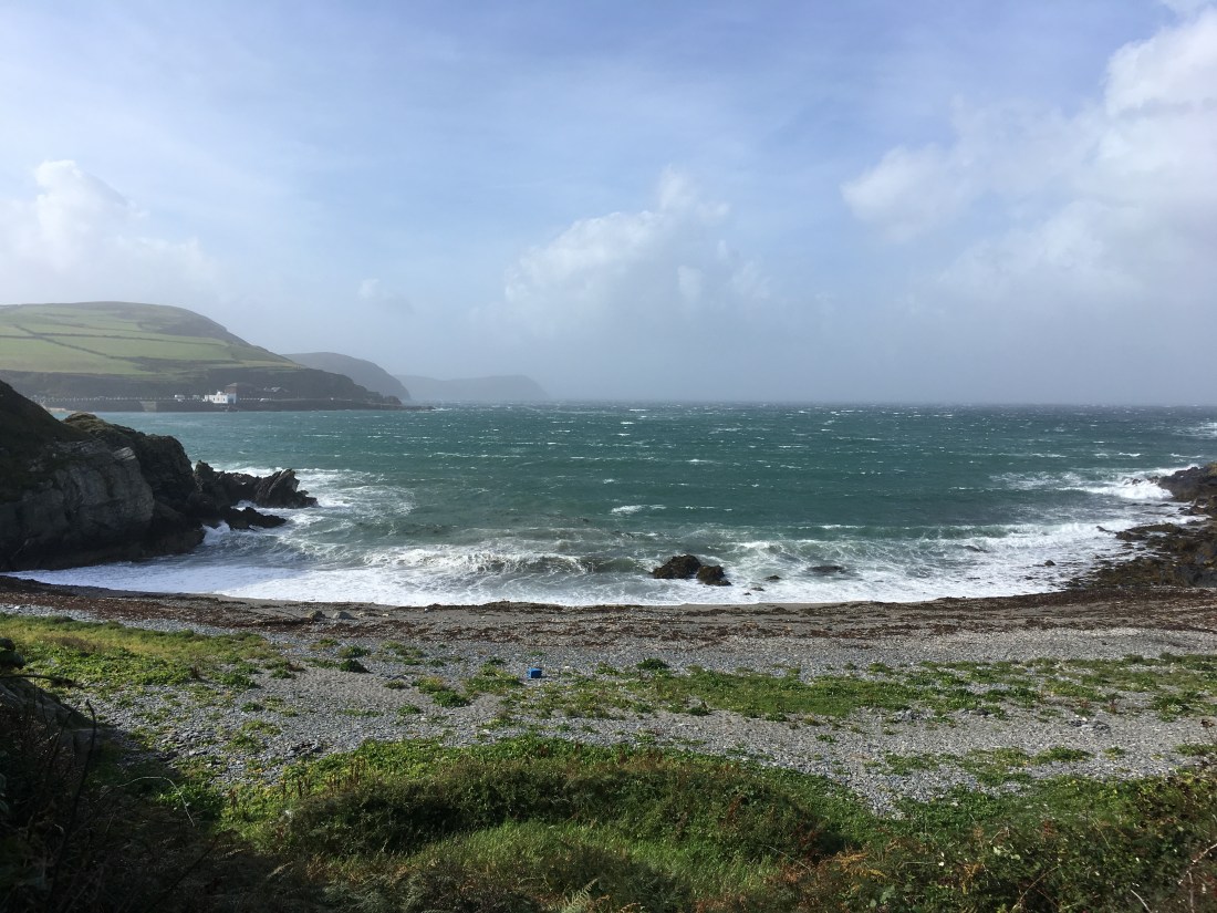
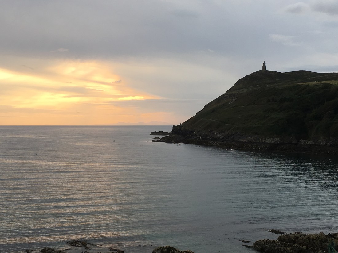
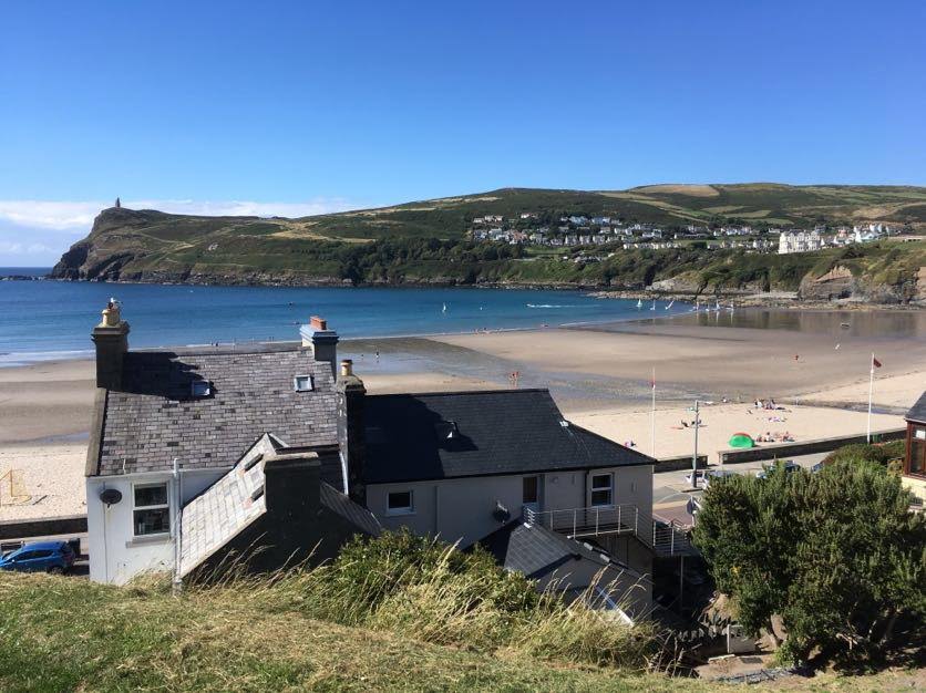
Autumn has definitely arrived, and I for one am grateful to be away from the blistering heat of the Mediterranean. This week’s windy and wet weather certainly is more typical of the Isle of Man than the sweltering two months we were treated to in June and July. Port Erin beach has a new shape to it, as the gale-force winds have created mini dune-like effects and swept the sand over the stones at the far end of the beach. Today, as I wandered around the bay, the same beach had changed again and the far end looked like the pebbly remains of a torrent of water that had gushed from a hillside dispelling its contents – not true of course, but it emphasises the power of the natural elements.

IMG_8760

On Thursday 20th September I played table tennis at the NSC (National Sports Centre for the uninitiated) in Douglas, and walked the short distance from there to M&S, following the river and walking alongside the Marina, about a mile and a half altogether. This is one of those walks that only odd people like me or locals will do as it does’t take you far and it is much easier to get a bus! I stand corrected – in fact, if you did the walk the other way round you could continue on a pretty track all the way to Port Soderick. I did think you might be interested in one small aspect of my town ‘walk’. It starts by Pulrose Power station with its ugly steel buildings, car parks and railings, but as soon as you turn a corner you are in a different world, one of trees and green and mystery. What struck me this day was the sweet smell coming from the trees and nuts only on the green side. Two contrasting worlds separated by a fence! The views below are literally fractions apart.

One one side of the hedge, grey steel and angular shapes; on the other side, soft green trees, leaves and nuts strewn across the footpath.

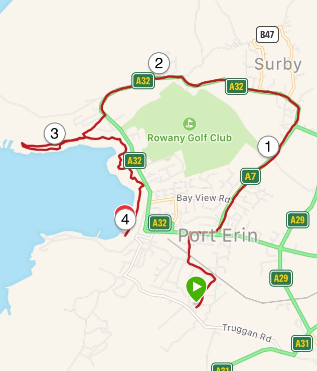
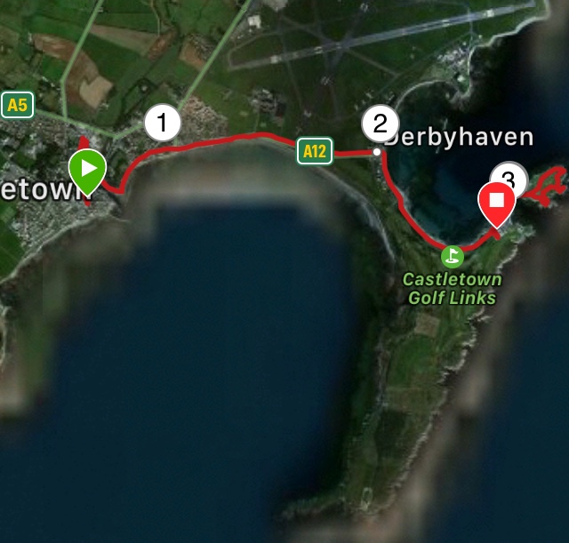
On Saturday, I went back in time. When I first visited the island in 1998, I didn’t have any transport of my own so used public transport for all my walks, no matter where they were on the island. This can make for long – but very enjoyable, days.

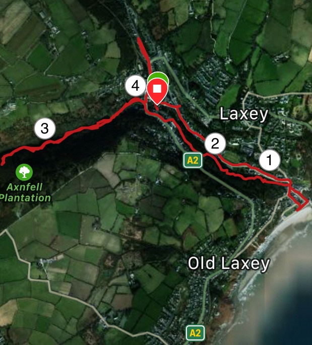
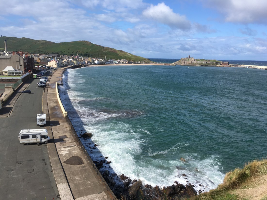
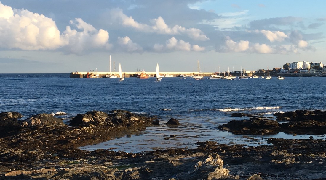
I got the 10am steam train at Port Erin, which left 15 minutes late as it had to wait for the incoming train before we could leave. No matter, I had plenty of time as I wasn’t due to be at Laxey for a Friends of Manx National Heritage event until 2pm. Arriving at the Douglas railway station I walked along the Marina up to the ferry port so that I could get a photo to show you to full extent of Douglas’s wonderful promenade, with its wide walkway and horse drawn tram (the longest running horse drawn tram in the world I believe). I was a bit ahead of time so popped into the shopping centre for a coffee, then walked up to the far end of the prom to catch the electric tram to Laxey. The prom was full of people, a chap on his bike, a lady and gent taking a stroll, another person doing their fitness routine and a lady with her children and pushchairs, and me walking very briskly as I had completely forgotten just how long the prom actually is – 2 miles end to end!! I needn’t have worried as the tram was late too. I thoroughly enjoyed this second journey by public transport, more so than the steam train. It goes along the coast to Ramsey and the views are tremendous. The further you go around the bay, the more it seems like a seaside resort and you can smell the air and see the views.  I could see Black Combe across the water in the Lake District and the many wind farms of Morecambe Bay.


Photo above: Spot the join; the two photos should overlap slightly.

I got to Laxey expecting to visit the Glen, but sadly the walk took us in the other direction down the old road to the Woollen Mills, through the beautiful old village to the beach. Our guide told us about the history of all the different mills, flax, paper, flour, and the pipe factory, although the only one of these historical buildings currently in use is the very large flour mill where we started at Laxey Glen. She also showed us secret waterfalls, leats and ponds (dips in the ground that you would walk past in an instant usually) that had been used in the processing of the various materials and an old delapidated brewery tucked away in a hidden spot. It was a very interesting tour. At the end I had to go in the opposite direction and explore the Laxey Glen itself. This is beautiful – one I had never visited – and a complete contrast to the main river valley leading down from Snaefell, with the famous Lady Isabella Laxey Wheel and the Washing Floors. Despite being heralded for its fame, I learnt that mining came late to Laxey but it was a thriving town long before that, mainly due to its plentiful mills. However, the number of lovely houses is thanks to the miners, not for their achievements in Laxey necessarily, but our guide told us that many people were sent to seek their fortunes in South Africa and they sent money back home that allowed them to extend their properties.

This is the only photo I managed to take of Laxey and is of the washing floors. Worth a visit in their own right. Laxey is a fascinating village with a lot of history. If you have never been here, it is well worth making a special visit and there are walks in all directions, which you can reach by the electric train , tram, bus, or walk. I am thinking of Dhoon Glen and Snaefell in particular.

Laxey Glen can be found to the west of the main road and is enclosed and very green with large trees. There is parking immediately on the bend by the mill. The river running through the glen is beautiful, with banks and groves on either side. As you climb higher into the plantation it becomes quite steep and muddy and as it was getting late and I didn’t know where it would come out or whether I would be able to find a new return route, I cut my losses first of all finding myself a sturdy stick to help me negotiate the steep downhill parts and I returned back by the route I had come. I hoped to reach the visitor centre to see if they had a map of the Glen but when I got there it was closed (4.45pm)

I had completely forgotten to charge my phone this time, so I will post photos of this area another time.

The walk around Laxey was a total of about 4.5 miles, and 2 miles altogether from one end of the prom to the other, although I managed 10 miles overall for the day one way of another. I shall revisit Laxey Glen as there look to be some interesting paths through and around it up to the mountain, some without the need to go to the very top and I should like to investigate.

IMG_5875.jpg

Another blowy walk – Port Erin 19/9/18 – 4 miles

If I thought yesterday was blustery, it was not a patch on today. I wanted to kick start my Garmin watch into registering my intensity minutes as it had gone on a go-slow, so decided to take the long route to the dentist this morning. And what an exhilarating walk it was. It might all have been on roads until the final 2 miles, but I was getting pushed and pulled by the wind, almost lifted off my feet at times, so it had some exciting moments.

I was walking at a cracking pace anyway, but I was definitely wind-assisted. It was such fun :-). I walked from home to Ballafesson and up the top road to East Bradda, where the wind tried to push me back down the hill! Then down to Bradda Glen and along the cliff path towards the Milner Tower. As I went through the glades, the wind howled through and jostled them about. It was quite deafening. There was one tree looking distinctly dodgy so I made a snappy move to get past that. I didn’t fancy a tree bonking me on the head. And then I had a jog along the cliff path, quite why I don’t know, but I was enjoying myself.

Having gathered speed there was no stopping me and I made short shrift of the cliff path back to Port Erin and the beach. I got sand blasted as gusts of winds tore up the beach. I did over 4 miles in 1hr 5 minutes, good going by anyone’s standards, especially given there was 670ft of ascent and 760ft of descent altogether. And yes, it did register my intensity minutes.

IMG_3762

Look at the map. Even that has entered into the spirit of the day and looks like a windswept head 🙂 🙂

IMG_5844


A blustery day in the South – Port St Mary & Port Erin 5.4 miles

I haven’t had much chance to get out since I returned home, but I have managed my 10,000 steps each day to keep my serial record alive. I am now at 69 consecutive days of 5 miles or more per day.

Today, I had to force myself out. It was a dull, cool day and I could quite easily have had a pyjama day, given that Tuesdays are my day off. It is something of a change from the hot and humid weather of Mallorca. Having caught up with all my marking in the morning, I went over to Tynwald Mills to check out waterproofs, and again bought nothing, but this was enough to convince myself I needed some fresh air.

I walked from home over to Port St Mary. On the home side of the hill, it was quite calm but when I hit the south coast the winds blew and my hair blew all over the place. The seas were in full motion, doing what they do best, whipping up the waves and splashing against the rocks. They were fun to watch, and still there was 90 mins to go to high tide.

As soon as I turned the corner the winds abated and normality resumed. It is hard to believe that the picture taken below is only about 200 metres from the ones taken above.

IMG_7094

I walked around this bay to the other side, up to Carrikey Bay and Gansey, where some kayakers were riding the waves.

From here, it was all road-walking home, more than planned as I had to do a detour into the village to post a letter, only to discover that we now have only one postal collection per day anywhere in the south. I could have posted my letter anywhere. We used to have an early morning collection but apart from Mondays, that has now ceased and we only have one collection late afternoon!

This is an easy walk on good roads and paths. The 5.4 miles took me 1hr 34 mins walking at a brisk pace. If you were starting in the heart of Port Erin, parking by the railway station, follow Drogadfayle Road to the footpath linking this to St Mary’s Road. There are alternative ways back, but it is still a good walk however you do it.

Slideshow of Milner Tower and Bradda Head, 4 miles Wednesday 29th August 2018

A stunning evening walk around Bradda Head, just 4 miles or so from my house. Do you need any other reason to live here?

There is quite climb up to Milner Tower which might not suit everyone, but there are other options to reach the top. If you take the car to West Bradda you can take a gentle sloping path with barely any ascent all the way!

Check out this video I took last night – I can’t upload it here, so have a look on my Facebook page:

Castletown to Langness Golf Links (No 19) and Fort Island – 4 miles (return 2.5 miles), Tuesday August 28, 2018

This short walk may be mostly on road and only a relatively short distance, but it is nonetheless spectacular in its simplicity, its peacefulness and breathtaking distant views in all directions, not forgetting the sea breeze that might sweep away any lingering cobweb at any moment. The bonus is the start and end point at Castletown, with its fine buildings, windy streets, castle and teahouses.

I was meeting some friends who had had an apartment in the Brambles at Port Erin when I was living there. They had moved to Anglesey and they were unexpectedly visiting the island for the Grand Prix, so we arranged to meet at No.19 for lunch.

For me, this meant I could get the bus to Castletown and then walk along the various beaches and shore lines with their different ambiences and if time walk the perimeter of the Langness peninsular. Today, this was unlikely as I had to get back to teach dancing but one can but dream…

I had thought of visiting the Castle first but decided I wanted to visit Fort Island and there wasn’t time for both, so I grabbed a takeaway coffee and walked round some of the quaint streets that comprise Castletown before visiting the loos on the bridge (worth knowing where they are, as there aren’t many that are open every day in Castletown). The loos in the Town Hall are closed at weekends.  I walked down past the Peggy Museum onto the coast road. I sat on some steps overlooking the bay and watched the tide whilst I drank my coffee, then resumed my journey stopping briefly at Hango Hill opposite the King William’s College and continuing on to Derbyhaven.


Photos: Derbyhaven Bay, Hango Hill and King William College

Here, rather than taking the road I continued on a very very short distance to the bay and walked along the beach. The tide was coming in and this is always the best time to see Derbyhaven. From there it is only a stone’s throw, say half a mile, around the Bay to the Golf Links and No 19, but I wanted to continue along the coast path as I still had an hour to spare.

And what a great hour I had, messing about on Fort Island. I haven’t been here for years. You walk across the causeway, which now prevents the island from being separated from the mainland.

IMG_3182

IMG_9198

It is quite a nature reserve here, and the sea so very clear and clean, and having rocky outcrops as opposed to the rest of Deebyhaven bay which is sand and pebbles, I could scramble about the rocks and have fun.  There is the old chapel and of course, the Fort, but most of all the views are simply terrific and you can really open your eyes and let your long distance vision take over. My thoughts were that my grandchildren, Emily and Joe would enjoy it here, so I must bring them when they come over next.


And that was yesterday’s walk as I had to return via almost the same route, except in Castletown I walked through the Bowling Green, where there were bowlers and spectators alike enjoying the sunshine. There is an excellent cafe here, where you can sit inside or out, and appreciate not just the bowling but beautiful landscaped flowerbeds. I also wanted to walk along the Crofts with its stunning houses. I reached Castle Rushen school and waited patiently for the bus, which was running late due to the Grand Prix, and got home just in time to spend the next three hours teaching ballroom dancing.

Although I walked this route, you can take the car all the way to the Golf Links and even on to Fort Island, so this is suitable for a wide range of ages and abilities. You could start your walk where I ended and walk round a variety of paths on Langness, but I will save that for another day.

IMG_5260

Peel Northern Cliff Walk – 3 miles

Well, this was a red-letter day: a short walk, only 3 or so miles!! And red in other respects too. The cliffs around Peel are different from any others you will come across in the Isle of Man landscape being made of red sandstone. The wonderful Peel castle is and the grand Peel Cathedral (as well as many of the houses in Peel) are made out of this same substance, just as in the south many of the buildings comprise the local limestone.

I had just been to a Pilates class. The weather was sunny with a fresh wind, the tide was in and the white horses were galloping over the sea. It was so inviting. I ignored my first thought to get back to Port Erin and the drudgery of work and allowed myself an extra hour of exhilaration before succumbing to the normal duties of life.

Walking beside the Marina, I started at the bridge over the River Neb and walked along the promenade. As I reached the far end the waves were crashing against the concrete defences, throwing up massive fountains of water onto the pavements. Some boys were having great fun on their bikes and getting soaked in the process. I avoided the temptation to touch or kick the rocks at the far end which I believe is a tradition for Peelers.

I climbed the short distance on to the cliff, which skirts round the edge of Peel, past the old beach swimming pool. This is a very easy walk, which is great for all ages and affords a wonderful view of Peel and its surrounds. A nice grassy path, hardly any elevation, and stunning views to the north and west. It’s just a shame I can’t share them with you as my phone ran out of battery after about 5 mins – nothing new there then.

IMG_6629

The jagged rocks stick out from the path and many seabirds were taking advantage of this, and there were shags and cormorants drying their wings in the fresh air, and several other smaller seabirds skirmishing around in the wind.

The walk continues north for about 1.5 miles on a relatively narrow and windy footpath when it turns inward in order to go round a cove. I stopped at this point and retraced my path back to Peel. If I lived in Peel this would become my standard constitutional walk and indeed there were others enjoying this path along with me, including a runner.

If you are bringing children, you would need to keep very young ones close to you to stop them straying off the path and into the sea,  but this is a walk children from 5+ (and dogs) would really enjoy and only being a short distance, it is well within their compass. Not a walk for wheelchairs or pushchairs however.

For those who like a longer walk, you could extend the walk to include Peel Hill or a short walk around the perimeter of the castle. Or, as this is the start of the coastal footpath to Kirk Michael walking northwards is another option, though getting back to Peel might be interesting as you would have to check the bus timetable and avoid TT. There’s a challenge  ….

IMG_5192

Local Walks round Port Erin & PSM – 8/10th August 2018

Over the last few days, despite best intentions I have only managed local short walks – 2 x 3+ mile walks, and today a 4 mile walk. My aim on short walks is to achieve my 10,000 steps in the nicest possible way – not too difficult when I am surrounded by beautiful countryside. Incidentally 3-4 miles will be between 6,500 and 8,500 steps so not enough on their own  to complete the daily target but well on the way. I won’t bother you with the actual routes for these, but if you want details just contact me.

Wednesday evening I walked with a friend from Port Erin along the main road to Carrikey Bay, round the coast to Chapel Bay in Port St Mary, then back to PSM along roads. A nice way to catch up with friends.

IMG_9320

Thursday, I walked down to Port Erin beach, a round trip of just over 3 miles. We have had few interesting shells lately, but many many jellyfish including moon jellyfish and some spectacular lion’s mane jellyfish. These were a good size whereas the moon jellyfish were mainly just babies washed up on the beach.

Today, I have walked to Port St Mary, along the top edge of the golf course to Perwick Bay. The tide was really far out. I don’t think I have seen so much rock exposed in that region before. I followed the coastline back into PSM on the underway, carried on towards Four Roads and then took the footpath across the fields back to Port Erin. It was a lovely afternoon and this took about 90 mins, so not a great deal of time. I would be quicker if I didn’t call in at the Coop and load myself up with potatoes, meats and veg!!

I doubt if I shall be doing a long walk this weekend and I am on duty at one of the Wildlife Reserves on Sunday, so instead of describing walks, my next blog will consider the costs and benefits of using fitness monitors.

Best Foot Forward…..

I don’t know about you, but I feel alive when I am outdoors, and what can be better than spending time walking around the beautiful Isle of Man. There is such a variety of walks, from strolls along the beach, along forgotten railway trails, down the (often steep) wooded glens with secret waterfalls tucked inside, across the windswept moors, or over the switchback hills. I won’t call them mountains as we only have the one over 2,000ft and that is Snaefell. All this in an island 32 miles long and 14 miles wide at best.

The purpose of this blog is to share with you some of the many and varied walks I undertake. I aim for one ‘long’ walk per week, long being a minimum of 6 miles, which isn’t really very long, but it can be up to 10 or 12 miles if I have the time. If I remember to set my Garmin, I record the route which I will post with photos taken en route on my mobile. More often I do shorter daily walks between 3-5 miles. I am fortunate in that I am spoiled for choice of route where I live, so I never get bored.

I usually manage the recommended 10,000 steps minimum per day (5 miles) and of course most hiking involves a degree of ascent, so quite often I add to my intensity minutes for the week. Given this helps the bones, muscles, heart and lungs to stay strong and as a by-product keeps the weight off, it is also a healthy hobby. On a planned longer walk I often aim for a brisk walk for the first hour with odd stops to take in the scenery and then I take the rest in a more relaxed manner.

Walking at any speed is always better than sitting on your bum, but casual and intermittent walking doesn’t really have much of a health benefit, although it is good for the soul. For health benefits you need to feel you have done it, and  exploring your local countryside is a great way to do it!

So, to get started on the next page, I will shortly upload details of my walk on 7th August 2018.