Tansley Woods and Lumsdale Waterfall

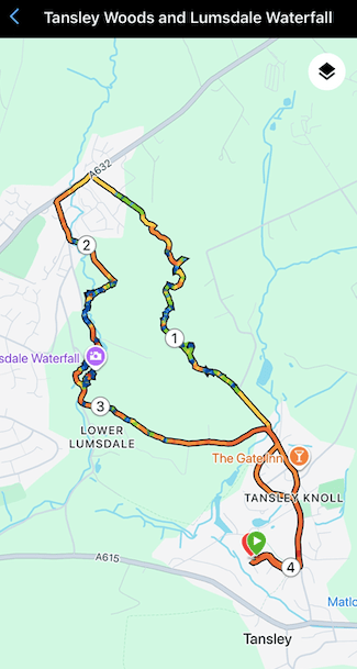
It had been a quiet day. The sun was shining and I needed to stretch my legs. What better than a short walk from home to raise an appetite.

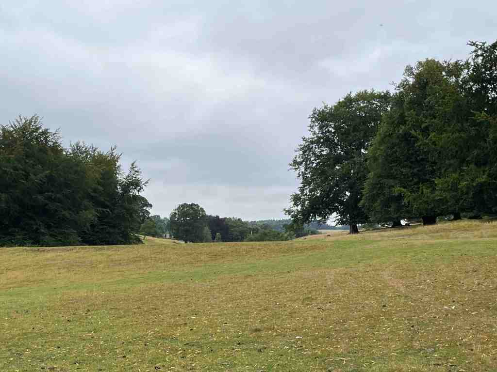
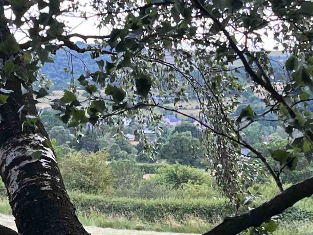
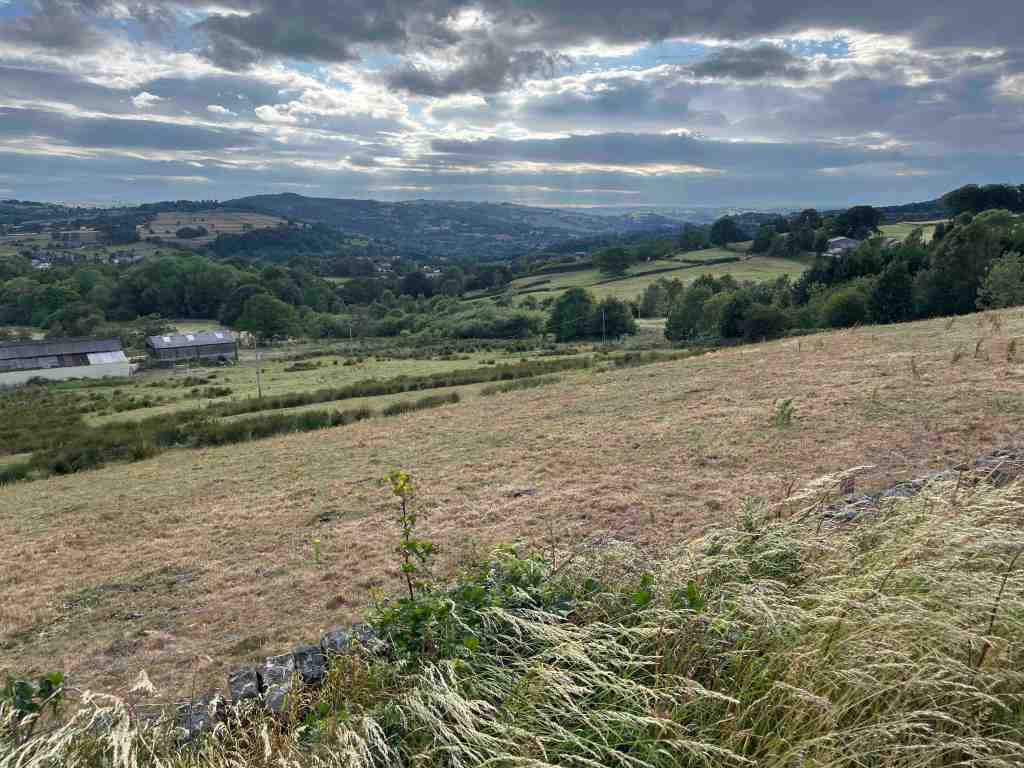
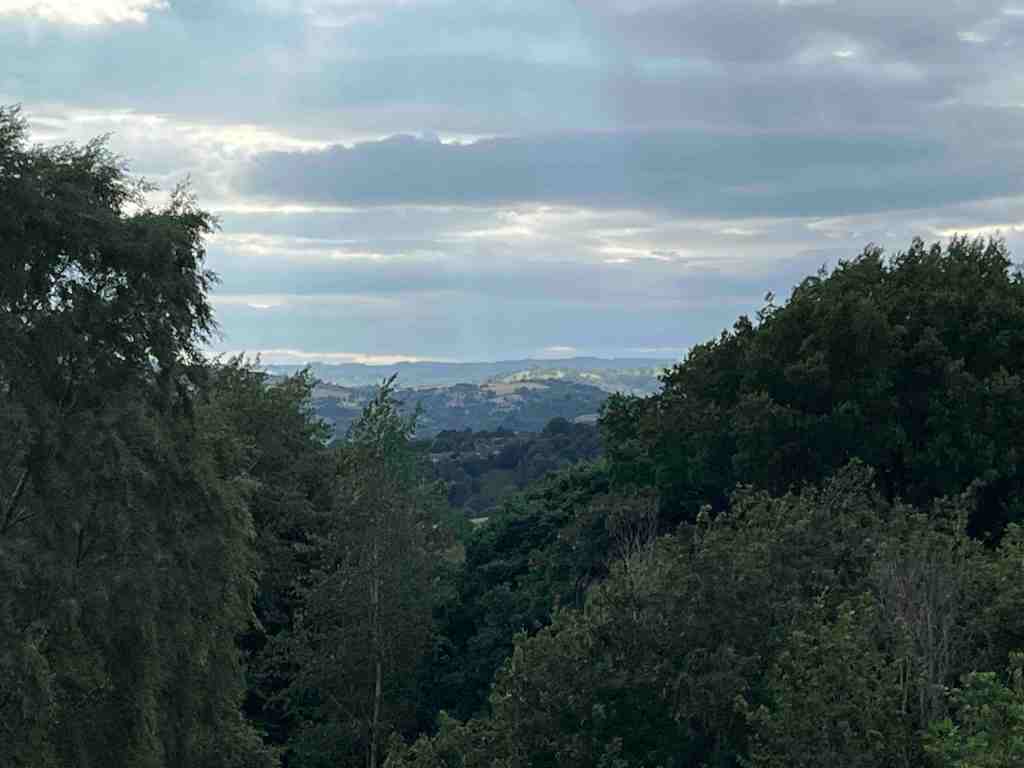
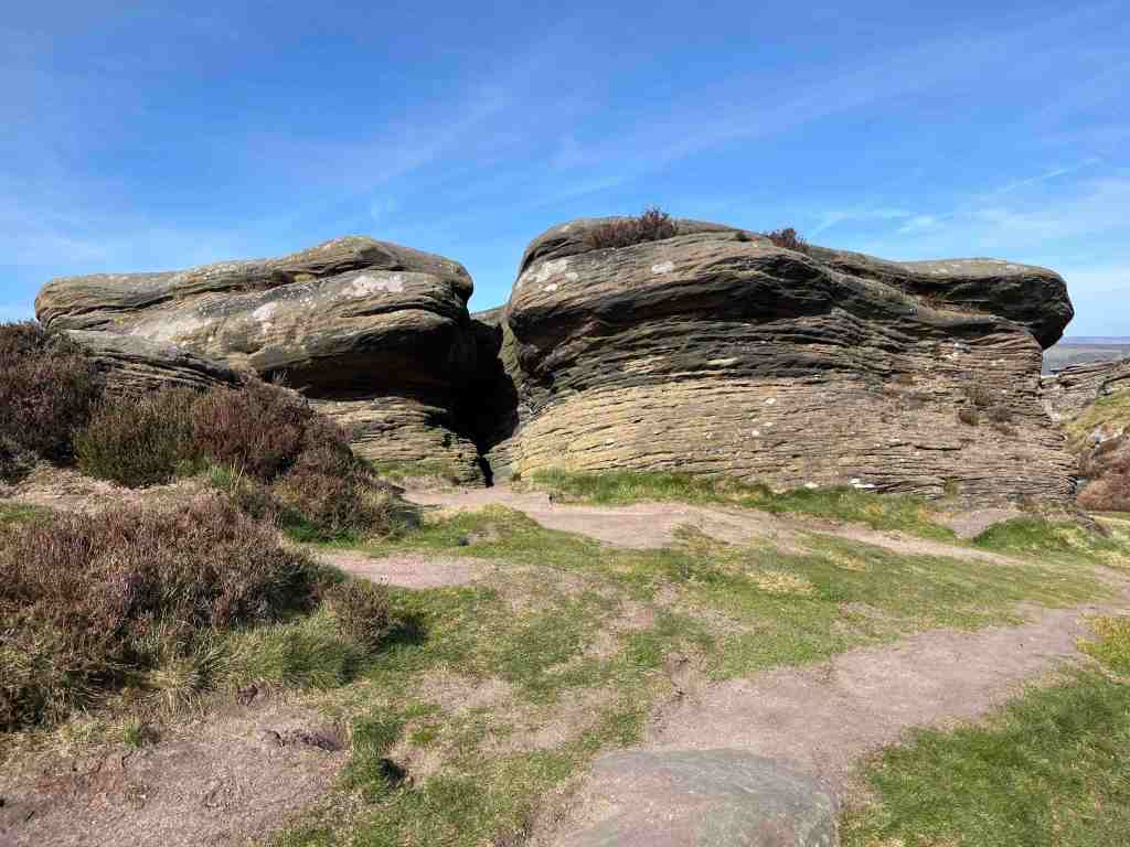
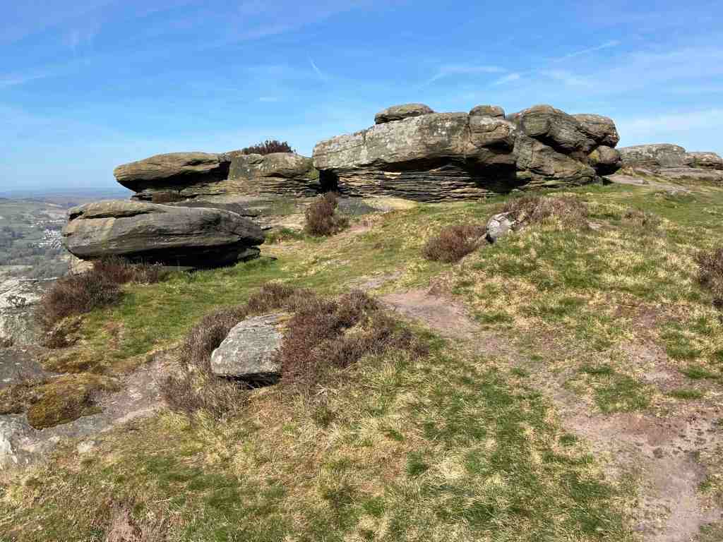
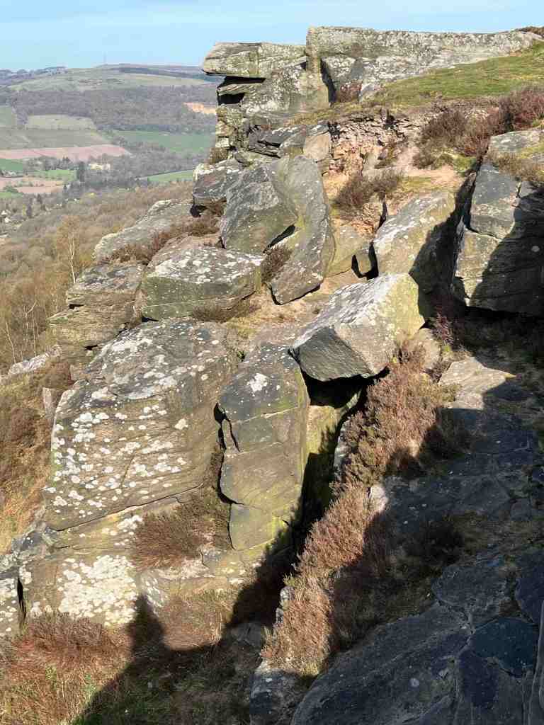
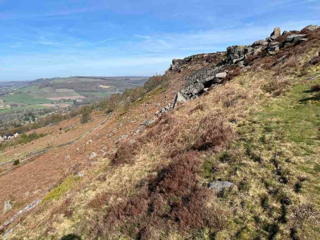
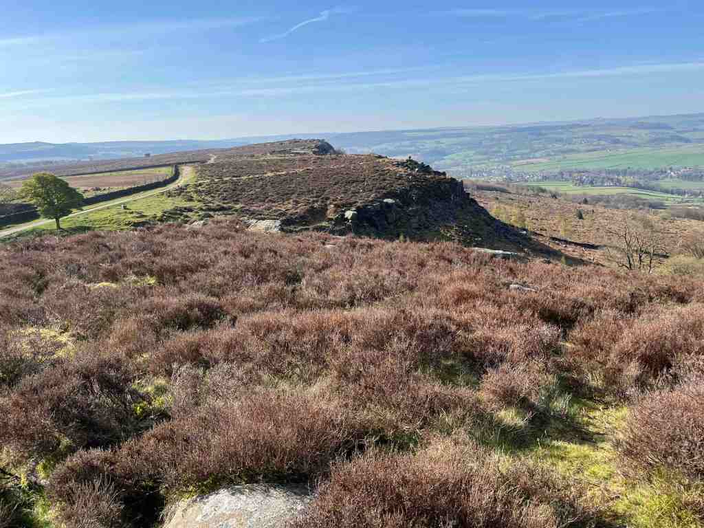
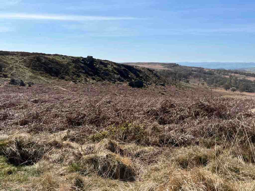
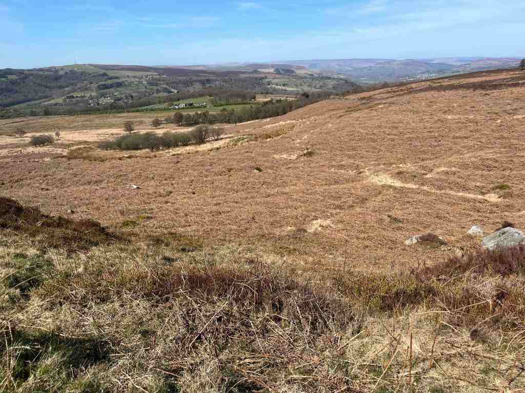
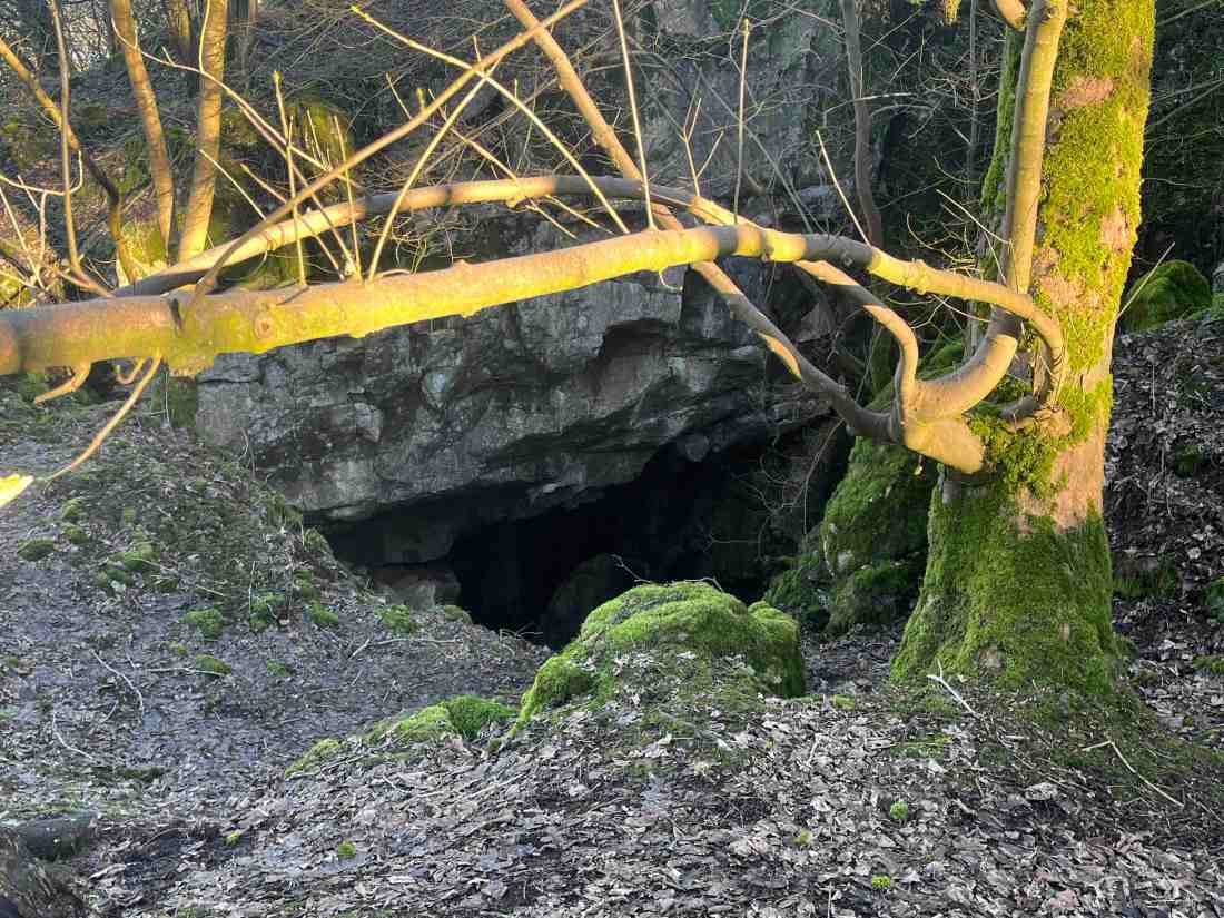
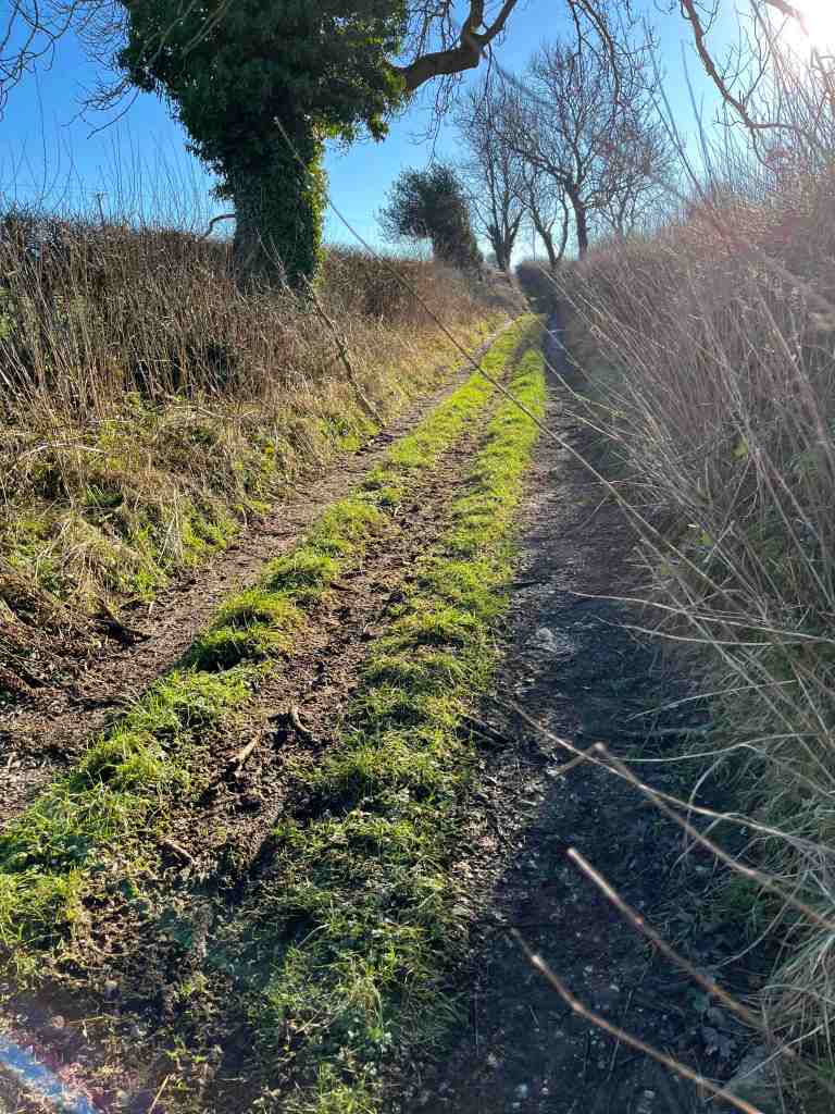
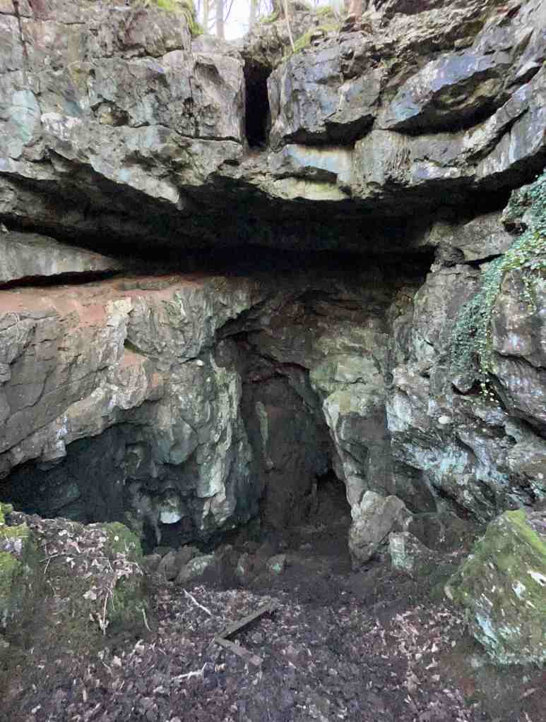
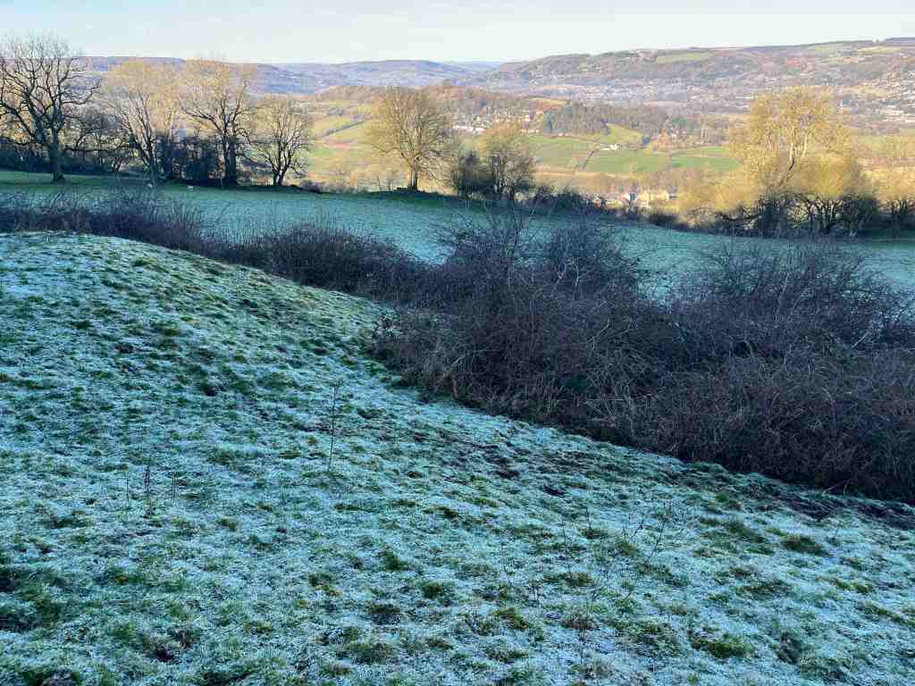
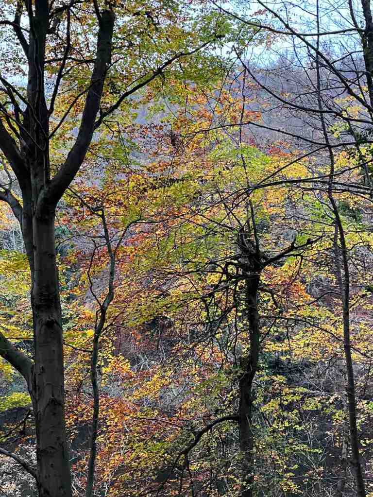
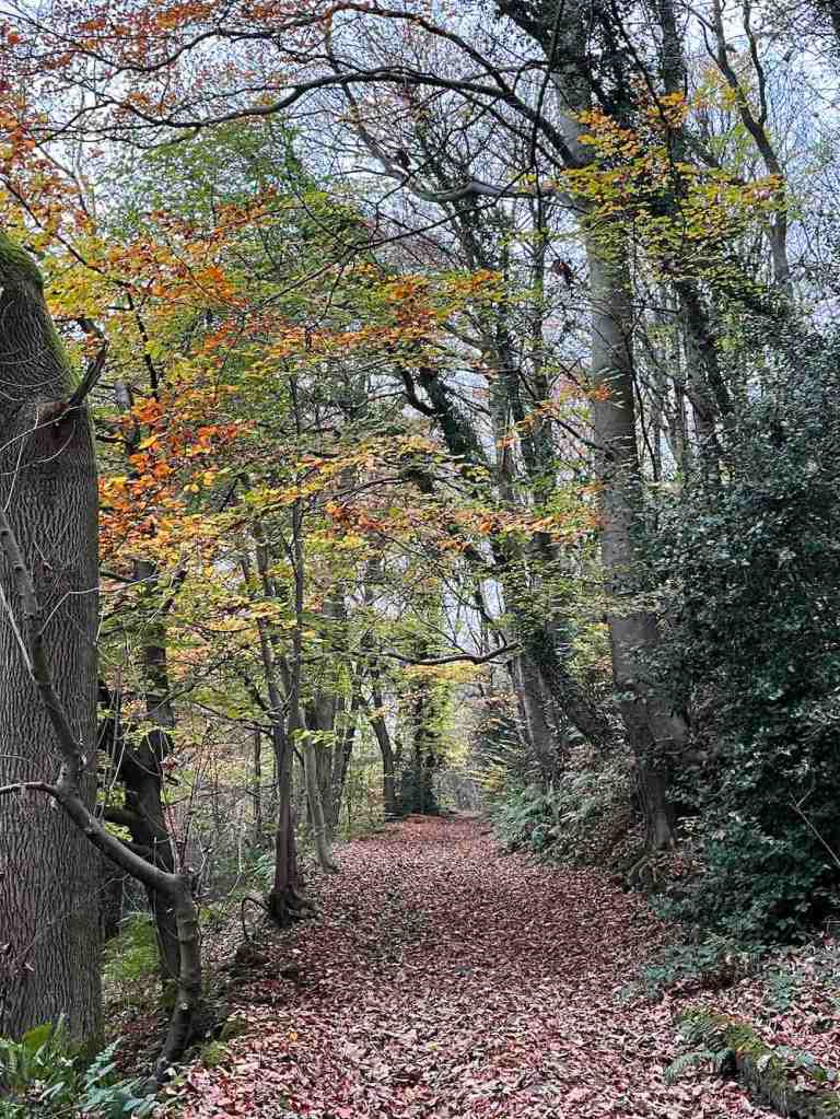
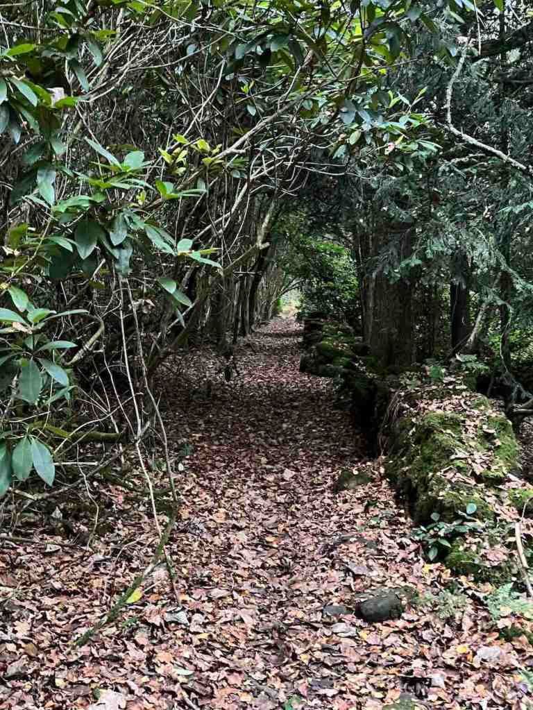
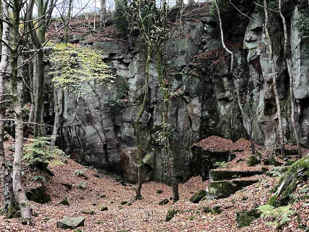
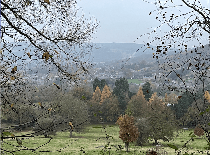
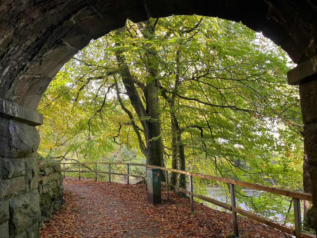
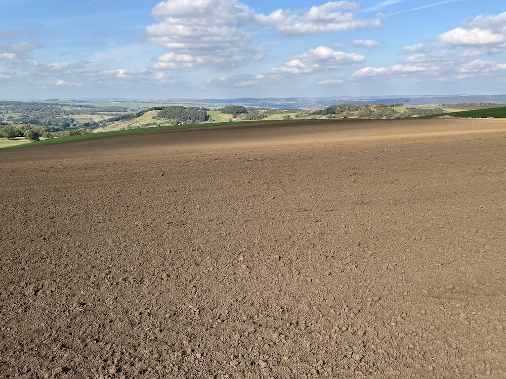
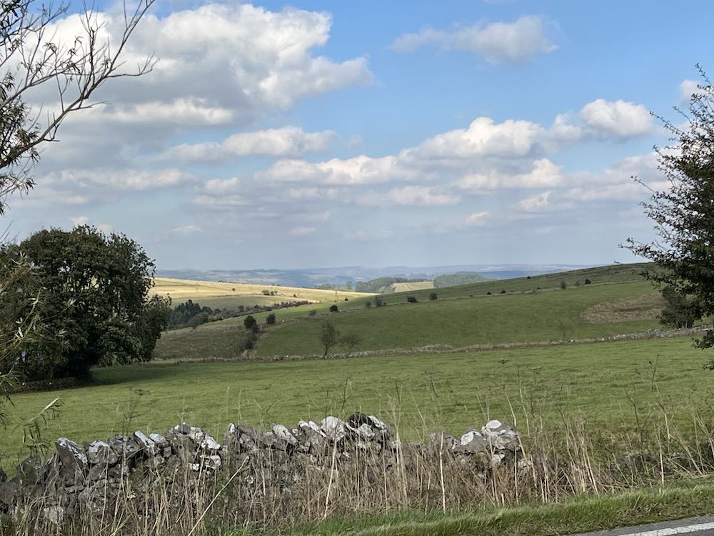
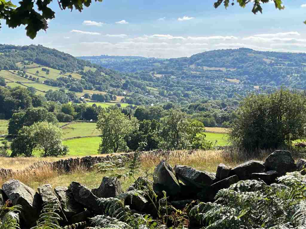
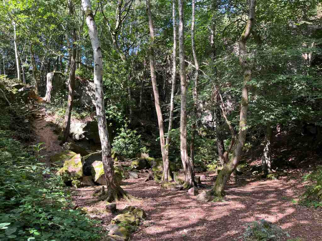
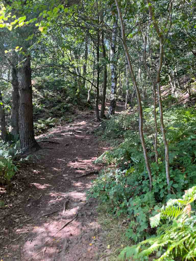
I walked through Tansley, past the Gate Inn and down the knoll to the bridge and continued up the very pretty lane. This is an ascent, perhaps slightly steeper than you might expect, but nothing too strenuous. At the point where the road veers to the right, continue up the track with the woods right in front of you. The views across the valley to Matlock Bath are particularly nice here. After a short distance there is a path leading into the woods. I don’t think it is marked as a footpath? Again, there are short ascents here and there, but by and large it is just a serene place to walk, dotted with remnants from mining in this area. Every now and again, you get steep drops to the side of the path so do take care. Having said that, there are many paths and you will do well to find yourself on the one marked on the map, but nonetheless you will eventually end up roughly where you were expecting. There is a path eastwards out of the woods that I reached, and I had intended to follow this direction, but I was enjoying the woods too much, so took a path that I thought would lead to the top of Lumsdale where the new houses are being built. This is indeed where I ended up, though slightly further up than I was expecting. The path eventually joins the main Chesterfield Road, and you are obliged to walk a little way down that before taking the road to Upper Lumsdale.

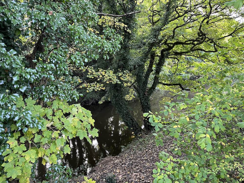
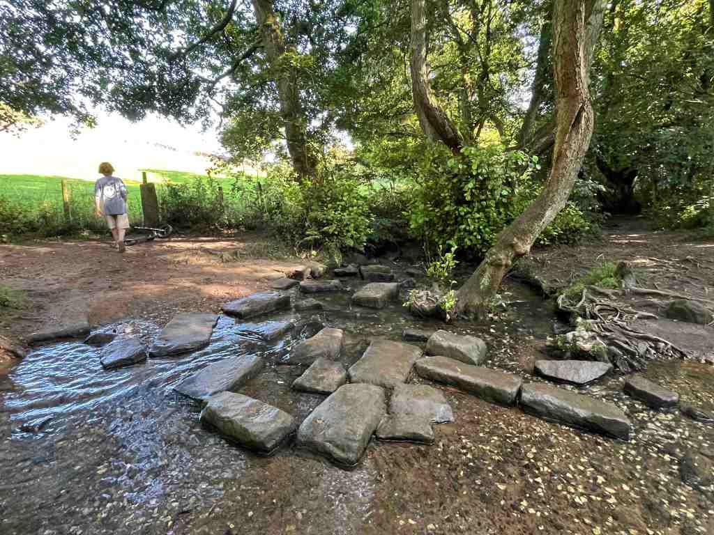
Again, you don’t need to follow the road very far. After about 100 metres there is a footpath over a rickety bridge that takes you just above the stream and to the side of the meadows. It has the air of an ancient path, that eventually reaches a junction where you can turn left to go back into the woods or right to go to the stream and the eventual waterfall. This path had a different air to it, with ramshackled stones bobbling about the path, which I expect will form a stream of its own in winter. At the bottom is an attractive set of stepping stones. I was met by two ladies saying to some young child playing in the stream to ‘mind the glass’. They knew this area well and for years had been finding remnants of bottles and some stonewear that looked as if it had melted. Judging by the thickness and colours of the glass, these fragments are probably 70-100 years old. It is a mystery why they are there. The ladies said, despite their research, they hadn’t been able to find a business or a pub etc further upstream that might have been their source. Who knows?

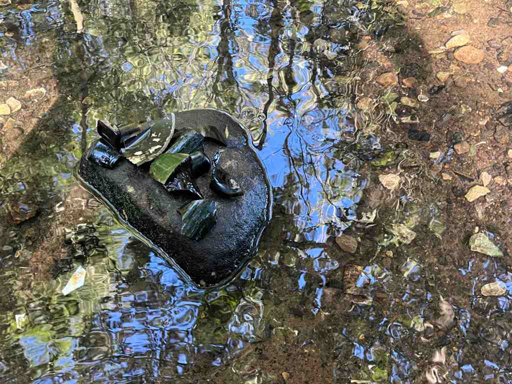
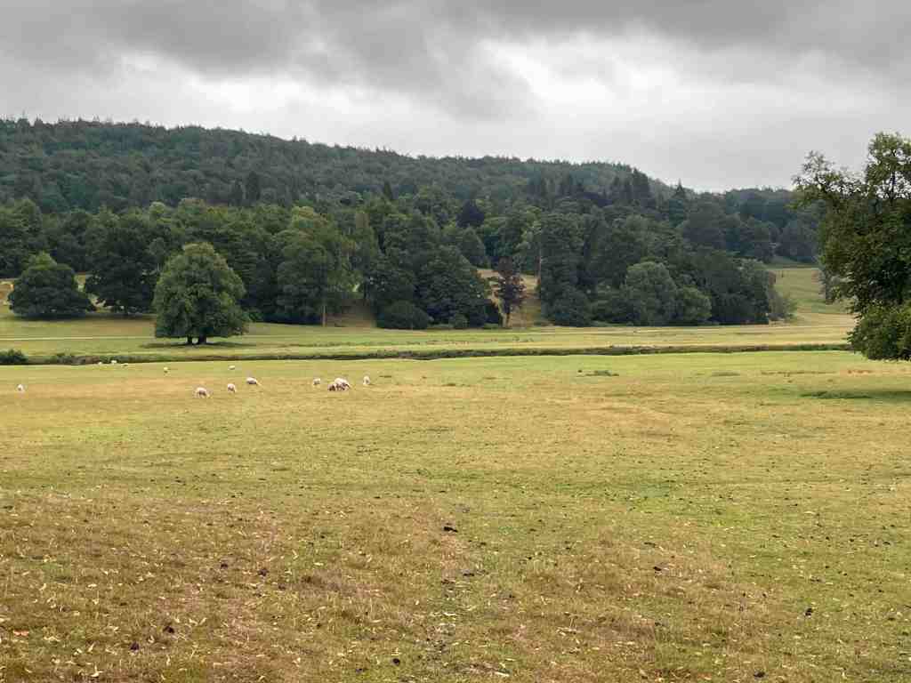
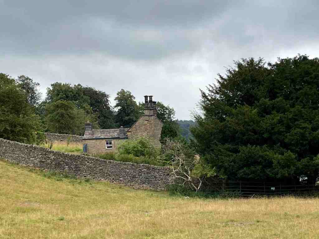
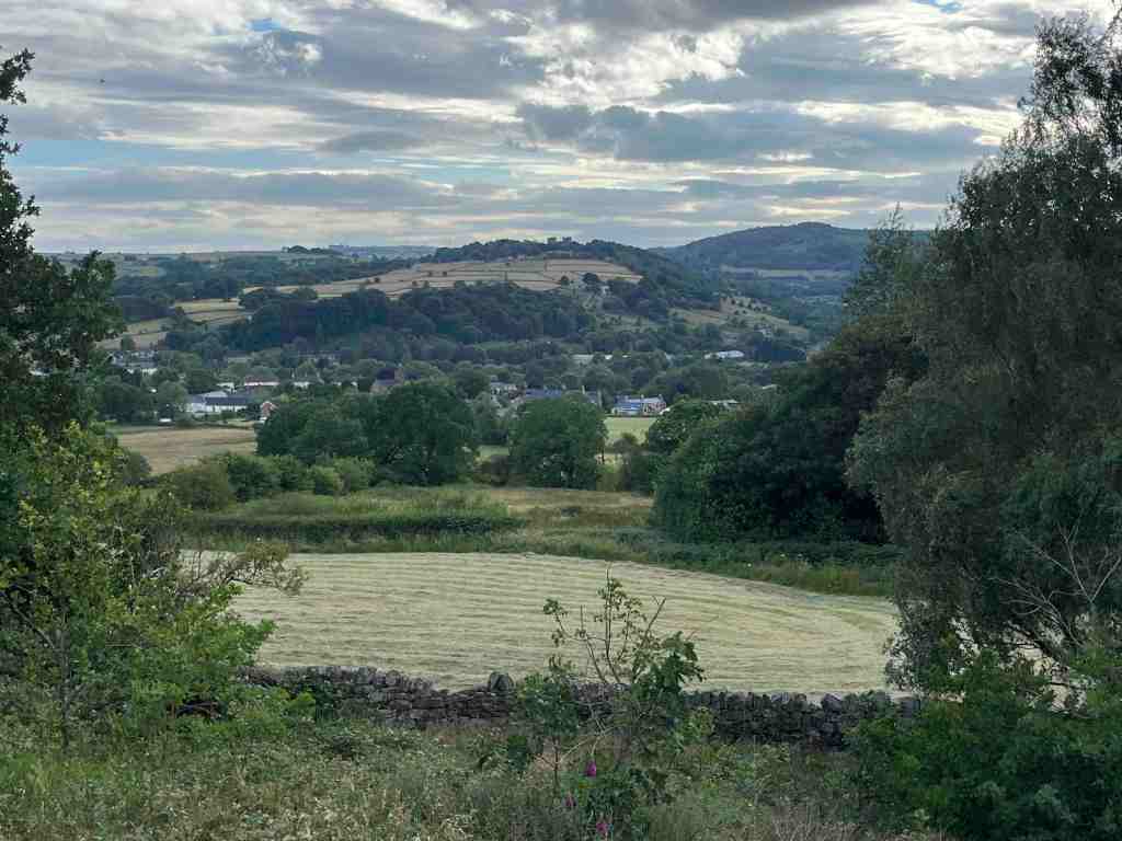
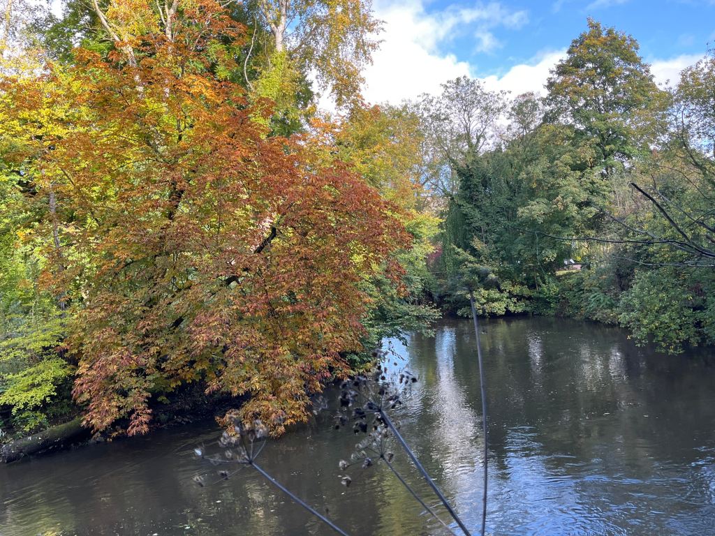
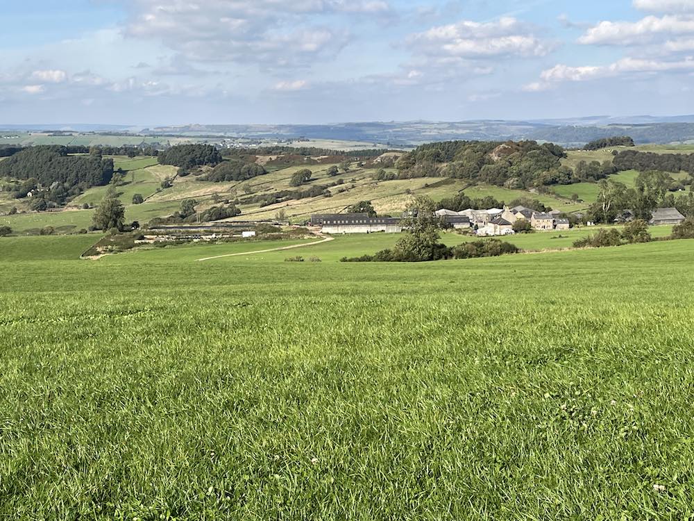
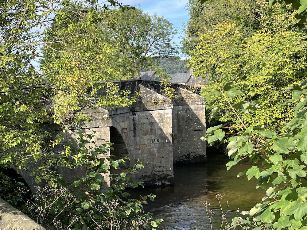
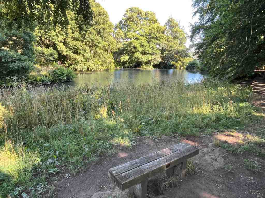
Continuing down the path beside the stream, I found more fragments, and then I was at the road again. This leads to two mill ponds, and old works and buildings all linked to milling in various forms, that was prominent in this area in the 18th and 19th centuries. It is worth spending time reading the noticeboards dotted around as they give a fairly comprehensive view of the industry in this area. This whole area is now owned by the Arkwright Society, Arkwright being responsible for innovating all the activity in this area. You can also read a potted easy-to-read history of this area by looking at the baldhiker.com website.

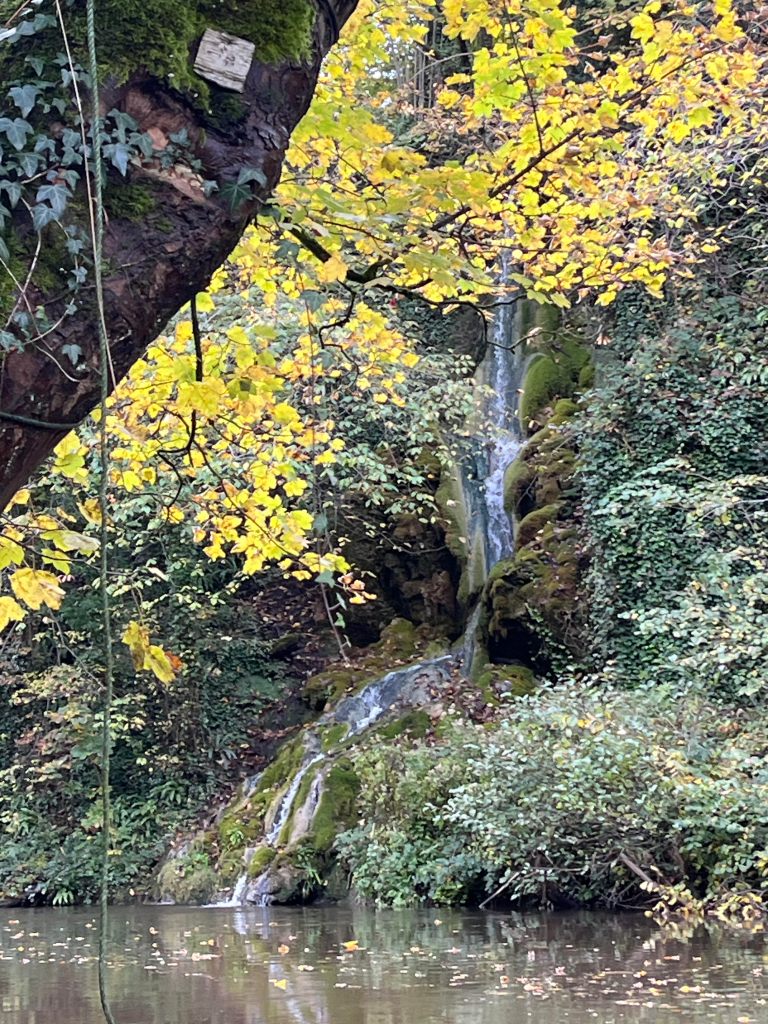
The Lumsdale waterfalls themselves are tucked away out of sight. There is a gate on a corner, which I assume is always open(?). Head through this and up a few steps, make your way across some stony boulders and you find yourselves at an angle half way up the waterfall. It has been a very dry summer, so there was a relatively small amount of water today, but this didn’t stop all the youngsters and teenagers (and older) from frolicking about, jumping across stones and blazing a trail downstream (not advised). It is very pretty and I can imagine it would look even more splendid at dawn or dusk, when you might be lucky enough to have it all to yourself.

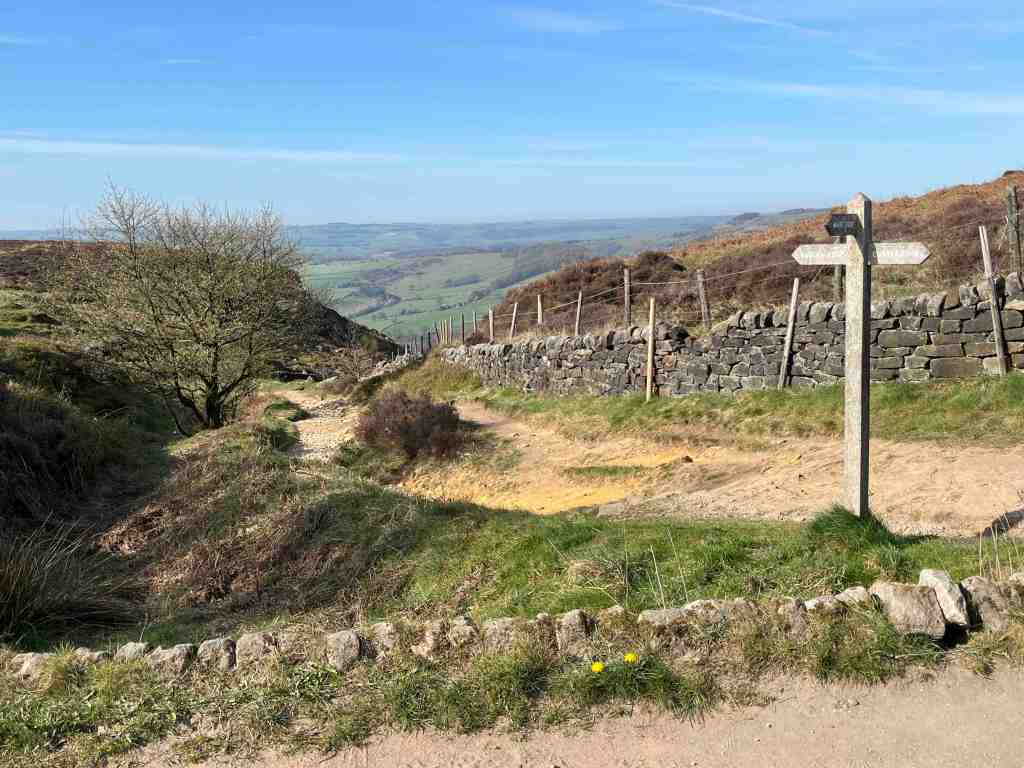
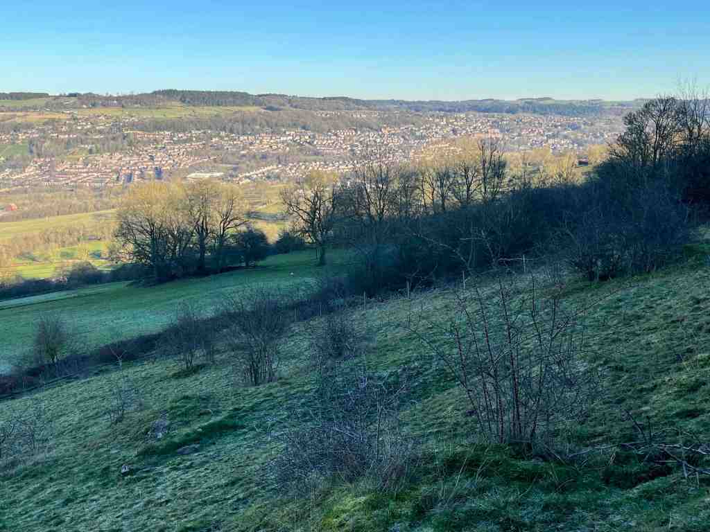
A few strides down the road and you come to a footpath sign, with two leads – one going eastwards and the other westwards towards the top end of Matlock through the trees. I took the easterly path, across fields and meadows back to Tansley.

This was a delightful late afternoon / early evening walk and one I suspect I shall do on many occasions. It was just about 4 miles long, with 650ft or ascent and descent, so nothing very strenuous, but just enough to let you know you have done some exercise and more importantly spent time enjoying and exploring the natural environment.

The hidden landscape of Chatsworth

I imagine many of my readers will have visited Chatsworth House, owned by the Cavendish family, the Dukes and Duchesses of Devonshire, over centuries going back as far as Bess of Hardwick (a National Trust house only a relatively few miles away). Chatsworth is now a Trust, so that the estate can be maintained and enjoyed by everyone, and its legacy continue well into the future, especially the house, gardens and deer park.

Thursday’s visit was a U3A Archaeology outing to explore the parts of Chatsworth that most people don’t see or know about. Our guide was Jamie, sorry I don’t know his other name, and what he doesn’t know about Chatsworth isn’t worth knowing. He has been a guide for Chatsworth in various guises for many, many years. He is a very interesting speaker and considering he was communicating outdoors, we could hear every word no matter where we were standing and it felt as if he were talking to each person individually.

You might ask was there a village called Chatsworth? Indeed, there was. It is now lost, but lies not far from the house itself. There are other lost villages too, which may in time re-surface such as Langley. We can only speculate right now as to exactly where some of these tiny villages were. It is thought that they were abandoned or lost possibly due to the plague.

To return to the beginning. We started by walking over the bridge and followed the river downstream. This is a path trod by many and it gives a wonderful view of Chatsworth House. We stopped seemingly in the middle of nowhere, and Jamie explained that this had been the former crossing point over the river; the path had previously continued uphill where the woods now are, and in the opposite direction it led to the original village of Edensor, which was demolished around 1830 as it detracted from the view from Chatsworth. We followed his trail, crossing the existing (relatively new) road onto a track that really was part of the original road, noticing the humps and hollows mainly to the right where the former cottages had lain.

There is one cottage that was not destroyed in the move, though no-one really understands why is escaped demolition. It is called Peak Cottage or Gardener’s cottage. It is a delightful looking property, encased in its stone walls. The second photo below shows the ‘new’ village of Edensor (pronounced Enza), and the third, is a very faint painting of Edensor as it was, and the fourth, taken from the Chatsworth.org website shows the layout of the old village in more detail:

We skirted round the lost village and went uphill, where again we stopped at a point where there was apparently nothing to see. On closer inspection, this field contained a few ancient remnants of cony-garths, which is a 14th century name for an artificial rabbit warren. Looking down at our feet, we could see some entrances and exits to the warren, but mostly they were covered over, and 99% of the time, you wouldn’t pay any attention to these, or even spot them.

We walked back to the bridge. I noticed that there were no statues on this side of the bridge, whereas there were ornamentations on the other side. Jamie asked us why the bridge was located at this particular angle, which would necessitate an arcing detour for carriages to the house. It is purely cosmetic. If the bridge had been built straight on, it would not afford an interesting view, whereas now at this angle, the bridge with its decorations could be seen and enjoyed from the house. Looking at the photos below, it does look as it there should be some statues on the other side after all, but they do not exist today.

We continued along the house side of the river towards Baslow, noting the locations of former fishponds by their boundary mounds. These covered quite an area. We also learned that this is the area of the old village of Chatsworth and Langley, and one other whose name I forget. A bit further on towards the cricket pitch, he showed us where the direction of the river had been changed. Originally, the cricket pavilion (not shown in the photo, but to the left) would have been on the other side of the river, but the U-bend was removed creating more meadowland and extending the deer park. We did see both fallow and red deer on this trip.

Finally, although he did point out more old relics on the way, we found ourselves at a mound with a channel at the bottom and a pond at the top. This was one of three ice houses, and we learned how the pond was used to create the ice, and how it was stored.

This was a fascinating morning out and certainly adds to the enjoyment of Chatsworth. I am encouraged now to explore more of the outlying estate and learn more about the topography of the area.

Thank you, Jamie, for a great morning, for all your research and the old and new maps you gave us, along with the lidor maps showing underlying features that cannot be seen any other way. If you get a chance to go on one of his guided walks, I thoroughly recommend it.

This was almost 4 miles in total; very little ascent and descent.

Tansley Circular

I had almost persuaded myself that it is time to close my blog. It’s not been the best of years, with two moves in eight months, both being complicated for different reasons. Then, I have had minor but painful health issues over the winter, followed one month ago by a heart attack, necessitating a stay in hospital, an angioplasty and a stent. I had only been in my Tansley house for two weeks when this happened. However, one month on, I am doing remarkably well, and once we sort out my medications so that I don’t have so many awful side effects (muscle pain in particular), I think I shall be back to climbing mountains and writing blogs.

This evening was the first time I have really been out since the heart attack. I could tell I was recovering because I was getting very itchy feet and even more irritable with myself and others, whereas for the first 2 weeks I was too exhausted to do anything. It has been a very muggy day here in Derbyshire today, so after a bite to eat (good healthy home-made fish salad), I donned my walking shoes and took off on my first venture in Tansley – very gently of course; must be sensible.

I walked through our village – it is a pretty village, with a quiet atmosphere. I took the path that I believe goes to what is called the Fete field. The footpath continues through it, but a game of football was taking place, so I took the side route, through the brand new, very small housing estate to Whitelea Lane. For a small country road that only goes to Tansley, it was surprisingly busy. It is uphill for about half a mile, nothing too strenuous and there are some lovely views. Before reaching Neville’s farm, I turned onto a footpath beside some old cottages, going into the wood. This is a very pretty, well-used path, with established trees. Before reaching the end of the path, I turned left, and again went uphill – I was beginning to think my cardiologist might not be too happy if this continues – but I stopped regularly as there was so much to see. The wild flowers were just beautiful, and so many varieties, and when I reached the top of this short hill, the views in all directions were stunning, and almost unexpected. Tansley is already at 450′ odd of elevation, and it didn’t seem as if it were possible to go much higher, but today’s highest point was 831′.

The footpath continues flat for a short distance before reaching Knabhall Lane. I have driven along this lane before when the main roads have been closed and thought how lovely it is, as it is a gentle climb to the top with open views, or in my case, a gentle descent down into the valley. There were swallows everywhere. Eventually, the lane joins the main A615 to Alfreton, at the corner with the big garden centre. However, it is only a very short walk before you turn off to the right on another footpath, to lead between some beautiful houses and gorgeous countryside before returning to the top end of Tansley. I had checked this out when I was on Knabhall Lane to make there was no significant ascent, and it is as I expected, almost flat. From here, it is just a hop and a skip down and around a few corners to my new house on Bentley Walk.

There is a big debate going on right now, as Tansley is rapidly expanding its housing (ergo, I have moved here), but it is not expanding anything else, no shop, small school, narrow lanes – the archetypal village. The infrastructure can’t really take the proposed developments, especially the water, all of which has to drain into a little brook just down from where I live. Matlock has always flooded – they may just make matters significantly worse if they keep building on all the high land above Matlock. The two recent developments on this side of the road are small (46 houses where I live, and less at the top) but the proposed plans are rather bigger. As I walked through one of the areas for the planned development, I did think that if this did get passed, this would be the least unpopular development. The field is flat, with no seemingly particular interest, and bordering just a few houses. Access would be very tricky though. I don’t necessarily support any development in the village – it is important to try and retain the integrity of a small village community, and as an interloper, who isn’t really entitled to have a view, the current developments are more than enough – any more, and the village will change its character.

I think this will be a happy home and place for me to live. I can do numerous walks on footpaths or minor country lanes in three directions, and the fourth direction takes me to Matlock 1.5 miles away, but still being able to use footpaths for a large section of the walk. And we do have buses (when they come!).

So, with luck, and no setbacks, I shall continue my blog and try and provide you with a variety of scenery in and around Derbyshire as and when I can.

Distance: 3 miles (1hr moving time): Total Ascent 397 ft; Total Descent: 400 ft; Minimum Elevation 498ft; Maximum Evelation 831ft

Screenshot

Curbar Edge, Froggatt Edge and White Edge

A brief update before I describe this lovely walk. I see my last post was in January. Where has the time gone? Well, I can tell you, actually. For most of the time, I have been harbouring a spinal problem which has created unimaginable pain down my right leg on walking, and surprisingly severe pain across the top of the foot. You wouldn’t believe how incapacitating that kind of foot problem is. So, for several months I have been developing an exercise programme for myself, which has been very successful and I am pleased to say, I walked over 6 miles yesterday and another 3+ miles today, with barely a hint of symptoms.

On top of this, 3 weeks ago I broke a rib – ok, I’ve broken ribs before, but this time, a few days later, I developed a nasty chest infection which is being very persistent. I feel as if I should be well, even with the remnants of this chest infection, but out walking yesterday I began to feel quite ill and I overheated and had to take unusual but effective remedial action to get me back to my car. So, I’m clearly not quite out of the woods yet. One day, I shall have to accept that I am getting older! I hope I am now back on my feet and once I have moved in 4 weeks time, I shall be able to get out and about and share more of the lovely Derbyshire countryside with you.

The ‘Edges’ in Derbyshire are magnificent. They protrude from the valley up to a majestic height of 340 metres (1112 ft), although Curbar village is already 118 metres (387ft) high. It doesn’t seem quite so impressive now until you see them, as they are sheer blocks of grey gritstone creating quite a drama against the sky. These are perfect for rock climbing and abseiling, which I remember doing many years ago on these very rocks.

This walk starts at the top at Curbar Gap (what three words – windows. fountain. precluded). The car park isn’t huge and this is a very popular area, so plan an early start. There is a fee to pay, which is free to NT members. One of my aims was to look for suitable vistas for our Painting for Pleasure group to replicate. Straight away, not far at all from the car park, is a seating area providing wonderful views across the valley and towards Baslow Edge to the south. The paths thereafter are easy, though you will still have to negotiate a few boulders from time to time; the main path is wide and sandy/soily and you can also walk on the grass and boulders parallel to the main path, which is more interesting but does require nimble footwork from time to time. Every few feet along the way, you are treated to wonderful rock formations, and your eyes stretch out into the distance as you gaze at the Dark Peaks in the north. These rocks have plenty of flat sitting stones where you can stop and paint, or simply admire the views.

This Edge continues for some distance, gradually descending, with a couple of steeper awkward sections, and it eventually turns into Froggatt Edge, which I guess is where the birch trees have taken hold. Continuing along, the birch trees become more numerous, but just before this, I discovered something I had never noticed before – an ancient burial mound, dating back to 3500 BCE. There is a notice alongside with a QR code, which I accessed and this tells you all about the excavations. I will leave you to investigate this further yourself when you visit.

The path becomes more even as we enter Froggatt Edge wood, where the willow warblers were having a field day. In a fairly exposed area, you come across a stone circle, now called Stoke Flat, also from the Bronze Age. It has been damaged, but it is clearly there in the landscape and a reminder, along with the former cairn, that this area has a very long history. I will direct you here to a very informative web page that is very well written: http://www.stone-circles.org.uk/stone/froggatt.htm

Once through the woods you meet the road taking you to the Longshaw Estate. The walk is about 2.5 miles to this point. The footpath guide I was using goes a slightly different way than I took. I stayed on the same side of the road and cut a trail, through the hummocky grasses and moorland to White Edge. You could also walk along the road up to the Grouse Inn and take a rather easier, but less interesting route, to the same destination. There is a small amount of uphill to get right on the top of White Edge, and now, as you are higher than on Curbar /Froggatt, you see all the way across the moors to Sheffield as well as the panoramic views to the east and north. The walk along the ridge has fewer boulders and is very easy and attractive walking. The descent is relatively steep and the footpath management team have created a series of steps down. From here, it is only a short distance back to the car park where there is kiosk with a lady selling teas, coffees and cakes. This is not a walk to be rushed. It is a walk to stop and stare. Incidentally, if you are short of time there is a shorter circular walk, just around Curbar Edge and coming back to the car park along the moor between Curbar Edge and White Edge.

Total distance: 6 miles (10km), 643 ft (196m) of ascent, and 679 ft (201m) of descent; highest point 1236ft (376m).

Salters Lane to Bonsall over the fields

It is a while since I have been out for a ‘proper’ walk, and today, I wasn’t really in the mood for one either. I had just been asked to lead a walk for the U3A in February, so thought I would use the opportunity to spark myself into action. I had already been thinking of doing a walk from Salters Lane, as I shan’t be living in this particular location for much longer, so I donned by hats, boots, scarf and anything else to keep out the cold air and ventured out. I took the car to the top of the hill where there is some parking next to three or four footpath signs. Take care where you park up here, so as not to block farm vehicles.

I started up the road for a short distance before turning left onto a footpath. This was a perfectly good path, that joined another and went between the hedgerows, affording lovely views of the surrounding countryside. It continues for some distance before dropping down into Bonsall. On its descent is becomes less attractive, being muddy and also turning into a stream for about 500 metres. There are alternative paths you can take and remain higher up for longer if you so choose. My path joined a back street in Bonsall, and then diverged from this lane to go behind the Croft Farm – this is not well signposted, so you have to trust your map. It is also very muddy and wet on this section, not just around the farm but on the sloping fields, which have been churned up by the hooves of many cattle. You can expect to get very muddy boots and to do a bit of squelching here and there. At a certain point, there is a meeting of footpaths according to the map, but these are not apparent on the ground. There is a small stream to jump across before making your way back up the hill past the pond back onto Salters Lane. At this point, you will have walked barely 2 miles, but it will feel like more because of the conditions.

You can choose at this point whether to continue along the road back to the car, or to do as I did, and go into the woods on the other side of the road. There is a lot to gain by doing so, but keep in mind, that if you go downhill you will have to come back uphill again at some point. I really enjoyed the woods, and in particular all the different rock formations, presumably created by mining activity. I began by going fairly steeply downhill through Jughole Wood, with its attendant formations, then taking a left on the level towards Leaward Cottage, before returning uphill through Lea Wood. The views of the valley are tremendous from here.

I completed the short distance back to the car along the road. There are many different variations that you can do of this walk, and I am sure the different seasons will dictate which routes are best to do when. Needless to say, I do not think this is a particularly enjoyable walk for a group of older people at this time of year, but nice enough if walking on one’s own or with a friend.

Distance: 2.75 miles Total Ascent: 492 ft; Total Descent: 535 ft

Ladygrove Woods

As it was Friday, this is my day for walking from home to Whitworth Institute at Two Dales. Depending on the route I take this is a 2.5/3 mile walk. I like the views from the Snitterton Road, which takes me past a cottage that I would rather like should it come up for sale. I took this same road up to Oaker, then rather than go up and over the hill I took the lower route into Darley Bridge. After this, I played table tennis for an hour and then sought out a different route home.

I wanted to take a look at properties in Two Dales, thinking that may be a good area to live, as if just slightly up the hill, houses will catch the evening sun. So, after a quick shop to buy baked beans I crossed the road and walked through the village. I was slightly surprised that it quite flat, until it is no longer flat as it turns into Syndcope Hill, but I turned off before that point. I had spotted some reservoirs and some woodland that looked worth a visit and I was not disappointed.

Ladygrove woods are mostly beech and you can imagine the beautiful colours on the paths carpeted with leaves. The first ‘reservoir’ is visible, but the path thereafter goes high above other waterscapes, so the others are barely visible. The path is narrow and a little uneven and every now and again you have to jump over a small stream. There was a lot of water in these streams given that is hasn’t rained for some time. The other surprise were some boulders and cliffs, looking very similar to Charnwood Forest. Presumably, these have been quarried but I don’t know the history of this area.

I realised as I was travelling the kilometer or so up the valley that this may not have been the most sensible plan as the daylight was fading and I was on uneven ground and didn’t really know where I was going, so I increased my pace a little until I reached the furthest point and then I returned via a higher route, still lovely, but not quite as attractive as the lower route.

From this point, it was mostly road walking through Upper Hackney before taking a nice footpath downhill towards the back of the hospital. This area is still unspoilt and marks the edge of Matlock. The next path downhill that I took, beside an old woodland, was immediately adjacent to relatively new houses and ultimately led down to the main road beside Valley Lodge Care Home. The traffic into Matlock was completely blocked up from there, and that must be almost 1 kilometer to the roundabout. I think I’ll settle for my flat from which I can walk everywhere most of the time. It would drive my potty having to deal with traffic jams day after day.

Total distance: 7.5 miles; morning 3 miles; afternoon 4.5 miles. Total ascent (afternoon): 505 ft; descent 476ft; total time (afternoon) 1hr 45 mins; moving time 1hr 34 mins.

You could do the afternoon walk using buses to and from Two Dales into Matlock.

Matlock to Matlock Bath Circular

My intention was to have a gentle stroll in a southerly direction along the river Derwent as it was a lovely sunny day, with gloomy forecasts for the next few days. Those of you who know me won’t be surprised to learn that it became more of a hike, taking in paths I hadn’t been on before.

I began by walking down by the river into Matlock and doing a few chores. Then I had a pleasant stroll through Hall Leys Park and Knowleston Gardens. The autumn leaves are stunning right now and I stopped many times to admire the views. I couldn’t stop myself from trying out the odd footpath but these mostly ended at a dead end and a shaft entrance to the former lead workings. So, I carried on around the bends until I saw a footpath sign to High Tor. This hadn’t been on my agenda, but the thought of walking along the noisy A6 really was not appealing.

So, I headed off uphill towards Starkholmes and took a clear footpath to the right that I would follow all the way to High Tor, getting glimpses into the beautiful, if noisy valley every now and again. The views to the left of Riber Castle were excellent. Once at High Tor, I took a path marked ‘Caution’ and ‘Viewpoint’. The cautionary notice is that there is a significant drop off the cliff to the right and only a narrow path to walk along. Someone has very kindly fitted a handrail in certain parts to avoid obvious mishaps. This I realised is known as ‘Giddy Edge’. It is easily passable with care, but certainly care is needed for a short distance before the path enters the woods. From here, it is a steady descent all the way down to the cable car entrance for the Heights of Abraham.

I followed the path on the same side of the river as far as I could, as it petered out and I had to cross the bridge at the start of Matlock Bath and walk a little way down the awful A6 until I could cross back over. Unfortunately, Lover’s Walk was closed for tree repairs, so I went back on myself until I saw a notice saying the Nature Walks are taken at your own risk. The footpath lead upwards again right up to the very top of the woodland, providing wonderful views of the hills to the east and occasional snippets of views of Matlock Bath. I continued on this path as long as it would allow me to, but eventually I had to drop down into the woods and back to the river, where again access to the river is limited. I walked back to the Derwent Gardens bridge and through the gardens and up to the main road, intent on having a coffee and finding a bus back. So far, this was 4.5 miles.

Suitably refreshed after a bag of chips and a latte, I changed my mind and decided to walk back over the hills to Matlock. It is a stiff climb up a relentless hill until the point where the path goes underneath the cable cars. It is then a delightful walk, mostly contouring, all the way back to Matlock. Much of this is wooded until the final section where it enters fields where donkies and sheep munch side by side on the grass. A quick trip into Sainsbury’s and two ticks after that I was back at my apartment.

It was a really lovely walk, but it did tire me, more than I would expect of that kind of walk. Nevertheless, It is so good to make the most of the weather and to see the wonderful autumnal colours in all directions.

My stats are a bit different today as my Garmin battery had run out and I couldn’t find the charger, so I used Map My Walk to record the details of this walk.

Section A: 4.43 miles, with 435 ft ascent; walking time 2hr 11mins.

Section B: 2 miles, with 406 ft ascent, walking time, just under 1hr.

Elton, Gratton Dale and Long Dale

This was Saturday’s walk, or was it Sunday. You tend to lose track of time, when there aren’t appointments on the calendar and one day merges into the next. That will change as I become more involved in the locality. I have already met a few people with the U3A in Matlock, and I shall be going to table tennis tomorrow and out with a ‘short walk’ group on Saturday.

I had spotted Elton on my OS map and noticed that it had a couple of dales in easy reach of the small village. It is only a short drive away – no more than 10 mins – so perfect as a starting point on my epic ventures in Derbyshire.

I parked close to the church. The village is lovely, with old and new houses blending in well together. No shop, but that’s nothing out of the ordinary these days. I set off down the road and met my first obstacle- actually, the only obstacle of the day. There were two (at least) paths shown going off at the farm but on the ground the one I wanted didn’t exist. Unperturbed, I followed what I thought should be the right of way following a line of trees around the farm. It was very muddy – mud is something I am going to have to get used to. Then where to go to at the other end of the farm buildings? Still no footpath signs, so using my common sense I skirted around the easterly edge of the buildings, the ground been mostly slurry – not attractive! And then, I spy a gap in front of me as if I was supposed to know I was on the right track all the time.

From there, it was downhill into an attractive valley – still no obvious path – but as I had my trusty map I knew I was going in the right direction. Finally it became clear as I reached a gate with a signpost. I could also hear voices just ahead of me. At Dale End, very appropriately named, I turned left to see the owners of the raucous laughter. A small family, doing their best to cover up a noticeboard? Um… interesting? It turns they were the lead family in a massive group of 30 people on somebody’s 50th birthday spree involving a treasure hunt. The family were way ahead of their party and sabotaging all the clues :-). I was warned about mud, but I hardly needed warning after what I had been through already.

Gratton Dale is a mostly dry, narrow valley with low scrub and green hillsides. It was still quite green with only a few autumnal colours, and I imagine in spring it will come alive with flowers and birdlife. I did see several butterflies and squirrels, but otherwise it was mostly devoid of active natural life. I had walked for many minutes before I met the remainder of the birthday party group – they were very spread out, laughing and enjoying each other’s company. Again, they warned me about mud! See what I mean?

This part of Gratton Dale continues for about 1 mile, when it reaches an abrupt end, rather like a T junction, with a hill banking up in front and hills to either side. The path to the left is the quicker path to the main road, but I was still exploring the hills and dales, so I went up Long Dale to the right. Incidentally, there are some awkward stiles just here that require care when climbing over. My old IOM walking Whatsapp companions “No, Not Another Stile” would no doubt be shaking their heads 🙂 .

Long Dale was short but lovely. There was a sense of timelessness about it, of people walking along these tracks from place to place with their sheep or youngsters frolicking about on lazy Sundays. I enjoyed it very much. All too soon, it was time to go into the western section of Gratton Dale. This was more open than the eastern side and followed a low stone wall all the way along, presumably a boundary of someone’s land. As I reached the end I was met by a herd of cattle who were clearly not going to budge so I had to elevate myself above them to get round. They didn’t even ‘moo’ to acknowledge my respect for them.

The next mile is very boring in one sense, in that it follows a main road. There is no real alternative, but once off the road it is plain sailing on grassland and ploughed land, and no stiles. It’s also in a dead straight line, so you barely need a map going from field to field. This time, you just have make yourself very slim to sidle between two stone posts. The birds were in their element here, lots of them, nesting? in the low growth. I couldn’t work out what birds they were. I did try, but my App gave me silly answers. One of the very large fields had only just been ploughed so I had to blaze the right of way through it, just in time to meet the 30 party-goers again on their way back to Hollybush Farm. The views all along the main road and into these fields is amazing. You need see it to appreciate it, as the distances are too big for a photograph.

From the high open fields, it is a gradual descent into Elton. There was a surprising number of wildflowers, including the tiniest primrose I have ever seen, on the very windy upland part of this walk.

This is not a long walk, but was fairly strenuous with the mud and rocks in the valleys. It’s one I shall look forward to doing it in other seasons, if I can find a better way around the farm at the start.

STATS -Distance: 5.66 miles; Total Ascent: 568 ft; Total Descent: 479ft. Total time taken 2hrs 26 mins; walking time 2hrs.

Screenshot

I’ve arrived..

My time up until now has largely been spent unpacking and carrying out the huge amount of admin involved with moving from one country to another. The Isle of Man, another country? Yes, it really is, and you really find out just what the differences are when you move back to England. For instance, I can’t drive the car until it is Mot’d (no Mot required on IOM) – done; then the car has to be re-registered with DVLA and Uk vehicle tax paid (pending); then I have to wait for the log book to be returned with the new registration number (pending); then I have reinsure the car (eventually) with new number plates (eventually); change IOM driving licence to UK driving licence (pending) – then I can finally drive my car. I am insured on my IOM insurance meanwhile, but technically it is illegal to drive until the process is complete.

Then there is the issue of getting a bank account – ideally, I wanted a bank with a branch in easy reach of Matlock and that means Nationwide, as everything else has either closed down or is about to close down. This seemed easy, until I tried to make my new current Nationwide account my nominated account for my NSandI account and my Skipton International account – and both refuse to verify Nationwide. NSandI can’t say why, or how long it might take for it to be verified. So, if IOM Bank decide to close my accounts, which they usually do when a person moves off-island, I shall have no direct access to the money in NSI or Skipton. And considering NSandI currently has my house sale money, this somewhat displeased me. The only way I could withdraw it in order to get a better interest rate in the short term was for them to send me a Banker’s Order, and indeed this is the only way I shall be able to withdraw money from NSandI until the Nationwide account is verified or I open a new (pointless) current account! If it’s good enough for the government to pay my pension into it, I can’t see what makes NSandI or Skipton any different.

Everything I have touched over the last two weeks seems to have had the same complications – and you can imagine the endless hours I have spent ‘on hold’ trying to sort out one issue or another.

BUT…. I am almost there, except this nagging nominated account problem. So, on Friday, on a lovely sunny afternoon, I put all this on one side and walked along the valley bottom to Darley Bridge and back along the other side of the river. It is taking time to get used to the noise of traffic, but it’s not as bad as I expected it to be. I really like Matlock, as a small town, with quaint shops and streets, and the river winding through it. And the countryside is just beautiful, in every direction. There are some wonderful footpaths not too far away from my apartment, including this one and just 5-10 mins in the car opens up a huge range of options for walking.

The valley walk was a good tonic. I know I shall be happy here, and there will so many footpaths to explore when I need some calm or a pick-me-up. Even better was a lovely walk I did yesterday around Elton, which I shall write up tomorrow.

Around the coast at Port St Mary

I was out today with a small explorer group from the island, having been enticed by the title “Caves, Cakes, Coffee and Reindeer” walk or something like that. Don’t get ahead of yourself, we have no reindeer on the island; our host had very ably made some buns to resemble reindeer, it almost being Christmas, and very successful they were too.

I can’t tell you too much about this walk as our host, Andy, wants to keep his ‘secret places’ secret for others to explore and to this end, the hidden places should remain hidden. However, it is no secret to say that we parked at Kallow Point in Port St Mary on an extremely blowy day to start our walk. When we arrived, it looked as if it was already high tide as the waves were crashing about the shore, but high tide would still be a few hours away.

We walked towards Perwick and along the shore, scrambling over rocks where necessary and where we encountered a stranded and decidely dead Porpoise, having got beached in the massive overnight tides. It otherwise looked healthy, but the rocks round here can be treacherous as you can see in the photos. I won’t be giving too much away by saying that there are a few caves along this stretch of the coast, but you won’t find them unless you do a bit of adventuring. Similarly, there are some hidden beaches, and again, you won’t find them by sticking to the coast path. Unfortunately, the weather was just too windy to risk going down to some of the secluded beaches, which would have required fairly steep and rocky descents whilst fighting offshore winds, so we satisfied ourselves with knowing where they are for another time.

Our host was very knowledgeable and pointed out different types of rock, provided us not only with cakes and coffee but scavenged sea spinach from the cliffs encouraging us to taste a morsel of this salty herb. There was plenty of sea glass amongst the pebbles that interested some and some fascinating patterns in the stones, one in the shape of a cross on all sides. He told us about a hidden lake, so hidden that it is impossible to find unless you have a boat, so please don’t go looking for that! If you fancy a walk with a difference, they have a website and a FB page with details of forthcoming outings: https://www.facebook.com/happyexploreriom/

To finish, here are a few photos, none which should give away too much 🙂