Port Erin Circular

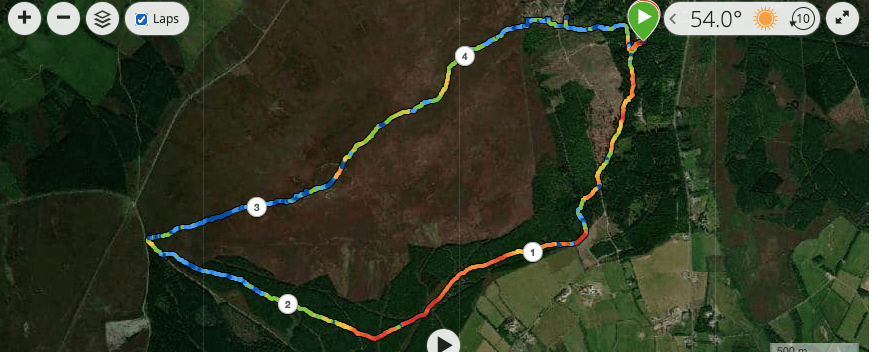
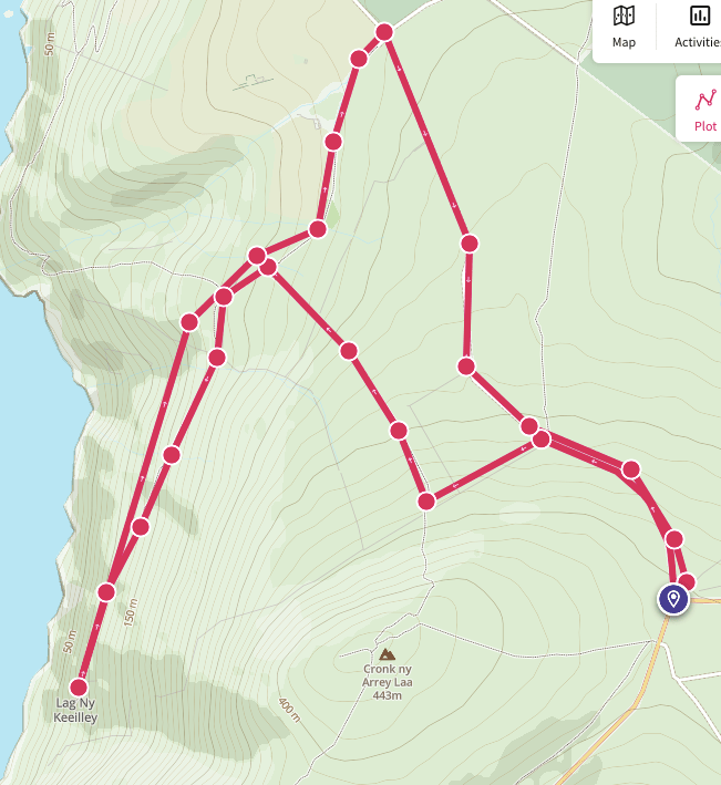
This was intended to be Port Erin to Castletown, but I really hadn’t thought it through; not only for the distance, which would have been 12 miles, but for the difficulty of the task. Hold on, you say, I’ve walked that many a time without any difficulty. True, I would reply, but not in winter when we have had weeks of rain. I hadn’t given this latter thought any consideration as I set out yesterday morning, to do the first walk in well over a year that I have been able to do entirely for myself with no hidden agenda.

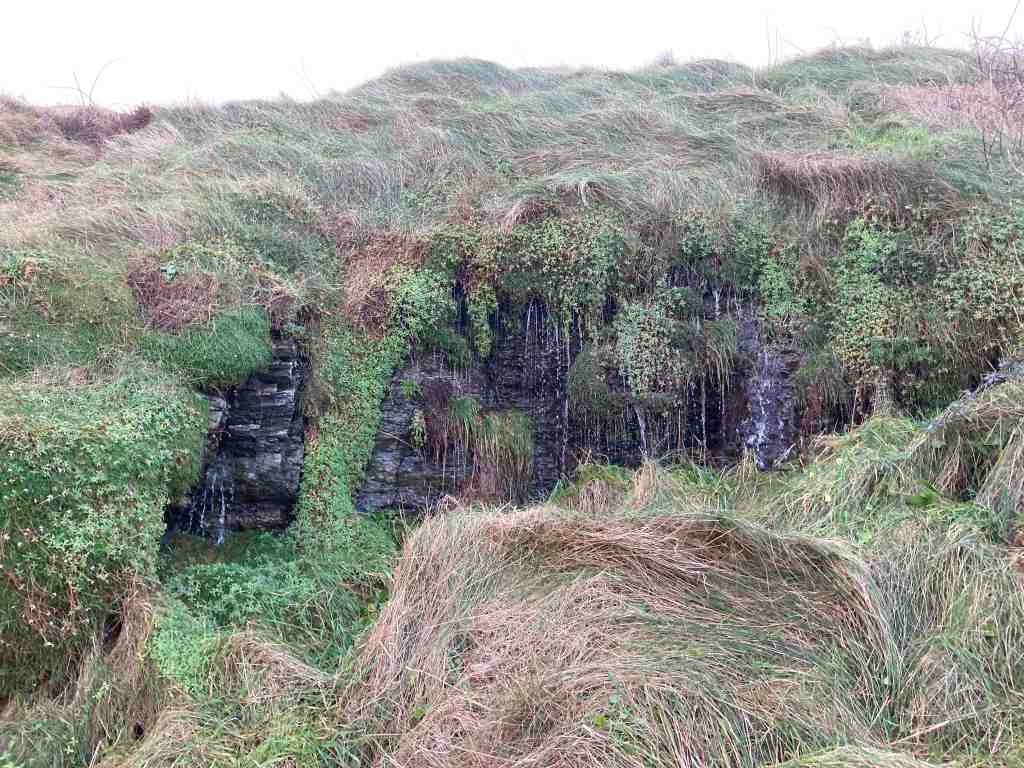
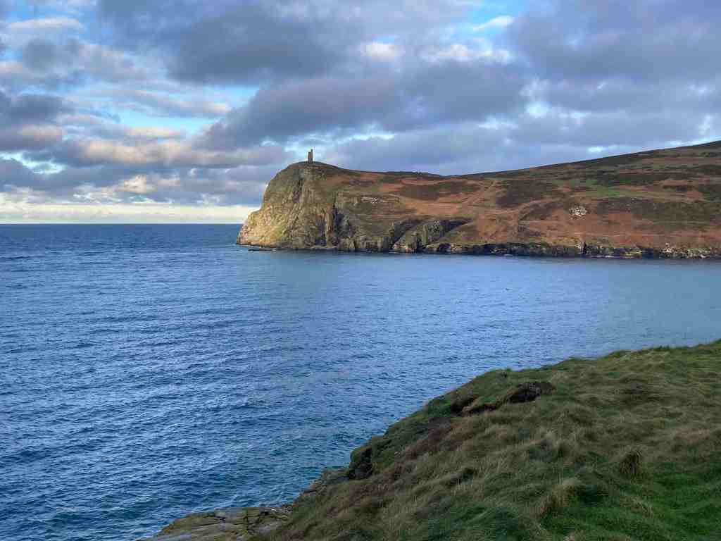
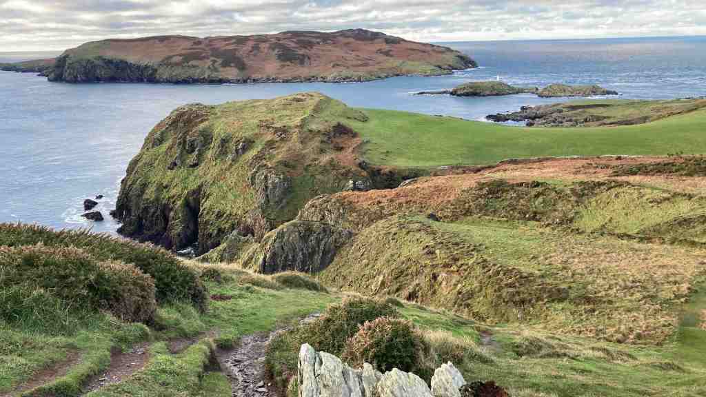
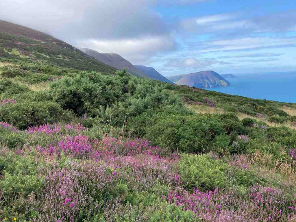
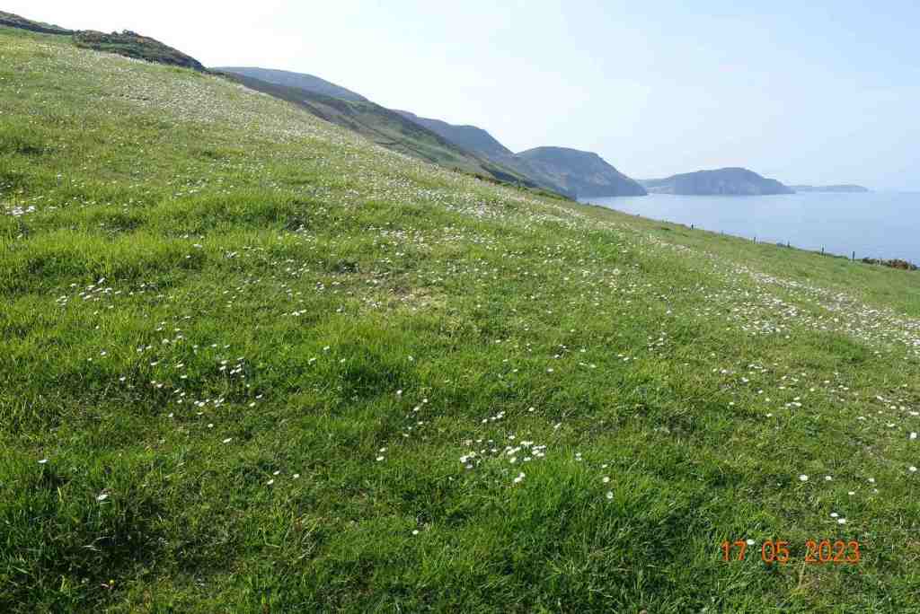
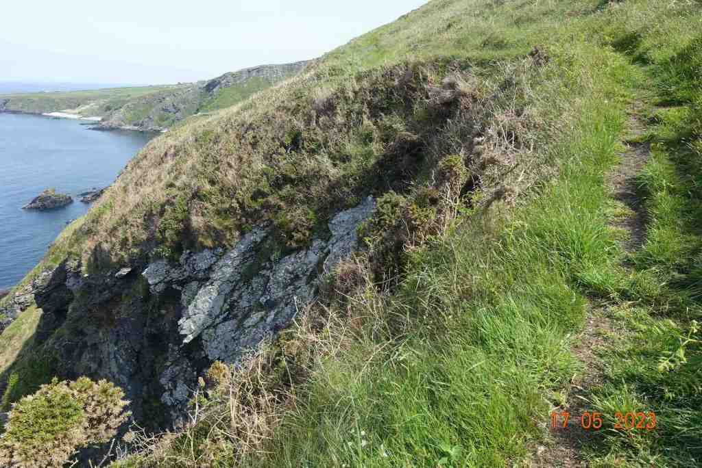
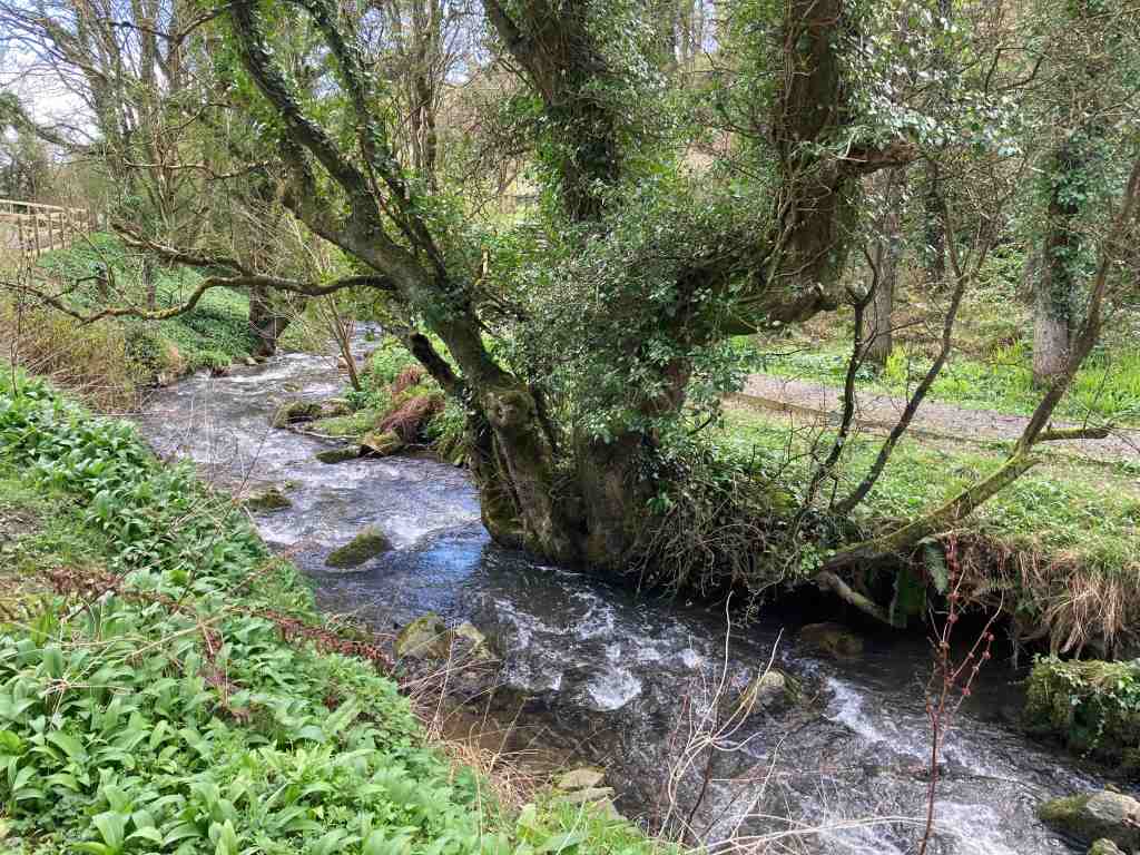
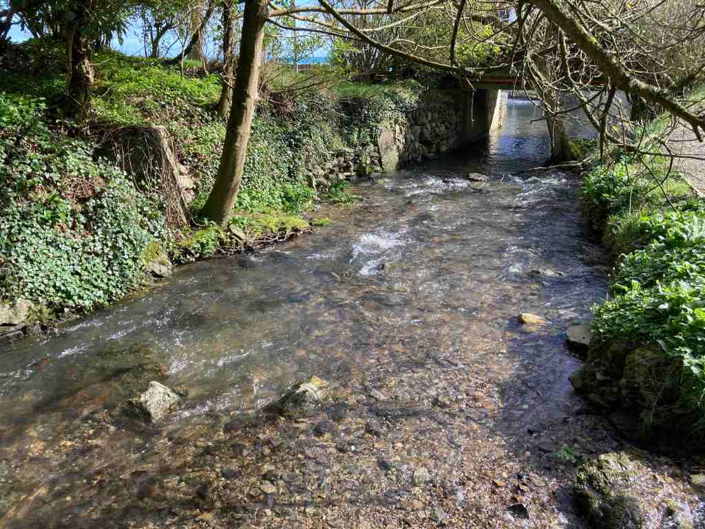
It was slightly warmer that it had been, with no rain forecast and not particularly windy, so I was expecting great things. My first photo shows Port Erin looking its glorious self as I headed down Dandy Lane. The light was lovely, with the sun peeping out from the clouds, highlighting different parts of the cliffs, and in my first photograph the tiny lighthouse. My expectations were dampened as soon as I reached the coastal footpath. There was literally a torrent of water hurtling down the footpath and surrounding cliff as if there was no tomorrow. I just stood and stared it for a while; in all my times of walking this route, I have never seen anything like it. Don’t get me wrong, it was never going to prevent me carrying on, but what a sight. I could see a lady on the road below thinking I was absolutely nuts! It’s a good job none of my friends had been able to join me on this occasion, as I imagine some at least would have turned back.

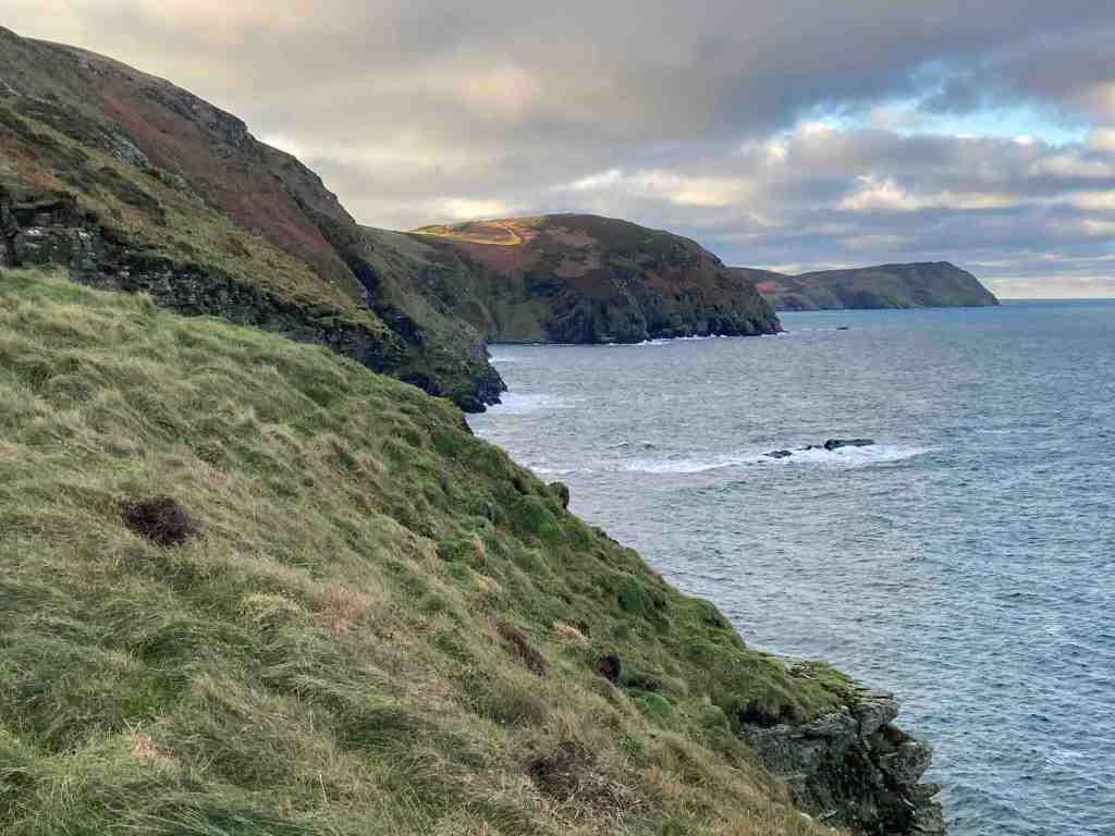
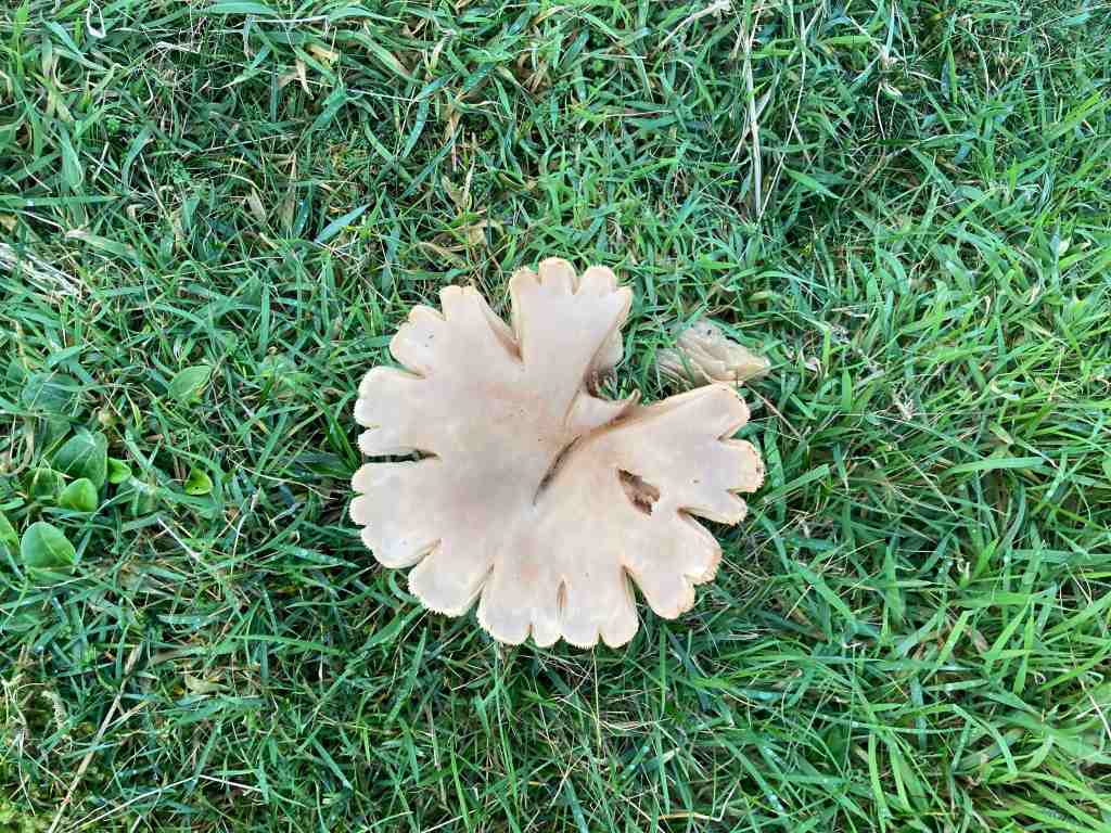
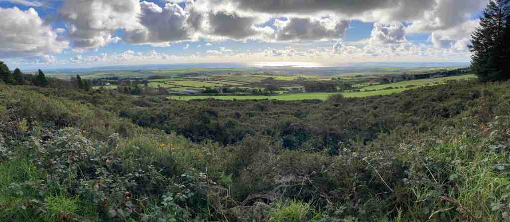
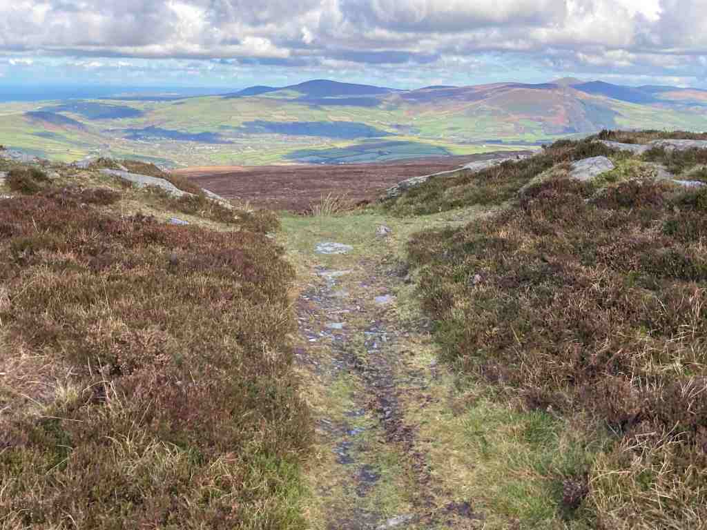
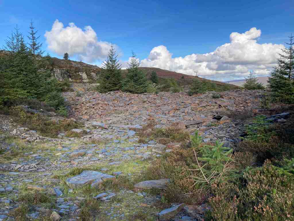
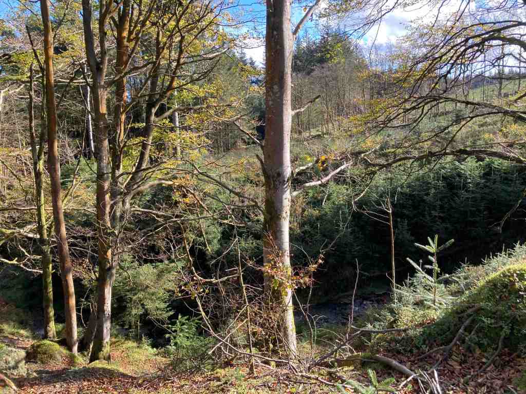
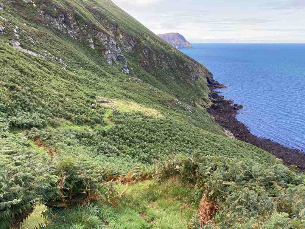
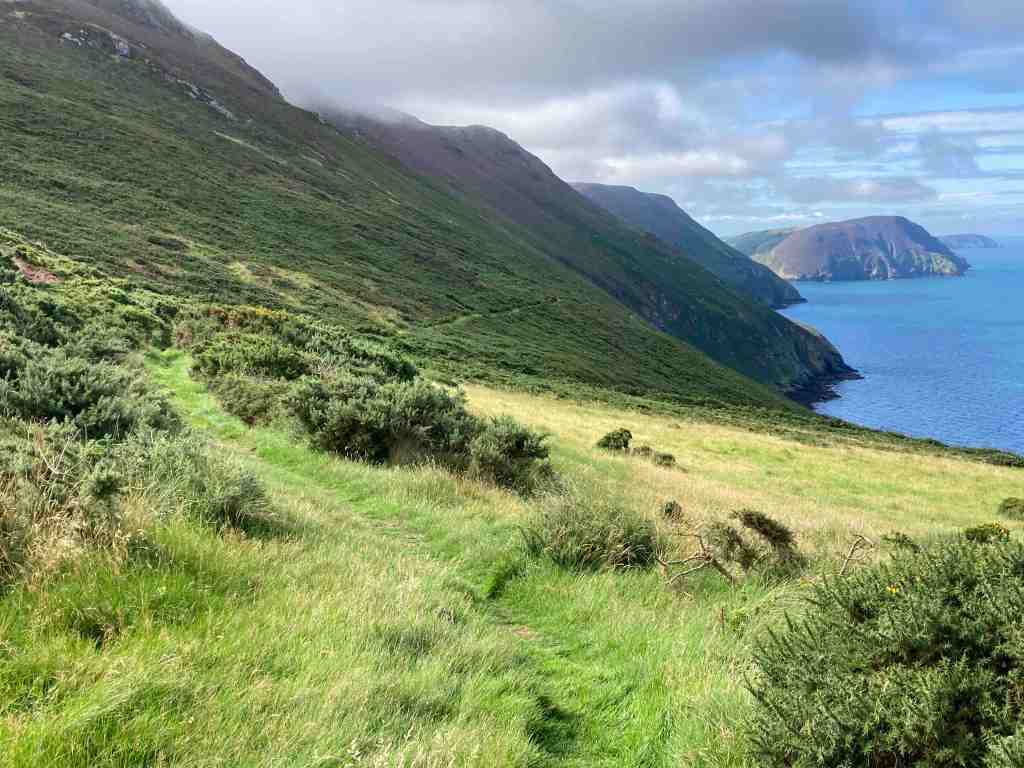
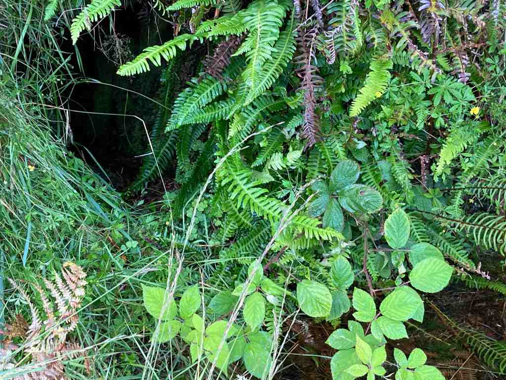
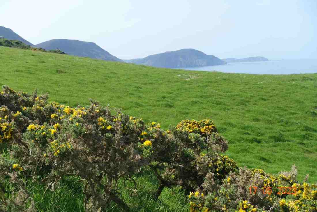
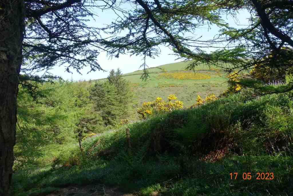
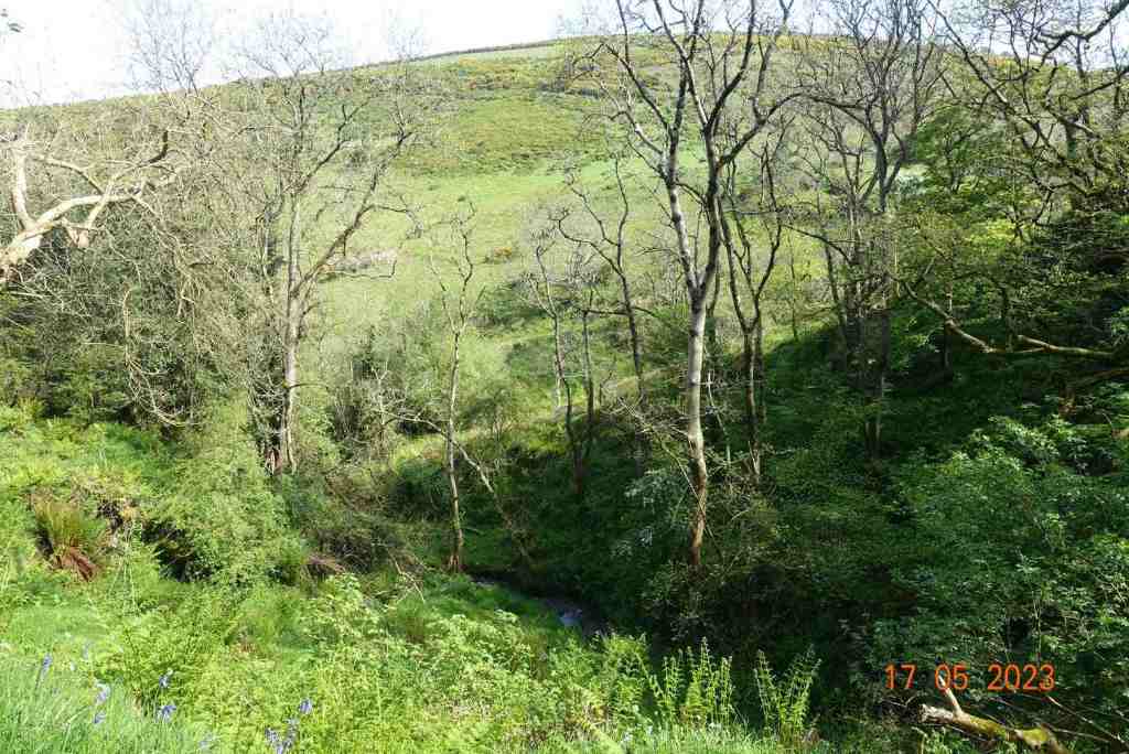
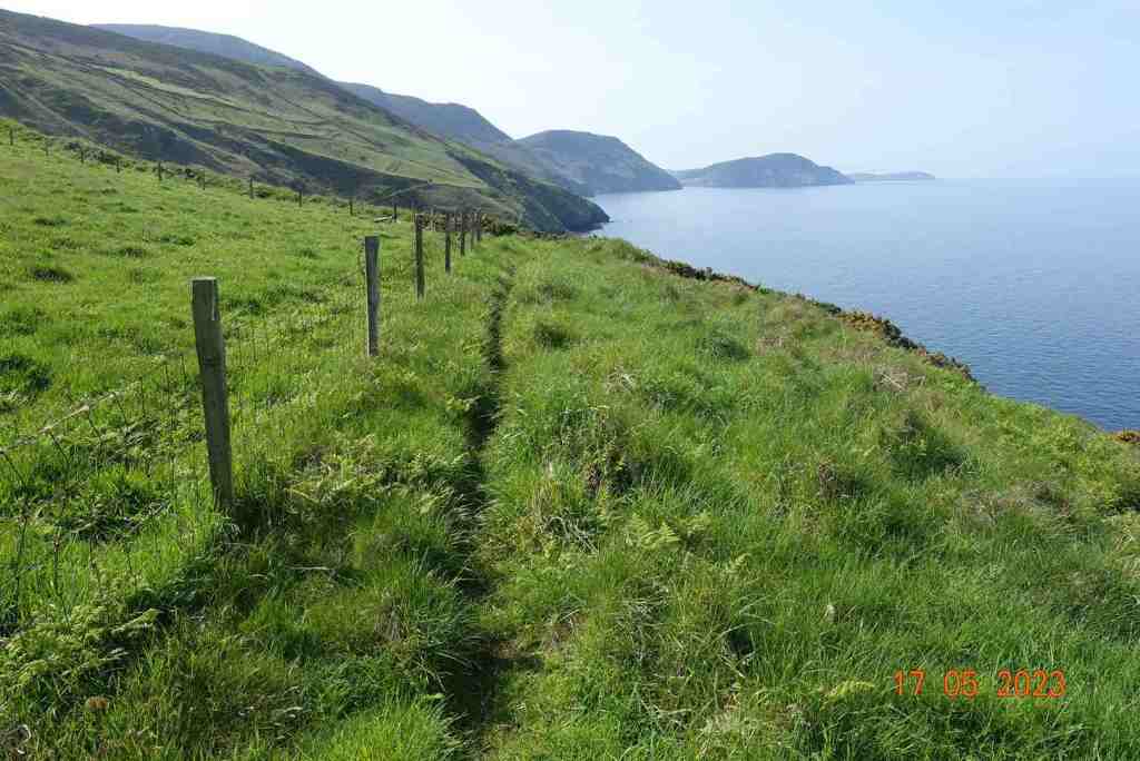
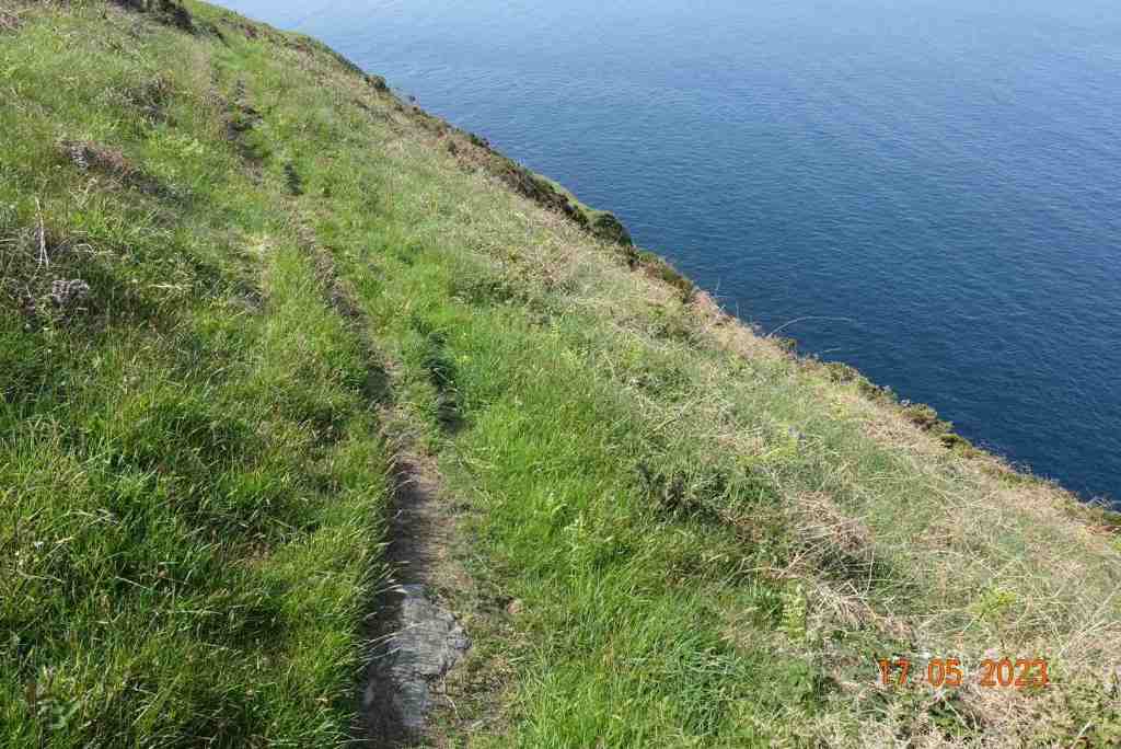
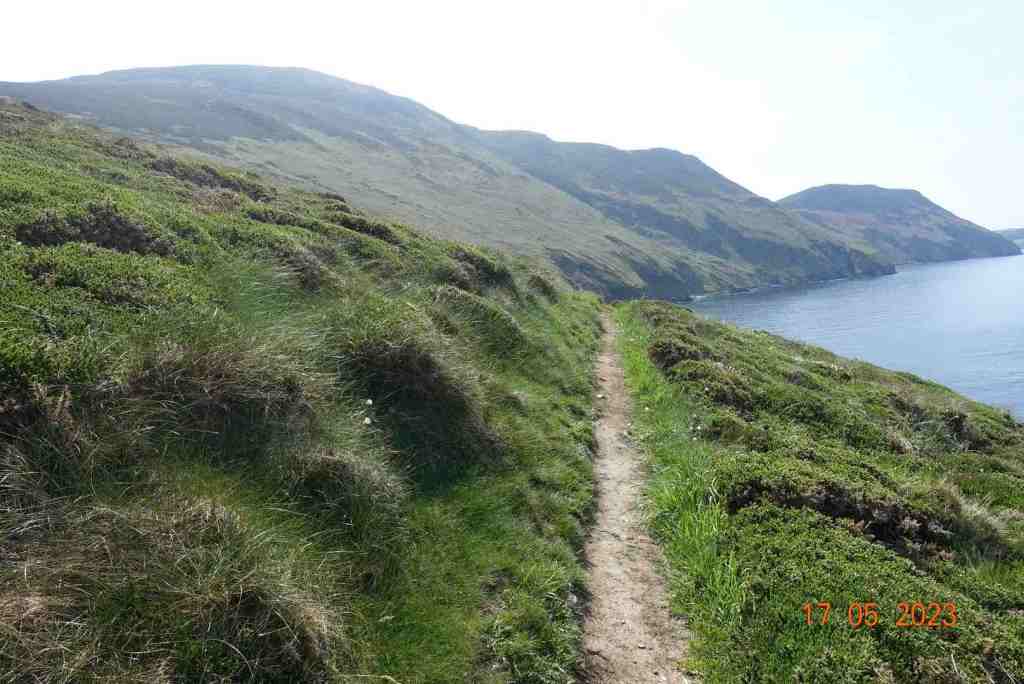
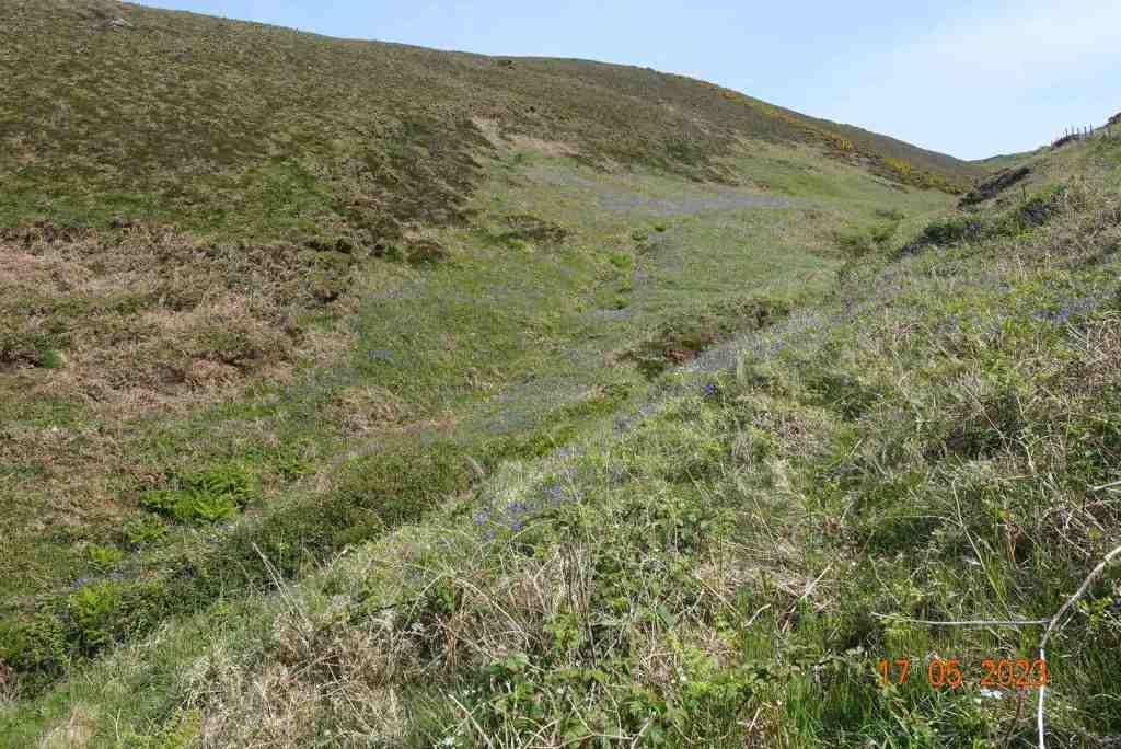
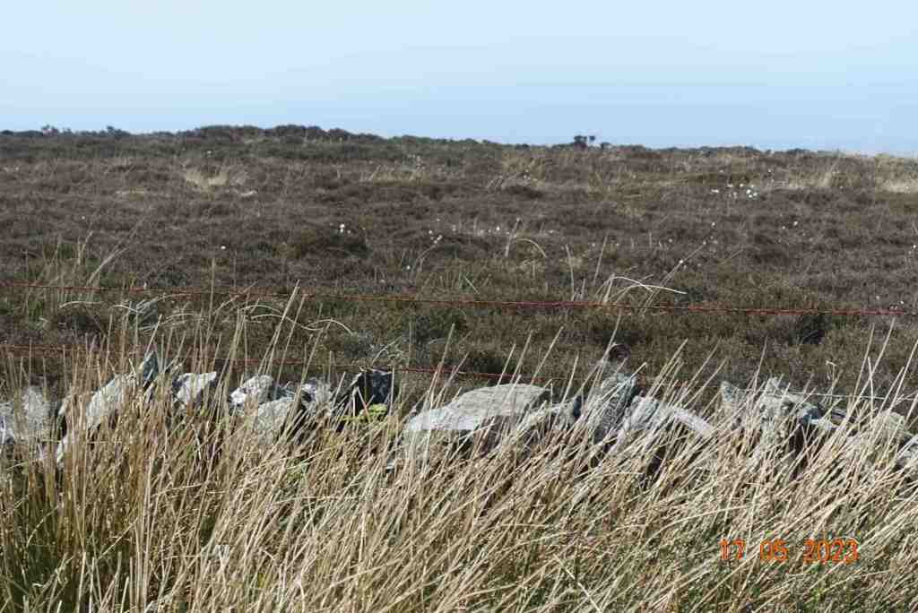
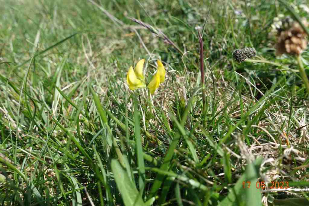
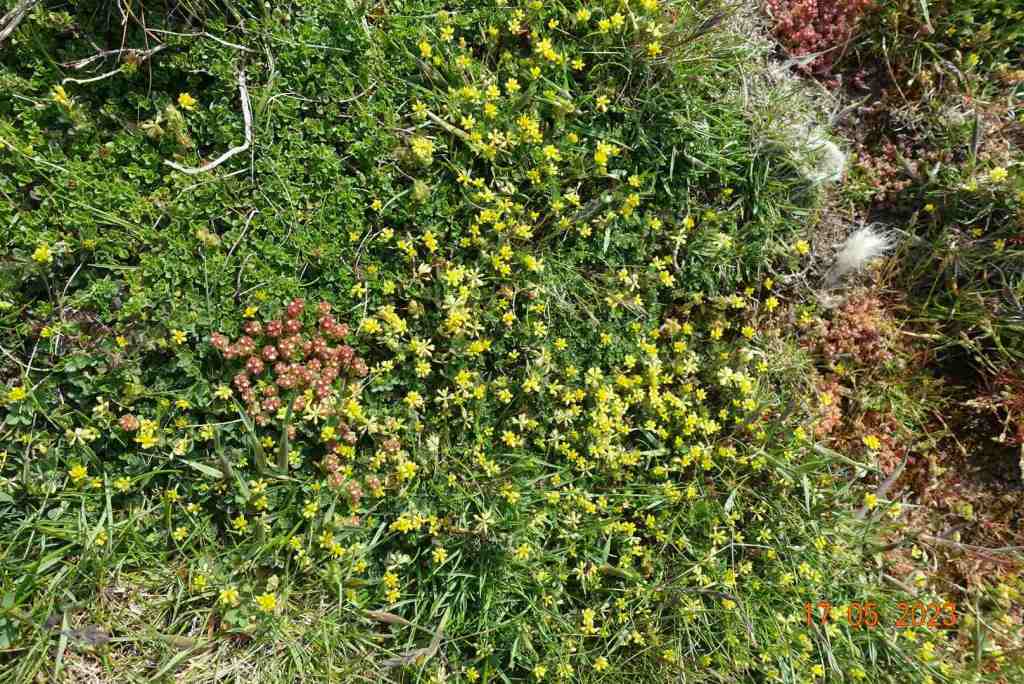
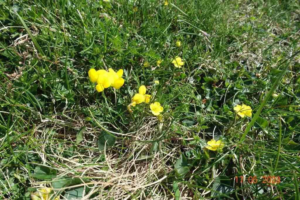
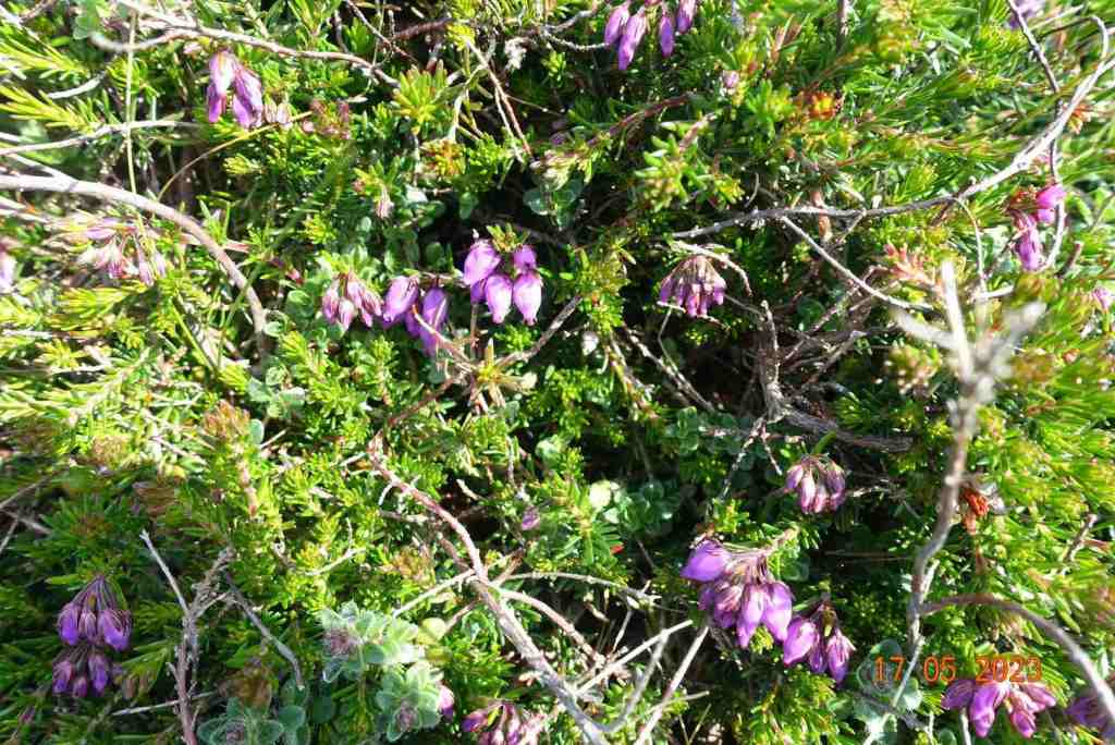
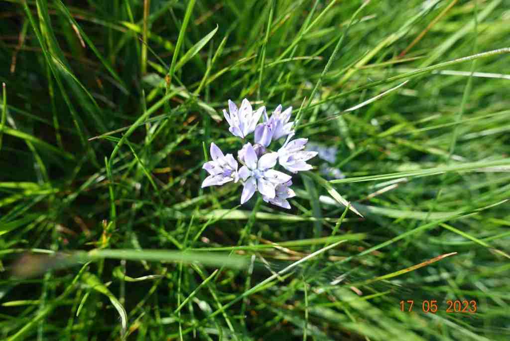
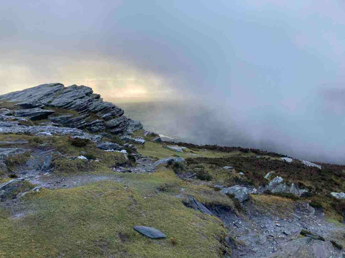
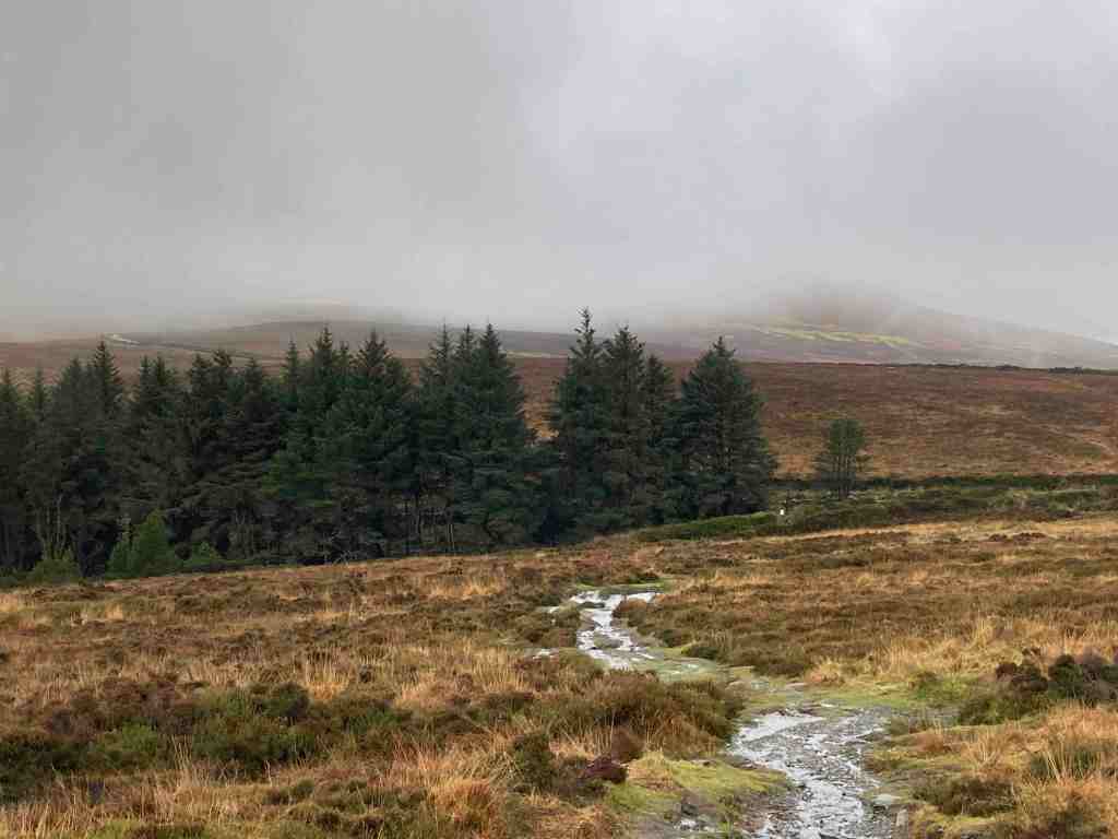
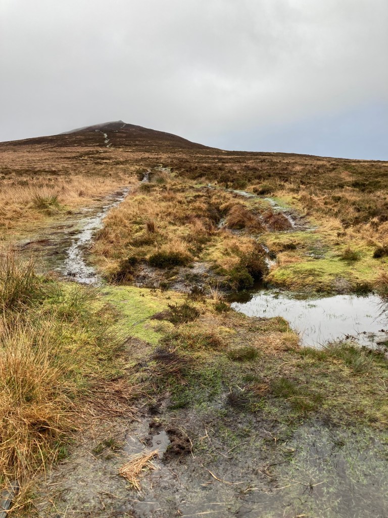
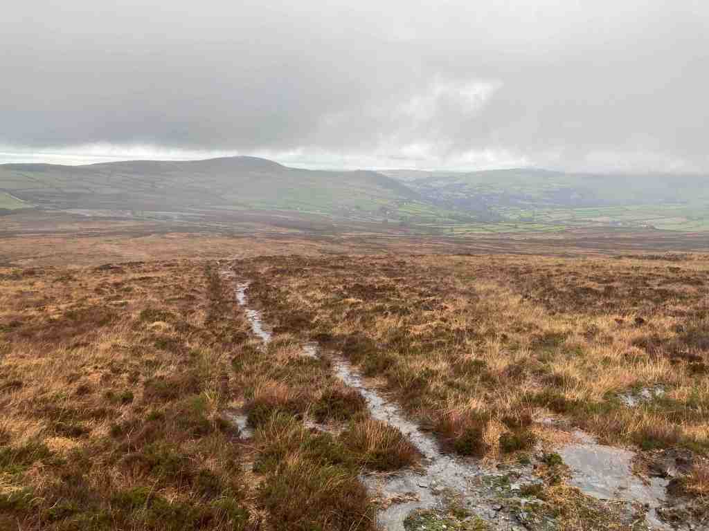
It took a little negotiating. The photos don’t show full amount of footpath under seige. The rocks and steps were slippery and in places there really was no foothold on dry ground, but I got through and remained surprisingly dry. Above the wall, the stream was still gushing down but at least it didn’t trouble me any more. I guessed that there would be more of this to come, but I was wrong. Yes, there were some very wet and boggy patches but where I had to cross streams, they were perfectly passable. In some ways, the narrow paths were the worst, as they were slippery and uneven. But, what does all this matter when you stop and take a look at what is around you. The light was stunning, giving me my own personal light show, as it lit up different sections of the countryside as I went past. Looking down at my feet, there were three varieties of fungus competing with the grasses, moss and ferns for space.

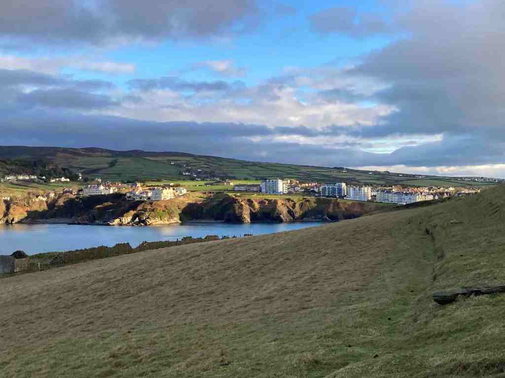
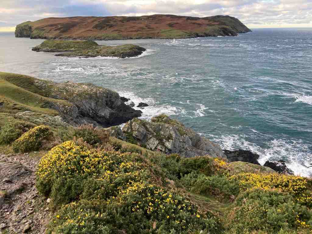
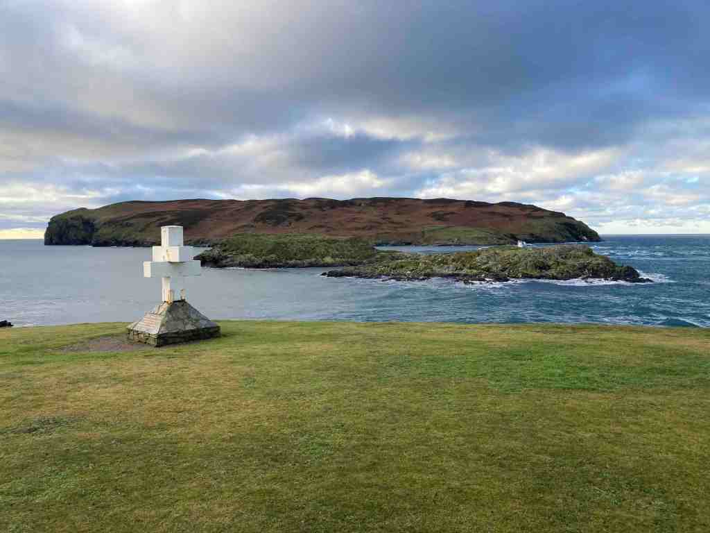
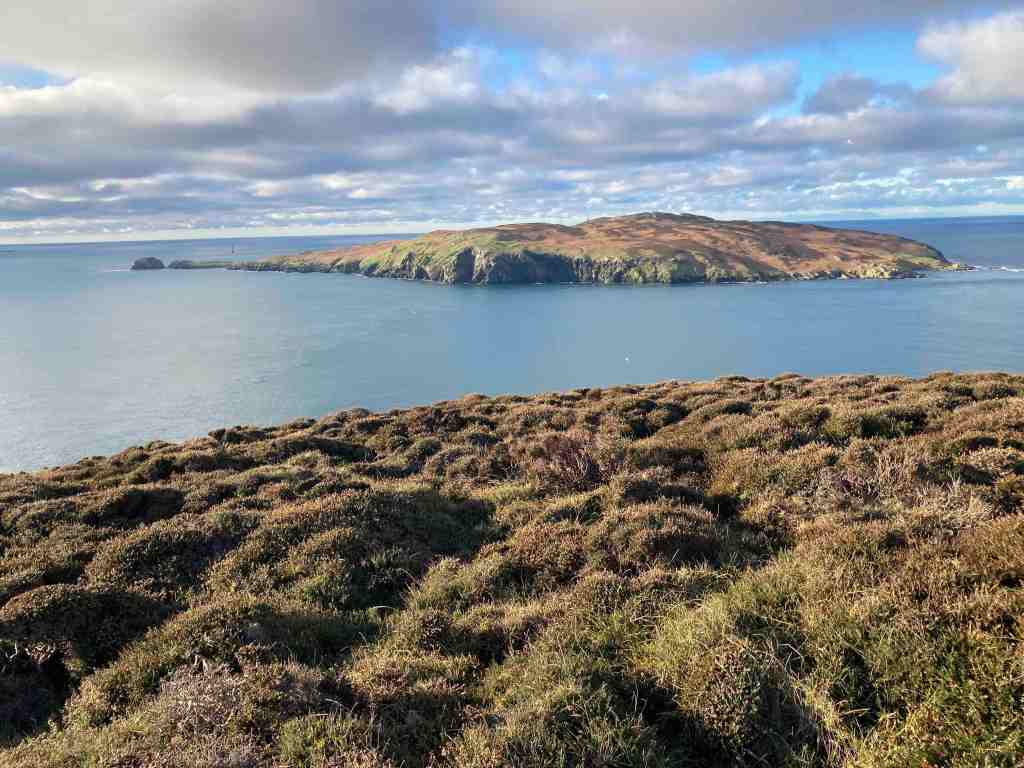
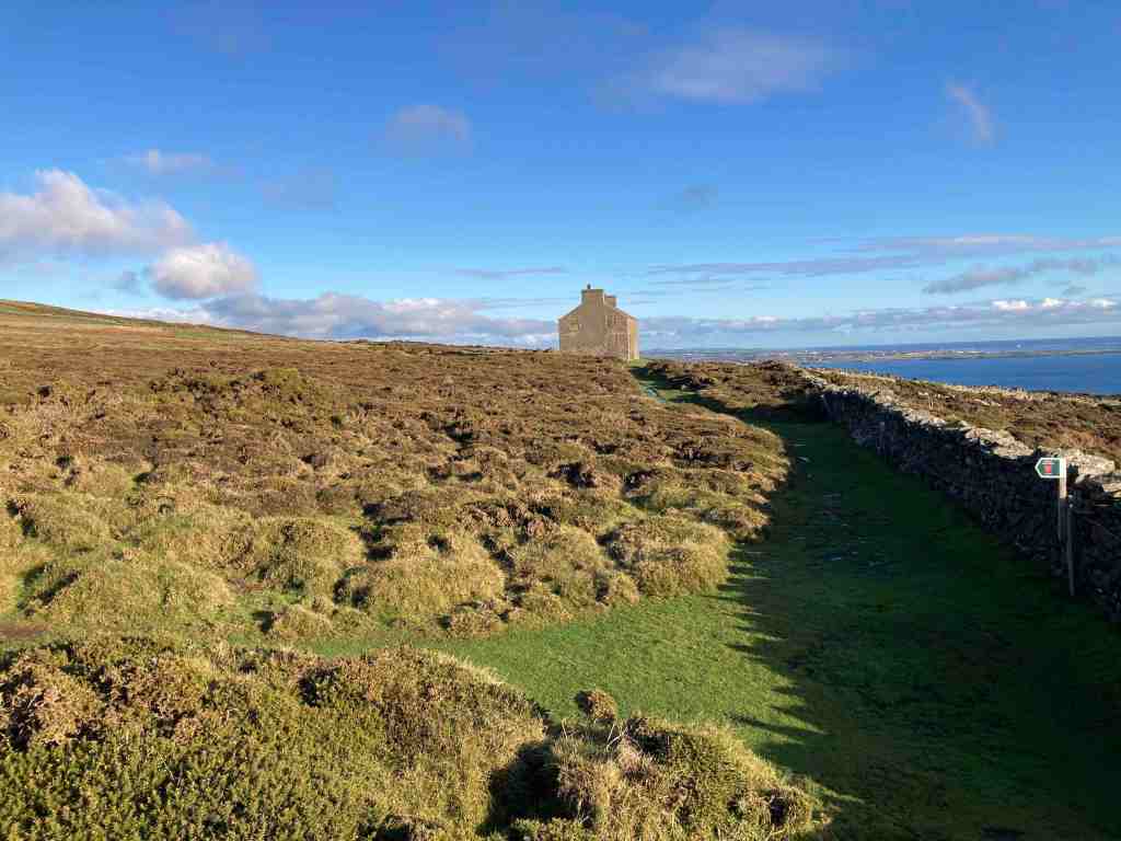
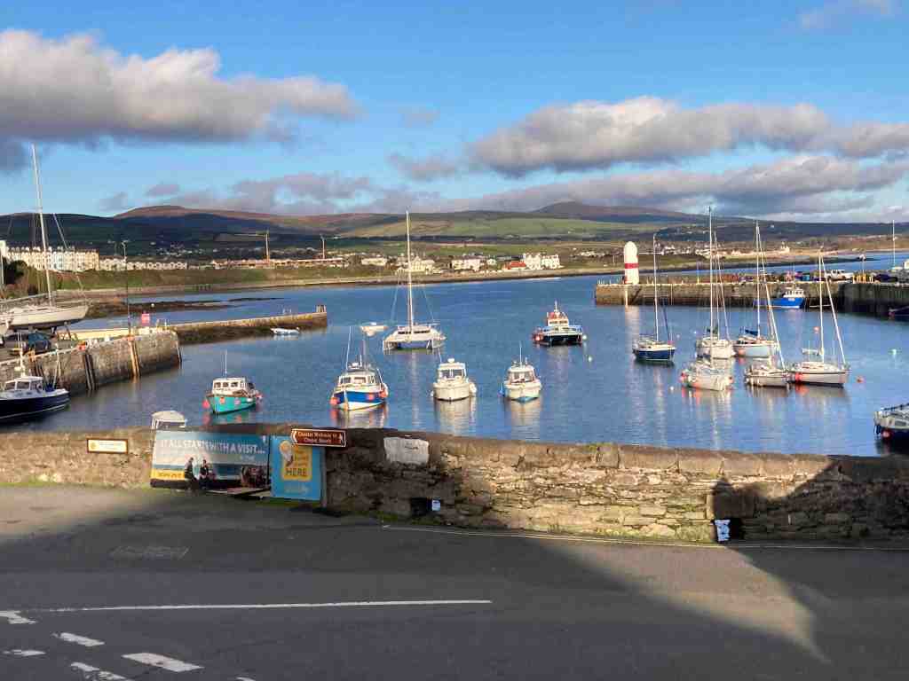
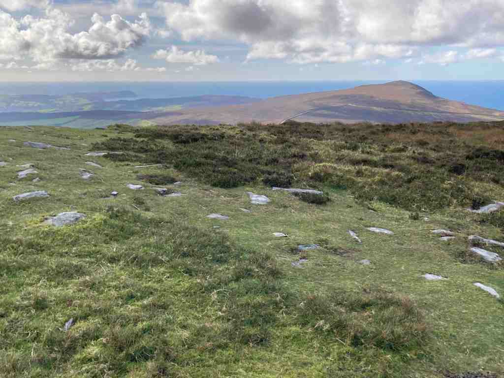
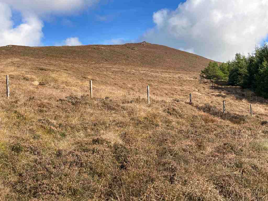
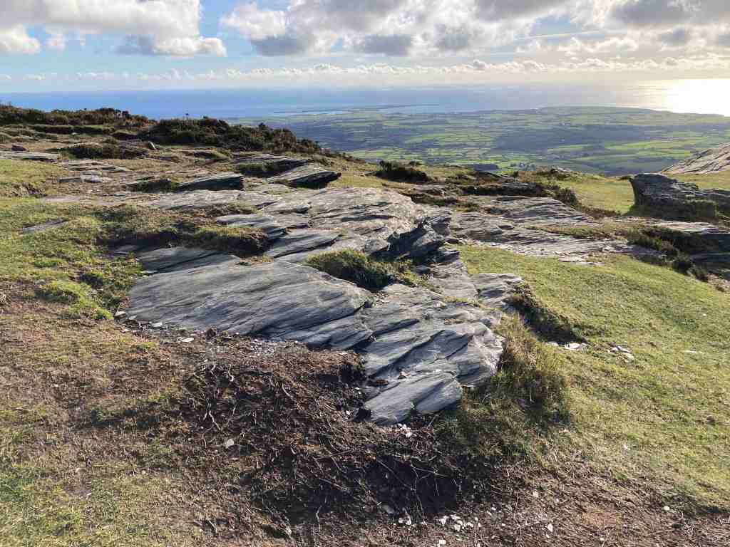
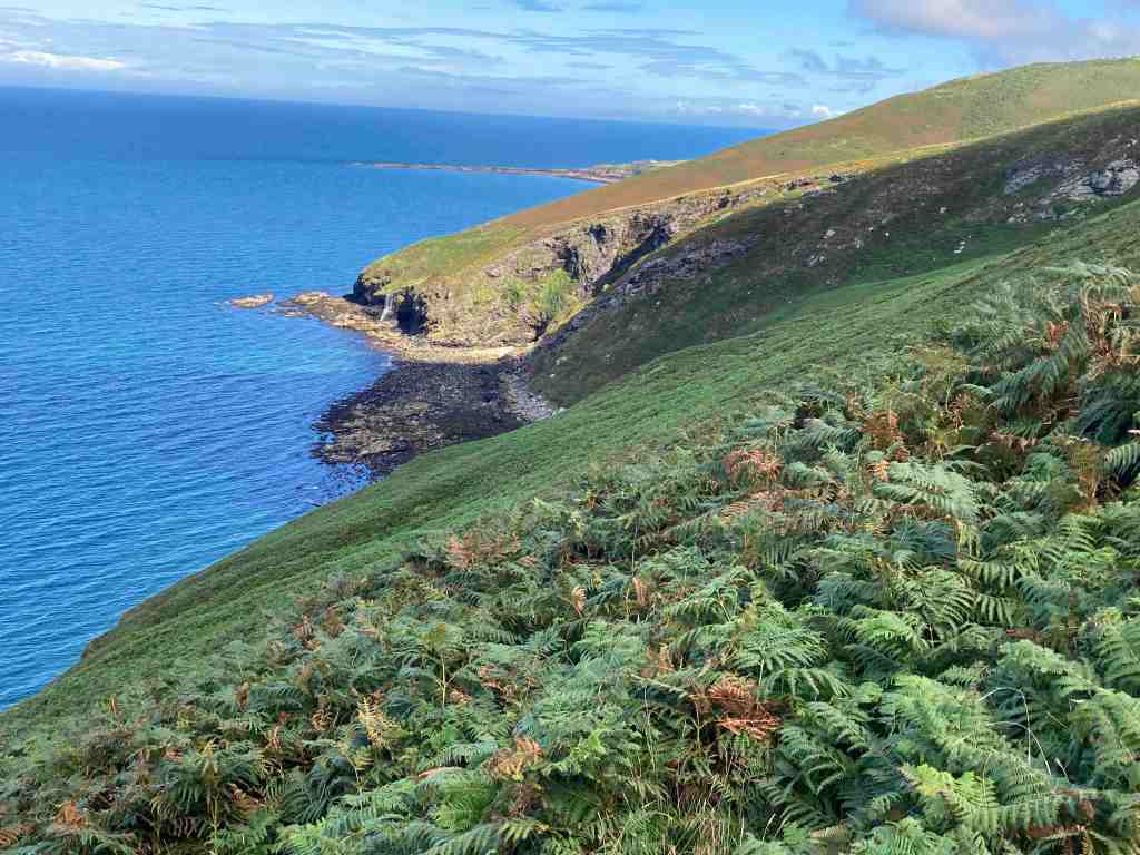
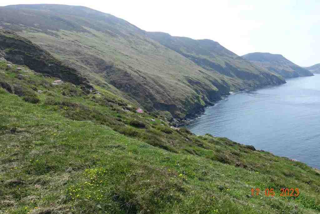
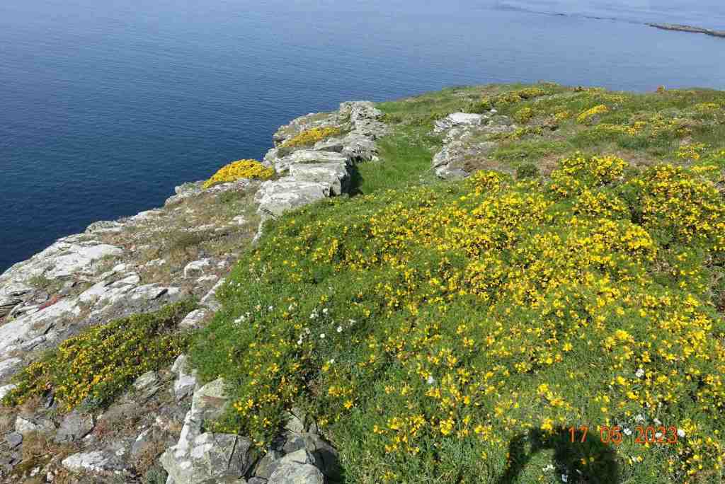
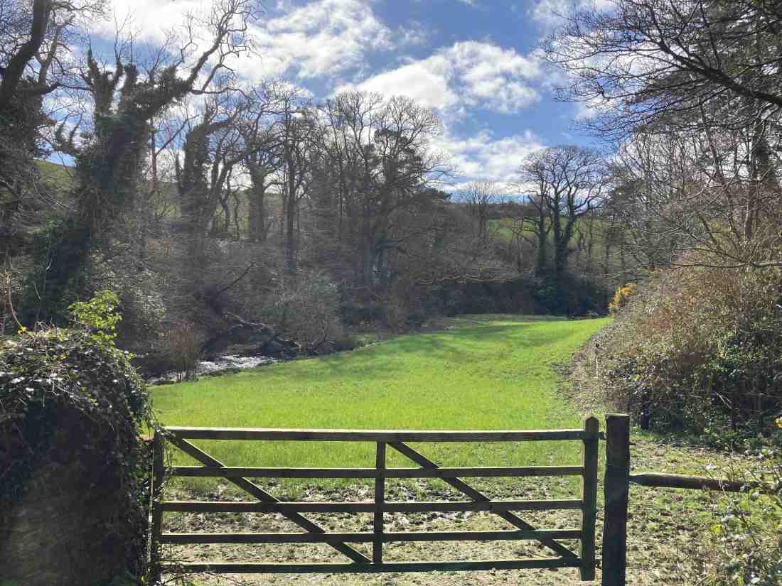
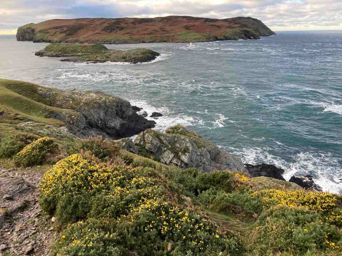
I arrived happily at the Sound, but didn’t stop until I reached the next headland, Spanish Head. The climb up wasn’t bad at all, the footholds not too muddy, but now the footpaths did become very muddy and awkward, with deep puddles that were unavoidable. And still, I had seen no-one to spoil my enjoyment of the countryside, and indeed this continued to be the case until I reached the Chasms Cafe (5 miles into the walk). People often walk from Cregneash and Port St Mary up to this very special place, so it was unsurprising that I met two couples at this point. I sat in the shelter and had my coffee. Looking out to sea I could just see Anglesey in the distance. The routes down from here have lovely views of the south from Port St Mary to Castletown and beyond, but the walking is not comparable with the terrain I had just been walking on. Given that I have a jippy left knee and sciatica in my right leg, I thought enough was enough and there really was not a lot to gain by continuing on past Port St Mary. I could have shortened the route home by going up through Glen Chass or across the golf course, but I satisfied myself that I wanted to see the village and then take the back route home.

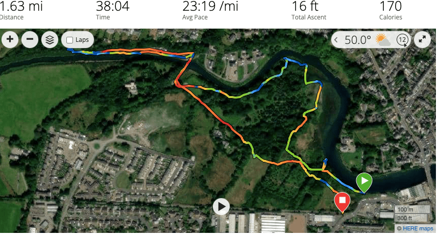
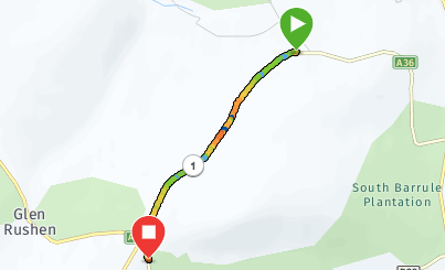
Total distance: 8.5 miles; 1352 ft of ascent; 1434 ft descent.

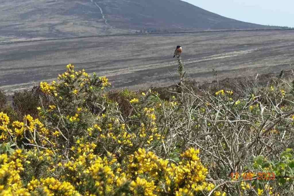
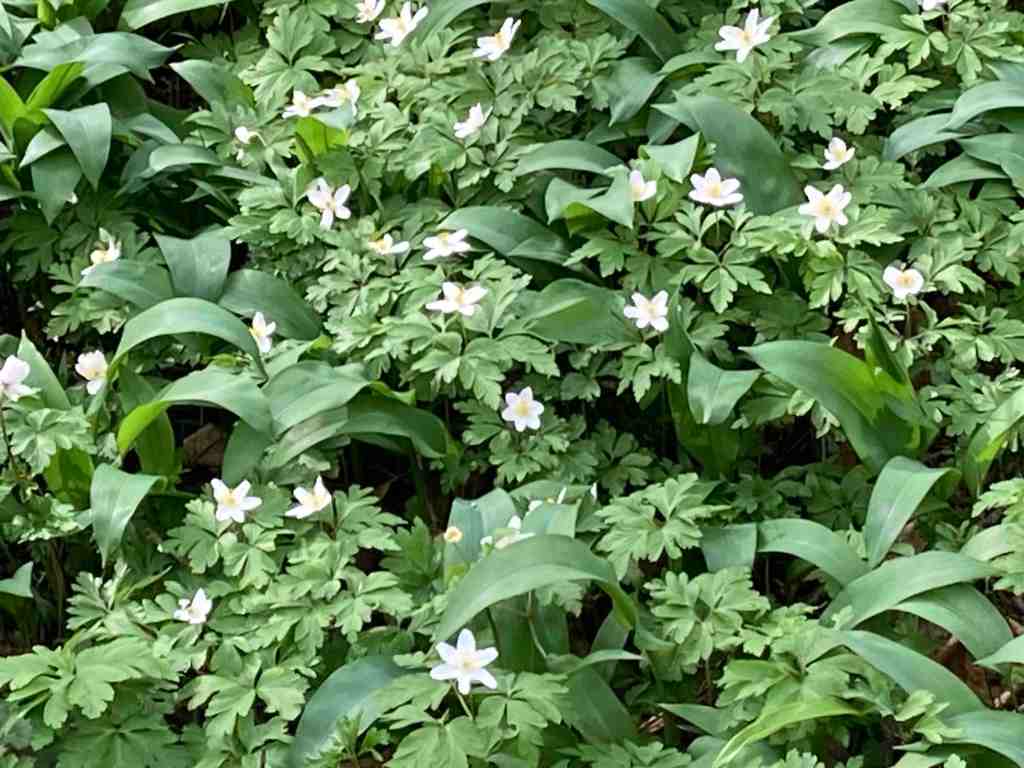
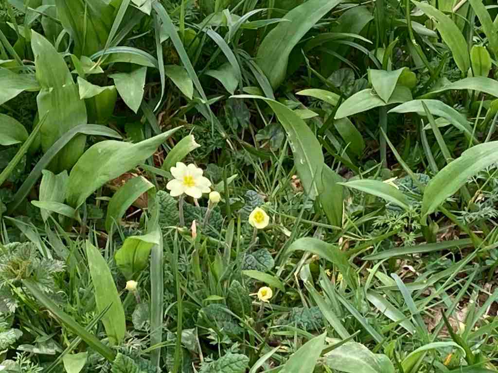
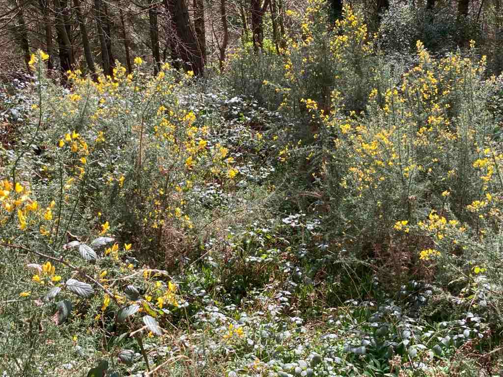
I have such a lot of nice photos from this walk, I have created a slide show for you. I had intended to edit a couple of them, but my computer won’t let me, so you have the raw versions.

My left knee pain seems to have resolved itself, but if anyone has any home remedies for sciatica, which has been plaguing me for a week now, do let me know!

Ramsey – Poyll Dooey (Black Pool) Nature Reserve

It seems a long time since I posted here! I don’t know what it’s been like where you live, but we seem to have had constant rain since July here on the Isle of Man, with only brief respites in between deluges. When we do have nice days, and they do occur sometimes, I am usually busy working. So, it was a delight to get out and up to Ramsey to do a recce of a very short morning route I am leading in 10 days.

This 2 mile stroll is our build-up for our U3A Walking Group’s Christmas meal. We are having an afternoon walk later after our slap-up meal. Indeed, this will be my last walk for the U3A as leader and organiser of this group as I have decided to stand down. Parking at Milntown, it is easy to cross over the road and walk down Gardener’s Lane before turning onto the old railway track and heading east towards Ramsey. In the past, this must have been an attractive stroll, but the first half of it goes between newly constructed houses, and it is only when it reaches the outskirts of Poyll Dooey that the old track regains nature on either side of the path. The walk starts at the very end of the track, where it joins a road where you can see the river on the left. The views of the river are beautiful in both directions. It is a tidal river, constantly bringing crustaceans and worms into the mudflats that are exposed at low tide. The mudflats then turn into a salt marsh, an unique specialised environment that allows grasses and herbs to grow that cannot grow elsewhere. This in turn encourages a variety of wildlife that can feed off this specialised turf and soils. It is also beautiful, and unexpected being so close to the town.

There is a variety of paths through the Nature Reserve, which is a recent creation. It was formerly an old tip, as recently as 1988. It just shows what can be done with a bit of imagination and dedication. It is a small area of only 12 acres but it packs plenty into it. The woodland is still quite scrubby, with the exception of the Secret Garden area that has been specifically planted with a variety of trees. Some parts are protected and therefore inaccessible; imagine, if you were to come back in 50 years I think this will be a very special place.

I followed narrow footpaths over the salt marsh so that I could follow the river as much as possible. Please try and avoid walking all over it and keep to the side as much as possible. Dogs are allowed, but better not to let them dig up the area. There is plenty of room for them to be off the leash in the woods themselves. It is not long before it is necessary to go into the woods and you will find yourself at the wooden footbridge, where there is usually a mass of ducks, geese, swans and the like. Today, they sounded just like a load of girls giggling in the playground. They were very funny. In the sheltered areas, especially in winter, you may be lucky enough to spot a kingfisher, a species which is declining on the Isle of Man, so if you do see one, please let the Bird Club know.

Crossing over the bridge you can walk a short distance westwards to admire the river and distant views; the river may contain trout and salmon as well as all the bird life. Further along is a mass of reeds, where I imagine birds nest or gather material for nests. It is not possible to go further in this direction but it is still worth a look before retracing your steps over the bridge.

It is possible to take a different route back to the start through the woods, going past the impressive 6 bedroomed Poyll Dooey House. This is entirely surrounded and hidden by the nature reserve, and part of the house goes back to the 17th century. If you do an online search you will find photos of the interior and exterior on the deanwood.im website. How the other half live… These buildings comprised one of the original quarterland farmhouses – a quarterland being a unit of farmland, usually arable land. Its boundaries would have extended all the way to the Ramsey to Ballaugh road in ages past.

From here, it is simply a matter of following any path; you cannot go wrong. They all take you back to the railway track one way or another. It is worth visiting this area during the different seasons and noting down what different birds you see and hear, and perhaps bring a picnic in the summer months. And don’t forget to visit Milntown itself – the house and gardens are open most of the year and they serve great lunches and afternoon teas, and the gardens are a delight.

A Circular Walk on South Barrule

Ever a favourite of mine, I never tire of walking up South Barrule. This is really my first venture out since Covid, and I am still struggling a little with chest and sinus problems but I am over the worst. This is a walk I am leading on November 6th for the IOM U3A and looking at the forecast for the next 10 days that expects nothing but rain every day I had to take advantage of a gloriously sunny and relatively warm day to get out and do my recce.

I parked at South Barrule plantation, by the Coffee Cottage, a cafe that is open every day. The car park was very busy with horses and trailers, but I managed to find a spot. The walk starts directly south from the car park. There are numerous tracks through the plantation, so it is important to start on the right one! At the start there is a junction of tracks and you need the track to the right leading uphill; it turns left after a short distance. From there, you follow your nose for some time, keeping right at any junctions, and not veering onto any lesser obvious paths at this stage. The track was quite wet in places, not surprising after all the heavy rain of late, but it is a good wide track, which means you can have a good natter as you are walking along. Continuing on, you will reach a point where the track goes clearly downhill. You can go this way, but I prefer to take the right fork, still a good track, that keeps you higher up and avoids going downhill to go back uphill again. From here you will contour round the southern edge of South Barrule with super views of the south as it all opens up and there are fewer trees. There is also a map board just where the land open up more, which will confirm you are on the right track.

The main path continues on until you join the Bayr Nr Skeddan path. My walk eventally does go off on a side track which then turns into a footpath. This was very wet and muddy today, and if you prefer, you can stay on the main track until you hit the Whisky Run (Bayr ny Skeddan) lower down. My route is more interesting and you remain high up and come very close to where you start the ascent of South Barrule itself. I found that I soon forgot about all the mud as I entered the moorland. The views to the west and south are amazing; you can see the Langness, Castletown, Calf of Man, Cronk Ny Arrey Laa, the Rushen Valley (another of my favourites), Peel and further north all the time you climb up the mountain. I should know by now, having climbed this many, many times, that when you reach the top, you get another surprise as the northern hills come into sight in a spectacular and unexpected way. Maybe I forget because quite often the weather isn’t good enough to see them!

If you haven’t been up South Barrule before, it’s worth taking your time to look for the “Round Table” – nothing to do with King Arthur but a 3500 year old Bronze Age burial mound with its head chopped off. This is a heather covered mound to the left as you start up South Barrule. You can walk around the perimeter of the ancient iron age fort, 22000 sq ft in size, which contains many of the original stones – but imagine it considerably higher. How impressive would that have been. Equally, there are granite stones scattered around, which would have been brought here from one of few areas that contain granite on the island, probably Foxdale in this instance. There are also depressions in the ground, sometimes filled with water, the remnants of roundhouses, where people lived around 500BC. Culture Vannin has an aerial view of the top of the South Barrule, if you look here:

https://culturevannin.im/exploremore/places/south-barrule-hillfort-383989/

Having taken time to enjoy the view and take in its history, we now start the gentle descent, beginning on a clear path northwards. This gets narrower and narrower until eventually, as we have to negotiate a path back to South Barrule plantation, we will be walking on a map bearing and walking over peat, grass and heather (not much gorse here) for about 15 minutes until we reach the boundary fence of the plantation beside the quarry. If you are walking without a compass, you will need good visibility. There is a small mound beside the quarry on the left, and the trees begin just to the right. There is also a sign clearly visible, so head in that direction. There is a rickety stile just to the right of the quarry before the land rises to the right, and the lone tree is a good marker.

Crossing the stile, this leads to the quarry tracks. It is worth a quick detour to have a look at the quarry area itself to see how large it is, then returning to your path, you will see an imposing mound of logs, even larger than when I last went. There is a track leading from these to the right; start to take that track but turn immediately left down a grassy, stony and possibly wet track. Another path will come in from the left, which you ignore. Just a few yards down the track after this junction keep left on the high ground and you will see that a dry path then detours down into the plantation. This is a delightful little path and you can hear the water cascading down the hillside in a mini waterfall, and the area is green and pleasant. It finishes right in front of the Coffee Cottage, so why not stop and have a coffee? To get back to the car park, whilst still in the forest take the footpath on the right through ‘Go Ape” and it brings you out where you started (alternatively walk along the road).

This is a fairly gently walk. The early part through the plantation is mostly flat with a few yards of gentle uphill here and there. The bulk of the ascent is the climb of South Barrule itself, but it is not especially strenuous and it is a fairly short distance to the top; it will take you no more than 30 mins to reach the summit. It is grassy and there are no really steep parts.

Distance: about 5 miles; Ascent total 1040 ft; descent 1079 ft. If you take the lower track avoiding the muddy footpath, this will add another half mile or so on to the walk and about 100-200ft more ascent.

Austria Day 4: Zell am See

The day had a promising start, with sunshine, after a dramatic storm overnight with thunder and lightning that almost burst a few eardrums. We set off from Sankt Johann (nicely pronounced by the operator at the railway station) for our 45 mins journey to Zell am See. This is a most attractive high level ride for much of its route, meaning you have excellent views of the mountains and valleys. It moves quietly through one valley to another. There is no indication of a lake until you reach it – it comes as something of a delightful surprise. Indeed, if you travel by road, you can avoid seeing it at all!

Zell am See has a calm and warming peacefulness. It is as if the surrounding mountains engulf and protect you. The lake is not huge, just 4 km long and 1 km wide, and 68 metres deep. It is a healthy place and the lake water good enough to drink, if you dare to try it. There is a footpath and a separate cycle path around the lake and plenty of places to stop for refreshments or to simply enjoy the magnificent views. At various points in the path are areas sheltered with trees and other places for children to play, all kinds of sculptures dotted around and water sports in abundance.

We did our own version of a watersport by taking a ride on the boat. This was enjoyable but at the same time unnecessary as you can see everything you want to see from beside the lake. However, the skyline was telling its own story. To the north, with its slightly lower mountains the sky was blue with puffy white clouds. To the south the clouds were grey and gathering and had a sense of foreboding; rain was clearly not too far away. For now though, it was bright if not hot sun, and warm enough to entice one into a lager.

It was then time to explore the town itself, which is fairly small but even so has over 10,000 inhabitants. It also has an ancient history, as far back as the Bronze Age, and it was a trading post in more recent centuries. Learning about its past will have to wait until I have a chance to revisit this area. There are cable cars up to its central mountain, the Schmittenhohe, itself standing impressively at 1965 metres. From here, you are able to see over 30, yes 30 mountains over 3000 metres high, including the Grossglockner that we visited a couple of days ago.

It was at this point that the heavens opened, and they weren’t even kind enough to give us much warning. I went in a shop in the dry and came out to a torrent of water flowing down the street – well, maybe not a torrent but you get my drift. They are clearly used to frequent downpours as the cobbled streets all have drainage channels that work very effectively, which is more than can be said for some inconsiderate drivers who soaked me as they sped past! Time for some shopping – I had needed to buy some new trainers and this was the perfect opportunity, and I found the best shoe shop I have been in for many a year. The lady actually wanted to help me, had some really good knowledge and as a result I am now the owner of a new pair of goretex shoes. She insisted I wear them straight away given the inclement weather, so my shoes and I went to look at the church in the main square, with its 15th century tower. As you look down the side of the church, it feels as if this is the only remnant of a bygone age, being surrounded by more modern buildings, but I suspect there are various gems to be discovered hidden away in the town.

It was then time to make my way to the Bahnhof for the return journey. The waiting room had one last surprise for us – exceedingly comfortable and colourful seating. Well done to the designer – compare this with the uncomfortable slanting metal seats we have in the UK and islands bus stops. Once on the train, I really wanted to see where the lake must spill into the surrounding plains but I didn’t detect any outlet. I have since learnt that the lake used to be much larger, reaching as far as Salzach, and much of the northern end has been drained, although there are still swamp areas in places.

By now the rains were eradicating any fine views of the mountains, but no matter. It is good to see landscapes in all their various moods and colours. Tomorrow, we visit Salzburg and we will have a guided walking tour, and this probably whet the appetite for future visits as I am sure we will not be able to see all we want to see in half a day.

Austria Day 2 – Grossglockner

This was not a walking day, but an exceptional day for views as the coach took us higher and higher to the very apex of Austria – the Grossglockner. The images speak for themselves, and although I could name ridges and mountains I doubt if you would care much. The glaciers have retreated enormously since I was last there in the 1960s. I remember having a snowball fight with my peers in this location, but there was not a drop of snow to be seen below the glacier level this year. There are numerous notice boards dotted around the visitor sites, explaining that the process of deglaciation is not uncommon in the vicinity if you look back over the aeons. Nonetheless the rate of change is quite remarkable as you will see from the photos.

and from former days:

After this, we travelled to the beautiful alpine village of Heilingenblut. This traditional village has an iconic church and tremendous views down the valley, but little else for the passing tourist unless you have time in your hands, in which case you could visit the waterfalls or amble along the valley. The church graveyard was beautifully maintained with flowers in every single grave and with photos of the departed in each one, enjoying the afterlife as in life, with the glacier in the background.

On this journey, I found it quite remarkable that where the glaciers would have combined to be a great force to be reckoned with, where the dams now exist across their exit down the mountain, there is only the merest sliver of land through which all the water would have had to travel when the snow melted. I imagine this must have caused catastrophic floods during its ancient history.

There were also some lovely alpine flowers including masses of purple gentian and a hapless butterfly feeding on a plant yet to be named.

Tomorrow I am planning a walk on my own again, after a trip up the Gondola to the top of the local mountain.

Lag Ny Keeilley, Eary Cushlin

I ventured out on the first sunny day I could find to do a short recce of an optional extra I was intending to offer on our next U3A walk. Lag Ny Keeilley, the home of a long gone hermit was my destination, and I was starting from the ‘car park’ at Cronk Ny Arrey Laa. I don’t propose to give you a full breakdown of this walk as I shall write it up another time, with a better map and possibly an alternative end-section, but most of this walk is absolutely stunning, especially if you did it as I did, first thing in the morning, before other people have got out of bed.

Having said that, as I started walking down the lane, I bumped into a man with his grandson picking bilberries. There are heaps of bilberries on this island. I did pick a few myself just to check what they were like. I walked down until I reached the footpath sign leading into the Dalby Nature Reserve, only I turned left instead up and over a stile onto the moorland on the lower edge of Cronk Ny Arrey Laa. The light was wonderful and the wild flowers were in abundance, making this a joyous walk. I walked alongside the wall, slightly uphill, until I reached the path leading down from Cronk Ny Arrey Laa, and followed that to Eary Cushlin. This path is becoming worn in places so do take care.

The path to Lag ny Keilley goes to the left in a southerly direction skirting along the bottom seaward edge of Cronk Ny Arrey Laa. Ignore the footpath sign to the right unless you want to visit the waterfall and have a steep climb back up the hill! Our path continues for about 3/4 mile hugging the coastline. It is not particularly exposed but neither is it a particularly easy path. You need to be sure-footed as it is uneven in a number of places and there are gaps in the path on the seaward side, so you may lose your poles if you are not careful. But, it is passable with care, and if you do trip you will get a soft landing :-). It is also very wet in places, made worse by the constant rain we have had recently. There is a bench if you want to stop and enjoy the views, which are spectacular. I sent a Whatsapp to my children with a couple of photos, saying that people go on holiday to get views like these, and here they are on my doorstep.

There is also one rather large boulder you have to navigate, but otherwise it is a narrow packhorse track, going steadily downhill. Before you reach Lag Ny Keeilley, look out for the Holy Well, which no doubt kept the hermit going with a constant supply of fresh water. I didn’t go down to the site itself, but I did take a photo. It looks rather uninspiring from a distance, but it is interesting when you get there, and imagine the life that was lived here, and the visitors it has seen. You can learn more about the site here : https://culturevannin.im/exploremore/places/lag-ny-keeilley-717214/ and here: http://early-med.archeurope.com/british-isles/the-celtic-church/lag-ny-keeilley/

It is a steady climb back to Eary Cushlin. The remaining section is on a stony road up the hill. Altogether this was a 4 mile walk, with 1000ft of ascent, which completely surprises me. I have checked the ascent on a couple of maps and it appears to be correct, but it is not at all difficult.

I shall not include this on my next U3A walk but instead I shall offer it as a separate walk sometime in the future, and maybe include Dalby Nature Reserve which will make it an even more interesting walk.

Below are some examples of the uneven path:

Update: Monday 7th August – found a tick embedded in my leg this morning, despite being fully covered from head to foot during yesterday’s walk. Am awaiting advice from dr as previously I became very ill following a tick bite. So, do be careful if out around bracken this summer. These tiny pesky creatures sit atop grasses and such like looking for passing prey. If you do find one on you, use a tick remover and seek advice sooner rather than later.

Marine Drive Circular

I have walked this route many times before, but not usually in this direction. It is so convenient to get the steam train from Port Erin to Port Soderick and walk into Douglas from there. I found this alternative route very pleasing and in many ways it affords better views walking from North to South and then back to Douglas.

I commenced the walk at the Arch on Marine Drive. If you are visiting /using a car, there is plenty of free parking just the other side of this arch. Before that, parking is limited to 2 hours on the road. The first section is about 3 miles, along an old road so very easy walking, or also suitable for pushchairs or wheelchairs. You get fantastic views of the twisty rock formations and in places you can divert from the road onto grassy areas where you can rest awhile and look at the views or try to catch a glimpse of a passing porpoise (they are quite common here). On a good day you can see all the way down to the Langness peninsula.

Marine Drive stops just short of Port Soderick, and there is a lovely stopping point overlooking the bay if you have time to stand and stare (or eat your packed lunch). There are choices just beyond this point. Port Soderick Glen is very short but always lovely, and new paths have been created, so it is worth a walk down to the bay and up the Glen. You can then either retrace your steps to the top road or continue westwards on the road and catch the steam train back to Douglas.

The route I was doing fell short of this latter option, and I did not venture down to the beach but instead hiked up a grassy track that leads over the track of the steam train and follows alongside it to the village of Port Soderick. Here you get completely different views, with glimpses of the northern views and hay-stacked fields or simple grass meadows. As a bonus, you may well meet some donkeys who will be keen to say ‘hello’, but please do not feed them as they are on a special diet.

This path terminates at the old Castletown road, where we turn left and walk from a short distance a little uphill until we cross the road and take an unmarked footpath (it is on the map though) to another footpath junction. This is a delightful tree-lined path all the way downhill, and as you walk it you feel the centuries of feet that have trodden this route before. It leads to the real Fairy Bridge, which is slightly off the path. Once you have gone over the footbridge over the tiny ford, take a left immediately into the woods and follow the informal track and you will soon spot the bridge. But don’t stop there. It is interesting in itself, but take time to go over the top and down the other side. There is an area like a platform nestling beside the stream, which is relatively wide at this point, and you really do get a sense of fairies dancing in the shrubbery.

Back on the main track, this continues all the way to the main road. There is no way of avoiding this, but it is only necessary to walk on for a short distance before we turn off and walk alongside Middle river. I just love this tiny, unexpected area of wilderness. It is sandwiched between Pulrose Golf Club and a set of unattractive warehouses on an industrial estate, but these are totally masked by trees and shrubbery. At the end of this section, you do have to walk for about 50 yds through this industrial estate before turning right on the Nunnery footpath, another gem you don’t expect in an industrial setting. This follows beside the main Douglas river and you may be lucky enough to see a steam train go overhead or a kingfisher darting about the river.

The last section is unavoidable road walking into Douglas, but it is not altogether unattractive, and just a little further along, you arrive at the Marina. There are plenty of cafes along the side of the marina where you can take a rest before the final short uphill section back to the car. This, too, has its rewards as Douglas Head has amazing views of Douglas and the northern hills. On the way there, you may be fortunate as I was today to see the new boat, the Manxman, in the harbour. I can’t wait to have a ride on that massive beast 🙂

Total distance: 8 miles, but with shorter options at various places. Total ascent: 564 ft; total descent 814 ft

West coast walk near Niarbyl

What a way to refresh your soul. I have been working flat-out for a few weeks now and had set aside today for a complete day to myself, without any students, without looking at emails or marking work. I had not anticipated such as treat as I started off through Kerroodhoo Plantation, having parked off the road at Dalby Mountain Nature Reserve.

The sun was shining and it was a warm day as I ventured into the eastern edge of the forest. It is always a delightful walk, no matter what time of year, but as the sun glinted through the trees, it was very pretty; even more so when, rather like Wordsworth daffodils, I came across a sudden drift of bluebells, that went on in all directions. I took photo after photo but show you just two here. Although the path is only partly marked out on the map, in practice it continues all the way to Barrane. In places it is a little muddy and in other places slightly steep. If you are slightly infirm of foot I would definitely use a pole to help you down safely, but these are very short sections and nothing to worry about. Not only was there an abundance of bluebells, but throughout this walk there were many, many different wild flowers and it was pure joy to be amongst them. I shall include a slideshow of these at the end.

Barrane appears after a mile of walking downhill, then the route joins the road leading to Dalby but go south instead of north, and this becomes a stony track uphill. After crossing the ford, or avoiding it by following the signs for the coastal footpath, take the footpath that leads to the edge of the coast. Most people turn right to go to Niarbyl, but our route goes south at this junction and the cliff path is delightful along here. There is a little uphill walking at this stage but there is a nice resting place where I stopped for some time watching the tortoiseshell butterflies doing a merry dance and listening to the linnets singing in the bushes. The view was sensational and there were different flowers in every direction that I looked. It was so restful and just what I needed.

From here, there is a little more uphill and then you join the standard coastal path which begins on a fairly level grassy path before zigzagging downhill for a short distance. Having crossed the ladder stile, the path becomes narrower and closer to the cliff edge. It is never dangerous, but I know some people get nervous on such paths so I have included some photos to show you how close it is. As I say, it is perfectly safe. After a little more downhill, where you are fairly close to the bottom of the cliff at 153ft above sea level, we cross a stream called Glion Mooar and then start the rather more cumbersome 500 ft / 3/4 mile climb up to Eary Cushlin house, of which the first part is the steepest. This can only be avoided by not taking the coastal footpath earlier, but it is a good, grassy path and you can rest whenever you like.

I plan to lead this walk in August, but from here I shall probably take a slightly different route to avoid walking on tracks. Today, I followed the main track up to the edge of the plantation then turned south. This goes very gently uphill to the highest point of day at 998ft. The route then turns off into the Dalby Nature Reserve owned by Manx Wildlife Trust and we walk through this back to the cars. This is likely to be boggy in places as it was today, so if you do follow this route I would recommend wearing long trousers and gaiters. Gaiters for the boggy bits and being a nature reserve the heather and gorse do not take account of walkers and sometimes the path is very narrow if existing at all.

I am feeling so much better these last few weeks and I hoping to get out in the countryside once a week from now on, so you can look forward to a few more posts over the coming months than I have been able to write in recent months.

Distance 5.25 miles; Total Ascent 1,184ft

Spring Afternoon in Port Soderick

The western boundary

It was a lovely sunny afternoon on Saturday and what better way to get some gentle exercise than to stroll up the small but beautiful glen that is Port Soderick Glen. You really don’t need to set any time aside for this walk as it will only take you 3/4 hr even if you are walking at a leisurely pace. It has a timeless tranquillity about it, and possibly because it is only half a mile long you can imagine all the feet that have traipsed beside the stream as you jump over the boggy bits and admire the hills on either side.

I was really on my way to Tesco in Douglas. This is what is so nice about the Isle of Man. I could have done a number of different short walks along other glens on the way, driving through lovely countryside to get there. This had to be a short walk as I was still suffering with a fair amount of pain but I needed to build up my exercise after 5 weeks. The first thing that struck me was the bird song – not that I can recognise birds from their song but I enjoy trying to find out where they are perching in the trees while they perform their arias. The second thing I noticed was that it was quite wet and there was a fair amount of water in this little stream. The third thing I noticed was that the paths have been upgraded and a new higher path has emerged. Of course, I had to try this out. As I reached the ‘top’ there was water gushing off the meadow above. It had created a small path in the grassy turf before it tumbled into the glen, but where was all this water coming from? It was only a few feet to the top from there, maybe 8-10 ft, so how was it generating that kind of force? It’s good to have mysteries – just as we have our faeries and elves on the Isle of Man.

There is little to say about the walk itself. I walked one side of the stream, admiring the celandine and wood sorrel; then as I crossed to the other side there were primroses and marsh marigolds and a few stray daffodils enjoying the sun. You reach the end of the glen where it joins a track and there is a quaint bridge to the left. Follow the track to the right and it will join the road – here there is a minor tributary than joins the Crogga River that you can just about make out in the vegetation below, and there are plenty of trees as you make your way upwards. At the road, it is necessary to walk a short distance back along the road towards the sea, but then it is possible to turn back into the woodland and rejoin the river near the bridge. It feels completely different up here, with less vegetation and the trees standing tall. It is a very well made path and pleasant to walk along.

I had just joined the forest track when I spotted something on the ground, that looked like pages from a book. Indeed, this is exactly what they were. What an odd place to find such a thing. The pages were from a very old-looking book “The Land of England” and covers what happens to the land in each month. There were only a few tattered pages and they just happened to be for March, telling me how a furrow-slice works and how to gather up the ridges; also a quote from an ancient scribe on how to keep oxen. It even told me the origins of the word ‘camping’ which has absolutely nothing to do with putting up a tent in a field….

What goes up must go down, and the path down eventually ends in very nicely constructed steps, not too steep and quite manageable. From here, there is no choice but to follow the stream back to (the car park) or the sea. I had a wonderful surprise when I glanced up and saw a falcon displaying it aerial talents over the top of the trees. After this brief respite, I continued my journey. The sea hits you as something of a surprise as if you park in the lower car park and walk up the glen you wouldn’t know the sea is just to the left and only yards in front of you. And what a view when you get there. I was delighted as the tide was well in and the waves crashing on the pebbles. The beach itself is not amazing and it is a bit scruffy but I believe there are plans to do the area up a bit and restore it to its former glory.

If you want a little more of a walk, continue along the edge of the beach to the steps that lead up the northern edge of the cliff. This is an attractive addition to the walk. You can go all the way to Douglas if you really want to, along Marine Drive, but that would take you a couple of hours. However, if you time it right you can get the steam train in one direction of the other to make it a linear route. Otherwise, when you have had enough, just turn round and retrace your steps back to the car.

I confess I am still sore after my operation, and it is making me feel unwell, but I had my post op appointment yesterday and the Consultant (Mrs. Moroney) was just wonderful and reassured me that my recovery is as it should be. My operation was bigger than we were all expecting so I couldn’t expect to be in any better condition than I am right now. However, she says the chances are that I will be fighting fit again for the May walk and she said that it is often the case that just one day the patient wakes up and feels well again and there is no looking back. So I remain optimistic.

I shall be joining the U3A walk on Tuesday from Castletown to Port St Mary, but just for part of it. It will be nice to see everyone again and for life to return to some semblance of normality. This weekend I plan to do a recce for the walk I shall be leading in May, so let’s hope for some good weather.

New Year’s Day – and What a Day

I forgive the many of you who decided to abandon thoughts of a walk this New Year’s Day. The weather forecast was not great – we could expect at least a few short, sharp showers, but some clear spells too, and given there is nowhere to take shelter on this walk I imagine this might have put a few people off, especially as it was hailing cats and dogs in some parts of the island I gather.

Even I was wondering whether this was a sensible route to undertake today, and in my head I had prepared a few other options with more cover or escape routes, if required: Glen Maye, Port Soderick, Marine Drive or total abandonment of the walk. One of my trusty walkers who is usually game for anything rang up to sorrowfully back out at the last minute – you know who you are – which left just three hardy fellows including me to climb South Barrule.

We met at Round Table as planned and the weather was already dull. I could see rainclouds bubbling up in the distance and I knew this was the calm before the storm. I did offer my alternatives but the group would not be discouraged and we began our ascent of South Barrule. There was no snow today, but in its place was water – everywhere, and it was hard to avoid placing one’s foot in one puddle or another. Even so, it was easy walking and a pleasant climb.

No sooner had we started when I got a call from my son, then another from my friend and a text from my daughter as my Garmin watch was under the impression that I had had an ‘incident’ and it promptly notified my emergency contacts, detailing exactly where I was (well, close..) and demanding that they contact me to see if I was all right. Quite what I had done to initiate this technical emergency response I don’t know as I had not had a fall, neither had I severely knocked my watch, but at least I know the system works!

We continued up South Barrule with Andy leading the way while Eve and I chatted. Then came the rain, and the mist – not quite enough to consider it to be ‘fog’ – engulfed us as we reached the trig point. To be fair, there was the tiniest glimmer of sunlight at this point for which we were thankful. It was a little breezy on the top, but for the first day of the new year, it was at least fairly mild, though a glance to the skies indicated it was not mild enough to stop for a coffee at this point.

From here, it was all downhill, trampling over the gorse and heather to avoid the slippery, stony and wet paths whenever possible. It may not sound great but I really was enjoying the walk and the company despite the rain, which would stop every now and again and afford us views into the distance, so I was able to point out the longer route we could take if the rain would cease. Um, yes, that was quite a big ‘if’.

On reaching the road, the decision whether to extend the walk was unsurprisingly made by the weather which turned really nasty for the rest of the walk back to the car. We had chosen to walk along the road rather than take the longer detour, but there was no shelter here at all, and the rain lashed relentlessly in our faces for 1.75 miles. I didn’t take any photos at this point – rain doesn’t show up on an iphone – but stepped up the pace a little and considered humming a merry song. We were drenched, thirsty and hungry, but still cheerful, as how else should you spend New Year’s Day but with a typical walk on the Isle of Man.

I have to say, it was nice to get home and change out of my wet gear (including underwear!), make a nice hot cup of tea and have a slice of cake. But would I do it again – you bet I would!

No map today, except for the road walk – I must have forgotten to switch it on! I have recreated one underneath, but it is approximate. Distance: about 4 miles; Ascent: about 650 ft.