Earystane nr Colby 26th October

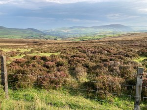
I have been living on the island for 7 years yet this is the first time I have visited Earystane Nature Reserve, a hectare of land owned by Manx Wildlife Trust that can’t be more than three miles away from my house as the crow flies. I had worked out a short circular walk of about 4 miles, just perfect for an afternoon walk now that the clocks have gone back and the nights draw in early. Our walk started at the top of Colby. Take the Colby Glen road uphill for just over a mile until you run out of houses and where Earystane is signposted. We parked on the corner beside the nature reserve, but it is preferable to park in one of the lay-bys just before or after the entrance.

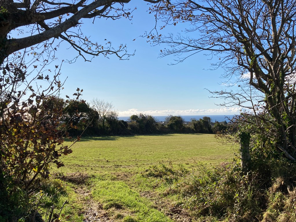
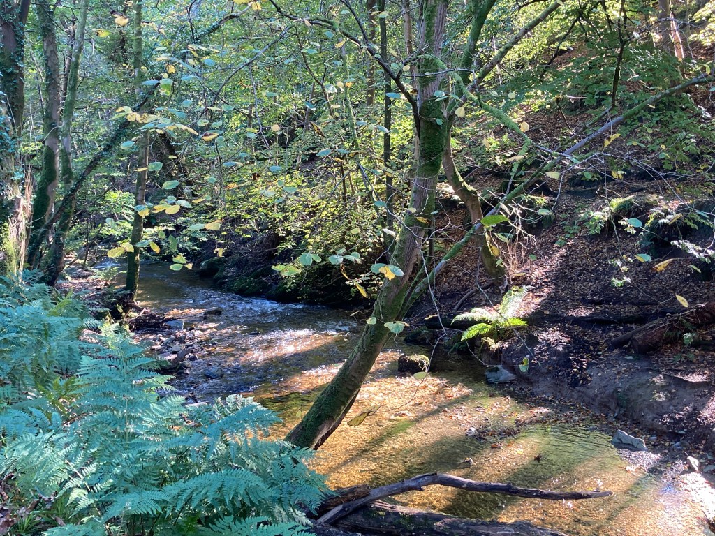
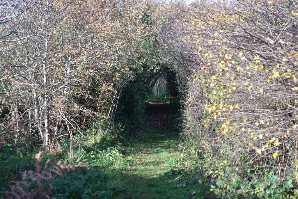
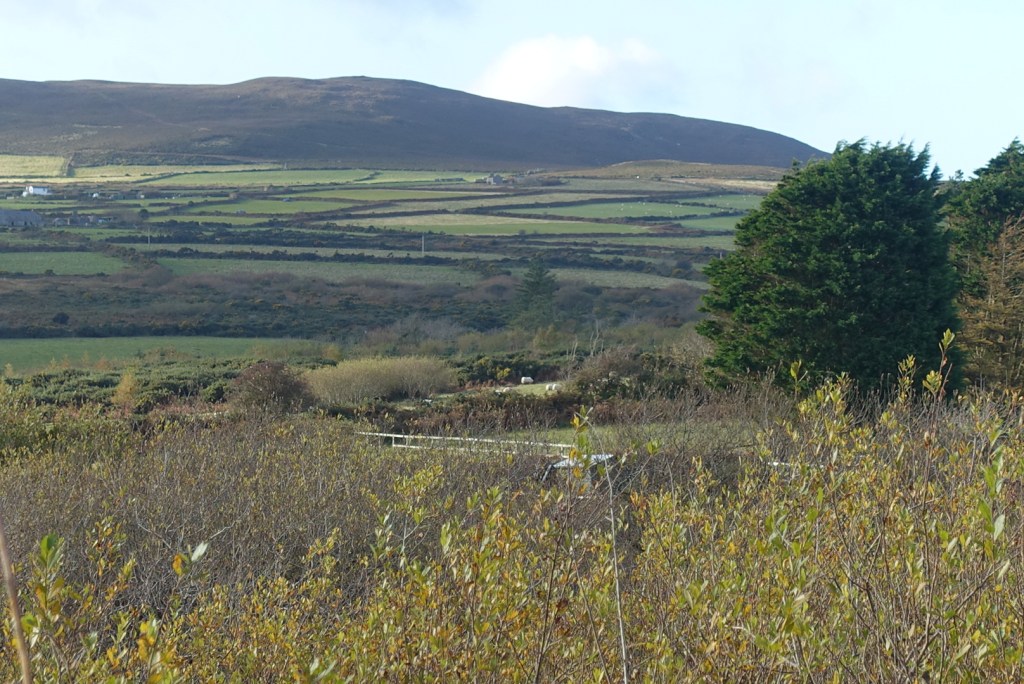
In the back of my head I thought this small site had only recently been converted into a nature reserve, but this is untrue. It was formerly the local tip and it was offered to the MWT in 1996 to transform it into a reserve and a local amenity. It has a most attractive natural tree arch over a good wide path suitable for wheelchairs that leads to a hide. At this time of year there weren’t many birds about, though we did see a small flock of goldfinches. The view across to the Carnanes is beautiful from the hide at any time of year. From here, there is a boardwalk which might be difficult for wheelchair users but would be possible with care. This takes you to a low wild wetland area of willow, shrubs and trees that would be called curragh in the north but is called moenay in the south (peat).

Tree Archway along the path
View from the hide

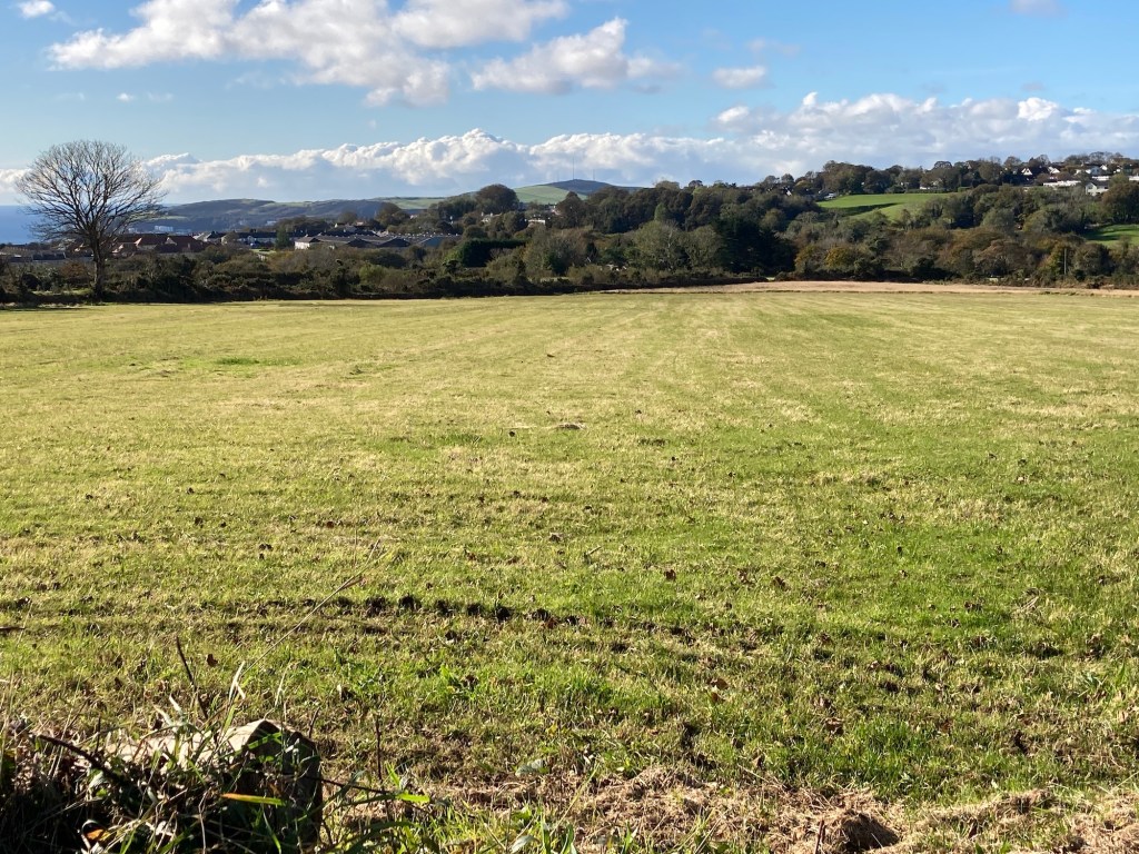
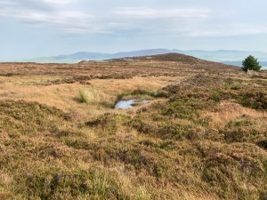
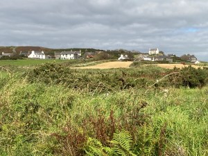
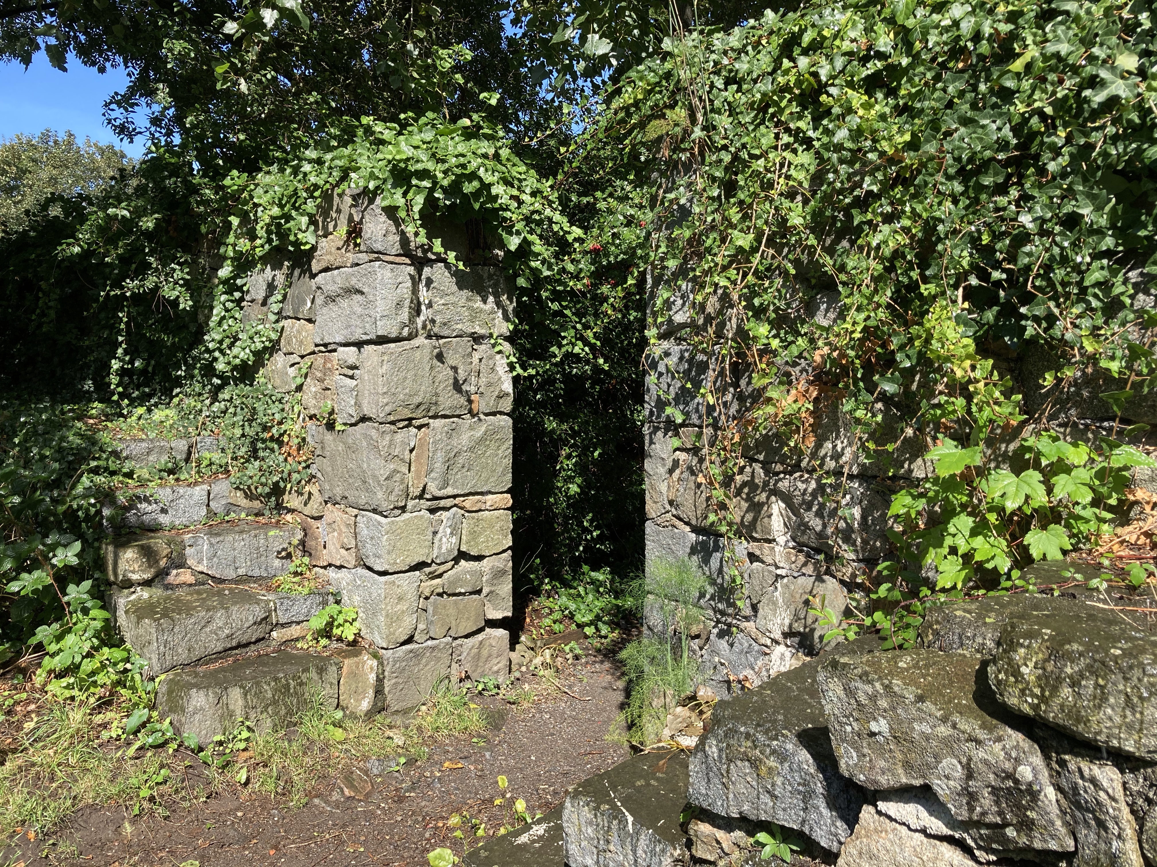
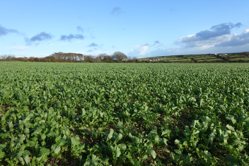
There is only one entrance or exit. From here our walk started. We followed the northwest track that leads to some old farms. We walked around the back of the farm called Ballamoar, where there is something that looks like a set of fence hurdles to negotiate. The path is clearly marked so do persevere. Where the path turns eastwards there was a huge field of turnips with no obvious pathway left for walkers. It was easy to traipse over the turnips but the farmer should have left a track through the field to avoid walkers damaging his/her crops. Reaching the other side, we met a few stiles and grassland taking us around the southern end of another most attractive dwelling to the A27.

The path is just passable between the gate fence and the wall!
The turnip field
The paths goes through this lovely garden, with ducks

We followed this road left for a short distance before turning right and right again down what I assume is the old road or farm track leading to Ballabeg. This was a little muddy in places but is a pleasant unspoilt grassy walk on a narrow lane, preferable to walking along the main thoroughfare.

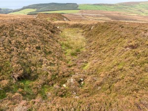
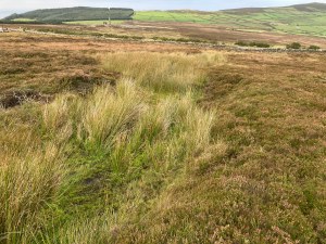
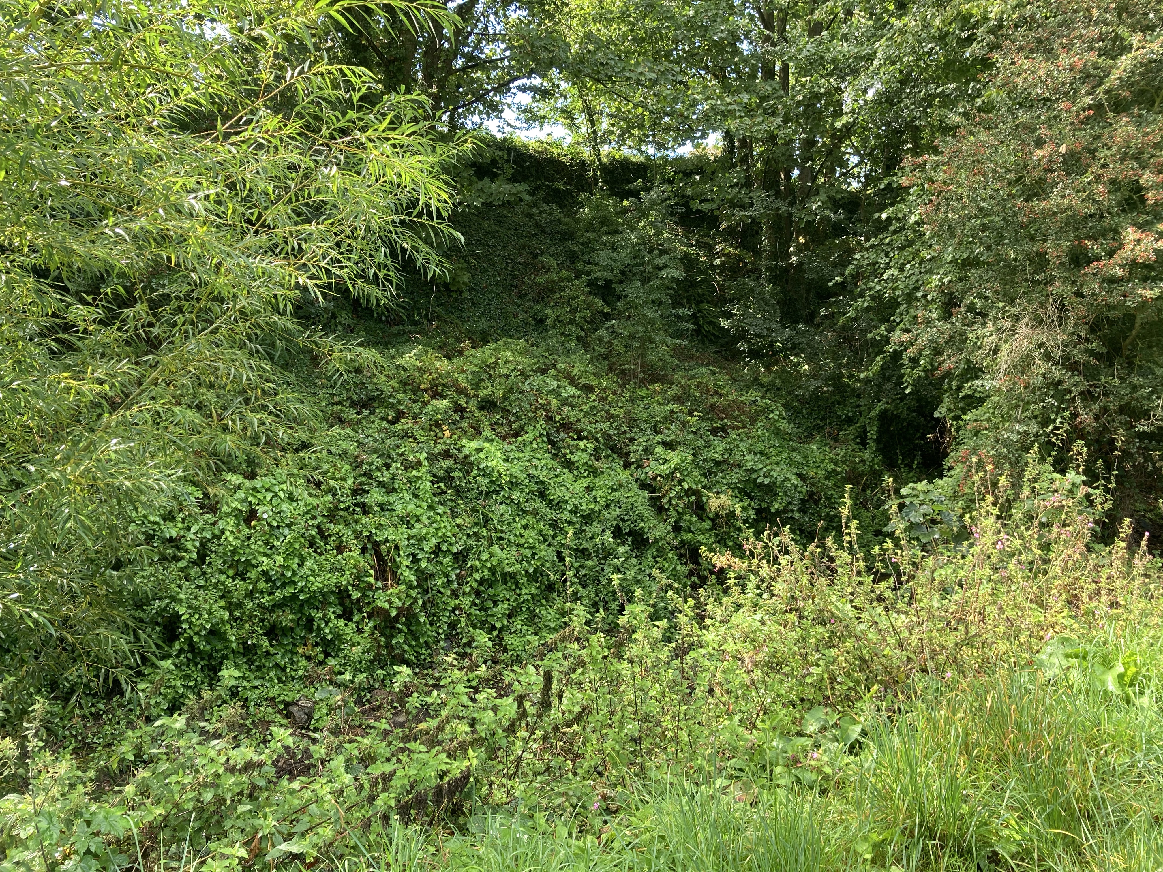
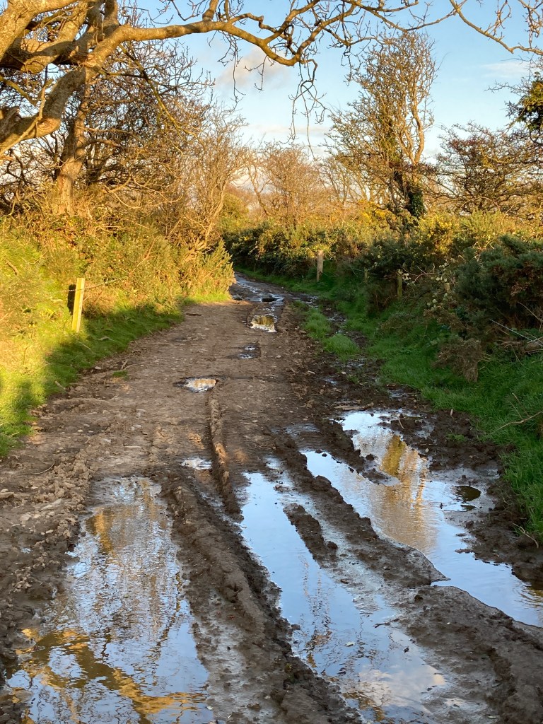
As we met Ballagawne Road, we turned right and shortly afterwards left into fields. I had remembered this particular footpath to be extremely muddy but the last time I walked this path was 20 years ago, so I wasn’t put off. Things change …. or not. I was so busy finding the most sensible path through the heavy mud I forgot to take a photo to show you, so the one I show below is one of the more friendly patches of mud. There are very ancient boardwalks in parts, but I wouldn’t trust them to withstand the weight of too many people – they were very rocky in places with just two of us walking on them.

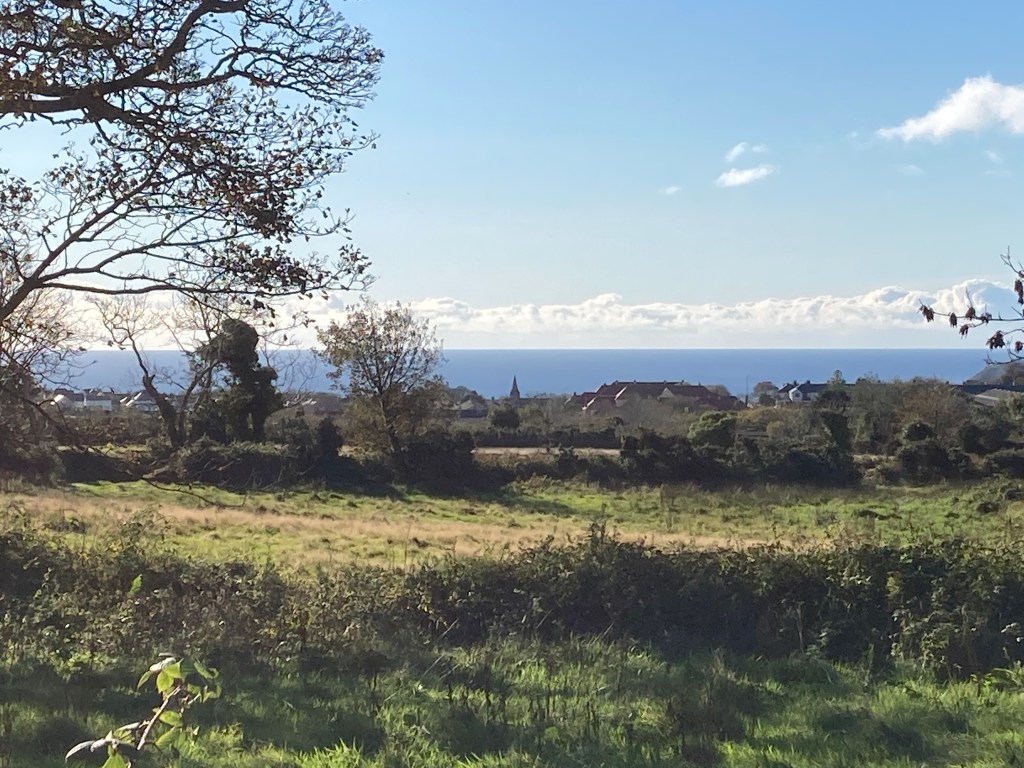
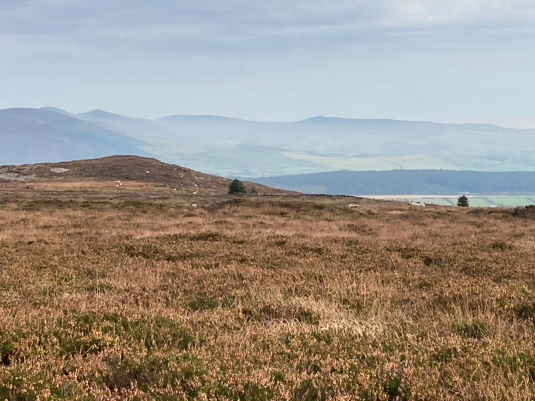
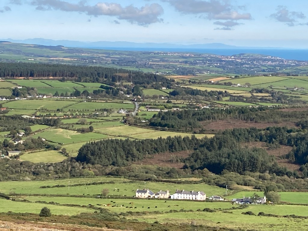
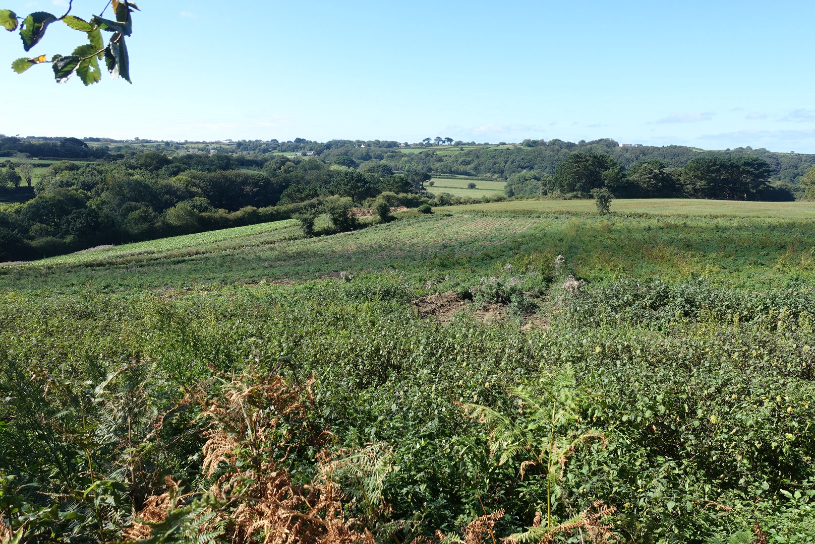
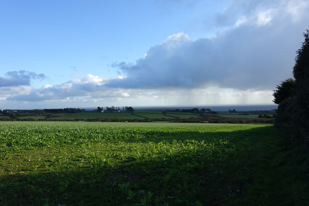
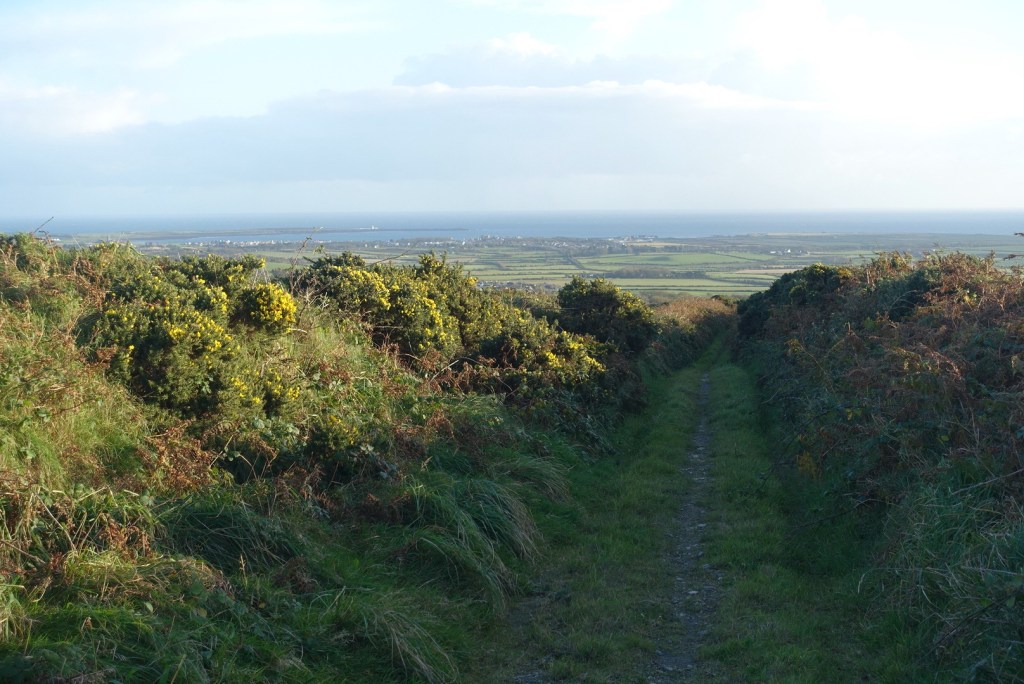
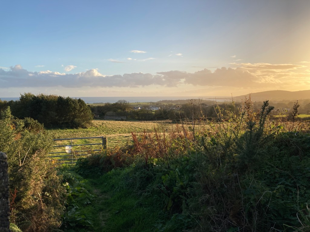
Despite the mud it had some nice sections, providing extensive views of the south. Wellies would have been better than walking boots but this is only a relatively short distance, and very soon you find yourself back on the edge of Colby where it was just a short walk back to the car. You can extend this walk by taking a diversionary path south over fields into the lower part of Colby then walking up the beautiful Colby Glen back to the car. If you have never visited Colby Glen then it would be a perfect extension to your walk. If you want to go this route, take the path over the fields beside the derelict house.

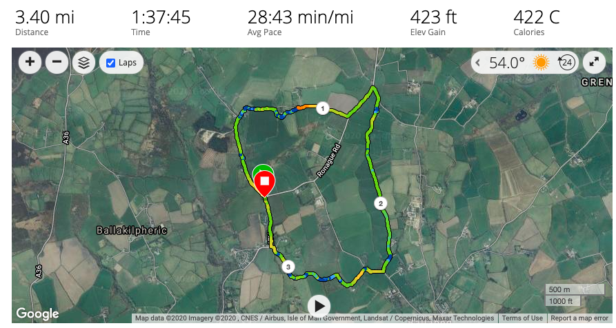
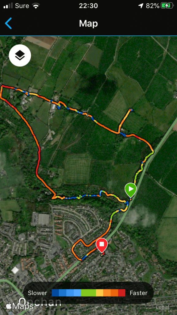
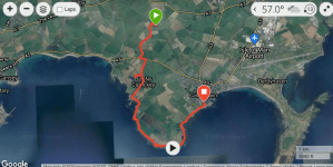
Ignore the elevation on the photo. I can’t imagine there was ascent of 423 ft as it is a mainly level walk. The distance is correct, however, and excludes the walk around the nature reserve.

A Trip Around the Calf – Saturday 17th October 2020

It might not be easy to get on and off the island just now, but there are ways, and this was one of them. I had seen a post on FB saying that Shona Boats would be offering boat trips to the Calf of Man, either landing and leaving you there to have a wander, or giving you a full onboard tour of the the whole island to show off its wildlife and spectacular scenery.

I knew I was unlikely to see much wildlife, but I thought there may be seal pups at this time of year, but perhaps not too many birds or cetaceans. One of my fellow passengers was hoping to see puffins but I knew that was out of the question, and we didn’t even see the decoy puffins designed to lure real life puffins on to the Calf.

The weather was mediocre, an overcast day, a little cool but not too windy, so we could expect a fairly calm boat ride. Our trip was delayed slightly by one of the passengers getting held up by a road traffic accident in Douglas which meant a detour for them of some distance to reach Port Erin. Soon we spied their car zooming along the promenade eager to catch us before we left. We were a little short of time, as we found out when we returned. Had we been much later we would have missed our landing berth on the Raglan Pier but as it was all was well and we disembarked using the last possible steps.

I had attired myself suitably for gusty winds and spray, and was wearing various layers and had hat, scarves and gloves in my rucksack, all of which got used during the trip. We set off around the buoy that marks the edge of the old pier where once upon a time cruise ships would unload their passengers who would then spill into Port Erin to see the wondrous sights our lovely bay has to offer. This jetty has long gone, and I have only ever known this area to be a mass of rocks that spew up water magnificently in windy weather in winter and serve as a perch for shags and cormorants.

I have walked this coastline to the Sound from Port Erin many many times, but it is interesting to see the gullies and rifts in the rocks from a different perspective and to see how the land at the top mirrors or does not mirror the lower reaches of the cliffs. We were soon at the Sound and Kitterland where we saw our first seal, and another popped its head out of the water curiously wondering what we were looking at. Then we followed the eastern edge around the Calf to the Drinking Dragon, and from hereon, this was new territory for me as I have never gone all the way around this tiny island. It was here that the wind picked up and everyone reached for their winter woollies. I would tell you some facts about the Calf but unfortunately I couldn’t hear the guide as I was perched on the outer edge of the seating area and everyone else was in the middle, so naturally enough he talked to them and his words were lost in the waves to me. I wasn’t too concerned as I will do this trip again sometime and then I will remember to sit in the right place. It would have been good if he had used some kind of headset, but he didn’t. However, I caught a few words here and there about the shipwrecks in these treacherous waters and the longtails swimming across to the Calf.

There were quite a few seals and their pups, but there was very little else except Choughs, Oystercatchers, Gulls and Shags. We had some good and unusual views of the 4 old lighthouses and a few cliffs later we left the island and made our way back to Port Erin, feeling considerably cooler than when we set out. Even so, it was such an enjoyable experience to see the Calf in its autumnal state, and I had a sense of getting away from everyday life and an opportunity to be off the island for a couple of hours.

We were so unlucky. The group that went out the next day were escorted by some bottle-nosed dolphins back to Port Erin; instead we had the quiet of the sea and the gentle rocking of the boat as we reentered the harbour waters.

Above Onchan and Molly Quirk’s Glen 11th October 2020

It’s hard to believe that I was only a stone’s throw from Douglas. The views were wide, soft and gentle with only the tenderest of hints of any kind of building. In the distance the top of the steeple of Onchan church could be seen, the rest hidden by the canopy of Molly Quirk’s Glen.

This was one of the walks offered as part of the Manx National Heritage culture weekends. I arrived at the meeting point totally unprepared as I had mistakenly dressed myself for an Onchan Town Tour and not a walk across fields or through glens. Luckily, I was wearing sturdy shoes and the terrain was not too inclement nor had we had our usual fill of rain, so still feeling embarrassed by my own ineptitude I informed the leader I would continue.

My friend informed me it was to be guided walk of two or three miles taking about three hours. Maybe this is why in my head I had thought it must be a town tour, as how can you take 3 hours to walk such a short distance? Well, I was soon to find out.

We started by walking up the narrow Bilbaloe Glen. This is a short side-shoot of the main Molly Quirk Glen and this small tributary takes you up on to the hills. Even before we began walking we were told about the history of an ancient bridge over this tiny stream which once bore the main road to Laxey. On the opposite side of the stream our guide pointed out a derelict building which had once been a vibrant methodist church but as methodism became stronger on the island it fell into disuse. As we reached the road there was a footpath sign to the left along a track, one I have never noticed before, and we followed this up to Ballakilmartin Farm, which is a total wreck. You can see it must have a busy, active farm at one time, but the current owner lives in South Africa and has no interest in restoring or even maintaining the property. We were shown the former coach house, cattle sheds and stables, and discouraged from exploring due to the state of the property. The main entrance to this farm was not originally from the east as we had just ventured but from the west where the old road would have passed alongside.

The farm buildings

We followed the old road north for a short distance to the point where it is no longer obviously an old road, and on the right there is the remains of a keill, which you would never normally see or even know about (no photos, sorry, as it is only a collapsed heap in a bit of woodland). This is why it is so good to go out with informed guides who bring it all alive for you. We learned that this keill (a type of private church) was about 18ft x 9ft and the excavations have shown that it crossed the Onchan/Laxey road, meaning that it must have been in use before the original road was built. It is dedicated to St Martin, a French catholic saint from the 4th century, who is also the patron saint of beggars, drunkards and the poor! This walk was organised by the Isle of Man Natural History and Antiquarian Society, so if you are visiting, you might want to contact them and see if you can join them for a walk www.manxantiquarians.com. You won’t be disappointed. Locals can join the society and enjoy lectures in the winter months and excursions in the summer.

The old road from Onchan to Laxey

From here, it was another hop skip and jump along the same trackway to another old farm, this time Ballig Farm, which was been in the same family for centuries, and where the Manx folklore writer Sophia Morrison spent a large part of her childhood. Unusually, we entered into its garden to spy a very special well. It has a stone entrance which protects the 17 steps down to the clear-as-a bell water, some steps being covered. Legend has it and the owner says that the water ebbs and flows with the tides, though in reality I think this is impossible. I suspect the water levels are due to an impermeable type of local rock, otherwise most of the Isle of Man would be underwater if this were the true water table given that this farm is 500ft above sea level.

Then, yet again, walking east along the same path we soon came to Mr. Kissack’s farm and buildings. He had built his own house on the land and had become a farmer having previously been a builder all his life. He looked very well and healthy with his new lifestyle and clearly this is his passion. However, hearing about machinery and cars was not to my taste so my friend and I decided to call it a day.

View to the north and Creg ny Baa on the mountain road from between Ballig and Ballkissack Farm

The remainder of the walk was just beautiful, initially along a wooded lane with just a few spectacular houses dotted along it until we came to the bridge leading down Molly Quirk’s glen. The story goes that Molly Quirk was robbed and murdered in this glen but there is no proof of this. Maybe had we stayed with the group the guide would have given us some interesting and more magical information about the glen. The paths are wide and easy to walk and with the golden leaves underfoot it was a very pleasant end to our walk. The total distance was indeed about 2.5. miles but as you can tell we were told a lot of stories along the way and the actual walking time was only just over an hour. You could extend this walk and continue along the stream into Groudle Glen, where you will eventually meet the sea.

This walk has peaked my interest to find these lesser known paths and to see how they connect to other areas.

Around and about – the last week of September 2020

As it is the last day of the month it seems appropriate to bring you up to date with the walks I have done in the last week or so. My time has largely been spent collecting data for the peat survey, which on Friday was absolutely exhausting and it took me the whole weekend to recover.

It started with a very very windy day, not cold particularly, though I did wear several layers and took hat and gloves, both of which I wore. On reflection, maybe I should have waited for better weather, especially as this walk involved going to the top of South Barrule for my first waypoint. It was a sunny day and the winds pushed the clouds out of the way affording me yet more views of our distant lands across the sea. I was glad I had worn my wellies too, as the ground was quite wet and boggy in places. I’ll tell you something – walking across naive territory where the only footprints have been made by sheep makes you aware of the fantastic footpaths that others have created (and maintain) for us to use to reach viewpoints and to engage with nature. I doubt if many people would venture out if they had to lift their legs knee high to cross the moors! Having finished this section, I then detoured to the South Barrule plantation thinking I might meet the dirt track and have an easy walk back to the car, but as you will see from the slideshow, it didn’t quite work out as planned. It was a strenuous day but one I look back on with a sense of achievement. That week my Garmin watch recorded 500 minutes of intensive training, when the govt guidelines advise a minimum of 150 minutes per week.

This slideshow requires JavaScript.


During this same week, I was lucky enough to be invited out for afternoon tea with my friend, Janet, so we decided to go to Peel (I seem to be there a lot these days) and commence with a 90 minute walk to justify eating sandwiches and cream cakes afterwards. If you like a short but interesting walk, this is perfect for you. Park at Fenella beach, either walk along the road to the bridge or take the upper route just above the roadway to the same point. Cross the bridge and immediately turn right. This will take you alongside the river. Believe it or not, I had never walked this particular section as I have always followed the Heritage Trail which takes you through the industrial estate (how exciting is that!). It is a delightful section and I shall never miss it out again. When you reach the bridge by the Raggatt you need to climb the steps to cross the road and go immediately behind the houses on the well made track. This is a gentle rise to Knockaloe Beg Farm where you turn right to go on to the hills. The fields are a lovely shade of green and look warm and inviting. It is a little pull up to the top, where you get unexpected views to the south all the way to the Calf of Man. There is a well-placed bench that allows you to get your breath back before making the final short climb to Corrin’s Folly. From there, it is a gentle undulating walk along the top before descending to Fenella beach. The footpaths are very good and there is no real need for sticks and you could get away with wearing stout shoes rather than walking boots. It’s a really lovely walk and one you can do any time you have a spare couple of hours.


And then, yesterday, I was back on the moors to finish those particular waypoints on South Barrule. This was much more pleasant. There was also a lot of sphagnum moss and on my final prod of the peat I recorded the deepest amount of the four sessions – 105cm. It’s one thing putting the prod in the ground but it’s quite another trying to get it out again. If I keep on doing this I shall soon look like Popeye. 🙂

So, that’s it for another month. I have quite a lot of activities coming up, with outings organised by Manx National Heritage, and I will document these as they happen over the next couple of weeks. I finish this post with some photos of Port Erin taken a couple of nights ago as I took an evening stroll.

Peat Survey on South Barrule – Sept 2020

There are both blessings and curses involved with measuring the peat on the moors. The blessings come from knowing that the views I am seeing are views that few people see and the paths I tread have probably never been trodden by anyone. The isolation is bewitching, even though habitation can be easily seen only a couple of miles away. Today, I could see England in the form of the Lake District, Scotland and Northern Ireland, and each looked as if I could step over the water onto their hills.

The curses, or rather the one and only curse is the terrain. One minute you are walking on level ground, with bits of stone, grass and small undulations, the next you are walking through a bog or trying to find a way around it, and after that wading waist-high through swathes of heather, made worse on a downward slope where you cannot see your footing. It can be quite hard work, and you will use up your weekly ‘intensity minutes’ but I wouldn’t change it for the world.

I have had two outings recently to South Barrule, monitoring the northern flank from the junction with the mines road up to the quarry and down to the plantation. It is further than you think, and although distance is irrelevant, I still covered nearly 3 miles yesterday on my sojourn and a couple of miles the previous time.

We are on the hunt for sphagnum moss, as I reported a while ago, and to measure the level of peat on the hills throughout the island. Previous areas I have surveyed have been somewhat devoid of moss, but there are some very large areas and deep peat in certain areas on South Barrule, but even so, they are in the minority. There is a lot of scrubby heather, gorse and grasses, and only in one section on the northwestern edge beside the quarry was there any sustained areas of bracken. An interesting find was a lighter coloured sphagnum moss in isolated wet locations, and in small patches. I didn’t notice many other flowers this time round.

So, I leave you with some photos of my days out in the hills from a few days ago. I have only surveyed half of my allocation on South Barrule so far, so still another two days to venture there at some point.

Ballabeg to Castletown 10th Sept 2020

Sometimes the simplest things can surprise you and make your day. This walk is only 4 and 1/2 miles, with a maximum ascent of about 250ft, so you might think nothing to write about. How wrong can you be?

It started with a journey on the steam train to Ballabeg, where I was the only one to disembark. Visitors beware – if you intend to get off at an unscheduled stop you need to tell the guard when you embark. I followed the road for a short distance towards the coast road and then turned off onto a delightfully overgrown and muddy path, where the tiny stream beside it would criss cross its way in front of you just to keep you on your guard. They were lots of speckled wood butterflies fitting in and out on this short path. It comes out on the coast road, where I turned left.

One of the joys of walking is making new discoveries. They do not need to be momentous, just reminders that life doesn’t stand still. As I walked along the main road to the farm I noticed a sign saying ‘sensitive verge’. I would never have seen this travelling at speed in a car, and now I shall look out for the wildflowers in spring and summer and watch how it develops.

I crossed the road at the farm, where I got another surprise. There was a lady looking out of the window; only on second glance, she was a cardboard cut-out. A short distance further down the lane that leads to Chapel Hill and I got another surprise. On the left was a plaque inviting me to sit down on the seat and enjoy the view. Of course, I must obey. It turned out to be a ‘talking bench’ and our very own ‘national treasure’ Charles Guard told me about the view in front of me and some of the history of buildings in the vicinity.

I then visited Chapel Hill, somewhere I have visited often. The Viking Ship burial site is looking rather unkempt but as usual the views are terrific and the light was dancing on the sea in the distance, giving it quite a magical feel. This is a place best visited with a guide who can tell you about the aeons of history of this site, from Bronze Age to Iron Age to Christianity and the defensive benefits of this location.

Back to the lane and past Balladoole House, which Charles had reliably informed me was built in 1714 and has Queen Anne architecture. Maybe Manx Heritage will add a tour of this house to their events sometime in the future.

Soon enough I was at the coastline, joining it at Pooil Vaaish Farm. The tide was reasonably well out, but this section is perhaps not a place to linger. There are many wonderful spots as you enter Scarlett, with its interesting geology and flora. I was in my element here. As the tide was sort of ‘out’ I was able to mess about among the rocks. I am not good at knowing one rock from another, but these were definitely old lava flows. The rock was very grippy and safe to walk on, and you could see the gas holes in the some of the rocks. Also there were no fossils, which can be readily found just a little further round past the lime kilns and the visitor centre, where the rocks are limestone.

This slideshow requires JavaScript.

I have walked this walk many a time, but none more enjoyable than the one today, and what a lot of variety. If you are a visitor I would recommend either getting the bus to Fisher’s Hill, and ask the driver to drop you off at the corner, or get the steam train to Ballabeg. The walk I have described takes you to the centre of Castletown where you can get a bus back to either Port Erin or Ballabeg. Just make sure you get the right bus as one goes along the coast and another inland to Ballabeg and Colby. You could get the train, but the last train in the afternoon is relatively early unless its a special week like TT.

Distance: 4.6 miles, but less if you stick to the paths.

Total ascent 259ft (mainly clambering over rocks!); total descent 220ft

A great walk for all ages. Children as well as those in their second or third childhood will enjoy the walk along the coast in particular.


Cregneash and Coast 9th Sept 2020

Being just one and a half miles cross country to Cregneash from Port Erin makes this a pleasant afternoon stroll, or an evening stroll if you have limited time.

There are countless routes to this quaint old village, which is always worth a visit at any time of year. I didn’t set out with a plan, other than to get some exercise, so I began by walking up Truggan Road, up the farm track to the Howe. The quickest way from here, but also the most boring, is to continue along the road, but I headed off in a westerly direction onto the moorland. This path is muddy at the best of times, but I did see some interesting flowers and quite a lot of sphagnum moss. I continued along the eastern side of Meayll Hill and joined the road at the quarry car park at Cregneash. If you are a visitor, there is a bus stop here that can take you down to the Sound or back to Port St Mary or Port Erin.

Cregneash from the back lane

I stopped at the Cregneash cafe for a light lunch before making up my mind what to do next. With all the logistical problems caused by COVID-19 their opening hours are limited to 11am – 4pm Wednesday to Saturday only. What would normally be a busy, vibrant village cafe was today very quiet, with only a couple of visitors. It shows what a difference it makes when the coaches usually bring visitors to the area. The cafe has been redecorated with comfortable sofas as well as tables, and the food was very good, if limited to sandwiches, fantastic cakes and soup. I do urge residents and Guernsey visitors to pay it a visit and you will be able to have some easy walks to the coast from there, too.

Cregneash Tea Rooms

I took a path that I have been meaning to try for a long time. It starts in the midst of the village beside a field of Loaghtan goats, who were bickering furiously and locking horns. This is a well made track going around the back of the hills to emerge at the coast just before Black Head. However, I took a very narrow track uphill and westwards, slightly overgrown with prickly gorse and heather (wear proper walking gear) which took me to my highest point of the day at Cronk Mooar. I then followed the coast path south to Spanish Head and traversed across the cliff to Black Head before returning to the standard path. The path descends to meet the end of the track I had begun on, and from there it is a steady climb up to the Chasms. There are two other tracks that you can take if you want to return to Cregneash, so it is easy to do a variety of circular walks of about 3 miles starting from Cregneash car park.

Once at the Chasms I chose the lower route which involves mostly descent, initially through the moor and grassland, and then through the sheep-strewn fields, all the way to Fistard and Glenn Chass. This is a level walk on good paths. The sea was like a mill pond today and with still air it was very peaceful and quiet.

Most often I would continue on the cliffs to Port St Mary but today I chose to continue up the narrow lane at Fistard. There are some pretty stone cottages in this part of the village. On reaching the bend in the road, I forked left and took a well disguised path beside and behind a modern house, that leads to the top end of the golf course. Checking I wasn’t in anyone’s aim of direction I followed the path along the top of the golf course that leads to the final high point of the day, where there is a mast and views to the whole of the centre of the island. Walking down from here the path was slightly overgrown and uneven, but absolutely full of wildlife. There were speckled wood butterflies in abundance and a host of other flying insects amongst the greenery. This walk made me aware of the need for unruly vegetation with a mind of its own. There is no doubt that I saw the most wildlife and wild flowers in these areas.

The path comes out at the top of Truggan Road. I had never noticed the information sign accompanying the road sign explaining the significance of the name. It derives from the Manx word ‘Strooan’, which means stream, and apparently it used to have another descriptive word meaning ‘swift’ alongside strooan so the name of the road means “the road leading to the swift stream”, that being the stream that flows down Meayll Hill and divides into two- one flow going into Breagle Glen, and the other flowing through farmland beside the Ballahane housing estate; both of course join the stream beside the railway leading to Athol Glen and ultimately Port Erin beach.

A lovely afternoon walk, that can be taken in a number of different stages to suit your time and abilities, with a tea stop and buses (usually!).

Distance: Truggan Road, Port Erin to Cregneash via the moor – 1.87 miles; Total ascent 407ft; Total descent 89ft

Distance: Cregneash to Port Erin via Spanish Head, Black Head, the Chasms, and Port St Mary – 4.91 miles; total ascent 535ft; total descent 863ft

Skies over Black Head


Guernsey – final day 30/08/20

With only a morning left, I had my last opportunity to visit any local attractions, and as Little Chapel was less than two miles from my hotel at La Villette, this seemed the perfect choice for my final walk.

The interior of the island is much quieter than the main thoroughfares and Guernsey has many publicised ‘Routes Tranquilles‘, the equivalent of our Green Roads. I was able to make use of many of these, which I imagine were farm roads in years gone by.

You will recall that the island claims to have no hills. Of course, it is not entirely flat, and inland it has a regular pattern of small hills cut through by attractive streamlets. I walked 7 miles inland this morning, and even then I managed to climb over 809 ft, so you can see this is a surprisingly undulating island. The highest point on Guernsey appears to be Hautnez at 111 metres, which is near the airport. Many of the cliffs are of similar height.

But today was pure countryside and brown and white Guernsey cows, and tiny villages with magnificent buildings.

The Little Chapel is very beautiful. I was expecting just one area for worship but there were a number of small chapels, all equally beautifully adorned. Creating it must have been a real labour of love and I could imagine using it for personal worship. Somehow it doesn’t feel as if it ought to be a tourist attraction.

Having visited the chapel I went to the village of Les Vauxbelets and followed the route tranquille up to the Candie Road. I turned left as I had spied a walking path through woodland that interested me at Les Fauxquets. This was a pleasant walk, though the end of the path was unfortunately very muddy, making a mess of my new shoes.

I followed the Route des Talbots with the Talbot Valley on the right. It is very picturesque with some beautiful houses. I then took side routes, that lead to St Andrew church. From this point I followed more routes that were ‘tranquilles’ but unremarkable and I was soon back at Mouilpied, the small village close to La Villette. I was back in time for a lunchtime pint in the bar, and later on a cream tea to keep me going until I arrive back on the Isle of Man.


So what have I gleaned of Guernsey these last few days?

1) it has far too many people and cars

2) the coastline to the south and south east is magnificent walking country.

3) their number plates contain only numbers, usually 5 digits but I saw one today with only 4

4) they have a good bus service, but narrow lanes therefore all journeys are slow, and if you happen to be behind pedestrians or cyclists, very slow

5) they build very large walls around their properties in the main town

6) books are cheap. My copy of Les Contemplations cost £3.71.

7) the footpaths are good but many do not contain waymarker signs. The scaled map is very good.

8) their post boxes are blue and set into walls.

9) many of the villages have their own ‘abreveur’, pumps which provided water for the local villagers

10) although the village names and places look and sound as if they are french, the pronunciation is different, more anglicised

11) it has a lot of cows

12) it is inundated with reminders of its war time histories

13) I didn’t pass a single shop on any of my walks, except beach cafes and, naturally, in the metropolis that is St Peter Port

14) if walking the coastline, be prepared for hundreds of steps! Continue reading “Guernsey – final day 30/08/20”

Guernsey Day 4 – coastal walk 29/08/20

This was my last full day of walking, so I started out early from the hotel finding a new route down to Petit Bot Bay.

Others had already arrived by the time I got there, mostly children and their parents who I think were about to go kayaking. There was already one group in the water. There is a cafe here, but as it was not yet 10am it had not opened.

The climb onto the cliffs is fairly strenuous, with something like 160 steps. I tasked myself with counting them today. Over the full day, I think I climbed 800 steps as well as encountering the standard undulations. It is worth the climb as the views are terrific and you get a sense of accomplishment too.

The coast path goes inland to cross streams in a few places and the paths weren’t always easy to find. To make matters worse ( or better), the Guernsey National Trust has purchased various areas around the cliff path and there are numerous routes within these areas, should you decide to veer off the regular track to explore. On one such occasion around Les Corbieres I did not quite end up back on the right path and found myself on a path slightly more inland than intended. Not that it mattered. This was a fairly long walk anyway of between 9 and 10 miles and I was more interested in reaching my destination than being pedantic about which path I took. However, because of this detour I did not visit the German Observation Tower at the top of this post, though I saw it for many miles thereafter.

There are only two places on this section of the coast path where you can get drinks so make sure you take plenty with you in case they aren’t open. It hasn’t been very warm for late summer but even so my stocks of water were getting low towards the end and I was concerned about getting dehydrated. There is a cafe and a bus terminus at the end of this walk, so it is easy to replenish your stocks and get back to your starting point, although buses are only once a hour. I had thought of going to see Little Chapel as I had finished by 2pm, but there were no buses going to that area at all on a Saturday.

The paths look very similar to the walk I did the other day, so instead of describing the route, I will leave you with a gallery of photos of the walk. I must say, I think this south western point is prettier and quieter than the eastern side around St Peter Port, and the houses I saw were much less showy.

Tomorrow, I shall walk to Little Chapel and return to my hotel for afternoon tea before my mid afternoon pickup for the airport.

Overall distance: 9.17 miles; total ascent 1414 ft; total descent 1762 ft

Guernsey Day 3 – St Peter Port, 28/08/20

Overnight the rain had been teeming down, waking me up several times. I decided a day doing touristy things might be the best solution and involve at least some indoor activities.

No sooner had I reached the bus stop and the rain pelted down. I was glad to embark the no 81 bus even if it meant an ultra tedious 4 mile 40 min journey to St Peter Port. It makes Traa Di Liooar seem almost instant in comparison. It isn’t even an interesting route – it goes down little residential lanes that go nowhere in particular and the inevitable visit to the local hospital en route.

When I finally reached St Peter Port, I had already decided to go to the Candie Gardens, which were reportedly very pleasant. Should it rain, it handily also contains the Guernsey Museum and Art Gallery. I followed the quaint Main Street, though I must admit I was disappointed not to see more local shops. There were all the usual department stores such as Boots, M&S, WH Smith but very little else it seemed on first acquaintance. Thankfully, there was a charity shop so I bought an umbrella and gave Cancer Research £3.50.

It says in my guide book there are ‘no hills’ on Guernsey. Would someone please tell me what I have just climbed then a couple of times today at 300 ft each! What strikes you most about St Peter Port is the amount of huge stone walls and the many steps up these non-existent hills. It looks like a grand fortress or a town that has barricaded itself in against the enemy. In fact, this is true of previous centuries; even if it hasn’t been invaded for a long time, it still bears witness to its past.

Candie Gardens were quite pretty but nothing out of the ordinary. The museum and art gallery is good, though it hasn’t quite decided what it wants to be. There are quite a few exhibitions concerning the war, which is clearly important to the island and interesting for many people. There were three different sets of art exhibitions. One by an artist with big colourful designs; another of incredible photographs of sea animals in microscopic detail; and yet another of more traditional paintings and a sculpture ( for want of a better word) of butterflies by Damian Hirst – the central photo below. This was staggeringly good and intricate and it was hard to take ones eyes off it. You want to expand that photo to enjoy its intricacies. I wonder how long it took him to complete it?

‘Brush Marks Heaven and Earth’ by Jonathan Skelton
Resurrection by Damien Hirst (2016)

The shop did contain items for sale created by locals and the glass ornaments were beautiful, and I could not resist buying something for my grand-daughter whose birthday is next week which will make her smile 🙂

It had already been pretending to rain while I was in the gardens and when I came out of the museum, it started up again in full fury. Undaunted, I continued with my plan to visit the Chateau des Marais, which looked on the map to be a modestly sized ancient mound. Of course, it was too wet to consult the map so I had to use my mind map to get me there, which did a fairly good job.

This was much more impressive than I was expecting, given that it was tucked away behind and between housing estates, on what had previously been sea-fed marshland, all now clearly drained centuries past. It was a huge area, with an outer moat and stone wall, a large grassy area, then another moat and stone wall leading to the inner sanctum. Look at the height of those ramparts over the moat! I shouldn’t beef this up too much as there are no other ancient remains. However, in its heyday it would have been a beacon standing out in its marshy hallows and it would have been very effective as a defence. The passage of time has taken its toll.

The notice-board did inform me that there had been a castle or defensive fort on this parcel of land for at least 800 years. The outer wall and moat had been built during the Napoleonic wars, when they feared invasion. Even in WWII they built a concrete command bunker on the main footprint of the original castle, which can clearly be seen.

The grassland, not visible in the photos above, or the old ‘Bailey’ is full of flowers and is almost like a nature reserve, and butterflies and dragonflies were plentiful. It is little oasis away from the hustle, bustle and noise of the town, especially the cars. The sun came out and so did the locals with their lunch packs.

From here, I walked down to the sea front and sat on the sea wall admiring the view and getting a wet bottom from stupidly sitting in a puddle. I had to walk for a good mile along the prom knowing that all the cars passing by me would be aware of my predicament, but finally I dried off. This could almost be Castletown Bay couldn’t it? It is called Belle Greve Bay, meaning ‘beautiful shore’.

I had rung Hauteville House and was fortunate to be able to be included in the 4pm tour of Victor Hugo’s house in exile. I had a bit of time to kill, so I found the location and walked to the top of the hill, where there was a bench with fine views across the bay to Helm and Sark, and wrote my postcards.

Hauteville House is not to be missed. You cannot just turn up, you have to book and they are almost at the end of the season now. It is a masterpiece of ingenuity. What a character Hugo must have been, a philanthropist, an artist, a collector, a recycler, a philosopher, never mind his literary credits. I am not so sure he was as successful in his relationships – probably too independent-minded for that. It is an inspiring and intriguing house, never settling for the mundane. He was already wealthy before his exile and he clearly had one of those minds that doesn’t switch off, always looking for the next project. I bought a copy of ‘Les Contemplations’ and have already started re-reading some of his evocative poems (in French) – it’s always best to read poetry in its native tongue if you can.

I didn’t take any photos other than the views from his balcony and his garden, but you access photos and more history at www.museums.gov.gg/Hauteville

And there my day ended as it had begun with the 40 min bus ride to the hotel, but this time the rain had ceased and it was a very pleasant evening.

Considering this wasn’t a walking day, I still walked nearly 10 miles. Tomorrow I am walking more of the coastline westwards from the hotel, which I am really looking forward to.