Slieau Freoaghane and views of Glen Dhoo

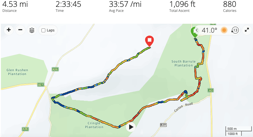
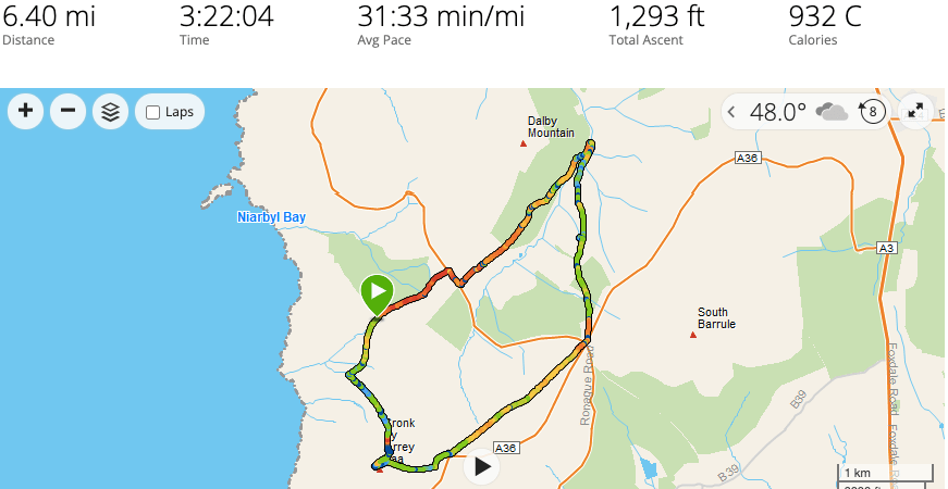
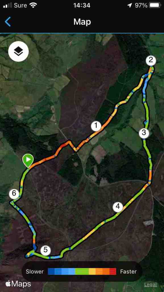
I have a new favourite walk, at least for the extensive views it provides in all directions. This is a ridge walk on the eastern side of Kirk Michael, and it is relatively short at just about 5 miles. You can choose how much ascent you do as well, so this walk caters for different kinds of walker.

It starts at the Sartfell car park on the Kirk Michael to Snaefell road just before the cattle grid. Today, the mountain road was closed, and I was up early, so I had the hills all to myself, something to be strongly recommended. My only companion was a very blustery wind, which I would have preferred to leave me alone, but it persisted for the whole walk. At least it was warm -ish, but it was also hazy, so this walk will be even better on a really clear day.

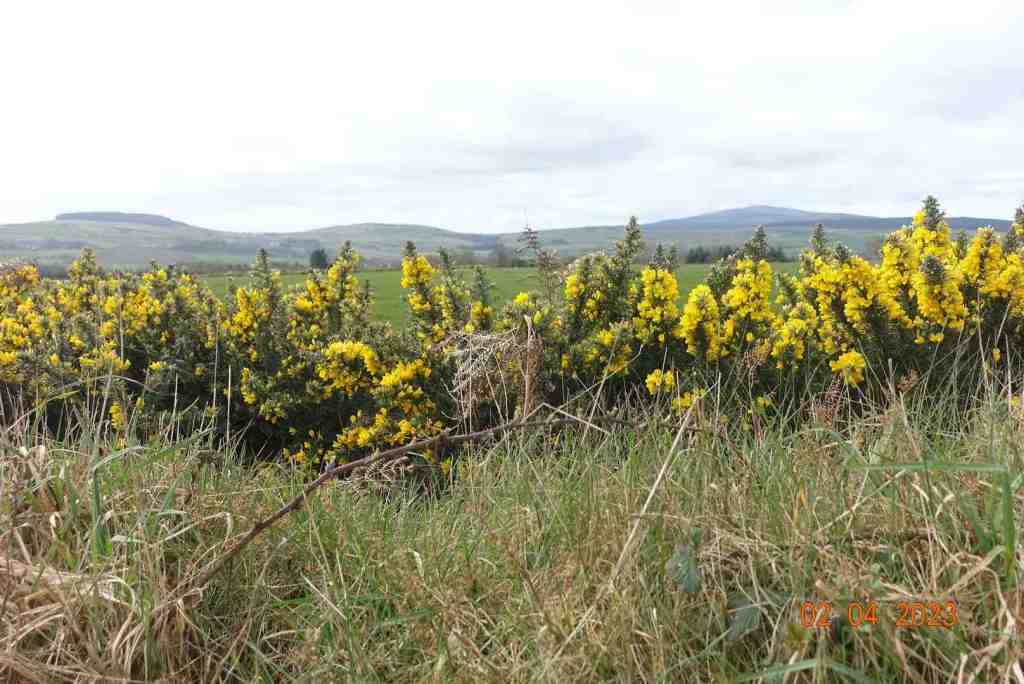
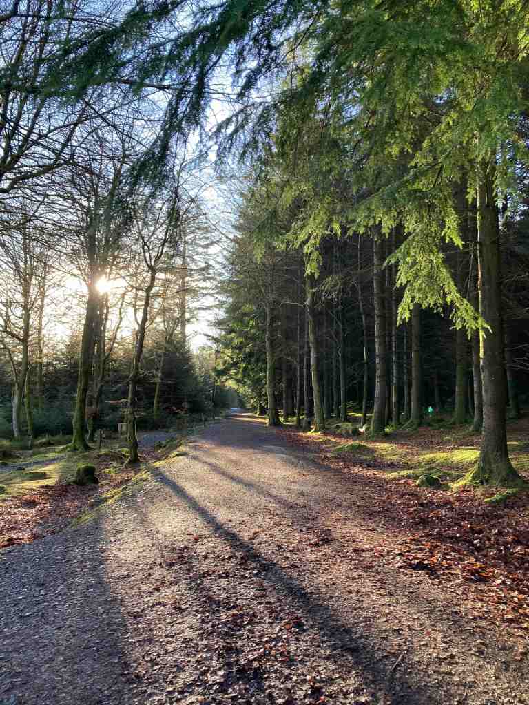
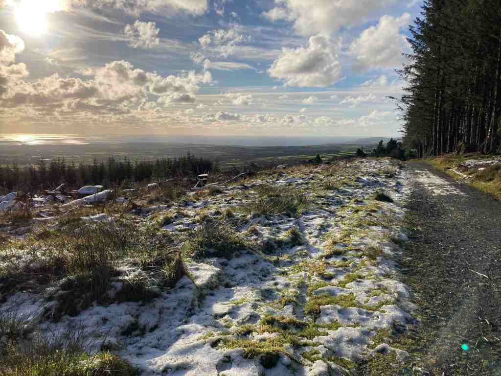
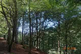
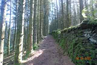
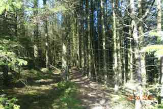
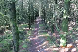
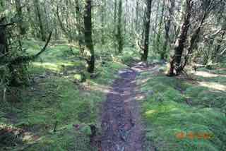
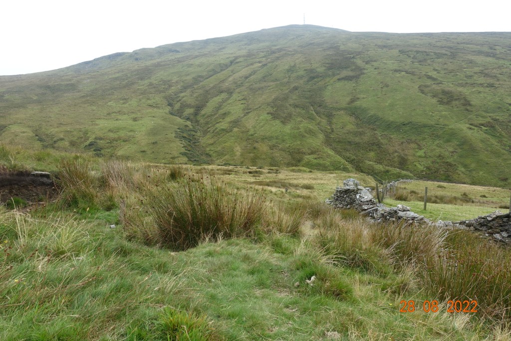
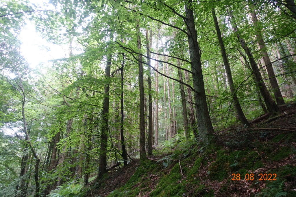
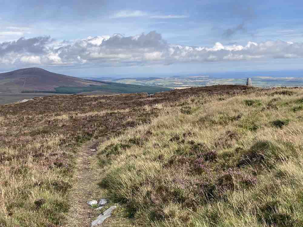
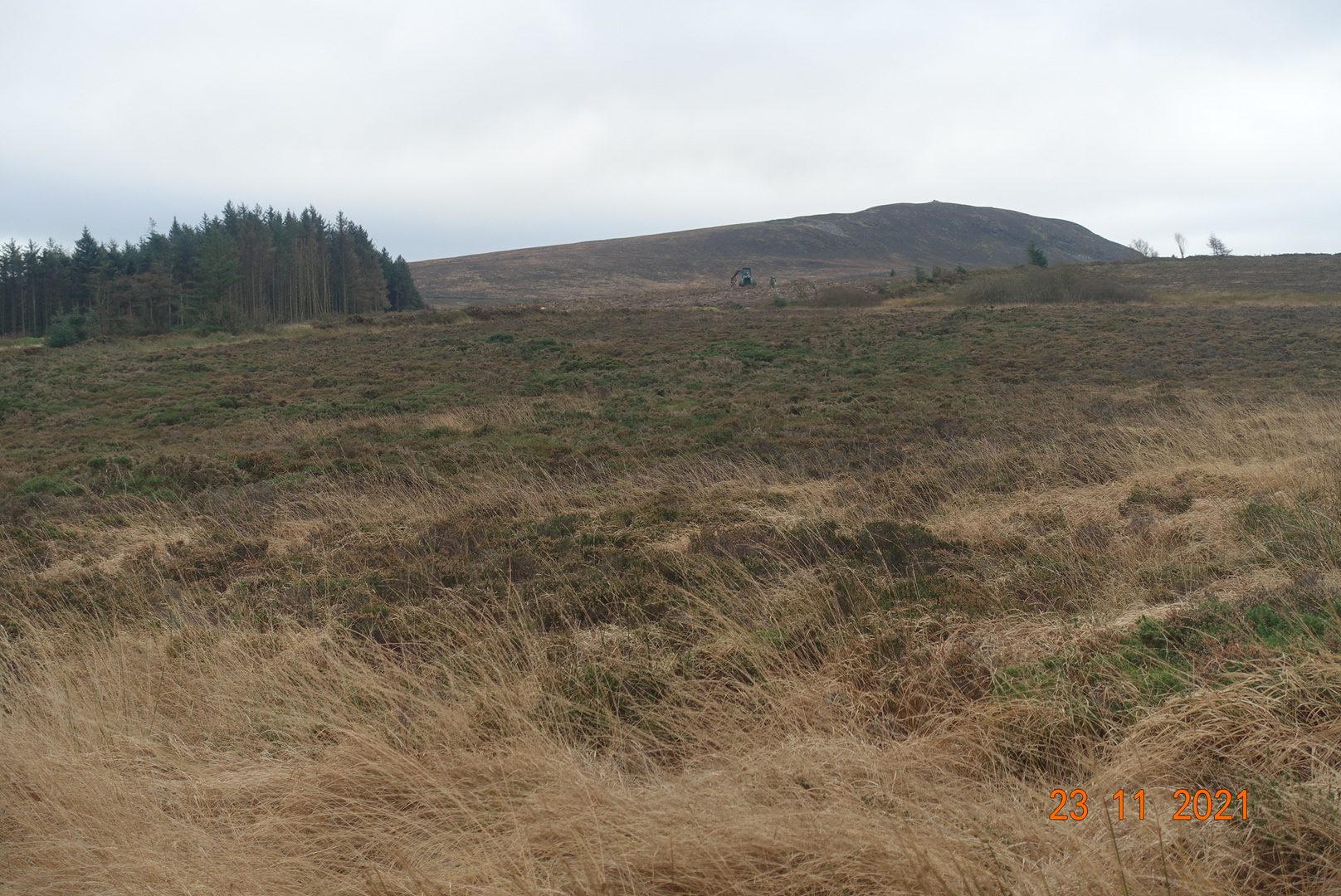
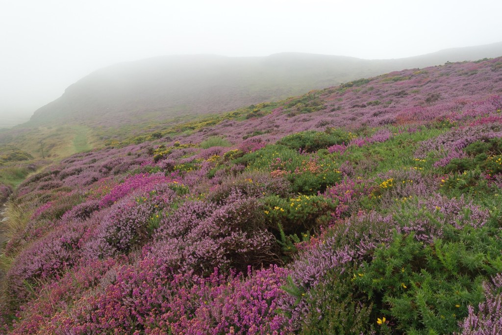
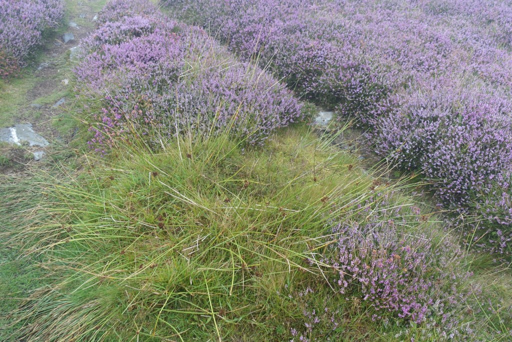
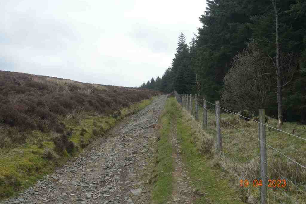
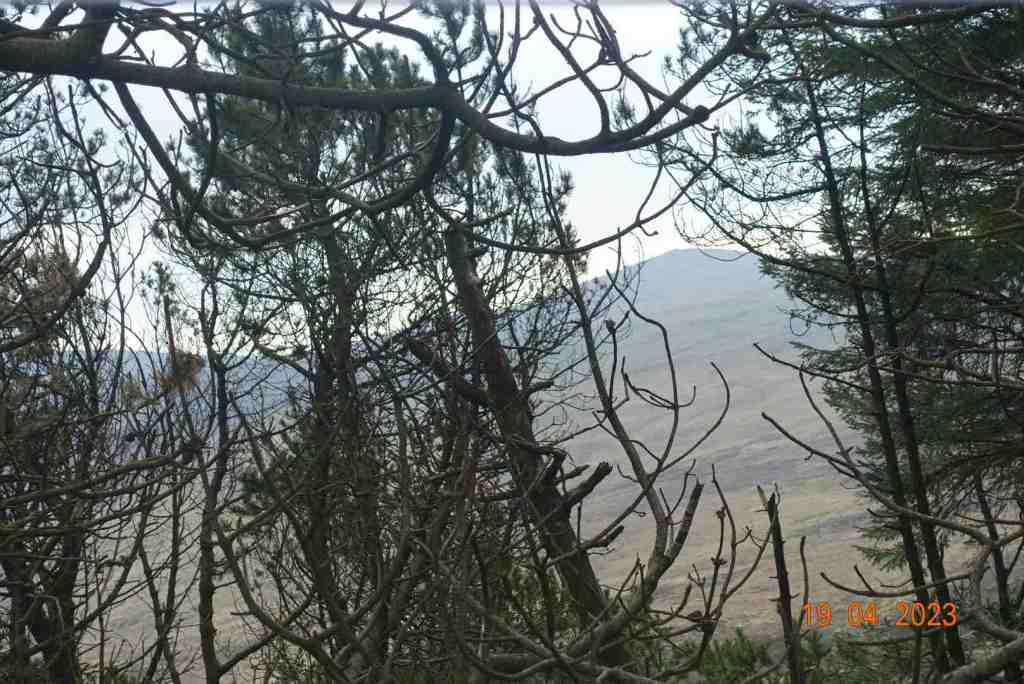
The walk follows a stony track gently and very gradually uphill contouring round the eastern side of Sartfell. There’s a deep plantation to the right to begin with prohibiting any distant views, but as you get a little higher, the trees become a little sparser and you get glimpses of a far distant land. Being so windy, the trees were making a heck of noise, sounding like gushing water or labourers felling trees, but no such thing was going on; it was just very windy.

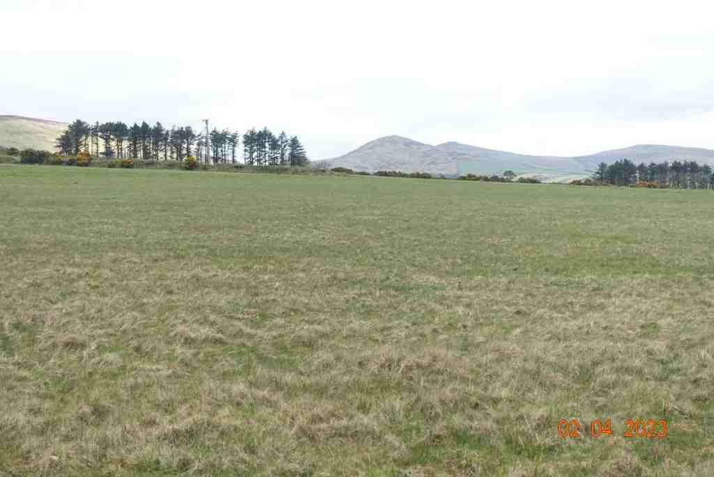
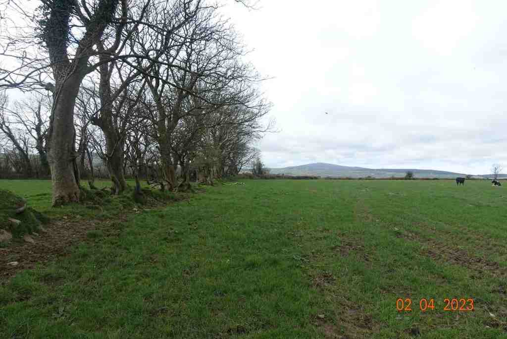
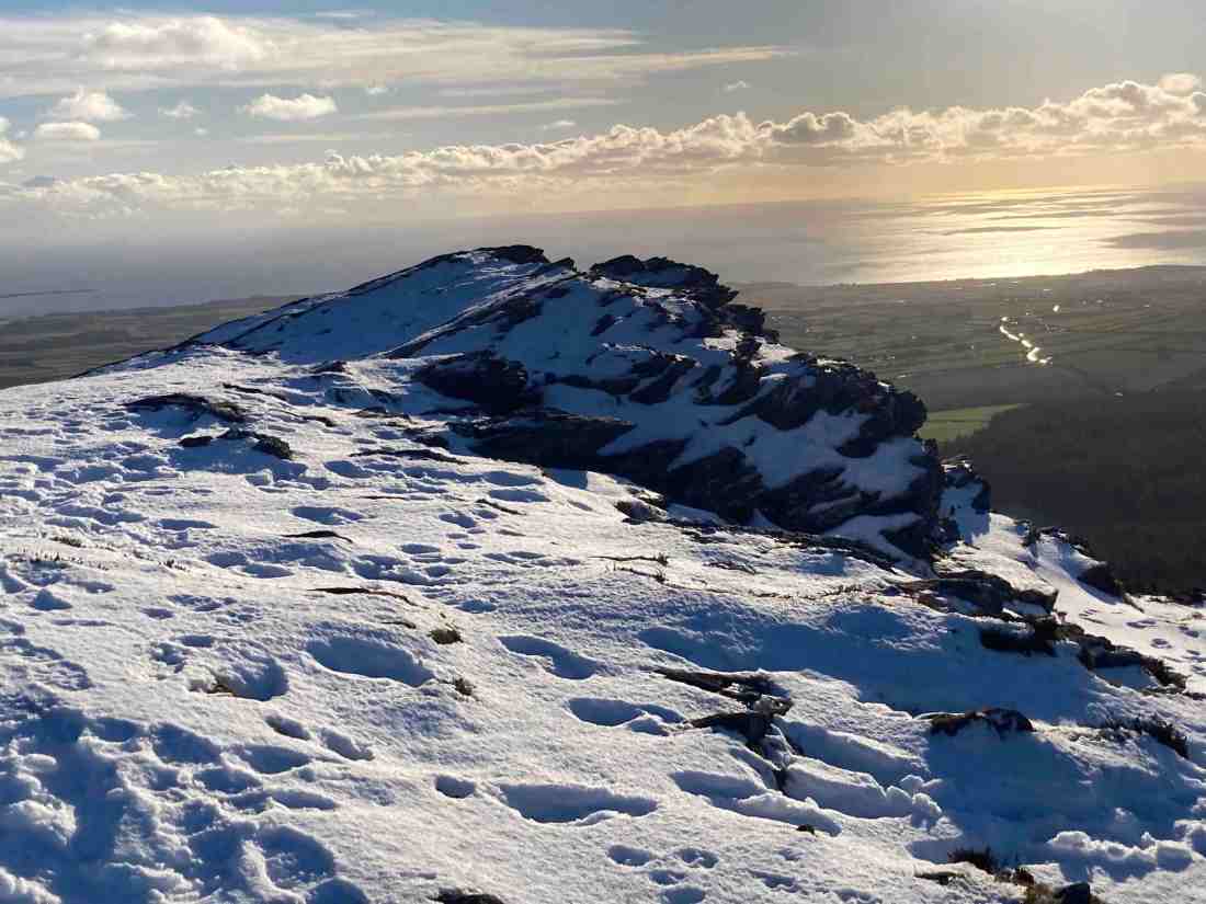
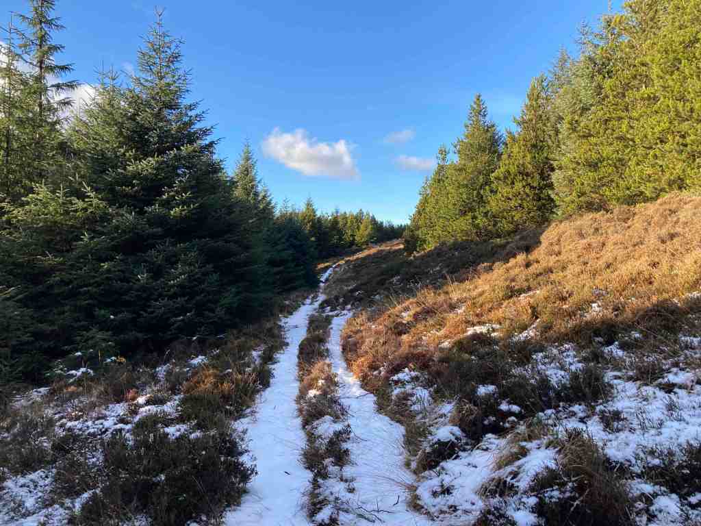
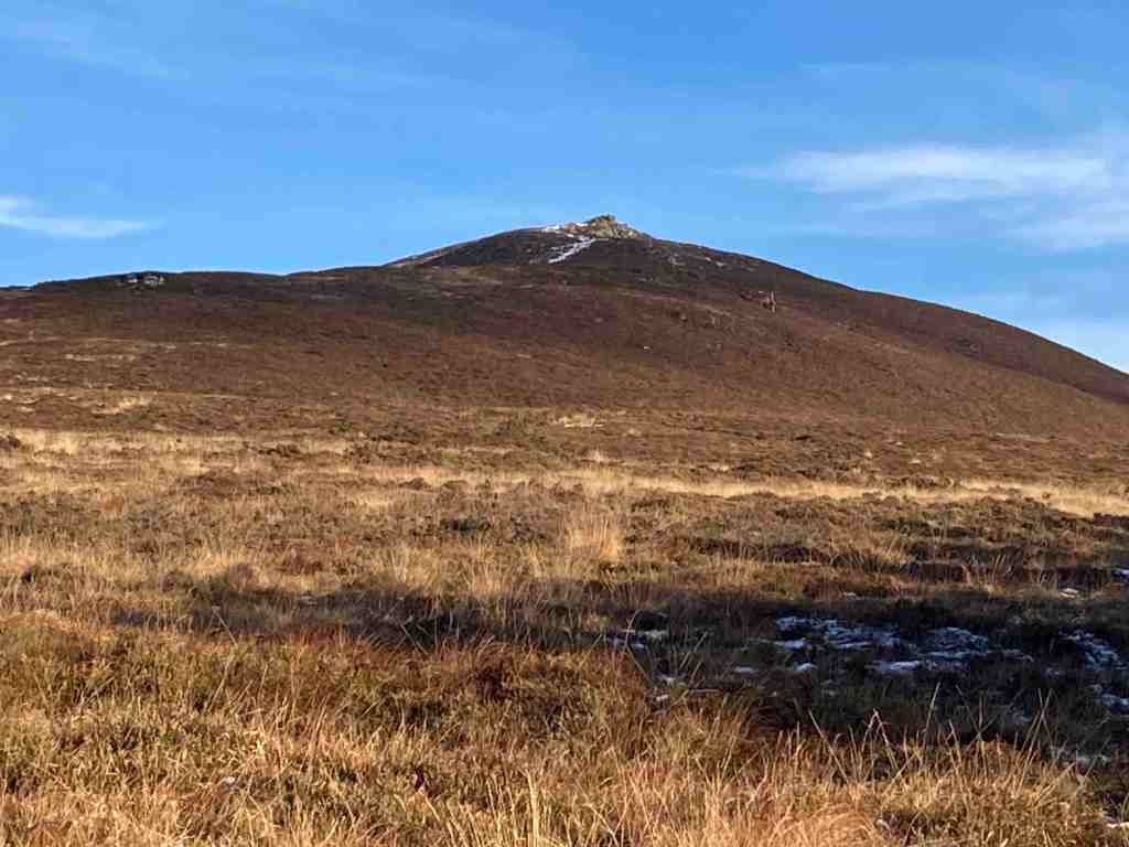
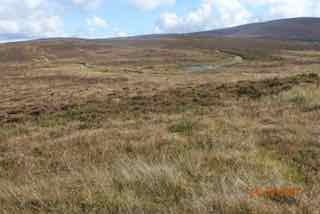
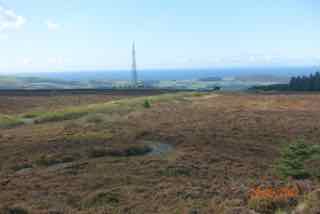
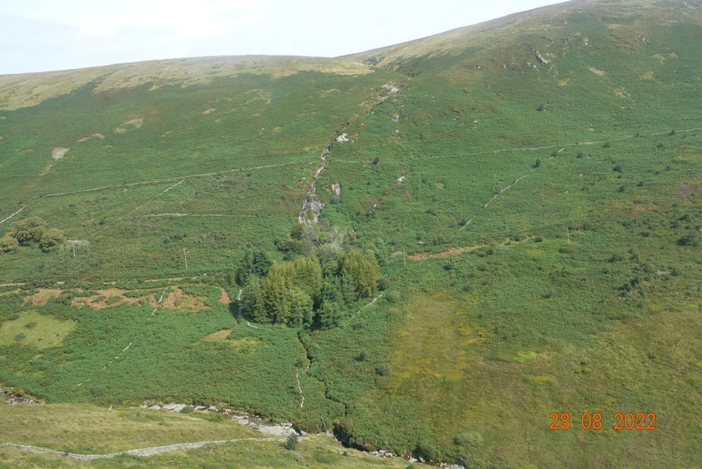
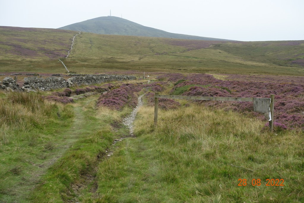
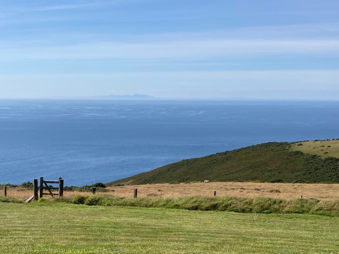
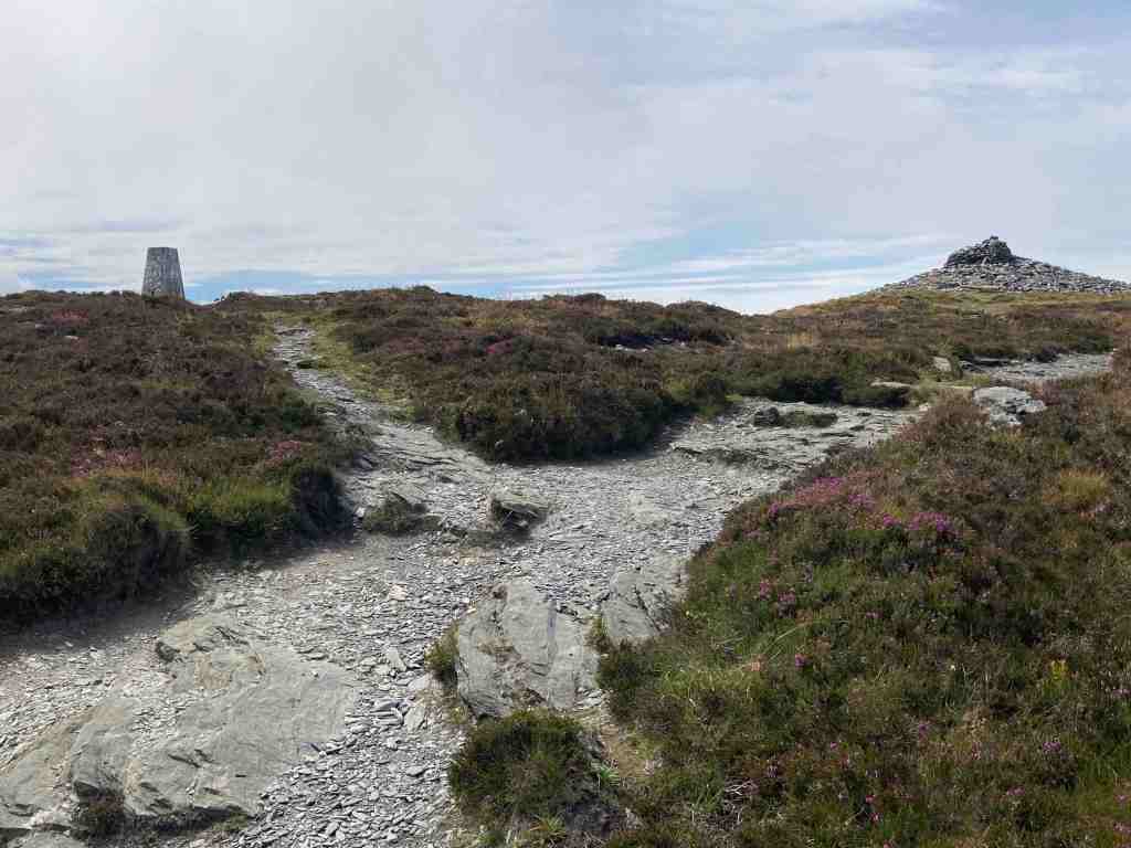
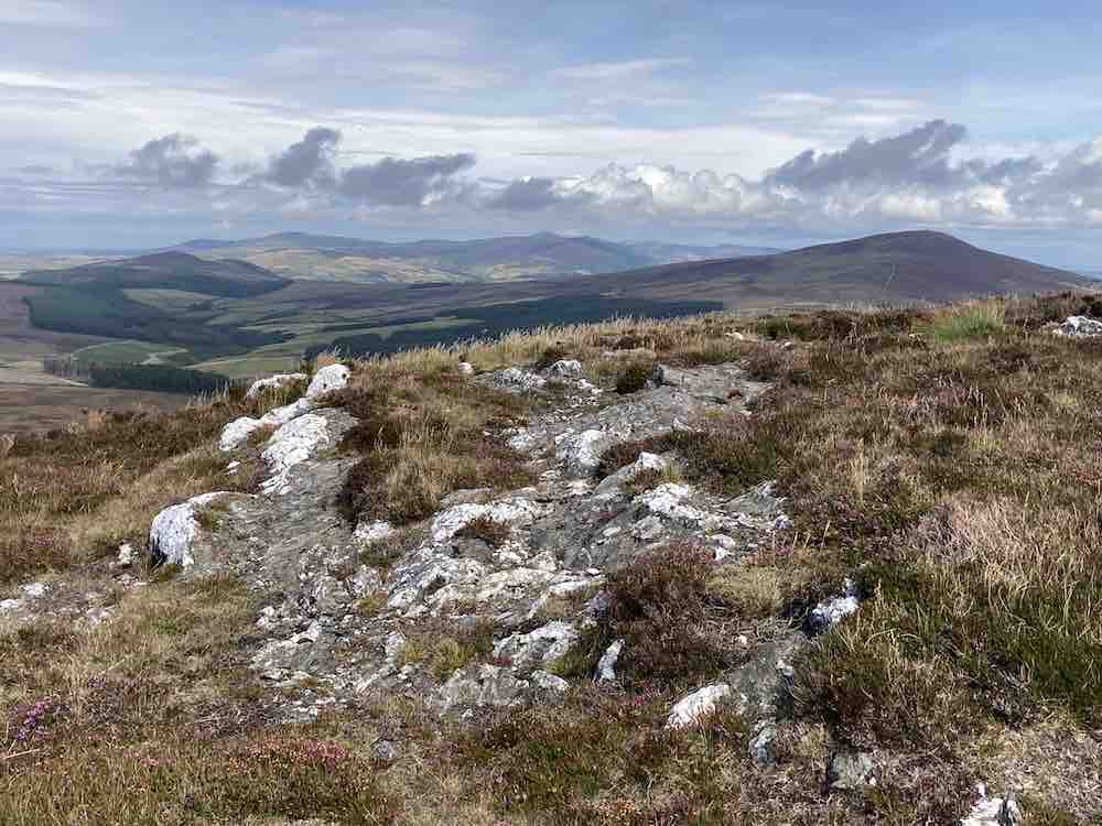
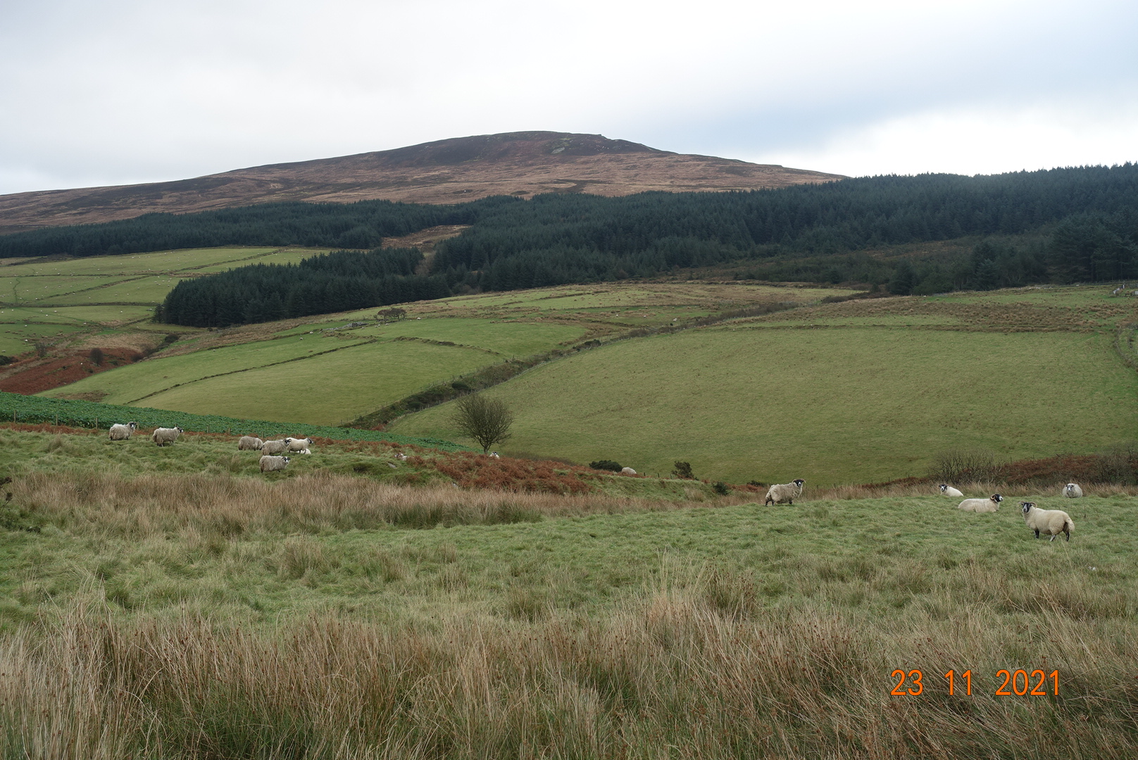
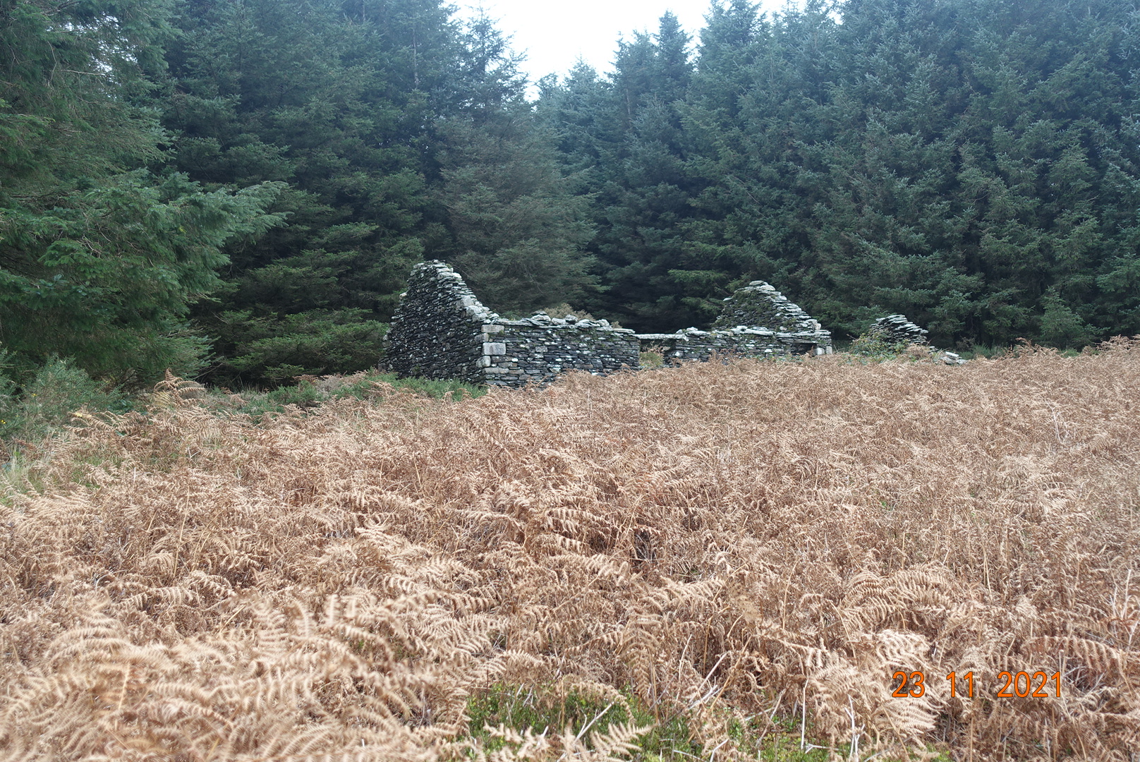
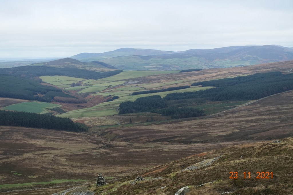
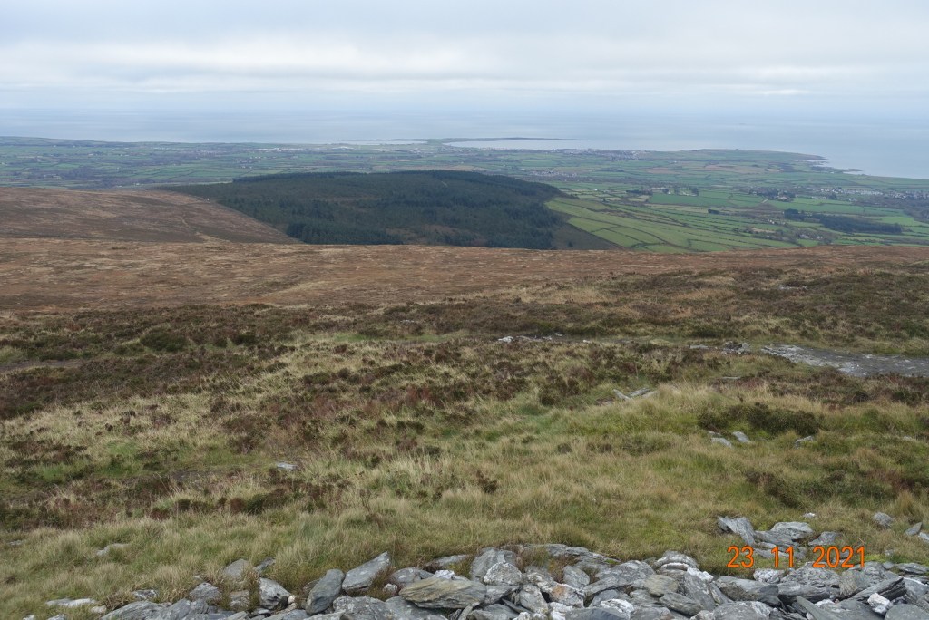
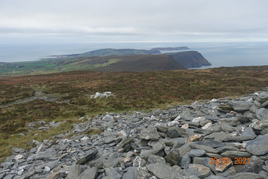
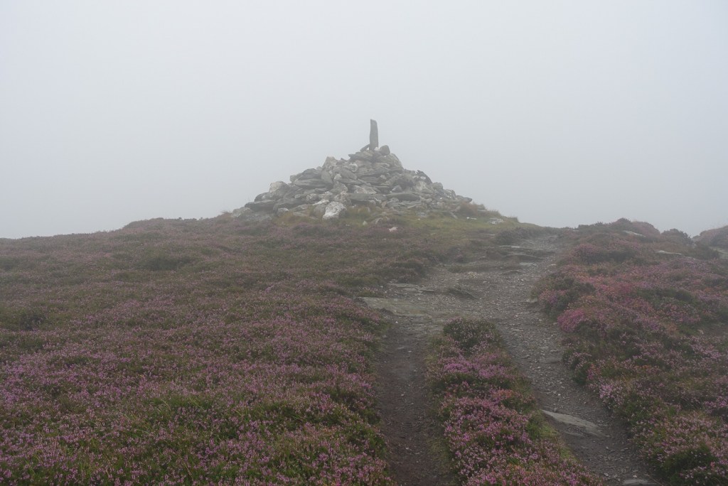
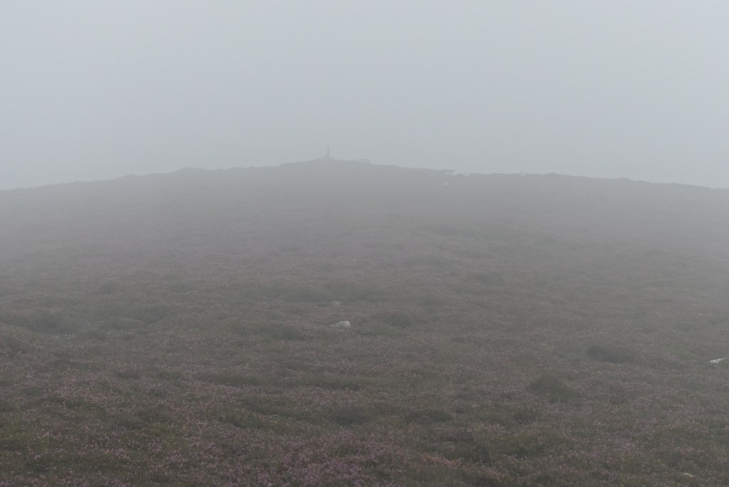
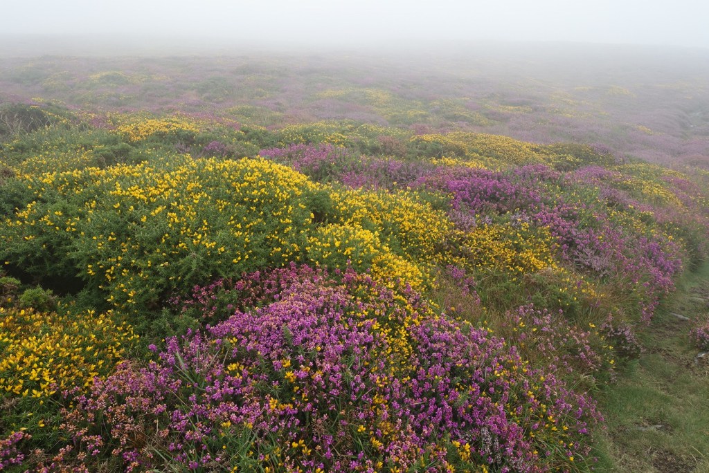
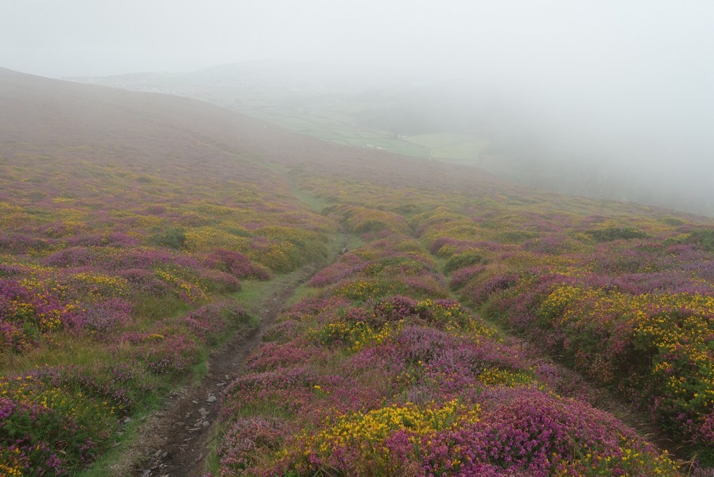
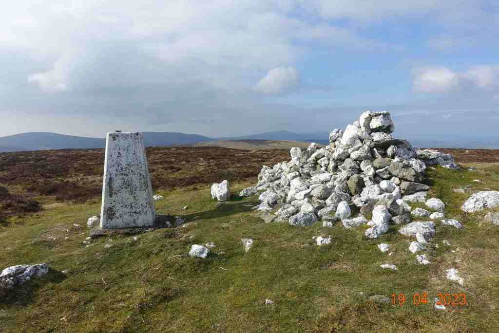
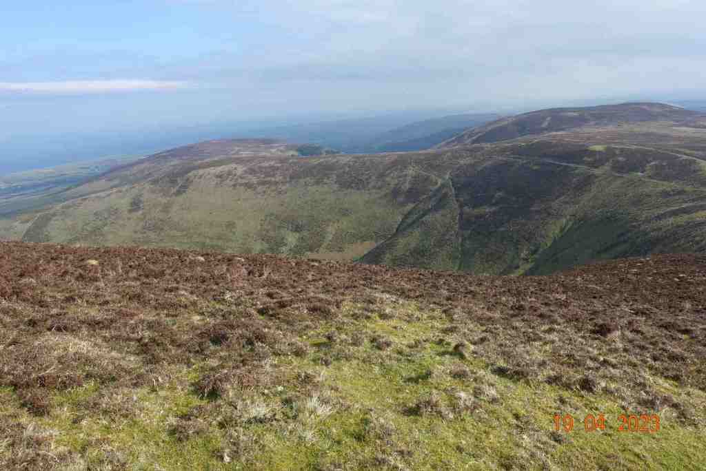
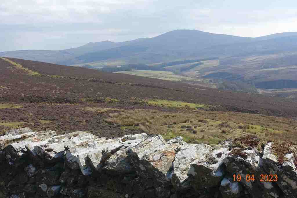
Once you leave the trees behind you are granted a full vista of the northern hills, with Sulby reservoir in the dip. It is still not possible to see over the hills to the east at this point. The stony track continues and becomes flatter. In the distance you can make out an old tumble-down wall on the right and that was where I was heading for. The map showed a foothpath up Slieau Freoaghane. It is a gentle hill climb from this starting point, on a well trodden path over mostly peat and heather. It is only when you reach the grassy top that you get the amazing views in all directions. At the trig point, there is a bell which I was very tempted to ring, but I managed to control myself, fearing that I might otherwise summon all the emergency services for no good reason. Reading someone else’s blog, this bell has not always been on the summit, but may have been linked to worker’s cottages lower down the hillside, and the bell was rung to signal the beginning and end of shifts – day and night. My walk was not going in this direction.

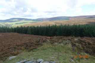
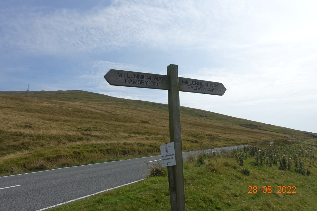
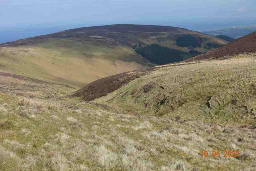
The path off Freoaghane is steeper than the climb up, but very friendly. It is a wide, grassy slope and a very enjoyable descent. As you walk down you can map out where you want to go next slightly off the beaten track, which is exactly what I did, as I wanted to avoid more stony tracks as much as possible. Eventually, it is necessary to meet the track again but only as far as the point where the path divides into two, one going to Kirk Michael, the other to Ballaugh.

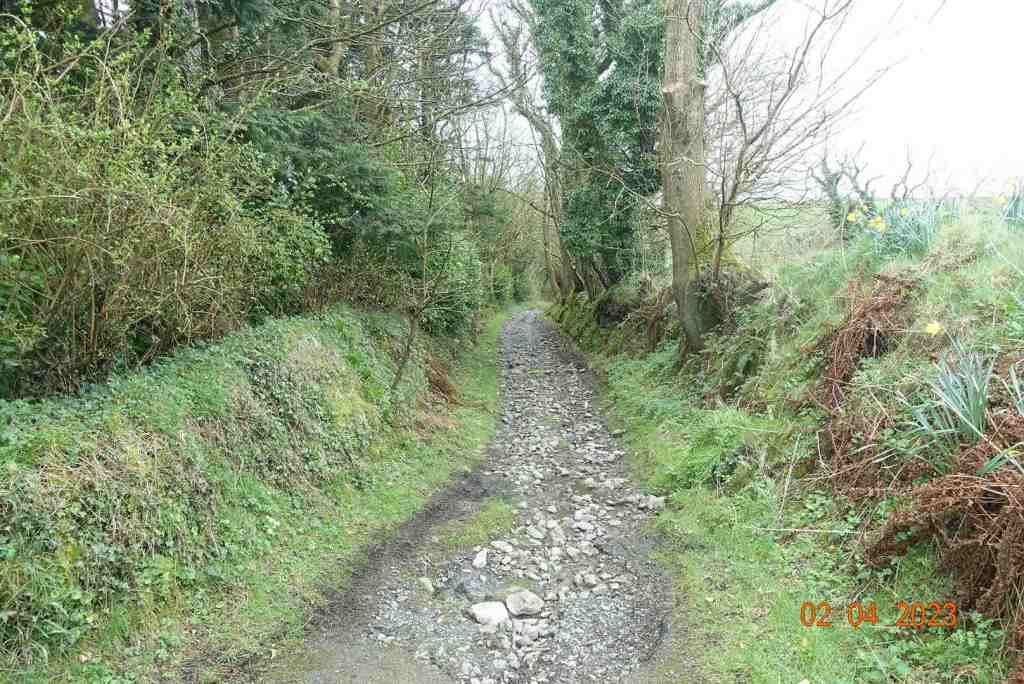
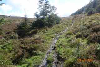
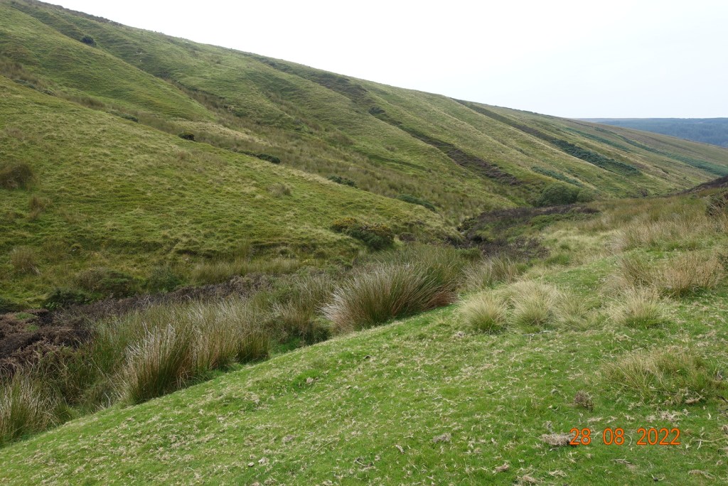
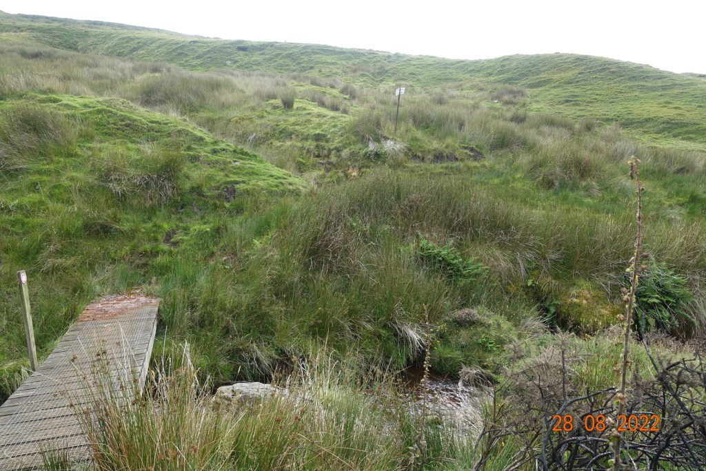
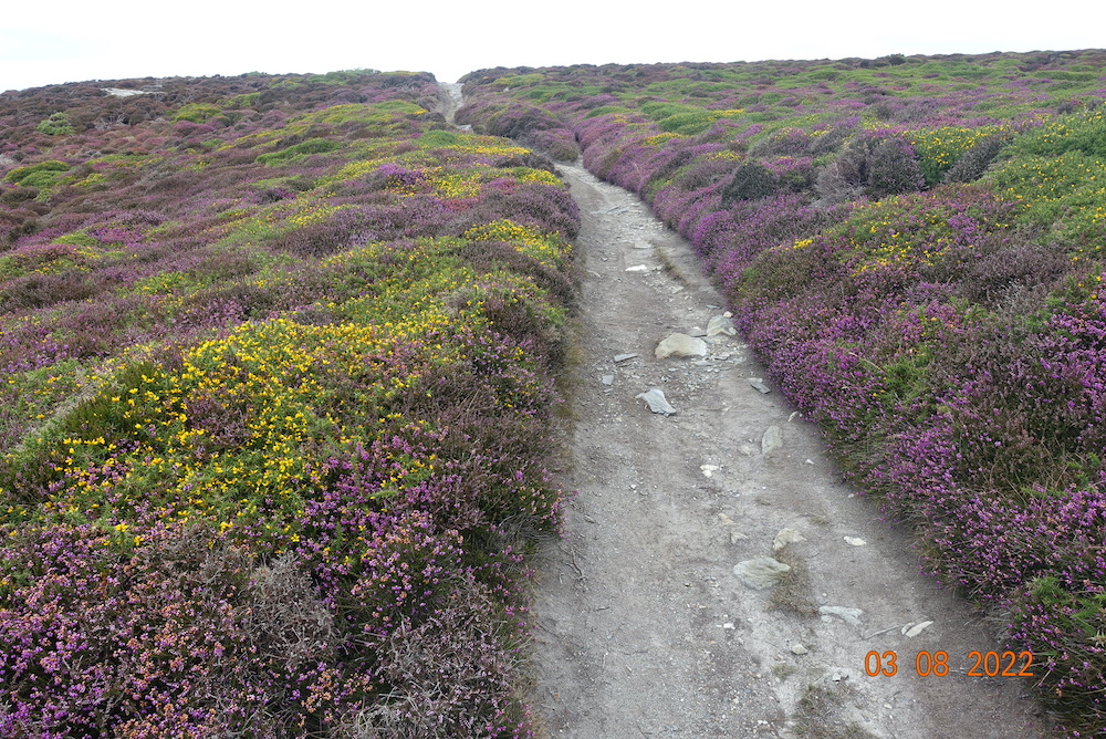
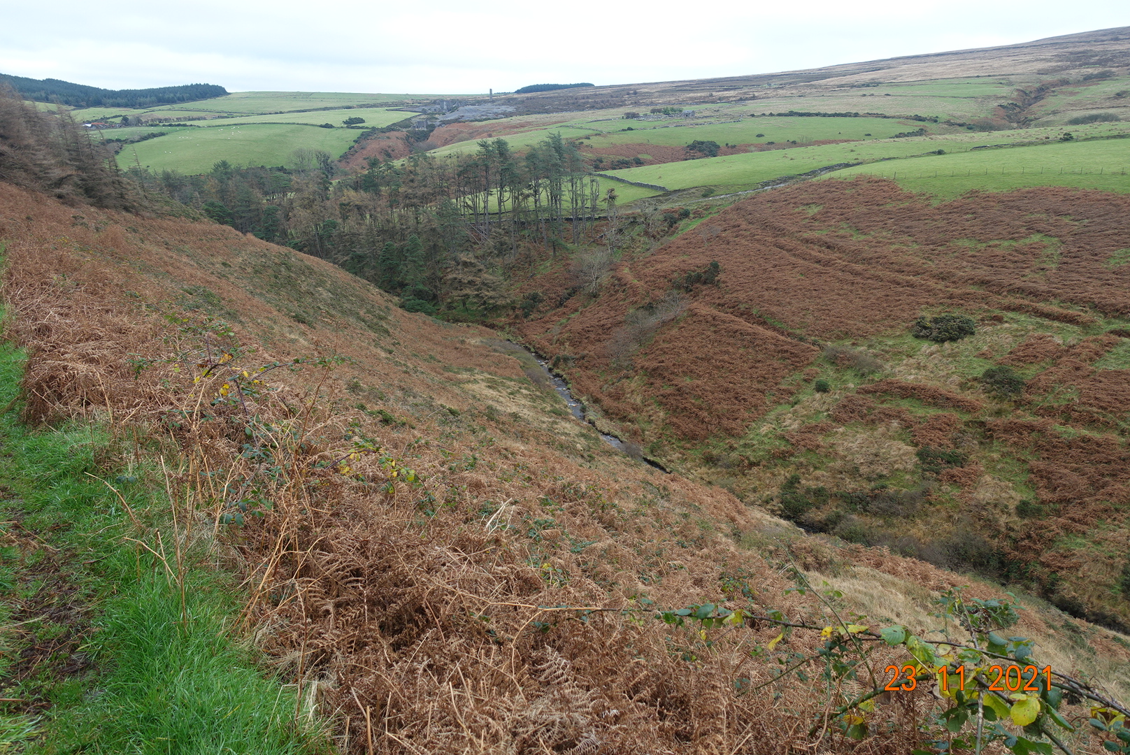
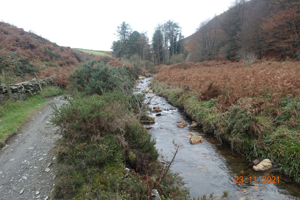
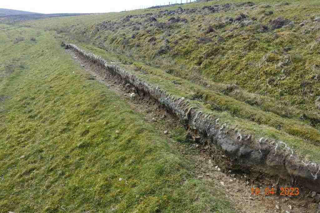
There is a very strange grid to walk over, which is semicircular with horizontal bars. Here there is a tremendous view of Glen Dhoo above Ballaugh. I then took a track leading up the delightful valley with Slieau Dhoo immediately opposite. This is a great lunch spot, with lots of grass and even a makeshift natural bench if everyone wants to sit in a row 🙂 There is small amount of ascent on this pleasant footpath which leads to over the brow of the hill and down to the yet another stony track. Don’t be put off by this path saying “road closed’ at either end. I am sure walkers are welcome, but the bikers are not. On some maps, there is a right of way immediately opposite leading down to Druidale, and another one a short distance to the right. In reality, these are in a bad state of repair and give the impression of being purposely neglected. About half a mile away, there is a new signpost, but it is not in the place shown on the map, although it does join up with another footpath that is in a slightly better state of repair.

Lunch stop overlooking Glen Dhoo

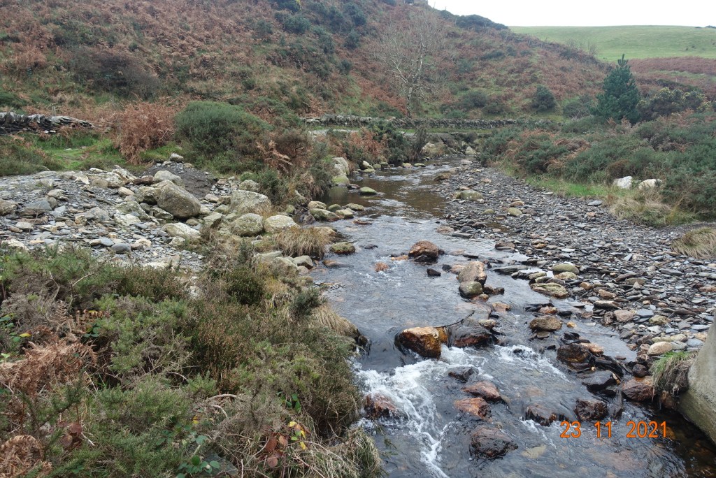
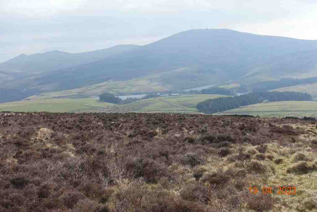
There is a choice at this point. This new track adjoins the former track we began walking on, so it is quite possible to simply walk along this back to the car. The views are stunning, so why not? Alternatively, you can take the track to the left which is about the 4 mile marker on my map, and follow the stream, again walking on heather and peat down to the Druidale Road. There is no alternative but to walk along the lane up the hill to the car, but it is a very quiet road and a pleasant walk. It does mean you do not have to retrace your steps for the last 3/4 mile. It will add on some uphill and probably another half mile.

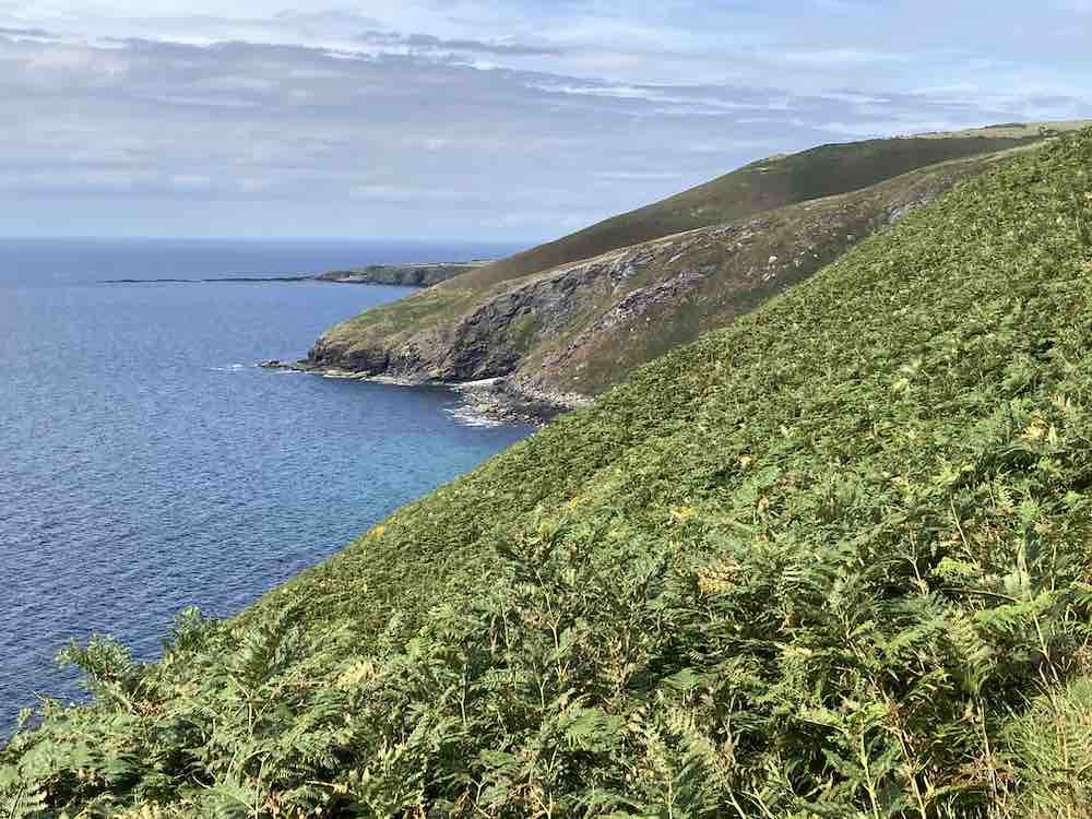
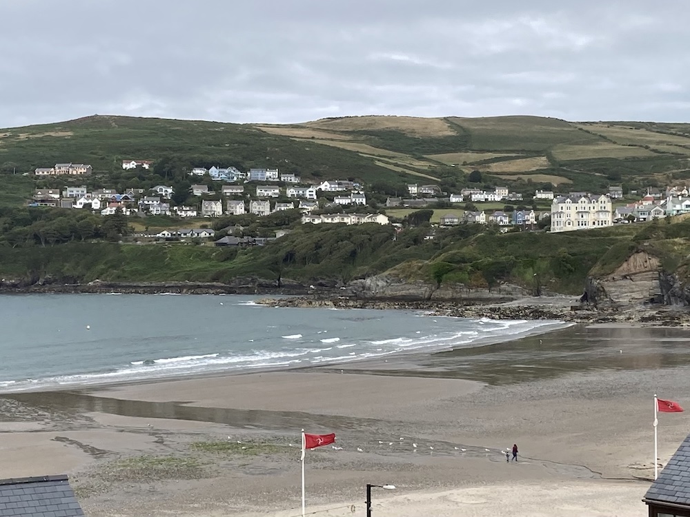
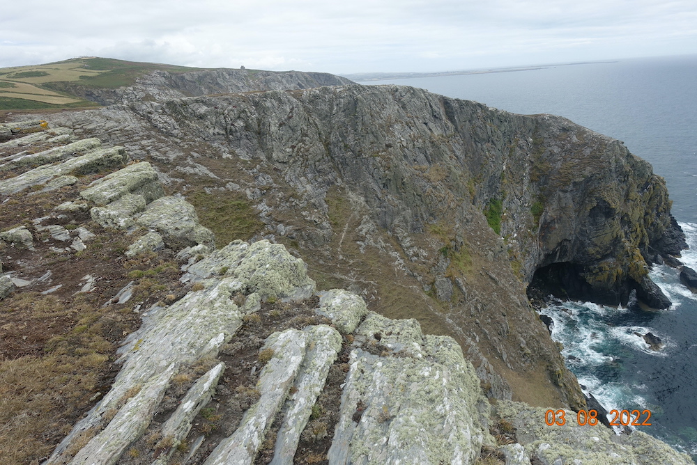
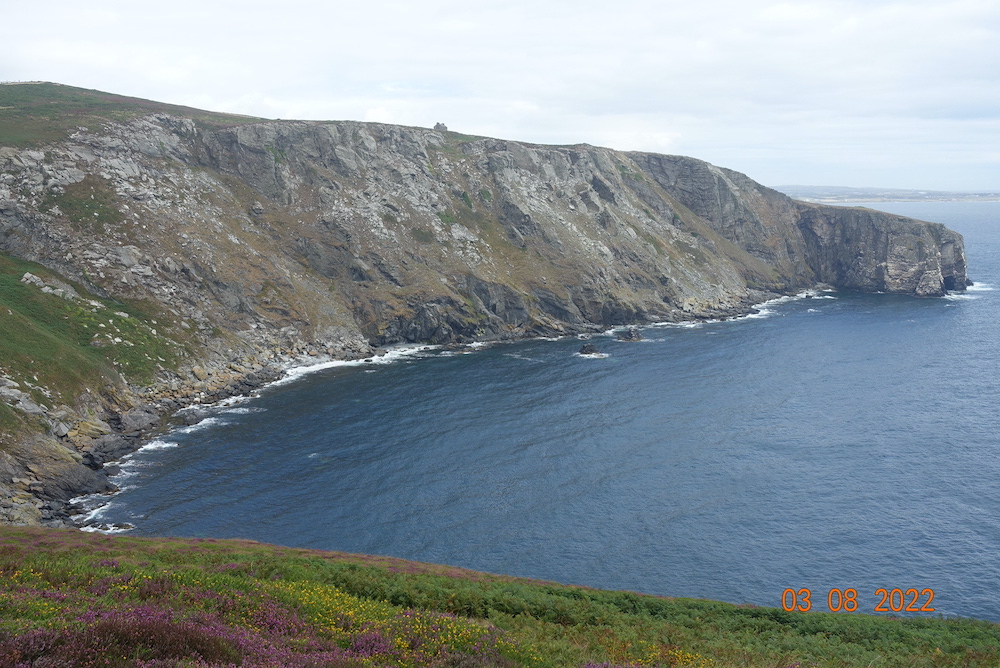
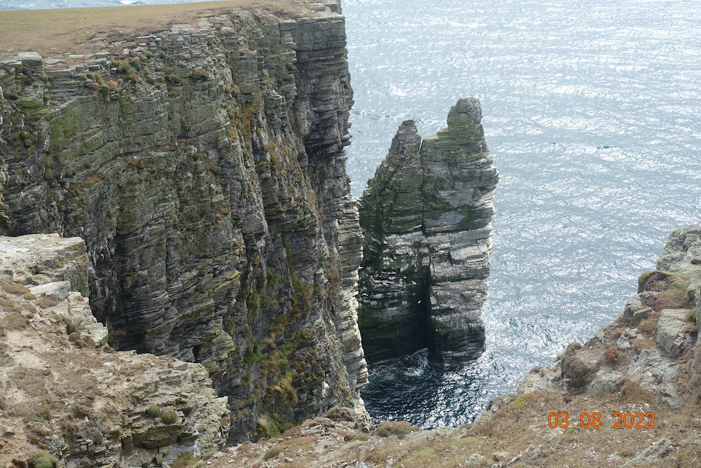
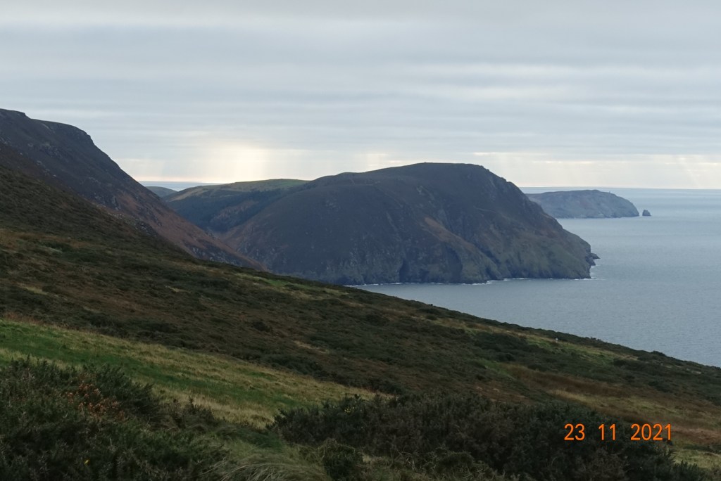
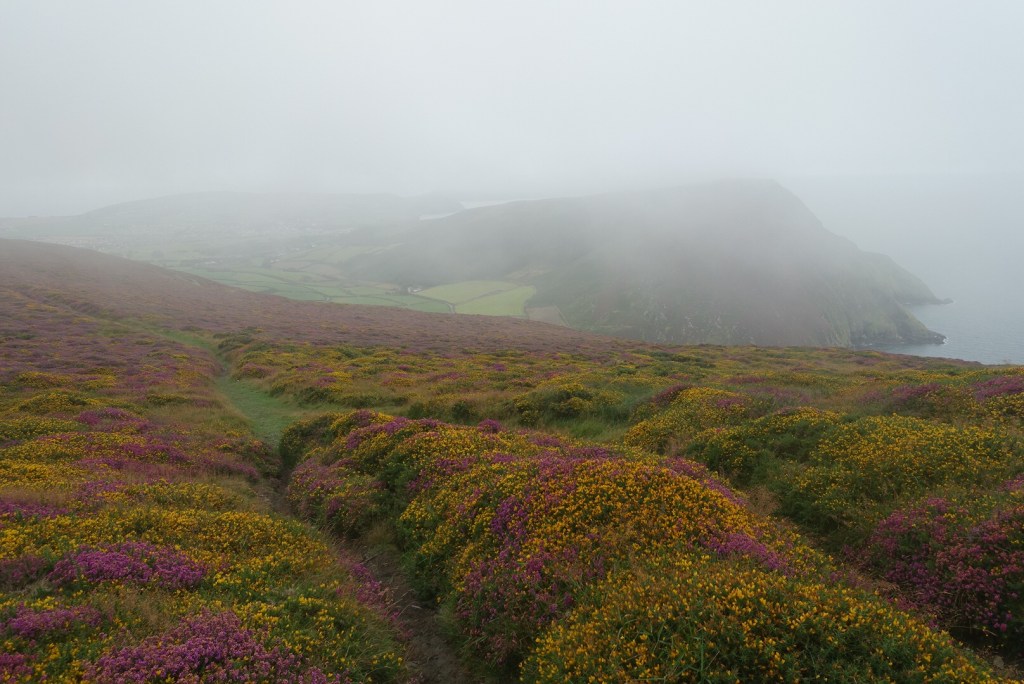
The hill walks on this island are just beautiful, but they have to compete with our splendid coastline. Last week my son came over for the Good Friday 10km run in Port Erin. On the Saturday, we went to one of my other favourite places – the rocky outcrops at Langness. We were really spoiled, as not only were the seals in abundance, but we also saw a pod of Risso Dolphins in Castletown Bay, a I guess sheltering to some extent from the blustery seas – yes, it was windy then too.

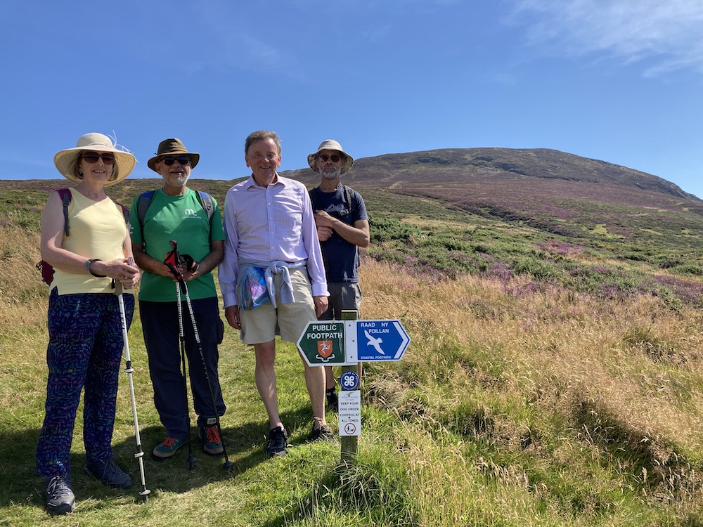
I am leading the Freoaghane walk for the U3A on June 14th, so if you are a member or would like to become a member, get in touch and I will send you details of where and when to meet us. There is no charge for walks; you are entitled to two try-outs but after that you have to become a member of the U3A to participate in any further activities. They are a great bunch of people, and there many different kinds of groups, so if you have time on your hands and you like meeting people and sharing ideas, it’s a good organisation to become a part of.

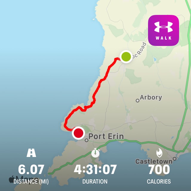
Distance: 5 miles; total ascent /descent 1010ft/ 974ft

Crosby to West Baldwin Circular

This was a route I have never walked and I didn’t know quite what to expect. I was planning a walk for the U3A and if this one wasn’t quite what I wanted I had another up my sleeve. However, the contingency plan was not required as this is a beautiful walk with extensive views in all directions. The paths are good to reasonable, if a bit muddy in places, and the route is easy to follow.

I started at the centre of Crosby parking by the Bowling Green. I haven’t been there since they build the new houses and Coop and the old-fashioned toilets that were so useful have now disappeared, although the gate remains! Crossing the main road requires care and then there is uphill section for some distance. The first part is the most arduous but it’s not too bad and with every step up you get a better view from where you have just come. A path beside the road has been created for a short distance and by the time we do this walk in May, it should be festooned with wild garlic.

We follow the Millenium Way all the way to West Baldwin, up hill and down dale. The maps show direct routes across fields but it is clear from sign markings that the farmers would prefer us to walk around the field, so please be considerate when you are walking across countryside. Some of these fields were very muddy today but I am hopeful that by May they will have dried out a bit. The views, especially to the west and north, make up for the terrain.

As you get close to West Baldwin, the route follows the river along a high track. This was a lovely section and I enjoyed listening to the water tumbling down into the valley below. West Baldwin is lovely and unspoilt, with some interesting and quaint houses and has a much-loved feel to it. The bridge is attractive in itself and a good place for a lunch stop. This is the half way point in this walk, at about 3 miles.

From here, we follow the road south through the village for a very short distance before taking a minor road uphill and going round a few corners before we drop onto what looks like an ancient track going down to a ford, with a tiny foot bridge for walkers. The track is stony but not difficult to traverse and as it goes uphill after the ford it becomes a grassy track leading to a small lane, which is wide and airy. From here you can retrace your footsteps in your mind’s eye as the vista unfolds in front of you.

This is our downwards stretch which takes us eventually to Glen Vine via tracks, a small amount of road and more fields. The stiles in the field section just beside Glen Vine need some attention. They are surmountable but you do need to take care. A couple of them can be avoided by going through gates, but not all of them. Arriving at the main Peel to Douglas Road, we turn right towards Glen Vine for a very short distance, before crossing over the road and following yet another stream (we have followed a lot of streams on this walk) through an old wood down to the old railway line. In all my years of walking I can’t believe I have walked down this path. It is clearly very popular as people have made higher and lower paths through it and created a swing over the stream for children to play.

The walk along the old railway track is very easy walking, and also interesting. There is a new nature reserve and I always enjoy looking at the wetlands just to the side of the track and thinking what life they have and how they developed over the years. The path was modernised in recent years to make it accessible for bikes, pushchairs and wheelchairs. It is settling in well now and doesn’t look quite so much like a road any more. The section from Glen Vine to Crosby is actually narrower and more appealing to me.

This is a walk I would definitely do again. It is not too demanding, with a total of 741 feet of ascent/descent and nothing too steep. Most of the uphill is in the section before West Baldwin. The distance is about 6.75 miles, which I confess was really too much me only 6 weeks after my operation but I am still glad I did it, and I shall look forward to taking our members around the route in May. Apologies for the poor quality of the photos. I obviously have some settings wrong on my camera, but they do give you a flavour of what to expect.

A winter’s day on South Barrule

I woke up to an icy scene outside and was glad I was in no hurry to go out. I had already postponed the U3A Port St Mary walk that I had been due to lead today, but I did have to find some time to do a trial run of the walk I was proposing for New Year’s Day. The weather forecast for next week is worse than snow, ice and freezing temperatures, so Sherpa Gill set out about 11am to basecamp at South Barrule and risk the icy conditions.

I parked at South Barrule plantation car park, with the aim of contouring through South Barrule plantation, my thoughts being that the heavy canopy of trees would protect the paths from the worse of the ice and snow. I was both right and wrong! There were several icy parts and then I would unexpectedly come across a completely clear section for a short while until another skidfest appeared.

I have never walked through the plantation in daylight. The only other time I have done this walk was in Oct/Nov 21 when I did an exciting night hike, so I had no idea of the number of different paths that might try to entice me in other directions. Having said that, I only made one mistake and I spotted that almost immediately. The paths do go very slightly uphill, but you barely notice the ascent until you find you have an open space and can see for miles and miles. It was a particularly bright and sunny day and I enjoyed the panoramic views. In these conditions, you do need patience. In places, it was possible to walk on snow to the side of the path, but it was prudent to tread fairly gingerly as you never quite know what is under the snow. I did keep on paths leading upwards or to the right, and the last section through the Cringle plantation was a little hazardous as the path was very narrow, very icy, with a lot of furrows. I had walked this section before when I was doing the peat monitoring. Although it seemed tedious today and this path seemed to go on and on, I was glad I had stuck to it, as I was able to completely avoid the Whisky Run, which looked like a skating rink.

Coming out of the plantation, you wouldn’t have thought there was any snow on South Barrule, but you would be wrong. There was icy and crisp snow on the path all the way to the top and the way down the other side was an absolute joy. The snow was a few inches deep and lovely to walk on. I could have enjoyed a snowball fight had I had anyone to chuck a snowball at, but I didn’t see anyone at all in the 3 hours I was out. The walk downhill is a relief in these conditions. I was walking on a compass bearing over the snowy moorland as I wanted to finish my walk where I had started in the forest. Having taken my bearing, I saw a mound just above the quarry so headed to the right of that. There are benefits to frozen terrain, in that I was able to walk over ground that I am fairly certain is a bog(!). I soon found the tiny stile, which was the iciest thing I had seen all day and with a big of guesswork and imagination given that there is no genuinely obvious path, I found my way down through the forest back to the car park.

My only sadness is that I was unable to take photos at the top. I had enough battery but my phone flatly refused to take photographs, complaining that it was too cold to be out in those temperatures. I had actually felt warm all the way round so I was surprised my phone was picking a fight. It was only really chilly on the very top. The view at the top was stunning. The sunlight was glinting on the snow and picking out interesting shapes, and the hills of Beinn Y Phott, Snaefell and Colden were all topped with snow, whereas the valleys were green. It was pretty.

The upshot of my trial run is that I shall not offer this walk to the U3A walking group, and instead we will start our walk at Round Table and do a circular walk in a different direction. Walking 3 miles through a forest is probably not most people’s idea of fun, but then I am not most people! Everyone can enjoy South Barrule, it is such a special place, no matter what the weather.

Distance: About 5.5 miles (I had forgotten to charge my Garmin watch, so the ran out of battery just before the end) and 1096 ft of ascent.

Glen Helen and Eairy Beg

This is a delightful walk of contrasts. It begins with a 2 mile walk along the wooded river valley. For a small river, it makes a lot of noise, with tiny cascades and small waterfalls along its route, culminating in the dramatic, if relatively small waterfall deep in its heart.

The path has recently been upgraded. It is wide, open and mostly flat, but this does not detract from its beauty. To the right, the scenery is wild and majestic as it has ever been. At this time of year, there are many different shades of green, and a mix of leafy and bare trees. You will find a good deal of fungus if you go looking for it too.

On reaching the end of the Glen, you can either retrace your steps or continue on, which necessitates a short climb to take you almost to the top of the tree line. This is still an easy walk, with well-made steps and boardwalks over boggy bits. You then return to Glen Helen on the opposite side of the river, which is just as beautiful. Looking at a map there is an ancient keeill in the fields immediately above the footpath, but sadly, no way to reach it.

On nearing the end (or start) of the Glen, I maintained the high path when the path starts to drop down into the valley, but if you prefer you can take the lower path back to the glen entrance. The higher path takes you into the plantation. The easiest way to describe the next part is to say to ‘keep left’ and ‘keep climbing’, as the paths are indistinct and there are many variations, so you can basically pick your own way. It is a moderately steep climb and takes about 30 mins from where we enter the plantation. My aim was to reach the top where it meets the moorland. Once you reach the wall, you can follow the track without deviation and you suddenly find yourself leaving heavily wooded plantation behind you with extensive moorland (and views) in front of you. It may be a little boggy here in places, but nothing extreme.

Walking along the edge of the plantation you will spot some tracks leading over Beary Mountain. You often see bikers of all descriptions and today was no exception, although they took a different route from me and didn’t bother me. There is a clear junction, where you can turn left to head through moorland to Lhargee Ruy, continue straight on, which takes you down to Greeba Bridge or turn right along a stoney track to our high point for the day of just over 300 metres (about 1000ft) called Beary Park or Eairy Beg, depending on which map you are reading. This commands fine views in all directions, though it is more enclosed than other high points on the island.

To return to Glen Helen, continue on the same path in a westerly direction. Where there is a track and gate leading to the pylon, there is a direct path going into the plantation. There is another path, continuing alongside the plantation which is the one mentioned in the Warden’s Walk No 5, but today this was quite overgrown so I took the path going into the plantation.

Whichever way you go, the descent is steep in places on grassy, peaty tracks that in places are worn down by cycles and motorcycles. It is perfectly passable but you should take care as there are a number of tree roots that can be slippery. Walking poles and very definitely walking boots are recommended for this section. The path through the plantation is not always clear with several paths criss-crossing each other; if in doubt, keep moving downhill and slightly to the right. Eventually, all paths will meet up. The path I took lead me to Eary Veg tholtan. This was in use as recently at 1946. At the turn of the 20th Century farmer Billy Quirk lived here, with his 10 children. It is worth a nose around to remind yourself of the local history and how the landscape changes. The farm house was sold to the forestry commision in the late 40’s, early 50’s and the plantation of Sitka Spruce was created in 1959.

From here, it is just a short walk back to the car park. Depending on which route you take downhill, the whole route is a very enjoyable walk of around 4.5 miles with 1000ft of ascent.

You may want to watch another Ray Kelly’s youtube videos: https://www.youtube.com/watch?v=1c-iaAK68aA

Triskelion Way Part 2

This walk did not quite go to plan. With all the uncertainty of road closures due to the Manx Grand Prix and not wanting a really, really long day of walking, I had decided to meet the pilgrims at their lunch spot at Sulby Reservoir at 1pm. I could get up at leisure, take my car to Laxey, as a permit holder have a free train ride up Snaefell, then casually make my way to Sulby Reservoir for lunchtime.

What could do wrong I hear you say. Well, nothing in theory. The first part worked a treat and I really enjoyed the train ride, only I was in a bit of a rush at the top if I were to meet them at 1pm. The queue in the Snaefell cafe was not long, but it was very slow as there was just one guy serving, and you know what coffee machines are like these days. Bring back the kettle and the instant coffee – instant is no longer a word associated with cafes. I decided to cut my losses and get the train back down to Bungalow. I had plenty of food and water anyway. This was another delightful journey, made even nicer by a very friendly and chatty conductor.

Reaching Bungalow I began the walk down the road. A family were walking in front and the dad stopped to walk with me and have a chat, which I thought was very nice of him. He had his wife, his daughter and his daughter’s boyfriend in tow. I did wonder if the young people knew what they were in for, as they definitely had an air of an afternoon stroll about them. Mr X rejoined his family and I messed about by the roadside, looking at little eddies of water and marvelling that there was a flowing stream at the top when we have had no significant rain of late (if you exclude the 4hr deluge last Monday). It just shows how good the peat is at retaining water. There was a fair amount of sphagnum moss clinging to the side of the road, which is good to see.

The family went off to Ramsey on the Millennium Way. I was a little early so decided to walk on a little and completed my descent at the Tholt-y-Will Iron Age Earthwork. This is a bank about 6ft wide, extending in both directions across the road for about 100 yards in each direction. It is thought to be a defensive rampart protecting the hill route between the two streams, but no-one really knows. At this point I had a call from Phil, the pilgrim, to say they were well behind and by the time they had had lunch it would be at least an hour. Big sigh, my end, but not surprised. I decided to start the walk without them, and if I walked slowly, they would eventually catch me up, so back up the road I went to join the Millenium Way. I was a little uncertain about doing this, as I have never been on this path, but hey ho, life is for living and having small challenges, so this was mine for the day.

The first two miles of the Millennium Way are absolutely glorious. As well as being able to see distances, you can see into valleys that you never even knew existed, and there was a complete sense of isolation. Mr X and co had long gone as I must have waited for the group at least 40 mins before embarking on my Millennium walk. Birds of prey were hovering overhead adding to the atmosphere. The path begins as a stony track, but soon becomes a narrow earth track, and then the track pretty much disappears and you have to find your way over the moorland. There are signposts, some more useful than others, but you need a map to know where the crossing point is over the stream. You will have to navigate several bogs, none of which were very deep on this occasion, but in winter I could imagine this being much more hazardous. There is a steep descent to the stream, but the climb out is less strenuous uphill and you soon find yourself back on the top, so here was I peering into the distance for my fellow pilgrims but not once catching sight of them.

At this point, I decided I may as well walk at a reasonable pace as they were clearly not going to catch me up. When you leave the river, the map suggests you take the soily path through the gorse, but in fact you need to go the other side of the wall to the top of the hill. I didn’t, so had to scramble over the wall higher up. There is then a helpful signpost telling you to go left. This is flat easy walk through heather with great views. The path here is well defined as long as you don’t believe it all the time. I realised pretty quickly that it was bending the wrong way after about half a mile, so I did some trail blazing (not as grand as it sounds; it was easy walking) to rejoin it further east. You need to curve to the right away from the trees, so if you find yourself heading towards them higher up so have gone wrong. Maybe I missed a sign, I don’t know. Anyway, it is neither here nor there. It is easy to correct.

Once back on the track, I followed it to where it joins the path from the Mountain Hut. There is a large section of boardwalk here across the bogs. I had to wait for some very slow bikers to come over it before I could go. Nearing the far end, one of the boards gave way, which was a little alarming. Going through a gate, you then join a stony track that goes on and on and on for miles, all the way to Ramsey. It is uneven and as a descent, although not steep, it is tedious. The early part is fine and has lovely views to the north. Scotland was visible today. I had just joined this section when I saw a very colourful lone walker dressed in yellow coming towards me. As we converged, I was delighted to realise it was Paul the Pilgrim from Friday’s walk. He is such an interesting person and it was a delight to spent a further few minutes in conversation with him. He was intending to meet up with the group and walk with them for a while, but I had serious doubts whether he would succeed.

There is little to say about the rest of the walk. By this time, the battery on my phone had given up the ghost, and I had lost my map. I only realised this when I wanted to see if there was a more interesting route into Ramsey. It was a brand new map so I was cross with my carelessness. Consequently, I had no choice but to walk down the never-ending stony track down Sky Hill (very disappointing), and then back along the road into Ramsey. As I was nearing the traffic lights, I spotted another person I knew – Mr X again, but without his family!! They had hoped to have afternoon tea at Milntown, but it was closed, and they had cadged a lift back to Douglas or wherever, but there wasn’t room for Mr. X in the car – or something like that – I didn’t quite understand how he had got separated from his family.

I had almost an hour’s wait for a bus but eventually caught the 18.10 bus back to Laxey with a million other people, all tourists. There had been no actual racing that day, but I believe there had been some event on in Ramsey to entertain the crowds.

I know you are wondering what happened to the pilgrims. Did they ever arrive? Yes, they did, but not until 19.20 or so, very hungry and I guess tired with sore feet. They had walked a long way. I walked 9.5 miles altogether, but they had done another 5 miles, of which about 3 miles was a steep ascent. I was very sorry not to see them at all – I had enjoyed their company a couple of days previously, but I was also relieved that I had decided to carry on alone, so that I got home in reasonable time. I had to work the next morning, Bank Holiday Monday!! I do admire those who did all 4 days, and if they do it again next year, I will try and do the full 4 days myself and stay at the Retreat with them to get the full benefit of the experience.

Here is a link to a website that describes the Triskelion Way : Triskelion Way. If anyone is interested in joining our pilgrimage next year, send me a message and I’ll send you a email address for the organiser.

The walk from Bungalow to Ramsey (via the Earthwork and the Millennium Way) is about 9 1/4 miles and just under 600ft of ascent. The full walk from Kirk Michael to Ramsey is closer to 14 miles and a good 2000ft of ascent. What an achievement! Well done, all of you.

The Tuesday U3A Walk – Eary Cushlin, Round Table, Cronk Ny Arrey Laa

What a wonderful day we had. Superb views, superb company and wall-to-wall sunshine. I have described this walk in detail on a number of occasions so today, I shall simply tell you some interesting facts that I related to the walkers en route.

The day started out not quite as planned as the Midweek Muckers (Manx Wildlife Trust’s sturdy volunteers) had taken up all the car parking spaces. This meant that we had to park at the far end of the track, but in reality this turned out to be an asset not an inconvenience, as we got all the track walking out of the way at the start. We were only 7 in number. A couple of people didn’t turn up, but I know that some of the regulars felt this particular jaunt would be a challenging step too many for them.

We set off down the Glen Rushen valley, stopping at the first tholtan (Thallaquaine, Claughbane). This is where I delivered my first interesting tale. But first, what a stunning location. It is set high up on the northerly slopes of Glen Rushen and has panoramic views of South Barrule and the moorland plateau. There is another tholtan in full view of Claughane, and the story involves both homesteads in the year 1906. Claugbane farmer and butcher, Robert Clarke, agreed to keep a light shining in his farmhouse all night and every day in case marauders came and he needed help. The light shone brightly for many a day, until one day, William Carran looked up from his farm across the Glen and noticed the light had gone out. Donning his overcoat and boots, he trudged off down the ‘main road’, crossed the river and climbed up the slopes on the other side until he reached the cottage. He knocked on the door – “Anyone there?”……. No answer. He tentatively pushed open the door to see everything exactly as it should be. Dishes on the side, clothes in the cupboard, furniture where it should be, but no people, not one. As he turned to leave, he spotted on the sideboard a slip of paper. Taking it to the light, he read “Gone to America”. The intrigue continues as a report I read states that not only Robert Clarke emigrated but also “Mrs. Christian, her son and daughter from Peel, gone to Ohio, Cleveland”. Do you think they eloped?

This set the scene nicely for the next stage of our walk to the other Tholtan on the other side of the river. This large farmstead has a rich history, but few details until 1820, when it is cited that the owner was Joseph Faulder. It is now called Carran’s Farm, but it is thought it had previously been called Glen Rushen Farm. In 1871 he put it (and Thallaquaine) up for sale and William and Anne Carran eventually bought the 350 acres for £230. They had 8 children all living here! It is reported that only one remained in the area, Thomas Carran, and indeed he inherited it and farmed it until 1932. At this point it was sold to the Peel Water Company, who promptly put all the assets up for auction, including cattle, poultry, horses, sheep and all the farm machinery, including a turnip drill, rabbit lamp and double barrel gun. Why did the Water Board buy the property? That’s odd you might think? Not at all once you know that this area had been designated to be dammed and the Glen Maye river and valley would have been swallowed up by a reservoir. Thankfully, this never occurred and we are able to enjoy all the benefits of rambling freely in this beautiful area.

Carran’s Farm contains the house, with an extension of a scullery and parlour, several outbuildings, a toilet (I wouldn’t recommend trying it), a theshing wheel and gardens, now all overgrown or in a state of disrepair. With such a rich history you do feel this farm warrants renovation by Manx National Heritage. There are many many similar tholtans on this section of the walk, as this was the ‘main road’ at the time leading from Colby down to Glen Maye and would therefore have been a thriving thoroughfare 150 years ago. There was no route contouring South Barrule as there is today, and the windy coast road to Dalby did not exist either. As we trundled up the track, we realised what a tough life these people had. Yet the valley had a large population whereas today people living in these hills are sparse.

Reaching Round Table we stopped for lunch before enjoying a most beautiful amble across the moorland. The heather had sprung into life since I last came, and the sheep were keen to see us. Reaching the corner at the foot of Cronk Ny Arrey Laa, two walkers decided they had walked far enough and made their way downhill back to their cars. The rest of us continued to the top of Cronk Ny Arrey Laa, also called Cronk Ny Irree Lhaa. The first term means Hill of the Day Watch, associated with Viking Times; the other term means “Hill of the Rising Day” associated with the herring fishermen. We discussed whether we could see Anglesey in the distance. We could certainly see Black Combe on the outskirts of the Lake District, and the mountains of Snowdonia further south. To the west, the Irish Mountains of Mourne loomed large, along with more northerly parts of the Irish coastline. To the north, Scotland was just visible. We spent a relaxing few minutes chatting away and enjoying the views before descending down the precipitous coast path to Eary Cushlin, where we stopped again for another chat and we all lamented the fact that we wished it were a pub or a cafe rather than rental accommodation.

So that was our day. This is a fairly tiring walk, especially in hot weather, but worth every tired limb and sunkissed arms and face to be treated to such delights. The full walk was just under 7 miles with about 1200ft of ascent and a similar amount of descent.

Apologies for the lack of photos. I only took 2 today, the two sunny ones! 🙂

Teaser for Tuesday

On Tuesday I am leading a walk for the U3A down the Rushen Valley up to the Round Table and on to Cronk Ny Arrey Laa and Eary Cushlin. I had offered an extension to view Lag Ny Keeilley, so the purpose of today’s walk was to check whether the coast path from the top of hill to this historic site was suitable for my walkers.

I must admit I wasn’t really in the mood for walking – horror of horrors I hear you say, but my apathy was soon dispelled once I started moving. It was a lovely day and there seemed to be no-one about so I had all this wonderful countryside all to myself. Maybe everyone is watching the Commonweath games or gone away…

The route to the top of Cronk Ny Arrey Laa is well travelled and easy. It is about 300ft from the road and takes about 15 mins to reach the top, from where the views are unsurpassed anywhere on the island, with the exception perhaps of Snaefell. The route down to Eary Cushlin is not so easy. It is narrow and steep and the footings are tricky in places where the ground has been eaten away over time, leaving fairly high steps on the banks. Having said that, it is easily passable with care. It looks no distance from the top but in reality takes between 20-30 mins to walk down and across the moor to where the path meets the lower path at Eary Cushlin.

On Tuesday, we shall continue straight on past Eary Cushlin house and back to the cars. I haven’t described the earlier part of the walk as I have covered this before. When I write it up on Tuesday I shall tell you all about the Tholtans in the area. However, for those wanting to visit Lag Ny Keeilley, turn left and continue mostly downhill on a rough path for about 3/4 mile. This was originally a packhorse route which would have run all the way around the steep western slopes of Cronk Ny Arrey Laa to the Sloc. I decided this path was not suitable for a group. Not only is it narrow and overgrown with bracken the ground has broken away in places on the slopes making the path very difficult to negotiate. It really needs some maintenance, but I guess this is not a very frequented path so won’t be high on the list of things to do over here.

If you do continue, the views are beautiful on this dramatic coastline, and it is extremely peaceful. There were several little birds hovering and chatting as I walked along and a very big bird kept circling overhead – possibly a harrier. When I eventually reached Lag Ny Keeilley, over 1000 years old, you will initally see two modern cairns at the entrance. The whole area is surrounded by a circular wall, though this is difficult to see, indicating a burial ground. Indeed several burials have been found, including a lady who lived at Eary Cushlin who was buried there in 1800. The keeill itself is fairly substantial and significant finds were found here, including the original altar and quartz pebbles, often found in these settings as a mark of respect for the dead. The remains of the priest’s cell is also visible. If you would like to know more about this site, take a look at Andrew Johnson’s explanation here: https://www.youtube.com/watch?v=SkxEbGS6Sos. Although his video was made only a few years ago, the site seems in better condition then than it does now, which is a shame.

Overall, the distance of this walk was about 4 .5 miles, and 1070ft of ascent and roughly the same amount of descent.

Ambling and Rambling Around the Sound Coastpath

It was one of those days that was just right for walking, if a little breezy. At least it wasn’t boiling hot! It is a while since I have walked this route west to east (or roughly that) and I was really looking forward to it. I wasn’t disappointed. There are a few noticeable changes – well noticeable to me – such as quite a lot of erosion in places, some caused by weather, some caused my man, and some very definitely caused by rabbits. The heather, whilst still beautiful, was not quite as abundant as it has appeared in the past, and the bracken seems to be getting a stronghold in some areas and crowding out the heather. The gorse was variable with several areas without flowers. On the plus side, there were a lot of choughs, all busy arguing with themselves as only they know how to do.

I started out from home and walked along Athol Park to the top road overlooking Port Erin. This is one of my favourite views of the bay. It always looks so inviting, no matter what the weather. I followed the road to where the coastpath starts behind the delapidated Marine Biological Station, noticing that the stream that generally gushes out from the top of the cliff was completely silent today, testament to the very dry summer we are having. The seagulls seem to have already abandoned the cliff face here, where they used to nest in abundance. They must be anticipating their home being ravaged by builders and machinery once the development of the apartments begins. Today, there were only a couple of beleaguered herring gulls scattered on the site.

The path soon starts to climb uphill and this was the first point where I noticed that more rocks were exposed than I remember. Again, areas that are usually a bit muddy were dry and the wild flowers even seemed to be begging for rain. Otherwise, I didn’t see anything unusual on my walk round to the Sound. I was as delighted as ever when I reached the Valley of the Rocks with all its contorted shapes. A few minutes later I arrived at the Sound in time for a bowl of soup, which was accompanied with a roll, but the greedy seagulls took it when I wasn’t watching. I had been debating whether I wanted the bread anyway, so they did my a favour, and boy did they enjoy it and make a fuss! I am on a keep fit campaign, not much of a campaign really. I just want to lose a little weight and cutting out or down on bread and cheese are high on my list.

After lunch I spent a little time sitting on the rocks watching the seals. Several were lounging close by and others were peering at the visitors peering at them. This is such a beautiful spot to stand and stare, and you know how good I am at that. After that it was the steep climb up on to the top of Cronk Mooar and then on to Spanish Head. On the way, I met a couple watching some sheep who were having an argument. I was to see them later on in my walk – the couple that is, not the sheep, and we spent a very pleasant few minutes talking about our respective experiences of the island and comparing it with Germany, where they live. This section of path usually has the best gorse and heather, and add in the sage and the grasses, it makes for wonderful variation in colour. There are also interesting rock formations on this section of Spanish and Black Head, rather like limestone pavements, but I’m not sure they are made of limestone. If anyone knows what type of rock these are please let me know.

The last bit of uphill takes you to the Chasms and the Sugarloaf. Here I met another couple, also visitors, wanting to know where to go next. I think their decision was made by telling them there were toilets at Cregneash as they then headed up in that direction. I took the lower grassy path and made friends with a number of sheep, and picked up feathers for my granddaughter to paint. The vista on this side of the Sound is very different. On the north western side all you can see are hills, but from here you can see not only the hills but the terrain also gently rolling down to the sea and the flat areas of Castletown and Langness.

By the time I reached Glen Chass I had had enough. If you are doing this walk, you might want to continue down to Port St Mary and take one of the roads back to Port Erin. There are a number of different options, depending on how far you want to walk. You can go over the hill at Fistard, taking the path upwards from the golf course, follow the coastal path or as I did follow the road at Glen Chass to the Howe Road. I then followed the farmer’s track down to Truggan Road and then I was about home. However, if you turn left at the Howe road junction, you can take a footpath behind some houses on the right, going over fields and retaining the height and the wonderful views until you finally have to drop down on one of three footpaths leading to the Port Erin end of Truggan Road.

This walk was just under 8 miles, with a total ascent of 1463′ and a total descent of 1503ft. I took it slowly, to enjoy looking at all the wildflowers and other wildlife. I would allow 3.5 – 4 hrs of walking time for this beautiful coastal walk.

Eary Cushlin Round 23rd Nov 2021

If you only ever do one walk on this island, this is the one to do. There is nothing more beautiful and I never tire of it. There is no walk that offers such variety, with a valley walk, a moorland walk and a coastpath, with fine views to all aspects of the island. Yes, you can see the four nations from Snaefell but on a good day you can see all these from the top of Cronk ny Array Laa as well.

This is a very accessible walk with no steep climbs. The coastal footpath is very worn in places and therefore there are some claggy steps down that require careful attention, but it is all passable and if this does deter you, there is an alternative route back to the car park at Eary Cushlin.

The walk starts at the picturesque car park of Eary Cushlin, half a mile down the track from the main road. There is room for about 8 cars here, and if full, you can revert to the car park beside the road at Dalby Mountain. It really doesn’t matter as you either walk the track at the start or end of the walk. Crossing over the main Peel road we take the designated footpath that contours around the side of Dalby Mountain and through the forest before descending to the bridge over the Glen Rushen river. It is two miles from Eary Cushlin to the bridge. All along this route there are tremendous views of the valley, and at this time of year the colours are magnificent, especially the rust coloured bracken and the green spruces. Notice the lone erratic rock left in the valley from the ice age. In the distance South Barrule stands magnificent and there are views of the mines to the north and looking over Dalby Mountain site of special scientific interest (the largest peat bog on the island) Cronk Ny Array Laa competes for our attention. The footpath is straightforward, mostly grassy or soil. Towards the bridge it becomes a little steeper downhill but is easily manageable.

There wasn’t much water in the river today. Crossing over the bridge I followed the wide farmer’s track that ascends steadily but surely up to Round Table, passing a large tholtan which has the most spectacular views in each direction. I have been here many times but never taken the time to look around the tholtan. It has many interesting features and it also gives an opportunity for a coffee stop after the climb up the hill.

Continuing on the same track we go through the South Barrule plantation to meet the road junction from Peel / South Barrule / Colby. This makes a good lunch stop as there is a nice flat grassy area with views of both South Barrule and Cronk Ny Array Laa and the moorland in between. After lunch, we continue across the moor in a south westerly direction, which is mostly flat and is a good path. I am always surprised how long it takes to walk this as the destination looks so close. It is a minimum of 20 mins walk across the moor only to be thoroughly enjoyed. Every now and again you come across small clumps of quartz shining brightly against the black peat. The picture below shows the easy path over the moor.

Reaching the corner, the walk continues up to Cronk Ny Array Laa at 1567ft. Most of the uphill has now been completed, but if you are unsure of foot and don’t wish to do the craggy sods of downhill footpath on the coast path to Eary Cushlin you can take the track (it starts as a road) that has a smooth descent and takes you back to Eary Cushlin car park. You can see this track on the map just to the east of the 5 mile marker. However, if you do this you miss some of the finest views you can have on the island, so if it is a good day when you do this walk, I would strongly recommend this last section. It only adds on another half mile and a few hundred feet of ascent. It was cool, dull and slightly windy day when I did this walk, so gloves, hat and scarf were in order when I got to the top, but I have done this on warm days in bright sunlight and spent many moments scampering happily around the top of this peak and exploring…

As it was, I quickly followed the coast path down the hillside, at all times admiring the extensive views to the north and west. The descent is a little steep in places and worn as I have said, and poles are very useful on this section for balancing as the steps down can sometimes be a good foot down, or more. It is possible to walk on the heather in places, but not recommended as you can’t see the dips and hollows very easily. It is a relatively short descent taking about 20 mins and once you reach the wall the path is more amenable going over the grassy terrain, where we treated to a surprise view of the Carnanes and the Calf in the distance. We join the footpath that leads to Lag Ny Keilly, a hermit’s ancient stronghold about half a mile down the path at the foot of Cronk Ny Array Laa. However, this walk does not visit this and I turned right and took the path to Eary Cushlin house, now self-catering accommodation. From here it is a very short walk back to the carpark. I can’t emphasies enough how beautiful are the views on this descent.

This is not a walk to be hurried. You do need to pay attention to where you are putting your feet and there are a couple of tholtans to visit, as well as spend time simply being and immersing yourself in this wonderful countryside. This 6.4 mile walk with 1293 ft ascent and 1227ft descent took me over 3 hours on my own, so I would recommend you treat this as a day walk and take your time. It is sensible to start fairly early to be assured of a space in the car park, but if you are unfortunate, there are other starting points, such as the lunch stop, or the track by Cronk Ny Array Laa. Enjoy 🙂

Heather Walk on the Western Cliffs 18/08/21

I make no apologies for there being a surfeit of photos mostly of purple heather and yellow gorse, as this was today’s mission. The Isle of Man boasts a kaleidoscope of spectacular colours at this time of year but you will see none better than on the walk from Cronk Ny Array Laa to Port Erin. I can see many of these from my house and can watch the terrain change from green to purple and yellow from my bedroom window.

However, it was one of those days starting in sunshine, quickly fading into soft clouds. Then the clouds would part, leaving you tantalised by a glimmer of sunshine, only to have it taken away just as quickly and be replaced by the thick veils of Mananan’s cloak, meaning that a large part of this walk was undertaken in fog, not great for photos. As you watch the slideshow below, it does eventually brighten up and offer up some views. 🙂

I had grabbed a lift to my starting point with my friend Janet, who was travelling to Peel to do her stint at the Wildlife Trust shop. She dropped me on the corner in thick fog. Undaunted, I made my way to the top of Cronk Ny Array Laa. I wondered if I might be a little late in the season for my photographs as a lot of the heather on the eastern side of the hill was going over from what I could see.

From here, it is a steady descent to The Slock. There are usually fine views of the south, but given the weather, imagination was necessary. I hadn’t gone far when I met a lady carrying a very large rucksack up the hill. It turns out she is Portuguese and was hiking around the island. We had a very interesting half an hour talking about her journey, bus times and tide timetables before we each continued on our respective ways.

Just before The Slock, I found myself below the cloud line and I was able to enjoy the magnificent colours all around me. It was then a short climb up to Gob Ny Beinn. The cairn is slightly further along the ridge. I stopped here for a late late lunch in the… fog… before continuing down to Fleshwick. This is usually the most stunning section for colour but the mist had the better of it for most of the walk. Even so, it was beautiful and moody and so very quiet. All I could hear was the wind under my ear muffs. Yes, it is August, but it was cold enough to wear a t-shirt, thin jumper, light fleece and waterproof at times!

Mission accomplished and numerous photos in the bag, once at Fleshwick I debated with myself whether to bother with the climb up Bradda Hill. I wasn’t feeling great and I knew really my body had had enough, but if I am presented with a challenge that is achievable I am likely to do it. There was an alternative, low route home from Fleshwick, but it is less interesting, so the more challenging route won.

The route up to Bradda Hill is known as a fairly ferocious climb, though not difficult as long as you take your time. It is 500-600ft, but it is only the first 450ft that is quite steep. And there are plenty of stopping places. It is then an undulating walk along the cliffs to Port Erin. The scenery changes a lot. There are still significant patches of heather and gorse but not the unbroken expanses of the Carnanes or Cronk any Array Laa. It is easier to see the effect of farming too, as where there might be moorland is grassland. At this point, the clouds decided to relieve themselves of their moisture, so I packed away my phone and stepped out to make my way home.

It was a most enjoyable afternoon, but it took its toll on me. I had to go to bed and rest when I got in, and I haven’t been a lot better today. But ask me anytime, I’ll just keep going until I no longer can.

I will leave the photos to do the rest of the talking. If you can get out in the next few days you won’t be disappointed. The hills all around the island look spectacular.

Distance on the hills 6 miles + 1 mile into Port Erin; Ascent 1200 ft