Ladygrove Woods

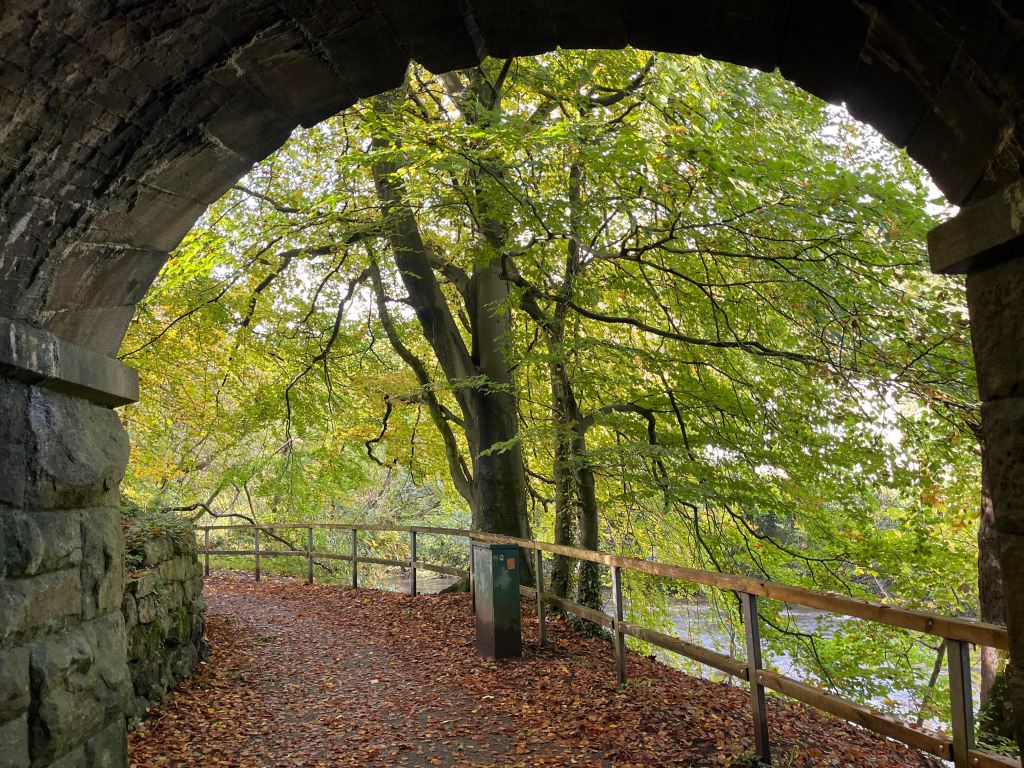
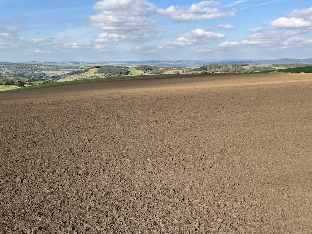
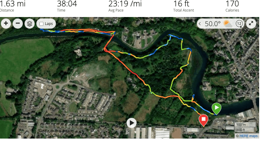
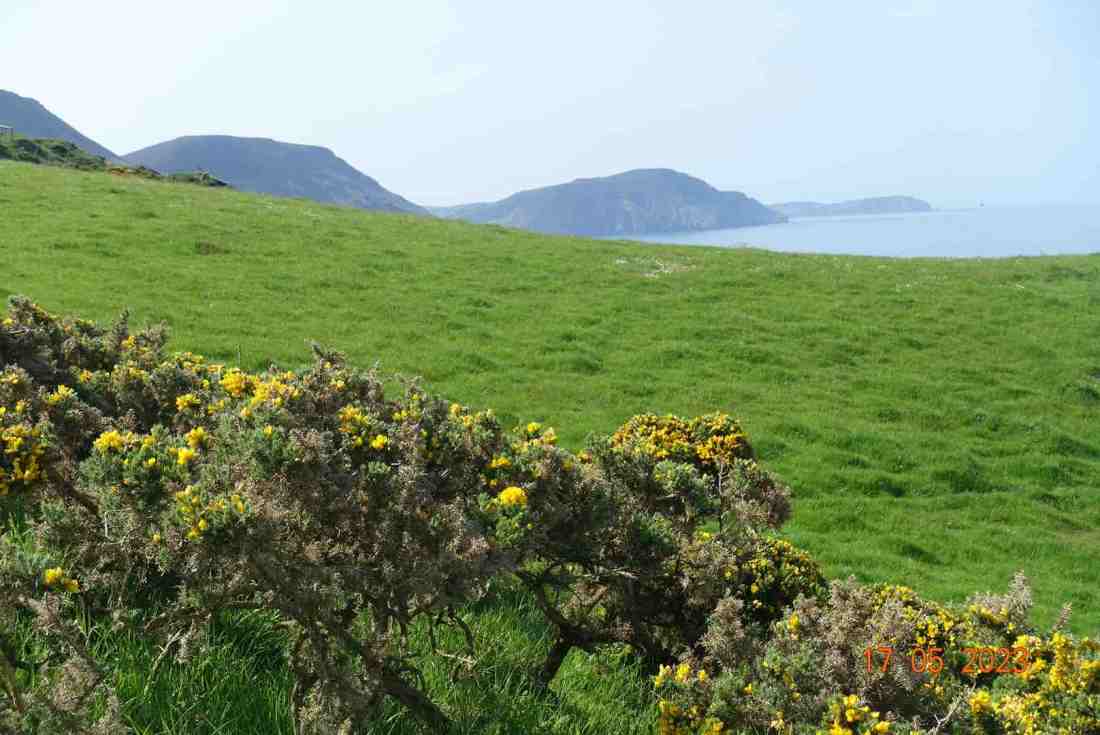
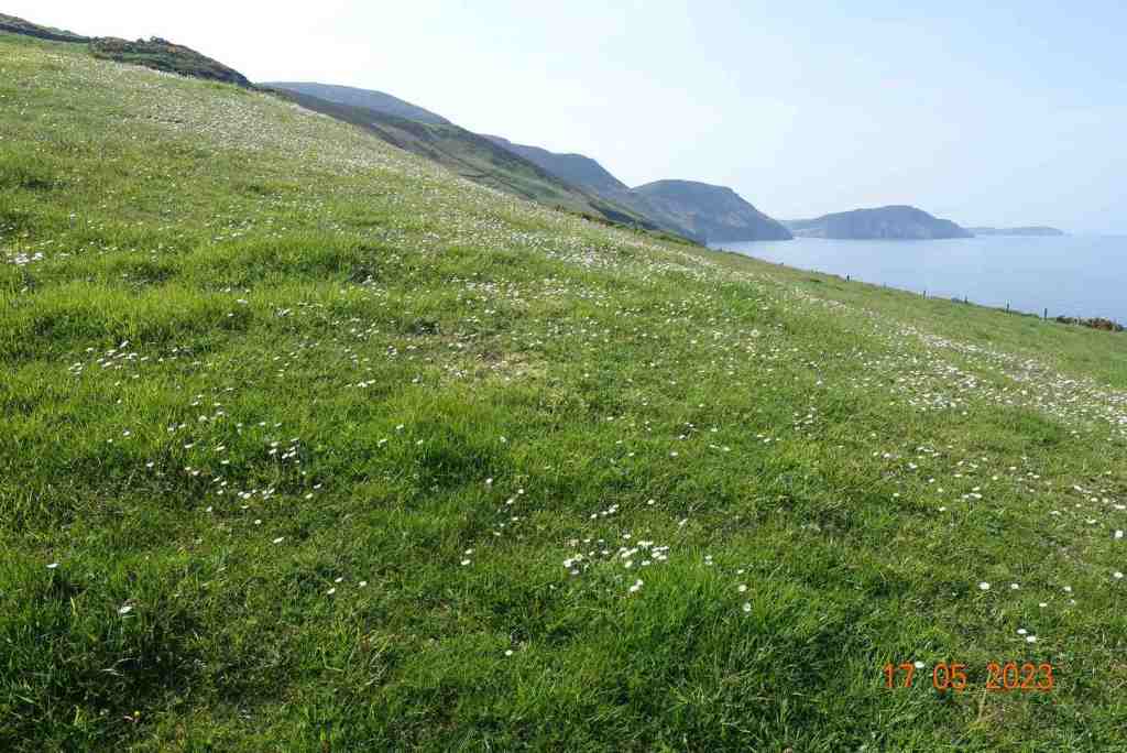
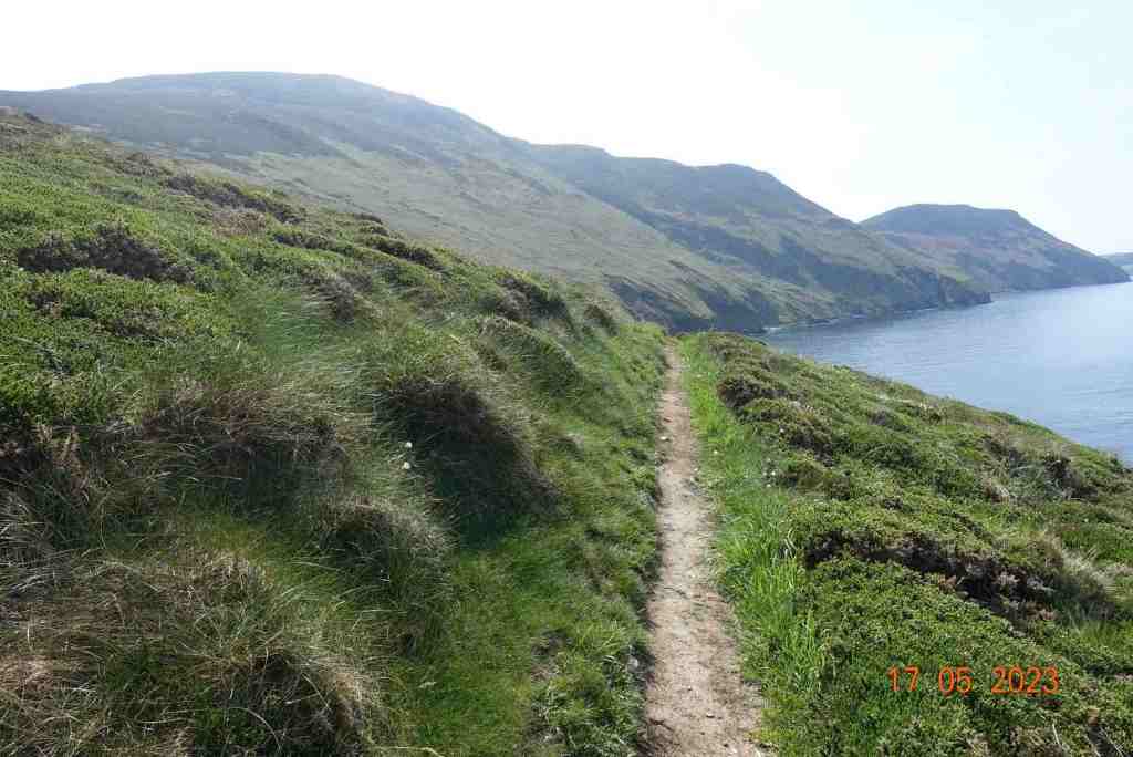
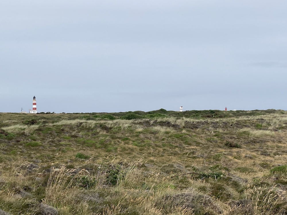
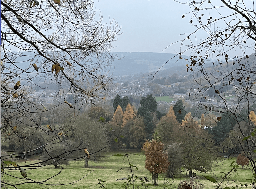
As it was Friday, this is my day for walking from home to Whitworth Institute at Two Dales. Depending on the route I take this is a 2.5/3 mile walk. I like the views from the Snitterton Road, which takes me past a cottage that I would rather like should it come up for sale. I took this same road up to Oaker, then rather than go up and over the hill I took the lower route into Darley Bridge. After this, I played table tennis for an hour and then sought out a different route home.

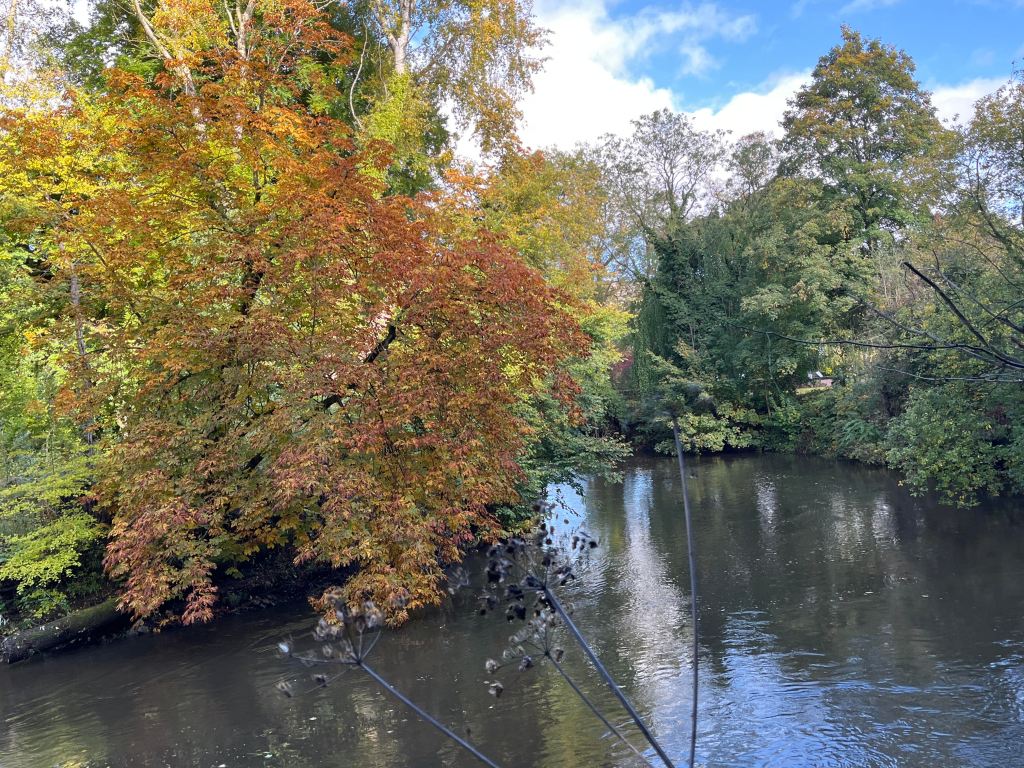
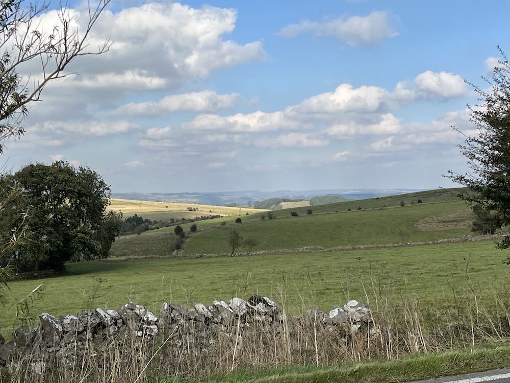
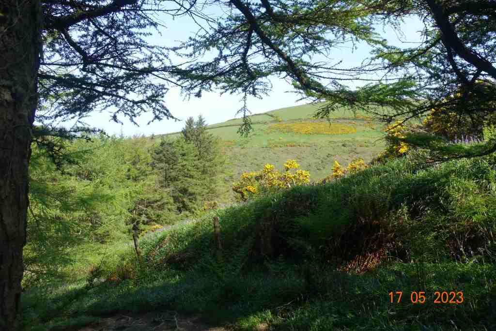
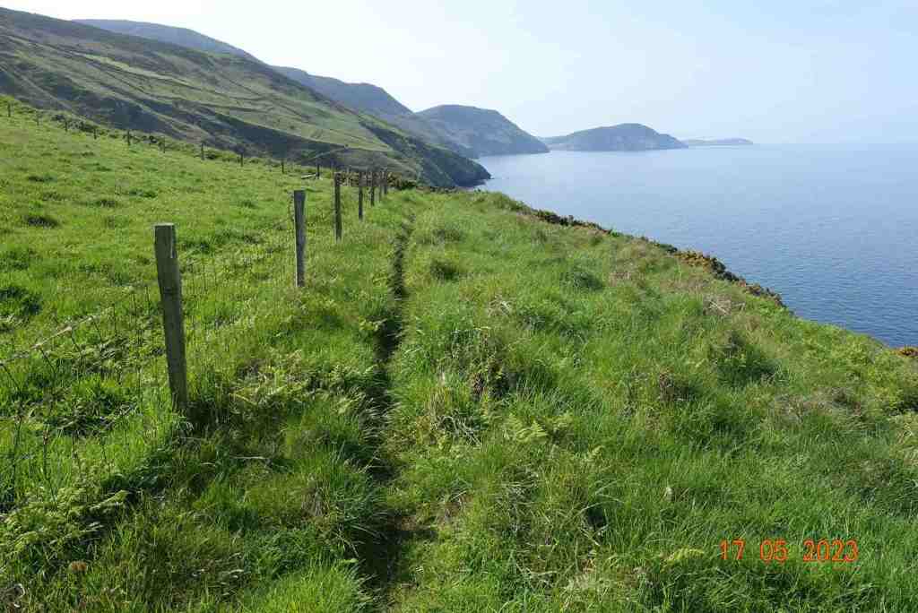
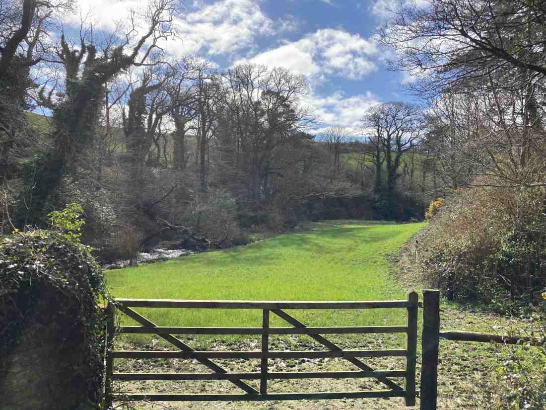
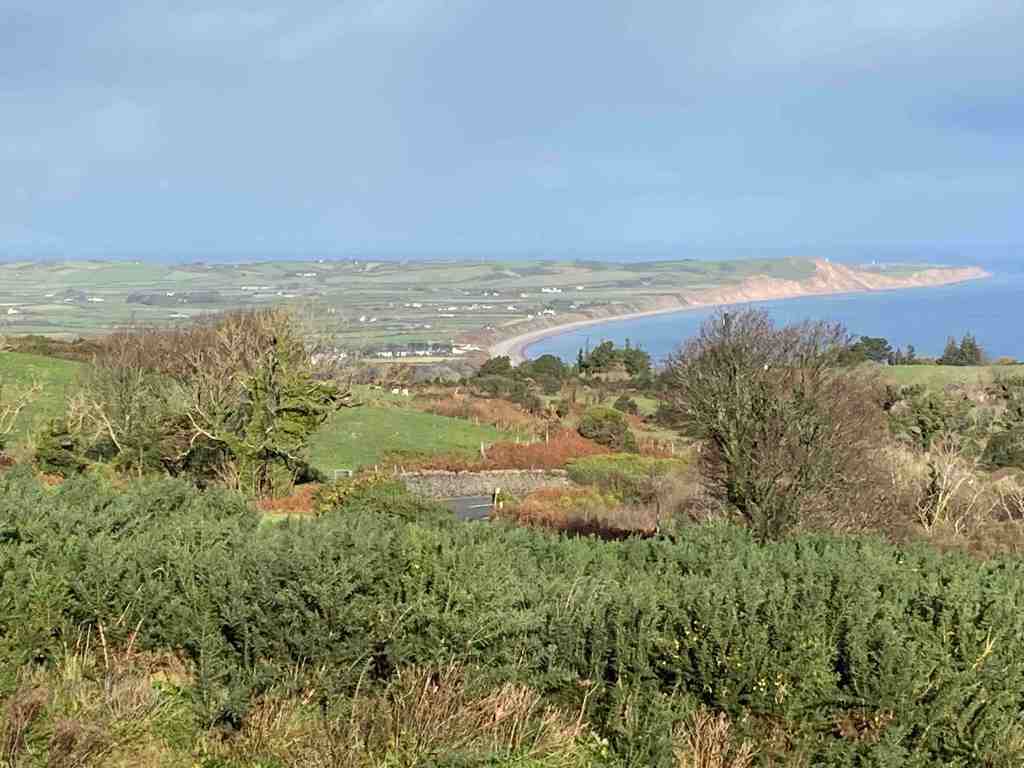
I wanted to take a look at properties in Two Dales, thinking that may be a good area to live, as if just slightly up the hill, houses will catch the evening sun. So, after a quick shop to buy baked beans I crossed the road and walked through the village. I was slightly surprised that it quite flat, until it is no longer flat as it turns into Syndcope Hill, but I turned off before that point. I had spotted some reservoirs and some woodland that looked worth a visit and I was not disappointed.

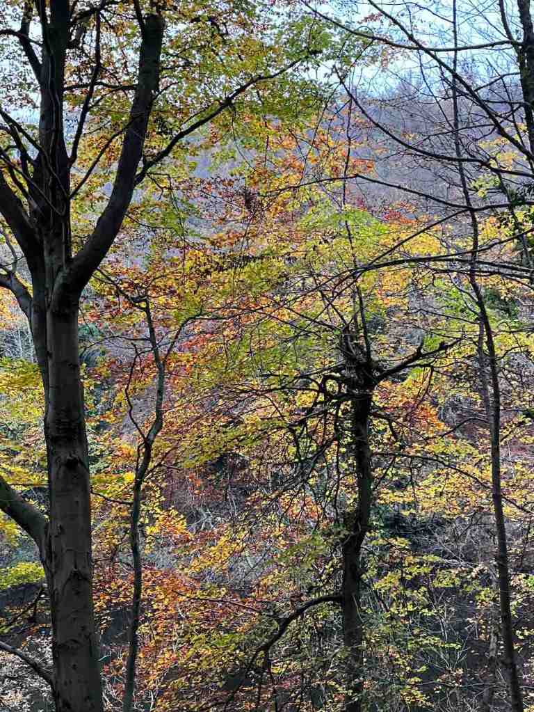
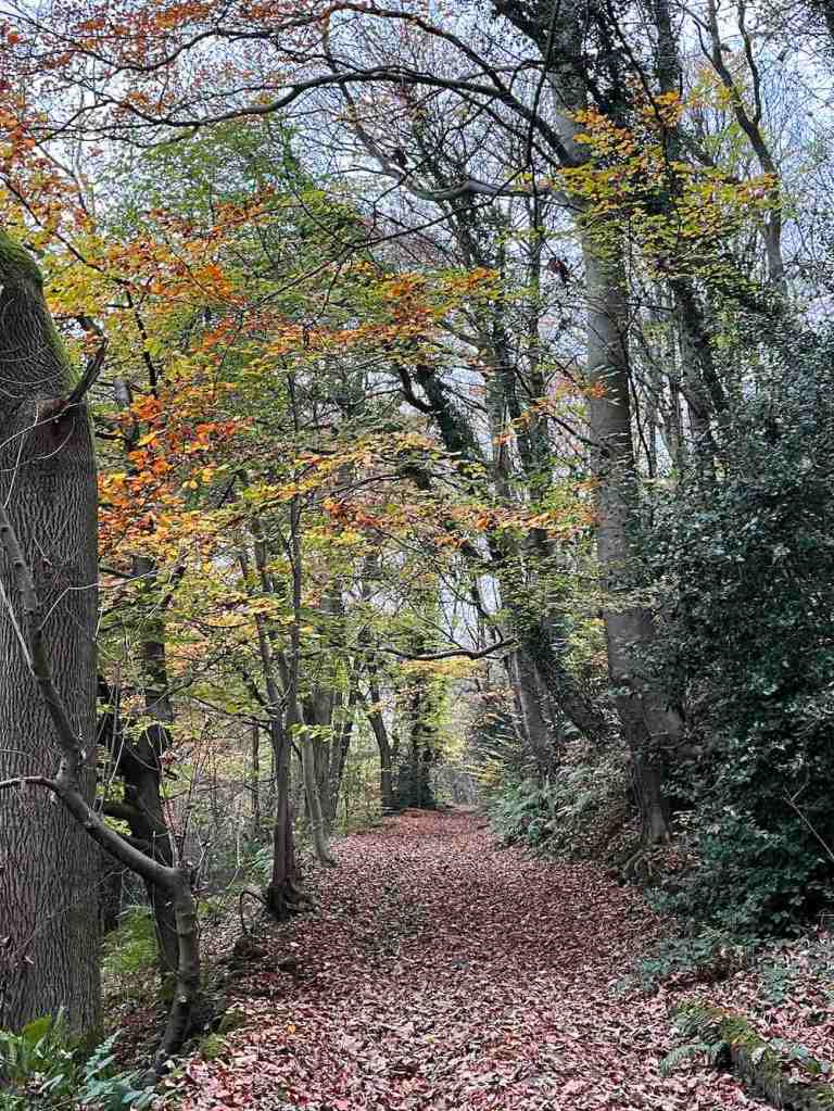
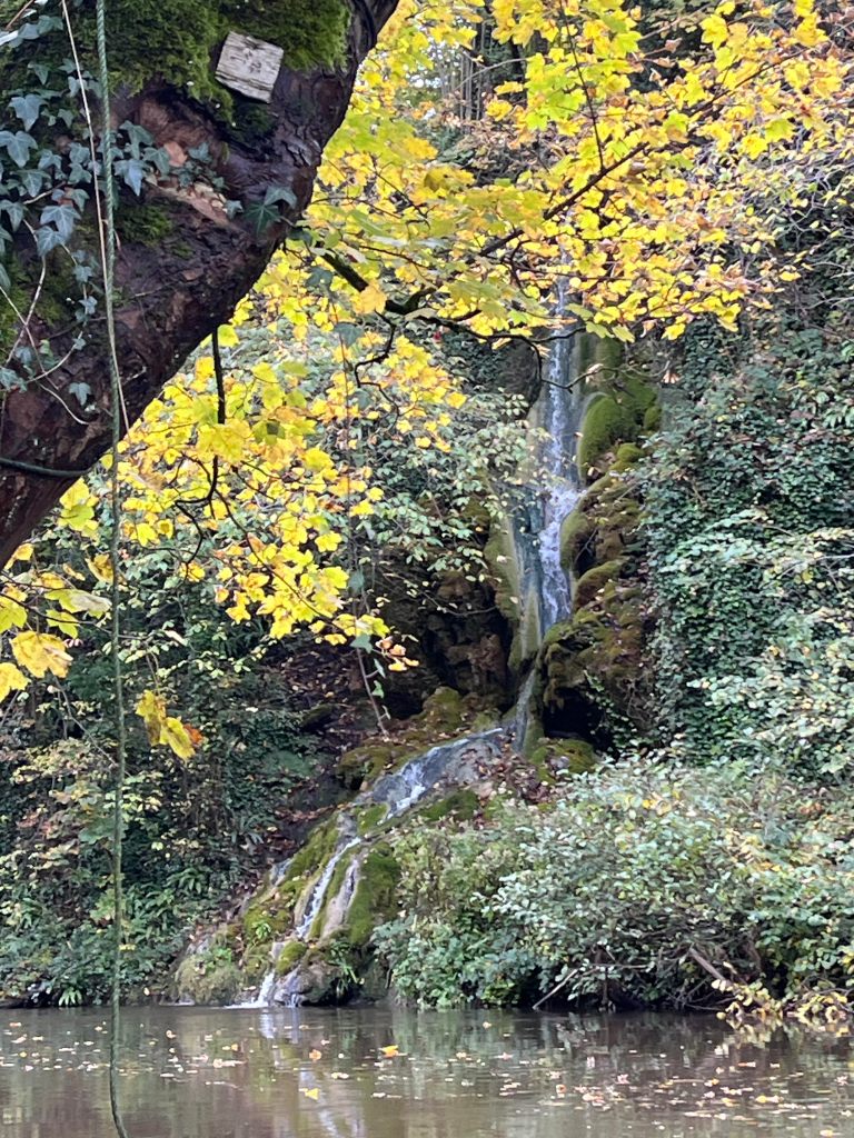
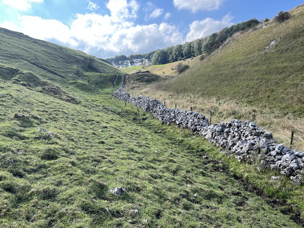
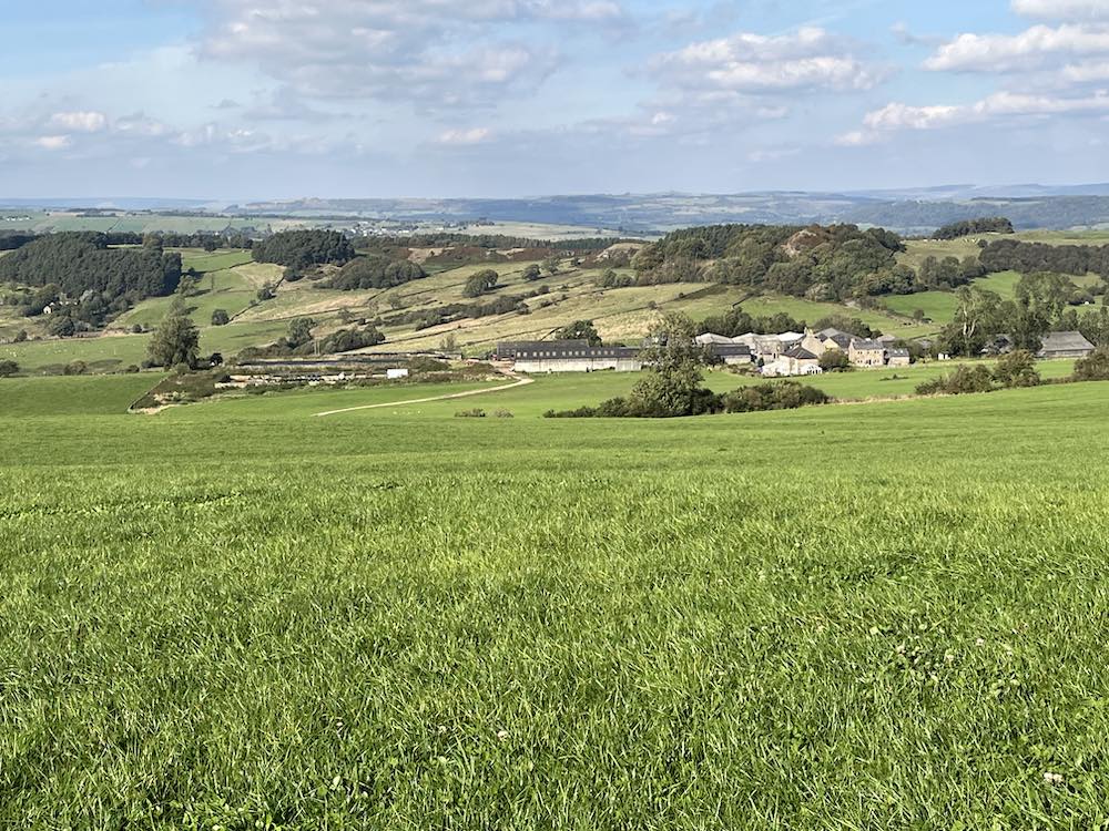
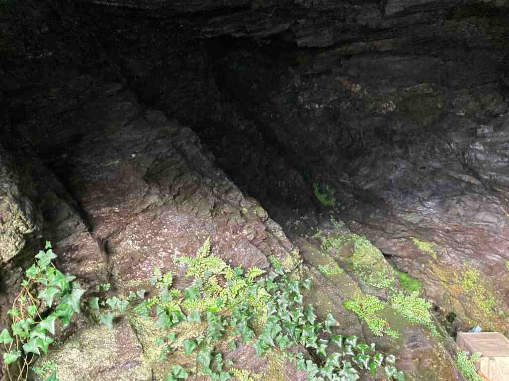
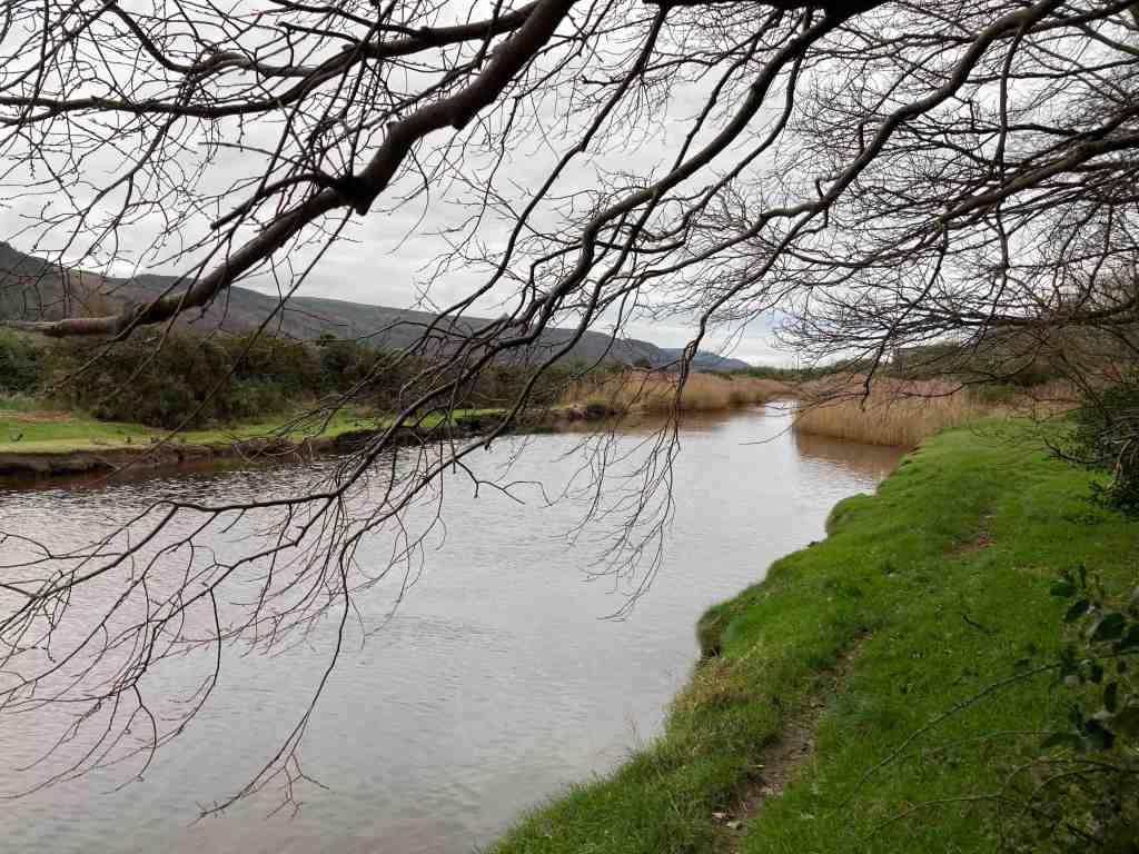
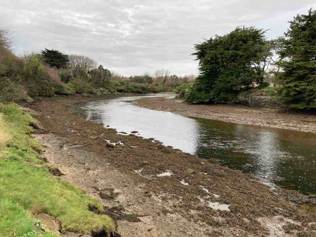
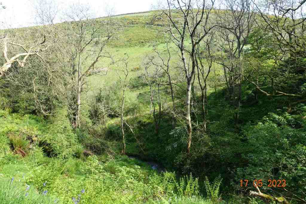
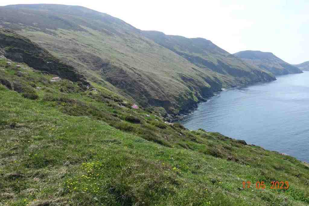
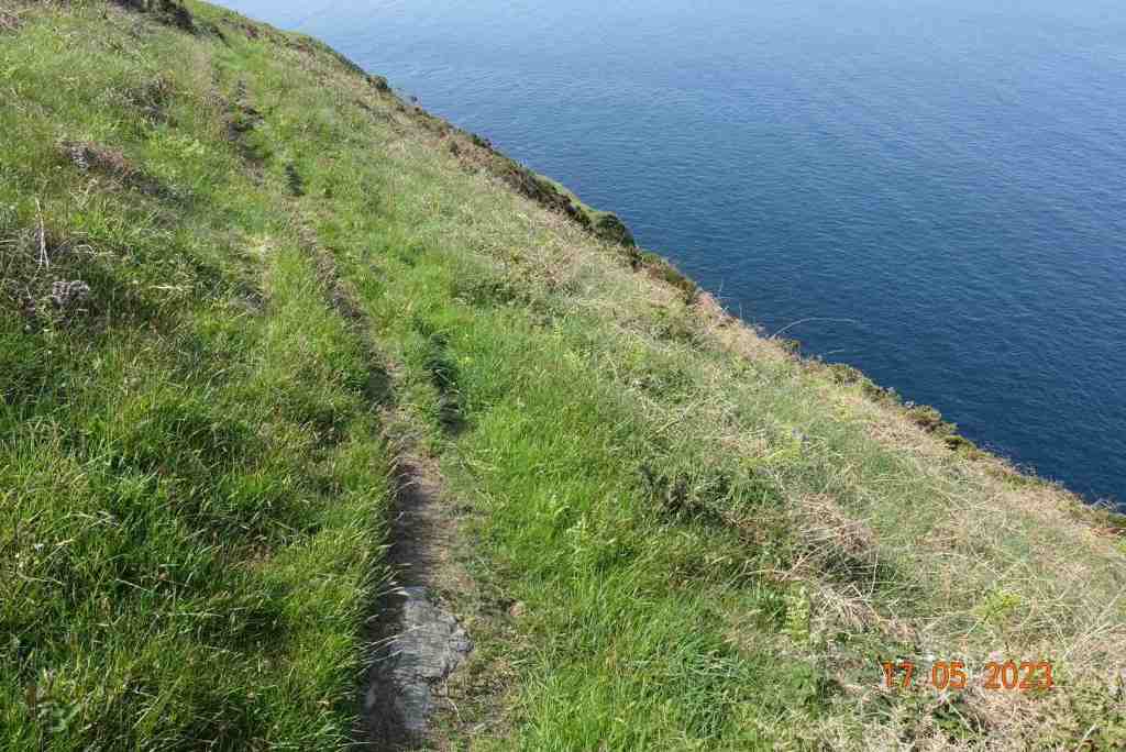
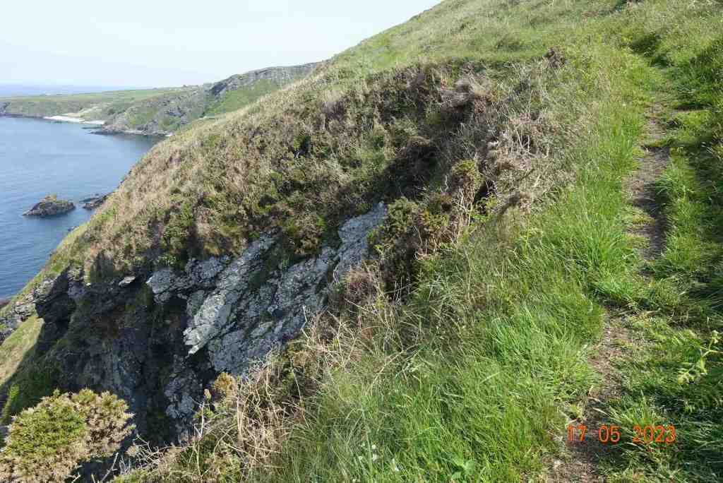
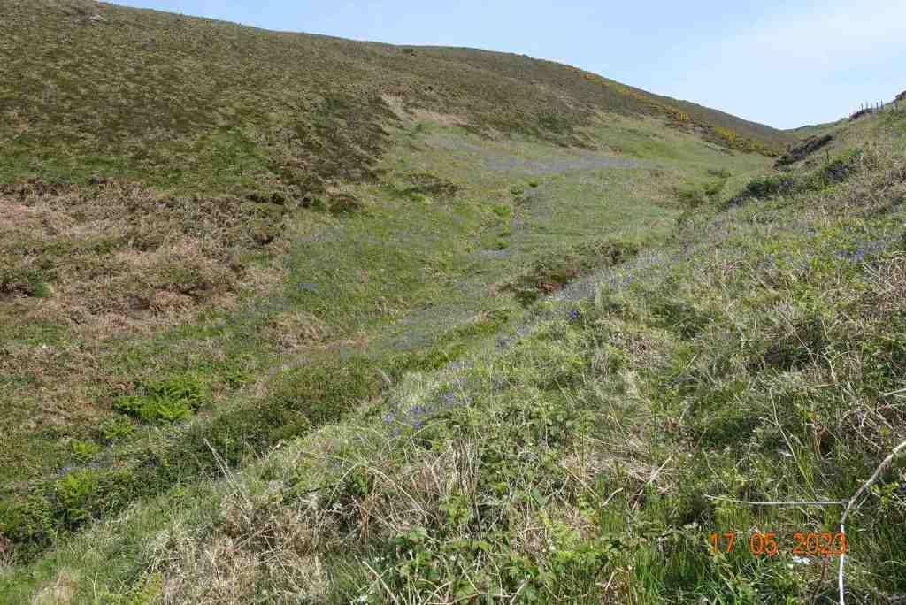
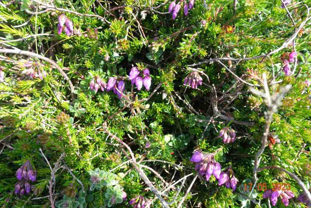
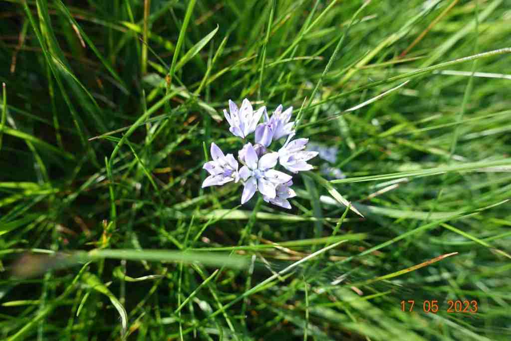
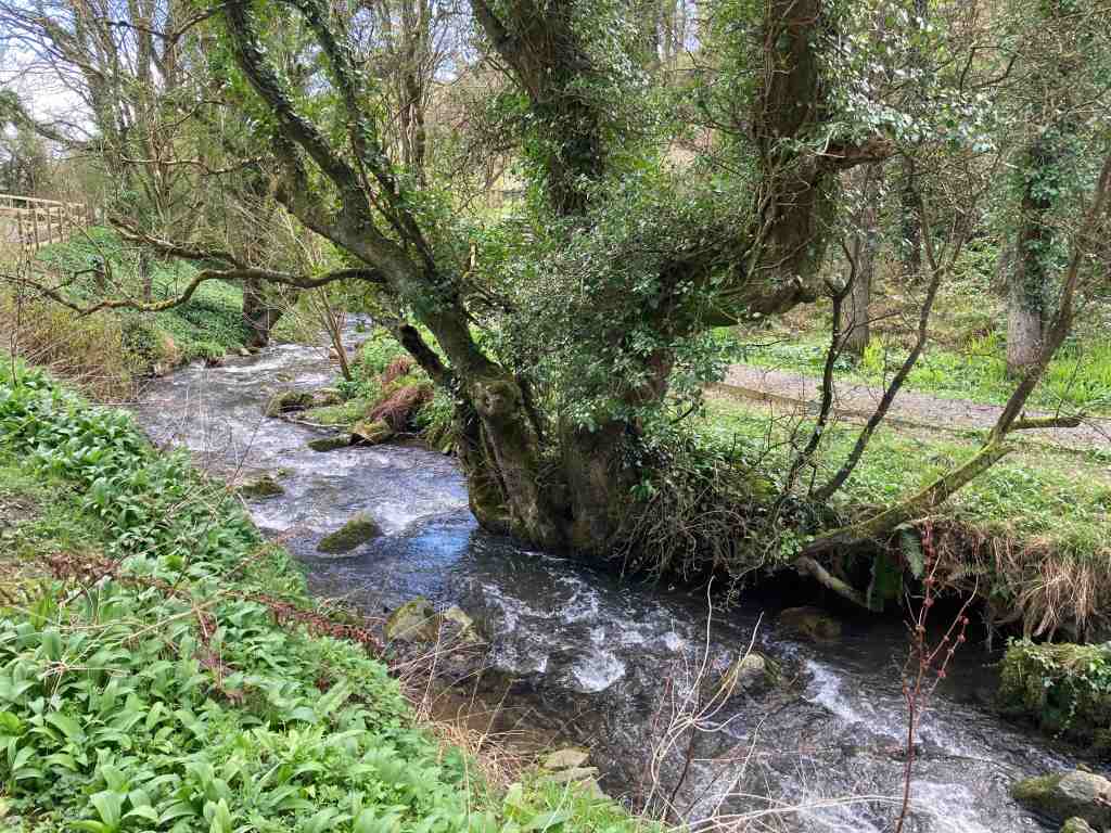
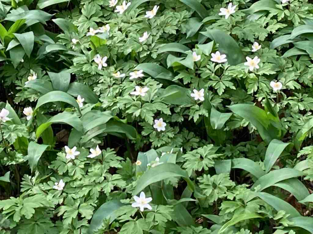
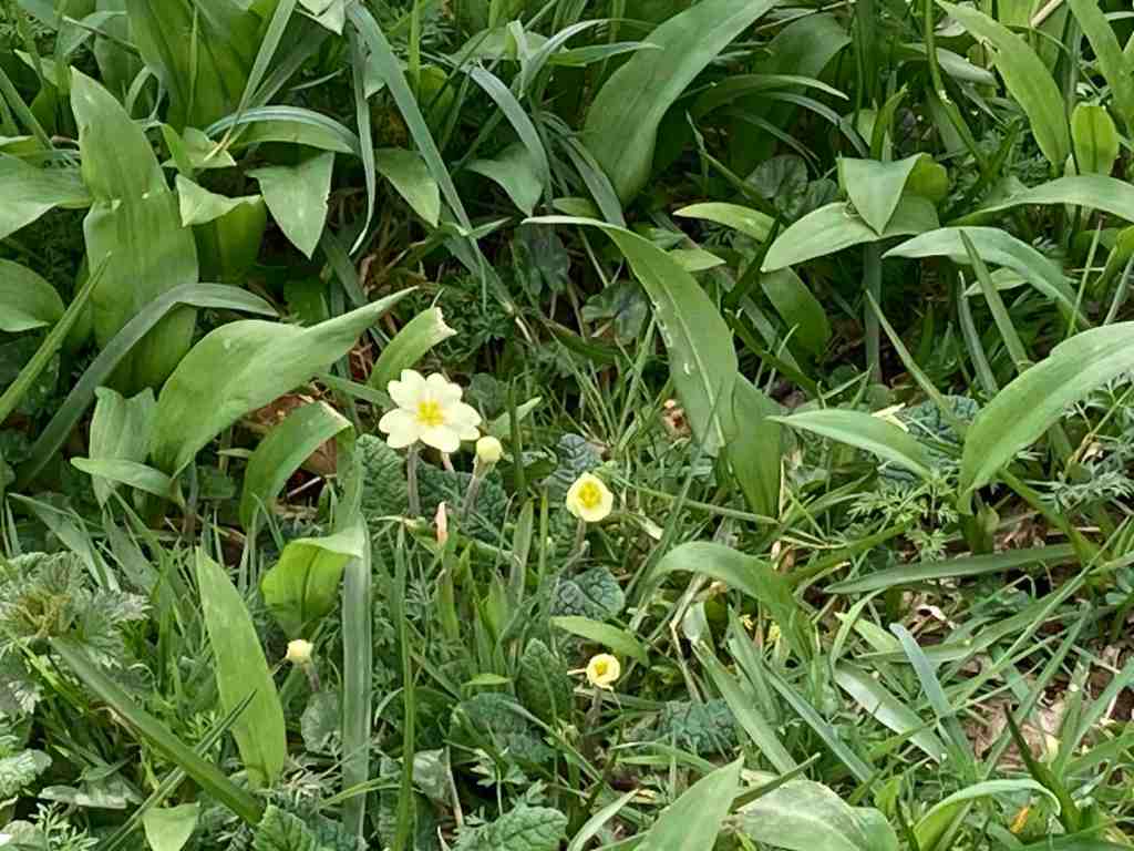
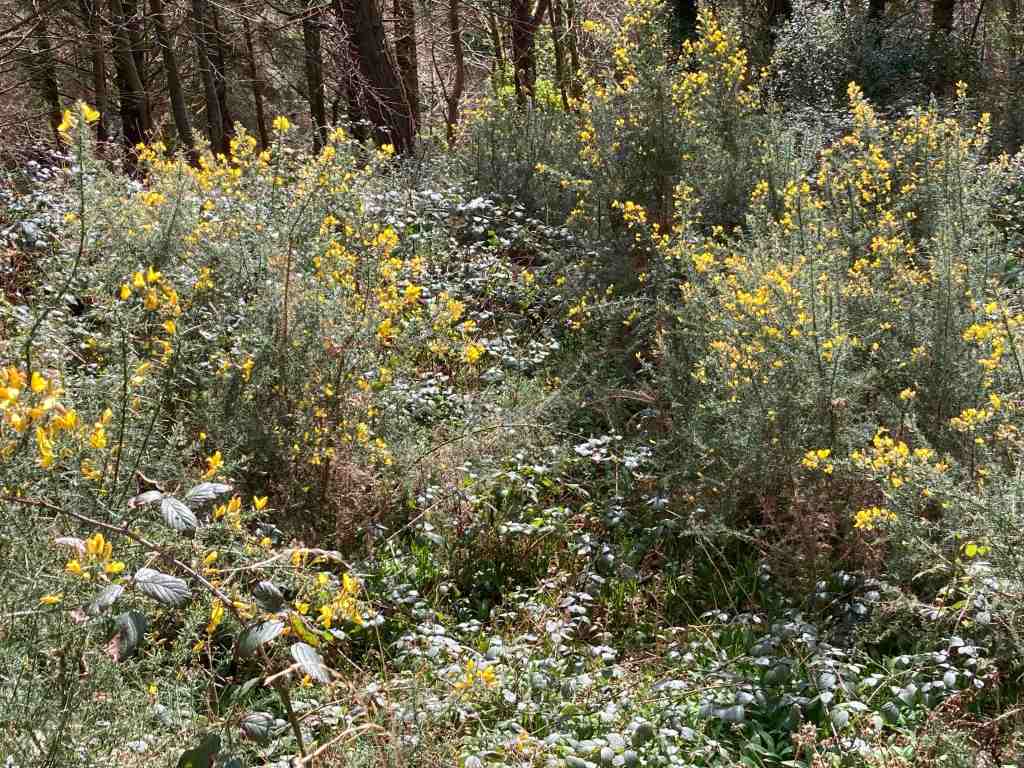
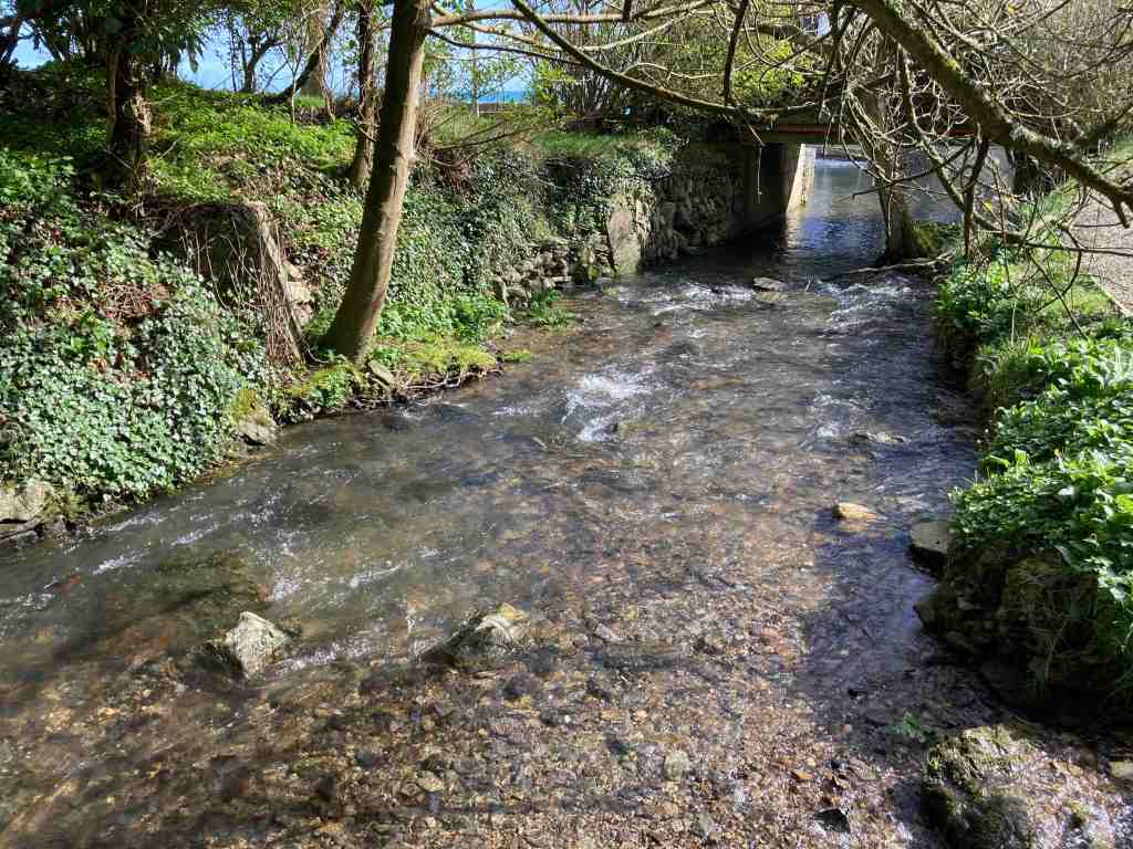
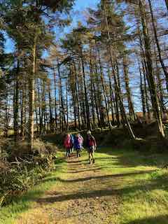
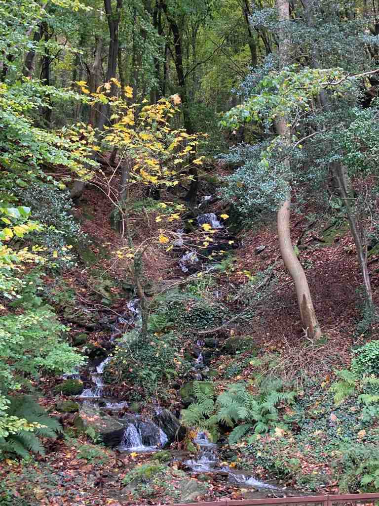
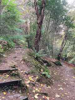
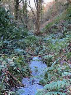
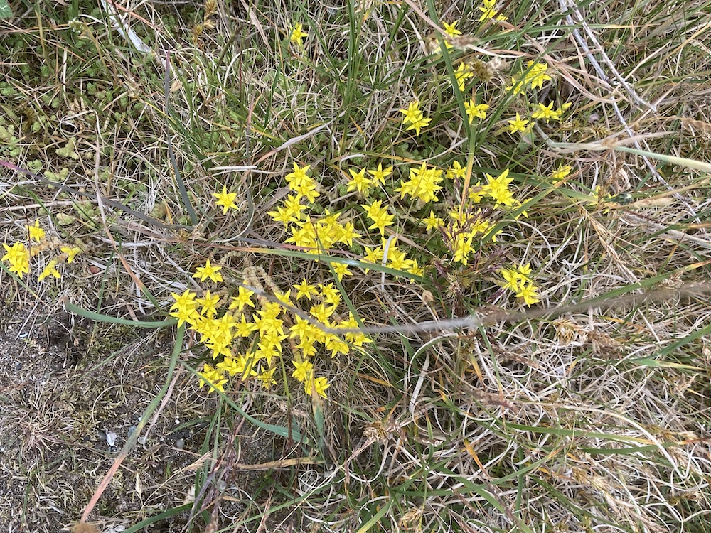
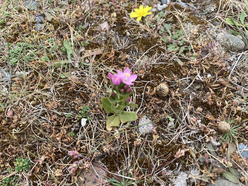
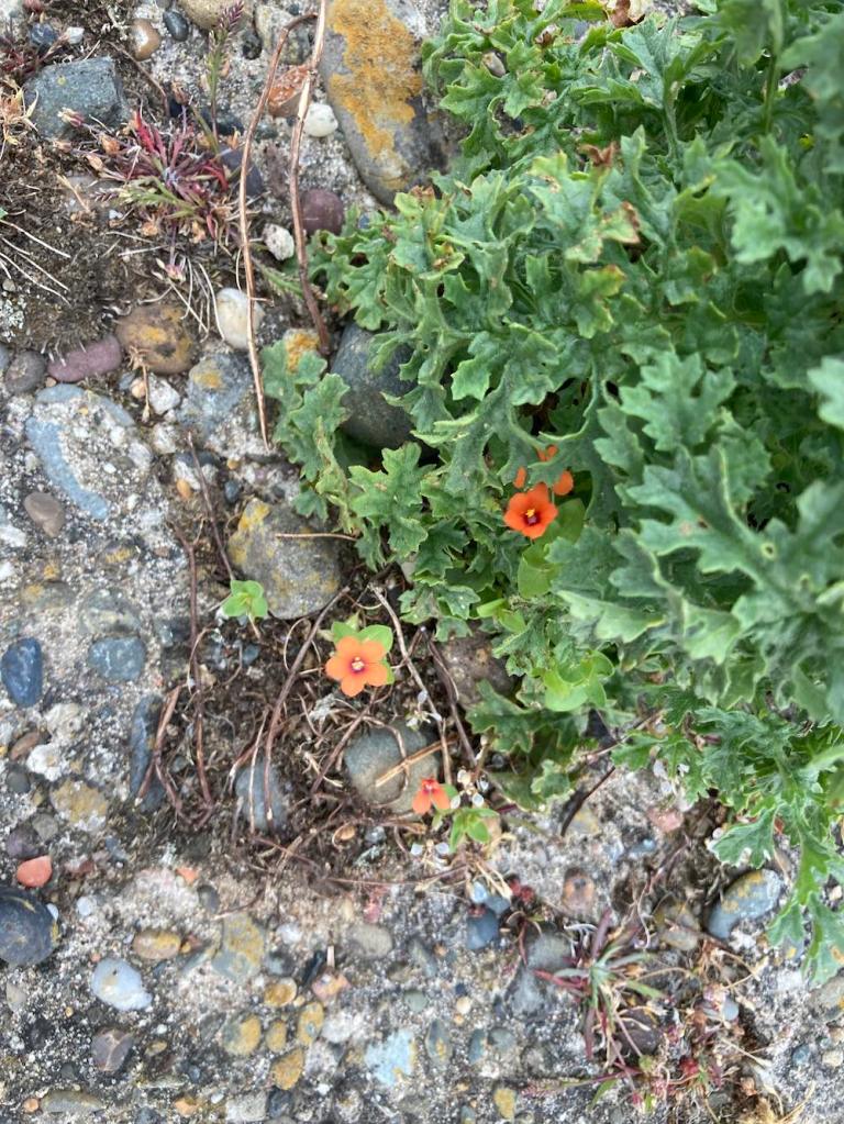
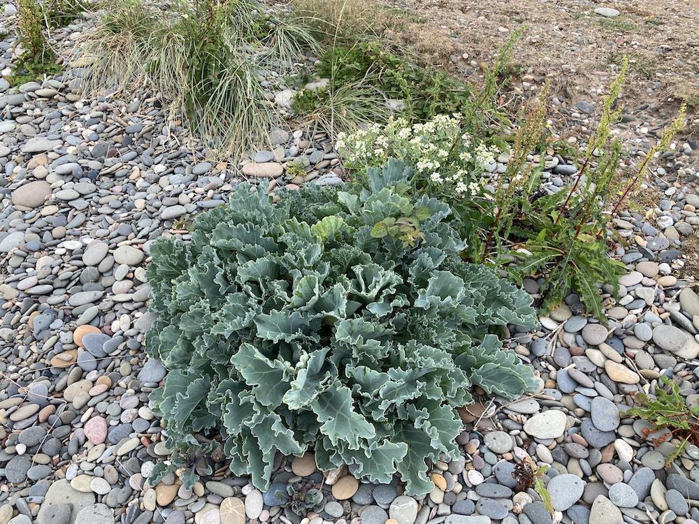
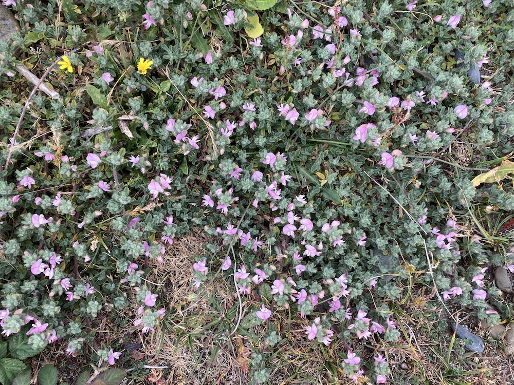
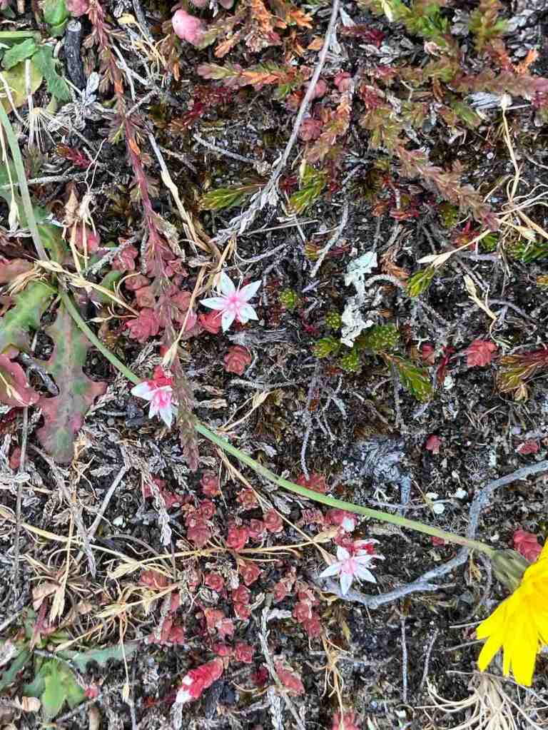
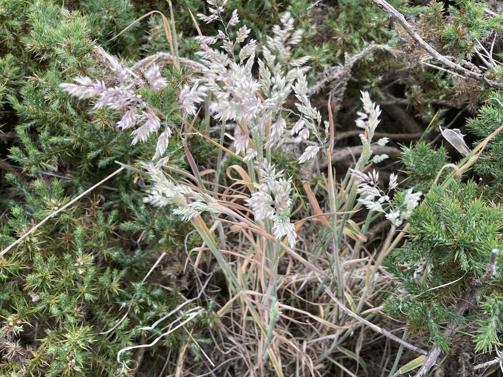
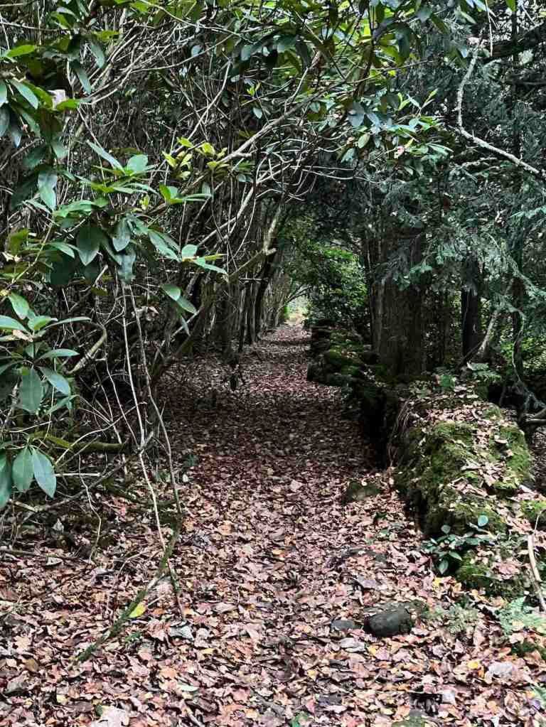
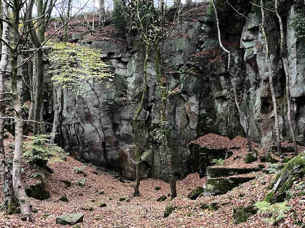
Ladygrove woods are mostly beech and you can imagine the beautiful colours on the paths carpeted with leaves. The first ‘reservoir’ is visible, but the path thereafter goes high above other waterscapes, so the others are barely visible. The path is narrow and a little uneven and every now and again you have to jump over a small stream. There was a lot of water in these streams given that is hasn’t rained for some time. The other surprise were some boulders and cliffs, looking very similar to Charnwood Forest. Presumably, these have been quarried but I don’t know the history of this area.

I realised as I was travelling the kilometer or so up the valley that this may not have been the most sensible plan as the daylight was fading and I was on uneven ground and didn’t really know where I was going, so I increased my pace a little until I reached the furthest point and then I returned via a higher route, still lovely, but not quite as attractive as the lower route.

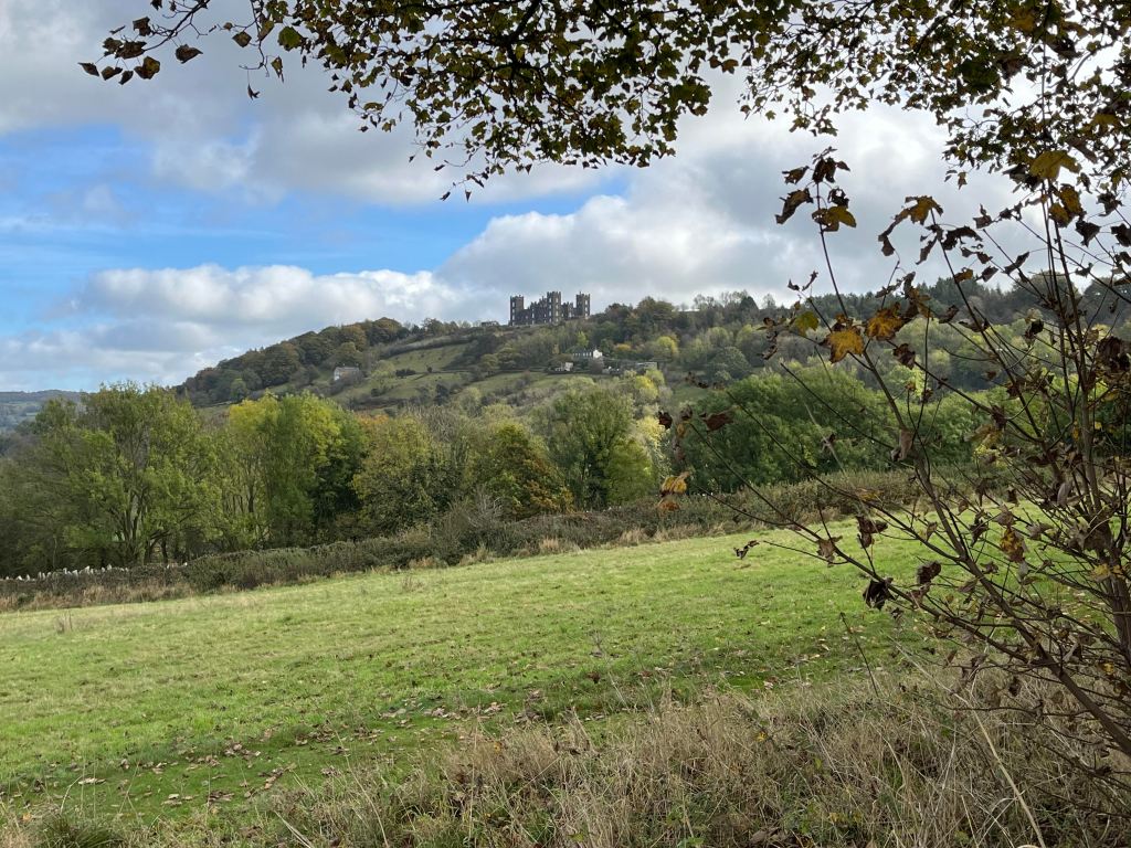
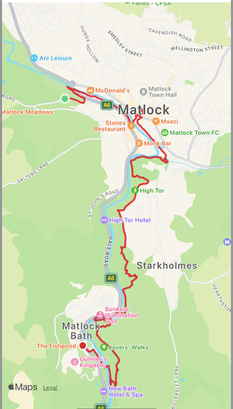
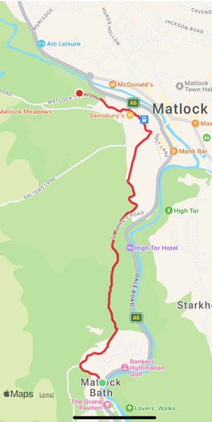
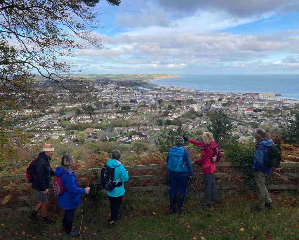
From this point, it was mostly road walking through Upper Hackney before taking a nice footpath downhill towards the back of the hospital. This area is still unspoilt and marks the edge of Matlock. The next path downhill that I took, beside an old woodland, was immediately adjacent to relatively new houses and ultimately led down to the main road beside Valley Lodge Care Home. The traffic into Matlock was completely blocked up from there, and that must be almost 1 kilometer to the roundabout. I think I’ll settle for my flat from which I can walk everywhere most of the time. It would drive my potty having to deal with traffic jams day after day.

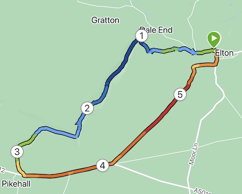
Total distance: 7.5 miles; morning 3 miles; afternoon 4.5 miles. Total ascent (afternoon): 505 ft; descent 476ft; total time (afternoon) 1hr 45 mins; moving time 1hr 34 mins.

You could do the afternoon walk using buses to and from Two Dales into Matlock.

Matlock to Matlock Bath Circular

My intention was to have a gentle stroll in a southerly direction along the river Derwent as it was a lovely sunny day, with gloomy forecasts for the next few days. Those of you who know me won’t be surprised to learn that it became more of a hike, taking in paths I hadn’t been on before.

I began by walking down by the river into Matlock and doing a few chores. Then I had a pleasant stroll through Hall Leys Park and Knowleston Gardens. The autumn leaves are stunning right now and I stopped many times to admire the views. I couldn’t stop myself from trying out the odd footpath but these mostly ended at a dead end and a shaft entrance to the former lead workings. So, I carried on around the bends until I saw a footpath sign to High Tor. This hadn’t been on my agenda, but the thought of walking along the noisy A6 really was not appealing.

So, I headed off uphill towards Starkholmes and took a clear footpath to the right that I would follow all the way to High Tor, getting glimpses into the beautiful, if noisy valley every now and again. The views to the left of Riber Castle were excellent. Once at High Tor, I took a path marked ‘Caution’ and ‘Viewpoint’. The cautionary notice is that there is a significant drop off the cliff to the right and only a narrow path to walk along. Someone has very kindly fitted a handrail in certain parts to avoid obvious mishaps. This I realised is known as ‘Giddy Edge’. It is easily passable with care, but certainly care is needed for a short distance before the path enters the woods. From here, it is a steady descent all the way down to the cable car entrance for the Heights of Abraham.

I followed the path on the same side of the river as far as I could, as it petered out and I had to cross the bridge at the start of Matlock Bath and walk a little way down the awful A6 until I could cross back over. Unfortunately, Lover’s Walk was closed for tree repairs, so I went back on myself until I saw a notice saying the Nature Walks are taken at your own risk. The footpath lead upwards again right up to the very top of the woodland, providing wonderful views of the hills to the east and occasional snippets of views of Matlock Bath. I continued on this path as long as it would allow me to, but eventually I had to drop down into the woods and back to the river, where again access to the river is limited. I walked back to the Derwent Gardens bridge and through the gardens and up to the main road, intent on having a coffee and finding a bus back. So far, this was 4.5 miles.

Suitably refreshed after a bag of chips and a latte, I changed my mind and decided to walk back over the hills to Matlock. It is a stiff climb up a relentless hill until the point where the path goes underneath the cable cars. It is then a delightful walk, mostly contouring, all the way back to Matlock. Much of this is wooded until the final section where it enters fields where donkies and sheep munch side by side on the grass. A quick trip into Sainsbury’s and two ticks after that I was back at my apartment.

It was a really lovely walk, but it did tire me, more than I would expect of that kind of walk. Nevertheless, It is so good to make the most of the weather and to see the wonderful autumnal colours in all directions.

My stats are a bit different today as my Garmin battery had run out and I couldn’t find the charger, so I used Map My Walk to record the details of this walk.

Section A: 4.43 miles, with 435 ft ascent; walking time 2hr 11mins.

Section B: 2 miles, with 406 ft ascent, walking time, just under 1hr.

Elton, Gratton Dale and Long Dale

This was Saturday’s walk, or was it Sunday. You tend to lose track of time, when there aren’t appointments on the calendar and one day merges into the next. That will change as I become more involved in the locality. I have already met a few people with the U3A in Matlock, and I shall be going to table tennis tomorrow and out with a ‘short walk’ group on Saturday.

I had spotted Elton on my OS map and noticed that it had a couple of dales in easy reach of the small village. It is only a short drive away – no more than 10 mins – so perfect as a starting point on my epic ventures in Derbyshire.

I parked close to the church. The village is lovely, with old and new houses blending in well together. No shop, but that’s nothing out of the ordinary these days. I set off down the road and met my first obstacle- actually, the only obstacle of the day. There were two (at least) paths shown going off at the farm but on the ground the one I wanted didn’t exist. Unperturbed, I followed what I thought should be the right of way following a line of trees around the farm. It was very muddy – mud is something I am going to have to get used to. Then where to go to at the other end of the farm buildings? Still no footpath signs, so using my common sense I skirted around the easterly edge of the buildings, the ground been mostly slurry – not attractive! And then, I spy a gap in front of me as if I was supposed to know I was on the right track all the time.

From there, it was downhill into an attractive valley – still no obvious path – but as I had my trusty map I knew I was going in the right direction. Finally it became clear as I reached a gate with a signpost. I could also hear voices just ahead of me. At Dale End, very appropriately named, I turned left to see the owners of the raucous laughter. A small family, doing their best to cover up a noticeboard? Um… interesting? It turns they were the lead family in a massive group of 30 people on somebody’s 50th birthday spree involving a treasure hunt. The family were way ahead of their party and sabotaging all the clues :-). I was warned about mud, but I hardly needed warning after what I had been through already.

Gratton Dale is a mostly dry, narrow valley with low scrub and green hillsides. It was still quite green with only a few autumnal colours, and I imagine in spring it will come alive with flowers and birdlife. I did see several butterflies and squirrels, but otherwise it was mostly devoid of active natural life. I had walked for many minutes before I met the remainder of the birthday party group – they were very spread out, laughing and enjoying each other’s company. Again, they warned me about mud! See what I mean?

This part of Gratton Dale continues for about 1 mile, when it reaches an abrupt end, rather like a T junction, with a hill banking up in front and hills to either side. The path to the left is the quicker path to the main road, but I was still exploring the hills and dales, so I went up Long Dale to the right. Incidentally, there are some awkward stiles just here that require care when climbing over. My old IOM walking Whatsapp companions “No, Not Another Stile” would no doubt be shaking their heads 🙂 .

Long Dale was short but lovely. There was a sense of timelessness about it, of people walking along these tracks from place to place with their sheep or youngsters frolicking about on lazy Sundays. I enjoyed it very much. All too soon, it was time to go into the western section of Gratton Dale. This was more open than the eastern side and followed a low stone wall all the way along, presumably a boundary of someone’s land. As I reached the end I was met by a herd of cattle who were clearly not going to budge so I had to elevate myself above them to get round. They didn’t even ‘moo’ to acknowledge my respect for them.

The next mile is very boring in one sense, in that it follows a main road. There is no real alternative, but once off the road it is plain sailing on grassland and ploughed land, and no stiles. It’s also in a dead straight line, so you barely need a map going from field to field. This time, you just have make yourself very slim to sidle between two stone posts. The birds were in their element here, lots of them, nesting? in the low growth. I couldn’t work out what birds they were. I did try, but my App gave me silly answers. One of the very large fields had only just been ploughed so I had to blaze the right of way through it, just in time to meet the 30 party-goers again on their way back to Hollybush Farm. The views all along the main road and into these fields is amazing. You need see it to appreciate it, as the distances are too big for a photograph.

From the high open fields, it is a gradual descent into Elton. There was a surprising number of wildflowers, including the tiniest primrose I have ever seen, on the very windy upland part of this walk.

This is not a long walk, but was fairly strenuous with the mud and rocks in the valleys. It’s one I shall look forward to doing it in other seasons, if I can find a better way around the farm at the start.

STATS -Distance: 5.66 miles; Total Ascent: 568 ft; Total Descent: 479ft. Total time taken 2hrs 26 mins; walking time 2hrs.

Screenshot

Around the coast at Port St Mary

I was out today with a small explorer group from the island, having been enticed by the title “Caves, Cakes, Coffee and Reindeer” walk or something like that. Don’t get ahead of yourself, we have no reindeer on the island; our host had very ably made some buns to resemble reindeer, it almost being Christmas, and very successful they were too.

I can’t tell you too much about this walk as our host, Andy, wants to keep his ‘secret places’ secret for others to explore and to this end, the hidden places should remain hidden. However, it is no secret to say that we parked at Kallow Point in Port St Mary on an extremely blowy day to start our walk. When we arrived, it looked as if it was already high tide as the waves were crashing about the shore, but high tide would still be a few hours away.

We walked towards Perwick and along the shore, scrambling over rocks where necessary and where we encountered a stranded and decidely dead Porpoise, having got beached in the massive overnight tides. It otherwise looked healthy, but the rocks round here can be treacherous as you can see in the photos. I won’t be giving too much away by saying that there are a few caves along this stretch of the coast, but you won’t find them unless you do a bit of adventuring. Similarly, there are some hidden beaches, and again, you won’t find them by sticking to the coast path. Unfortunately, the weather was just too windy to risk going down to some of the secluded beaches, which would have required fairly steep and rocky descents whilst fighting offshore winds, so we satisfied ourselves with knowing where they are for another time.

Our host was very knowledgeable and pointed out different types of rock, provided us not only with cakes and coffee but scavenged sea spinach from the cliffs encouraging us to taste a morsel of this salty herb. There was plenty of sea glass amongst the pebbles that interested some and some fascinating patterns in the stones, one in the shape of a cross on all sides. He told us about a hidden lake, so hidden that it is impossible to find unless you have a boat, so please don’t go looking for that! If you fancy a walk with a difference, they have a website and a FB page with details of forthcoming outings: https://www.facebook.com/happyexploreriom/

To finish, here are a few photos, none which should give away too much 🙂

Ramsey – Poyll Dooey (Black Pool) Nature Reserve

It seems a long time since I posted here! I don’t know what it’s been like where you live, but we seem to have had constant rain since July here on the Isle of Man, with only brief respites in between deluges. When we do have nice days, and they do occur sometimes, I am usually busy working. So, it was a delight to get out and up to Ramsey to do a recce of a very short morning route I am leading in 10 days.

This 2 mile stroll is our build-up for our U3A Walking Group’s Christmas meal. We are having an afternoon walk later after our slap-up meal. Indeed, this will be my last walk for the U3A as leader and organiser of this group as I have decided to stand down. Parking at Milntown, it is easy to cross over the road and walk down Gardener’s Lane before turning onto the old railway track and heading east towards Ramsey. In the past, this must have been an attractive stroll, but the first half of it goes between newly constructed houses, and it is only when it reaches the outskirts of Poyll Dooey that the old track regains nature on either side of the path. The walk starts at the very end of the track, where it joins a road where you can see the river on the left. The views of the river are beautiful in both directions. It is a tidal river, constantly bringing crustaceans and worms into the mudflats that are exposed at low tide. The mudflats then turn into a salt marsh, an unique specialised environment that allows grasses and herbs to grow that cannot grow elsewhere. This in turn encourages a variety of wildlife that can feed off this specialised turf and soils. It is also beautiful, and unexpected being so close to the town.

There is a variety of paths through the Nature Reserve, which is a recent creation. It was formerly an old tip, as recently as 1988. It just shows what can be done with a bit of imagination and dedication. It is a small area of only 12 acres but it packs plenty into it. The woodland is still quite scrubby, with the exception of the Secret Garden area that has been specifically planted with a variety of trees. Some parts are protected and therefore inaccessible; imagine, if you were to come back in 50 years I think this will be a very special place.

I followed narrow footpaths over the salt marsh so that I could follow the river as much as possible. Please try and avoid walking all over it and keep to the side as much as possible. Dogs are allowed, but better not to let them dig up the area. There is plenty of room for them to be off the leash in the woods themselves. It is not long before it is necessary to go into the woods and you will find yourself at the wooden footbridge, where there is usually a mass of ducks, geese, swans and the like. Today, they sounded just like a load of girls giggling in the playground. They were very funny. In the sheltered areas, especially in winter, you may be lucky enough to spot a kingfisher, a species which is declining on the Isle of Man, so if you do see one, please let the Bird Club know.

Crossing over the bridge you can walk a short distance westwards to admire the river and distant views; the river may contain trout and salmon as well as all the bird life. Further along is a mass of reeds, where I imagine birds nest or gather material for nests. It is not possible to go further in this direction but it is still worth a look before retracing your steps over the bridge.

It is possible to take a different route back to the start through the woods, going past the impressive 6 bedroomed Poyll Dooey House. This is entirely surrounded and hidden by the nature reserve, and part of the house goes back to the 17th century. If you do an online search you will find photos of the interior and exterior on the deanwood.im website. How the other half live… These buildings comprised one of the original quarterland farmhouses – a quarterland being a unit of farmland, usually arable land. Its boundaries would have extended all the way to the Ramsey to Ballaugh road in ages past.

From here, it is simply a matter of following any path; you cannot go wrong. They all take you back to the railway track one way or another. It is worth visiting this area during the different seasons and noting down what different birds you see and hear, and perhaps bring a picnic in the summer months. And don’t forget to visit Milntown itself – the house and gardens are open most of the year and they serve great lunches and afternoon teas, and the gardens are a delight.

Langness

You know how writers and walkers all say that no two days are the same at the same location, well this is certainly true of this walk. Last week I was here with my grand-daughter, Emily, and the tide was satisfyingly in; yesterday, the tide was interestingly out, carving out a completely different landscape.

I was doing a recce for a walk from Castletown. If this is a walk you are planning to do, don’t take your car into the main streets and car parks of Castletown as there is only 2 hr parking. Instead, take the road to Derbyhaven and park either along the prom, or in one of the free car parks on just the other side of Hango Hill (above), opposite King William’s College. I had taken the train, so was walking from the station. However, I would recommend this walk to start at the first car park after Hango Hill. It is only a short distance back to explore this ancient monument before retracing your steps to start the walk.

As you can see from the photographs, if the tide is out, you can walk along the beach. Even so, there is a grassy footpath from the car park which is good to follow. It bypasses Derbyhaven and the start of the golf course, making a more interesting start to the walk. There are a few pebbles on the path as these are constantly thrown up by the sea, but it is easy walking. Eventually you reach the small lane and you are obliged to walk along this most of its way, but no more than half a mile or so. It is very quiet and there is lots of vegetation, birds and butterflies to look out for. You will pass the stone bird water trough commemorating one of the island’s principal ornithologists and you will very likely see Egrets or Herons perching on the rocks around here.

A little further along is the main car park for Langness and it is here where you enter the reserve itself, the paths taking you round the very tip of Langness. To your right, you will see strange rocks of conglomerate, arches looking as if they will collapse at any moment and notice areas of unconformity where millenia of rocks have miraculously disappeared. I am no geologist, but this area is described in many of our local books if you wish to find out more. If you are feeling adventurous you can scramble about on the rocks to the west as they dip and turn, but take care, not just of your footing, but make sure that you don’t get cut off by the tide, unless you want to join the shags and cormorants on the very last morsel of rock remaining at high tide!

The path takes you around the lighthouse, where you can take a look at the old foghorn. This is the most southerly point on Langness. It is a good stopping point for lunch, which is exactly what I did yesterday. As I sat muching away I heard the lamenting sound of a seal and got out my opera glasses (yes I know, proper binoculars would be so much better, but these fit into a side pocket). There they were, some lumbering about on the rocks, others swimming in the sea. As I continued on the eastern side of Langness there were even more seals. They do seem very big this year.

The eastern side has a different feel to the western side. The terrain is soft underfoot with more varied rocks landward and more gullies with sharp upright rocks on the seaward side. There is gorse and heather setting off the herring tower, and as you walk the mile or so towards the golf clubhouse you get amazing views of the range of hills all the way from Bradda Head to North Barrule. The path eventually goes onto the golf course itself, so keep towards the edge. There is plenty of room to walk beside the course rather than on it. However, to get to the clubhouse you do need to cross it for about 50 yards, so watch out for flying balls.

The golf club welcome visitors and the food is always tremendous so don’t be shy about calling in. The rest of the walk takes you around the glorious bay of Derbyhaven and then back along the road for about half a mile to the car park. There are few places like this on our island, and I thoroughly recommend it for a morning walk, a lunchtime walk, or an afternoon walk. Keep in mind, it can be very blowy as it is mostly flat with just a few humps and hollows. You will also be walking in a southerly direction so the sun can be a problem on the odd occasion it shows itself.

The total length of the walk from the Hango Hill car park is about 5 miles.

West coast walk near Niarbyl

What a way to refresh your soul. I have been working flat-out for a few weeks now and had set aside today for a complete day to myself, without any students, without looking at emails or marking work. I had not anticipated such as treat as I started off through Kerroodhoo Plantation, having parked off the road at Dalby Mountain Nature Reserve.

The sun was shining and it was a warm day as I ventured into the eastern edge of the forest. It is always a delightful walk, no matter what time of year, but as the sun glinted through the trees, it was very pretty; even more so when, rather like Wordsworth daffodils, I came across a sudden drift of bluebells, that went on in all directions. I took photo after photo but show you just two here. Although the path is only partly marked out on the map, in practice it continues all the way to Barrane. In places it is a little muddy and in other places slightly steep. If you are slightly infirm of foot I would definitely use a pole to help you down safely, but these are very short sections and nothing to worry about. Not only was there an abundance of bluebells, but throughout this walk there were many, many different wild flowers and it was pure joy to be amongst them. I shall include a slideshow of these at the end.

Barrane appears after a mile of walking downhill, then the route joins the road leading to Dalby but go south instead of north, and this becomes a stony track uphill. After crossing the ford, or avoiding it by following the signs for the coastal footpath, take the footpath that leads to the edge of the coast. Most people turn right to go to Niarbyl, but our route goes south at this junction and the cliff path is delightful along here. There is a little uphill walking at this stage but there is a nice resting place where I stopped for some time watching the tortoiseshell butterflies doing a merry dance and listening to the linnets singing in the bushes. The view was sensational and there were different flowers in every direction that I looked. It was so restful and just what I needed.

From here, there is a little more uphill and then you join the standard coastal path which begins on a fairly level grassy path before zigzagging downhill for a short distance. Having crossed the ladder stile, the path becomes narrower and closer to the cliff edge. It is never dangerous, but I know some people get nervous on such paths so I have included some photos to show you how close it is. As I say, it is perfectly safe. After a little more downhill, where you are fairly close to the bottom of the cliff at 153ft above sea level, we cross a stream called Glion Mooar and then start the rather more cumbersome 500 ft / 3/4 mile climb up to Eary Cushlin house, of which the first part is the steepest. This can only be avoided by not taking the coastal footpath earlier, but it is a good, grassy path and you can rest whenever you like.

I plan to lead this walk in August, but from here I shall probably take a slightly different route to avoid walking on tracks. Today, I followed the main track up to the edge of the plantation then turned south. This goes very gently uphill to the highest point of day at 998ft. The route then turns off into the Dalby Nature Reserve owned by Manx Wildlife Trust and we walk through this back to the cars. This is likely to be boggy in places as it was today, so if you do follow this route I would recommend wearing long trousers and gaiters. Gaiters for the boggy bits and being a nature reserve the heather and gorse do not take account of walkers and sometimes the path is very narrow if existing at all.

I am feeling so much better these last few weeks and I hoping to get out in the countryside once a week from now on, so you can look forward to a few more posts over the coming months than I have been able to write in recent months.

Distance 5.25 miles; Total Ascent 1,184ft

Spring Afternoon in Port Soderick

The western boundary

It was a lovely sunny afternoon on Saturday and what better way to get some gentle exercise than to stroll up the small but beautiful glen that is Port Soderick Glen. You really don’t need to set any time aside for this walk as it will only take you 3/4 hr even if you are walking at a leisurely pace. It has a timeless tranquillity about it, and possibly because it is only half a mile long you can imagine all the feet that have traipsed beside the stream as you jump over the boggy bits and admire the hills on either side.

I was really on my way to Tesco in Douglas. This is what is so nice about the Isle of Man. I could have done a number of different short walks along other glens on the way, driving through lovely countryside to get there. This had to be a short walk as I was still suffering with a fair amount of pain but I needed to build up my exercise after 5 weeks. The first thing that struck me was the bird song – not that I can recognise birds from their song but I enjoy trying to find out where they are perching in the trees while they perform their arias. The second thing I noticed was that it was quite wet and there was a fair amount of water in this little stream. The third thing I noticed was that the paths have been upgraded and a new higher path has emerged. Of course, I had to try this out. As I reached the ‘top’ there was water gushing off the meadow above. It had created a small path in the grassy turf before it tumbled into the glen, but where was all this water coming from? It was only a few feet to the top from there, maybe 8-10 ft, so how was it generating that kind of force? It’s good to have mysteries – just as we have our faeries and elves on the Isle of Man.

There is little to say about the walk itself. I walked one side of the stream, admiring the celandine and wood sorrel; then as I crossed to the other side there were primroses and marsh marigolds and a few stray daffodils enjoying the sun. You reach the end of the glen where it joins a track and there is a quaint bridge to the left. Follow the track to the right and it will join the road – here there is a minor tributary than joins the Crogga River that you can just about make out in the vegetation below, and there are plenty of trees as you make your way upwards. At the road, it is necessary to walk a short distance back along the road towards the sea, but then it is possible to turn back into the woodland and rejoin the river near the bridge. It feels completely different up here, with less vegetation and the trees standing tall. It is a very well made path and pleasant to walk along.

I had just joined the forest track when I spotted something on the ground, that looked like pages from a book. Indeed, this is exactly what they were. What an odd place to find such a thing. The pages were from a very old-looking book “The Land of England” and covers what happens to the land in each month. There were only a few tattered pages and they just happened to be for March, telling me how a furrow-slice works and how to gather up the ridges; also a quote from an ancient scribe on how to keep oxen. It even told me the origins of the word ‘camping’ which has absolutely nothing to do with putting up a tent in a field….

What goes up must go down, and the path down eventually ends in very nicely constructed steps, not too steep and quite manageable. From here, there is no choice but to follow the stream back to (the car park) or the sea. I had a wonderful surprise when I glanced up and saw a falcon displaying it aerial talents over the top of the trees. After this brief respite, I continued my journey. The sea hits you as something of a surprise as if you park in the lower car park and walk up the glen you wouldn’t know the sea is just to the left and only yards in front of you. And what a view when you get there. I was delighted as the tide was well in and the waves crashing on the pebbles. The beach itself is not amazing and it is a bit scruffy but I believe there are plans to do the area up a bit and restore it to its former glory.

If you want a little more of a walk, continue along the edge of the beach to the steps that lead up the northern edge of the cliff. This is an attractive addition to the walk. You can go all the way to Douglas if you really want to, along Marine Drive, but that would take you a couple of hours. However, if you time it right you can get the steam train in one direction of the other to make it a linear route. Otherwise, when you have had enough, just turn round and retrace your steps back to the car.

I confess I am still sore after my operation, and it is making me feel unwell, but I had my post op appointment yesterday and the Consultant (Mrs. Moroney) was just wonderful and reassured me that my recovery is as it should be. My operation was bigger than we were all expecting so I couldn’t expect to be in any better condition than I am right now. However, she says the chances are that I will be fighting fit again for the May walk and she said that it is often the case that just one day the patient wakes up and feels well again and there is no looking back. So I remain optimistic.

I shall be joining the U3A walk on Tuesday from Castletown to Port St Mary, but just for part of it. It will be nice to see everyone again and for life to return to some semblance of normality. This weekend I plan to do a recce for the walk I shall be leading in May, so let’s hope for some good weather.

Ramsey Glens and Albert Tower

This is a delightful short walk providing extensive views to the north of the island. On a good day you will see Scotland, the Lake District and Wales, and all just a stone’s throw from Ramsey.

The walk began at the Gooseneck car park on the Mountain Road. There is a grassy footpath leading upwards beside the main road but away from it, so it is safe to walk the short distance to the bend in the road, when we turned left onto the Hibernian road. At this junction a new bench has been placed to commemorate a couple who both died of covid within weeks of each other – a very sad memorial. The bench is beautifully made and the views towards Ramsey are unsurpassable. This is a viewing point for the TT, being between the 25th and 26th milestone and is 550ft above sea level.

We passed by the top end of the Ballure plantation before turning into it to follow a delightful track, made even better by the dappled sunlight sparkling on the trees. There has been a lot of rain lately and we had a small flurry of light rain for a short time, just to give some variety. As you walk through the plantation you can hear the stream rumbling away in the distance. One and a half miles into the walk and we find ourselves at the Ballure Reservoir. This was originally created by Ramsey Waterworks in 1884, collecting water from Druidale to Ballure for the merry folks of Ramsey. There were in fact two reservoirs slightly lower than the existing one. The current Water Treatment works was constructed in the 1950’s and the new dam created over a valley of glacial deposits on top of the bedrock. The embankment is 17 metres high. The reservoir itself is is 11.5m at its deepest point, contains 18 million gallons of water, providing 3.5 acres of fishing, mostly rainbow trout and the occasional incomer of brown trout. In summer you are allowed to catch 4 fish in summer, and 2 in winter, all by licence of course.

The actual Ballure (Place of the Yew) plantation is relatively new and was constructed in the 1960s and covers 30 hectares. There were people on our walk today who could remember there being few trees, just a few old gnarled ones. In the mid 1990’s it was completely restocked with broadleaf trees, which we are all benefiting from today. It is a delightful walk through the lower part of the glen. Taking the upper path close to the road you can imagine that this would have been the original Moutain Road before the super-route was developed sometime after 1866. Prior to this the mountain road barely existed, just feeding small, isolated farmsteads. Then the government got involved to decide whether this was private land or ‘crown’ land. Various parts were sold off and £25,000 (a fortune in those days) was raised to develop the road across the mountain.

We reach the Hairpin bend and cross over the road. There was a lot of water in the small waterfall at the corner, something I have never noticed before, and our leader said that often there is very little water there, but of course it has done nothing but rain for several weeks on and off. We continued through the Claughbane plantation, which was originally a commercial plantation but has more variety now and a range of activities go on here, courtesy of The Manx Wildlife Trust. They are currently developing some natural playgrounds for children there. At the bottom end the beech trees looked wonderful in their autumn glory, but they do deplete the vegetation on their leafstrewn banks.

It is just a hop and a skip then into Elfin Glen, so named to incite the imagination of tourists. It’s original name was Ballacowle Glen. While I remember, for those who participated in this walk and wanted to know the translation of ‘Cooil”, it means ‘winding nook’. Elfin Glen does not contain a wide variety of trees, being mostly, oak ash and hazel. There is also evidence of pedunculate oaks. This Glen was purchased in 1963 by the Forestry Board for £3625. It is a steep sided glen and you can wander freely through it and it does have quite an eerie feel to it. It is very quiet and unspoilt with a very small stream running through it deep below the path. At its furthest point, you cross over a bridge where there is a small waterfall. Crossing over to the other side, we come out of the glen to reach our final viewpoint of the day – the Albert Tower, visible for some distance as your traverse the Mountain Road or descend North Barrule.

This is located at the top of Lhergy Frissel – don’t we have wonderful names? Lhergy means a hill slope or a high wasteland, both of which apply here. This folly was created to commemorate a visit of Prince Albert, who surprised everyone by rowing from his boat into Ballure rather than Ramsey and taking a walk up to this place on 20th September 1847. Who knows what inspired him, but if this story interests you, you can read more about it here:

http://www.isle-of-man.com/manxnotebook/wma/v1p102.htm

The tower is built of granite and marble blue slate. It is an impressive construction, 45 ft high (14 m) on top of a hillside (Albert Mount) 430ft above sea level. It cost £300 to build. It became a registered building in 2003. You cannot go inside as I believe the staircase is in a state of disrepair. It was used in WW2 as a look-out by the Home Guard. The old photo above is courtesy of the i-museum.

From here, it is a short trip across fields back to the car park. If you just want to visit this, it takes no more than 5 -10 mins to walk to it. The total walk is just over 4 miles with a maximum of 800 ft of ascent; there are few steep areas, just a lot of ups and downs adding to the total ascent. Thank you for Dulcie for leading it for the IOM U3A. It was most delightful and so nice to visit hidden spots and see the sights at a different time of year too.

Trip up north to Point of Ayre

This trip was planned to allow me to test out my feet, both for driving and for walking. As it turns out I did more of the former than the latter, and I guess my left foot in particular will not be too keen on long walks right now. Driving was better, my main injury being my left ankle so not too much required on this foot except for gear changes. Even so, the 2 hrs in the car, and the 1.5 mile walk was quite enough for one day. As I have to drive in England before too long, I was testing the water.

It was a dull and cloudy day, promising to rain. Believe it or not, I have never walked around the Point of Ayre towards Cranstal & The Dog Mills down to Ramsey, only walking along the most ‘northerly’ part of the island previously towards the Visitor Centre. It isn’t really due north, as the island lies on an angle, but technically this is the most northerly point on the island. I took this photo off my tv having recorded a programme about Earth from Space, and it conveniently gave this interesting view showing the true location of the Isle of Man.

Starting at the large lighthouse, I walked around the headland, much to the consternation of the terns and oystercatchers who were nesting there. They kept track of me until I was out of their danger zone. Key areas on the beach are fenced of to prevent the public from inadvertently or advertently intruding onto nest sites. There were several stonechats too keeping watch from their vantage points on the gorse and shrubs inland, alerting their pals to my presence. The beach is mainly pebbles of assorted sizes and the solid land too is a mix of pebbles and sand dunes with a bit of soil and grass on the top in places. It is very unstable and is constantly being unearthed by the winds, rains and seas. The vegetation grows low around the periphery of the beach but when you move even a few metres inland, it has a chance to grow taller and dominate more. The flowers that grow abundantly around the seashore all around the island are miniscule here, holding on for dear life, but hold on they do, and in the 40 minutes I was out and about, I took 30 photographs of different species, a few of which I have put in the slideshow at the end for you.

Photo courtesy of lighthouseaccommodation.co.uk showing the foghorn and Winkie

The main lighthouse in the top photo was completed in 1818 , with 124 steps and a 105ft tower. Winkie, in the middle was completed in 1890 and designed to avoid high water tides being 33ft above sea level. I suspect the difference in height has grown now with the shingle build up in this area. I didn’t walk on the pebbles but tried to walk on the grassy tops, which have eroded away in many places. Indeed, even though not a deep drop from the ‘cliff’ to the beach, it would not pay to walk too close to the edge as there are many overhanging edges. Unfortunately, this scatty terrain meant I had to curtail my walk as the path that had been gradually climbing came to an abrupt and unexpected end at a ‘precipice’ with no means of continuing unless I retraced my steps and walked along the beach towards Ramsey which would have been a good few miles circular walk. I didn’t take a photo of this, but you get the idea from this one, taken a little earlier, slightly further north:

The coastal footpath is signposted to walk along the beach and when the tide is further out this would be possible; but not today, so I turned slightly inwards and back to the car. The area adjacent to this section of coastline is being reclaimed so there really are only two choices – walk along the beach or walk along the road around this area. A word of warning. It is important to check the tide times if you intend to do the beach from Cranstal to The Dog Mills, otherwise you may find yourself running out of beach at high tide!

I had planned to walk along Marine Drive in Douglas on Wednesday but it may be a step (or many steps) too far for my ankles/feet, but we’ll see. I hope to be fit enough to lead my U3A walk on July 14th as this had to be postponed this month.

The slideshow starts with the 3 buildings in line with one another, the old lighthouse, the foghorn peeping out and the newest, Winkie, on the right, then the rest of the slideshow is of the wonderful spring flowers.