Curbar, Froggatt and Baslow Edges

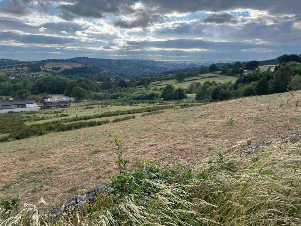
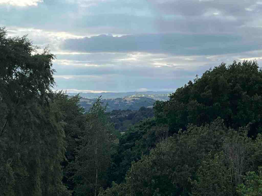
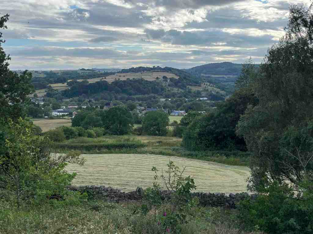
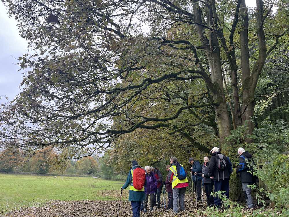
I have done quite a few walks during August and early September, mostly around 5-7 miles, just building up my strength and resilience after my recent illness. I am pleased to say that I can now comfortably walk this distance, so well on the way to recovery.

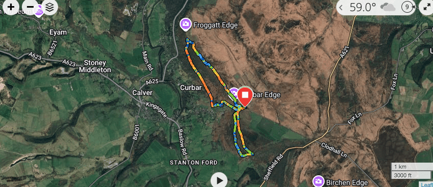
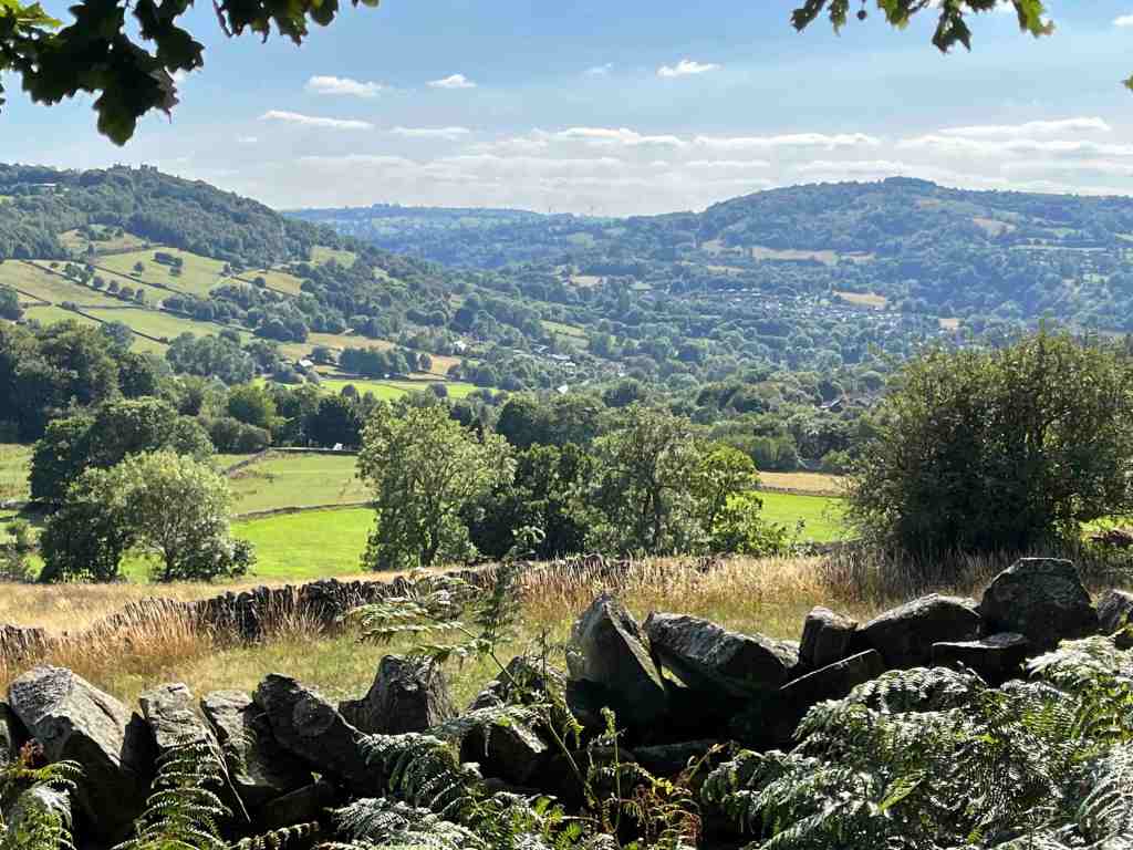
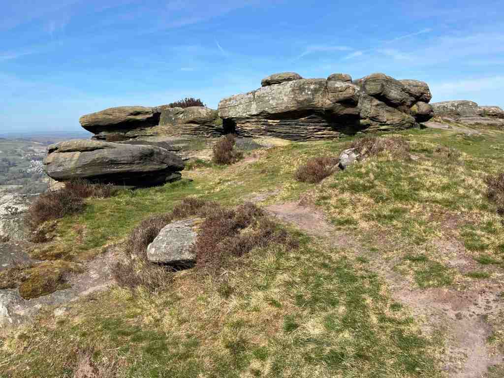
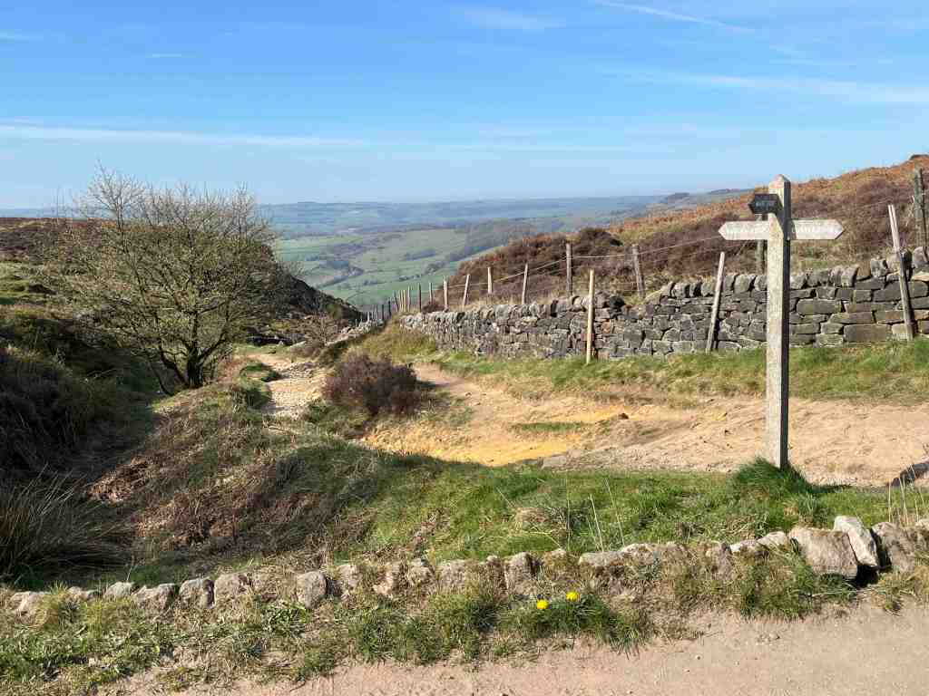
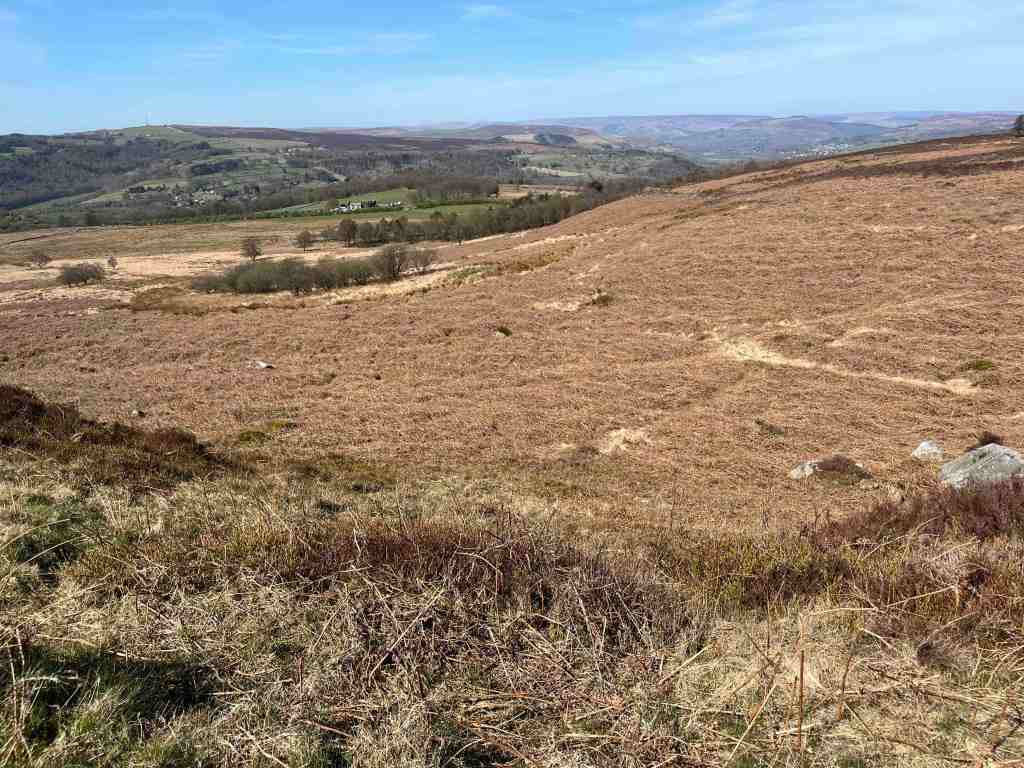
Taking the first of my August walks, this was a gorgeous walk along two of the Edges in Derbyshire. I began by parking at Curbar Gap (free to anyone with a National Trust membership). Walking north along the edge, this is a delightful and very easy stroll along the top of the ridge, with tremendous views. You can either follow the main path, which is wide and sandy, or you can walk along home-made paths darting between the boulders on the left, the latter being my general preference. You can follow this ridge all the way over Froggatt Edge to the Longshaw Estate. I, however, was looking for the path that would take me under the ridge and curve back to take me through the woods to Curbar.

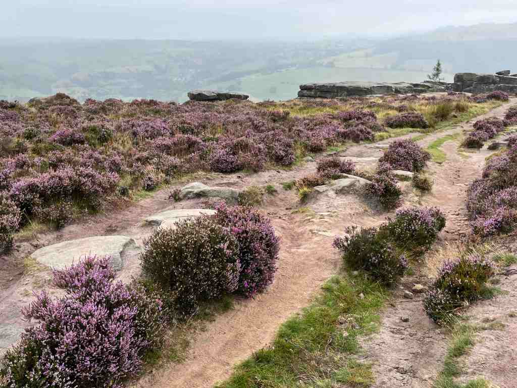
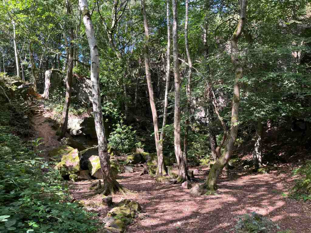
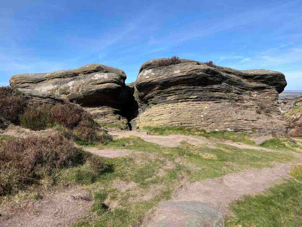
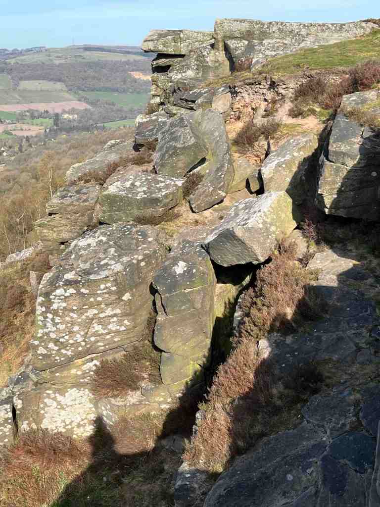
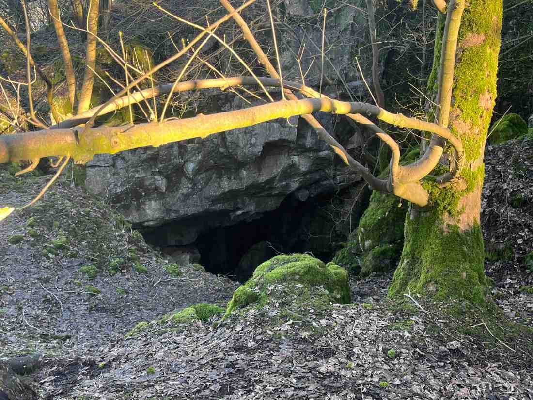
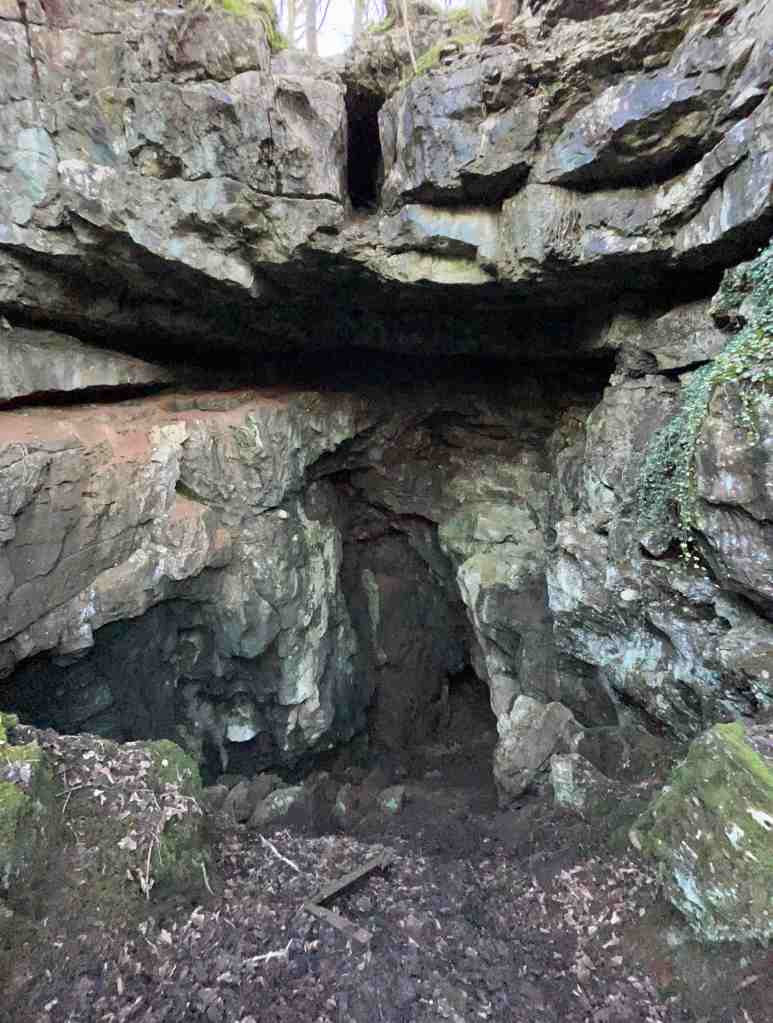
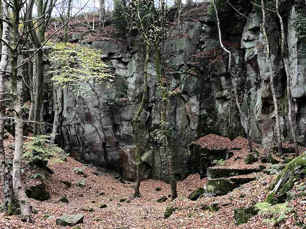
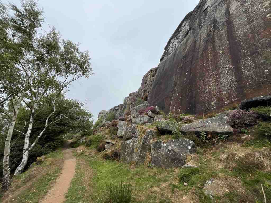
This path emerges after about a mile of walking; it is signposted but it is quite unspectacular and you could easily miss it. It descends on a moorland path to go under the start of Froggatt Edge. These are massive boulders where you can practice rock-climbing, or stop for a picnic to admire the view. The rocky path goes steeply downhill for about a third of a mile, and this requires attention. It’s one of those paths that is better going uphill. Having said that, it isn’t especially difficult – just take care.

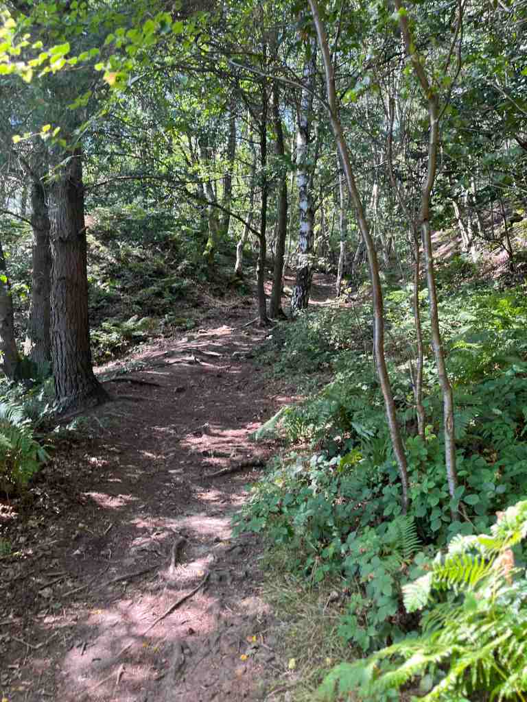
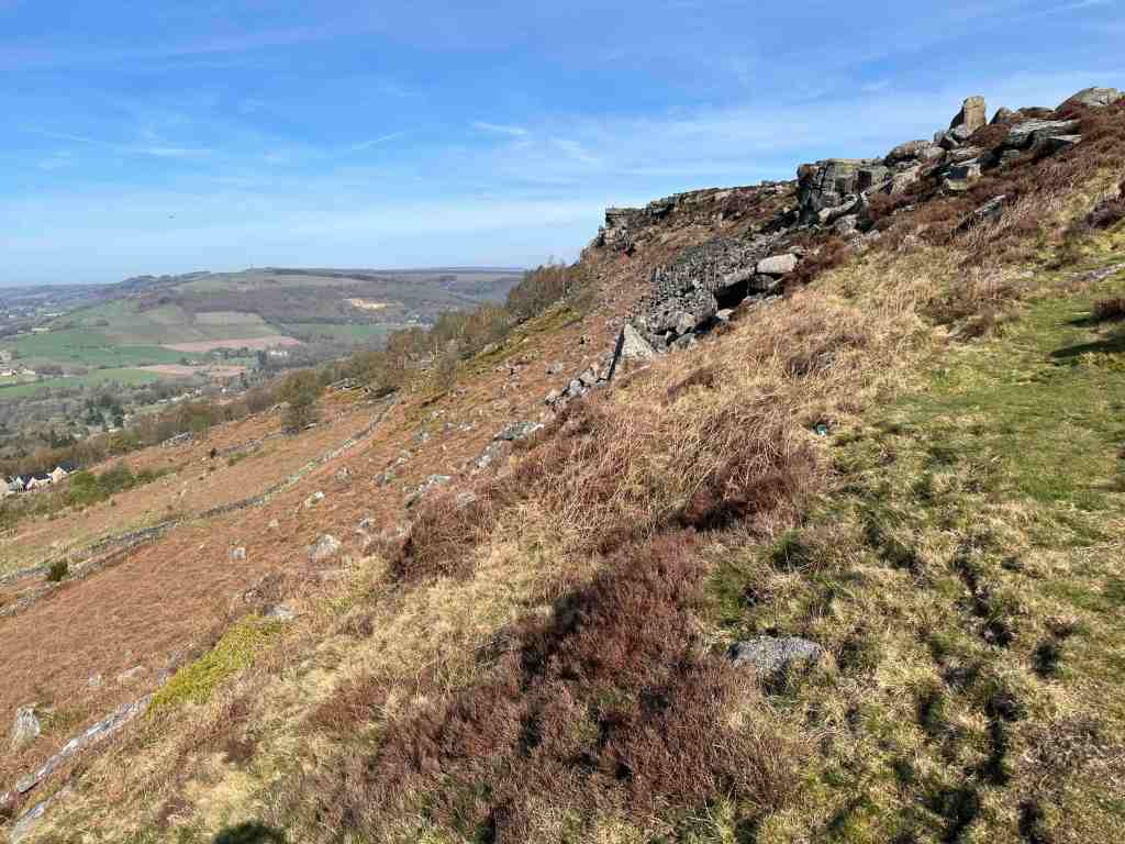
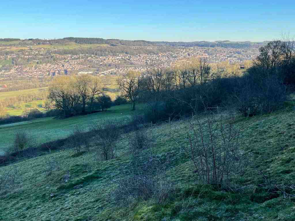
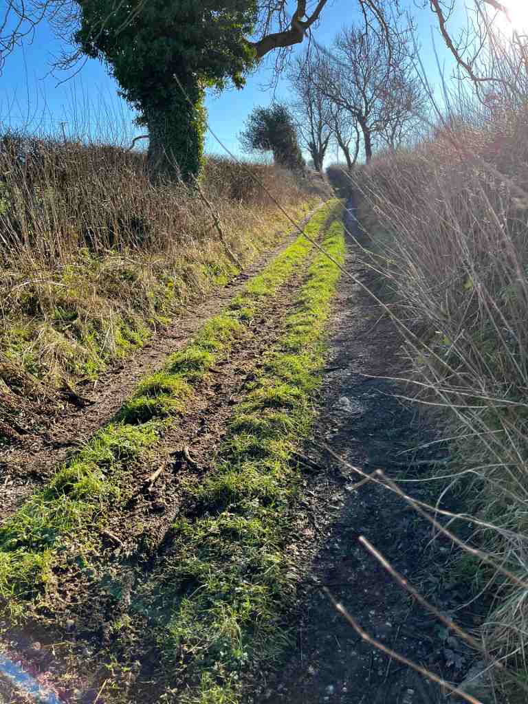
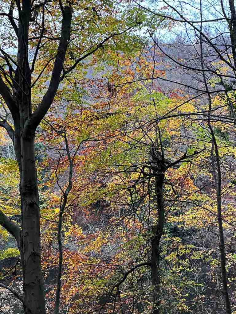
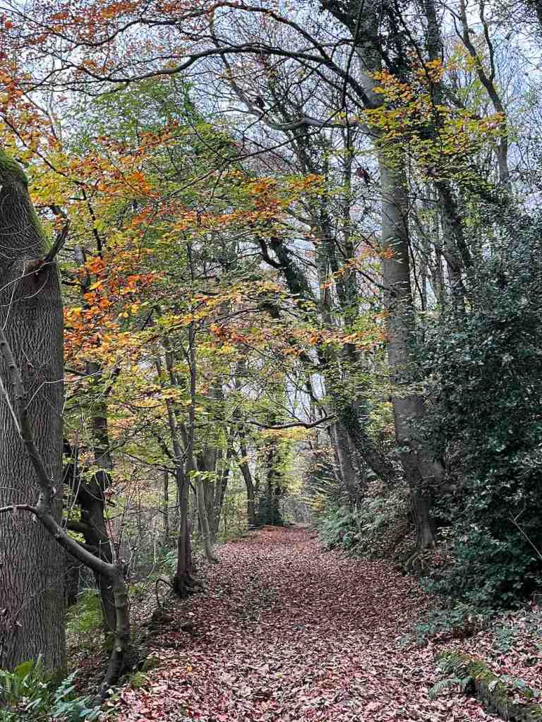
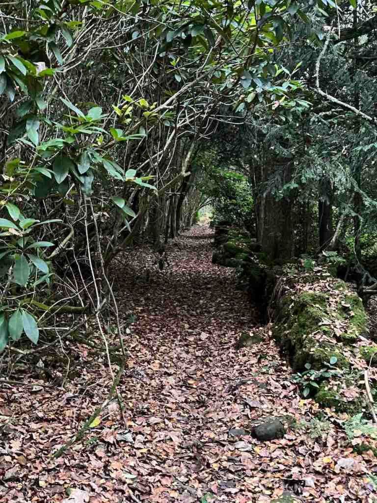
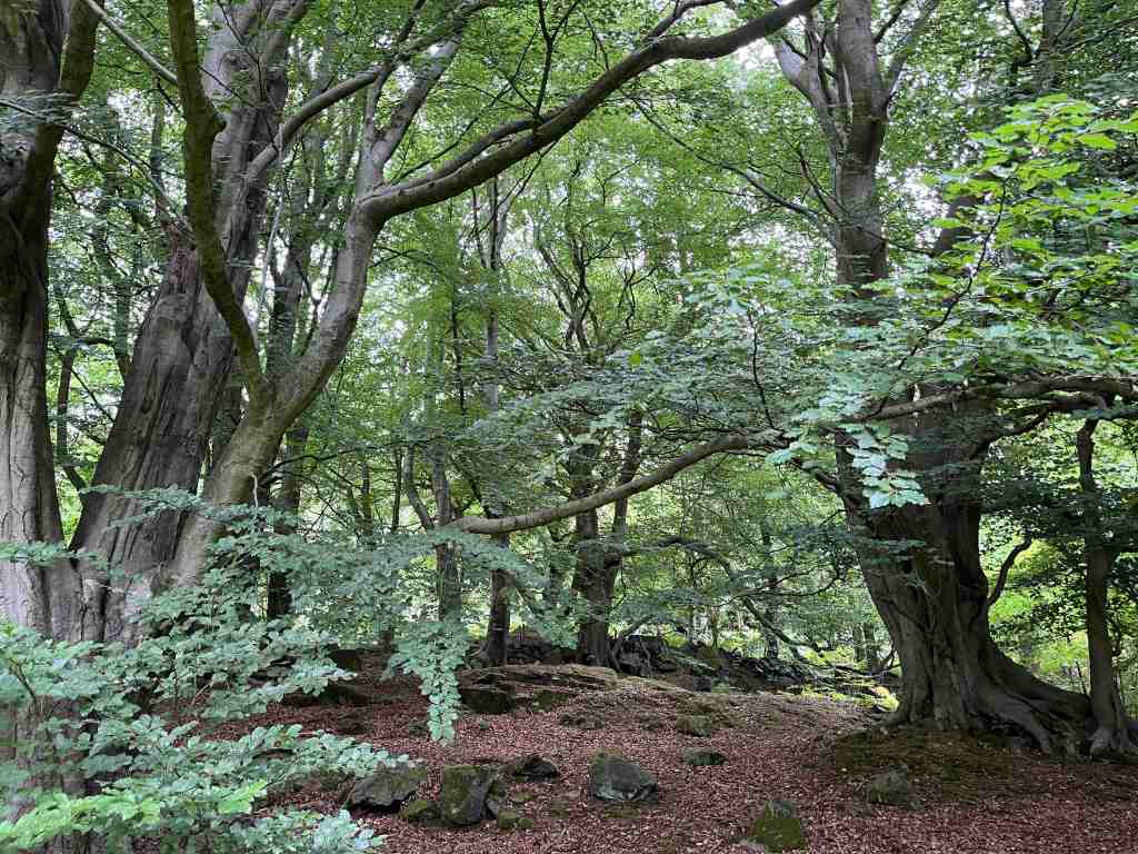
After a while, the path becomes grassy and even and it is a lovely walk through the wood. You are unlikely to meet many people on this track and it is very peaceful. When you reach a wall with a gate, make sure you turn left to continue through the woods. You will eventually come out in the fields at the top end of Curbar. Take the path uphill and join the road just before the big bend. There is no choice now but to follow the road back to the car park. It isn’t as steep as it appears on the map, and towards the top you can walk on a grassy footpath, where you will come across a couple of boulders with religious inscriptions, the one below from Isaiah and another from Hebrews. At this point, you will have walked about 3 miles.

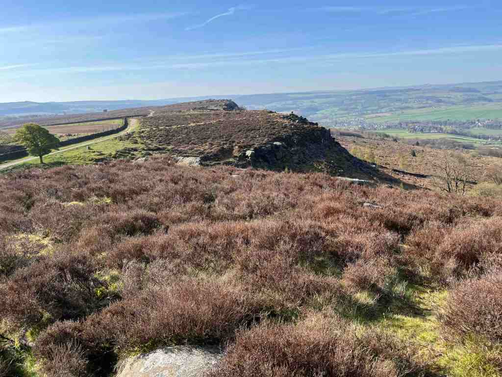
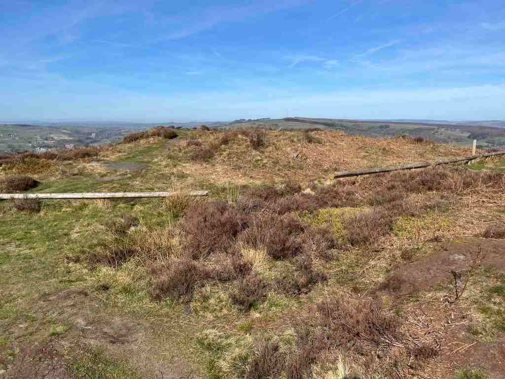
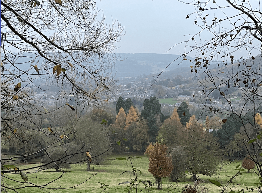
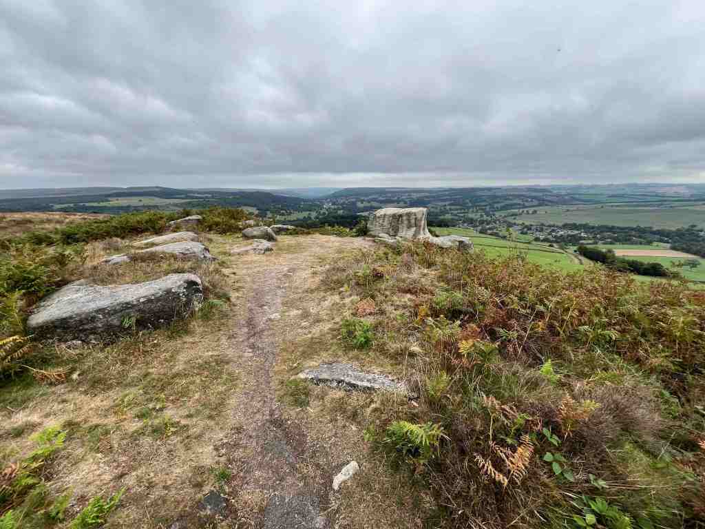
If you have had enough, you can stop here; but I would recommend going onto Baslow Edge. You might think you’ve seen all there is to see, but I find the viewpoint here is more interesting and you can see further to the south. There is a picture board, showing you everything you can see from here. It is easy walking most of the time, although you will go on a narrow and slightly overgrown and bouldery path if you continue on to the Wellington Memorial.

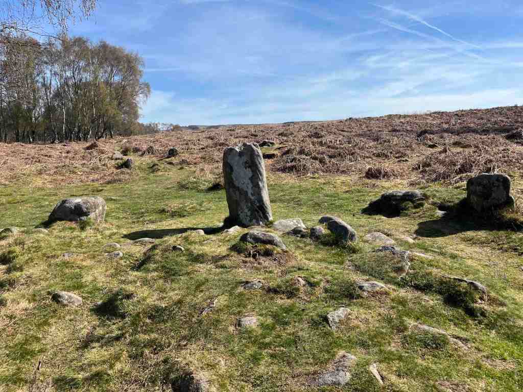
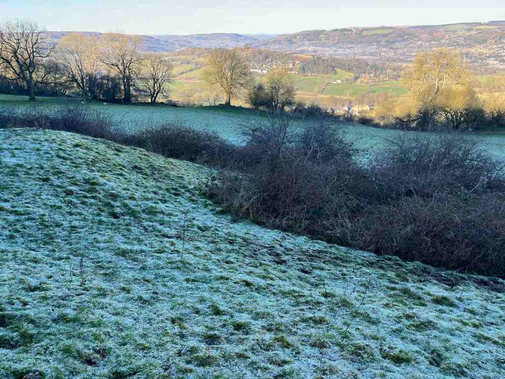
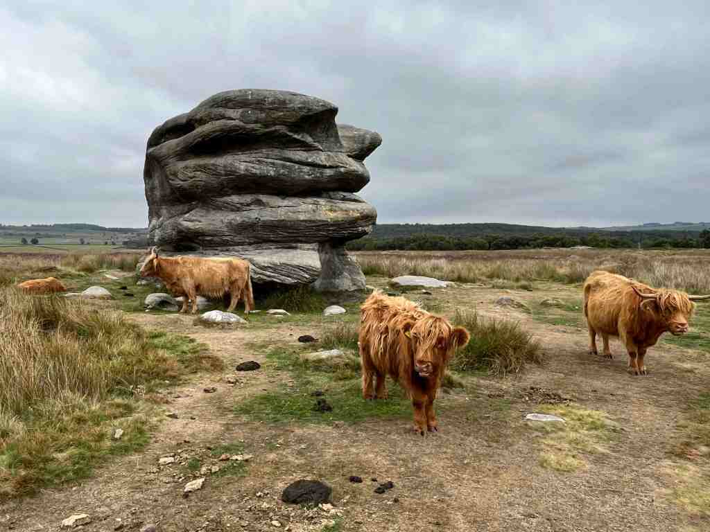
From there, you can take a different path back to take a look at the Eagle Stone, which is an incongruous mound of stones in the middle of the moorland, well favoured by the cattle. From here, it is an easy back to the car park. This second 2 mile section is extremely flat and accessible for most people.

This is a walk to do when you need some fresh air and to stretch the eyes. It is always beautiful and you will always feel refreshed when you walk along the edges.

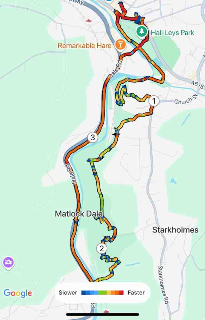
Total distance: 4.9 miles; total ascent 551ft and similar descent; Maximum altitude 1,128ft.

Tansley Woods and Lumsdale Waterfall

It had been a quiet day. The sun was shining and I needed to stretch my legs. What better than a short walk from home to raise an appetite.

I walked through Tansley, past the Gate Inn and down the knoll to the bridge and continued up the very pretty lane. This is an ascent, perhaps slightly steeper than you might expect, but nothing too strenuous. At the point where the road veers to the right, continue up the track with the woods right in front of you. The views across the valley to Matlock Bath are particularly nice here. After a short distance there is a path leading into the woods. I don’t think it is marked as a footpath? Again, there are short ascents here and there, but by and large it is just a serene place to walk, dotted with remnants from mining in this area. Every now and again, you get steep drops to the side of the path so do take care. Having said that, there are many paths and you will do well to find yourself on the one marked on the map, but nonetheless you will eventually end up roughly where you were expecting. There is a path eastwards out of the woods that I reached, and I had intended to follow this direction, but I was enjoying the woods too much, so took a path that I thought would lead to the top of Lumsdale where the new houses are being built. This is indeed where I ended up, though slightly further up than I was expecting. The path eventually joins the main Chesterfield Road, and you are obliged to walk a little way down that before taking the road to Upper Lumsdale.

Again, you don’t need to follow the road very far. After about 100 metres there is a footpath over a rickety bridge that takes you just above the stream and to the side of the meadows. It has the air of an ancient path, that eventually reaches a junction where you can turn left to go back into the woods or right to go to the stream and the eventual waterfall. This path had a different air to it, with ramshackled stones bobbling about the path, which I expect will form a stream of its own in winter. At the bottom is an attractive set of stepping stones. I was met by two ladies saying to some young child playing in the stream to ‘mind the glass’. They knew this area well and for years had been finding remnants of bottles and some stonewear that looked as if it had melted. Judging by the thickness and colours of the glass, these fragments are probably 70-100 years old. It is a mystery why they are there. The ladies said, despite their research, they hadn’t been able to find a business or a pub etc further upstream that might have been their source. Who knows?

Continuing down the path beside the stream, I found more fragments, and then I was at the road again. This leads to two mill ponds, and old works and buildings all linked to milling in various forms, that was prominent in this area in the 18th and 19th centuries. It is worth spending time reading the noticeboards dotted around as they give a fairly comprehensive view of the industry in this area. This whole area is now owned by the Arkwright Society, Arkwright being responsible for innovating all the activity in this area. You can also read a potted easy-to-read history of this area by looking at the baldhiker.com website.

The Lumsdale waterfalls themselves are tucked away out of sight. There is a gate on a corner, which I assume is always open(?). Head through this and up a few steps, make your way across some stony boulders and you find yourselves at an angle half way up the waterfall. It has been a very dry summer, so there was a relatively small amount of water today, but this didn’t stop all the youngsters and teenagers (and older) from frolicking about, jumping across stones and blazing a trail downstream (not advised). It is very pretty and I can imagine it would look even more splendid at dawn or dusk, when you might be lucky enough to have it all to yourself.

A few strides down the road and you come to a footpath sign, with two leads – one going eastwards and the other westwards towards the top end of Matlock through the trees. I took the easterly path, across fields and meadows back to Tansley.

This was a delightful late afternoon / early evening walk and one I suspect I shall do on many occasions. It was just about 4 miles long, with 650ft or ascent and descent, so nothing very strenuous, but just enough to let you know you have done some exercise and more importantly spent time enjoying and exploring the natural environment.

Pic Tor and High Tor, Matlock

For a short walk, this has a lot of diversity: a river walk, a woodland walk, a war memorial, gripping drops and views in all directions, including downwards into the depths of the rocks.

It had been a hot day, only one of many, many hots days over previous weeks. I can barely remember when it last rained before then, though as sod’s law would have it, as I write this there has just been a massive, but much welcome deluge. However, this was Monday and it was the end of the day and I needed some air. On the Isle of Man, this would have been one of my regular walks to the beaches of Port Erin and Port St. Mary. As yet, I haven’t found staple routes to walk when I am in need of air. I took the car to Matlock, walked through Hall Leys Park beside the river, crossed the river at Knowleston Gardens and walked along the river bank until taking a left fork uphill to Pic Tor. You can see how low the river is here, but as yet we don’t have a hosepipe ban in Matlock.

There is a fairly short, steep-ish climb through the woodland up to Pic Tor, where the war memorial stands majestically on the top of the hill, overlooking the church at Matlock Green and keeping an eye on the whole of the Darley Dale and Bentley Brook valleys. There is not a lot of choice as to the way down and then up to High Tor. I took the path that goes through the churchyard and up through what was originally old Matlock leading to Starkholmes, then took the track originally designed for carriages along the Grand Walk to High Tor. This is not a very inspiring footpath, that is, until one reaches the very top. There is a flat topped rock at this point, but care does need to be taken as one step in the wrong direction and you will take an unplanned dip in the river 300ft below! The views from here are terrific.

Returning off the mound, there are gulleys, caverns and footpaths that lead into the very rocks themselves. I didn’t investigate. These are mostly the result of a form of open mining in the limestone seams for lead, barite and fluorspar, that has possibly been going on since Roman times. These mine workings with their original tool marks are a scheduled ancient monument, and some exposed caverns can be as much as 20 metres deep – undisturbed local history. Indeed, there is evidence of one shaft arising at High Tor and finishing underneath the river 120 metres below. If you or your children are walking off track in these parts, you must be especially careful, as there are many hidden mine shafts just waiting for their victims.

Incidentally, choose the western footpath off High Tor and you can take your chances around Giddy Edge, which again needs care and is dramatic, but it is not too daunting. It does have a rail you can hold on to, but I would probably advise against this path in strong winds! Since my hospitalization 6 weeks ago, I suffer with hypotension (must sort the drugs out), so this was not an option today. The walk off the hill is very attractive whichever path you take, continuing downhill through the trees and eventually coming out at the point where the Gulliver’s Kingdom cable car takes off. There is a bridge over the beautiful river, and you can go left into Matlock Bath with its cafes, restaurants, museums and entertainments – and lots of fish and chip shops, or you can turn right to walk alongside the river for about a mile back into Matlock.

Total distance: approx 4 miles; 500ft total ascent, 500ft total descent

Tansley Circular

I had almost persuaded myself that it is time to close my blog. It’s not been the best of years, with two moves in eight months, both being complicated for different reasons. Then, I have had minor but painful health issues over the winter, followed one month ago by a heart attack, necessitating a stay in hospital, an angioplasty and a stent. I had only been in my Tansley house for two weeks when this happened. However, one month on, I am doing remarkably well, and once we sort out my medications so that I don’t have so many awful side effects (muscle pain in particular), I think I shall be back to climbing mountains and writing blogs.

This evening was the first time I have really been out since the heart attack. I could tell I was recovering because I was getting very itchy feet and even more irritable with myself and others, whereas for the first 2 weeks I was too exhausted to do anything. It has been a very muggy day here in Derbyshire today, so after a bite to eat (good healthy home-made fish salad), I donned my walking shoes and took off on my first venture in Tansley – very gently of course; must be sensible.

I walked through our village – it is a pretty village, with a quiet atmosphere. I took the path that I believe goes to what is called the Fete field. The footpath continues through it, but a game of football was taking place, so I took the side route, through the brand new, very small housing estate to Whitelea Lane. For a small country road that only goes to Tansley, it was surprisingly busy. It is uphill for about half a mile, nothing too strenuous and there are some lovely views. Before reaching Neville’s farm, I turned onto a footpath beside some old cottages, going into the wood. This is a very pretty, well-used path, with established trees. Before reaching the end of the path, I turned left, and again went uphill – I was beginning to think my cardiologist might not be too happy if this continues – but I stopped regularly as there was so much to see. The wild flowers were just beautiful, and so many varieties, and when I reached the top of this short hill, the views in all directions were stunning, and almost unexpected. Tansley is already at 450′ odd of elevation, and it didn’t seem as if it were possible to go much higher, but today’s highest point was 831′.

The footpath continues flat for a short distance before reaching Knabhall Lane. I have driven along this lane before when the main roads have been closed and thought how lovely it is, as it is a gentle climb to the top with open views, or in my case, a gentle descent down into the valley. There were swallows everywhere. Eventually, the lane joins the main A615 to Alfreton, at the corner with the big garden centre. However, it is only a very short walk before you turn off to the right on another footpath, to lead between some beautiful houses and gorgeous countryside before returning to the top end of Tansley. I had checked this out when I was on Knabhall Lane to make there was no significant ascent, and it is as I expected, almost flat. From here, it is just a hop and a skip down and around a few corners to my new house on Bentley Walk.

There is a big debate going on right now, as Tansley is rapidly expanding its housing (ergo, I have moved here), but it is not expanding anything else, no shop, small school, narrow lanes – the archetypal village. The infrastructure can’t really take the proposed developments, especially the water, all of which has to drain into a little brook just down from where I live. Matlock has always flooded – they may just make matters significantly worse if they keep building on all the high land above Matlock. The two recent developments on this side of the road are small (46 houses where I live, and less at the top) but the proposed plans are rather bigger. As I walked through one of the areas for the planned development, I did think that if this did get passed, this would be the least unpopular development. The field is flat, with no seemingly particular interest, and bordering just a few houses. Access would be very tricky though. I don’t necessarily support any development in the village – it is important to try and retain the integrity of a small village community, and as an interloper, who isn’t really entitled to have a view, the current developments are more than enough – any more, and the village will change its character.

I think this will be a happy home and place for me to live. I can do numerous walks on footpaths or minor country lanes in three directions, and the fourth direction takes me to Matlock 1.5 miles away, but still being able to use footpaths for a large section of the walk. And we do have buses (when they come!).

So, with luck, and no setbacks, I shall continue my blog and try and provide you with a variety of scenery in and around Derbyshire as and when I can.

Distance: 3 miles (1hr moving time): Total Ascent 397 ft; Total Descent: 400 ft; Minimum Elevation 498ft; Maximum Evelation 831ft

Screenshot

Curbar Edge, Froggatt Edge and White Edge

A brief update before I describe this lovely walk. I see my last post was in January. Where has the time gone? Well, I can tell you, actually. For most of the time, I have been harbouring a spinal problem which has created unimaginable pain down my right leg on walking, and surprisingly severe pain across the top of the foot. You wouldn’t believe how incapacitating that kind of foot problem is. So, for several months I have been developing an exercise programme for myself, which has been very successful and I am pleased to say, I walked over 6 miles yesterday and another 3+ miles today, with barely a hint of symptoms.

On top of this, 3 weeks ago I broke a rib – ok, I’ve broken ribs before, but this time, a few days later, I developed a nasty chest infection which is being very persistent. I feel as if I should be well, even with the remnants of this chest infection, but out walking yesterday I began to feel quite ill and I overheated and had to take unusual but effective remedial action to get me back to my car. So, I’m clearly not quite out of the woods yet. One day, I shall have to accept that I am getting older! I hope I am now back on my feet and once I have moved in 4 weeks time, I shall be able to get out and about and share more of the lovely Derbyshire countryside with you.

The ‘Edges’ in Derbyshire are magnificent. They protrude from the valley up to a majestic height of 340 metres (1112 ft), although Curbar village is already 118 metres (387ft) high. It doesn’t seem quite so impressive now until you see them, as they are sheer blocks of grey gritstone creating quite a drama against the sky. These are perfect for rock climbing and abseiling, which I remember doing many years ago on these very rocks.

This walk starts at the top at Curbar Gap (what three words – windows. fountain. precluded). The car park isn’t huge and this is a very popular area, so plan an early start. There is a fee to pay, which is free to NT members. One of my aims was to look for suitable vistas for our Painting for Pleasure group to replicate. Straight away, not far at all from the car park, is a seating area providing wonderful views across the valley and towards Baslow Edge to the south. The paths thereafter are easy, though you will still have to negotiate a few boulders from time to time; the main path is wide and sandy/soily and you can also walk on the grass and boulders parallel to the main path, which is more interesting but does require nimble footwork from time to time. Every few feet along the way, you are treated to wonderful rock formations, and your eyes stretch out into the distance as you gaze at the Dark Peaks in the north. These rocks have plenty of flat sitting stones where you can stop and paint, or simply admire the views.

This Edge continues for some distance, gradually descending, with a couple of steeper awkward sections, and it eventually turns into Froggatt Edge, which I guess is where the birch trees have taken hold. Continuing along, the birch trees become more numerous, but just before this, I discovered something I had never noticed before – an ancient burial mound, dating back to 3500 BCE. There is a notice alongside with a QR code, which I accessed and this tells you all about the excavations. I will leave you to investigate this further yourself when you visit.

The path becomes more even as we enter Froggatt Edge wood, where the willow warblers were having a field day. In a fairly exposed area, you come across a stone circle, now called Stoke Flat, also from the Bronze Age. It has been damaged, but it is clearly there in the landscape and a reminder, along with the former cairn, that this area has a very long history. I will direct you here to a very informative web page that is very well written: http://www.stone-circles.org.uk/stone/froggatt.htm

Once through the woods you meet the road taking you to the Longshaw Estate. The walk is about 2.5 miles to this point. The footpath guide I was using goes a slightly different way than I took. I stayed on the same side of the road and cut a trail, through the hummocky grasses and moorland to White Edge. You could also walk along the road up to the Grouse Inn and take a rather easier, but less interesting route, to the same destination. There is a small amount of uphill to get right on the top of White Edge, and now, as you are higher than on Curbar /Froggatt, you see all the way across the moors to Sheffield as well as the panoramic views to the east and north. The walk along the ridge has fewer boulders and is very easy and attractive walking. The descent is relatively steep and the footpath management team have created a series of steps down. From here, it is only a short distance back to the car park where there is kiosk with a lady selling teas, coffees and cakes. This is not a walk to be rushed. It is a walk to stop and stare. Incidentally, if you are short of time there is a shorter circular walk, just around Curbar Edge and coming back to the car park along the moor between Curbar Edge and White Edge.

Total distance: 6 miles (10km), 643 ft (196m) of ascent, and 679 ft (201m) of descent; highest point 1236ft (376m).

Salters Lane to Bonsall over the fields

It is a while since I have been out for a ‘proper’ walk, and today, I wasn’t really in the mood for one either. I had just been asked to lead a walk for the U3A in February, so thought I would use the opportunity to spark myself into action. I had already been thinking of doing a walk from Salters Lane, as I shan’t be living in this particular location for much longer, so I donned by hats, boots, scarf and anything else to keep out the cold air and ventured out. I took the car to the top of the hill where there is some parking next to three or four footpath signs. Take care where you park up here, so as not to block farm vehicles.

I started up the road for a short distance before turning left onto a footpath. This was a perfectly good path, that joined another and went between the hedgerows, affording lovely views of the surrounding countryside. It continues for some distance before dropping down into Bonsall. On its descent is becomes less attractive, being muddy and also turning into a stream for about 500 metres. There are alternative paths you can take and remain higher up for longer if you so choose. My path joined a back street in Bonsall, and then diverged from this lane to go behind the Croft Farm – this is not well signposted, so you have to trust your map. It is also very muddy and wet on this section, not just around the farm but on the sloping fields, which have been churned up by the hooves of many cattle. You can expect to get very muddy boots and to do a bit of squelching here and there. At a certain point, there is a meeting of footpaths according to the map, but these are not apparent on the ground. There is a small stream to jump across before making your way back up the hill past the pond back onto Salters Lane. At this point, you will have walked barely 2 miles, but it will feel like more because of the conditions.

You can choose at this point whether to continue along the road back to the car, or to do as I did, and go into the woods on the other side of the road. There is a lot to gain by doing so, but keep in mind, that if you go downhill you will have to come back uphill again at some point. I really enjoyed the woods, and in particular all the different rock formations, presumably created by mining activity. I began by going fairly steeply downhill through Jughole Wood, with its attendant formations, then taking a left on the level towards Leaward Cottage, before returning uphill through Lea Wood. The views of the valley are tremendous from here.

I completed the short distance back to the car along the road. There are many different variations that you can do of this walk, and I am sure the different seasons will dictate which routes are best to do when. Needless to say, I do not think this is a particularly enjoyable walk for a group of older people at this time of year, but nice enough if walking on one’s own or with a friend.

Distance: 2.75 miles Total Ascent: 492 ft; Total Descent: 535 ft

Ladygrove Woods

As it was Friday, this is my day for walking from home to Whitworth Institute at Two Dales. Depending on the route I take this is a 2.5/3 mile walk. I like the views from the Snitterton Road, which takes me past a cottage that I would rather like should it come up for sale. I took this same road up to Oaker, then rather than go up and over the hill I took the lower route into Darley Bridge. After this, I played table tennis for an hour and then sought out a different route home.

I wanted to take a look at properties in Two Dales, thinking that may be a good area to live, as if just slightly up the hill, houses will catch the evening sun. So, after a quick shop to buy baked beans I crossed the road and walked through the village. I was slightly surprised that it quite flat, until it is no longer flat as it turns into Syndcope Hill, but I turned off before that point. I had spotted some reservoirs and some woodland that looked worth a visit and I was not disappointed.

Ladygrove woods are mostly beech and you can imagine the beautiful colours on the paths carpeted with leaves. The first ‘reservoir’ is visible, but the path thereafter goes high above other waterscapes, so the others are barely visible. The path is narrow and a little uneven and every now and again you have to jump over a small stream. There was a lot of water in these streams given that is hasn’t rained for some time. The other surprise were some boulders and cliffs, looking very similar to Charnwood Forest. Presumably, these have been quarried but I don’t know the history of this area.

I realised as I was travelling the kilometer or so up the valley that this may not have been the most sensible plan as the daylight was fading and I was on uneven ground and didn’t really know where I was going, so I increased my pace a little until I reached the furthest point and then I returned via a higher route, still lovely, but not quite as attractive as the lower route.

From this point, it was mostly road walking through Upper Hackney before taking a nice footpath downhill towards the back of the hospital. This area is still unspoilt and marks the edge of Matlock. The next path downhill that I took, beside an old woodland, was immediately adjacent to relatively new houses and ultimately led down to the main road beside Valley Lodge Care Home. The traffic into Matlock was completely blocked up from there, and that must be almost 1 kilometer to the roundabout. I think I’ll settle for my flat from which I can walk everywhere most of the time. It would drive my potty having to deal with traffic jams day after day.

Total distance: 7.5 miles; morning 3 miles; afternoon 4.5 miles. Total ascent (afternoon): 505 ft; descent 476ft; total time (afternoon) 1hr 45 mins; moving time 1hr 34 mins.

You could do the afternoon walk using buses to and from Two Dales into Matlock.

Thorpe, Tissington and Dovedale

I was on my way to a painting weekend in Thorpe and what could possibly be more wonderful than spending the early part of the day walking around this lovely countryside.

I parked the car at Thorpe Station ( free parking with my High Peaks Annual Pass) and began walking along the High Peaks Trail to Tissington. This is another former railway track and despite its name it is not particularly high, and on this section of the route it is not very interesting. It leads to paths around Tissington Estate which may be of interest to some.

At the former Tissington station there is a cafe with seating, boldly stating on its boards that it sells excellent plum tart. The cafe owner was very friendly and offered my various suggestions as to where to walk, and suggestions for another day. Not being able to resist the offer of an excellent tart, I succumbed to tasting this delicacy and found it to be truly…. excellent.

The village of Tissington is delightful with housing centred around the village green and pond. I continued past the stately Tissington Hall, past the church with its stunted spire. I walked along this lane until the main road. I did have another plan, but decided it might make the walk too lengthy. The walk north in the road is only for a short distance before crossing over towards Sharplow Farm. The route is then uphill over farmland and then immediately downhill to Gaglane Farm. This is a really quiet part of the Peak District and I didn’t see a soul. A short walk up the road to Standlow and I took the angled path leading to Nabs View.

It blew a hooley at this point, all the time I was on higher ground, necessitating me donning my cagoule. Even so, it was delightful, with massive views in all directions. At one point, a Royal Mail van passed me leaving Hanson Farm and it so reminded me of Postman Pat. All it needed was for Jess to be hanging out of one of the windows. Be aware that at Hanson Farm the path skirts around it to the left beside the cattle grid. The footpath sign was pointing towards the farm so I followed it to my detriment, as the farmyard was full of slurry. But, I did see lots of cows and tractors which was a bonus. If you find yourself like me going the wrong way, there is a gate, and you will have to negotiate A LOT of mud.

Very soon past the quagmire, my path turned downhill to the right, into woodland, which was very beautiful. Autumn has mostly shed its leaves now, so there was little colour, but the contours and shapes were interesting. What was less so was the footpath, which was full of small stones covered with leaves and slime, making it very tricky to step safely. This continues for about a kilometre and was not very pleasant. It would be much easier walking that route uphill.

Having safely reached the basin beside the river at Dove Holes, it was lovely to walk on an even path, listening to the sound of the water as I walked along, admiring the stone structures and the caves that have formed in the limestone. The footpath kids you that it is about a mile to the stepping stones, when in reality it is closer to two, but well worth the wait. I had a brief stop here, before completing my walk up grassy Lin Dale, going past Thorpe Cloud on the right, Hampton Hill to the left and the HF house a little further on. I veered around the back of the house up to a lane leading directly to Thorpe and the station. Incidentally if going up Lin Dale the path is through the little gate by the stepping stones, not the Thorpe Cloud path.

Distance: 8.3 miles; Ascent 1119 ft; Descent 1296ft; Total time taken 3 hr 40 mins; walking time 2hrs 45 mins.

Matlock to Matlock Bath Circular

My intention was to have a gentle stroll in a southerly direction along the river Derwent as it was a lovely sunny day, with gloomy forecasts for the next few days. Those of you who know me won’t be surprised to learn that it became more of a hike, taking in paths I hadn’t been on before.

I began by walking down by the river into Matlock and doing a few chores. Then I had a pleasant stroll through Hall Leys Park and Knowleston Gardens. The autumn leaves are stunning right now and I stopped many times to admire the views. I couldn’t stop myself from trying out the odd footpath but these mostly ended at a dead end and a shaft entrance to the former lead workings. So, I carried on around the bends until I saw a footpath sign to High Tor. This hadn’t been on my agenda, but the thought of walking along the noisy A6 really was not appealing.

So, I headed off uphill towards Starkholmes and took a clear footpath to the right that I would follow all the way to High Tor, getting glimpses into the beautiful, if noisy valley every now and again. The views to the left of Riber Castle were excellent. Once at High Tor, I took a path marked ‘Caution’ and ‘Viewpoint’. The cautionary notice is that there is a significant drop off the cliff to the right and only a narrow path to walk along. Someone has very kindly fitted a handrail in certain parts to avoid obvious mishaps. This I realised is known as ‘Giddy Edge’. It is easily passable with care, but certainly care is needed for a short distance before the path enters the woods. From here, it is a steady descent all the way down to the cable car entrance for the Heights of Abraham.

I followed the path on the same side of the river as far as I could, as it petered out and I had to cross the bridge at the start of Matlock Bath and walk a little way down the awful A6 until I could cross back over. Unfortunately, Lover’s Walk was closed for tree repairs, so I went back on myself until I saw a notice saying the Nature Walks are taken at your own risk. The footpath lead upwards again right up to the very top of the woodland, providing wonderful views of the hills to the east and occasional snippets of views of Matlock Bath. I continued on this path as long as it would allow me to, but eventually I had to drop down into the woods and back to the river, where again access to the river is limited. I walked back to the Derwent Gardens bridge and through the gardens and up to the main road, intent on having a coffee and finding a bus back. So far, this was 4.5 miles.

Suitably refreshed after a bag of chips and a latte, I changed my mind and decided to walk back over the hills to Matlock. It is a stiff climb up a relentless hill until the point where the path goes underneath the cable cars. It is then a delightful walk, mostly contouring, all the way back to Matlock. Much of this is wooded until the final section where it enters fields where donkies and sheep munch side by side on the grass. A quick trip into Sainsbury’s and two ticks after that I was back at my apartment.

It was a really lovely walk, but it did tire me, more than I would expect of that kind of walk. Nevertheless, It is so good to make the most of the weather and to see the wonderful autumnal colours in all directions.

My stats are a bit different today as my Garmin battery had run out and I couldn’t find the charger, so I used Map My Walk to record the details of this walk.

Section A: 4.43 miles, with 435 ft ascent; walking time 2hr 11mins.

Section B: 2 miles, with 406 ft ascent, walking time, just under 1hr.

Hassop Station Short Walk

This was my first walk with Matlock U3A. They have a ‘short’ walk group and a ‘longer’ walk group. The short walks are up to about 5 miles, start at 10am and finish by lunchtime, but there is often the option of extending it with a lunch at the end of the walk.

The weather did not look promising as we started out, it having been raining cats and dogs in Matlock over night, with an equally unpromising forecast for the morning. Undaunted, but wrapped up in wet weather gear, I walked down to Sainsbury’s to meet my lift.

Parking at Hassop Station cafe involves paying for parking. If you prefer to avoid payment, many people had parked down a nearby lane. Hassop Station cafe is directly next to the Monsal Trail so it is a popular starting point, as it is a nice flat walk to Monsal Head, one of the highlights of this area in the Peak District.

Our walk was short, as expected, and indeed was only just over 3 miles altogether. Never disparage short walks – they have a place; for those short of time, for those exercising dogs, for those in less robust health. The views, even in inclement weather, as today, still offer something very exciting, and it’s good to see nature in all its moods and seasons.

Our group of 13 people started northwards along the Monsal trail, but only for a short distance. We then turned left onto a stony footpath leading uphill, and very soon we could see hills in the distance in all directions. There was a chill in the air and even the cattle seemed to be moaning about the weather, looking forlorn and bedraggled on the hillside. This footpath ultimately leads into Bakewell and as we went down the hill it looked quite mystical in the hazy mist that was covering everything.

Avoiding Bakewell, the next section of the walk turned right across beautiful meadows towards the top end of a wood. I loved the wood with its tall trees dripping leaves of autumnal colours. This was their land and their ownership of it was clear.; we were just passing through like millions of people over the centuries. I may be exaggerating here, but why not! We need a bit of imagination and am appreciation of beauty, and what’s a bit of hyperbole between friends. At the end of the wood, the path emerges at the top end of a short dale that goes down towards Bakewell. We went in the opposite direction and joined a small, but busy road, for a short distance before regaining the Monsal trail. It was then a direct walk back to Hassop station.

Hassop station had been busy at 9.30am and the cafe was even busier at 12 noon. There is a pleasant covered area to sit outside and some takeaway vans for coffees, pizzas and cakes, so we finished our time together with warm drinks and food. The inside cafe is excellent if you don’t mind queueing, and there are toilets both inside and out.

The others then made they way home, whereas I decided to walk into Bakewell as the weather was improving. I would mess around there for a short time, buy myself a nice apron and some stamps (way more expensive in England than the Isle of Man), and then it was time for ‘hunt the bus stop’, which was in a different place than all the other bus stops – but in a very sensible and I should say, very obvious place!

Stats for U3A Walk: Distance 3.09 miles; Total Ascent: 295ft; Total Descent: 262ft; Total time taken 1hr 55min; actual walking time 1hr 23 mins. Add on another mile + to go into Bakewell.