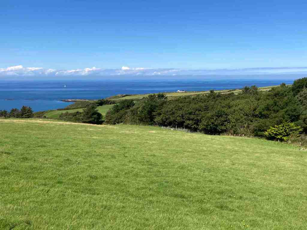
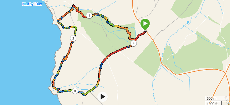
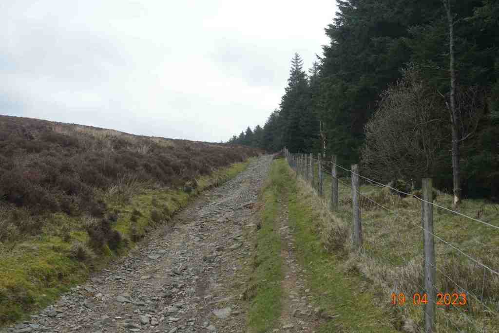
This is one of my favourite walks. It has such variety and breath-taking views. We began by walking through the Kerroodhoo plantation, which is a very pleasant path, keeping ourselves in the dappled shade as we made our way downhill. There were a couple of obstacles, such as steeply dropping paths and streams to cross but nothing too daunting. Towards the bottom end of the plantation a new woodland of deciduous trees is being created whilst the everygreen Norway Spruces are being removed as part of a community measure to improve the environment. The idea is to create more diversity and provide better habitats for three b’s – birds, bees and butterflies. New trees being planted include Birch, Oak, Alder, Hazel and Ash, all native trees that have been grown locally. It will be interesting to watch this develop in future years.
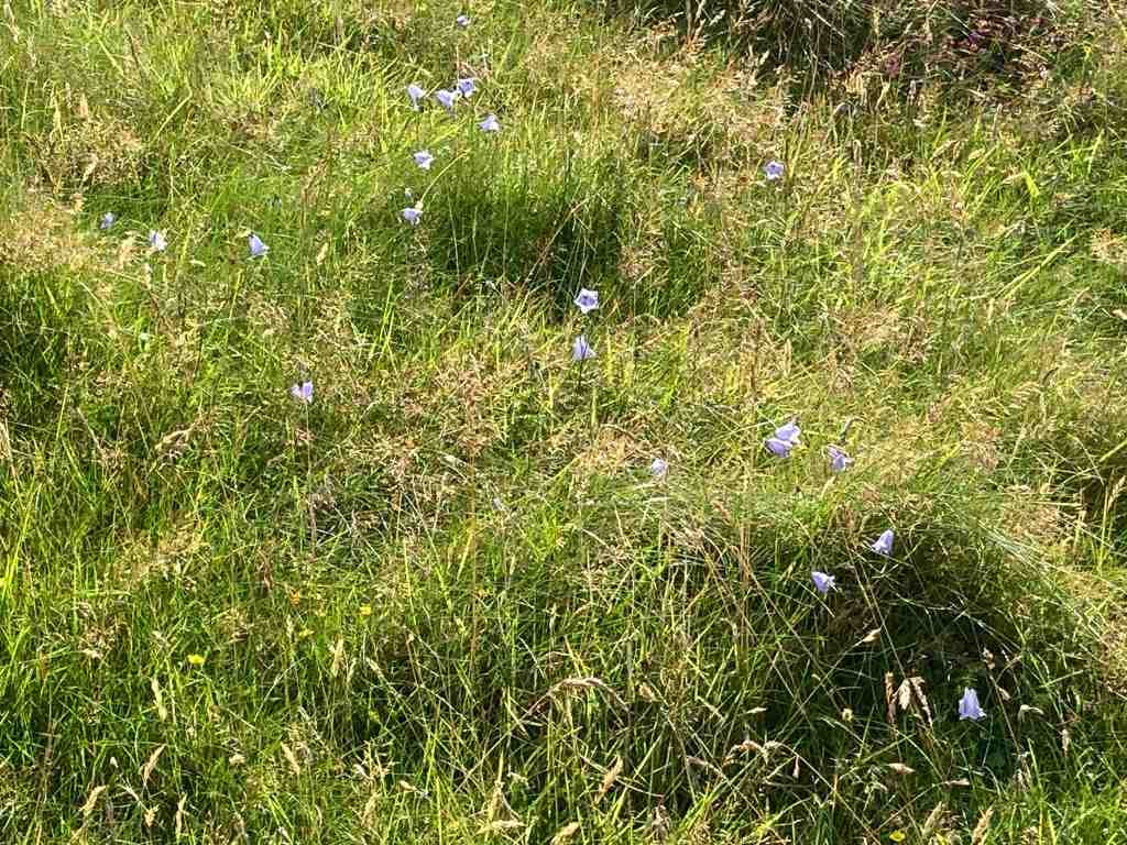
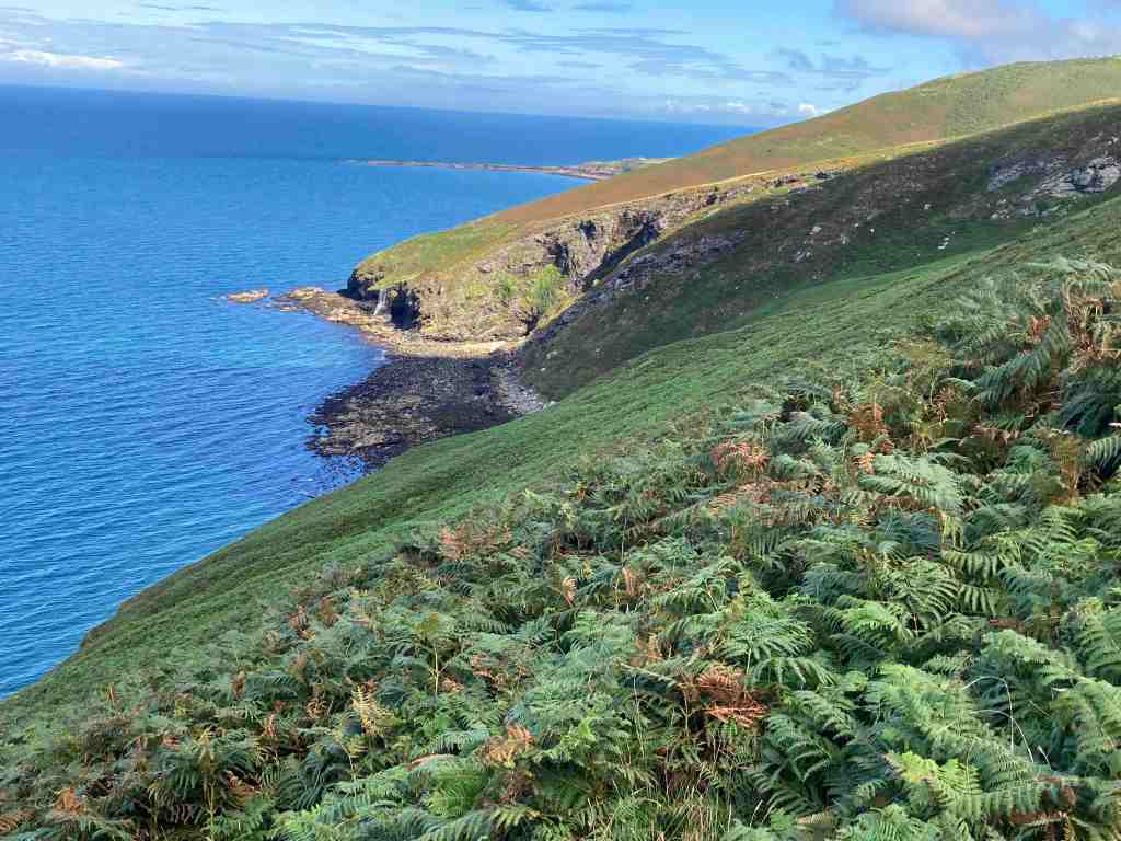
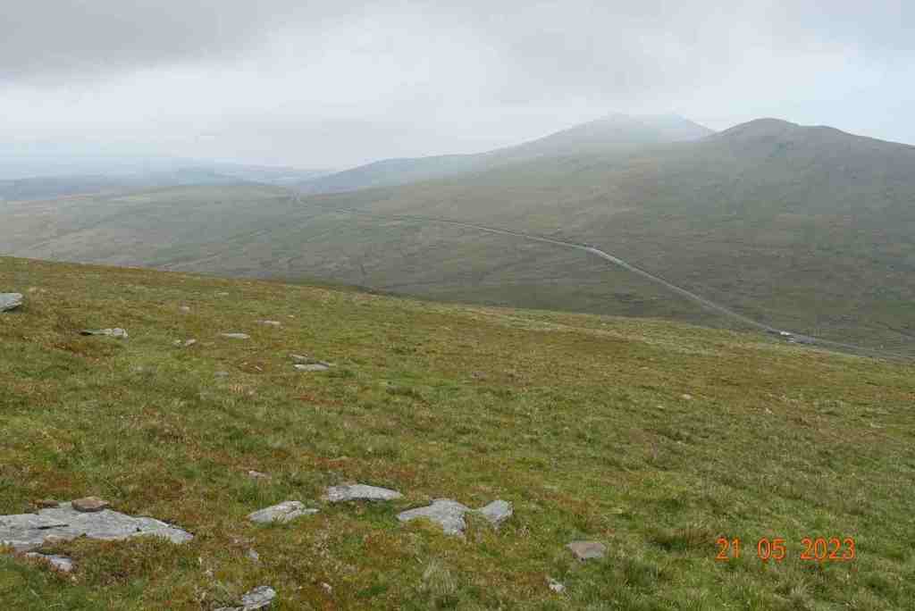
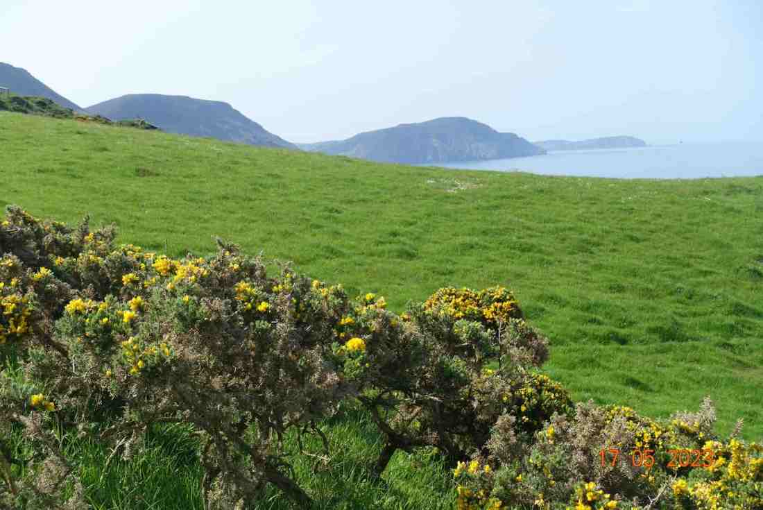
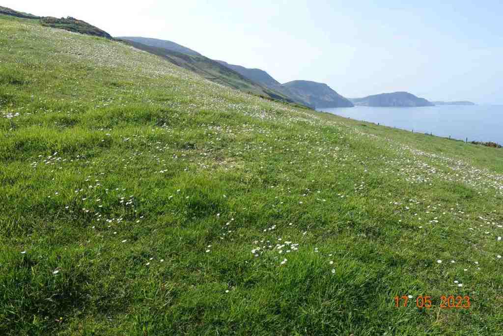
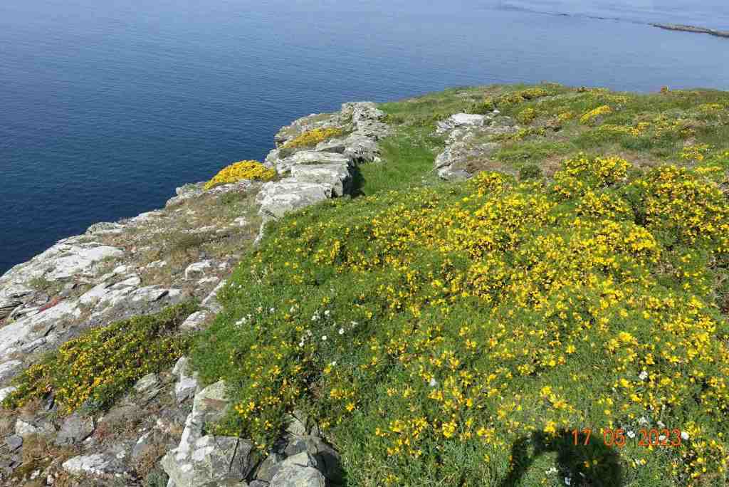
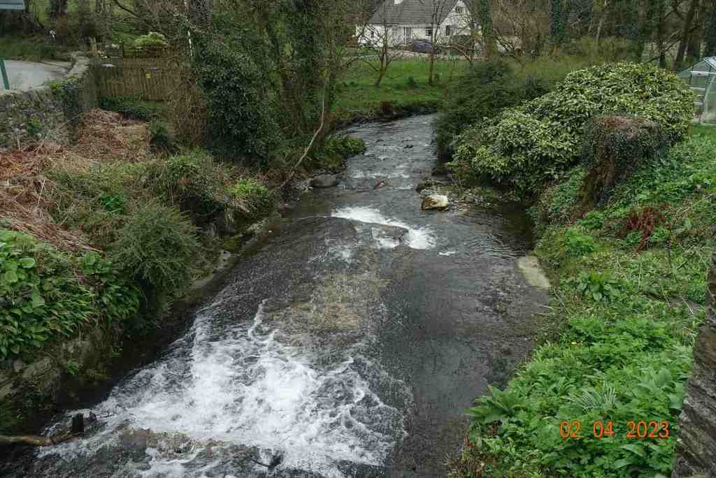
Reaching Barrane and its chattering ford, we soon found ourselves crossing over meadows strewn with flowers to greet the footpath on the coast above Whitesands. Niarbyl lies in the distance and the white cafe stands aloft, although it has been closed as a cafe for a while and no-one knows when it is to reopen. The path southwards is not seemingly part of the coastal footpath route but is perfectly accessible and provides a super lunch spot where you can sit on rocks, watch the butterflies and listen to the birds circling overhead, all the time gazing wistfully into the distance at the towering cliffs of the southwestern part of the island.
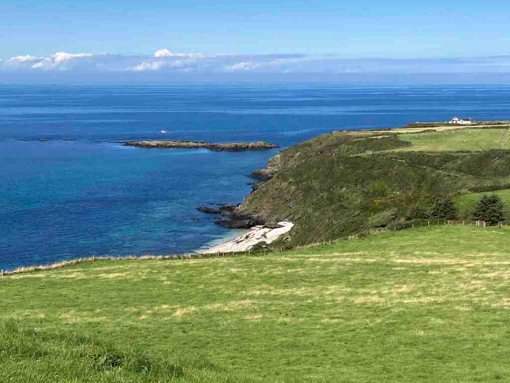
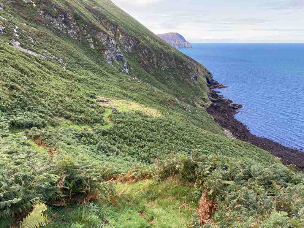
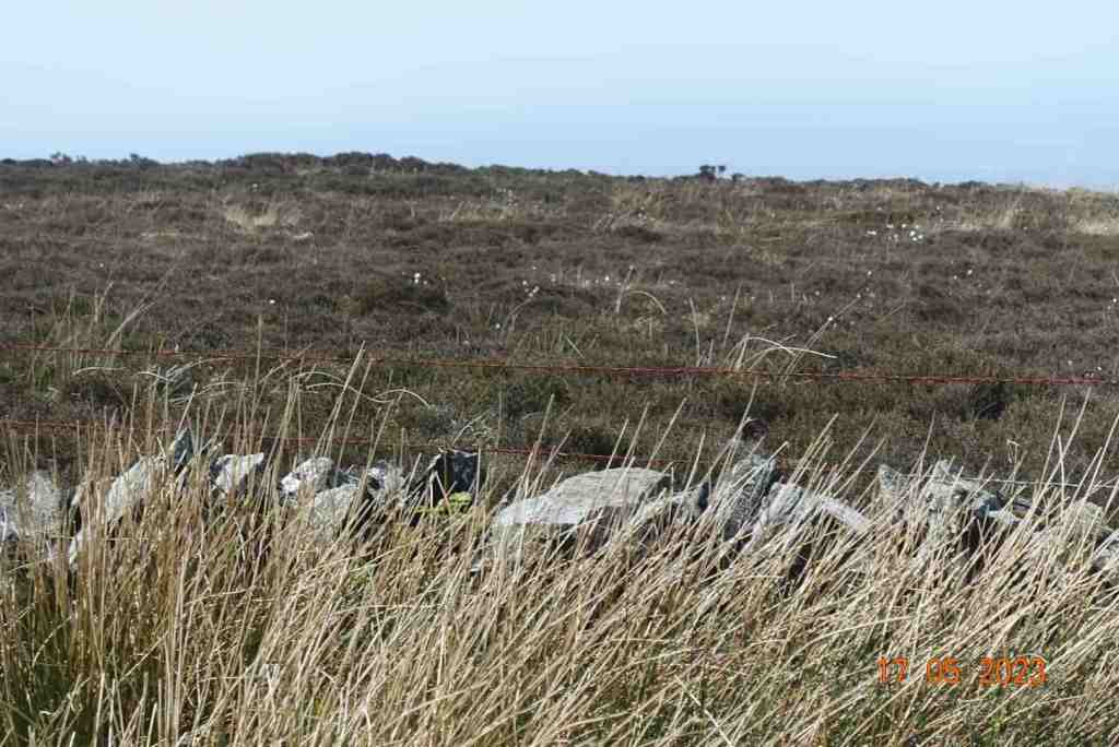
After lunch we followed a grassy but uneven track with overgrown bracken for the next mile of so. In places, it is a little exposed as the cliffs fall away into the sea. We met a lady and her dog from Arnside who had never visited the island but was now smitten by it, as we all are. It was a little tricky crossing the swollen stream at Glion Mooar, and then we had our main uphill section of 300ft or so. We took it steadily, stopping to look at the wild flowers, or to admire the beautiful common blue butterflies that were darting here and there, or just stopping when we wanted a rest.
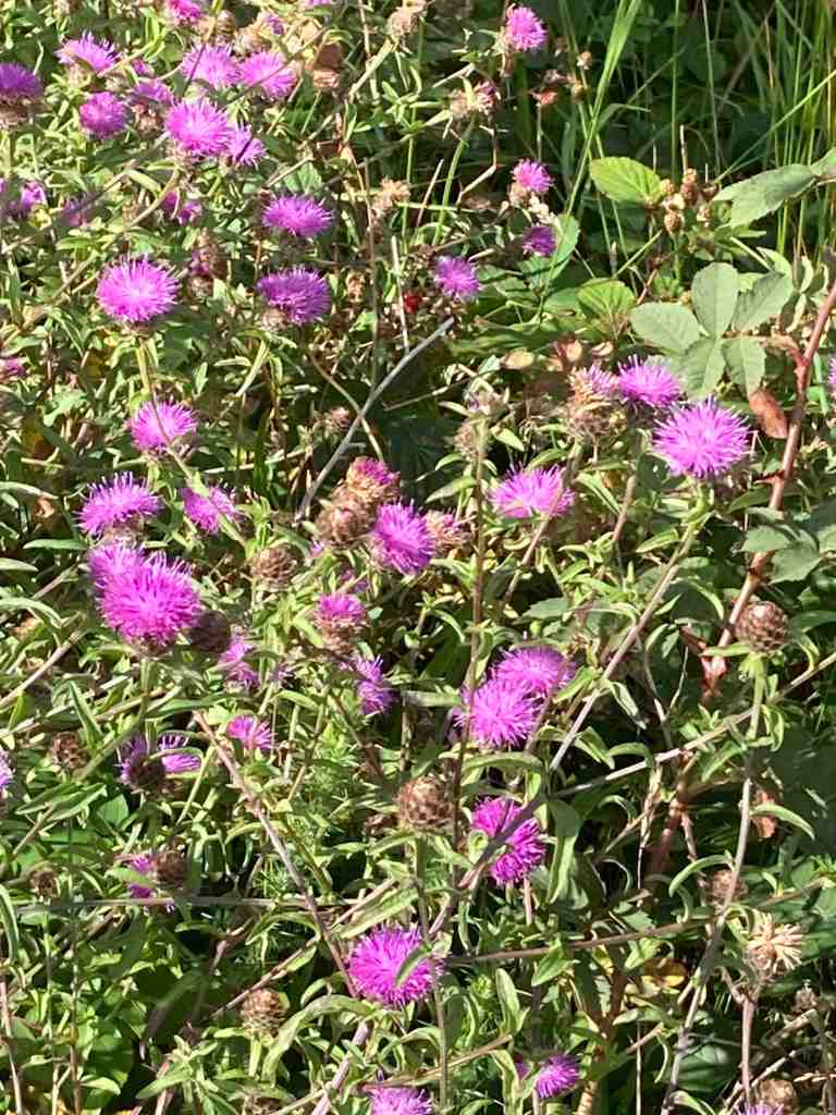
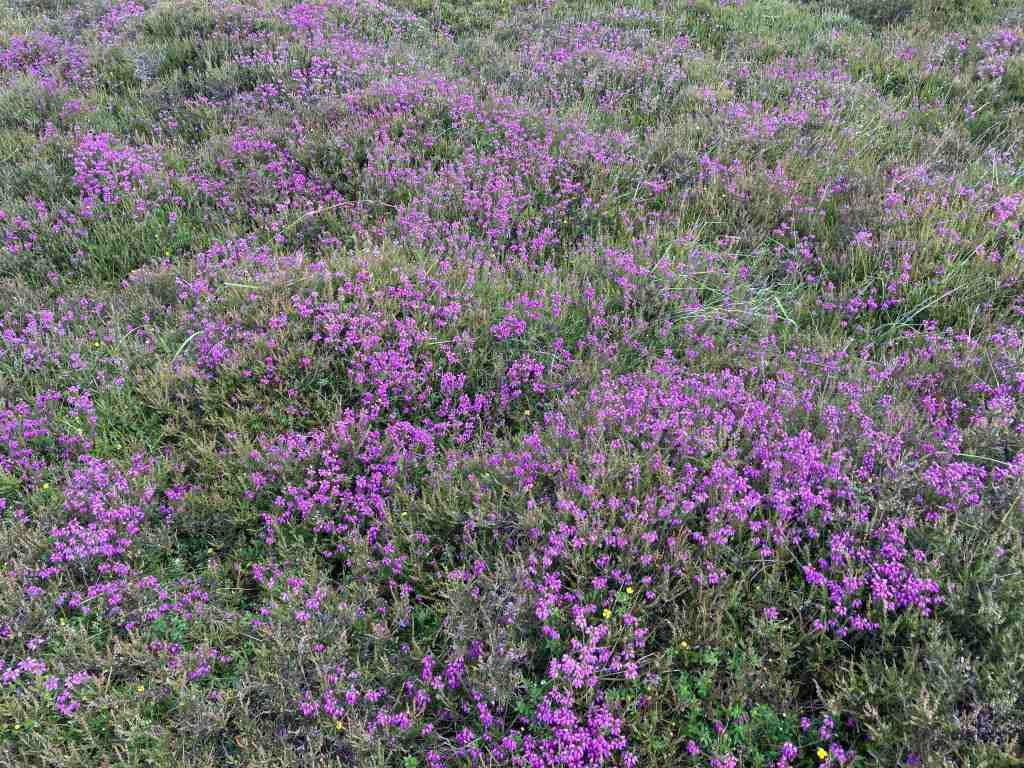
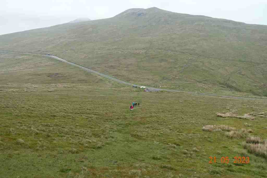
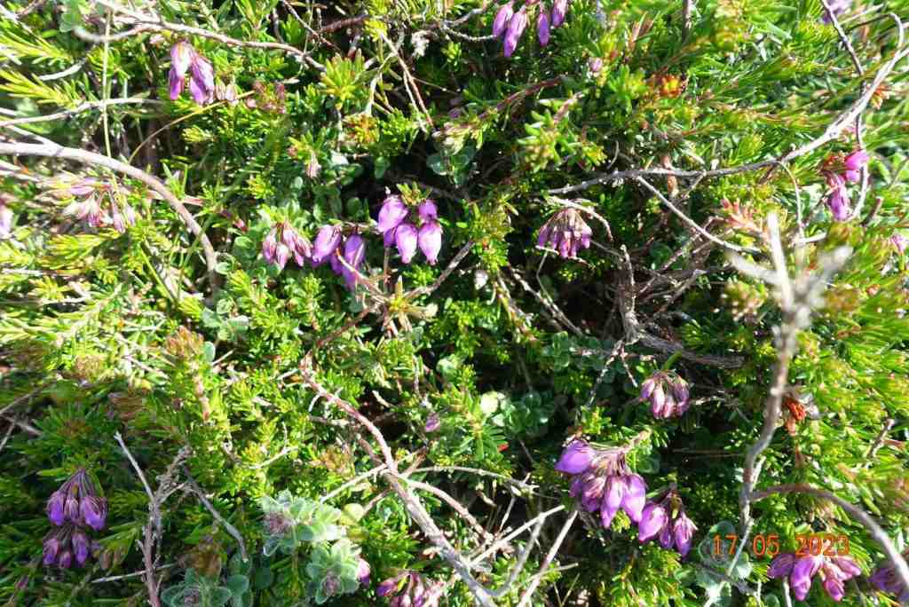
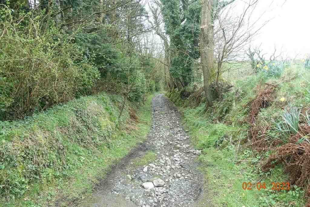
When we reached Eary Cushlin house a few of us were pleased to remove ourselves from that environment as we were being bitten by midges and such like. It was then a flat walk along the track back to the cars, but not before we stopped to admire the glorious heather on the Dalby Nature Reserve. We had had a wonderful day and enjoyed each other’s company. Distance: 4.25 miles, 935ft of ascent and descent.
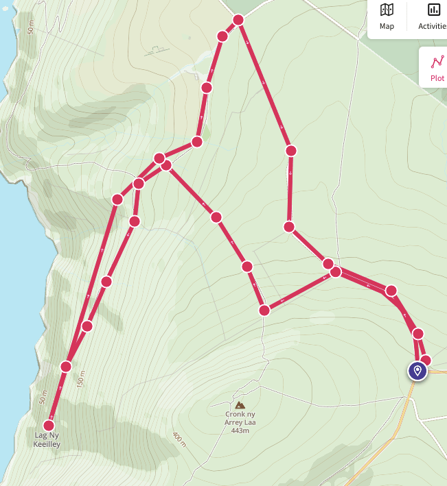
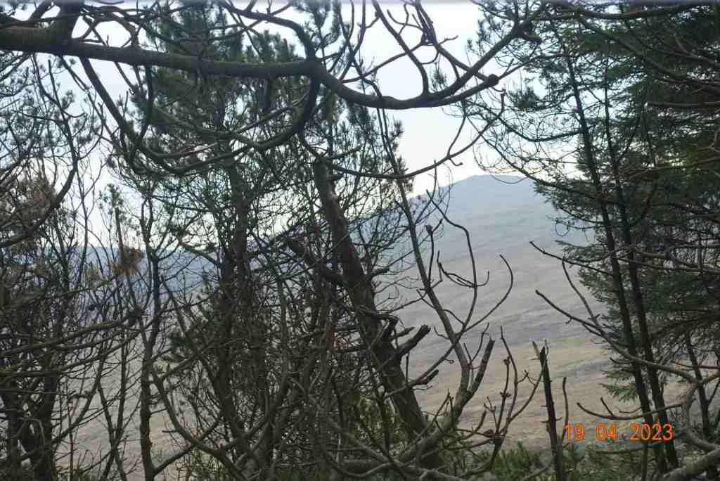
I ventured out on the first sunny day I could find to do a short recce of an optional extra I was intending to offer on our next U3A walk. Lag Ny Keeilley, the home of a long gone hermit was my destination, and I was starting from the ‘car park’ at Cronk Ny Arrey Laa. I don’t propose to give you a full breakdown of this walk as I shall write it up another time, with a better map and possibly an alternative end-section, but most of this walk is absolutely stunning, especially if you did it as I did, first thing in the morning, before other people have got out of bed.
Having said that, as I started walking down the lane, I bumped into a man with his grandson picking bilberries. There are heaps of bilberries on this island. I did pick a few myself just to check what they were like. I walked down until I reached the footpath sign leading into the Dalby Nature Reserve, only I turned left instead up and over a stile onto the moorland on the lower edge of Cronk Ny Arrey Laa. The light was wonderful and the wild flowers were in abundance, making this a joyous walk. I walked alongside the wall, slightly uphill, until I reached the path leading down from Cronk Ny Arrey Laa, and followed that to Eary Cushlin. This path is becoming worn in places so do take care.
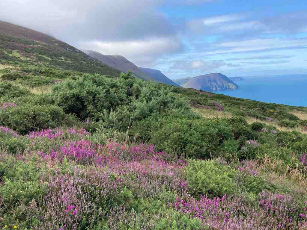
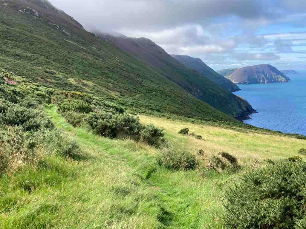
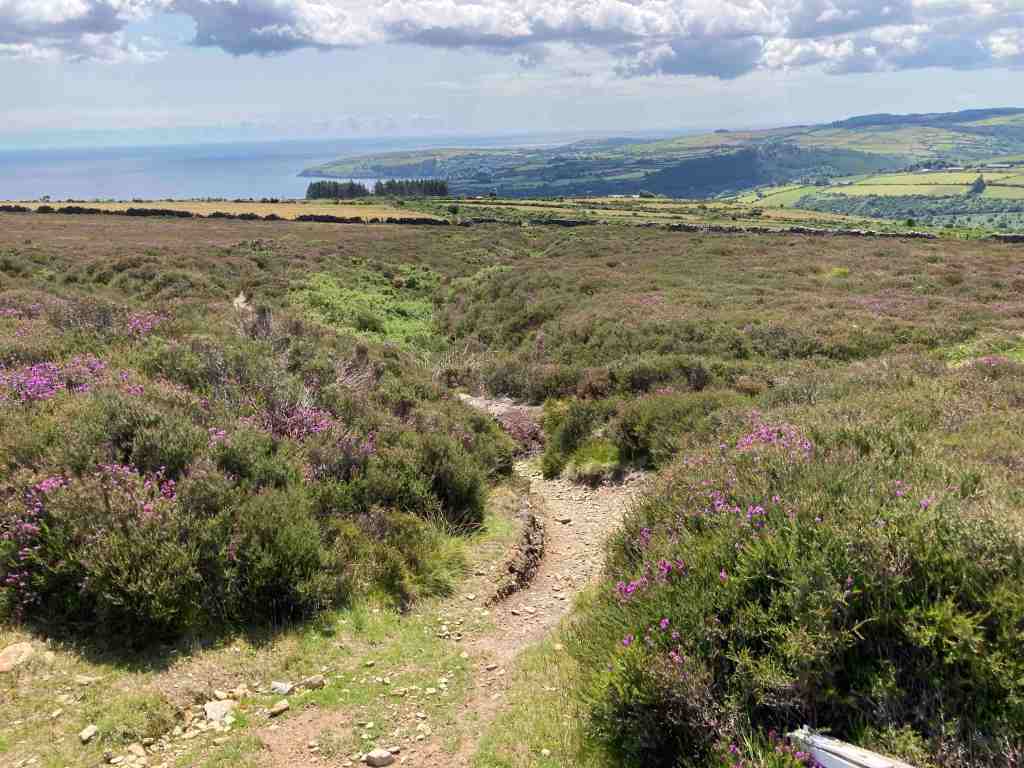
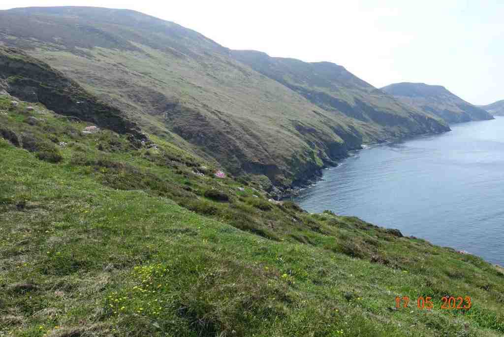
The path to Lag ny Keilley goes to the left in a southerly direction skirting along the bottom seaward edge of Cronk Ny Arrey Laa. Ignore the footpath sign to the right unless you want to visit the waterfall and have a steep climb back up the hill! Our path continues for about 3/4 mile hugging the coastline. It is not particularly exposed but neither is it a particularly easy path. You need to be sure-footed as it is uneven in a number of places and there are gaps in the path on the seaward side, so you may lose your poles if you are not careful. But, it is passable with care, and if you do trip you will get a soft landing :-). It is also very wet in places, made worse by the constant rain we have had recently. There is a bench if you want to stop and enjoy the views, which are spectacular. I sent a Whatsapp to my children with a couple of photos, saying that people go on holiday to get views like these, and here they are on my doorstep.
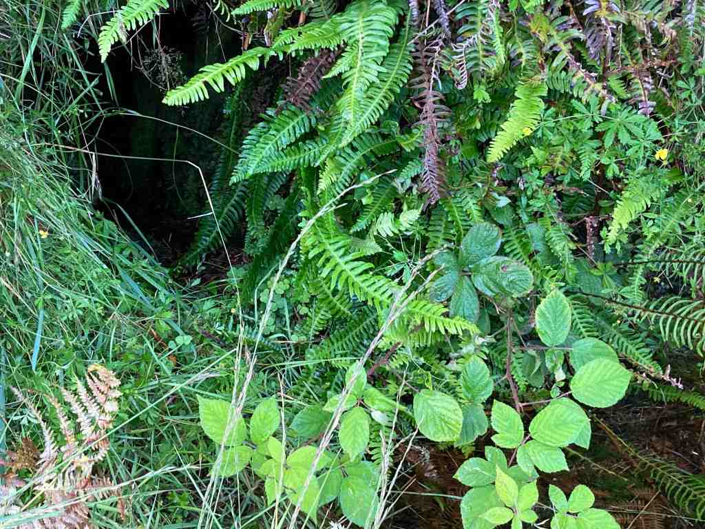
There is also one rather large boulder you have to navigate, but otherwise it is a narrow packhorse track, going steadily downhill. Before you reach Lag Ny Keeilley, look out for the Holy Well, which no doubt kept the hermit going with a constant supply of fresh water. I didn’t go down to the site itself, but I did take a photo. It looks rather uninspiring from a distance, but it is interesting when you get there, and imagine the life that was lived here, and the visitors it has seen. You can learn more about the site here : https://culturevannin.im/exploremore/places/lag-ny-keeilley-717214/ and here: http://early-med.archeurope.com/british-isles/the-celtic-church/lag-ny-keeilley/
It is a steady climb back to Eary Cushlin. The remaining section is on a stony road up the hill. Altogether this was a 4 mile walk, with 1000ft of ascent, which completely surprises me. I have checked the ascent on a couple of maps and it appears to be correct, but it is not at all difficult.
I shall not include this on my next U3A walk but instead I shall offer it as a separate walk sometime in the future, and maybe include Dalby Nature Reserve which will make it an even more interesting walk.
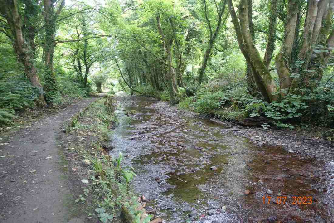
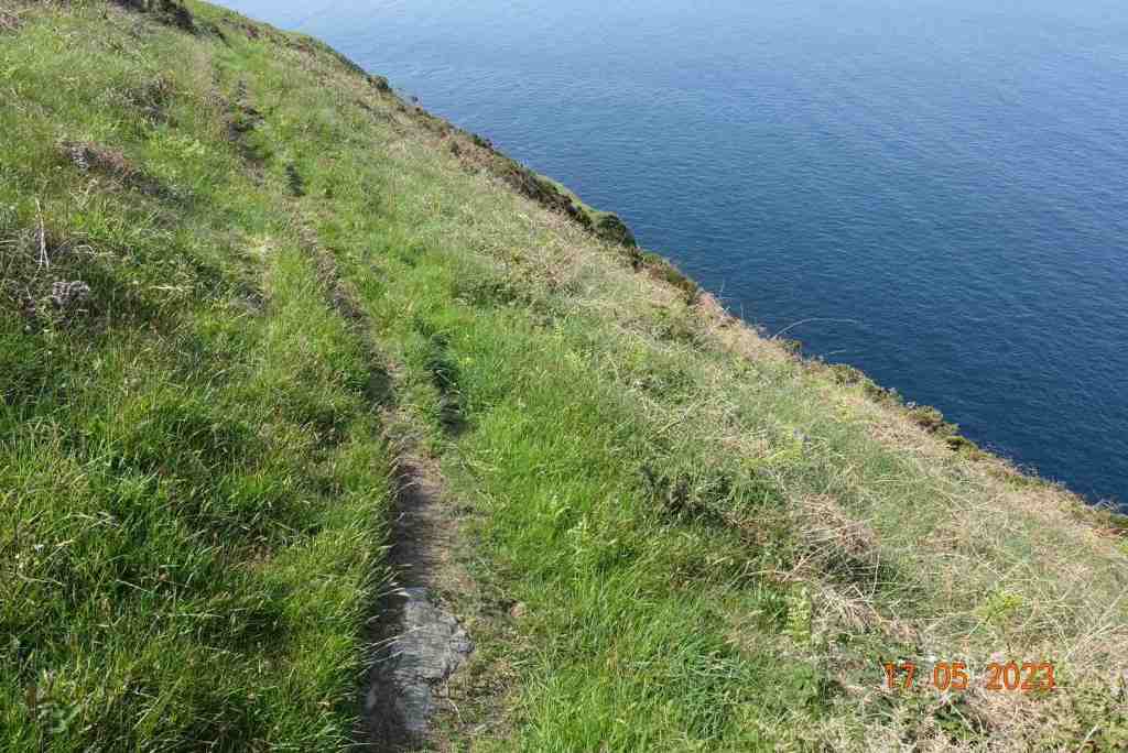
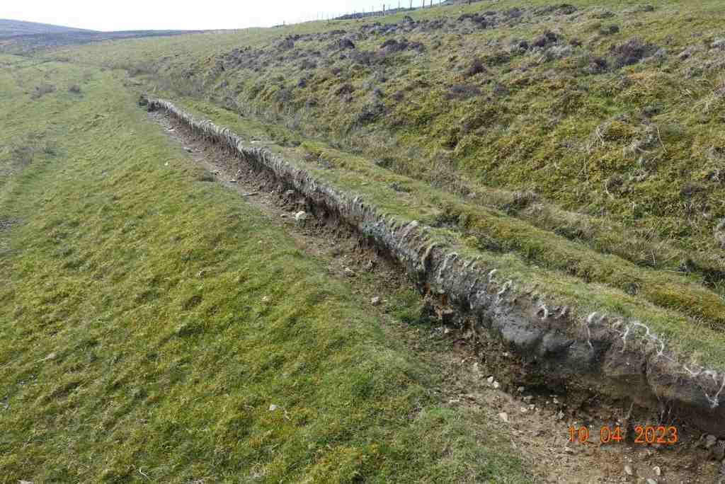
Below are some examples of the uneven path:
Update: Monday 7th August – found a tick embedded in my leg this morning, despite being fully covered from head to foot during yesterday’s walk. Am awaiting advice from dr as previously I became very ill following a tick bite. So, do be careful if out around bracken this summer. These tiny pesky creatures sit atop grasses and such like looking for passing prey. If you do find one on you, use a tick remover and seek advice sooner rather than later.
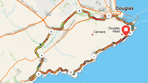
I have walked this route many times before, but not usually in this direction. It is so convenient to get the steam train from Port Erin to Port Soderick and walk into Douglas from there. I found this alternative route very pleasing and in many ways it affords better views walking from North to South and then back to Douglas.
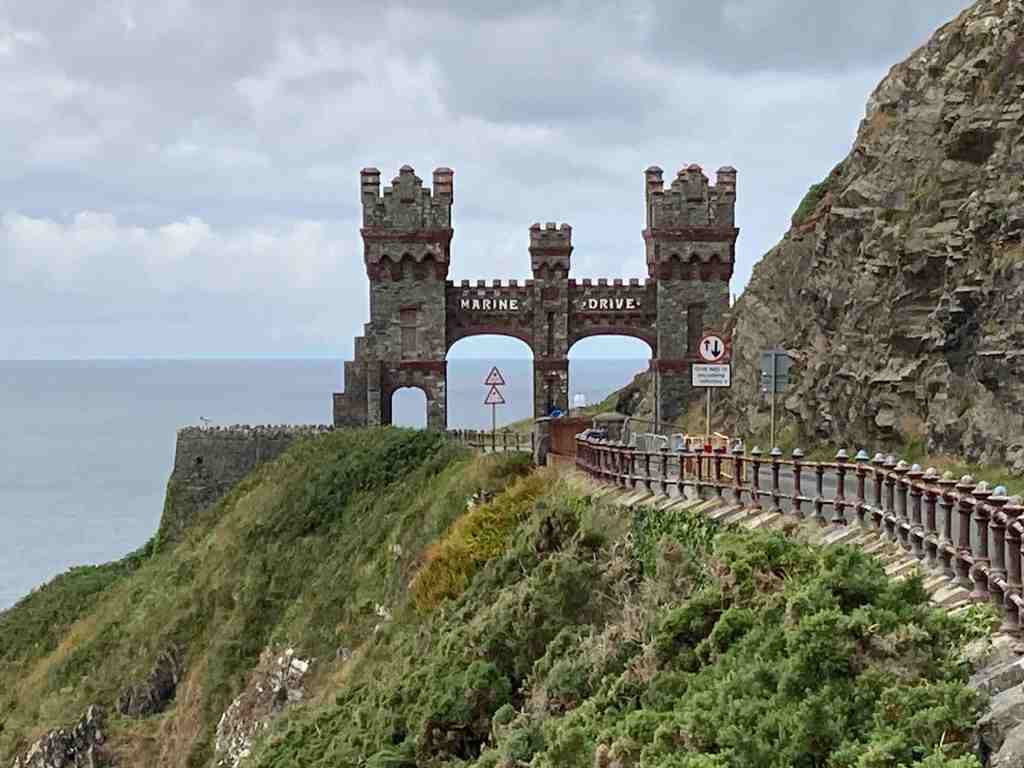
I commenced the walk at the Arch on Marine Drive. If you are visiting /using a car, there is plenty of free parking just the other side of this arch. Before that, parking is limited to 2 hours on the road. The first section is about 3 miles, along an old road so very easy walking, or also suitable for pushchairs or wheelchairs. You get fantastic views of the twisty rock formations and in places you can divert from the road onto grassy areas where you can rest awhile and look at the views or try to catch a glimpse of a passing porpoise (they are quite common here). On a good day you can see all the way down to the Langness peninsula.
Marine Drive stops just short of Port Soderick, and there is a lovely stopping point overlooking the bay if you have time to stand and stare (or eat your packed lunch). There are choices just beyond this point. Port Soderick Glen is very short but always lovely, and new paths have been created, so it is worth a walk down to the bay and up the Glen. You can then either retrace your steps to the top road or continue westwards on the road and catch the steam train back to Douglas.
The route I was doing fell short of this latter option, and I did not venture down to the beach but instead hiked up a grassy track that leads over the track of the steam train and follows alongside it to the village of Port Soderick. Here you get completely different views, with glimpses of the northern views and hay-stacked fields or simple grass meadows. As a bonus, you may well meet some donkeys who will be keen to say ‘hello’, but please do not feed them as they are on a special diet.
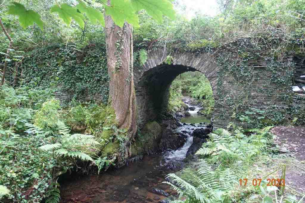
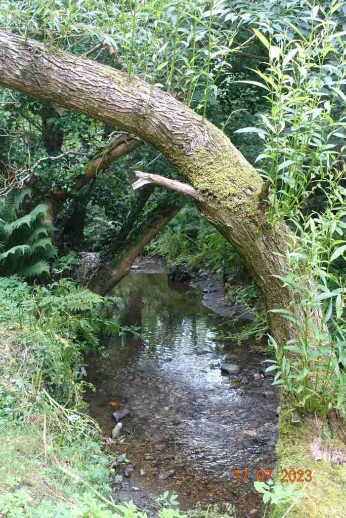
This path terminates at the old Castletown road, where we turn left and walk from a short distance a little uphill until we cross the road and take an unmarked footpath (it is on the map though) to another footpath junction. This is a delightful tree-lined path all the way downhill, and as you walk it you feel the centuries of feet that have trodden this route before. It leads to the real Fairy Bridge, which is slightly off the path. Once you have gone over the footbridge over the tiny ford, take a left immediately into the woods and follow the informal track and you will soon spot the bridge. But don’t stop there. It is interesting in itself, but take time to go over the top and down the other side. There is an area like a platform nestling beside the stream, which is relatively wide at this point, and you really do get a sense of fairies dancing in the shrubbery.
Back on the main track, this continues all the way to the main road. There is no way of avoiding this, but it is only necessary to walk on for a short distance before we turn off and walk alongside Middle river. I just love this tiny, unexpected area of wilderness. It is sandwiched between Pulrose Golf Club and a set of unattractive warehouses on an industrial estate, but these are totally masked by trees and shrubbery. At the end of this section, you do have to walk for about 50 yds through this industrial estate before turning right on the Nunnery footpath, another gem you don’t expect in an industrial setting. This follows beside the main Douglas river and you may be lucky enough to see a steam train go overhead or a kingfisher darting about the river.
The last section is unavoidable road walking into Douglas, but it is not altogether unattractive, and just a little further along, you arrive at the Marina. There are plenty of cafes along the side of the marina where you can take a rest before the final short uphill section back to the car. This, too, has its rewards as Douglas Head has amazing views of Douglas and the northern hills. On the way there, you may be fortunate as I was today to see the new boat, the Manxman, in the harbour. I can’t wait to have a ride on that massive beast 🙂
Total distance: 8 miles, but with shorter options at various places. Total ascent: 564 ft; total descent 814 ft
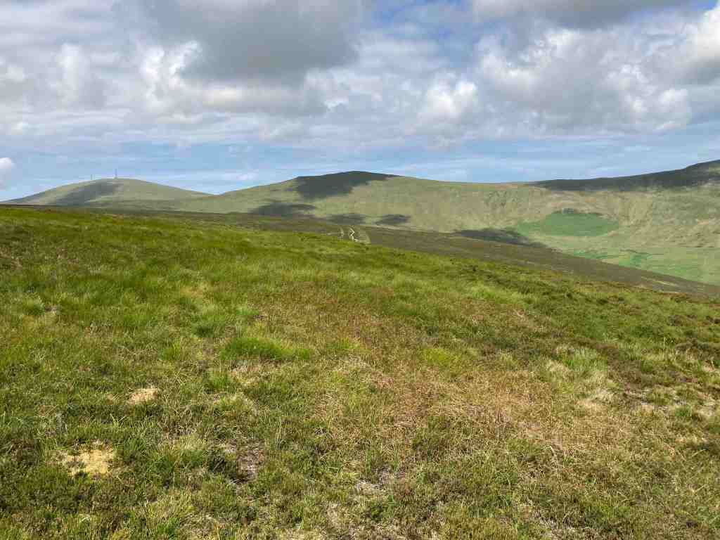
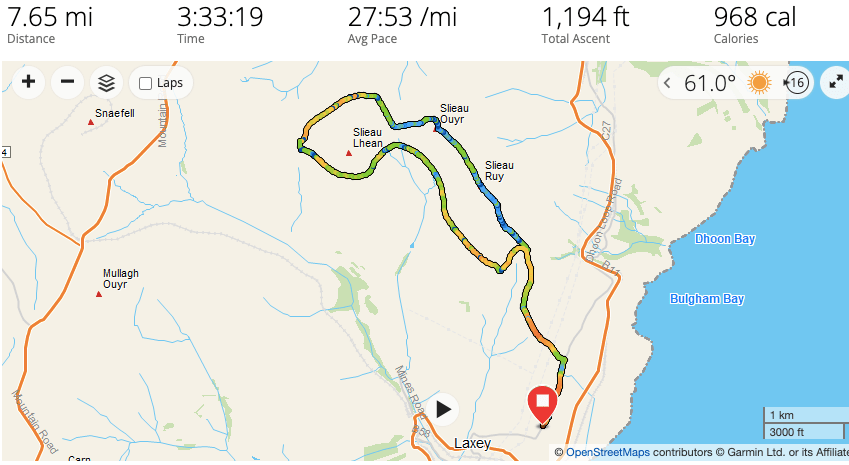
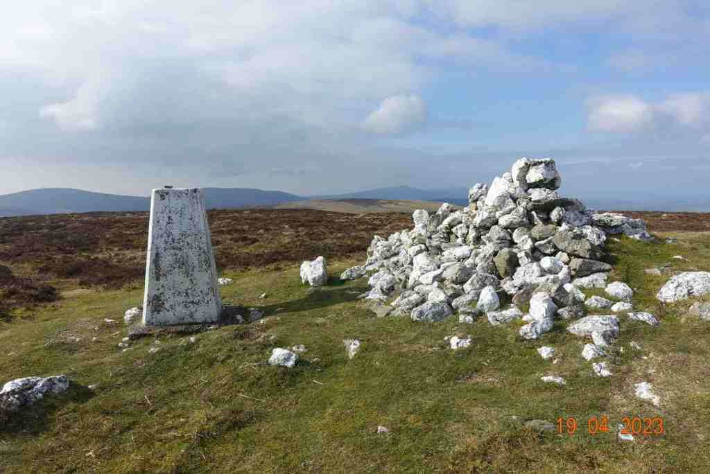
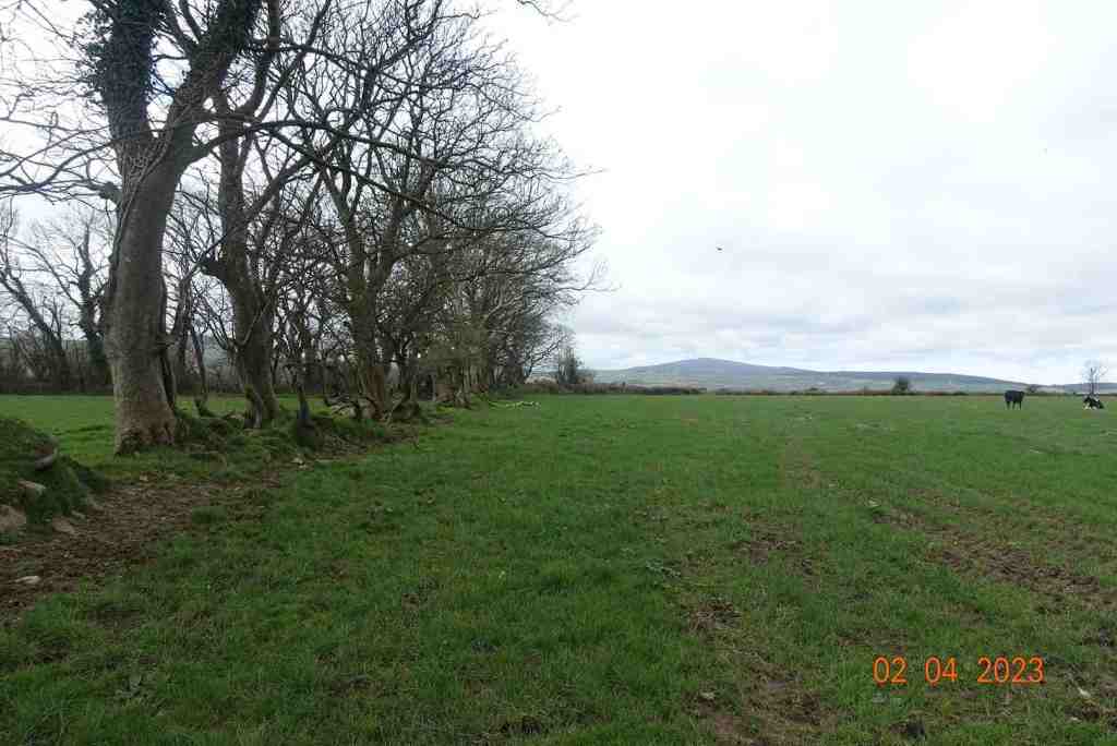
Today’s walk was part of a previous walk in reverse as I wanted to find out if there was a path or sheep track over the top of Slieau Lhean (469m). I parked the car on the minor road above Laxey before Ballachrink (which is actually the Raad Ny Foillan), and walked up the lane to where the right of way leads off onto the moors on the left.
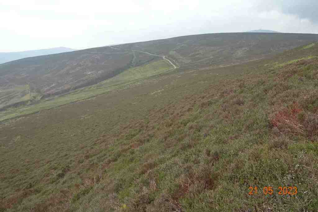
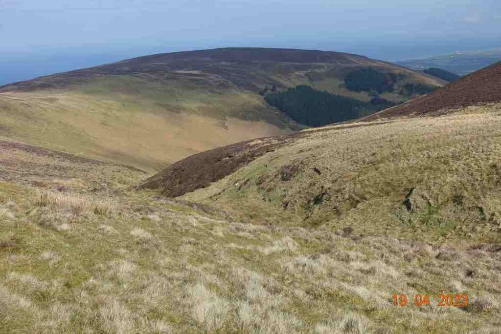
It was a bright sunny day, a change from the unremitting dull weather we have been having recently. Yes, I know, we had no rain for 5 or 6 weeks so we need some bad weather in between the good weather. It is a very gentle, steady climb once on the lane that goes nowhere, other than to a few houses and farm buildings. The lane stops abruptly at a field gate where it turns into a green lane, which means bikes and horses can use them. This is good in one way as it opens up the countryside to various forms of locomotion, but the bikes certainly mess up the tracks and pathways too. The track enters ‘The Dreem’, the Manx word for the back of a hill. After about half a mile, the eagle-eyed person will spot a tiny footpath leading off up the hill to Slieau Ruy (396m). We have several hills with this name and despite sounding regal it only means ‘red’, but in this case, it means the red of the purple heather, which was already flowering. I have never seen so much heather this early on in the summer.
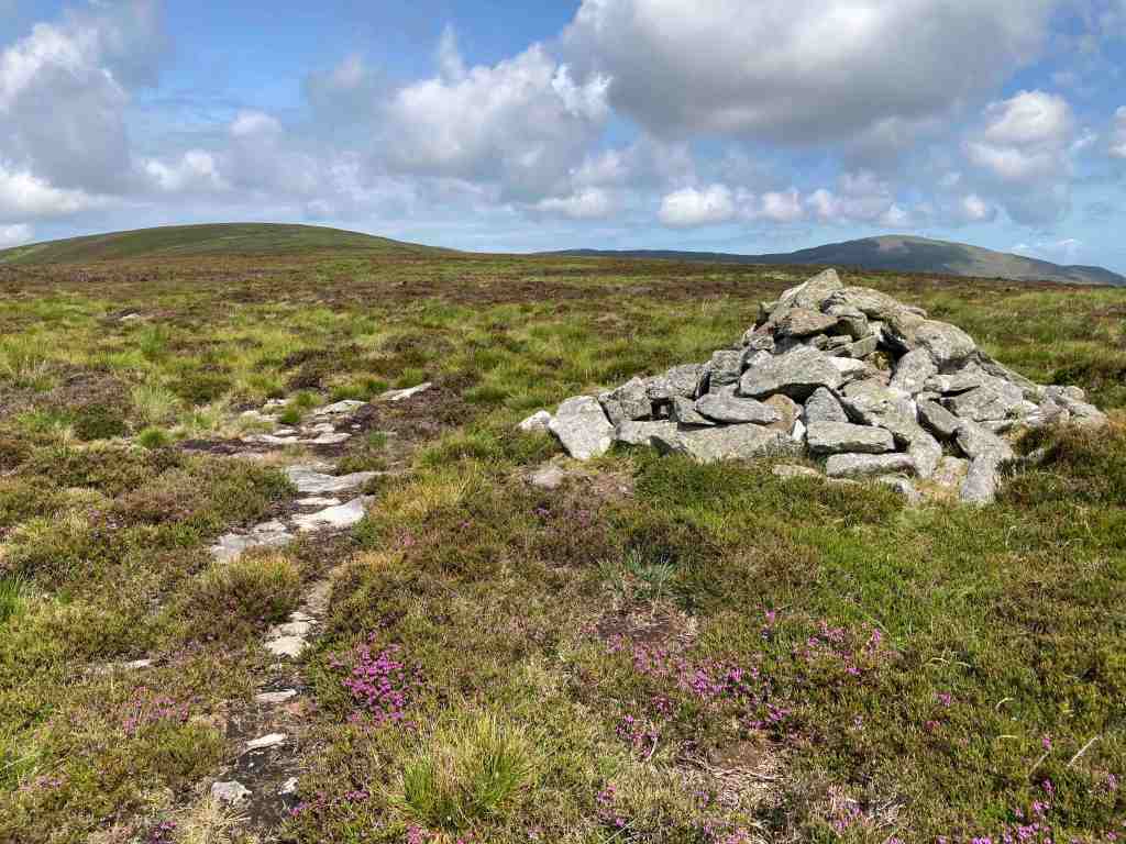
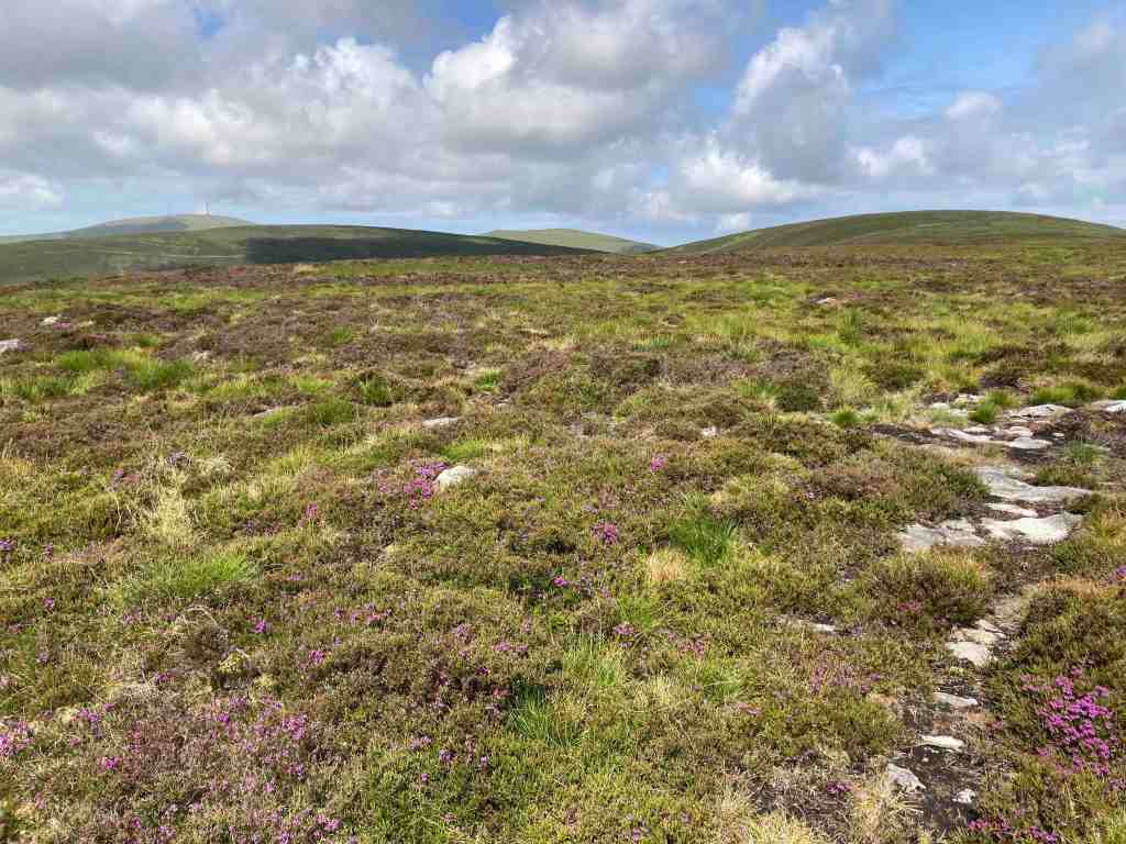
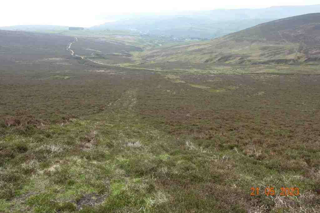
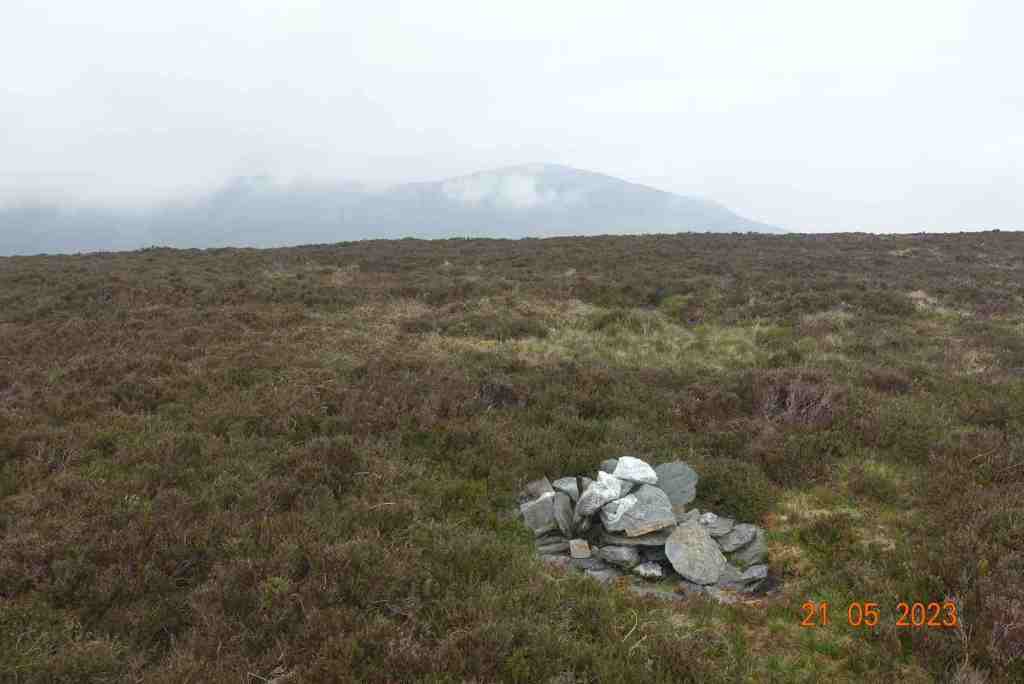
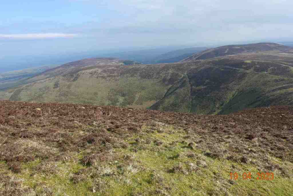
The steady climb continues until you reach a false summit with a cairn, but it isn’t actually at the top, so it more of a waymarker. However, as you climb, the vista begins to open up especially to the south and east and you get good views of Maughold as well as distant views to Douglas and beyond. You can imagine in your mind’s eye the Creg Ny Baa (rock of the cow !?) and the mountain road to the south of Windy Gap. After Slieau Ruy there is a plateau of heather and grass before another short climb up to Slieua Ouyr (yes, you guessed it – ouyr means yellow, as in ochre). It is worth heading off the path a little to the north to get the best views of the Corany Valley and Ramsey. You cannot miss the sausage shape of the North Barrule hills which dominate this landscape. It was at this point I needed to hunt for a new path, and find one I did. It leads down to the gap between Slieau Ouyr and Slieau Lhean (meaning broad and long). The map indicates there are cairns but I didn’t see any. This is a watershed where one half flows down into the Laxey valley and the other half flows into the North Laxey Mine area. There is a faint path going up Slieau Lhean but I gave this a miss, in favour of a wide, grassy track to the north, which eventually joins the Glen Mona track. Distances are so deceptive; hills look to be a stone’s throw away yet take an age to go round or over them.
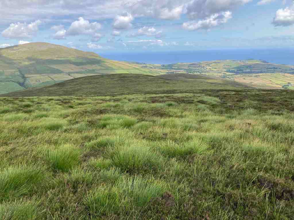
This was the furthest point for me today. I had already walked 3-4 miles, so I knew it would be the same amount back again. This time, I took the track to the south around the hills; this meanders very slowly all the way around the three hills but now, instead of seeing the big bullies of Barrule, we see the softer side of the hills as they gently roll down to the sea. We pass over the watershed again this time on the south side, where it has the name of Glion Ruy, red creek, which when you see it seems very apt. This track is not my favourite, as it is stony and awkward in places, but it is possible to walk on the grass just to one side most of the time.
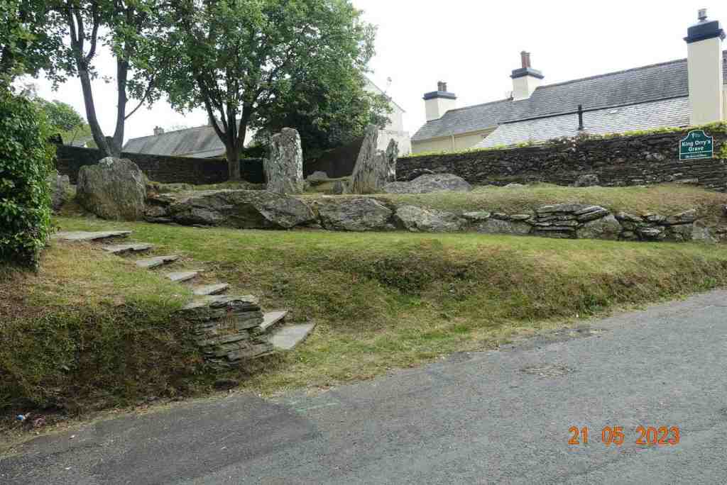
I was retracing this route for the Southport U3A group as I so want them to walk along the tops if there is a suitable way, and in this I succeeded. However, if you stay on the track, rather than walk on the tops it is not necessary to continue all the way. There is a small footpath that leads directly towards the canopy of trees which leads down to King Orry’s Graves, so if you wish you can miss out about half a mile of unpopular track walking!
That was it for today. I should just mention that although not a difficult walk, there is far more uphill walking (just under 1,200ft) than if you walk it the other way round, from Snaefell. As I was finishing the walk a holiday organiser rang me to confirm that I had got the last possible space on a train trip to Austria. I was so delighted I didn’t re-check my diary and managed to book myself on a wonderful holiday at precisely the same time as I was due to lead the Southport group on their walks. When I realised this I was devastated, but I am sure it will all work out. I can at least do one day with them. How ironic is that when you think I had gone out today specifically to recce a walk for them. That momentous birthday that crept up on me last week may be signalling a faster deterioration in my mental abilities than I am aware of!!!
I won’t be doing much walking over the next few weeks as my son, Matthew, and his son, Thomas, are coming over to the Isle of Man and then we are going to the Lake District (they for longer than me), but I will post as soon as I can.
Distance 7.65 miles, Ascent 1194 ft; Descent 1161 ft. Min Elevation 483ft; max Elevation 1507 ft
After another session of teaching, preparing my students for their final Psychology exam today, I had a stroll down to the beach, and continued on to Milner Tower.
It was a balmy evening and the TT guests were out in number enjoying the beach and the sunshine. The bands were playing on the beach and many people were sat on the wall drinking beer whilst they listened to it.
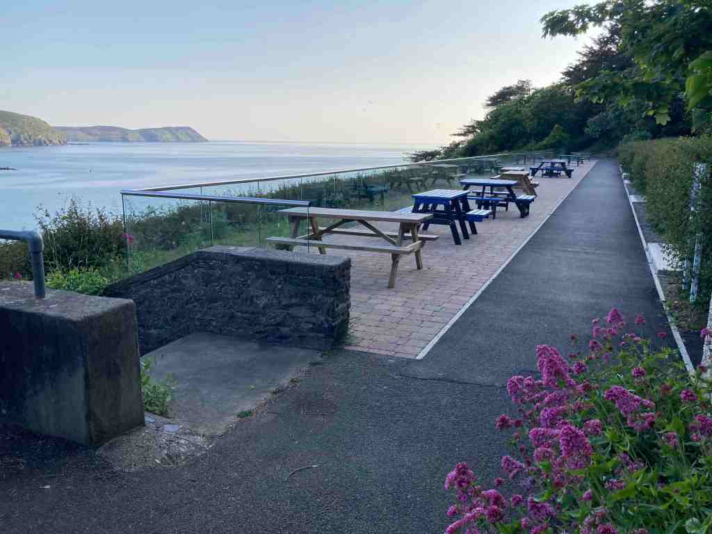
I walked up to where the marine biological station had been, to see what progress was being made on the development there. Absolutely nothing. I stayed a few minutes gazing out from the old sea wall looking for dolphins or basking sharks, but none were to be seen today. Instead, there were a number of small boats dotted around the bay. The tide was well out and I walked along the beach, the full distance as far as I could go, minding my way among the jellyfish, before climbing the steps onto the cliff path that meanders along the cliffs to Bradda Glen restaurant. I was surprised to see this was still open in the early evening, but I guess this is a good time of year to stay open later than usual with the influx of holiday-makers. Just beyond this point is where the commissioners have created a viewing platform with picnic area.
The light was so attractive tonight, making the scenery look so beauitful that I just had to carry on up to Milner Tower. It was also quiet up there, and there were hardly any walkers so I pretty much had the place to myself. I didn’t stop too long though as I hadn’t eaten, and I was after all, out for just an evening stroll.
That will be it for the next few days as I shall be busy working again. Roll on August when I shall get a proper break, although in 10 days I am off to Derbyshire to spend time with my children while I celebrate a big birthday!
It has been fine, sunny and warm weather for a couple of weeks now, with no rain, and here have I been, holed up in my office, looking after my exam students. I was determined to get out this weekend, but as it is TT fortnight, I thought I would wait until later in the day, when it might also be a little cooler.
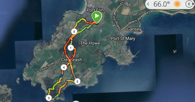
At 5pm out I strode, up the Golden Road to Meayll Hill. The path was unusually overgrown, which is odd given the lack of rainfall. It is not yet golden and I saw few wildflowers on this section of the path. I stopped every now and again to look back and admire the view of Bradda Head and The Carnanes, catching the odd glimpse between the hills of Niarbyl in the far distance.
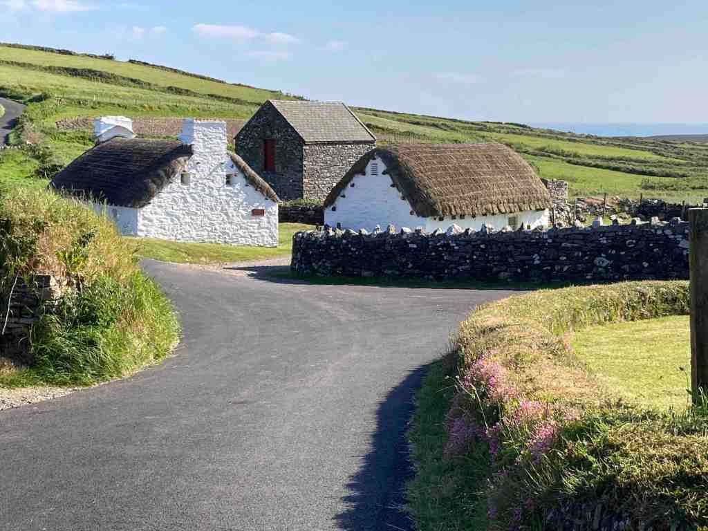
The first section is unavoidably uphill but it is not steep. It is mostly grassy until it reaches a track where there is a house. Just past this, I was treated to the most beautiful song of a linnet, merrily chirping away on a tree just feet from where I was standing. I am now wondering if this was a chaffinch – not the usual habitat of a chaffinch, but it could just be. I have just tried listenting to recording of both linnets and chaffinches and the song wasn’t like either! Any ornathologists out there can let me know. There is a junction of paths here. To the left, the path contours around Meayll Hill to the Howe. Straight on and the path leads over the moors to the stone circle, devoid of colour right now, but by August and September when Southport U3A visit these should be ablaze with colour. I should have expected to see some bikers exploring this ancient monument, so, as I have been there many times before I gave it a miss. Indeed, there were more bikers at the very top so I took a detour and came into Cregneash from the northeastern side.
Cregneash looked very sleepy. The cafe and MWT trust shop were closed and there was no-one to be seen. I continued up the road that leads to the Chasms, one of my favourite views being from the vantage point at the top of the hill before the descent to the old cafe.
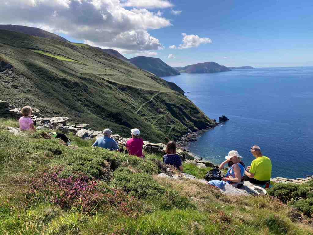
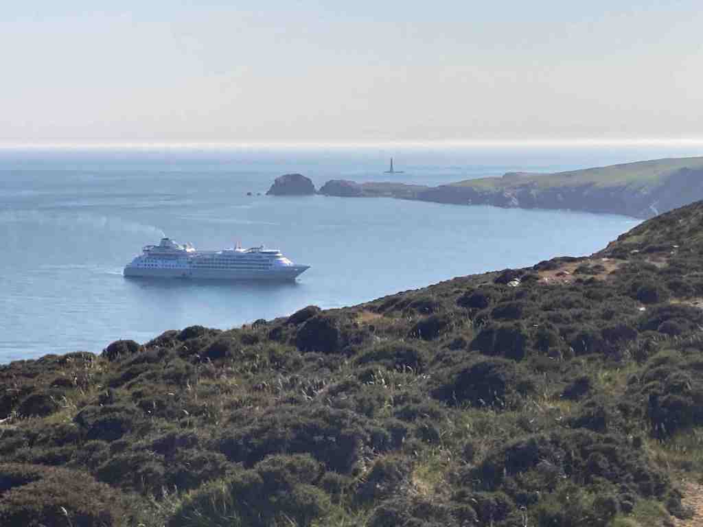
From here, I followed the cliff path to Spanish Head. As I reached the top of Black Head I was surprised to see a cruise ship sitting in the path of the Sound. Apart from a few sounds heralding from the ship, it was otherwise silent. The sun was glistening on the sea and there was a slight mist shrouding the Chicken rock and other distant views.
I was only going as far as the cairn in the next peak, that as far as I know has no name, as this was already about 3 miles. From here, I took a path over the moors back towards Cregneash. I have walked this many times before and usually it is very boggy where the path crosses a stream, but not today. The only muddy paths anywhere were on the farmer’s track leading back into Cregneash.
I followed the minor road back down to Port Erin and home. This is always a delightful road to walk down on a summer’s evening as the light falls on the village and makes it look even more attractive, showing off the beach in all its glory. However, I was surprised to see that a very small plantation has been planted half way down the road, just above the Ballaman mansion, which looks as if they are conifers. I am surprised the owners have been given permission to plant everygreens; I would have expected the commisioner to agree to only deciduous trees in that landscape, but what do I know. The trees were heavily covered up in wrapping so I may have been wrong.
Distance 5.75 miles; just under 1000ft of ascent/descent and a beautifully warm summer evening. What’s not to like?
A free day, and one planned to do a recce before the madness of TT starts, with practice week next Saturday. I was up early, too early for the first train from Laxey to the summit of Snaefell. It wasn’t a great day, overcast and a little gloomy but it was possible to see the top of Snaefell, so it could have been worse.
As I entered Laxey station I immediately saw a walking colleague, Ken. He is a great leader and was taking a walking group from Orpington up Snaefell and on to Ramsey. The one-carriage train was almost full as we headed off up the valley, with the female voice-over telling us all the important points to look at on the way, such as the Laxey Wheel and the mines. Once at the top, the passengers spilled off the train onto the viewing platform. It certainly was hazy, and there was no question of seeing the Mountains of Mourne today, but it was calm and warm, and considering how often blows a hoolie up here, I settled for that.
I tried to let Ken’s party lead off ahead of me, but my delaying tactics didn’t seem to work, so eventually I found myself at the tail end of his party, enjoying idle gossip as we went downhill to Black Hut. There, we parted company as their route would take them to the left and mine to the right. I only saw them briefly again as they reached their first summit of Clagh Ouyr. My route was a gentle climb up the flank of the hill, across heathery moorland and occasional shallow bogs until I reached a plateau that I walked on for about a mile. On a good day, the views would be fantastic on this section, and even today, they were still very good. The path is easy to follow and at the saddle between two hills there is a signpost where you can turn left and follow a track in a north-easterly direction to Glen Mona. That would be for another day. My path went around the southern side of the hill, turning into a stony track. This was all right for a while, but it gradually got wider and stonier and although relatively easy to walk on it did become a little tedious. I looked for a path, even a sheep path to take me to the top of the hill, but there seemed no easy way amongst the heather, so I refrained for the moment. Crossing a small bridge, it seemed as if there should be a path up between two hills, Slieay Lhean to the left and Slieau Ouyr to the right, but I couldn’t make one out from the track. I could see some grassy areas on a steeper section, so I made my way towards those on Slieau Ouyr and blazed my own trail up to the top of the hill. In reality this was only an ascent 322 ft but it felt more as it was straight up for 1/4 mile max!
I was pleased I had chosen this route as it was far more pleasant higher up and I could see in all directions: North Barrule and eventually the coast up to the Ayres and all the hills around Snaefell. Not having done this route before I was surprised how much of an arc these hills make. From Laxey, they look as if they are in a straight line, but they are not. Having reached the final summit of Slieau Ruy, it was all downhill towards The Dreem, across sometimes difficult moorland. The path is narrow, barely visible sometimes, and you have to be careful where you put your feet as there can be sudden drops invisible because of the heather. It eventually joins the boring track I had been on before. The boring track is absolutely fine really and you still get good views of the southern part of the island, but of course, being lower, you can’t see over the mounds immediately adjacent to the path, so you cannot see the northern hills.
Once off the green track there is a choice of routes. Continue straight on and before long you join a minor road that you can follow back to the top of Laxey. I turned right. This next section was lovely; you are still reasonably high, so there are good views, and there were very green paths in between farmed land. The colours had changed from being purple and brown wherever you looked to being bright green wherever you looked. There is a great direction-finder for the next path, as there is a tall, fairly small wood, that you can see for miles, so you can just head for that, as the next path starts here and goes immediately south down into Laxey, or Minorca to be more accurate. As I neared habitation, the colours became even more dynamic and the trees looked magnificent and seemed to own the place. I wasn’t expecting a ford on this walk, but there it was, but with no water overlapping the road today. There must be deluges from time to time, as someone has constructed quite a strong footbridge for those very occasions.
It is now just a few more paces until you join the minor road where you will find King Orry’s Graves. I didn’t visit them on this occasion as I have done so many other times before. Instead, I continued to the main road and followed it along the top road into Laxey before dropping down a delightful path into Laxey village itself. It was then just another short climb up the road back to the station, and Laxey Glen where I had parked the car.
Distance 6.9miles; 614ft of ascent; and a whopping 2,516ft of descent. You won’t notice the descent. It is very gradual, and if you have good weather, this walk deserves the full day treatment. And of course, once you arrive in Laxey, you can spend time walking around the village or have an afternoon tea in a local cafe, or mooch along the beach. It is a lovely village, and you should allow yourself some time to enjoy it.
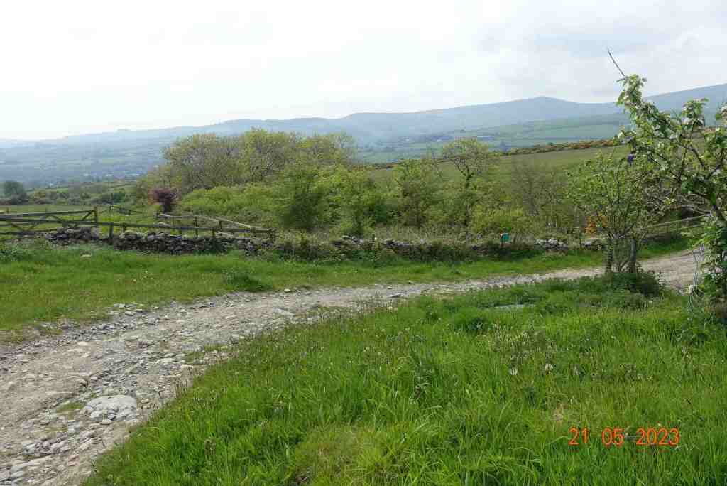
What a way to refresh your soul. I have been working flat-out for a few weeks now and had set aside today for a complete day to myself, without any students, without looking at emails or marking work. I had not anticipated such as treat as I started off through Kerroodhoo Plantation, having parked off the road at Dalby Mountain Nature Reserve.
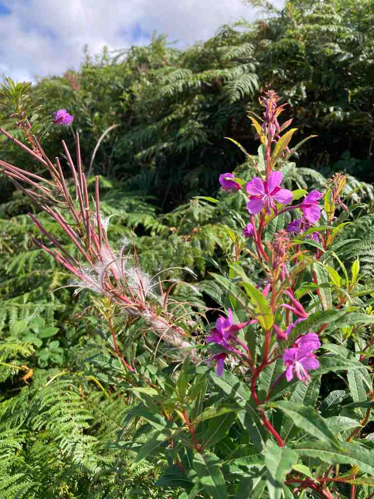
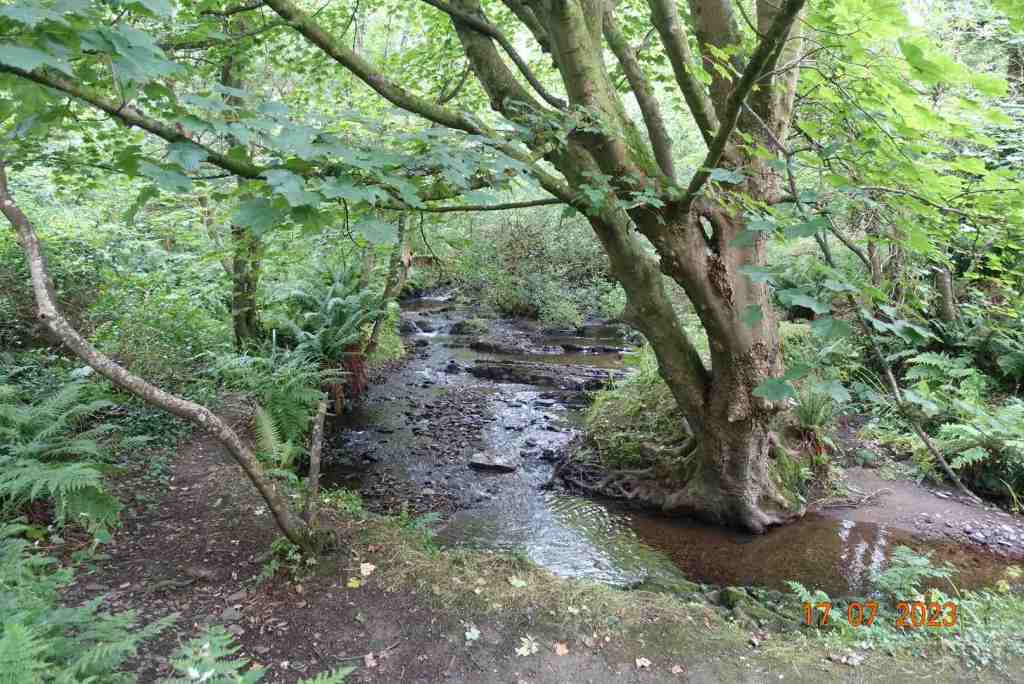
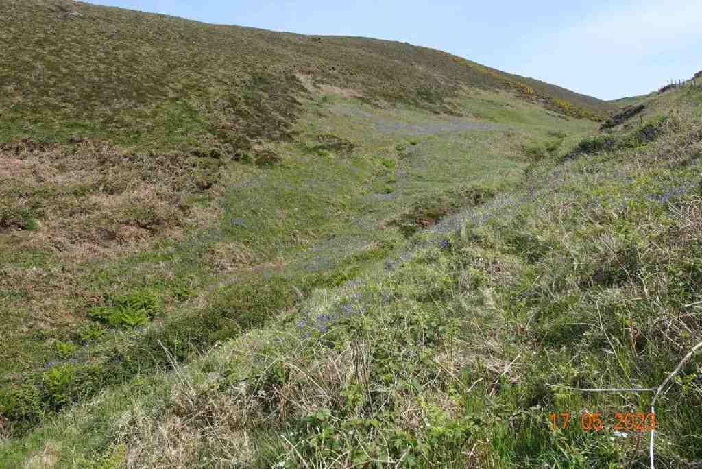
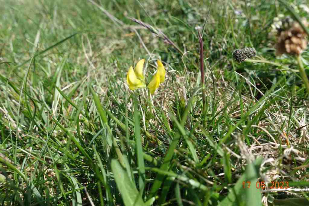
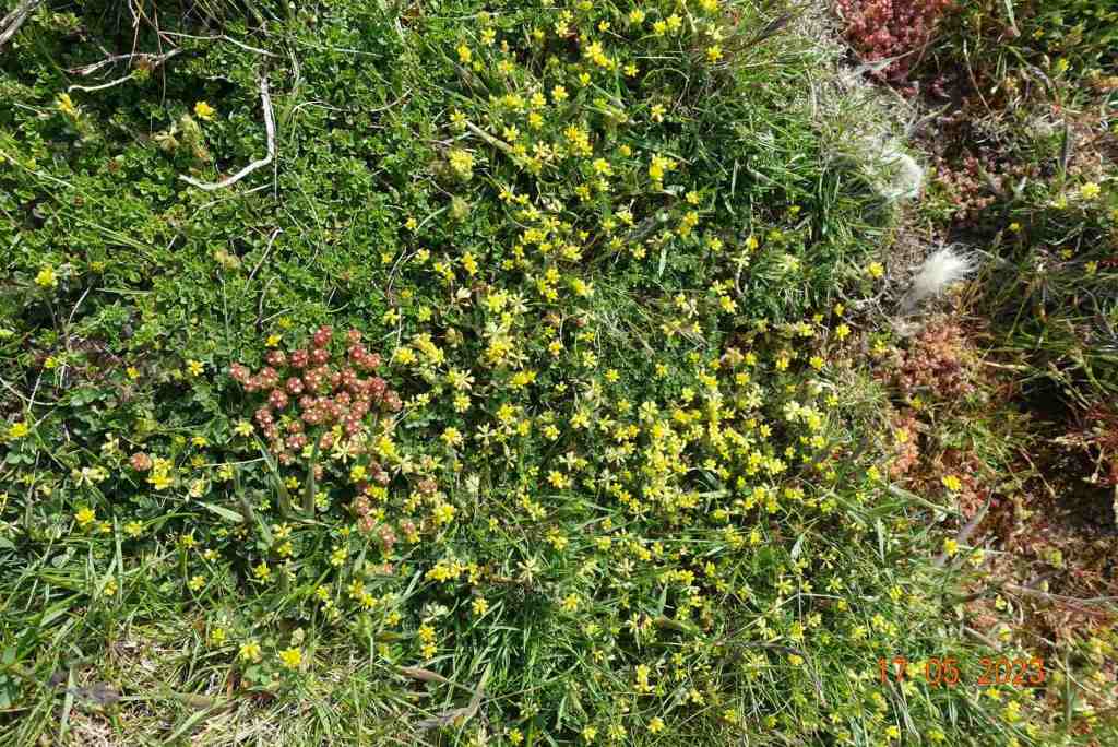
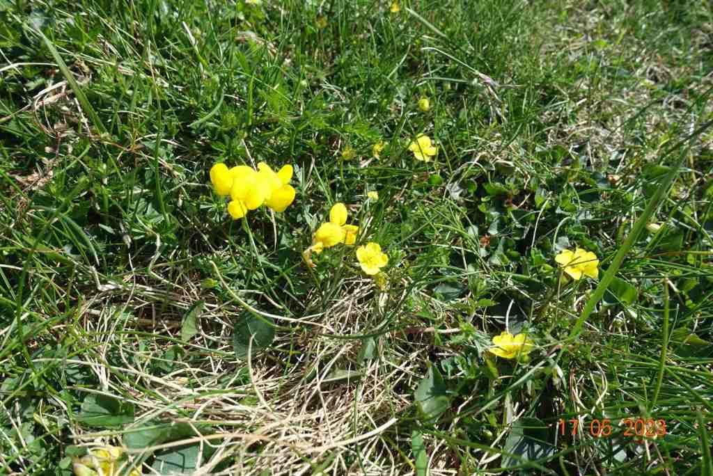
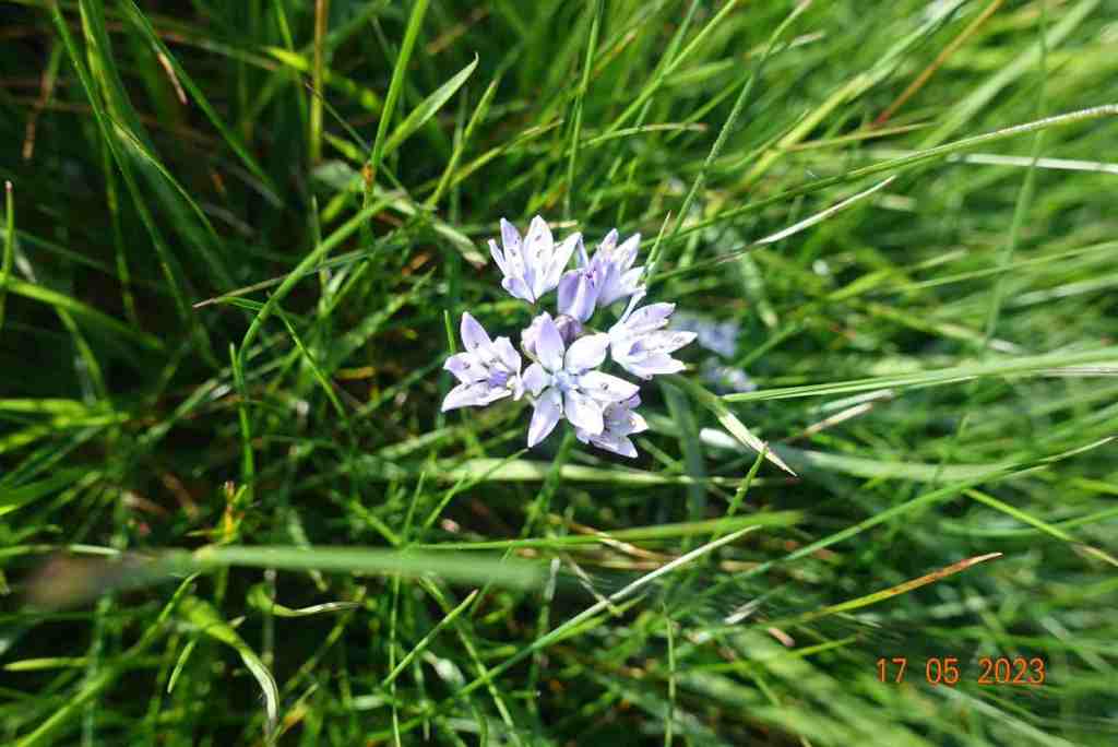
The sun was shining and it was a warm day as I ventured into the eastern edge of the forest. It is always a delightful walk, no matter what time of year, but as the sun glinted through the trees, it was very pretty; even more so when, rather like Wordsworth daffodils, I came across a sudden drift of bluebells, that went on in all directions. I took photo after photo but show you just two here. Although the path is only partly marked out on the map, in practice it continues all the way to Barrane. In places it is a little muddy and in other places slightly steep. If you are slightly infirm of foot I would definitely use a pole to help you down safely, but these are very short sections and nothing to worry about. Not only was there an abundance of bluebells, but throughout this walk there were many, many different wild flowers and it was pure joy to be amongst them. I shall include a slideshow of these at the end.
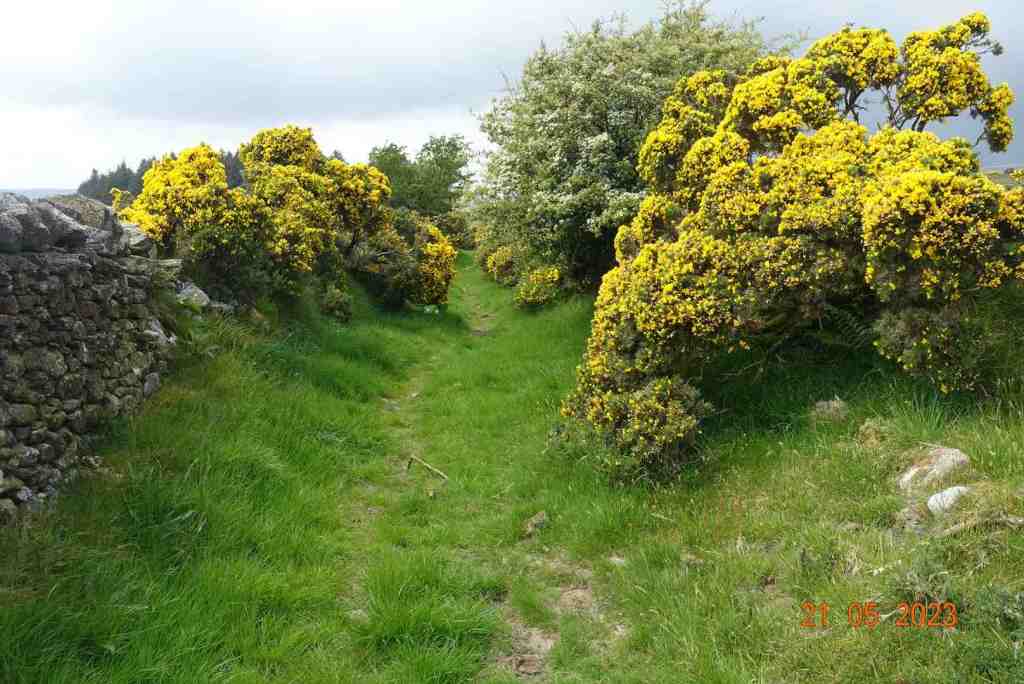
Barrane appears after a mile of walking downhill, then the route joins the road leading to Dalby but go south instead of north, and this becomes a stony track uphill. After crossing the ford, or avoiding it by following the signs for the coastal footpath, take the footpath that leads to the edge of the coast. Most people turn right to go to Niarbyl, but our route goes south at this junction and the cliff path is delightful along here. There is a little uphill walking at this stage but there is a nice resting place where I stopped for some time watching the tortoiseshell butterflies doing a merry dance and listening to the linnets singing in the bushes. The view was sensational and there were different flowers in every direction that I looked. It was so restful and just what I needed.
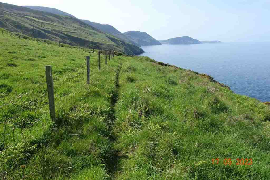
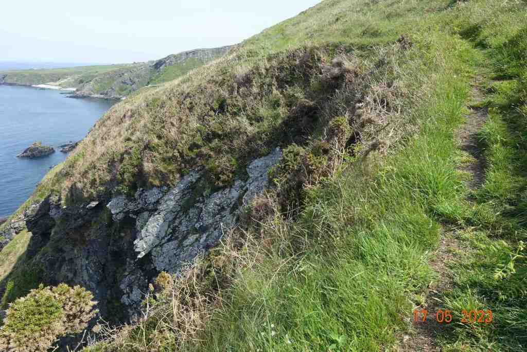
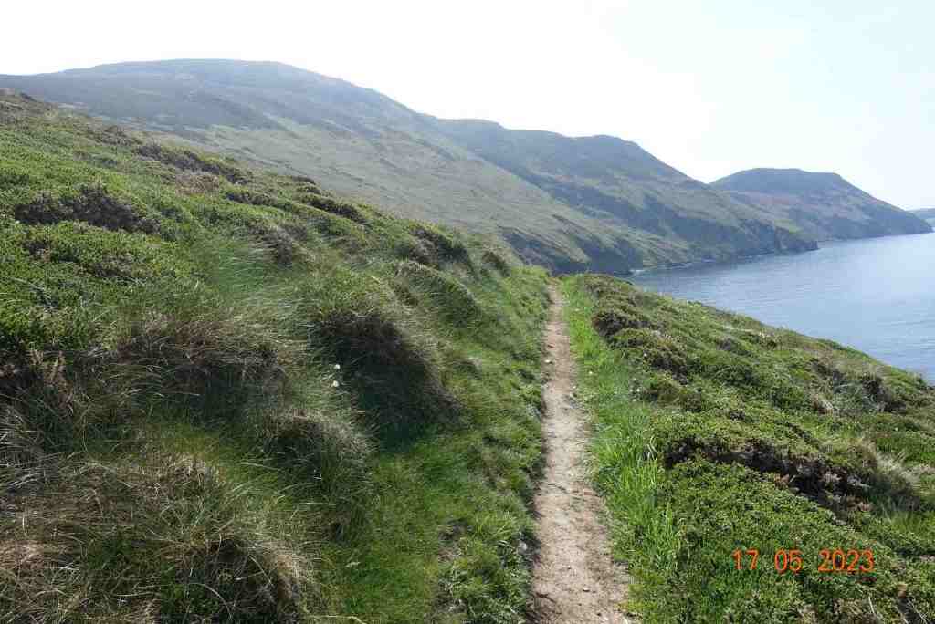
From here, there is a little more uphill and then you join the standard coastal path which begins on a fairly level grassy path before zigzagging downhill for a short distance. Having crossed the ladder stile, the path becomes narrower and closer to the cliff edge. It is never dangerous, but I know some people get nervous on such paths so I have included some photos to show you how close it is. As I say, it is perfectly safe. After a little more downhill, where you are fairly close to the bottom of the cliff at 153ft above sea level, we cross a stream called Glion Mooar and then start the rather more cumbersome 500 ft / 3/4 mile climb up to Eary Cushlin house, of which the first part is the steepest. This can only be avoided by not taking the coastal footpath earlier, but it is a good, grassy path and you can rest whenever you like.
I plan to lead this walk in August, but from here I shall probably take a slightly different route to avoid walking on tracks. Today, I followed the main track up to the edge of the plantation then turned south. This goes very gently uphill to the highest point of day at 998ft. The route then turns off into the Dalby Nature Reserve owned by Manx Wildlife Trust and we walk through this back to the cars. This is likely to be boggy in places as it was today, so if you do follow this route I would recommend wearing long trousers and gaiters. Gaiters for the boggy bits and being a nature reserve the heather and gorse do not take account of walkers and sometimes the path is very narrow if existing at all.
I am feeling so much better these last few weeks and I hoping to get out in the countryside once a week from now on, so you can look forward to a few more posts over the coming months than I have been able to write in recent months.
I have a new favourite walk, at least for the extensive views it provides in all directions. This is a ridge walk on the eastern side of Kirk Michael, and it is relatively short at just about 5 miles. You can choose how much ascent you do as well, so this walk caters for different kinds of walker.
It starts at the Sartfell car park on the Kirk Michael to Snaefell road just before the cattle grid. Today, the mountain road was closed, and I was up early, so I had the hills all to myself, something to be strongly recommended. My only companion was a very blustery wind, which I would have preferred to leave me alone, but it persisted for the whole walk. At least it was warm -ish, but it was also hazy, so this walk will be even better on a really clear day.
The walk follows a stony track gently and very gradually uphill contouring round the eastern side of Sartfell. There’s a deep plantation to the right to begin with prohibiting any distant views, but as you get a little higher, the trees become a little sparser and you get glimpses of a far distant land. Being so windy, the trees were making a heck of noise, sounding like gushing water or labourers felling trees, but no such thing was going on; it was just very windy.
The gentle climb to the top of Freoaghane, with no hint of the superb views to be seen from the summit
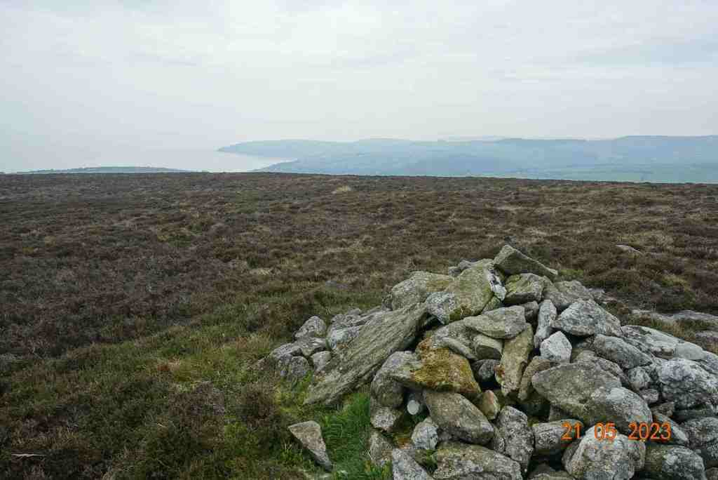
Once you leave the trees behind you are granted a full vista of the northern hills, with Sulby reservoir in the dip. It is still not possible to see over the hills to the east at this point. The stony track continues and becomes flatter. In the distance you can make out an old tumble-down wall on the right and that was where I was heading for. The map showed a foothpath up Slieau Freoaghane. It is a gentle hill climb from this starting point, on a well trodden path over mostly peat and heather. It is only when you reach the grassy top that you get the amazing views in all directions. At the trig point, there is a bell which I was very tempted to ring, but I managed to control myself, fearing that I might otherwise summon all the emergency services for no good reason. Reading someone else’s blog, this bell has not always been on the summit, but may have been linked to worker’s cottages lower down the hillside, and the bell was rung to signal the beginning and end of shifts – day and night. My walk was not going in this direction.
The path off Freoaghane is steeper than the climb up, but very friendly. It is a wide, grassy slope and a very enjoyable descent. As you walk down you can map out where you want to go next slightly off the beaten track, which is exactly what I did, as I wanted to avoid more stony tracks as much as possible. Eventually, it is necessary to meet the track again but only as far as the point where the path divides into two, one going to Kirk Michael, the other to Ballaugh.
There is a very strange grid to walk over, which is semicircular with horizontal bars. Here there is a tremendous view of Glen Dhoo above Ballaugh. I then took a track leading up the delightful valley with Slieau Dhoo immediately opposite. This is a great lunch spot, with lots of grass and even a makeshift natural bench if everyone wants to sit in a row 🙂 There is small amount of ascent on this pleasant footpath which leads to over the brow of the hill and down to the yet another stony track. Don’t be put off by this path saying “road closed’ at either end. I am sure walkers are welcome, but the bikers are not. On some maps, there is a right of way immediately opposite leading down to Druidale, and another one a short distance to the right. In reality, these are in a bad state of repair and give the impression of being purposely neglected. About half a mile away, there is a new signpost, but it is not in the place shown on the map, although it does join up with another footpath that is in a slightly better state of repair.
Lunch stop overlooking Glen DhooThe natural bench
There is a choice at this point. This new track adjoins the former track we began walking on, so it is quite possible to simply walk along this back to the car. The views are stunning, so why not? Alternatively, you can take the track to the left which is about the 4 mile marker on my map, and follow the stream, again walking on heather and peat down to the Druidale Road. There is no alternative but to walk along the lane up the hill to the car, but it is a very quiet road and a pleasant walk. It does mean you do not have to retrace your steps for the last 3/4 mile. It will add on some uphill and probably another half mile.
The hill walks on this island are just beautiful, but they have to compete with our splendid coastline. Last week my son came over for the Good Friday 10km run in Port Erin. On the Saturday, we went to one of my other favourite places – the rocky outcrops at Langness. We were really spoiled, as not only were the seals in abundance, but we also saw a pod of Risso Dolphins in Castletown Bay, a I guess sheltering to some extent from the blustery seas – yes, it was windy then too.
I am leading the Freoaghane walk for the U3A on June 14th, so if you are a member or would like to become a member, get in touch and I will send you details of where and when to meet us. There is no charge for walks; you are entitled to two try-outs but after that you have to become a member of the U3A to participate in any further activities. They are a great bunch of people, and there many different kinds of groups, so if you have time on your hands and you like meeting people and sharing ideas, it’s a good organisation to become a part of.
Distance: 5 miles; total ascent /descent 1010ft/ 974ft
This was a route I have never walked and I didn’t know quite what to expect. I was planning a walk for the U3A and if this one wasn’t quite what I wanted I had another up my sleeve. However, the contingency plan was not required as this is a beautiful walk with extensive views in all directions. The paths are good to reasonable, if a bit muddy in places, and the route is easy to follow.
I started at the centre of Crosby parking by the Bowling Green. I haven’t been there since they build the new houses and Coop and the old-fashioned toilets that were so useful have now disappeared, although the gate remains! Crossing the main road requires care and then there is uphill section for some distance. The first part is the most arduous but it’s not too bad and with every step up you get a better view from where you have just come. A path beside the road has been created for a short distance and by the time we do this walk in May, it should be festooned with wild garlic.
We follow the Millenium Way all the way to West Baldwin, up hill and down dale. The maps show direct routes across fields but it is clear from sign markings that the farmers would prefer us to walk around the field, so please be considerate when you are walking across countryside. Some of these fields were very muddy today but I am hopeful that by May they will have dried out a bit. The views, especially to the west and north, make up for the terrain.
As you get close to West Baldwin, the route follows the river along a high track. This was a lovely section and I enjoyed listening to the water tumbling down into the valley below. West Baldwin is lovely and unspoilt, with some interesting and quaint houses and has a much-loved feel to it. The bridge is attractive in itself and a good place for a lunch stop. This is the half way point in this walk, at about 3 miles.
From here, we follow the road south through the village for a very short distance before taking a minor road uphill and going round a few corners before we drop onto what looks like an ancient track going down to a ford, with a tiny foot bridge for walkers. The track is stony but not difficult to traverse and as it goes uphill after the ford it becomes a grassy track leading to a small lane, which is wide and airy. From here you can retrace your footsteps in your mind’s eye as the vista unfolds in front of you.
This is our downwards stretch which takes us eventually to Glen Vine via tracks, a small amount of road and more fields. The stiles in the field section just beside Glen Vine need some attention. They are surmountable but you do need to take care. A couple of them can be avoided by going through gates, but not all of them. Arriving at the main Peel to Douglas Road, we turn right towards Glen Vine for a very short distance, before crossing over the road and following yet another stream (we have followed a lot of streams on this walk) through an old wood down to the old railway line. In all my years of walking I can’t believe I have walked down this path. It is clearly very popular as people have made higher and lower paths through it and created a swing over the stream for children to play.
The walk along the old railway track is very easy walking, and also interesting. There is a new nature reserve and I always enjoy looking at the wetlands just to the side of the track and thinking what life they have and how they developed over the years. The path was modernised in recent years to make it accessible for bikes, pushchairs and wheelchairs. It is settling in well now and doesn’t look quite so much like a road any more. The section from Glen Vine to Crosby is actually narrower and more appealing to me.
This is a walk I would definitely do again. It is not too demanding, with a total of 741 feet of ascent/descent and nothing too steep. Most of the uphill is in the section before West Baldwin. The distance is about 6.75 miles, which I confess was really too much me only 6 weeks after my operation but I am still glad I did it, and I shall look forward to taking our members around the route in May. Apologies for the poor quality of the photos. I obviously have some settings wrong on my camera, but they do give you a flavour of what to expect.