The Triskelion Way Part 1

Not only do we have our gorgeous Raad Ny Foillan coastpath, but we also have an equally interesting pilgrimage route called The Triskelion Way, which covers 36 miles from Ballasalla in the south to Maughold in the north east. You can do this in 7 sections or combine some of them if you don’t have the legs or the time to do long stretches.

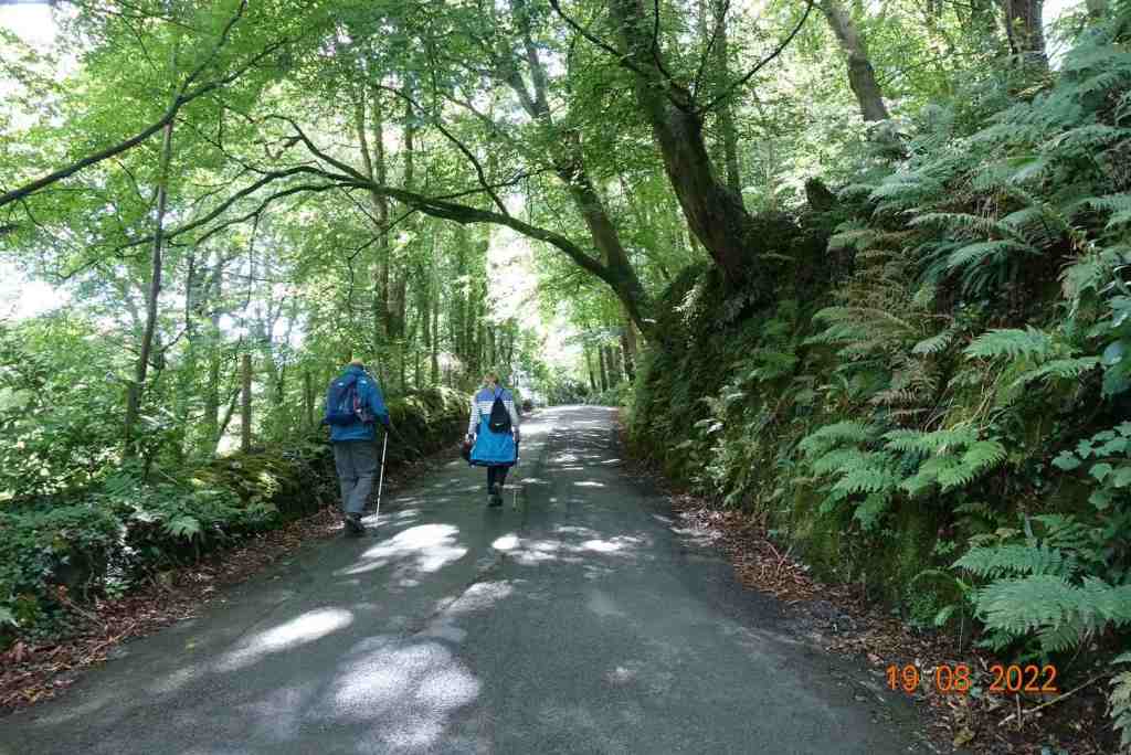
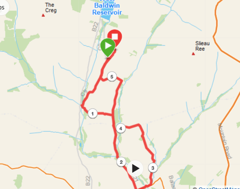
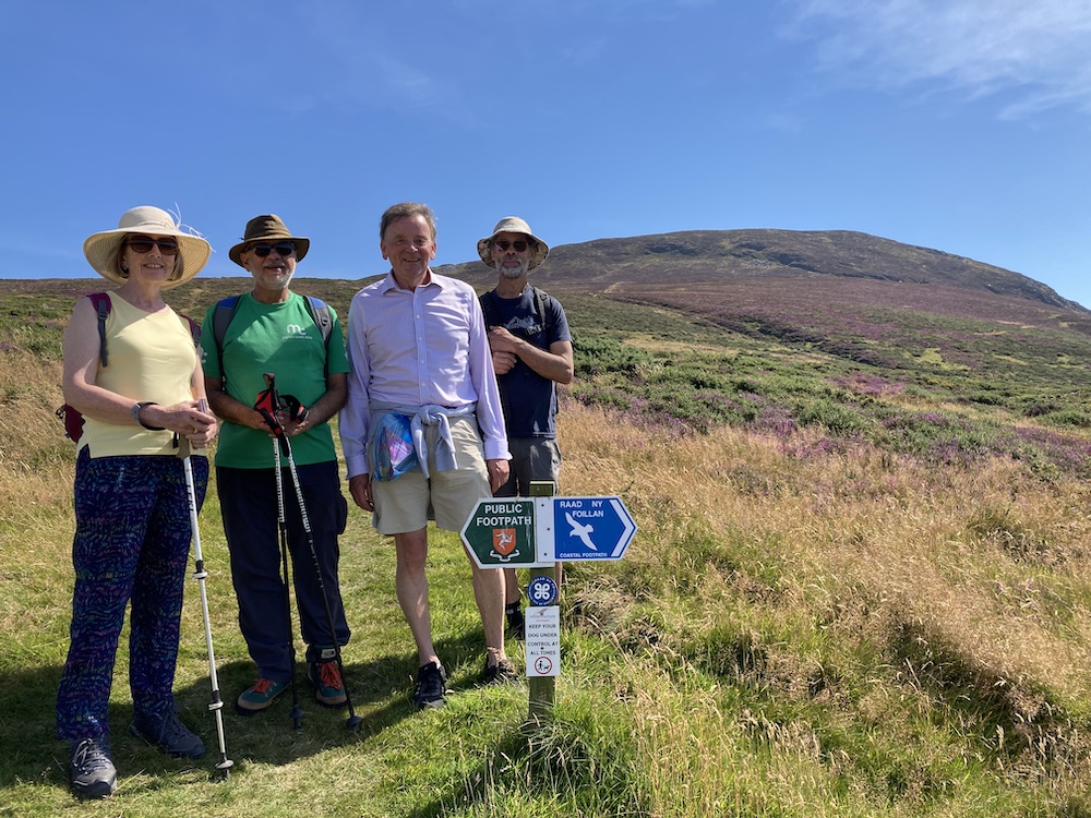
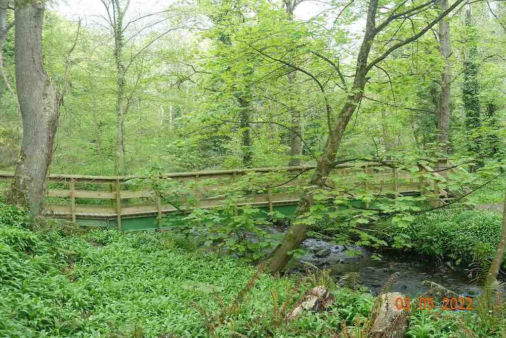
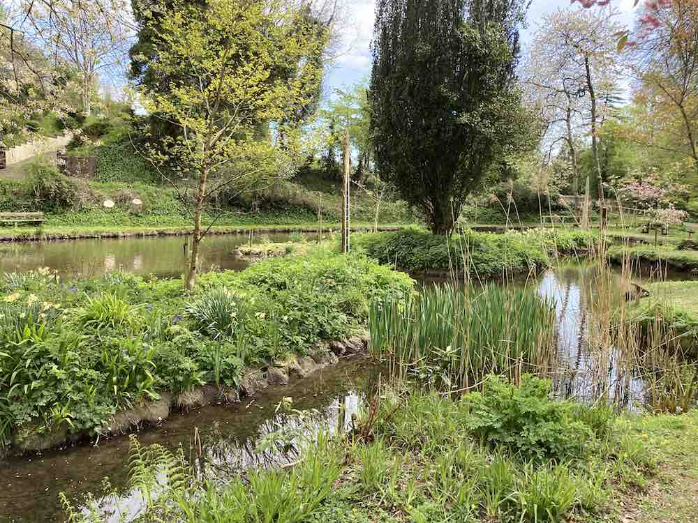
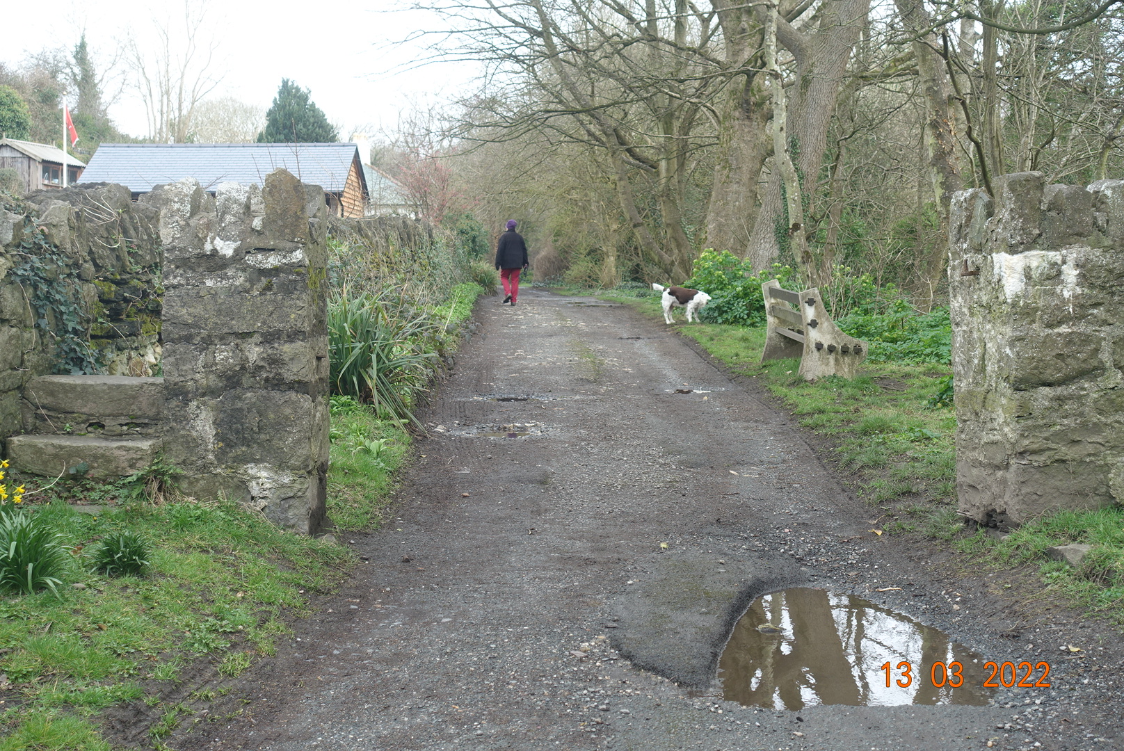
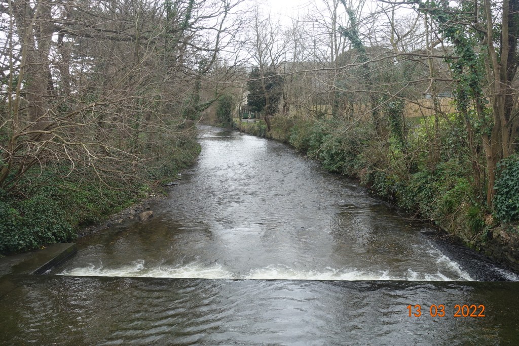
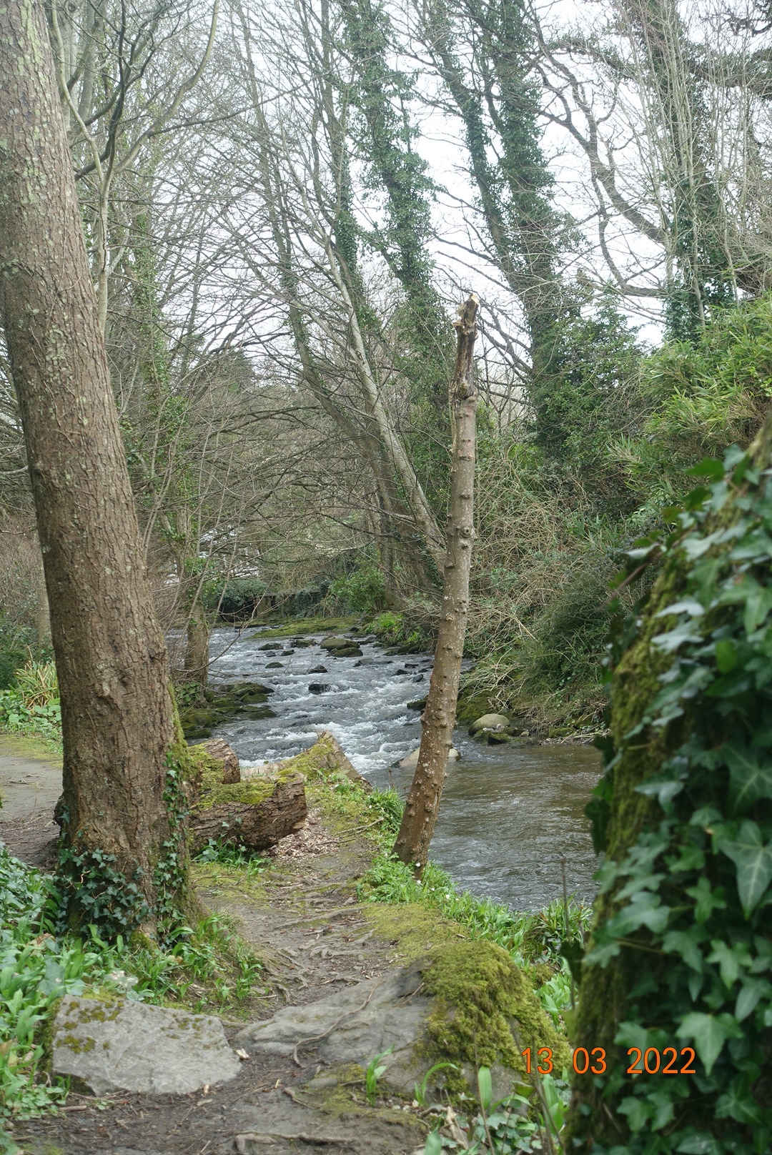
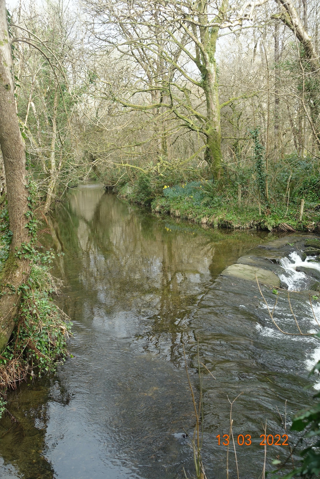
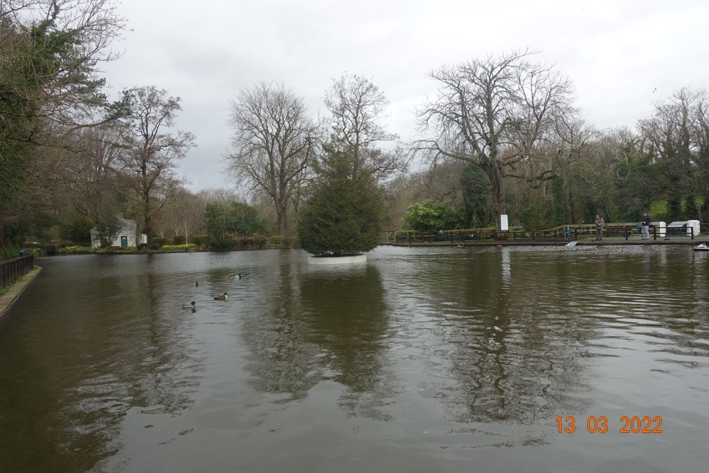
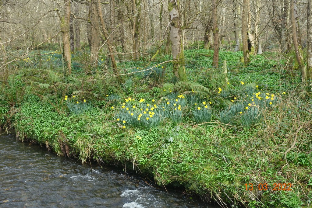
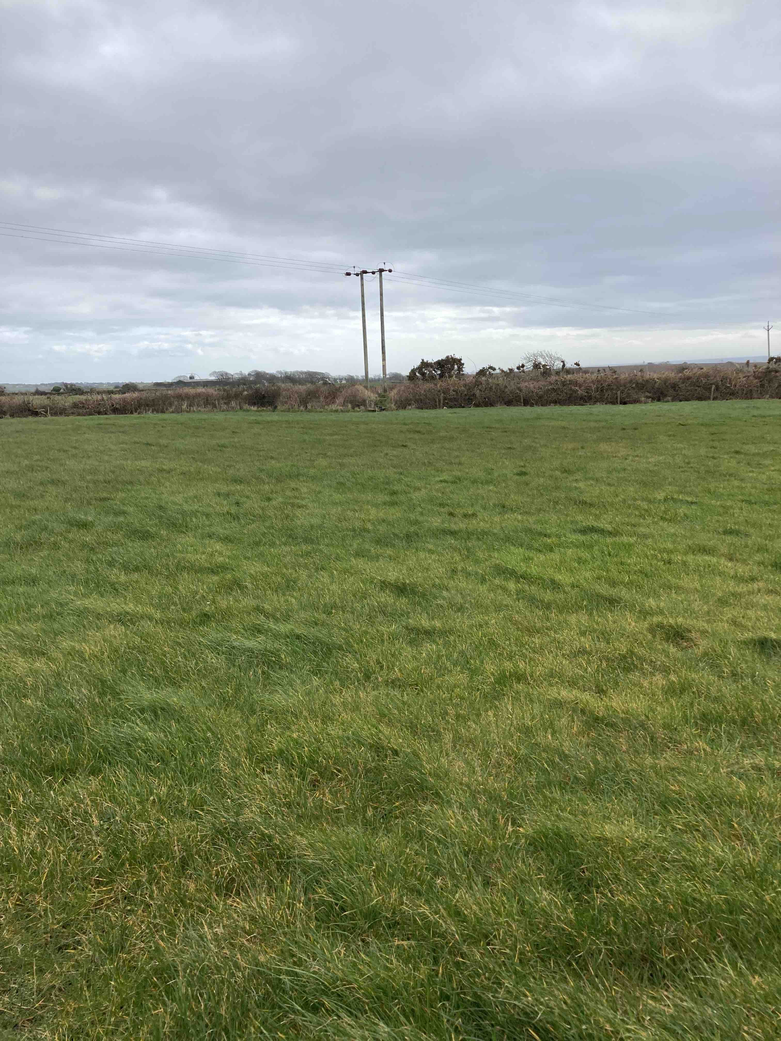
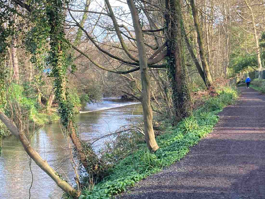
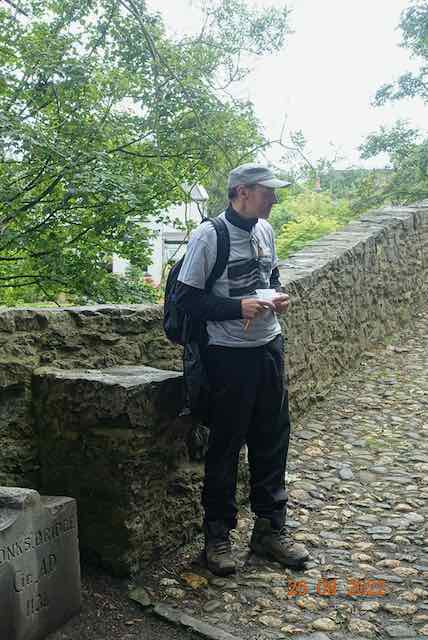
Today was the first of a 4 day pilgrimage, organised by Phil Craine. A group of about 15 people, of mixed ages, abilities, nations and religions assembled at Ballasalla and began walking along the lovely Silverdale Glen up to the Ballamodha Road, stopping at the Monk’s Bridge where fellow pilgrim Paul delivered a haiku poem he had written, setting us in the mood for the journey.

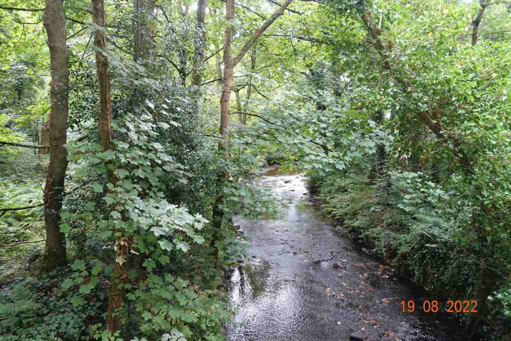
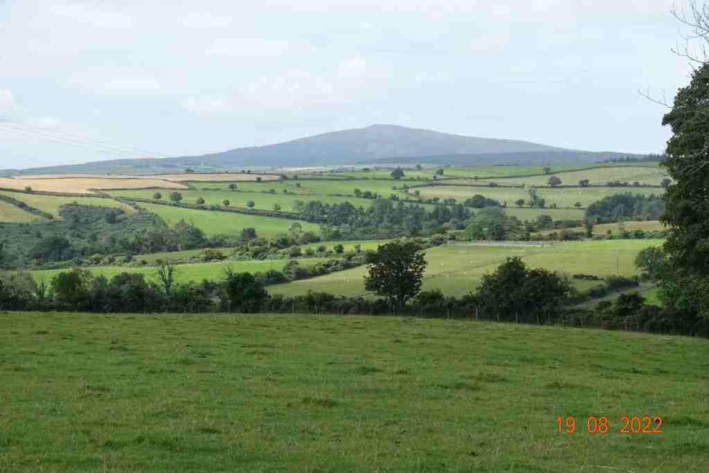
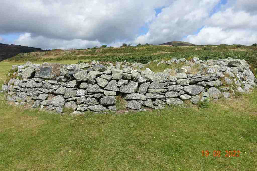
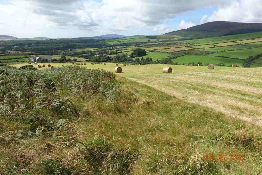
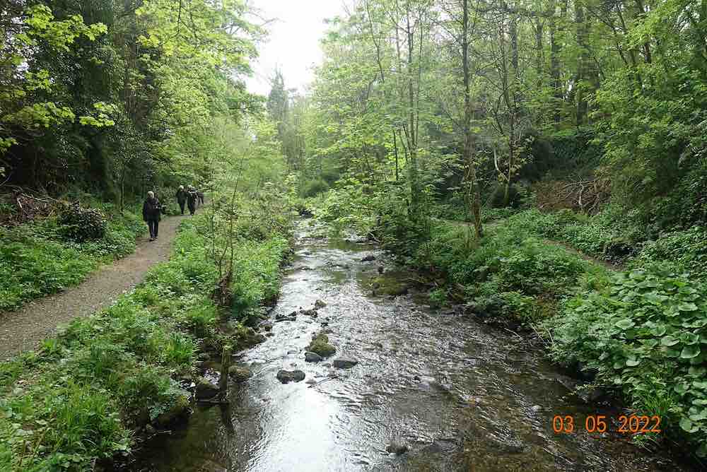
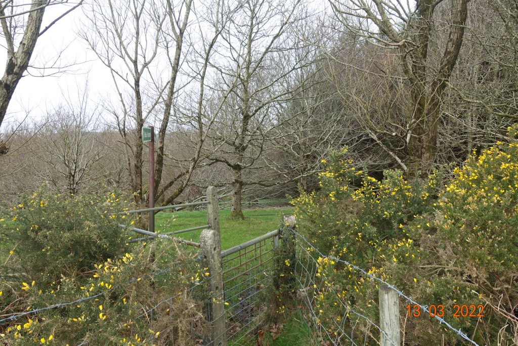
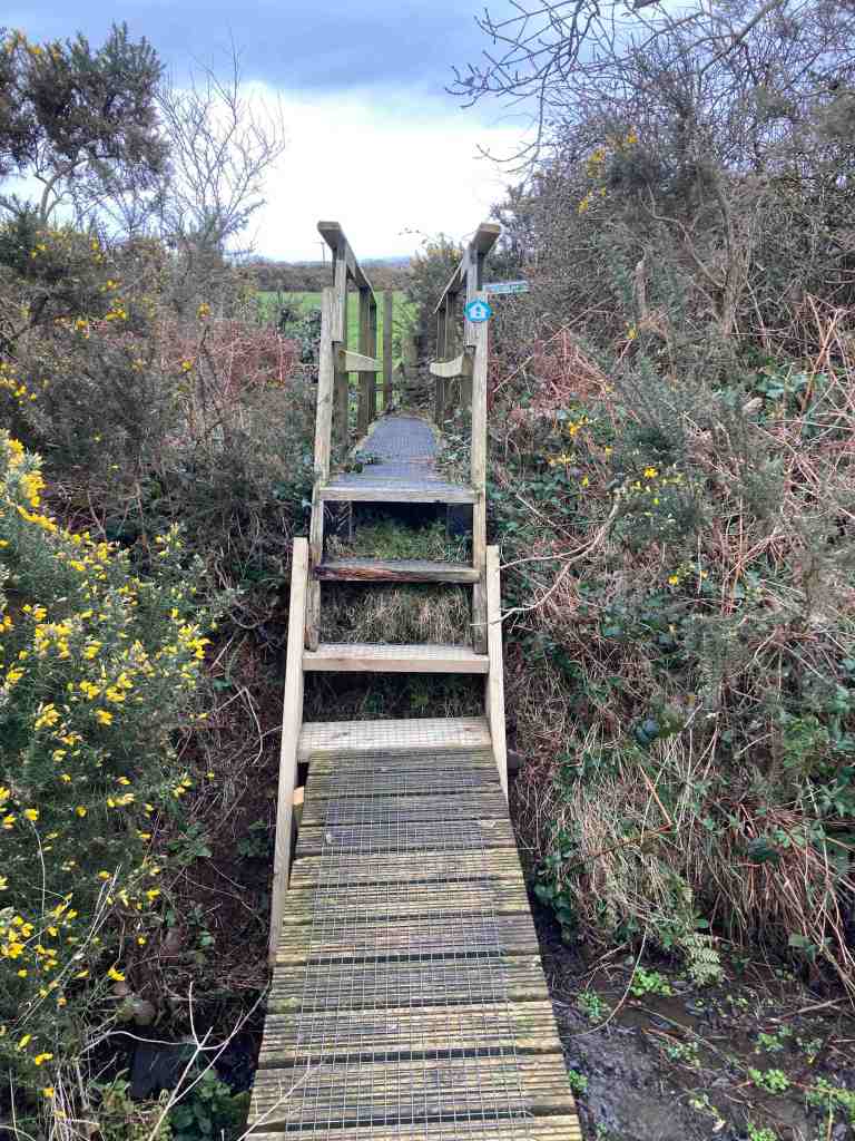
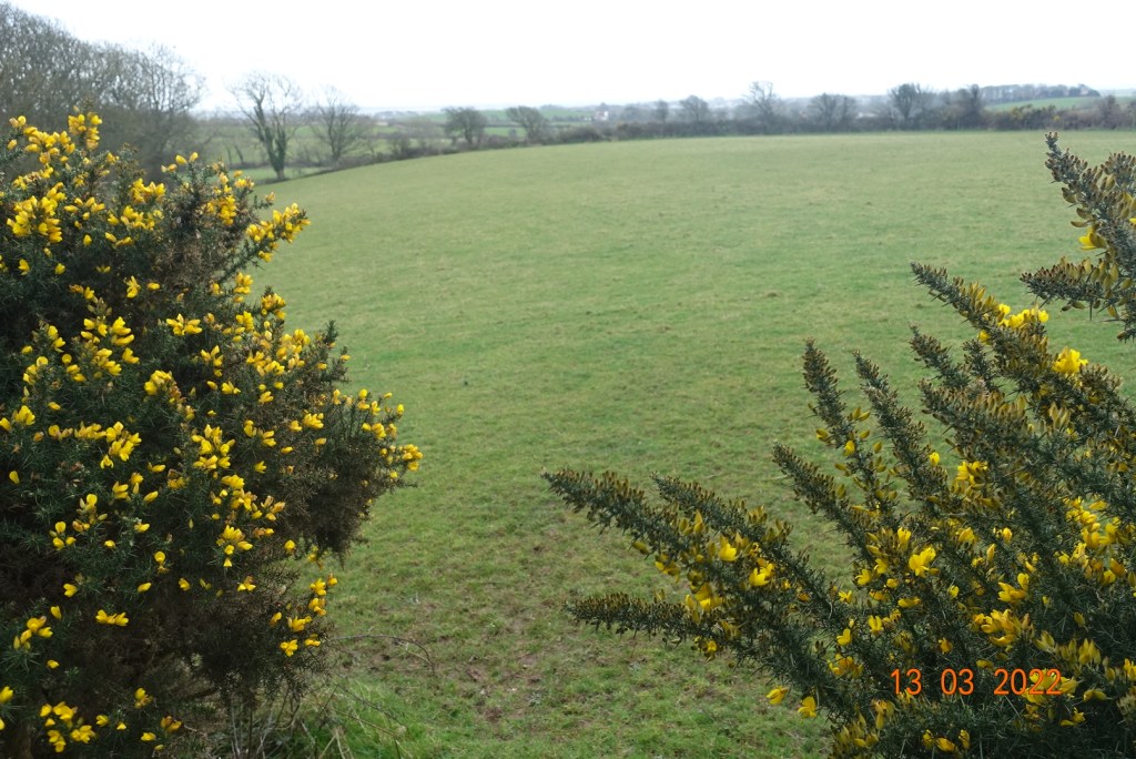
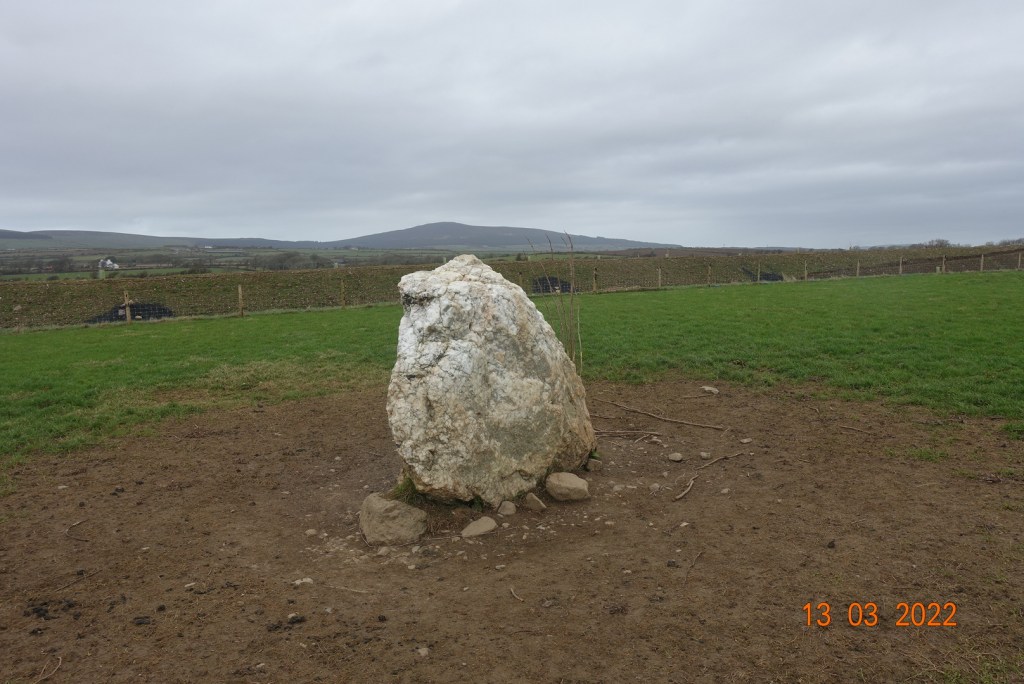
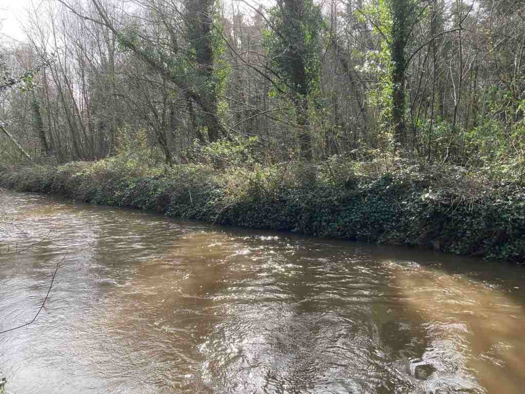
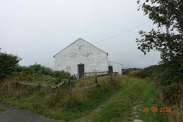
The walk along the river gave us all a chance to get to know each other and find out about each person’s extraordinary gifts and talents or to walk in silence if preferred. The next section across the road is still closed, so we walked up the road and across fields to Grenaby Bridge. From here, we followed the very quiet lane uphill, passing the Kerrowkeeill chapel on the way to the junction with the Ronague road. This provides expansive views to the south and Langness – if only it weren’t so misty. For those interested, you can hear a recording of the Manx Language Harvest service held there in 1969 here: Kerrowkeeill. Unfortunately, we couldn’t visit as the building is now in private ownership but at least one of the pilgrims could remember attending services there.

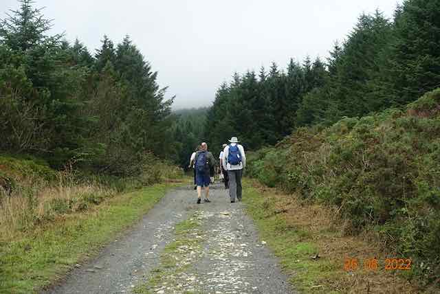
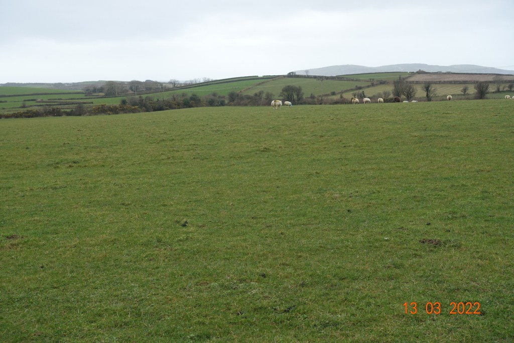
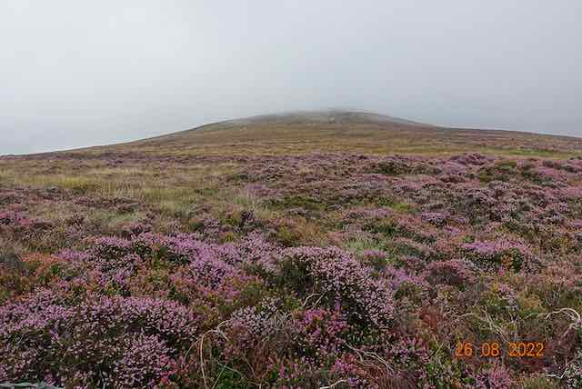
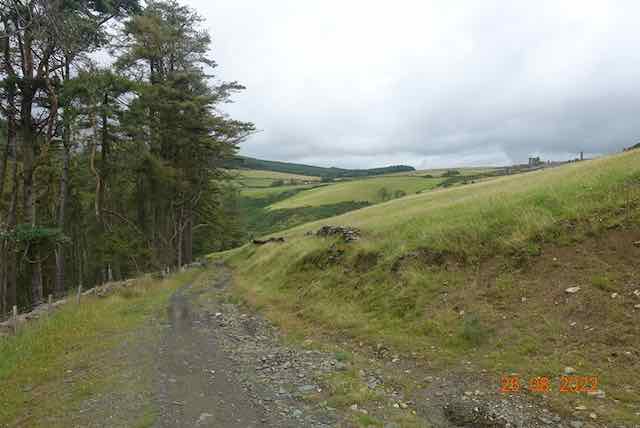
We joined the Whisky Run, a stony track leading up to the main entrance to South Barrule at Round Table, one of our high points for the day. The midges were out in abundance at this point, but the bilberries tasted delicious as we had a short stop. By this point one or two of the pilgrims had gone their separate ways and another had joined us.

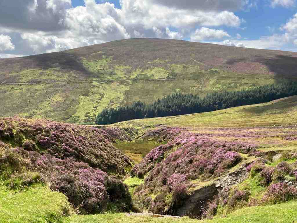
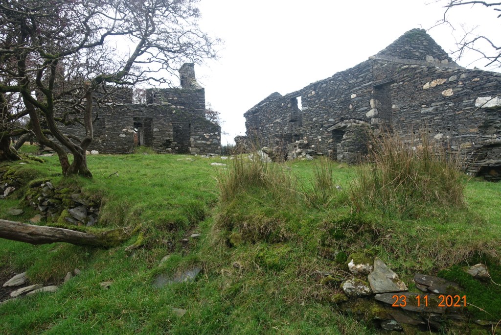
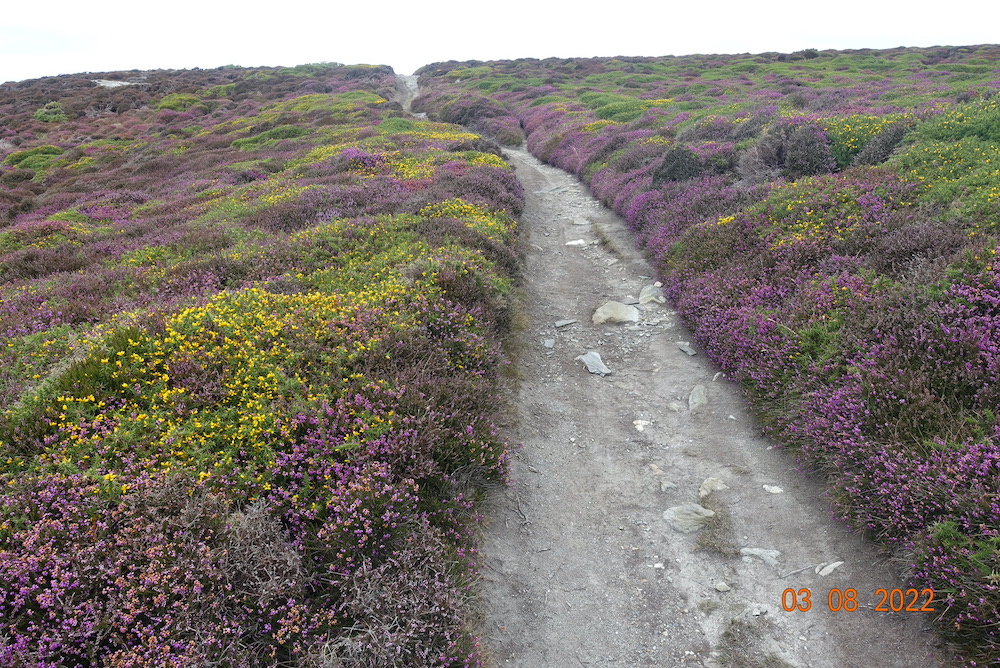
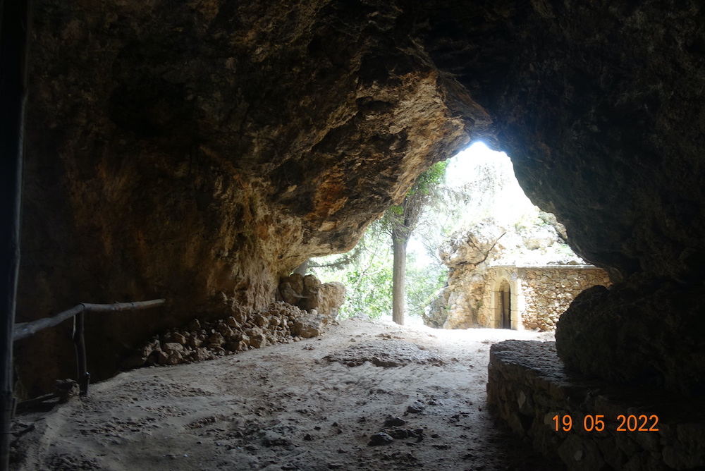
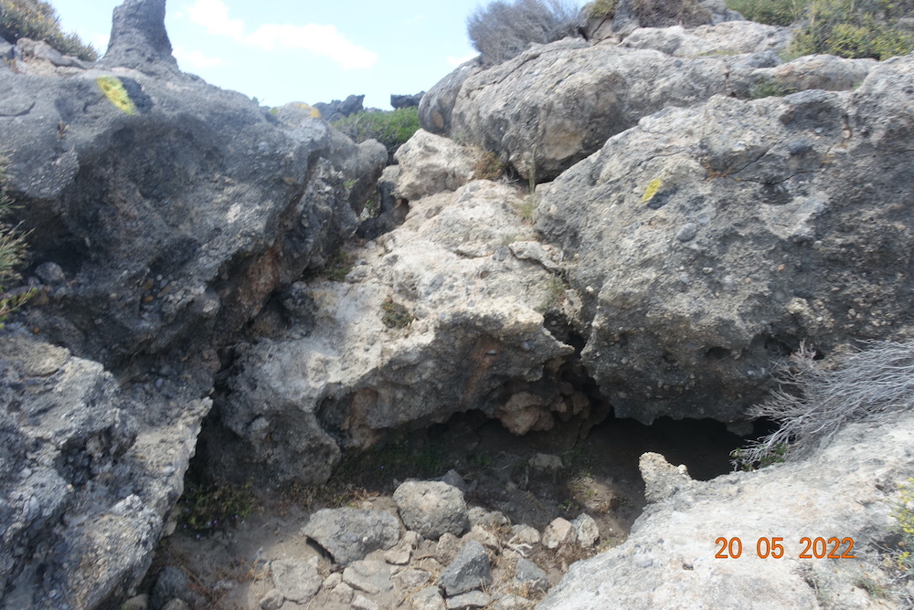
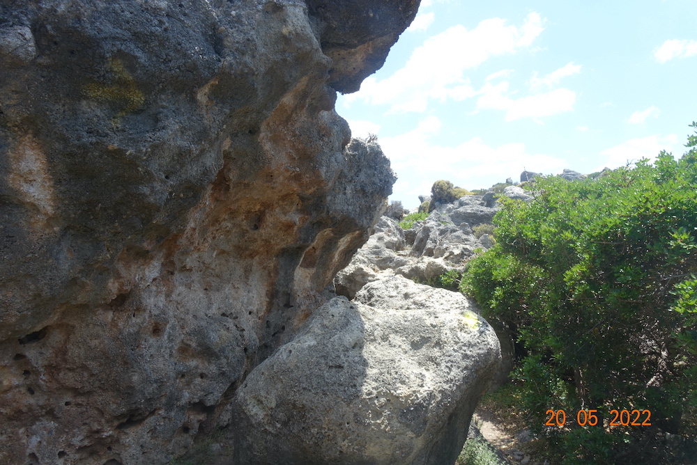
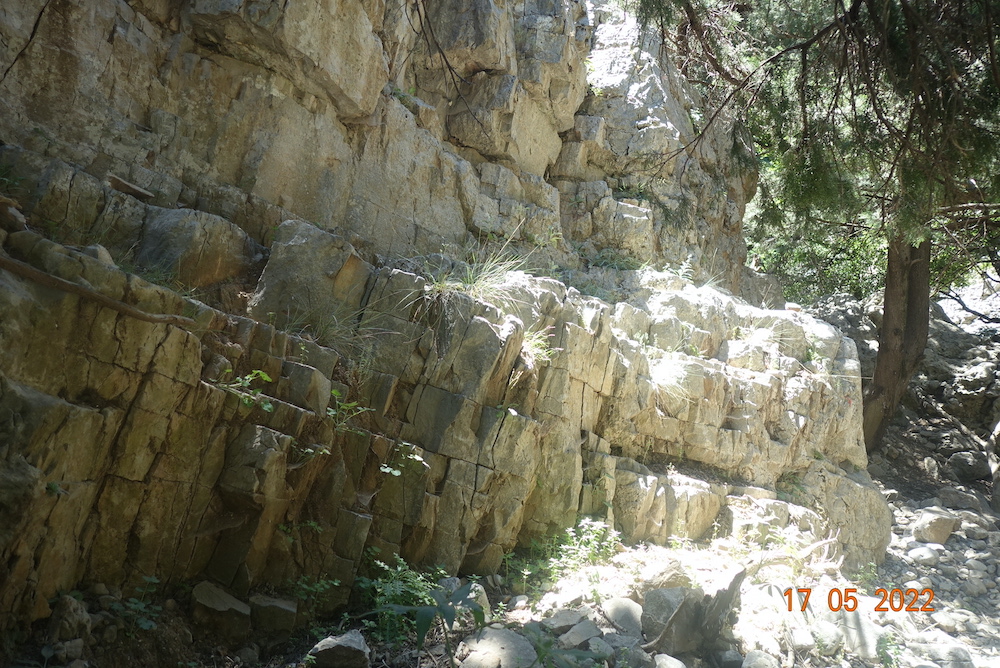
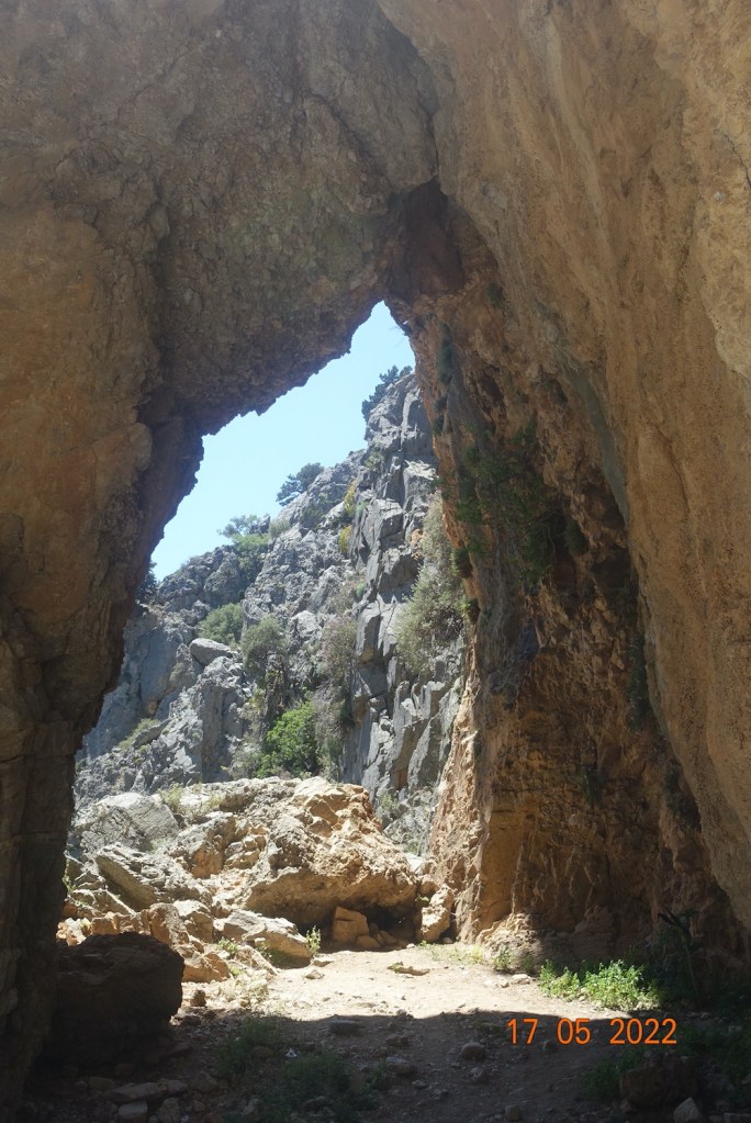
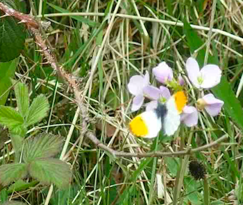
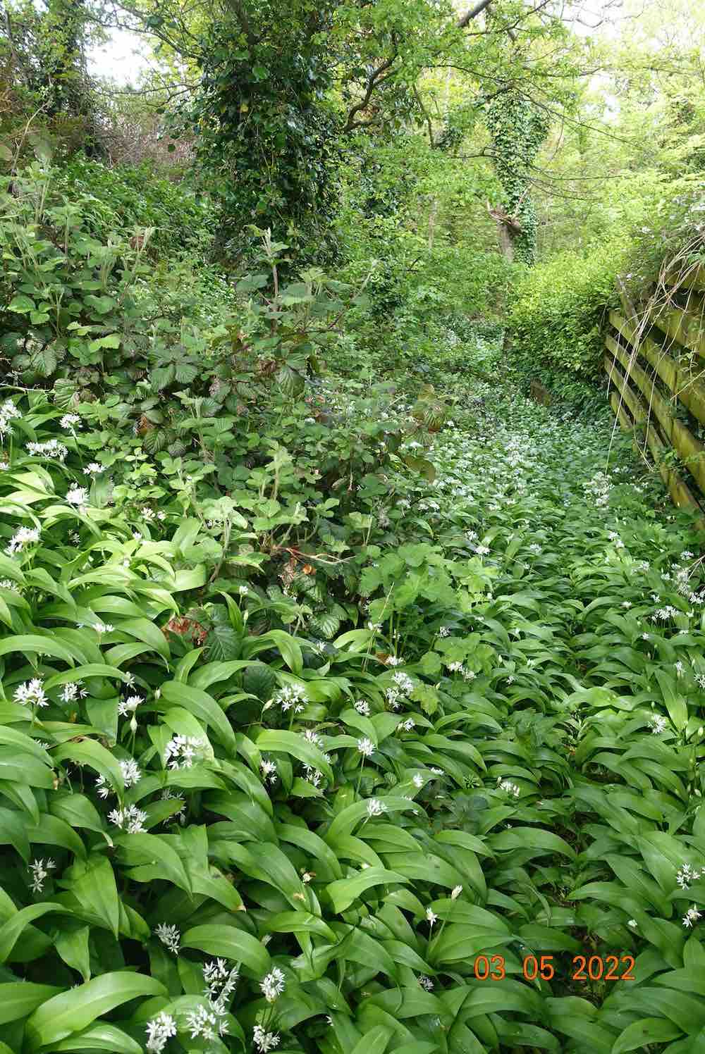
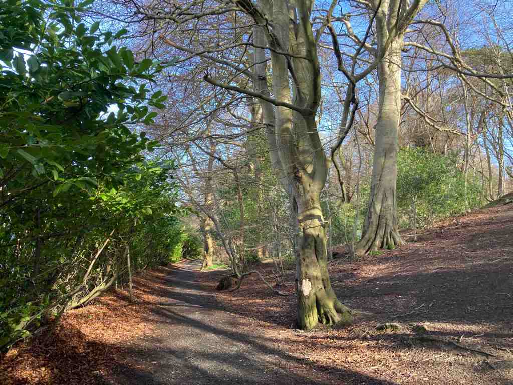
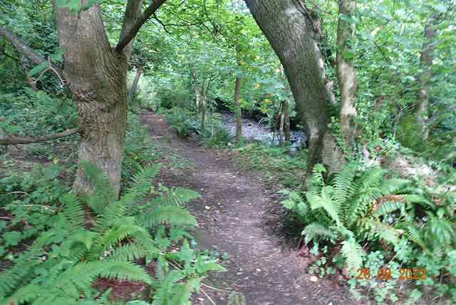
Next was the continuation of the track down to Glen Maye. It is only a few weeks since I wrote about (the tholtan on) this route, so I will simply show you some photos coming from the opposite direction. The cover photo is from this area. It is here that the route becomes most attractive and sitting by the bubbling river eating my homemade onion foccacia I had a blissful few moments amongst the purple heather and the yellow gorse. The rest of the group had stayed at the tholtan for lunch, but there were just too many midges for me – and couple of others who turned up shortly after I sat down. I am still feeling the presence of the midges three days later!

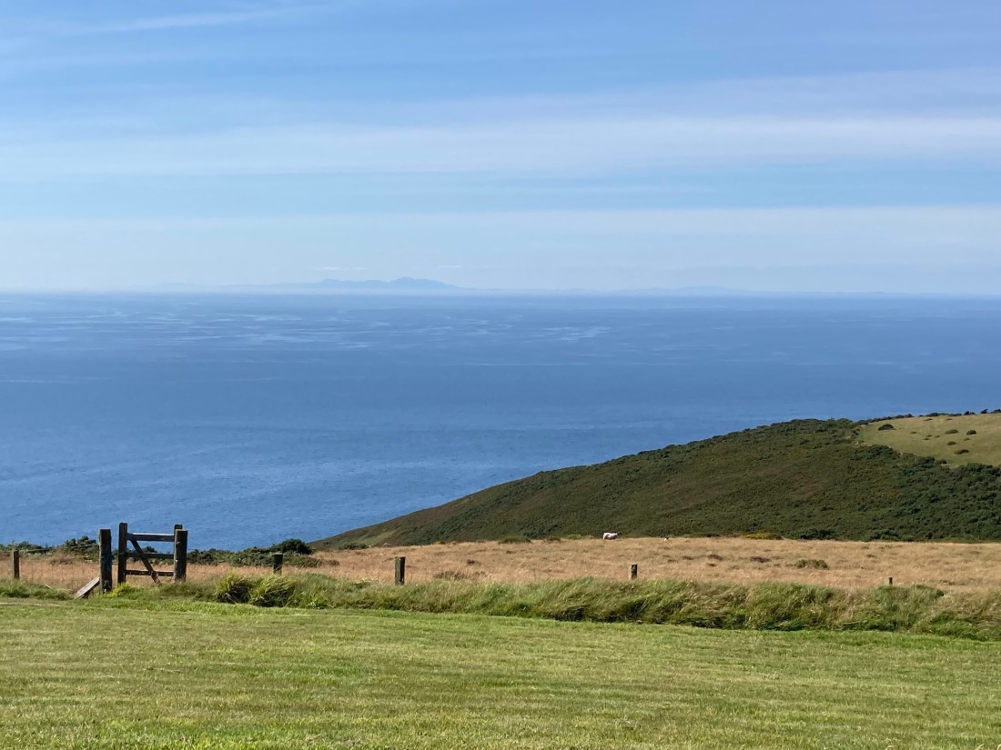
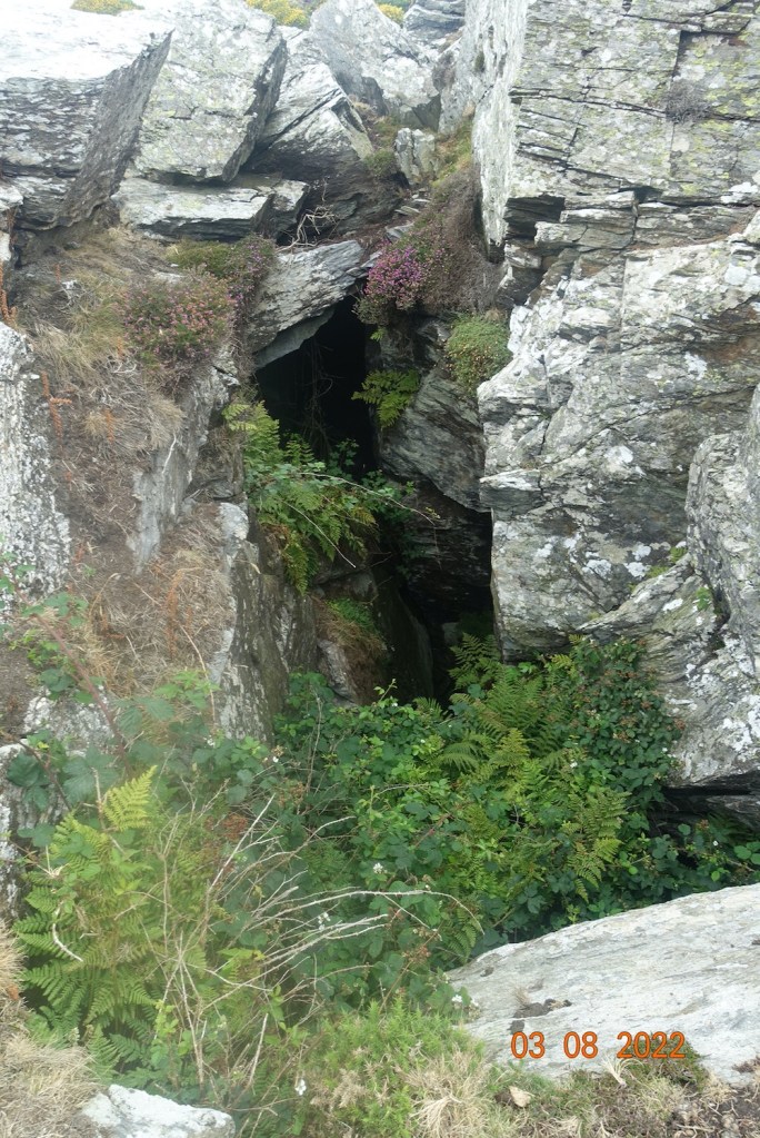
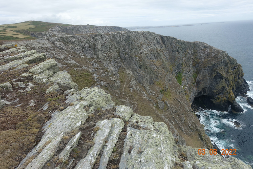
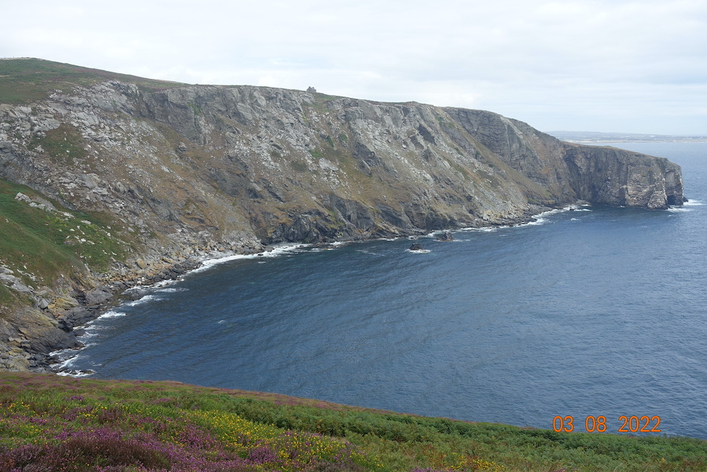
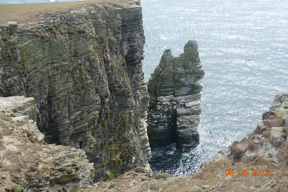
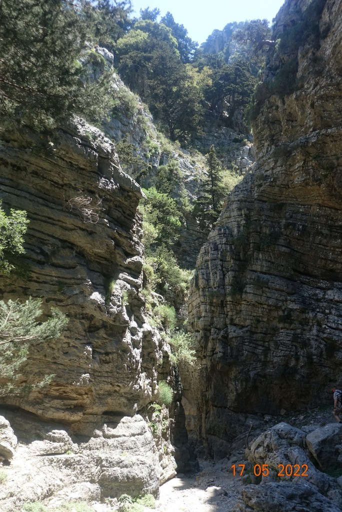
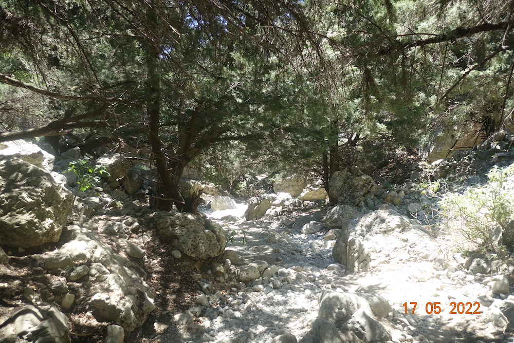
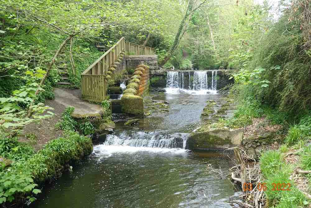
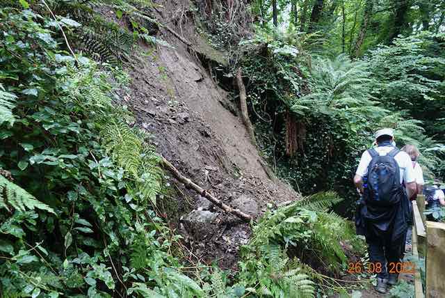
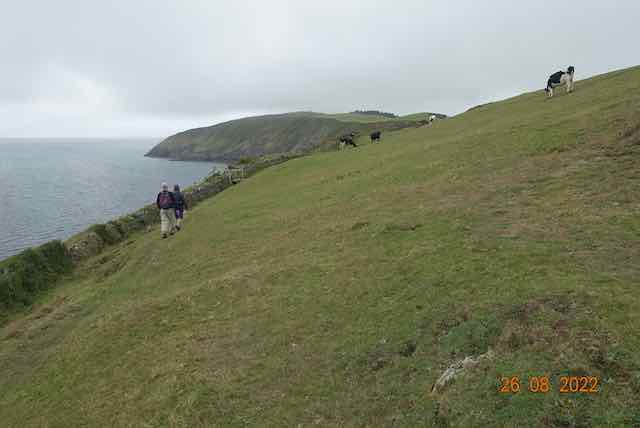
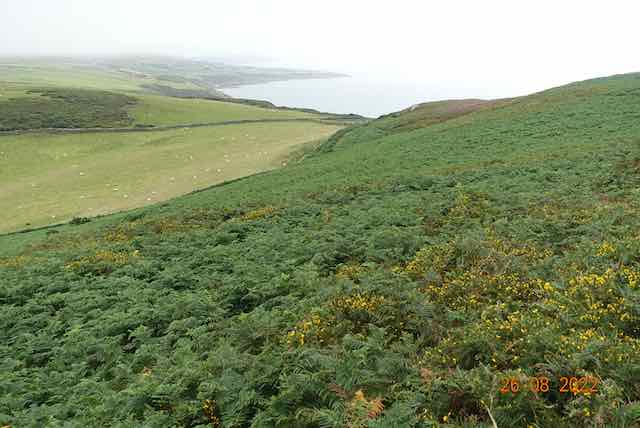
The path down by the Glen Maye waterfall has been upgraded in several sections. There was little water there today, but the greenery was magnificent. I never fail to be amazed by the vines tumbling from 100ft until they just touch the water. There have been two small landslides in the glen, one causing a minor encumbrance on the path, the other on the far side closer to the sea. The last section of the walk was along the wonderful coastline, a walk of about 4 miles. It is so different here from the south with its rugged cliffs. Here the cliffs gradually slide into the sea exposing the rocks below. You can see for miles, all the way to the Calf of Man.

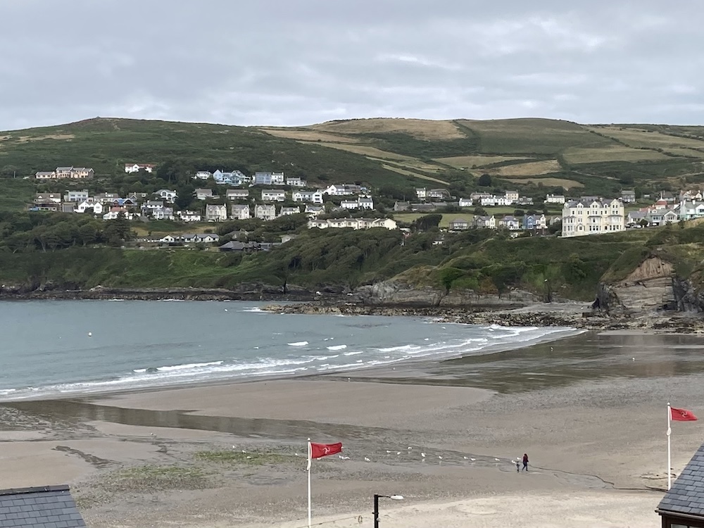
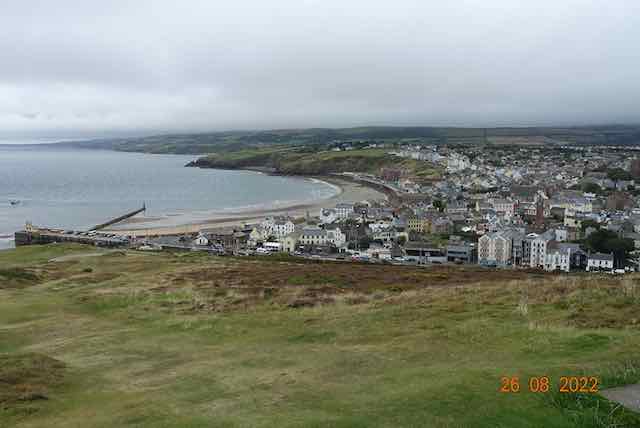
We walked at our own pace and a small group of us led the way, which became a smaller group as we reached the end. I had a very interesting chat with the co-leader about health and illness and how the mind can influence the body, which continued all the way down the grassy Peel Hill and took my mind off my aching legs. From here, you can see all the way to Jurby, but there was heavy cloud on the hills spoiling the views along the way. No sight of the Mountains of Mourne on this occasion.

The group had become separated by quite a distance apart by the end, as the miles mounted up and the hills began to feel harder to walk. It was a good 12 miles from start to finish, with almost 2000ft of ascent, so a major achievement for all no matter what age or ability. A few of us met up again and compared notes at the Retreat in Peel where some of them were staying, and where we had a most welcome cup of tea.

Thank you to all who made this day so enjoyable, with a special mention to Val, who became a taxi driver for the day as well as a general dogsbody, helping out wherever needed – and her sister too. What stars they are ⭐

More pilgrimage blogs to come, or just one actually, another beautiful route across our big hills. To view any photos full size, just click on the individual photo; some of them are showing as portrait when they should be landscape, but when enlarged they show the full photograph. I will post details of a book that has been written about the Triskelion Way and contact details for anyone wanting to join a similar pilgrimage in the future, tomorrow.

West Baldwin and Abbeylands

I do like to try out new walks so I was delighted to see walking.im offering this walk today. I really don’t know the north of the island very well in comparison with the south. I showed my ignorance as to where the north starts as I was informed that St Lukes Church where we started this walk is actually in the middle of the island, and not ‘north’ at all. The position of the church affords amazing views in all directions. It is worth spending time there.

I had never even been along this section of road which leads from Injebreck to Abbeylands. The church stands proudly at the top. The only way to continue north is on foot or cycle along the Millenium Way which take you to the fine mountains of Beinn-Y-Pfott, with Carraghan in front of it and Snaefell in the distance.

Today, we were heading south towards the very outskirts of Douglas. This is a straightforward walk with nothing difficult; a few minor uphill and downhill stretches, no rocks to clamber over, just soft turf and some road walking. It is a very pleasant route that takes a couple of hours or so. We began with a fair bit of road walking, or ‘lane’ walking. These are very quiet, leafy lanes, mostly going nowhere in particular and sometimes it is nice to have the space to walk alongside a friend and chat about your experiences, rather than walking single file along a narrow track.

After about 3/4 mile we stopped outside a very attractive white house whose post was being delivered by a courier, before appearing to walk right through their garden on a recognised footpath that you would not know is there. This is short uphill section behind the house, leading onto very soft, green fields with superb views to the north. We carried on over more fields until we hit another lane, where we turned to the right. I have walked this section before after an archaeological trip. There is not a lot to see along this lane as it is heavily wooded, crossing over quaint streams that eventually become the River Douglas. It is therefore an attractive amble along the lane for about a mile.

At this point, you reach the road junction and turn left towards Abbeylands. Crossing yet another bridge, with the evocative name of Sir George’s Bridge (a statesman who contributed £100 towards the building of this bridge in 1836 – thank you very much, Sir George!), there is a delightful wooded walk along the valley bottom, with a stream gently meandering to the right. After this lovely gently ascending path, we were then followed another nice lane, until we were able to step over the stile on the left and walk across the most beautiful meadow, full of yellow flowers that were really eye-catching against the dark green trees in the valley (see photos above). This sloped gently at first and then a little more steeply into a short section of woodland, and guess what, another bridge, before finishing on the road at East Baldwin where we had passed earlier. We would continue on this road further than we had previously before our final ascent back to West Baldwin. I amused myself by looking upwards at the skeletons of trees with their interesting shapes, the products of which are found below:

At this point, some people made their way to the pub and a few of us continued up to look at the ancient monument, the site of Tynwald Hill (recreated by the Victorians), but clearly a meeting place for all the surrounding parishes. The hill is called Cronk y Keeill Abban, indicating a long heritage and no doubt giving us the name Abbeylands. The views of the heather strewn Slieau Ree were stunning.

Being in the middle of nowhere, any way would take me home eventually, so I ventured home via the hills. The heather was just beautiful and the sun had come out so I was really blessed on my journey home.

Distance 5.5 miles, with 856ft of ascent (lots of small ups and down, nothing much).

The Tuesday U3A Walk – Eary Cushlin, Round Table, Cronk Ny Arrey Laa

What a wonderful day we had. Superb views, superb company and wall-to-wall sunshine. I have described this walk in detail on a number of occasions so today, I shall simply tell you some interesting facts that I related to the walkers en route.

The day started out not quite as planned as the Midweek Muckers (Manx Wildlife Trust’s sturdy volunteers) had taken up all the car parking spaces. This meant that we had to park at the far end of the track, but in reality this turned out to be an asset not an inconvenience, as we got all the track walking out of the way at the start. We were only 7 in number. A couple of people didn’t turn up, but I know that some of the regulars felt this particular jaunt would be a challenging step too many for them.

We set off down the Glen Rushen valley, stopping at the first tholtan (Thallaquaine, Claughbane). This is where I delivered my first interesting tale. But first, what a stunning location. It is set high up on the northerly slopes of Glen Rushen and has panoramic views of South Barrule and the moorland plateau. There is another tholtan in full view of Claughane, and the story involves both homesteads in the year 1906. Claugbane farmer and butcher, Robert Clarke, agreed to keep a light shining in his farmhouse all night and every day in case marauders came and he needed help. The light shone brightly for many a day, until one day, William Carran looked up from his farm across the Glen and noticed the light had gone out. Donning his overcoat and boots, he trudged off down the ‘main road’, crossed the river and climbed up the slopes on the other side until he reached the cottage. He knocked on the door – “Anyone there?”……. No answer. He tentatively pushed open the door to see everything exactly as it should be. Dishes on the side, clothes in the cupboard, furniture where it should be, but no people, not one. As he turned to leave, he spotted on the sideboard a slip of paper. Taking it to the light, he read “Gone to America”. The intrigue continues as a report I read states that not only Robert Clarke emigrated but also “Mrs. Christian, her son and daughter from Peel, gone to Ohio, Cleveland”. Do you think they eloped?

This set the scene nicely for the next stage of our walk to the other Tholtan on the other side of the river. This large farmstead has a rich history, but few details until 1820, when it is cited that the owner was Joseph Faulder. It is now called Carran’s Farm, but it is thought it had previously been called Glen Rushen Farm. In 1871 he put it (and Thallaquaine) up for sale and William and Anne Carran eventually bought the 350 acres for £230. They had 8 children all living here! It is reported that only one remained in the area, Thomas Carran, and indeed he inherited it and farmed it until 1932. At this point it was sold to the Peel Water Company, who promptly put all the assets up for auction, including cattle, poultry, horses, sheep and all the farm machinery, including a turnip drill, rabbit lamp and double barrel gun. Why did the Water Board buy the property? That’s odd you might think? Not at all once you know that this area had been designated to be dammed and the Glen Maye river and valley would have been swallowed up by a reservoir. Thankfully, this never occurred and we are able to enjoy all the benefits of rambling freely in this beautiful area.

Carran’s Farm contains the house, with an extension of a scullery and parlour, several outbuildings, a toilet (I wouldn’t recommend trying it), a theshing wheel and gardens, now all overgrown or in a state of disrepair. With such a rich history you do feel this farm warrants renovation by Manx National Heritage. There are many many similar tholtans on this section of the walk, as this was the ‘main road’ at the time leading from Colby down to Glen Maye and would therefore have been a thriving thoroughfare 150 years ago. There was no route contouring South Barrule as there is today, and the windy coast road to Dalby did not exist either. As we trundled up the track, we realised what a tough life these people had. Yet the valley had a large population whereas today people living in these hills are sparse.

Reaching Round Table we stopped for lunch before enjoying a most beautiful amble across the moorland. The heather had sprung into life since I last came, and the sheep were keen to see us. Reaching the corner at the foot of Cronk Ny Arrey Laa, two walkers decided they had walked far enough and made their way downhill back to their cars. The rest of us continued to the top of Cronk Ny Arrey Laa, also called Cronk Ny Irree Lhaa. The first term means Hill of the Day Watch, associated with Viking Times; the other term means “Hill of the Rising Day” associated with the herring fishermen. We discussed whether we could see Anglesey in the distance. We could certainly see Black Combe on the outskirts of the Lake District, and the mountains of Snowdonia further south. To the west, the Irish Mountains of Mourne loomed large, along with more northerly parts of the Irish coastline. To the north, Scotland was just visible. We spent a relaxing few minutes chatting away and enjoying the views before descending down the precipitous coast path to Eary Cushlin, where we stopped again for another chat and we all lamented the fact that we wished it were a pub or a cafe rather than rental accommodation.

So that was our day. This is a fairly tiring walk, especially in hot weather, but worth every tired limb and sunkissed arms and face to be treated to such delights. The full walk was just under 7 miles with about 1200ft of ascent and a similar amount of descent.

Apologies for the lack of photos. I only took 2 today, the two sunny ones! 🙂

Ambling and Rambling Around the Sound Coastpath

It was one of those days that was just right for walking, if a little breezy. At least it wasn’t boiling hot! It is a while since I have walked this route west to east (or roughly that) and I was really looking forward to it. I wasn’t disappointed. There are a few noticeable changes – well noticeable to me – such as quite a lot of erosion in places, some caused by weather, some caused my man, and some very definitely caused by rabbits. The heather, whilst still beautiful, was not quite as abundant as it has appeared in the past, and the bracken seems to be getting a stronghold in some areas and crowding out the heather. The gorse was variable with several areas without flowers. On the plus side, there were a lot of choughs, all busy arguing with themselves as only they know how to do.

I started out from home and walked along Athol Park to the top road overlooking Port Erin. This is one of my favourite views of the bay. It always looks so inviting, no matter what the weather. I followed the road to where the coastpath starts behind the delapidated Marine Biological Station, noticing that the stream that generally gushes out from the top of the cliff was completely silent today, testament to the very dry summer we are having. The seagulls seem to have already abandoned the cliff face here, where they used to nest in abundance. They must be anticipating their home being ravaged by builders and machinery once the development of the apartments begins. Today, there were only a couple of beleaguered herring gulls scattered on the site.

The path soon starts to climb uphill and this was the first point where I noticed that more rocks were exposed than I remember. Again, areas that are usually a bit muddy were dry and the wild flowers even seemed to be begging for rain. Otherwise, I didn’t see anything unusual on my walk round to the Sound. I was as delighted as ever when I reached the Valley of the Rocks with all its contorted shapes. A few minutes later I arrived at the Sound in time for a bowl of soup, which was accompanied with a roll, but the greedy seagulls took it when I wasn’t watching. I had been debating whether I wanted the bread anyway, so they did my a favour, and boy did they enjoy it and make a fuss! I am on a keep fit campaign, not much of a campaign really. I just want to lose a little weight and cutting out or down on bread and cheese are high on my list.

After lunch I spent a little time sitting on the rocks watching the seals. Several were lounging close by and others were peering at the visitors peering at them. This is such a beautiful spot to stand and stare, and you know how good I am at that. After that it was the steep climb up on to the top of Cronk Mooar and then on to Spanish Head. On the way, I met a couple watching some sheep who were having an argument. I was to see them later on in my walk – the couple that is, not the sheep, and we spent a very pleasant few minutes talking about our respective experiences of the island and comparing it with Germany, where they live. This section of path usually has the best gorse and heather, and add in the sage and the grasses, it makes for wonderful variation in colour. There are also interesting rock formations on this section of Spanish and Black Head, rather like limestone pavements, but I’m not sure they are made of limestone. If anyone knows what type of rock these are please let me know.

The last bit of uphill takes you to the Chasms and the Sugarloaf. Here I met another couple, also visitors, wanting to know where to go next. I think their decision was made by telling them there were toilets at Cregneash as they then headed up in that direction. I took the lower grassy path and made friends with a number of sheep, and picked up feathers for my granddaughter to paint. The vista on this side of the Sound is very different. On the north western side all you can see are hills, but from here you can see not only the hills but the terrain also gently rolling down to the sea and the flat areas of Castletown and Langness.

By the time I reached Glen Chass I had had enough. If you are doing this walk, you might want to continue down to Port St Mary and take one of the roads back to Port Erin. There are a number of different options, depending on how far you want to walk. You can go over the hill at Fistard, taking the path upwards from the golf course, follow the coastal path or as I did follow the road at Glen Chass to the Howe Road. I then followed the farmer’s track down to Truggan Road and then I was about home. However, if you turn left at the Howe road junction, you can take a footpath behind some houses on the right, going over fields and retaining the height and the wonderful views until you finally have to drop down on one of three footpaths leading to the Port Erin end of Truggan Road.

This walk was just under 8 miles, with a total ascent of 1463′ and a total descent of 1503ft. I took it slowly, to enjoy looking at all the wildflowers and other wildlife. I would allow 3.5 – 4 hrs of walking time for this beautiful coastal walk.

Peel coast, railway line and river circular

I had a lovely walk yesterday with walking.im. Thank you to Ken and Catriona and all the regulars who made me feel very welcome. We met at Fenella Beach in Peel. People were swimming in the bay and I overheard a lady getting very excited about all the scallop shells on the beach, and off she and her son went hunting for the best specimens to take home.

We walked along the bay northwards. This is a wonderful stretch of coastline and easy walking. It provides a great panoramic view of Peel and you can see the coastline as far as Jurby. You will pass stacks of red sandstone, only found in this area, and the sea birds, especially the shags and cormorants make your acquaintance, perching and drying their wings only a few arm’s lengths away. Shags are slightly smaller than cormorants and slender and can be seen on the right on the photo below. One distinguishing mark of a cormorant is a white patch on the thigh which can be seen particularly when flying. A distinguishing mark of a shag, if you can get close enough, is its emerald eye which is sourrounded by feathers. This is different from the eye patch of a cormorant. This is only a marginally undulating path, and it does not have steep drops to put anyone off. This is a popular stretch of coastline for runners, hikers and dog-walkers alike.

Eventually, the path meets the main Peel to Kirk Michael road, and there is no way of avoiding this. A short walk along the road and you come to some houses on the left, and we turned into these. It is not marked as a footpath, so it is less well known. Follow it initially across a field and then very shortly you reach the dunes where there is a fairly steep path down to Whitesands beach. I had never been here before. It is very reclusive as there is no other access path, so you could spend many a happy hour with your family sharing a picnic, playing in the sand or swimming in the sea. Perhaps not best to do right now though, as there were several dead gulls and razorbills washed up on the beach amongst the sea weed, due to avian flu. If you come across dead seabirds, please do not touch them.

Retracing our steps, we walked a short way along the road before crossing over to follow the railway track almost back to St Johns. This is an unspoilt track, so very different from the Heritage Trail from St John’s to Peel that runs alongside the river, which is more like a glorified road and heavy to walk on. I understand that it does mean that cyclists, wheelchair users, or people with prams can enjoy the walk without the ground being uneven, but it does lose some of its magic in the transition.

The quintessential countryside landscape that surrounds Peel is just as nice as the coastal scenes and shows what variety we have on our lovely island. This is what you can expect to see as you walk along the railway line.

This walk was 8.25 miles with a total ascent of 433′, which is all along the coastpath and going down and back to Whitesands. The remainder of the walk is flat. Allow 3.5hrs for this walk so that you have time to sit on the beach and admire the views as you go along.

Dalby Mountain & Nature Reserve

At last I am back out walking. Both feet and ankles are behaving reasonably well, so I am looking forward to getting out and about in our fantastic countryside on a regular basis.

Today, I was really just wanting to check an alternative route across the moors for a route I am leading soon; and, I also wanted to do a recce for a large painting I am planning for the autumn. I started off at the big bend in the road between the Sloc and South Barrule at the foot of Cronk Ny Array Laa, and followed the farm track as far as Kerroodhoo plantation. That wasn’t actually the plan, but I missed my designated footpath as I was examining all the different styles and steps leading off Cronk Ny Array Laa on the opposite side of the track. Note to self, pay attention if you have a plan in mind!! Not to worry, I would just do it in reverse.

I carried on the farm track as far as the coast road to Dalby/Peel, turned left and took the first track immediately to the right. When I walked this a few weeks ago the orchids were still out but they had gone now. In their place there is knapweed and heart’s ease and smaller flowers such as eyebright. I took this path in order to find a good vantage point for my painting, as it is a little higher up than the path leading into Glen Rushen and would give a better aerial view. I stopped for 15 minutes and did a quick preliminary sketch, then decided to walk down to the other footpath. Only when I got there, there was a massive hedge that was impenetrable so having checked for alternatives I decided I had no choice but to go back to the top of the hill.

As usual, this is where my original plan and my impetuous nature were at odds with each other, so rather than return to my original route, I turned right onto the track only permitted for horses and motorbikes (though I am sure walkers are fine too), the one with numerous gates with fastenings that are easy to manipulate. This skirts just below the top of Dalby Mountain and provides excellent views to the north, west and south. Peel seemed just a stone’s throw away but in reality must be 4-5 miles. Scotland was clearly visible too. I eventually joined the path that goes from the road to Glen Maye and turned left onto this to retrace my steps back to Dalby Nature Reserve. I really enjoyed this part of the walk and I discovered another track that I would take another time, and another route for the U3A (down to Dalby/Niarbyl).

Reaching the nature reserve, I didn’t know whether the path across the moor would be well defined or a mass of heather and gorse, so I decided to walk on a compass bearing back to the track at Cronk Ny Array Laa. As it turned out, this was totally unnecessary, but it’s good to remind yourself of your skills every now and again. The moorland was full of Bog Asphodel in its yellow clothes, some beginning to look rather tatty as they turn brown towards the end of their life. The bell heather is coming out, and in places there was bog cotten too. If you take this path and are using a map, you will notice that the woodland on the left (looking south) adjacent to the reserve has been felled. However, at the corner, there is a large ladder stile over a wall, so if you have binoculars you can look out for this. This is more visible from the opposite direction as you are going slightly uphill this way round. On the other side of the wall, the path is less well marked but still easy to follow. There is more grass and less heather. There are waymarks although some have fallen down. There is a small area of bog, even in this very dry weather, and the sphagnum moss was having a field day just there. It is passable. I was only wearing strong walking trainers, not boots, and my shoes didn’t get too wet. However, I can imagine this could be very different in winter or if we have a lot of rain. My phone battery had run down by this point so there are no photos of this section of the walk. But the cover photo shows you the moorland very clearly.

After about half an hour I was back on the track, with the short climb back up to the car. This was a most enjoyable and unexpected walk, of about 5 miles (without my painting detour). The total ascent and descent was virtually identical at about 741 ft, but there is nothing strenuous about this at all. It is easy walking, and the views are tremendous. Of course, it is uneven underfoot, but nothing that most people could not manage. A good morning’s walk.

Time away in Crete

Yes, I know it’s not the Isle of Man, but reluctantly I cannot do any walks at the moment as I have an ankle injury sustained while I was… in Crete, two weeks ago.

This was a walking holiday but I was not sure how much walking I could actually do, so on the spur of the moment I put a sketch pad in my suitcase along with my walking boots and off I trotted to Crete. I have been before, but not stayed on the western side. I had hoped to do the Samaria Gorge this time, at least that was my intention.

We stayed in a beautiful 4 star hotel miles from anywhere in a village called Spilia, a little distance from Chania. If I wanted to do any walks by myself this would necessitate a 32 mins walk each way to the nearest village to use public transport. But I am not complaining. The hotel was so relaxing, with two lovely swimming pools; the food was excellent and each room was completely individual and all scattered around the complex. It had originally been an olive pressing factory.

I did some walks with the group, alternating days, sometimes doing my own thing and yes, I did do some sketching, sometimes just 30 mins sketches and at other times adding in watercolour, but nothing taking more than 2hrs from start to finish. This was an absolute joy and has opened my eyes to painting ‘plein air’. I never want to have to paint anything from a photo again. Just give me an image and let me and my imagination paint the picture.

My highlights of the week are probably rather different from the rest of the walking group. The intrepid walkers did do the Samaria Gorge, but I and others opted for the Imbros Gorge, this being the shorter option and with the opportunity of a boat ride to otherwise inaccessible villages along the coast. I completed the Imbros Gorge in under two hours, then did a quick sketch of a village by the sea and then Loutro after the boat ride. The weather of course, was just wonderful, hot and sunny, but not too hot. Other than that, my favourite times were spent on my own, walking up the hill to the magnificent St John’s Cave at Spilia, seeking out other lesser known tiny chapels built into the rocks, and paying for a tour to Elafonisi beach on a day when nobody in their right mind would think of spending time on the beach as it was really windy, open and exposed! It looks idyllic on the photos but they are deceptive. It was extremely windy! But I loved it, and despite sand blowing all over my paints and painting, my water getting blown over time and time again, and the wind and sun drying out the paint as soon as it landed on the paper, I have a sketch painting that I positively like. It has life and vibrancy, not surprisingly rather more than was actually present on the day. The odd thing about Elafonisi is that the coastal footpath is certainly not flat and even. You have to walk through a boulder field, often clambering over rocks taller than me, but offering views of the most beautiful coastal nature reserve. The E4 footpath goes right round the island. Now that sounds like my kind of walking, at least in my mind. I would go back there again should I revisit Crete, but take a little more care as it was on the last stretch of this that I twisted my ankle and it still swells and bruises two weeks later if I walk on it.

The cave of St John’s at Spilia was a real bonus. I didn’t expect it to be so spectacular. It was huge, with lots of nooks and crannies, so I was able to sit there with the dog I acquired on the way up and just do an outline of the pillar cave. On returning to the hotel, I spent a couple of hours painting it from memory. It is so nice to have 5 sketches /paintings all in one sketchpad and I shall take this with me every time I go away to add others to my collection. Florence will be my next trip in the autumn – just two or three days, but time for my more experiences and sketching. I think a sketchbook will be more memorable than any photo I could take and when I am in my dotage I shall enjoy reminiscing about my time in Crete and other places I have visited.

The HF walking party were great fun. We all got on together so well, and there was a lot of laughter, eating and drinking, and until I did my ankle, we played table tennis too. Thank you to everyone who made my holiday so enjoyable. I shall try and put behind me the absolutely dreadful treatment we got from Easyjet when our flight to the IOM was cancelled having been half way round England before taking us back to Gatwick and totally abandoning all the passengers in the evening and not even providing any food or accommodation! To make matters worse, there were no flights for 3 days. As you would expect, I found an alternative and was back on our island the next day.

So I finish with a slideshow of photos to whet your appetite. Oh, and if you wish to try out the hotel it is called Spilia Village and you can find out more here: https://spiliavillage.gr/

Silverdale and Grenaby (again) with more history

This walk has a lot of stiles as commented on by many of my group but by compensation such a lot of beauty – a tranquil river, spectacular spring flowers, historical features and distant vistas. Having walked this route twice recently as I was leading a U3A group along these paths yesterday, I am amazed how a single week can make such a difference. The wild garlic are now out in full force, whereas last week they were just appearing. The field grass is about a foot tall in places now and the meadows of lady’s smock (cuckoo flower) were even more beautiful and the orange tip butterflies were enjoying their abundance.

I think my wildflower and historical notes really inspired my walkers as it took us an hour and a quarter just to walk a mile up the glen to Athol Bridge as we would stop at anything interesting or unusual. Perhaps I should have publicised it as a nature walk.

We began by grouping together on the bridge by the ford while I gave them a short history of the river and Ballasalla, with the aim of showing that river, albeit fairly small, has played a significant role in this landscape. There have been numerous mills over the centuries mostly involved with the cotton industry (rather than a flour mill). As yet, we don’t know quite where the cotton came from, whether or not it was grown on the IOM. Most interesting, for me at any rate, was the wide number of occupations that were found in Ballasalla in 1837 – two blacksmiths, 3 boot and shoe makers, one brewer, 3 joiners and carpenters, 2 millers, 2 milliners and dressmakers, 8 shopkeepers (!), 3 tailors, 1 tanner, 4 taverns etc etc. You can read more here if you are interested. https://www.gov.im/media/633197/silverdaleappraisalwithpicsv2.pdf I guess today there would still be variety but not closely linked to the natural environment in the same way.

We walked along the riverbank to look at the violets, alexanders, celandine, herb robert, red campion and wonderful wood anemones that were just beginning to go over but still looked fab. There were bluebells and a few wild garlic here and there in this section, but much more wild garlic further on. Deeper into the glen we saw wood sorrel, stitchwort and masses of wild garlic that would challenge Wordsworth’s view of golden daffodils. In the photos I have included my painting of the mineral water factory, which is really part of the old Cregg Mill buildings. Just before the mill where there is the boating lake is the old water wash ladder, presumably for cleaning the cotton, seen in the middle photo below.

One of the unfortunate aspects of this walk is that the river footpath on the other side of the Ballamodha is closed necessitating a short walk up the hill. Suprisingly there were more wildflowers on the embankment, inlcuding ivy-leaved toadflax and bugle, the latter not usually considered to be a wild flower, and some distance from any habitation. We even saw some trailing St. John’s wort – that wasn’t out last week, neither was the garlic mustard that we saw at Grenaby bridge.

As we crossed the road, we took a farmer’s grassy track. The pussy willow looked beautiful, and the lamb’s looked delightful gambolling in the fields. We stopped for a very belated lunch (2 miles and 1 and 3/4 hr of walking!!) at the creepy doll’s house on the corner at Grenaby. It is in a desperate state of repair but it is a fantastic location and is up for sale at £500,000.

Normally, I don’t like road walking, but we had a walk of about 15 minutes along a very quiet lane. What was particularly nice about this was that we could walk and chat alongside each other and it was very pleasant. We then took field paths, saying hello to some beautiful bay and black horses who seemed pleased to have some company, passing over many rickety stiles across fields with massive clumps of lady’s smock, a mound to negotiate and surprisingly beautiful gently sloping hills to the north of the quarry, and finished by taking the back path by Ballahott into Ballasalla with a ‘surprise’ ending. Having started by walking through masses of wild garlic, we were able to walk a less frequented path that took us round the back of the stunning art and craft houses above Rushen Abbey, that led into woodland brimming with wild garlic in flower right by the car park, just after a most beautiful field of dandelions.

The walk was actually 5.5 miles and would usually take about 2.5 hours but on a day like this, with so much to see, allow yourself lots of time. We took 4 hours and it wasn’t a minute too long.

To finish, here are two maps of this area. The first shows just how narrow the glen really is and what a micro climate it creates for itself and the second is an old map showing how tiny Ballasalla was in days gone past.

Silverdale and beyond 13th March 2022

This is always such a delightful walk, especially in the spring. Give it a few more weeks and the wild garlic and bluebells will be out.

I started out from the Abbey Hotel car park in Ballasalla. There is a large public car park here in addition to the private car park for the hotel. You find yourself beside the picturesque ford over the Silverburn, a popular spot for photographers and children alike, as they have fun crossing from one side to the other. If you do this, just be careful. It can be a tad slippery.

I followed the path north beside the river up to the ancient Monk’s Bridge and continued taking the winding path beside the river up to the Mill, passing Cam’s tree. There are a number of different paths, but most are likely to be muddy at this time of year. There are various things of interest on this river walk. It was noticeable that the storms have wreaked havoc with a number of trees having had to be felled.

After about half a mile there is a cafe and duck pond at the Mill; today model boat enthusiasts were out skimming their boats across the water. If you have time on your hands you can have a look at the pretty river to the right, as we have digressed from this path. We continue past the old dairy and into the woodland where we rejoin the river. Here there were masses of daffodils, Wordsworth would be proud.

Reaching the Ballamodha Road, usually the route continues beside the river, but at the time of writing (and for some time) this path has been closed. I believe the bank beside the river has deteriorated and is unsafe. This necessitates a walk up the road for about 5-7 minutes to join a higher path leading to Grenaby. I have walked this in the opposite direction many times, but never this way. It is absolutely delightful and has wonderful views towards South Barrule and the south and you can pick out the route of the river below you. As well as crossing through fields, this takes you through and interesting woodland, and you eventually find yourself at the bridge with the doll’s house beside it. This is for sale if you are interested.

Crossing the bridge and turning left up the hill for a short distance, the road then leads to the right. Had we been able to walk by the river that path comes out just above the junction. There is no choice but to walk along this road for about 15 minutes, but it is a very quiet lane and once on the top (our highest point for the day) you can literally see for miles – the southern uplands to the right as on the cover photo and the sea to the left.

I took the first public footpath to the south. Unfortunately the gate collapsed as I tried to open it as the post securing the gate was rotten. Down it went and being on my own there was no way I could life a heavy steel gate. Hopefully when the entrance is repaired the farmer (or whoever is responsible for it) will consider putting in a stille or kissing gate for walkers. Fortunately, this does not lead into a standard field with sheep but more of a track around a field. The path goes left, almost parallel with the road. Keep left over a bridge and stile and continue to the next one. When you reach a large field head for the H shaped pylon as it is difficult to see the exit from this field initially. The route continues across another field to a kissing gate in the left corner.

Here you meet a horizantal track. Turn left and follow the track for the short distance bearing right at the next junction. You will see a mound of rubble obscuring the entrance to the next footpath, which is clearly signposted. You can just about get around the side of the mound of rubble. You will be surprised by the lovely view you get. There is a small stream winding its way down the slight hill to the left and a smooth hill to the right. The path takes you down to the left corner, through some more mud at the gate, and following the stream to a bridge where the stream diverts to the right.

At this point you are nearing the quarry. I have never walked on this section of the path. If you have an OS map the path originally went in a more direct fashion to the main road, but now you have to skirt around the quarry, at times getting glimpses into it. There are two or three ladder stiles, all of which are quite steep and it is absolutely essentially to go down them backwards. After the last stile (still circling the quarry) you enter one final field, where you turn right to join the road at Cross Four Ways. There is a pavement on the other side of the road, but you may be surprised to learn that there is a lake opposite, completely hidden by trees and inaccessible. It must be a haven for migrating birds.

There is a choice at this point, either to continue walking along the pavement back to Ballasalla or to do as I did and walk up the unpaved Ballamodha road for 5 mins to turn onto a footpath taking you through a farmstead, across fields with fine views to Rushen Abbey. From here, it is a short walk back to the cars, either by the river or the back road whichever you prefer.

This is an easy walk, but muddy in the glen and when crossing the fields, so you do need boots. You get extensive views and variety of scenery without very much ascent. What ascent there is is gradual. However, there are quite a few stiles, some which are a little tricky to negotiate, so if you have difficulty with stiles, this may be one to miss out. But for everyone else, it is pure joy, especially on a sunny day. Distance 5.75 miles, 593ft ascent; 643ft descent.

As always, if you want to look at one of the photos in detail, just click on it and you will be able to see the full view.

Braddan Bridge to Douglas 12th Mar 2022

I hadn’t intended to have any sort of walk today. I was supposed to be helping with the Manx Wildlife Trust’s ‘Watch’ group, only I discovered I had the wrong time down in my diary and I had missed the event. Only, I didn’t find out until I had arrived at Braddan Church when no-one turned up. So, there was nothing for it, but to get the bus home again!

The walk into Douglas from Braddan Bridge by the river is very pleasant. The birds were clearly delighted it is spring and were busy singing in the treetops and the sun had come out after a dull start to the day. I was also able to walk better than usual so I too was feeling quite chirpy 🙂

The route goes alongside the main road to Peel, but you could avoid this by taking the back road which brings you out at pretty much the same place on the Castletown road. Crossing over the main road, I took the cycle track that goes round the back of the NSC. The river is now on your left and it curves round towards the power station where the new Pulrose Bridge has been built. Looking at this, I wonder if it will cope with any massive swell or a flooding situation. The space under the bridge looks quite small.

From here, I crossed the bridge and took the first road left. This is not the most exciting part of the walk through the electricity complex (as you can see on the photo) but you are soon into the grounds of the Nunnery and once again following the river. The trees here are magnificent and this short walk along here is beautiful. When I play table tennis at the NSC on a Thursday I often take this route into Douglas. It is particularly useful if you want to get the steam train to Port Erin as it is very close to the end of this route.

I couldn’t renew my season ticket as I hadn’t got it with me, but the assistant let me on the train anyway. I was so delighted. I haven’t been on the steam train during the covid pandemic and I had forgotten how beautiful the route is, and how calming it is taking the train rather than the bus. So thank you for your kindness there.

The walk from Braddan Bridge to the railway station is barely 2 miles, but it is much better than getting the bus or driving and you spot things you have never spotted before, so give it a try sometime.