Port Erin, Glenn Chass, Port St Mary – 13th March 2021

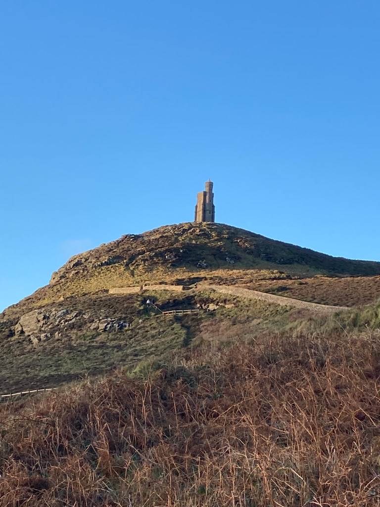
Just when you think there is nothing more to say about a walk you have done many many times you get a pleasant surprise. That’s just what happened today. I have walked the back route up the golden road to Glenn Chass and Port St Mary many times, but only today did I discover something new.

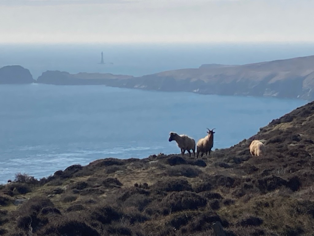
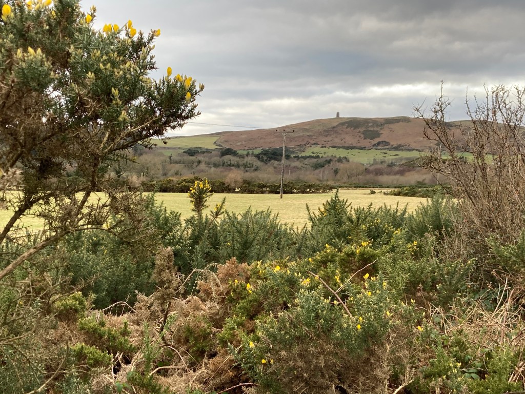
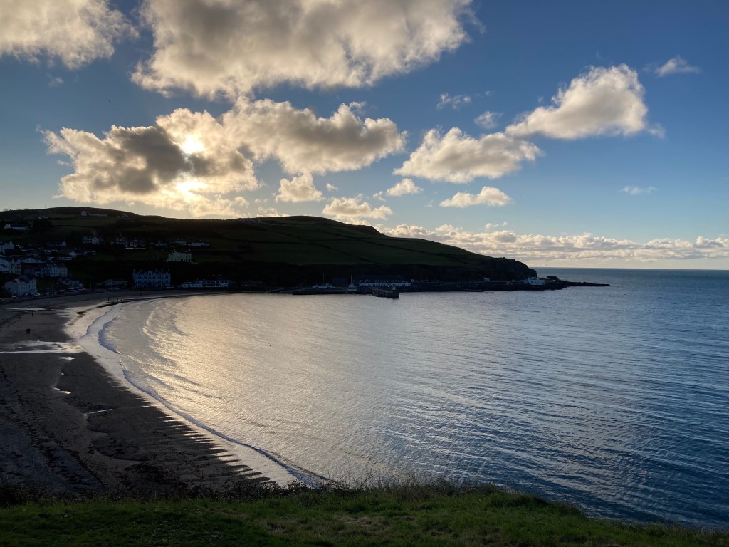
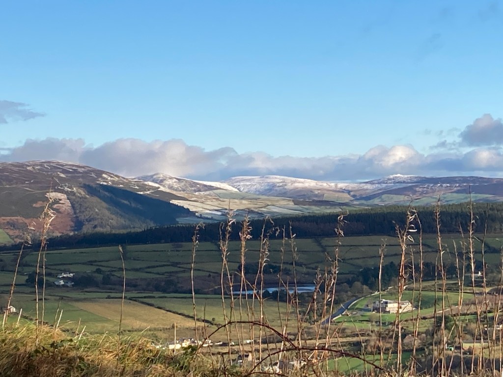
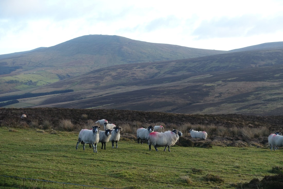
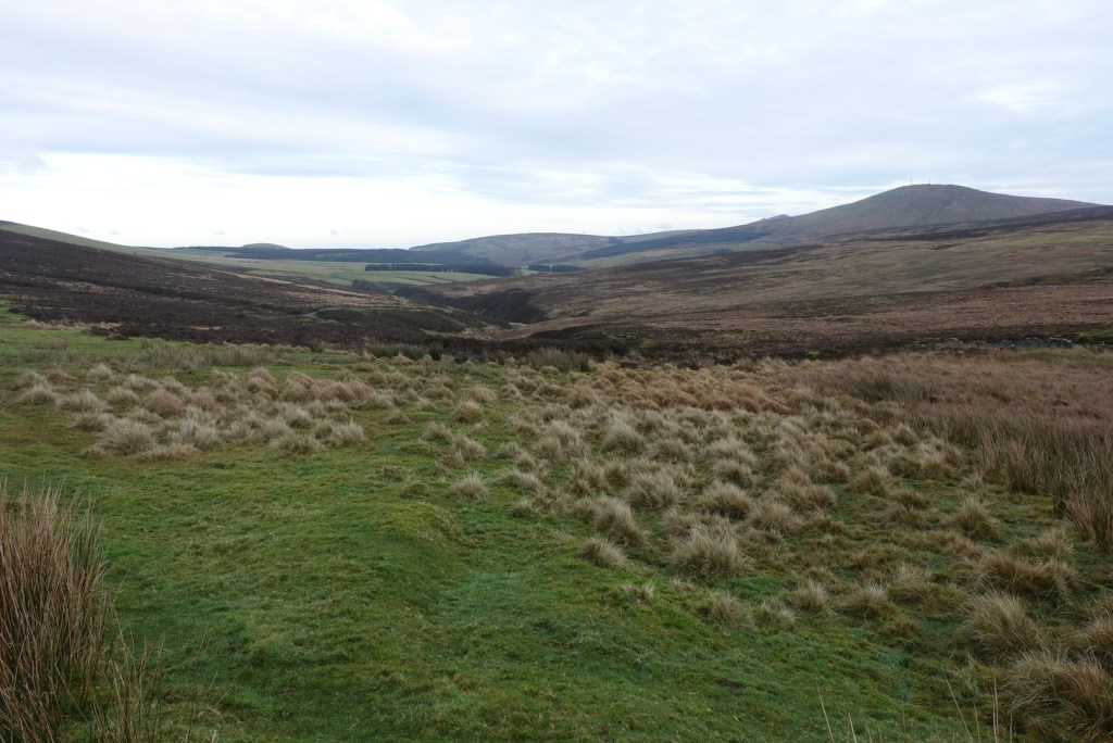
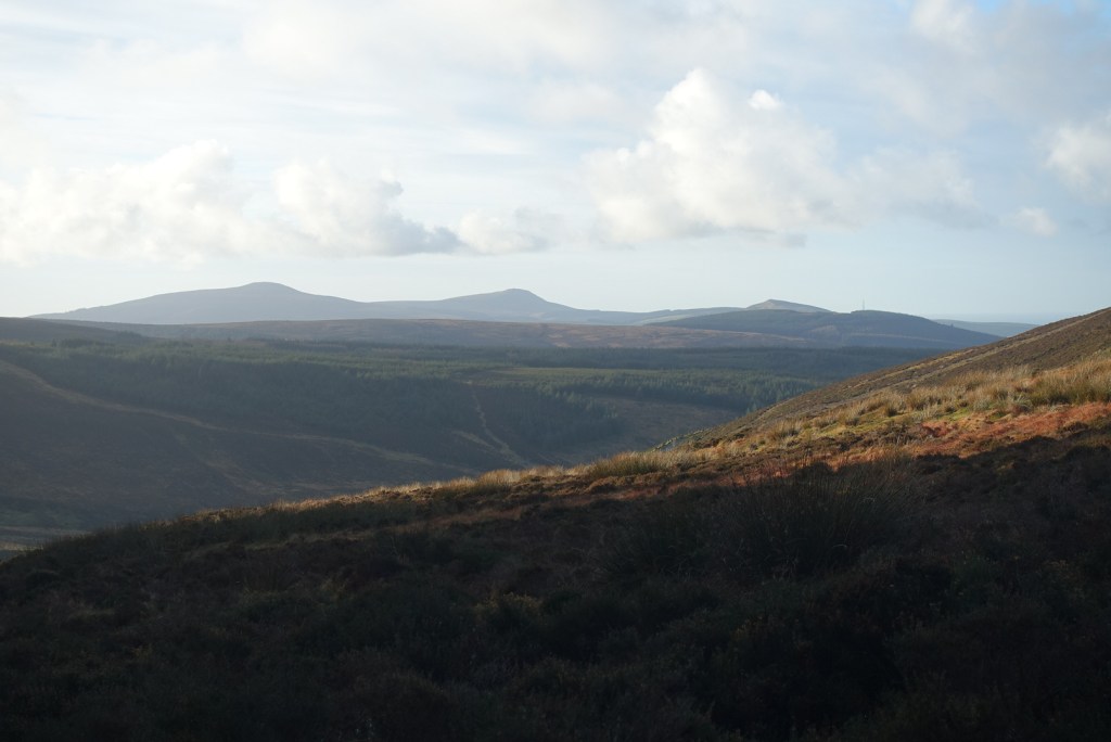
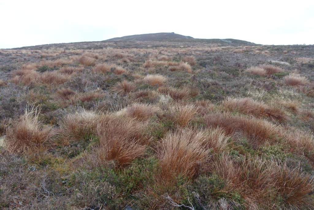
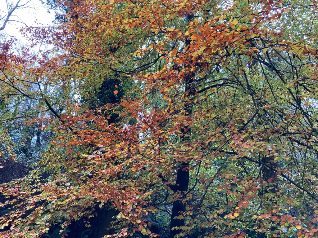
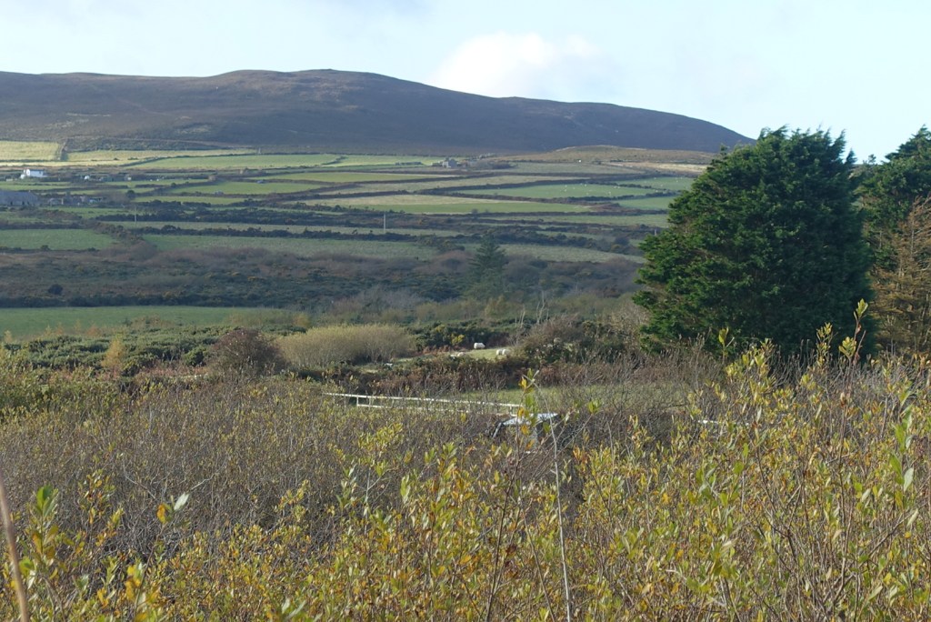
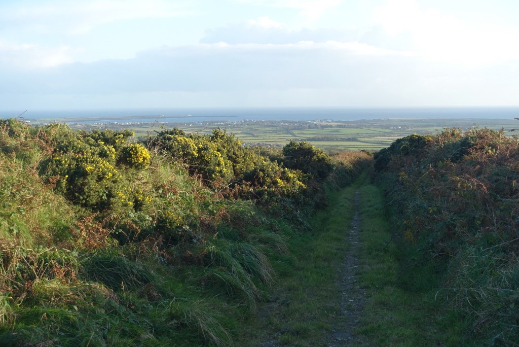
It started out as usual, well almost as usual, with a minor socially-distanced stop to allow some other people to pass on the path. Then it was onwards and upwards along the golden road. It was a bright, breezy but cool day and it afforded some fine views of the valley between the Meayll Hill headland and the Bradda / Carnanes range of hills.

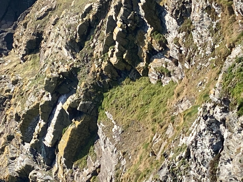
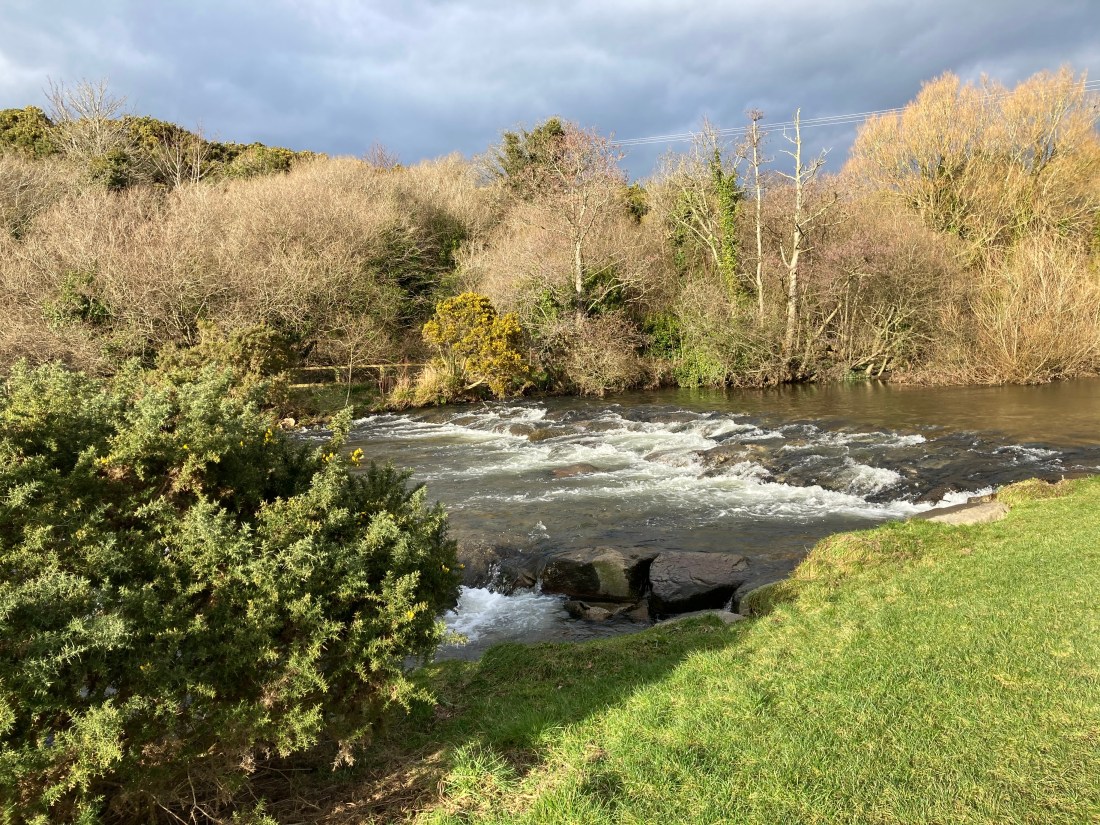
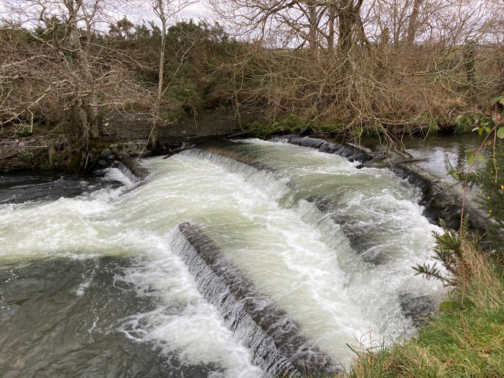
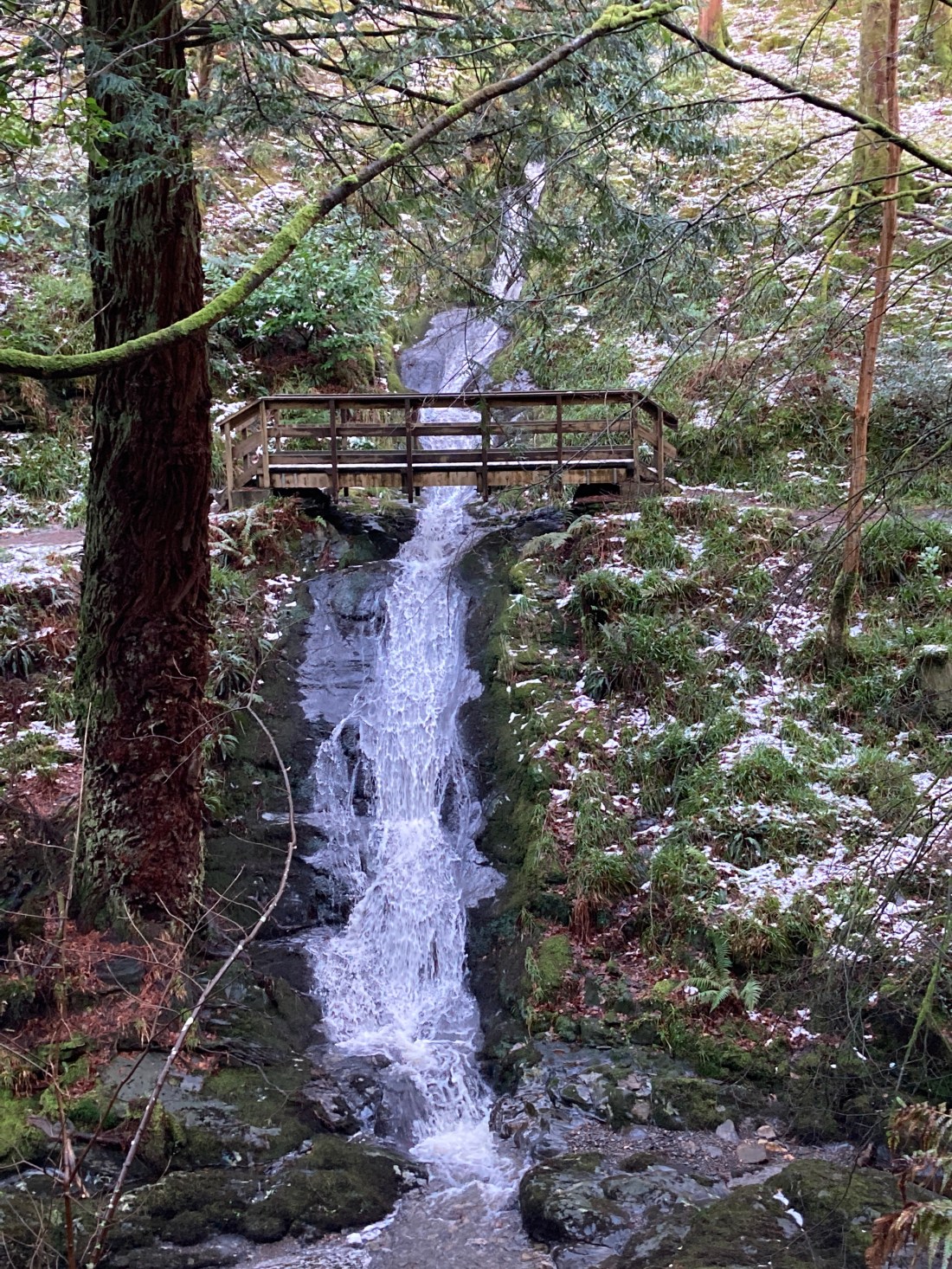
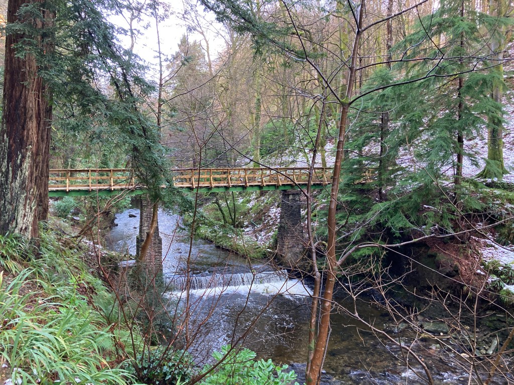
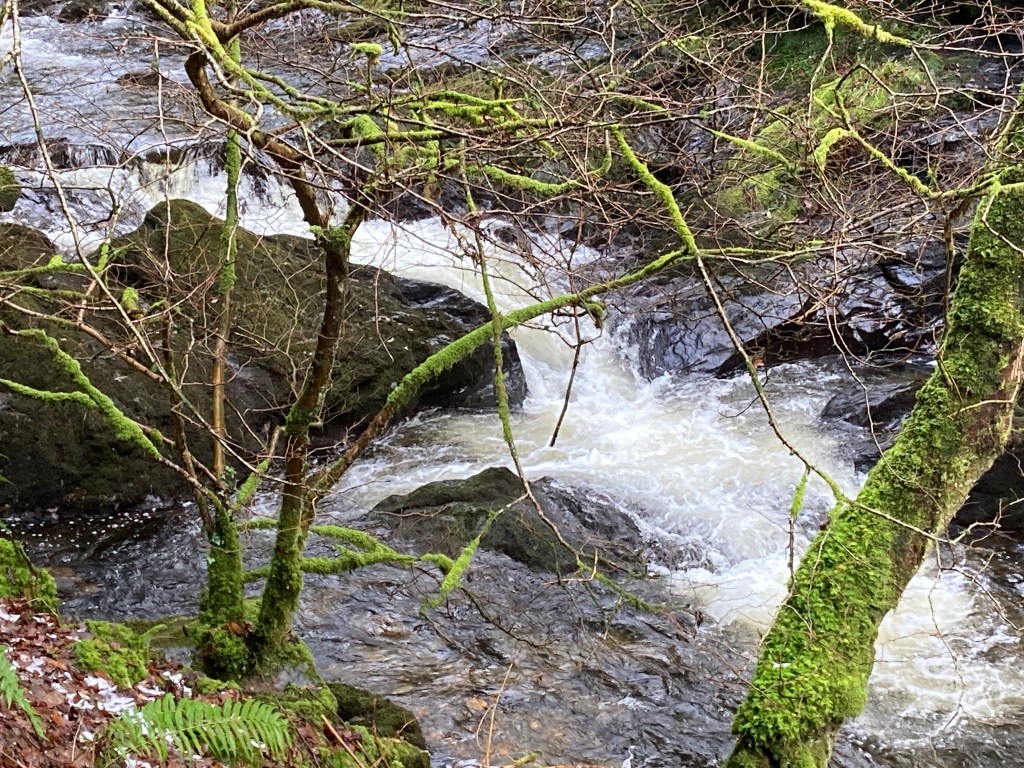
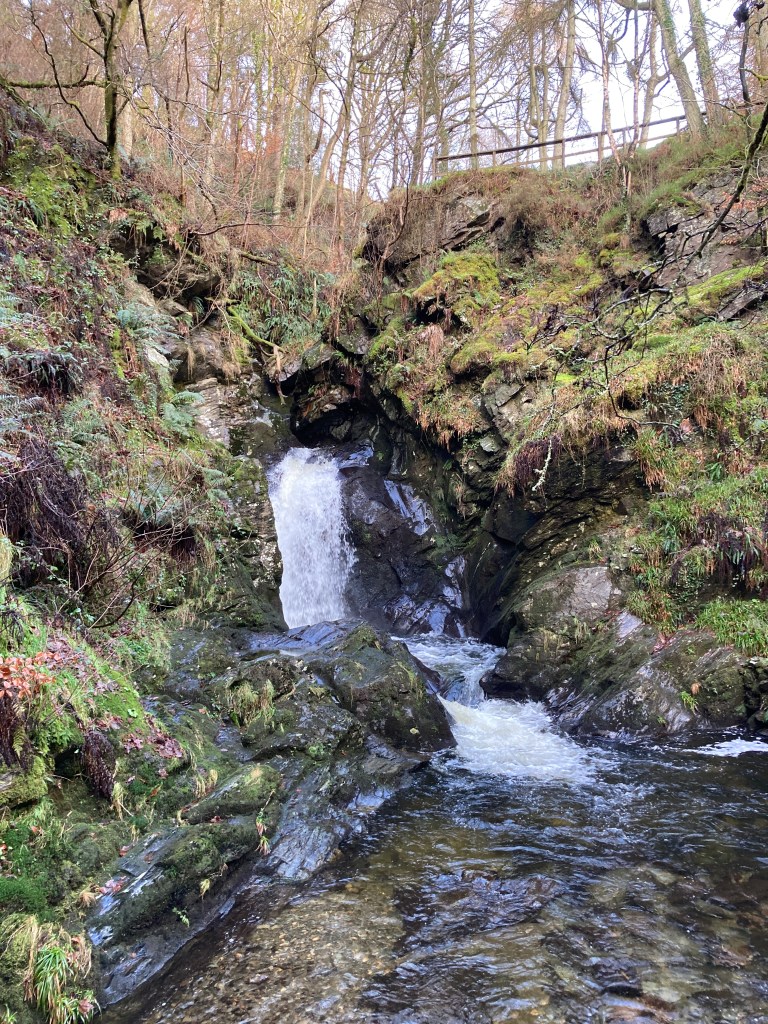
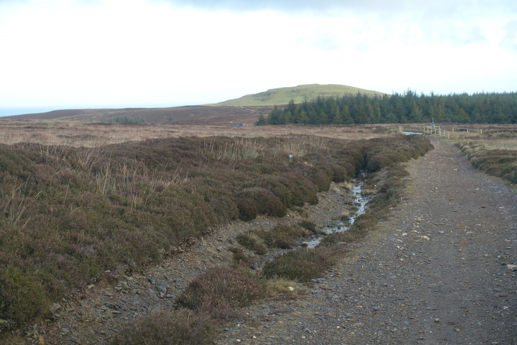
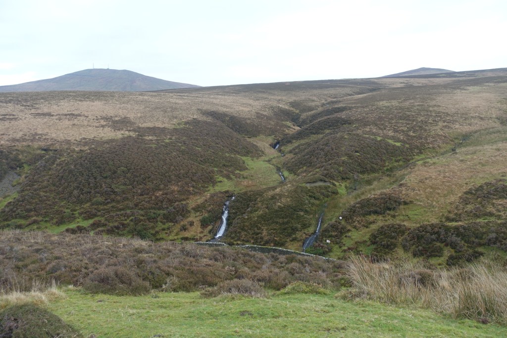
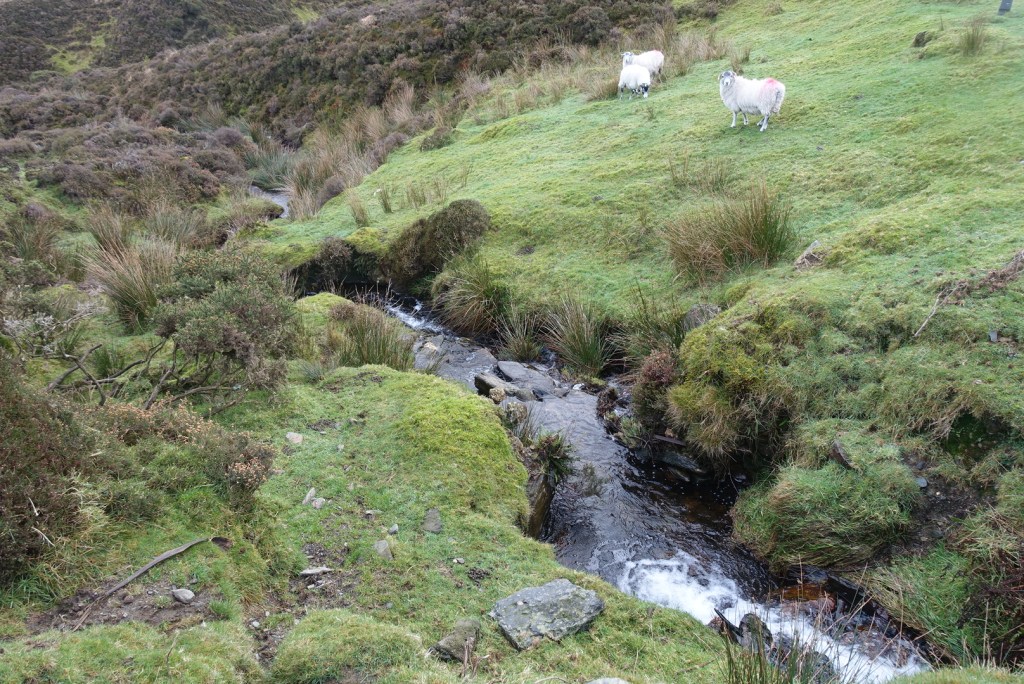
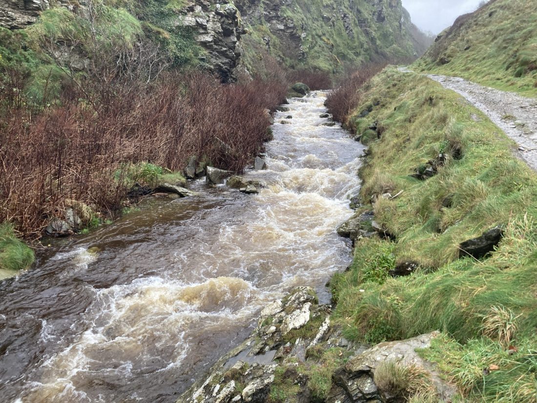
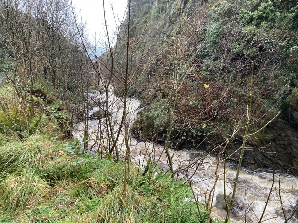
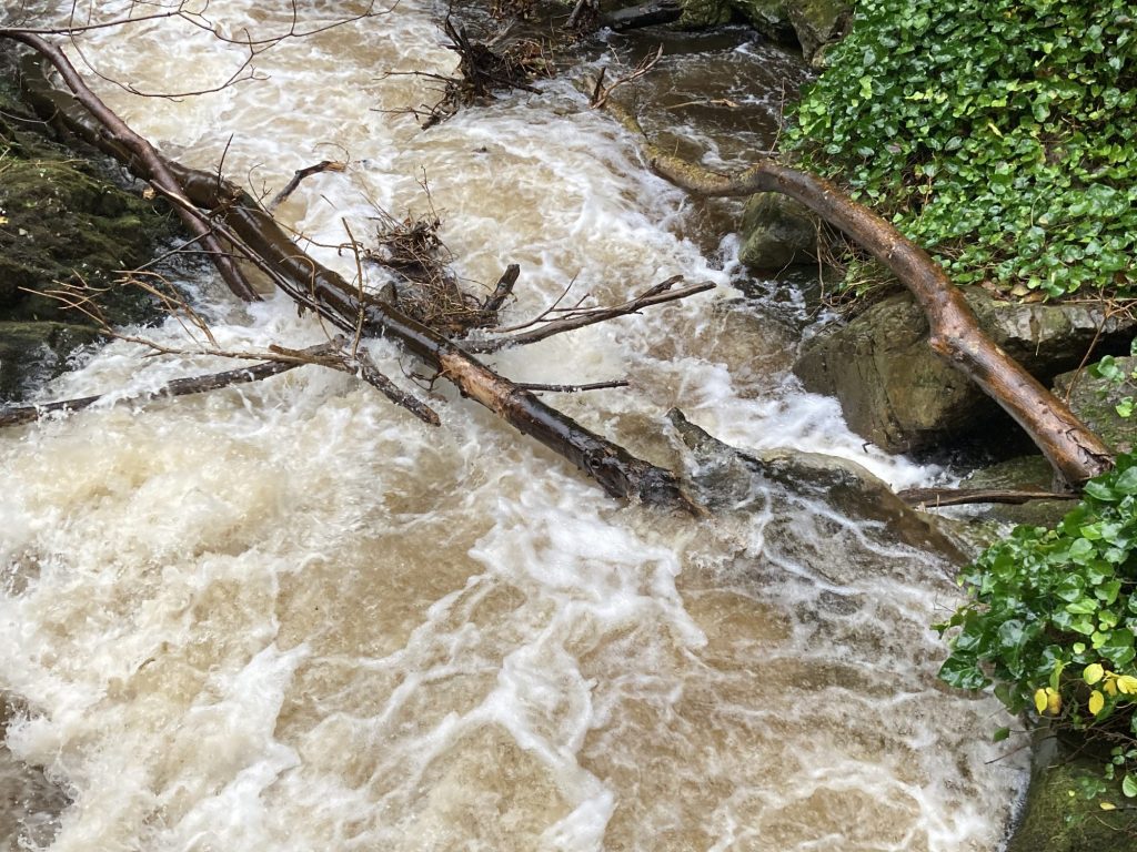
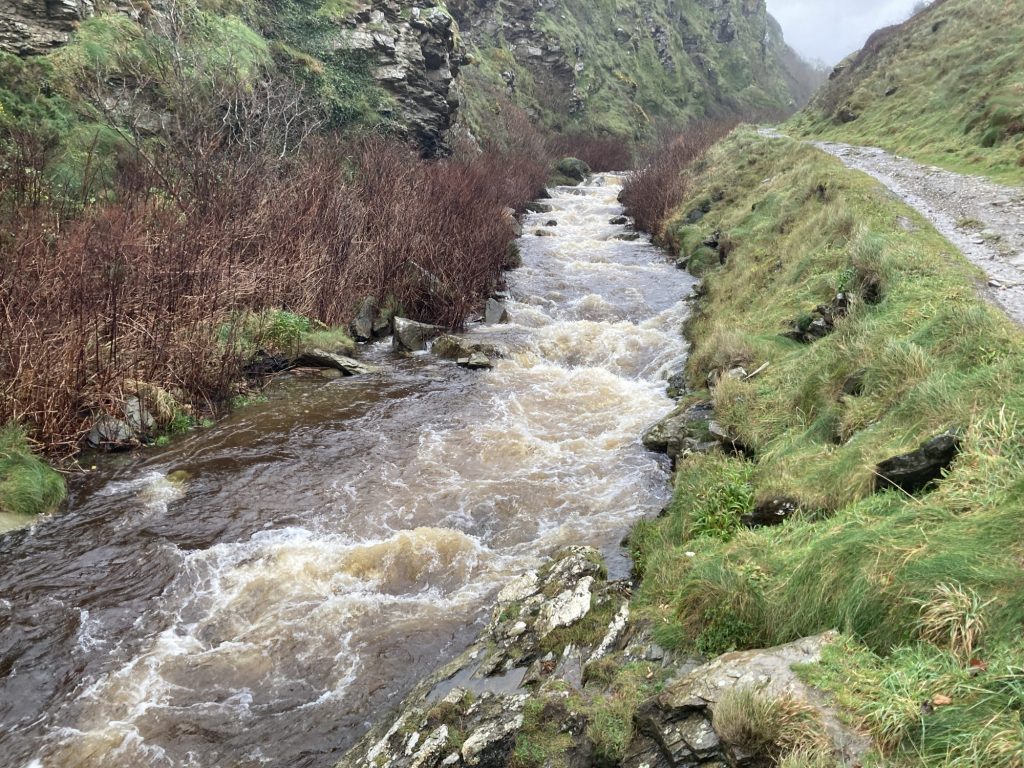
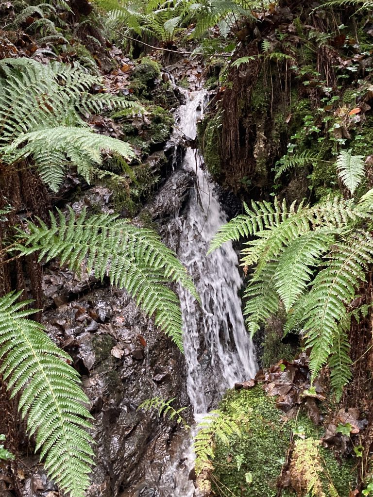
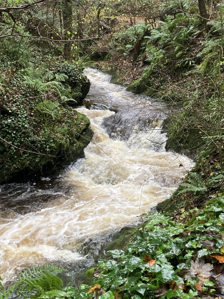
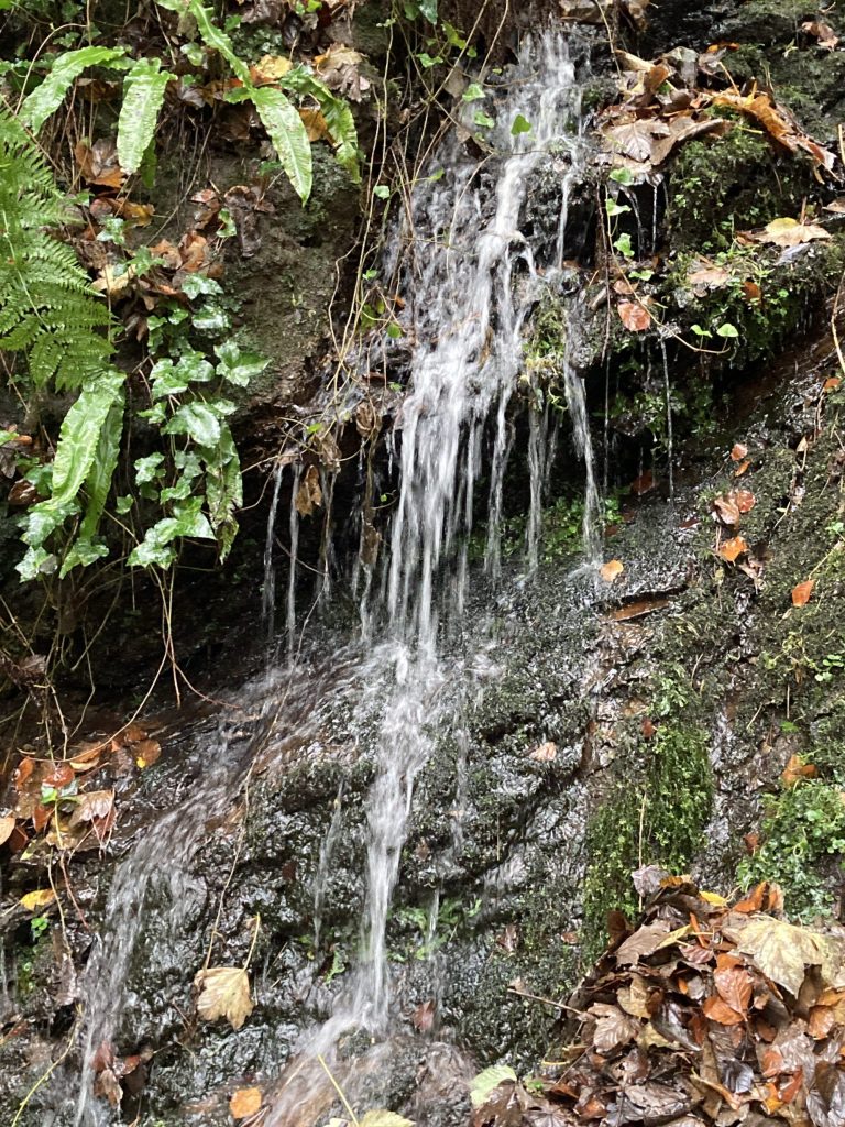
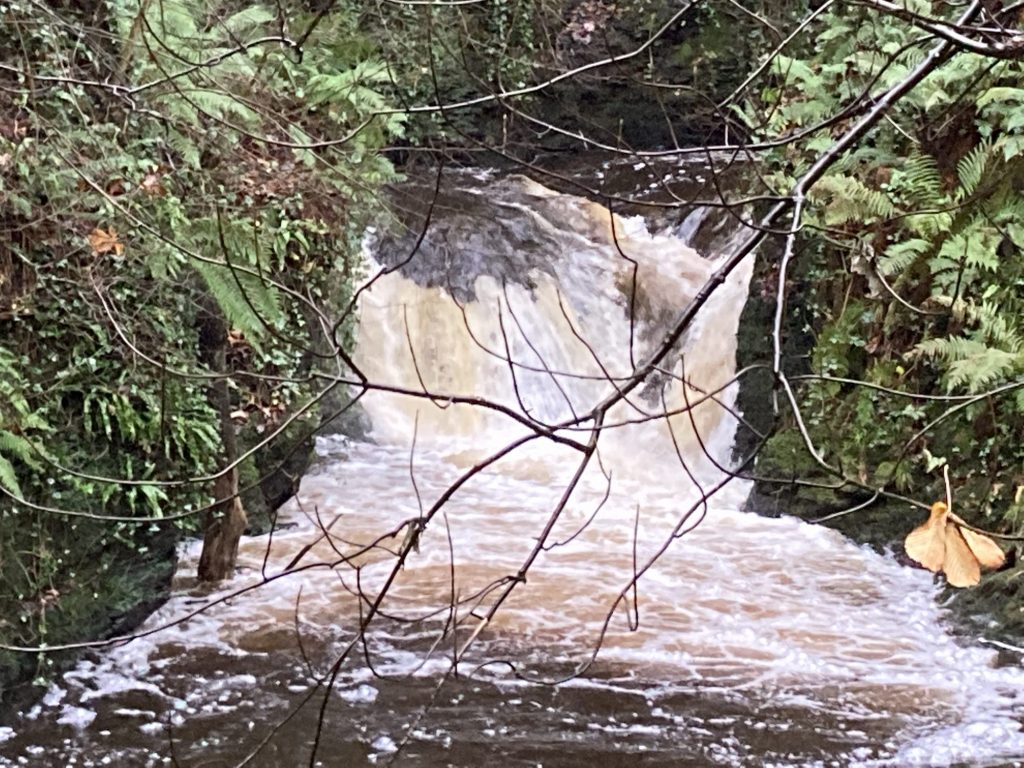
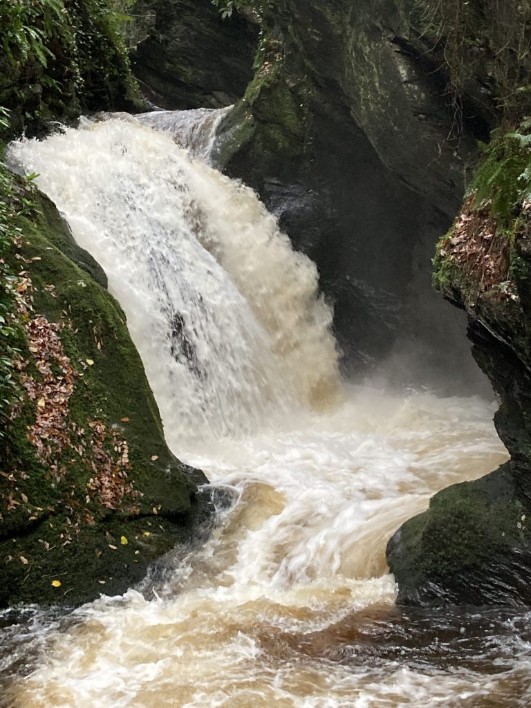
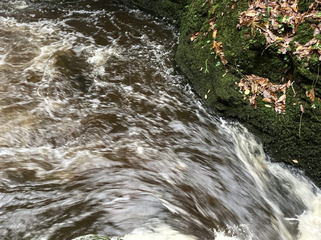
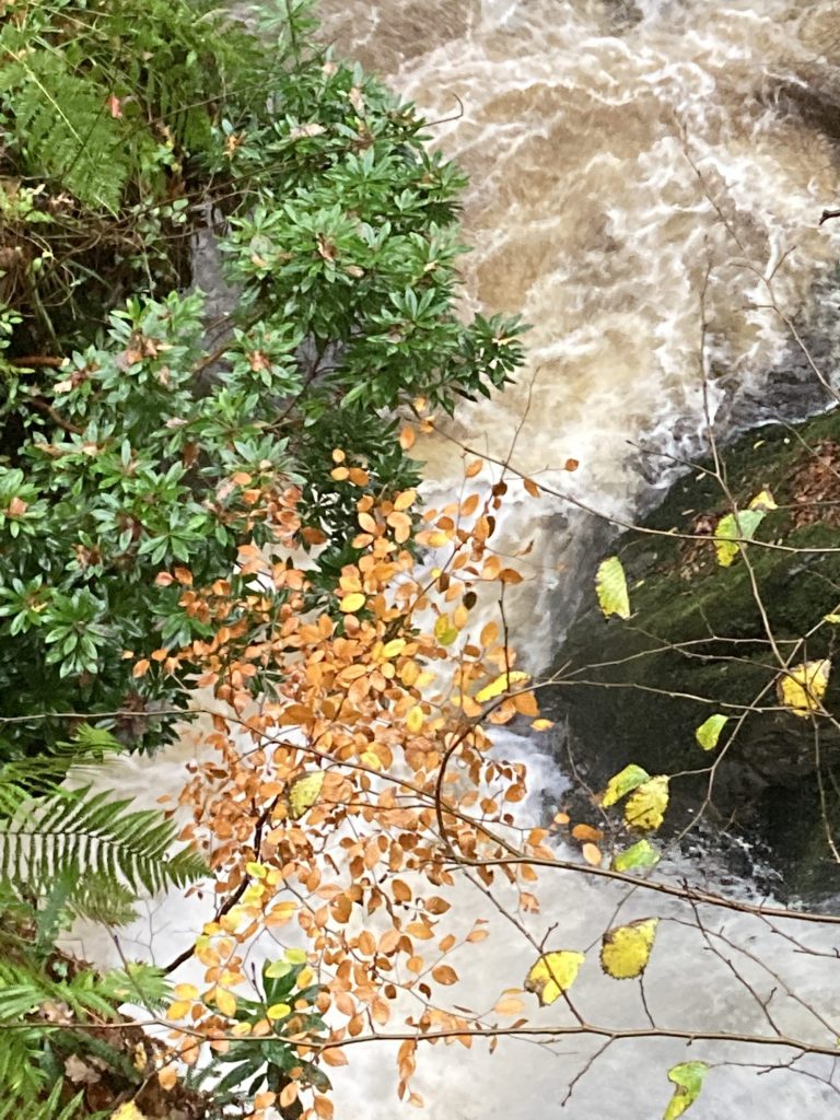
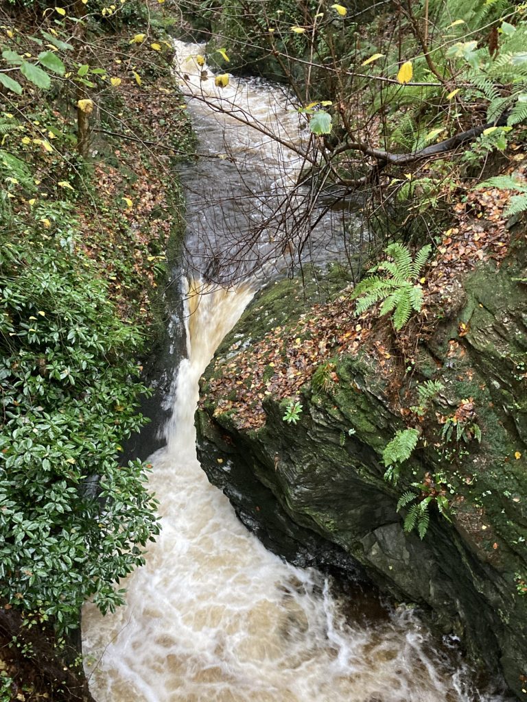
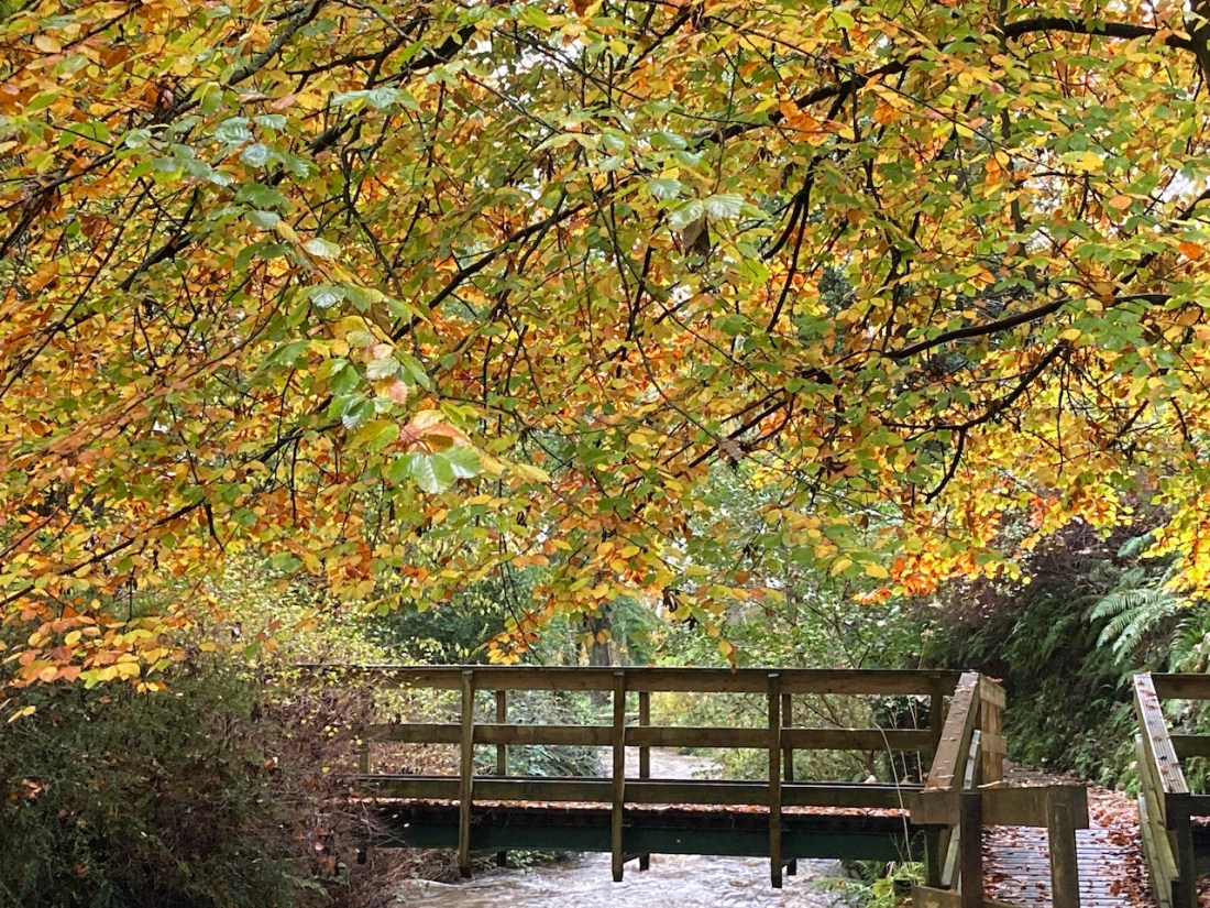
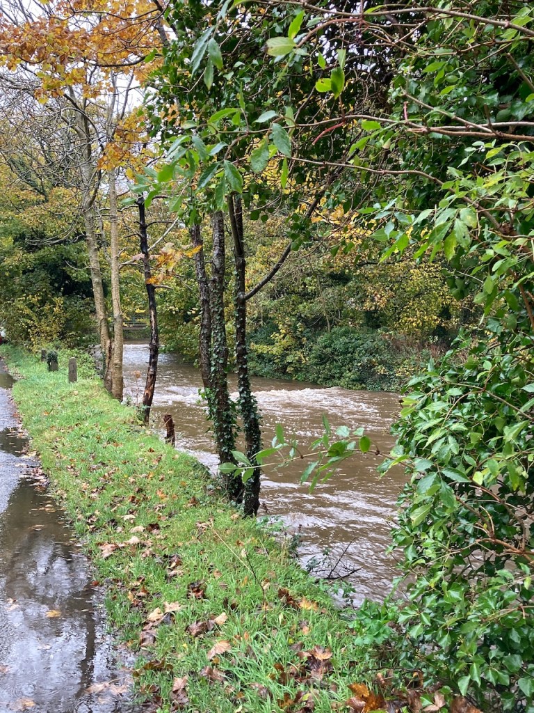
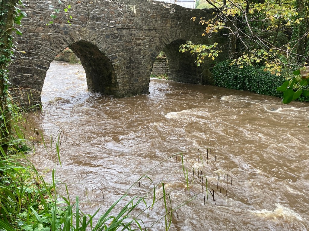
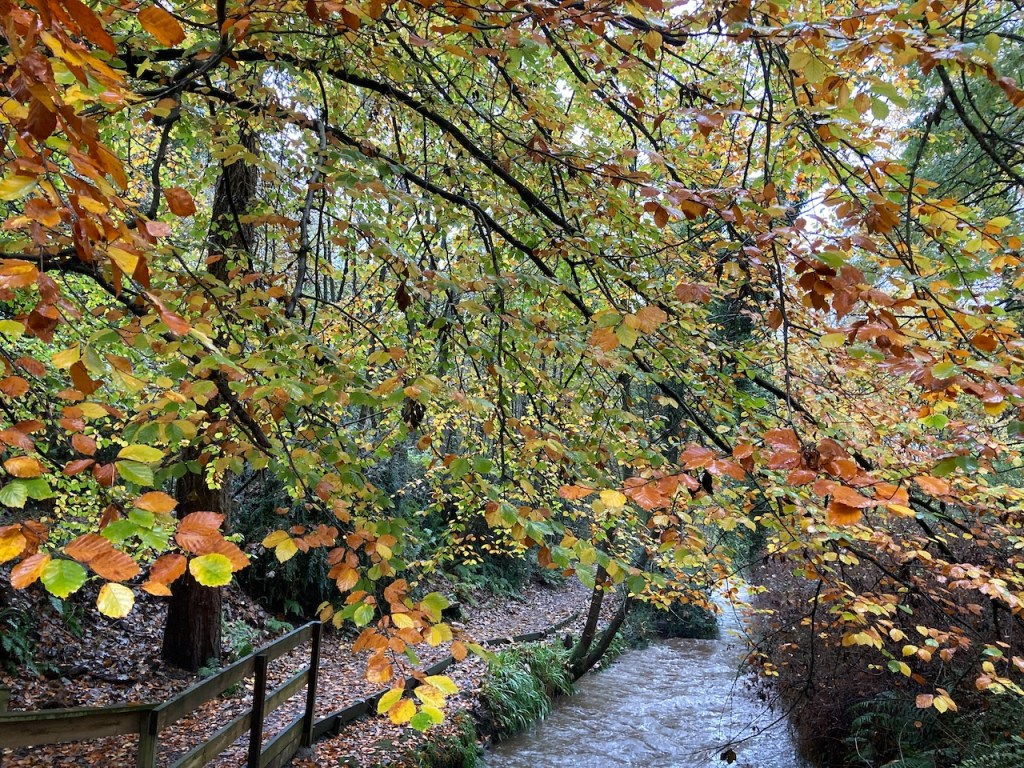
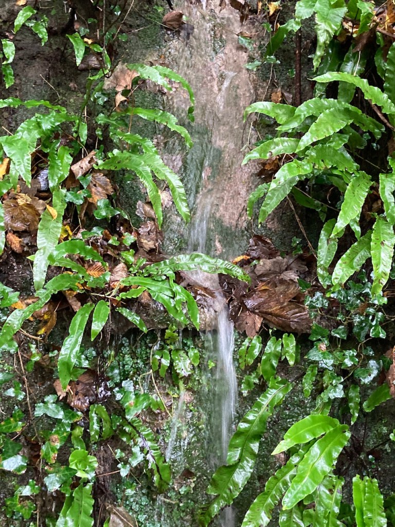
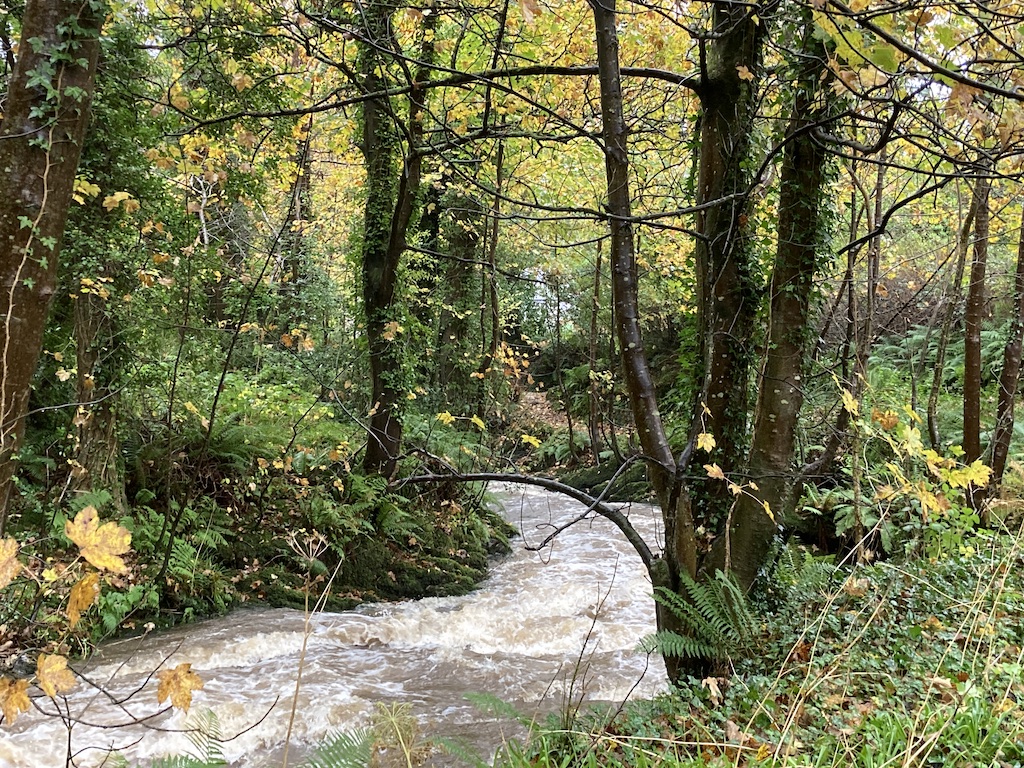
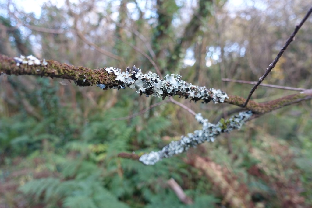
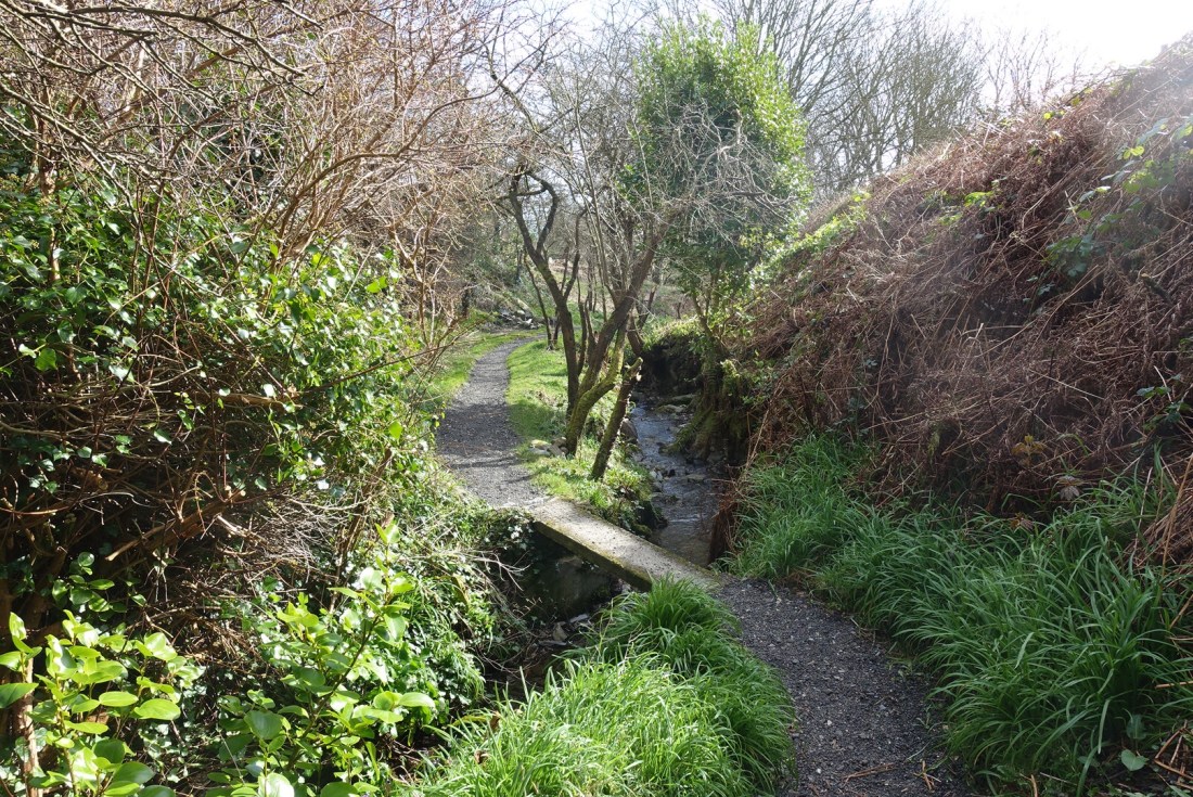
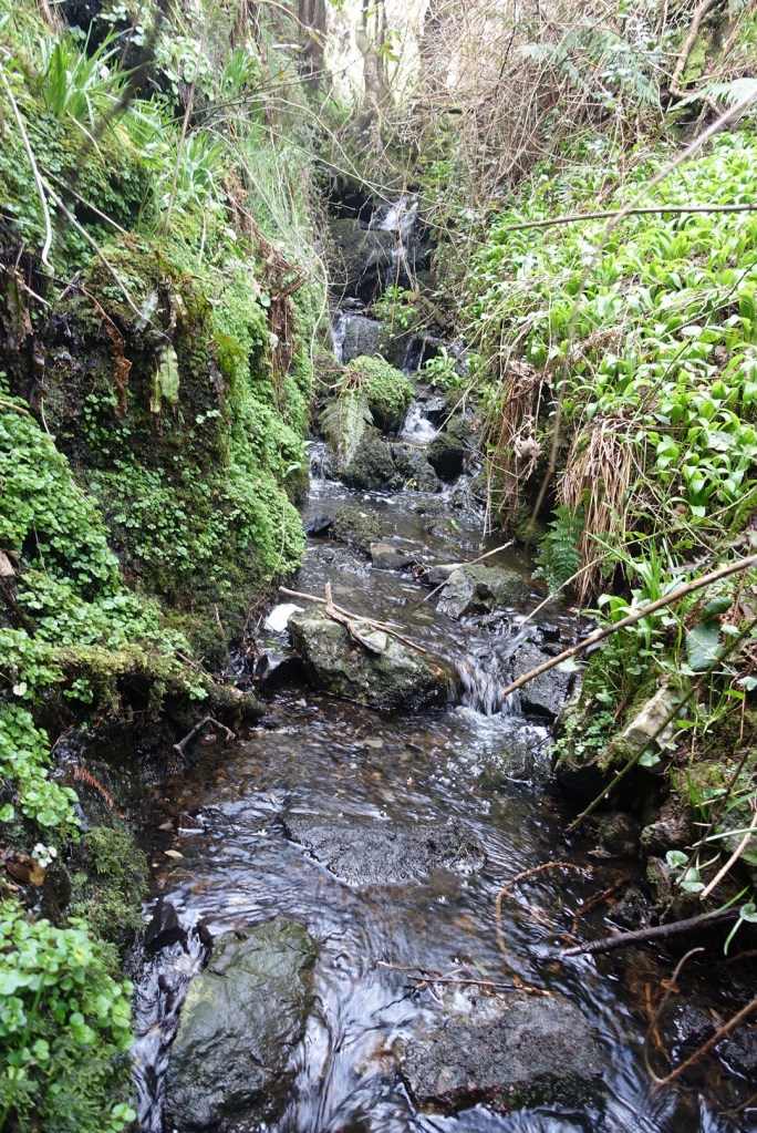
This path follows tracks across farmland, crossing over streamlets until you get to one of my favourite streams – yes, I know, who else has favourite streams. It flows off the moorland down through the edge of Port Erin and has a delightful bridge that you can only see if you scramble down the side of the stream. Today, there was quite a lot of water in the stream and I could hear gushing water from above, so true to form I found myself wading upstream to see what there was to see. I wasn’t really wearing suitable footwear so it was a matter of hopping from stone to stone and clinging on to vegetation in places. Just for the record, this sort of messing about is my idea of bliss! I didn’t manage to get very far, but I did see the source of the noise – a tiny waterfall cascading over some rocks. You will have to look very closely to see it!

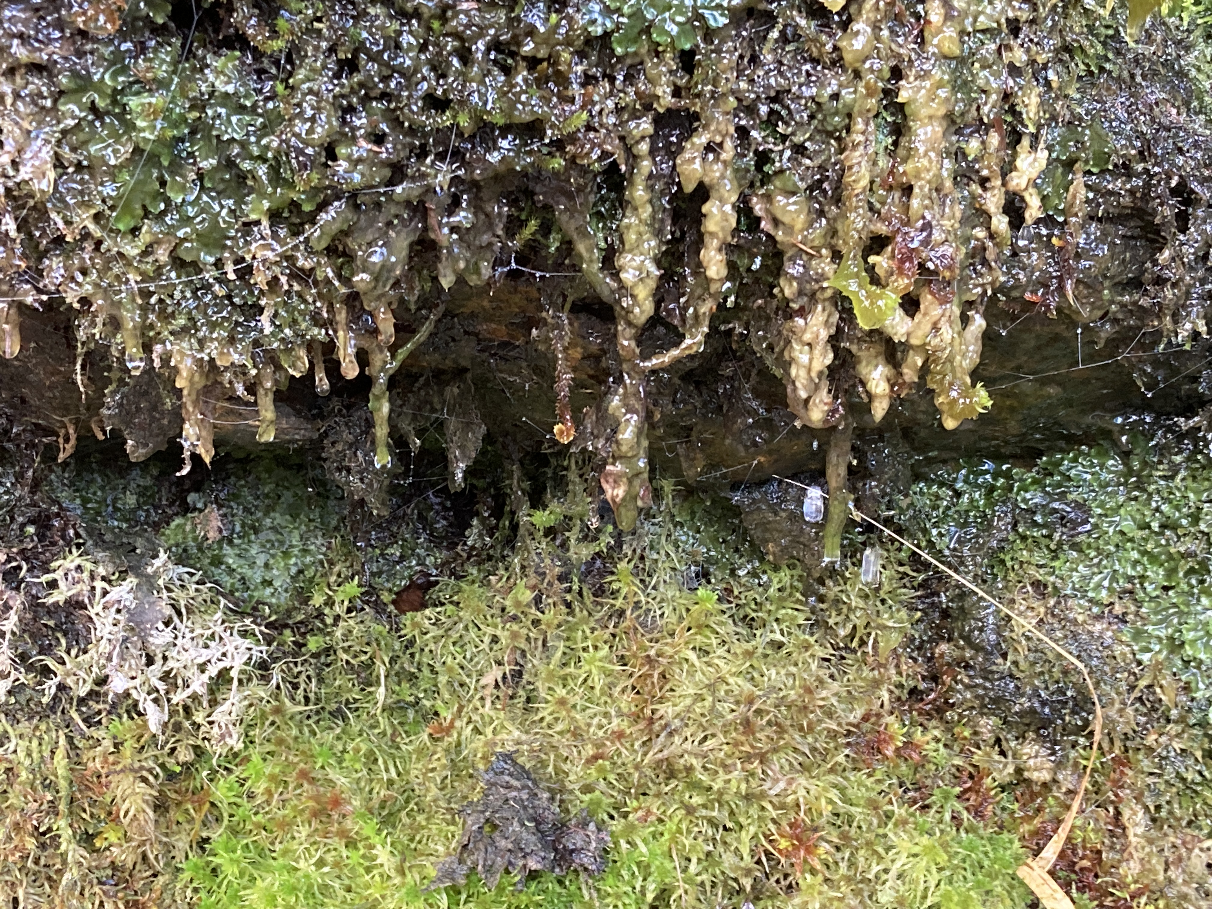
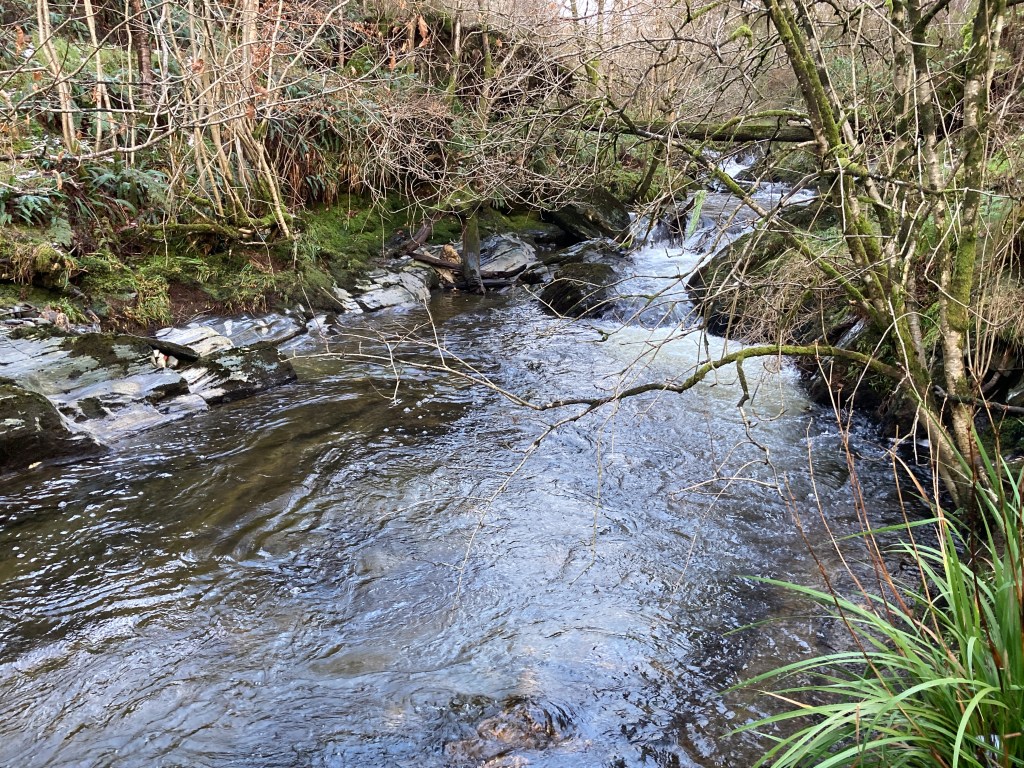
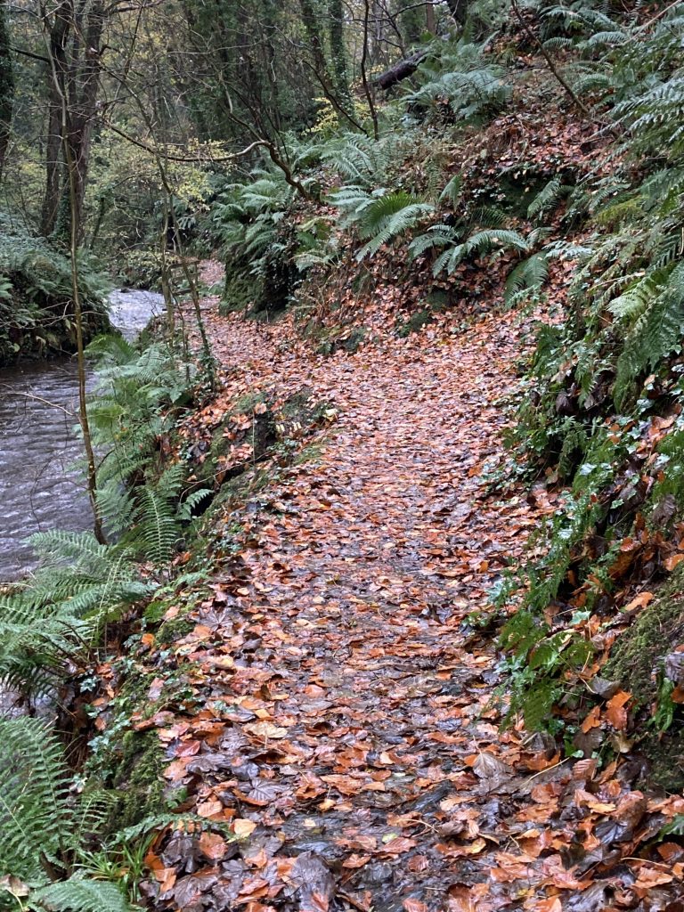
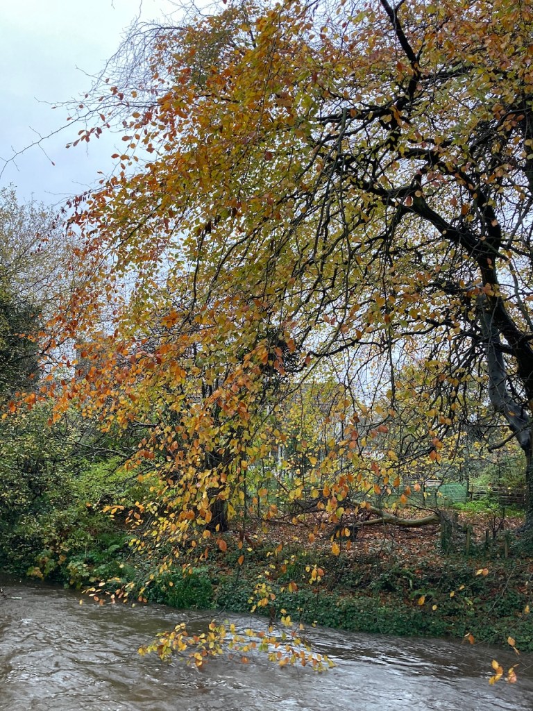
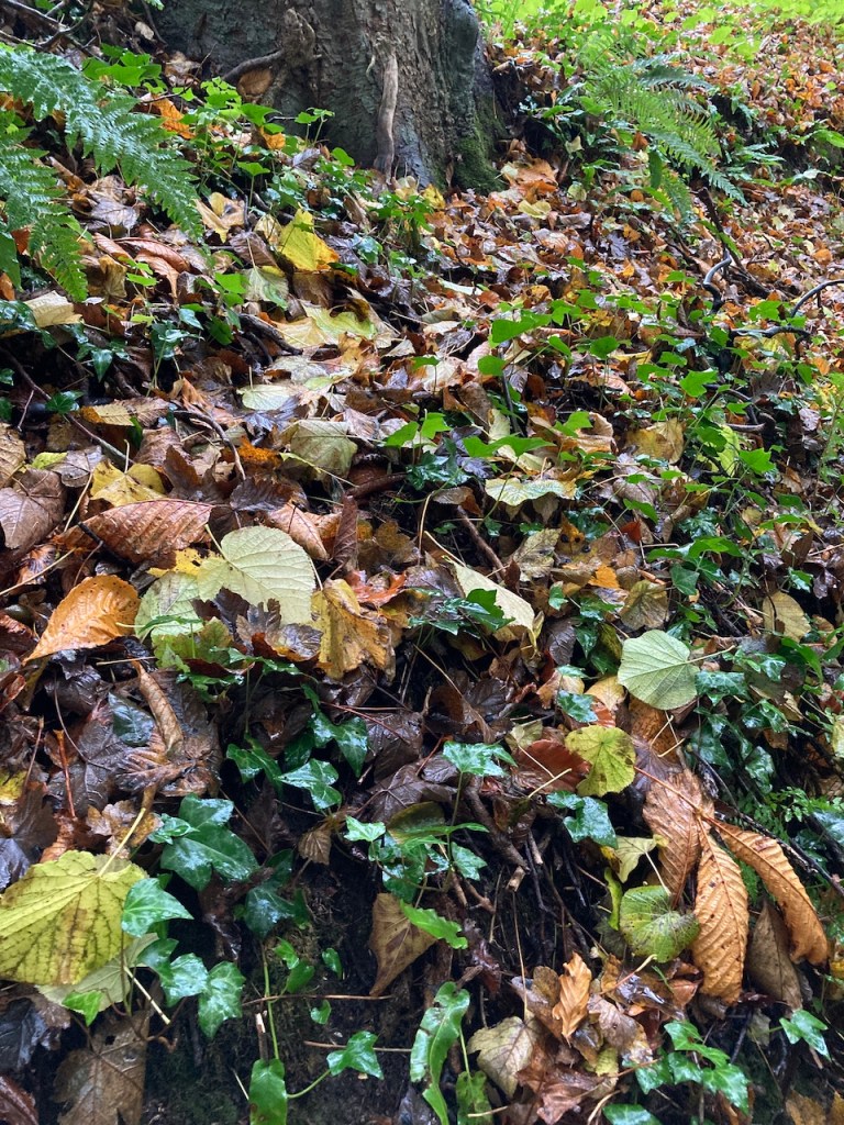
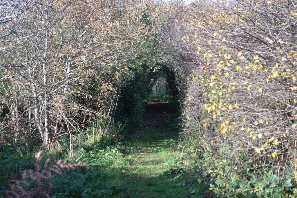
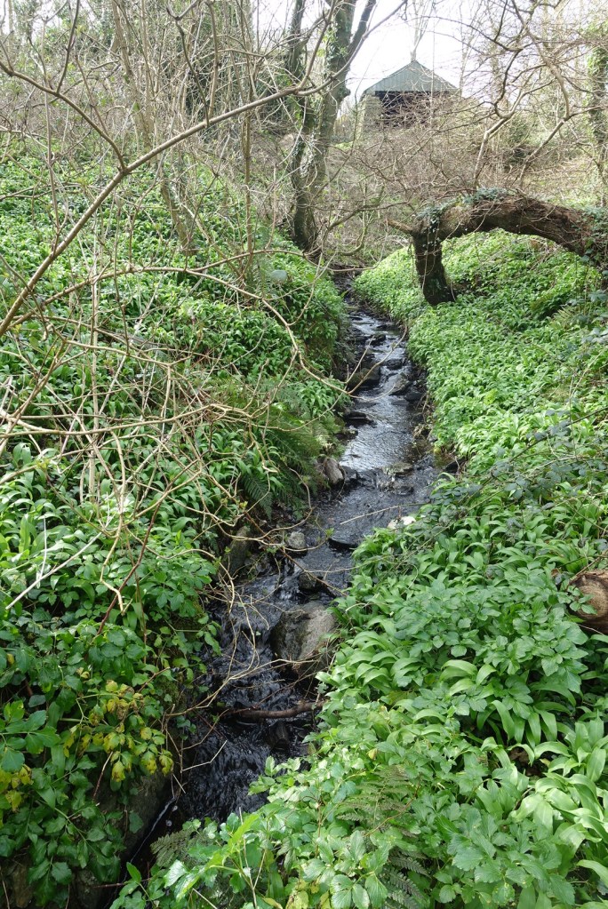
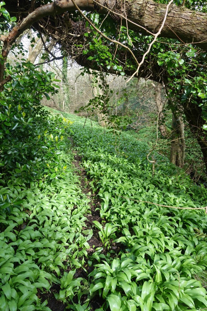
From here it was back to the path, only to be immediately diverted by a footpath going the other way, and then a made-made track following the stream in the opposite direction. No wading this time, just a curiosity to discover what might be round the next corner. And what was round the corner? Lots of wild garlic just beginning to sprout from the undergrowth and casting a heavenly smell. And looking up through the bare canopy of trees I could hear but not see a bird equally as happy as I to be enjoying the spring day.

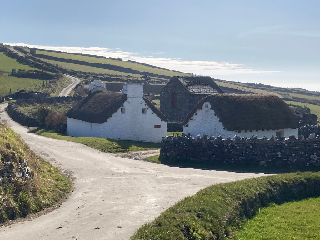
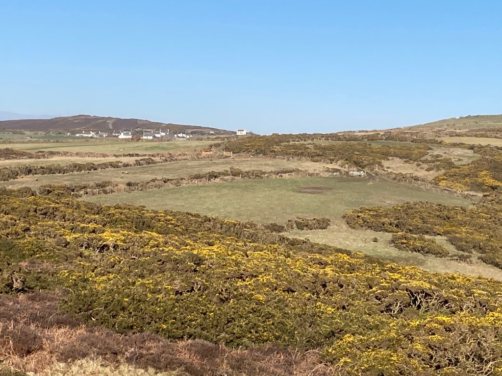
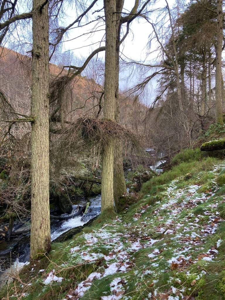
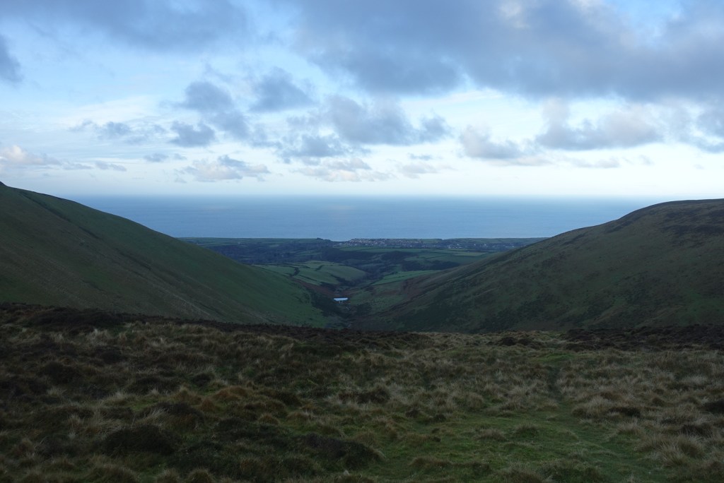
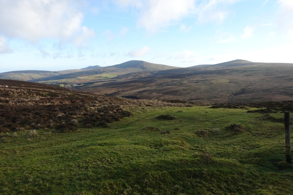
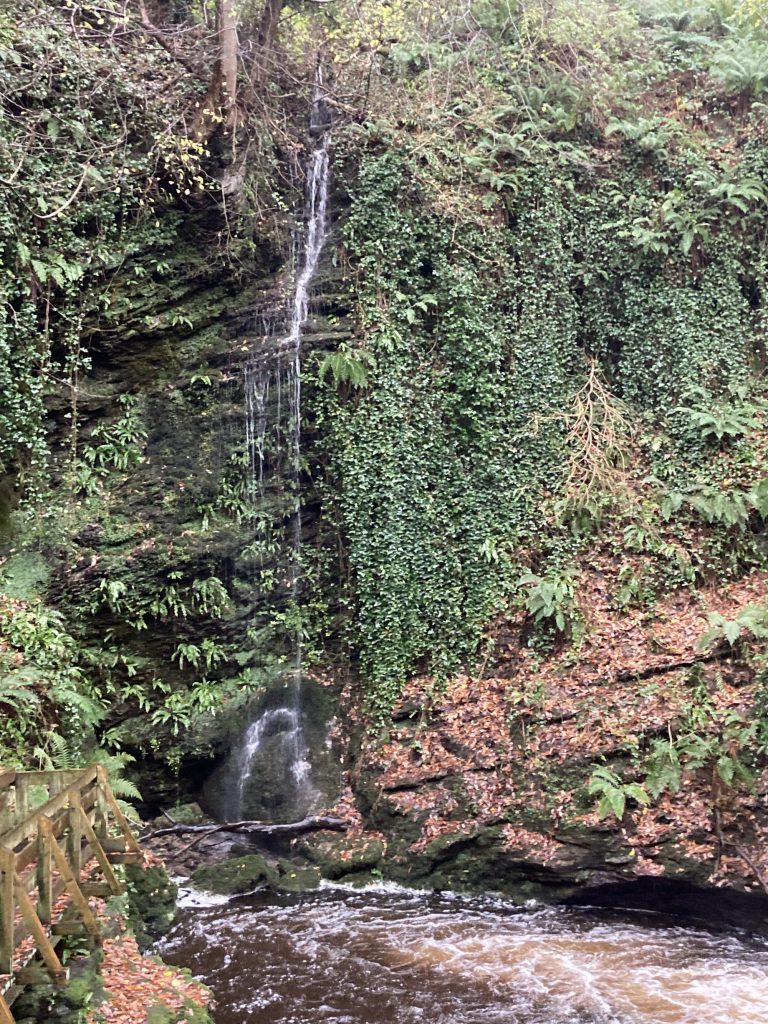
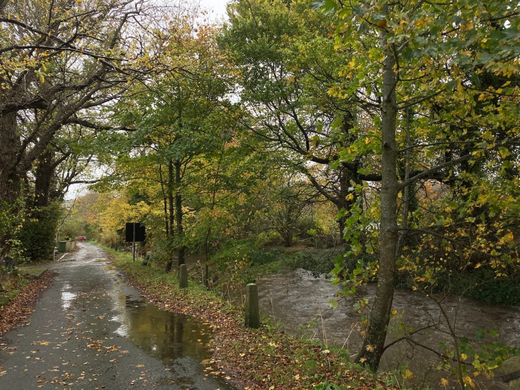
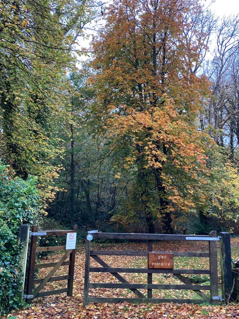
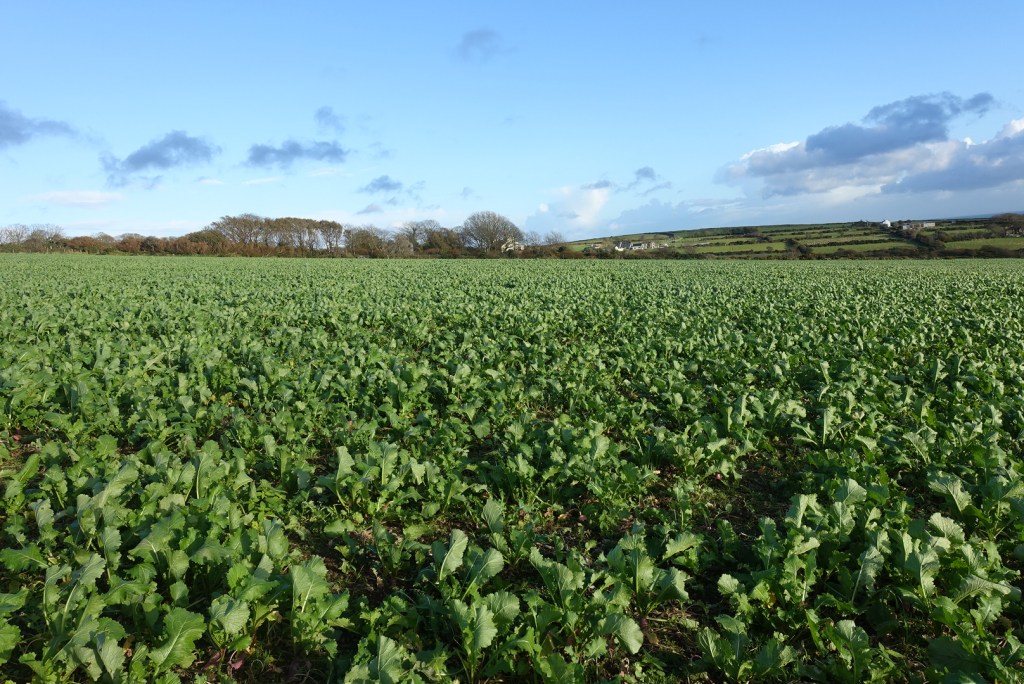
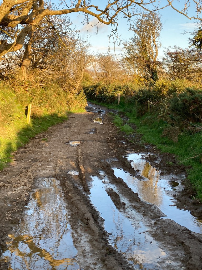
After my detour I followed the main track to Glenn Chass to walk down the narrow stream let that feeds into Fistard Bay. Only now, this looks completely different from previous times I have been here. It is being managed, and a new footpath has been created so it is possible to do a circular route in this uppermost part of the Glen. Not that there is a lot to see. Some of the vegetation has been cleared but this will soon grow back and I look forward to seeing how it develops in the future.

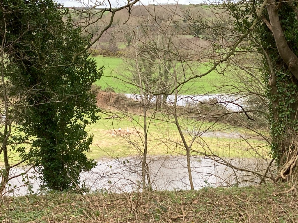
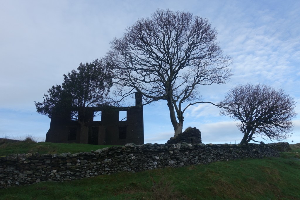
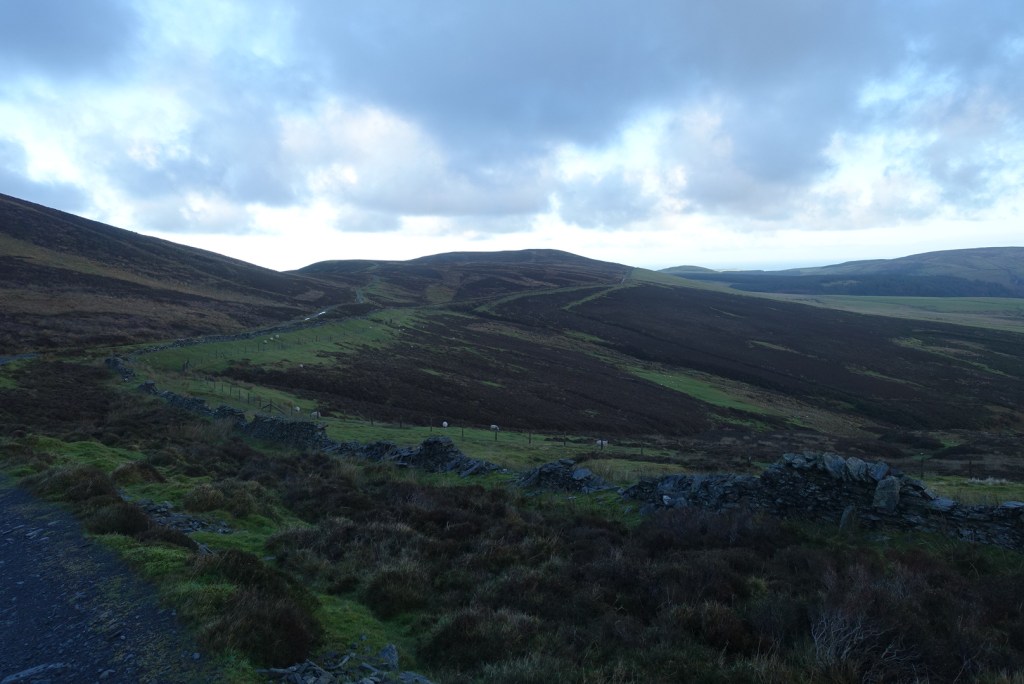
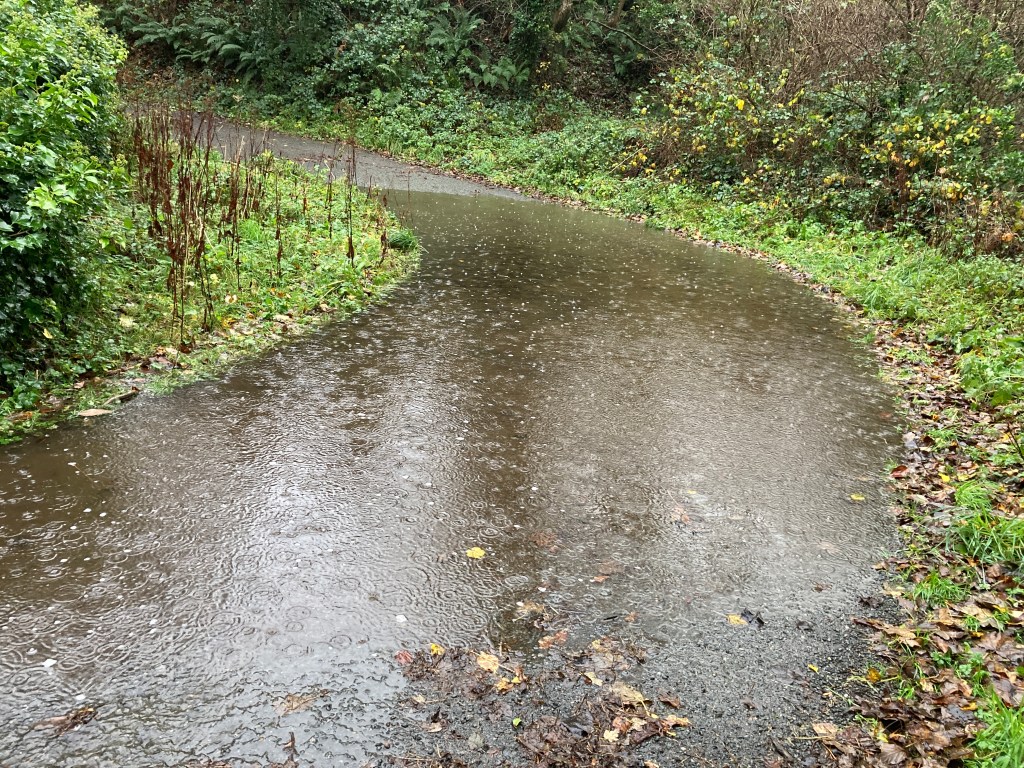
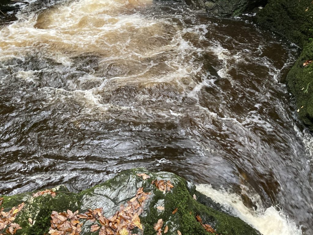
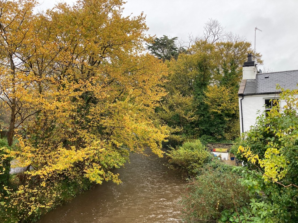
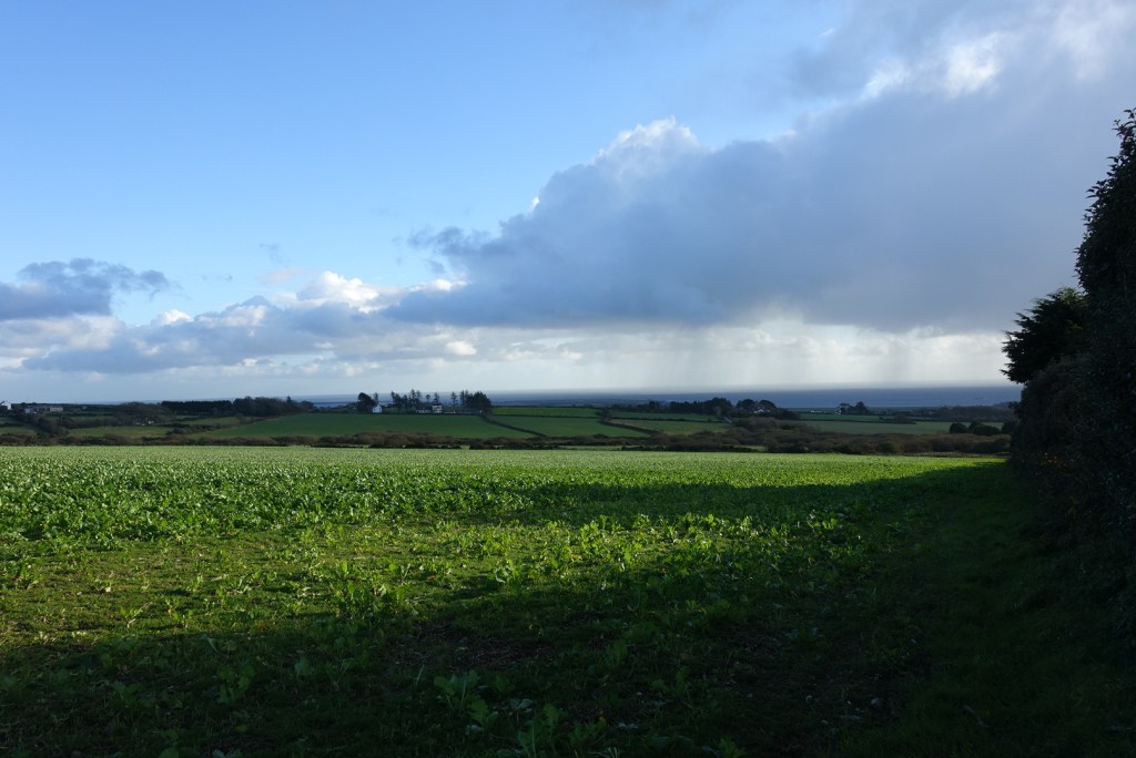
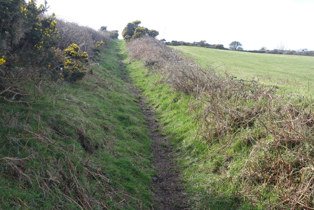
The path joins the lane and continues down to the sea, looking rather different from its neighbour on the other side of the road.

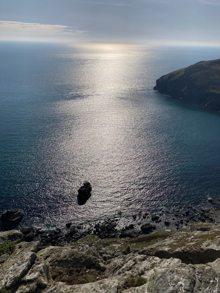
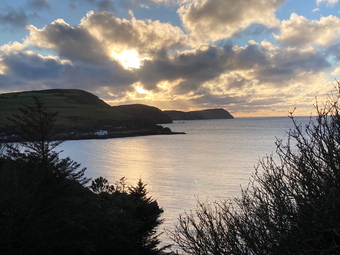
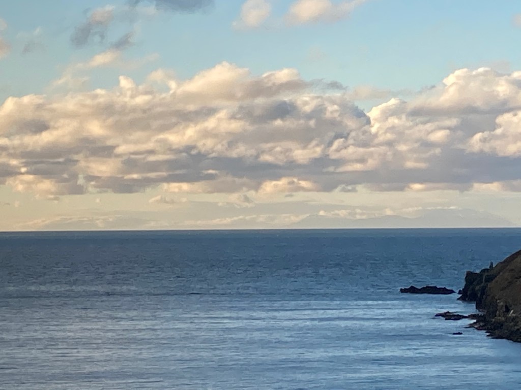
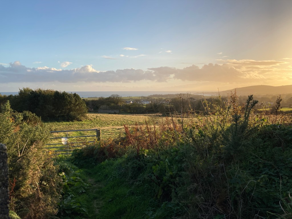
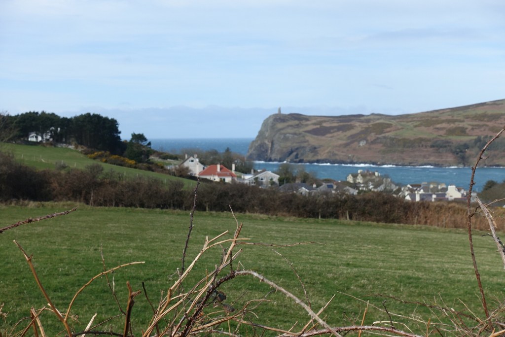
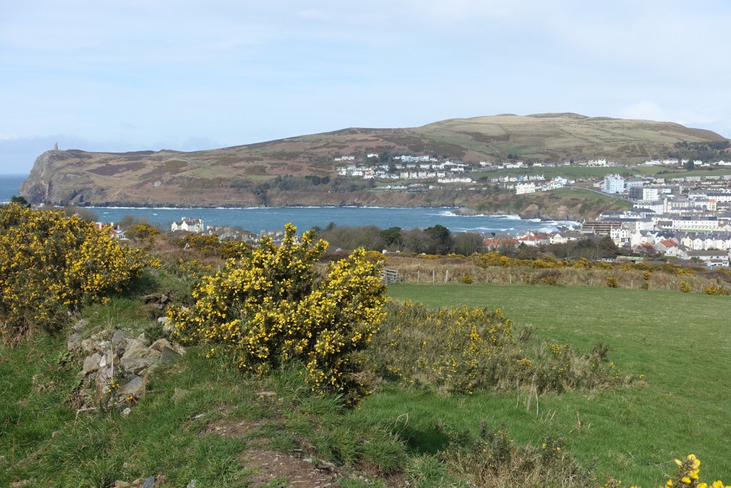
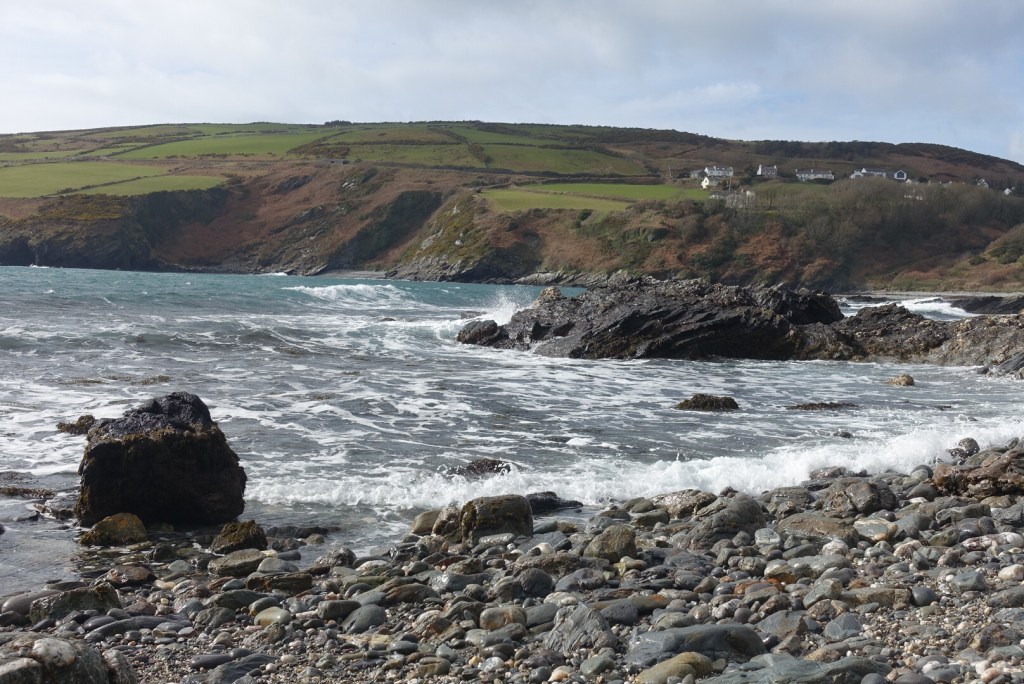
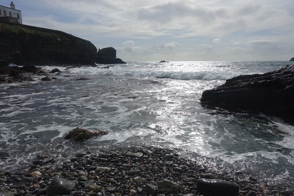
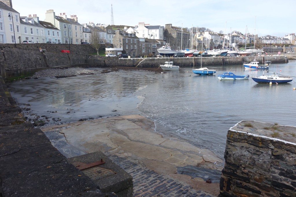
From here, I followed the coast path into Port St Mary. I didn’t deviate too much this time, only stopping to go down on the beach at the point where the golf course and footpath conjoin. I had missed high tide, which was a shame given it was a blustery day. Even so, the waves were having fun crashing against the rocks and the sunlight gave cool approval as it kissed the sea.

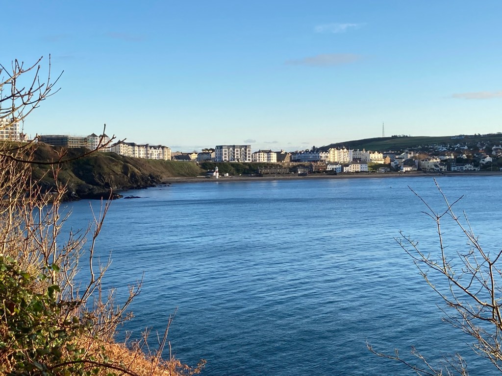
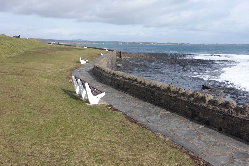
Up to this point, I had seen barely anyone but now in the town there were more people taking the air, or taking their dog for a walk. All stopped to allow others to pass, and many were wearing face coverings. Port St Mary had a peaceful air today and splendid views to the hills behind. Note how the benches look like seagulls looking out to sea for their prey. I reached the underway, but at this point had to leave the coast path as this is only one direction now and not the right direction for me, so I climbed up the cliff in front of the apartments, walked through the church grounds to the top road so that I could take the Truggan Road back to Port Erin. I may or may not have told you this before: Truggan Road can be translated as ‘the road to the swift stream’. How poetic is that, and very fitting for my adventurous afternoon.

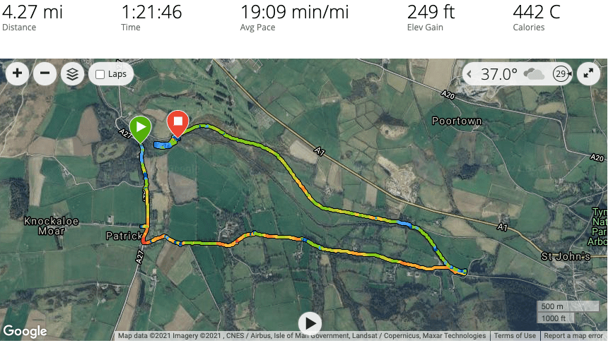
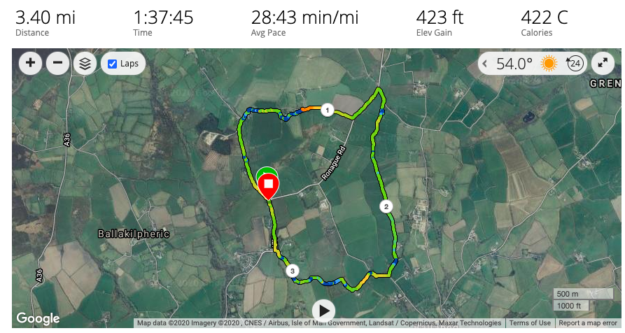
This was a short walk of about 4 miles and about 650 ft of elevation in total. A most enjoyable way to spend a couple of hours.

Cregneash and the Coast – March 7, 2021

At last! I had been waiting for a sunny day in order to take some supplementary photos for a watercolour I am planning to paint. For those who don’t know, the Isle of Man went back into lockdown again almost a week ago, following some unaccounted-for cases of Covid-19. Since then, we have an unusual amount of children and families with the virus and one of my cancer clients has family members affected by the recent outbreak, making it very real. Our 3 week lockdown looks like extending over Easter, but we are a robust island and we cope well with adversity, by and large.

It does make it hard to justify going out, even if we are allowed to go out for exercise for as long as we like. I took the car up to the Cregneash quarry and walked down into the village, where I wanted a particular shot of some of the cottages. There were several cars parked in the quarry so I knew to expect to see people on my walk. I secured my mask around my neck just in case and off I went. As I went through Cregneash I saw a few units of people, singles, family groups and couples all keeping strategically away from each other, or waiting for each other to pass on narrow sections. As I went up the hill towards the coast, the horses didn’t recognise social distancing and galloped from one fence to another to say hello to all and sundry.

At the top of the lane, again there were several cars parked, some of whom no doubt belonged to residents of the cottages, but again it indicated there would be people about, and indeed there were. However, this was my next photo point. One of my painting projects is a view from here looking down toward the Chasms cafe, and I needed to know the lie of the footpath in order to extend my painting. I also needed to know where the sea and sky meet behind it, if you know what I mean. My house faces south, and if I could make a direct path through the hills from my house to the sea this would be the view I would have, so I thought it would be nice to have a bright painting of this scene at midday on my stairwell. It would make me feel alive every time I walk down the stairs. Whether I can accomplish this is an entirely different matter. I only started painting at all in lockdown 1, but four watercolours on and I am doing ok, and they are all hanging on my walls in my house right now 🙂

It wasn’t a bright day and there was a very slight haze, but the sunlight was beautiful on the old Chasms cafe and as I walked along the coast line, I noticed things I don’t normally notice, such as the lichen growing on the rocks and the wave effect on some of the bigger slabs that I would walk over time after time. The light played beautifully on the sea too and I was so glad to be out in this sensational secenery. I paused for a while and watched the sea and listened to the many birds chattering on the Sugar Loaf. Can you spot the sheep grazing on Black Head? No, not the photo with the sheep posing in the middle but the photo next to it of the steep cliff. You may need to enlarge it. How they manage to make their way down there is remarkable.

I only walked as far as Spanish Head, via Black Head, where the Calf of Man looked more like one of the Canary Isles in the haze. From here I turned back returning to Cregneash through the farmers’ fields by a very muddy farm track but not before I snapped what I thought was a Chough, but looking at the wing span I now doubt my judgement.

This was only a short walk, only about 3.5 miles and only just about 500 ft of ascent. You could spend a whole afternoon wandering around these hills and never be bored.

Update: 11th April 2021. This is the painting I have done of this area, a watercolour on board. The wrong kind of material for watercolour. I was advised to score the board before applying the paint, which unfortunately didn’t work and has made the sky almost impossible to paint or cover the scouring marks. For the moorland I used a dabbing technique applying light colours first. This is only my fourth painting, having started during lockdown. The logo is a digital watermark so is not actually on the painting.

Heritage Trail & The Raggatt

Welcome first and foremost to all those of you on Facebook and Twitter who have recently stumbled across my blog and taken the trouble to read and follow it. I have been staggered by the number of new followers I have on those media in recent weeks, and thank you. I have been quiet this month due to our Covid-19 circuit-breaker and not getting out much. However, now that we are free of restrictions again I did get out for a short walk on Sunday afternoon before Evensong at Peel Cathedral.

I parked at the Raggatt and walked for a short distance along the main road back to Patrick, trying to work out where the railway track may have lain that took the internees to Knockaloe all those years ago. There is evidence of the track within the Raggatt itself but I failed to work out its route after that on this occasion.

Walking is so good for the soul and developing observational skills. As I reached the entrance to Knockaloe (for those reading this who are not local – there is now a museum opposite this entrance detailing its history and displaying artefects from the time. One item was recently shown on Antiques Roadshow!), I noticed the stone mount (see above) which presumably was used for climbing into your carriage? I have never noticed this before. The hills behind are some of the oldest on our island.

I turned left onto a beautiful tree-lined lane that takes you to St John’s the back way. There is a narrow pavement all the way. It is a fairly quiet road and enjoyable to walk along. Just past the church is an area entitled “Patrick Orchard Community Allotments” or similar. I couldn’t see any allotments just trees, so this is something of a mystery. On my short journey along this road I counted nine streams coming off the hillside under the road into the River Neb, all with fairly fast flowing water. It has rained cats and dogs these last few days (and loughtan sheep), causing floods last Thursday in Strang that at least one mad fool was caught driving through (!), so this was not surprising.

I passed Close Leece Farm Shop and Cafe that was doing a roaring trade, and walked a little further before crossing left over the bridge into the fields that would lead to the Heritage Trail. When I have been on this newly created path before I haven’t enjoyed walking along it. It is certainly harder underfoot than it was previously and having had all the vegetation stripped on either side of it, it is certainly less interesting as a path and …. yes, there is a ‘but’ coming. As I walked a couple of miles along it I began to appreciate it more. No longer do you have to wade through muddy sections as where the water table is high the path has been raised. It is still possible to enjoy the wildness of the area in parts and the Raggatt itself is as beautiful as ever. And of course, it is accessible to more people. There is even a picnic area with benches, tables and a cycle stand for weary cyclists and walkers.

There are various places along the river where there are small weirs and fishing places. I stopped beside one of these and had my lunch (the stepping stones in the feature photo), and when the temperature dropped and the odd snowflake started to appear out of the sky I walked as far along the other side of the river as one can go, which is another half mile, so not very far. This is a dirt path mainly for fishermen I think. It is a shame that one cannot continue beside the river and cross back. I am sure many people would enjoy a shorter circular route.

As it was, without the minor extension of 1 mile, the circuit is 4.5 miles of easy, mostly level walking. You could take a wheelchair/pram or pushchair, though the field section of no more than half a mile would be slightly tricky. And of course, you can take a break at the Cafe or have a picnic on the trail itself or in the Raggatt. A nice afternoon walk that children and adults will enjoy alike.

I apologise for the slow upload of the photos. I will try and find a way to make them smaller files in the future.

The maps below show the main walk to the lunch picnic spot, and the extension where you have to retrace your steps.

New Year’s Day 2021

The first day of the year would not be complete without a brisk walk, and today was no exception. Well, it didn’t start out that way. Having had weeks of sleepless nights or very little sleep I was finally asleep at the time I had intended to rise to go and view the dawn. After a light breakfast I went back to bed and slept for another couple of hours, so this was really not a promising start to 2021.

Indeed, our government had reported some unwanted findings of coronavirus in the community at 2 minutes to midnight, heralding in more doom and gloom for the New Year. Given that they had had this information since Boxing day and not deemed it of enough importance even to mention in the briefing on 30th December, they could have waited instead of spoiling everyone’s New Year celebrations.

Anyway, I finally shook myself out of my lethargy and suggested to Janet that we have a walk up to Bradda Head. This would mean I couldn’t opt out if I suddenly found I couldn’t be bothered. We met up at Athol Glen, wearily looked at each other, and decided maybe Bradda Head was a step too far today :-). However, we did go most of the way, with suitable rests after moments of exertion on perfectly positioned benches and were rewarded with some lovely views and a crisp air to shake away the cobwebs.

In the end, we walked 3 miles or so, the sun shone, and we could see the remnants of snow on the Mountains of Mourne in Ireland. I do have some plans for longer walks in the hills over the next few days, so look out for those posts.

When I loaded up the information from my Garmin, I found I had been awarded the Strong Start Badge 🙂

Final Day of 2020 – Glen Helen

We had had snow overnight and a sudden flurry of hail, causing some chaos on the roads. By the time I went out today the situation was much improved. It was a bright day with extensive views in all directions. On the way home I could clearly see Snowdonia (hello Ros!) and Anglesey (hello Ian and Valerie).

Over Foxdale to Snaefell

On reaching South Barrule I stopped along the Round Table Road to get a view of Snaefell in its winter wonderland. Then onwards and upwards, with the roads getting just very slightly slippery as I neared Glen Helen.

It is months since I have been here, so I thought it would be a good place to meet up with my friend, Jill, for a short walk before lunch at Greens in St. Johns. It was still quite cold, even though it was midday, so we wrapped up warmly to accommodate the chilly weather.

There were few people about and no-one else stopped and stared at the things we spied: the necklace-like spider’s web shimmering in the light, the russet colours of the beech and oak leaves lying on the ground; the sphagnum moss clinging for dear life to defunct tree trunks as they toppled down the hillside; some broom in flower. The colours were suprisingly bright for mid winter.

The path has recently been renovated and this is one of the better paths that is pleasant to walk on, with plenty of room for pushchairs and wheelchairs. New sturdy wooden bridges have been created which give wide views of the river, which was furiously scrambling over rocks, pebbles and collapsed trees on its way to meet the sea. At one point a new bench had been positioned looking away from the river back up the hillside – very odd, especially as there was fencing behind it to stop anyone from falling into the river!

In no time at all we were at the waterfall which was putting on a special show just for us. The water-scuplted rocks made interesting shapes. About 5ft above the level of the water was an unusual ball-shaped space, looking as if it might have contained a large boulder at some time, and which had long ago tumbled into the water. You can just make this out on the photo below. The alternative is that the waterfall may have changed its course, so that was my cue to continue upwards to investigate. I left Jill admiring the waterfall and took off up a grassy, muddy path with some slippery stones to negotiate. There were more waterfalls at the top and I concluded that it is possible that many aeons ago the waterfall would have been a lot higher and the bowl shaped sculpture could have been made by a previous waterfall, though we shall probably never know. Maybe the elves spend the winter carving out the stone for their palace in the woods.

So, from there it was the same walk back, although we did cross the river to view a throne on the other side. There is nothing to indicate its significance but that is something more for me to investigate another time.

This was a short walk of only 2.3 miles and a coupleof hundred feet of ascent on my extension, so it really is a basically flat walk that anyone can enjoy. You can walk right to the end and return on the other side and the total distance would be no more than 3 miles.

Tomorrow is New Year’s Day. I had planned to do a Sunrise Walk in the hills, but with potentially icy road conditions forecast, I have decided to give that a miss, but there is nothing to stop me doing the same thing up Meayll Hill, stand in the stone circle and watch the new year come in from the east.

I wish you all a very Happy and Healthy New Year. Whatever it may bring, the countryside remains accessible and open to us all to renew our souls and bodies, so let’s take advantage of the natural beauty wherever we live. So far, it is the one place that coronavirus has not colonised and we can breathe.

Pre Christmas Walk – Druidale 22nd Dec 2020

I was itching to get out in the hills. It is so long since I have walked anywhere but in the south, and this time I could leave my measuring stick behind me, ignore the peat and sphagnum moss and just appreciate our wonders scenery. Instead of including photos as I go along there is a slideshow at the bottom instead today.

I picked the day when the weather would be best ( both Monday and today being rainy days) and invited my friend Janet to join me on a walk I have never done, but have often looked at from afar. We took the road up from just outside Kirk Michael and parked on the grass at the start of the walk, just before the road to the right leading to Injebreck and the cattle grid leading onto the main Snaefell uplands. You can find this easily by looking for a triangular piece of woodland, called Sartfell plantation.

It was bright and sunny initially, though a little chilly. We followed the green lane gently upwards. Sartfell at 454 m is immediately to the left but there is no direct footpath to the top and there are signs discouraging people from going off the track, though I suspect this is mainly for the benefit of the bikers and possibly horse-riders who are allowed to use these green lanes. We continued north on the path skirting Slieau Freoaghane (488m). There is a choice of paths at this point and I wanted to go slightly westward so that we would get a view of the western slopes of the island, so we took the left fork temporarily to the saddle between the said previous hill and Slieau Dhoo (424m). We were not disappointed. The views down the valley to Kirk Michael were lovely and the hills around had satisfyingly geometric green slopes.

We retraced our steps a little to continue on the eastern side of the hills up to where the green road meets the ‘main’ Druidale Road that leads down to Ballaugh. Along the whole of this path we had had wonderful views of Snaefell and its neighbouring hills, with North Barrule tipping its head up so we could see it in the distance. The green road is not particularly pleasant to walk on being heavily rutted by the motorbikes, but there is room to walk on grassy ledges most of the time. There were quite a few puddles to negotiate as well.

This was our midpoint at the head of the Tholt -e- Will plantation and there were excellent views down to the Sulby reservoir and at one point we could see the Ayers lighthouse far away in the north. We now turned south to walk along the road all the way back to the car. Usually I don’t like road walking but at this time of year when it has been so very wet it’s a good idea and in any case cars were few and far between and it is a most attractive road to walk along.

As we walked back and looked across to our left, we reflected on the fact that are no footpaths across most of the land we could see. A few sheep would venture over on to the moorland, and there are very very few buildings, so the area is quite unspoilt.

This walk was just under 7 miles, with about 810ft of ascent. However, it is easy walking with no really steep gradients and if you need to take a break at any point you can simply say you are admiring the view.

The slideshow starts with a view the hills of South Barrule and Cronk ny Array from the car park then a mix of locations on the walk itself.

My next planned walk in a very early morning (7am) walk to herald the New Year on January 1st!

More peat surveying Dec 2020

To be more accurate I should perhaps write ‘less’ peat surveying as the peat was disappointingly thin on the ground – excuse the pun. I am getting to know every inch of South Barrule, sometimes very personally! This time I was on the western flank where the path leads up to the top from the Cringle Plantation.

I had planned my waypoints following contours to ease the number of ups and downs and scrambling over rocks, heather, gorse, and falling down gullies. In windy weather measuring the peat can be quite a chore, so a boring grey day seemed a good choice.. until I got there. There had been some quite heavy rain the previous few days and the terrain was slippery, whether it was grass or stone, and being on uneven ground only made the matter worse. Having the measuring pole is quite a blessing as it acts like a walking stick and enables me to move faster over the moorland and prevent falls.

There is little to say about the 17 waypoints I measured, as there were very few prods with depths of over 30 cm, and very little sphagnum moss, except in secluded areas. It seems to like plateaus or areas where there are natural springs and gullies, so as this section of South Barrule is mostly a continuous slope there was little of interest by way of peat and sphagnum moss. However, I did find a toadstool and I observed an unusual plant ( unusual to me anyway) and the deer grass looked absolutely splendid in its autumn colours. Towards the end of the session I came across an area abundant with sphagnum moss and this was a very bright and cheerful green lying on a springy bed of turf.

At my coffee stop I sat and admired the view down the Glen Rushen Valley, one of my favourite sights, and as I was at ground level I took advantage of the grasses blowing at head height to get some different photos of this area. As you will see from the slideshow there is a lot of tufty grass or heathers and gorse blocking the way for the mosses to grow.

I called in at the Manx Wildlife Trust office to discuss the recording of waypoints and Sarah told me that South Barrule had previously been an area with deep rich peat, but with the mining, quarrying and peat cutting, those days seem to be long gone.

But I live in hope that the remaining 50 or so waypoints I have to measure above Round Table will provide something of value, but either way I am in my element out in the hills, just me and my trusty pole.

I have a few more ‘normal’ walks in the pipeline during the Christmas period, including a Coast to Cairns at the top of Snaefell and a very very early morning walk on New Year’s Day to watch the sunrise. Watch out for these posts, and meanwhile have a lovely and safe Christmas wherever you are.

Glen Maye Sunday 15th November 2020

What else might you conceivably do on a very very wet day when it has been raining for hours? Spend hours over your Sunday lunch, watch a box set, snuggle up around a warm fire? I chose to don my waterproofs and go for a walk down Glen Maye on my way to Peel for the annual Friends of the Cathedral Choir service.

It really was raining cats and dogs and I suspected the paths and steps would be very slippery, especially as they would be strewn with autumn leaves, so rather than take the direct route into the glen I took the road that bypasses the main beauty spot and takes you towards the beach. Even this was tricky to negotiate in places with massive puddles and streamlets meandering down the road.

What a joy to enjoy this area and have it all to myself – I can’t imagine why! – and to see the swollen river rushing down little alley ways and bubbling furiously over rocks and stones. Having reached the beach and already soaked I didn’t hang around and went back to join the track that goes into the main glen. There were a few places where the waters were more gentle and every now and again it would surprise me with sudden spurts and mini waterfalls that are never usually present.

The autumn leaves lying on the path were beautiful. Most of the leaves had left the trees, leaving the canopy more open to the sky, and allowing the rain to tumble through more easily. This is only a short walk, gradually going uphill, and I could sense a build up of water as I heard the rush of water falling in the distance. Turning the corner, I was at the Glen Maye waterfall, looking resplendent and owning the place. I have never seen it so full of water and I stood there mesmerised watching it pounding down over the rocks and creating a misty haze over the pool. It was stunning. This was definitely the way to encounter the waterfall, starting low with expectation building up as I walked though the glen.

From here, it is just a short climb up to the car park. I am always surprised by the contrast of the beautiful tree-laden glen down below and the stark car park just 50 metres above. When you are down there it is as if you are in a different world, but you very rapidly come out into reality.

Silverdale in the Fall – 29th October

This should have been a wellie walk and would have been had this not been a spur of the moment decision to catch the bus to Ballasalla to admire the trees beside the Silverburn before they lose their leaves for the winter. I was lucky. It was pouring with rain as I left home to go to the post office so had already donned my waterproof trousers and waterproof trainers. I was midway from home to the village when I made my decision and what a good decision it was. The trees were magnificent in their autumn glory and the river was flowing with all its might, furiously tippling and toppling over stones on its way to the sea.

I won’t bother you with the details but will leave you with some photos to enjoy. Maybe they will give you pause for thought, that bad weather can bring moments of joy and enlightenment that never can be anticipated, and to try would be to spoil the occasion.

Earystane nr Colby 26th October

I have been living on the island for 7 years yet this is the first time I have visited Earystane Nature Reserve, a hectare of land owned by Manx Wildlife Trust that can’t be more than three miles away from my house as the crow flies. I had worked out a short circular walk of about 4 miles, just perfect for an afternoon walk now that the clocks have gone back and the nights draw in early. Our walk started at the top of Colby. Take the Colby Glen road uphill for just over a mile until you run out of houses and where Earystane is signposted. We parked on the corner beside the nature reserve, but it is preferable to park in one of the lay-bys just before or after the entrance.

In the back of my head I thought this small site had only recently been converted into a nature reserve, but this is untrue. It was formerly the local tip and it was offered to the MWT in 1996 to transform it into a reserve and a local amenity. It has a most attractive natural tree arch over a good wide path suitable for wheelchairs that leads to a hide. At this time of year there weren’t many birds about, though we did see a small flock of goldfinches. The view across to the Carnanes is beautiful from the hide at any time of year. From here, there is a boardwalk which might be difficult for wheelchair users but would be possible with care. This takes you to a low wild wetland area of willow, shrubs and trees that would be called curragh in the north but is called moenay in the south (peat).

Tree Archway along the path
View from the hide

There is only one entrance or exit. From here our walk started. We followed the northwest track that leads to some old farms. We walked around the back of the farm called Ballamoar, where there is something that looks like a set of fence hurdles to negotiate. The path is clearly marked so do persevere. Where the path turns eastwards there was a huge field of turnips with no obvious pathway left for walkers. It was easy to traipse over the turnips but the farmer should have left a track through the field to avoid walkers damaging his/her crops. Reaching the other side, we met a few stiles and grassland taking us around the southern end of another most attractive dwelling to the A27.

The path is just passable between the gate fence and the wall!
The turnip field
The paths goes through this lovely garden, with ducks

We followed this road left for a short distance before turning right and right again down what I assume is the old road or farm track leading to Ballabeg. This was a little muddy in places but is a pleasant unspoilt grassy walk on a narrow lane, preferable to walking along the main thoroughfare.

As we met Ballagawne Road, we turned right and shortly afterwards left into fields. I had remembered this particular footpath to be extremely muddy but the last time I walked this path was 20 years ago, so I wasn’t put off. Things change …. or not. I was so busy finding the most sensible path through the heavy mud I forgot to take a photo to show you, so the one I show below is one of the more friendly patches of mud. There are very ancient boardwalks in parts, but I wouldn’t trust them to withstand the weight of too many people – they were very rocky in places with just two of us walking on them.

Despite the mud it had some nice sections, providing extensive views of the south. Wellies would have been better than walking boots but this is only a relatively short distance, and very soon you find yourself back on the edge of Colby where it was just a short walk back to the car. You can extend this walk by taking a diversionary path south over fields into the lower part of Colby then walking up the beautiful Colby Glen back to the car. If you have never visited Colby Glen then it would be a perfect extension to your walk. If you want to go this route, take the path over the fields beside the derelict house.

Ignore the elevation on the photo. I can’t imagine there was ascent of 423 ft as it is a mainly level walk. The distance is correct, however, and excludes the walk around the nature reserve.