Marine Drive Circular

I have walked this route many times before, but not usually in this direction. It is so convenient to get the steam train from Port Erin to Port Soderick and walk into Douglas from there. I found this alternative route very pleasing and in many ways it affords better views walking from North to South and then back to Douglas.

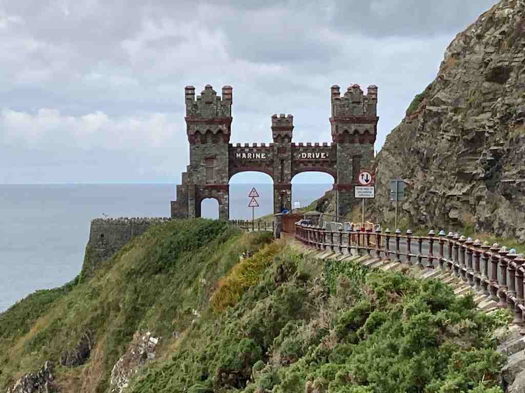
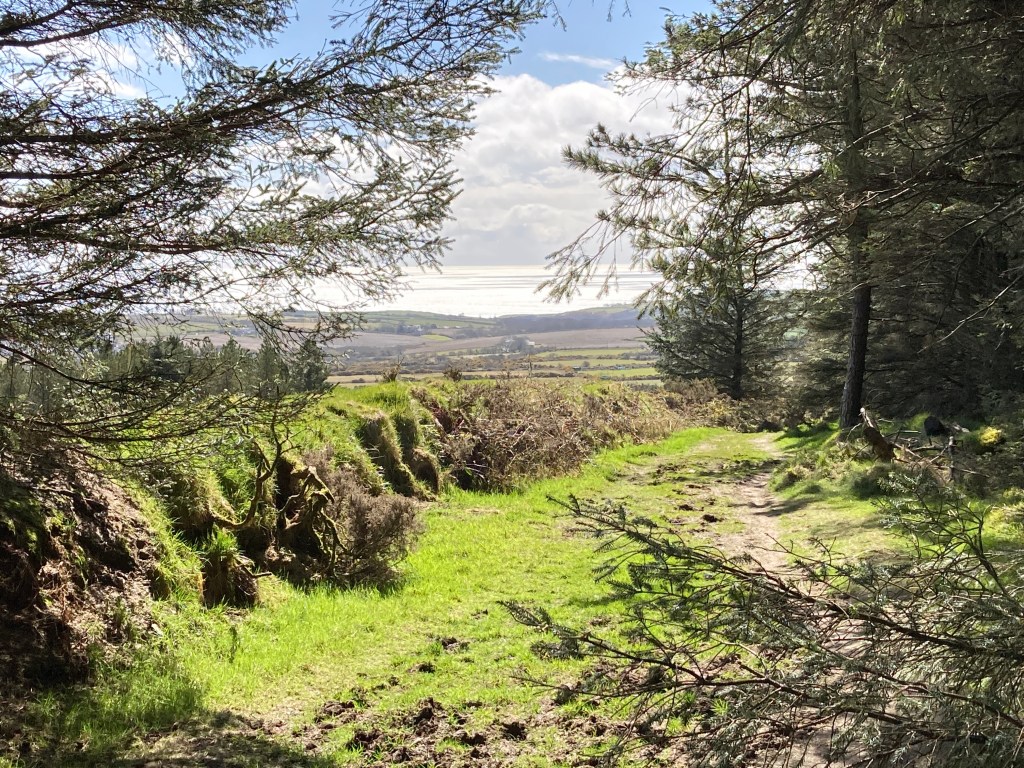
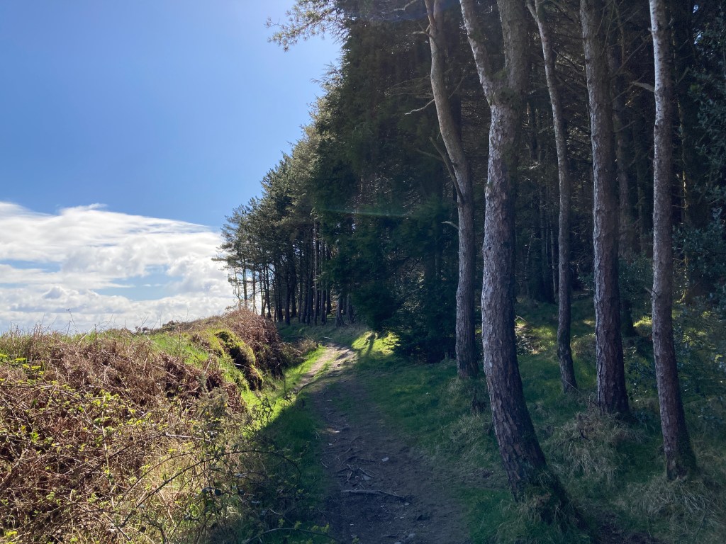
I commenced the walk at the Arch on Marine Drive. If you are visiting /using a car, there is plenty of free parking just the other side of this arch. Before that, parking is limited to 2 hours on the road. The first section is about 3 miles, along an old road so very easy walking, or also suitable for pushchairs or wheelchairs. You get fantastic views of the twisty rock formations and in places you can divert from the road onto grassy areas where you can rest awhile and look at the views or try to catch a glimpse of a passing porpoise (they are quite common here). On a good day you can see all the way down to the Langness peninsula.

Marine Drive stops just short of Port Soderick, and there is a lovely stopping point overlooking the bay if you have time to stand and stare (or eat your packed lunch). There are choices just beyond this point. Port Soderick Glen is very short but always lovely, and new paths have been created, so it is worth a walk down to the bay and up the Glen. You can then either retrace your steps to the top road or continue westwards on the road and catch the steam train back to Douglas.

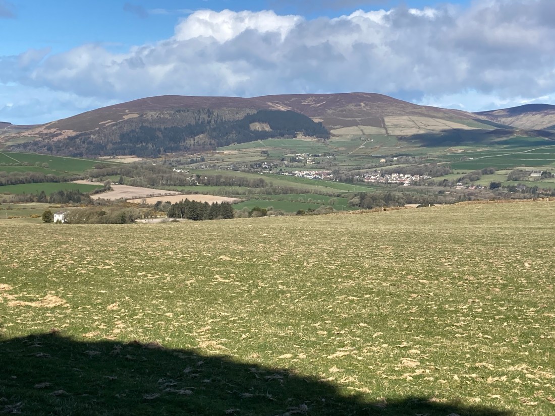
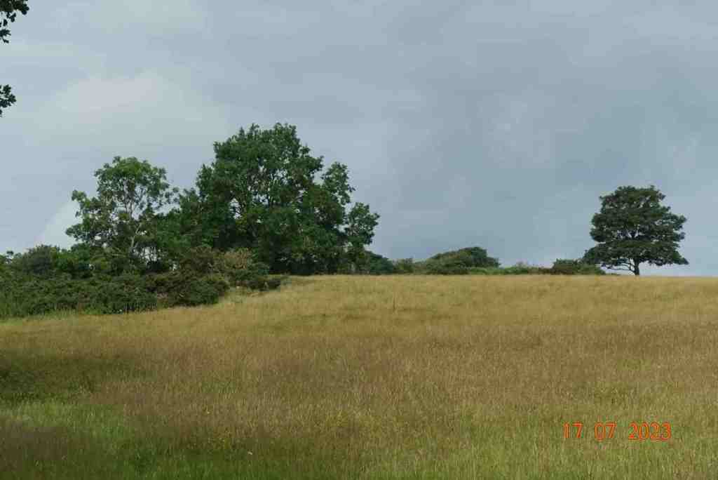
The route I was doing fell short of this latter option, and I did not venture down to the beach but instead hiked up a grassy track that leads over the track of the steam train and follows alongside it to the village of Port Soderick. Here you get completely different views, with glimpses of the northern views and hay-stacked fields or simple grass meadows. As a bonus, you may well meet some donkeys who will be keen to say ‘hello’, but please do not feed them as they are on a special diet.

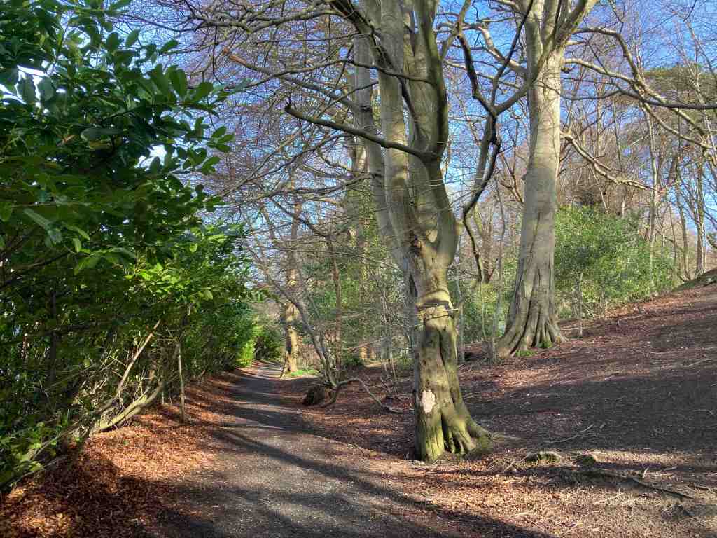
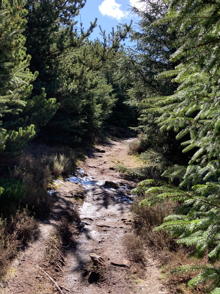
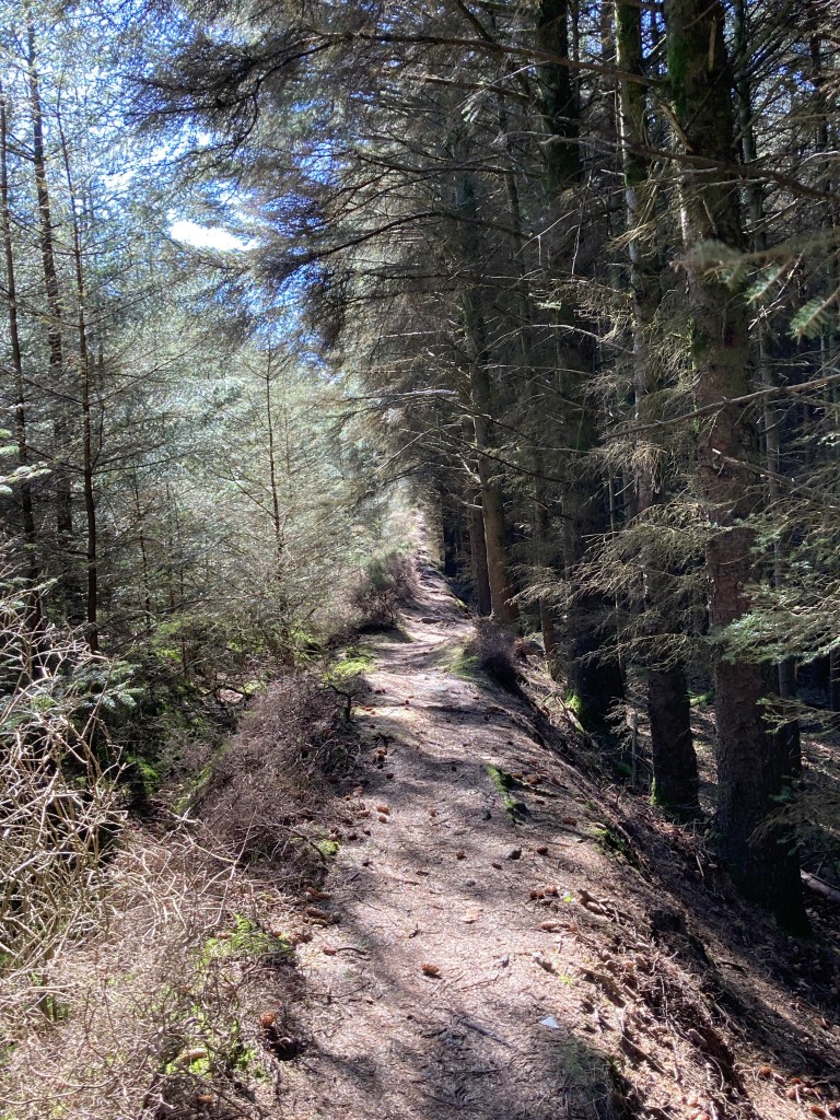
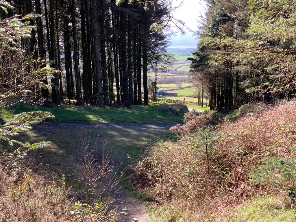
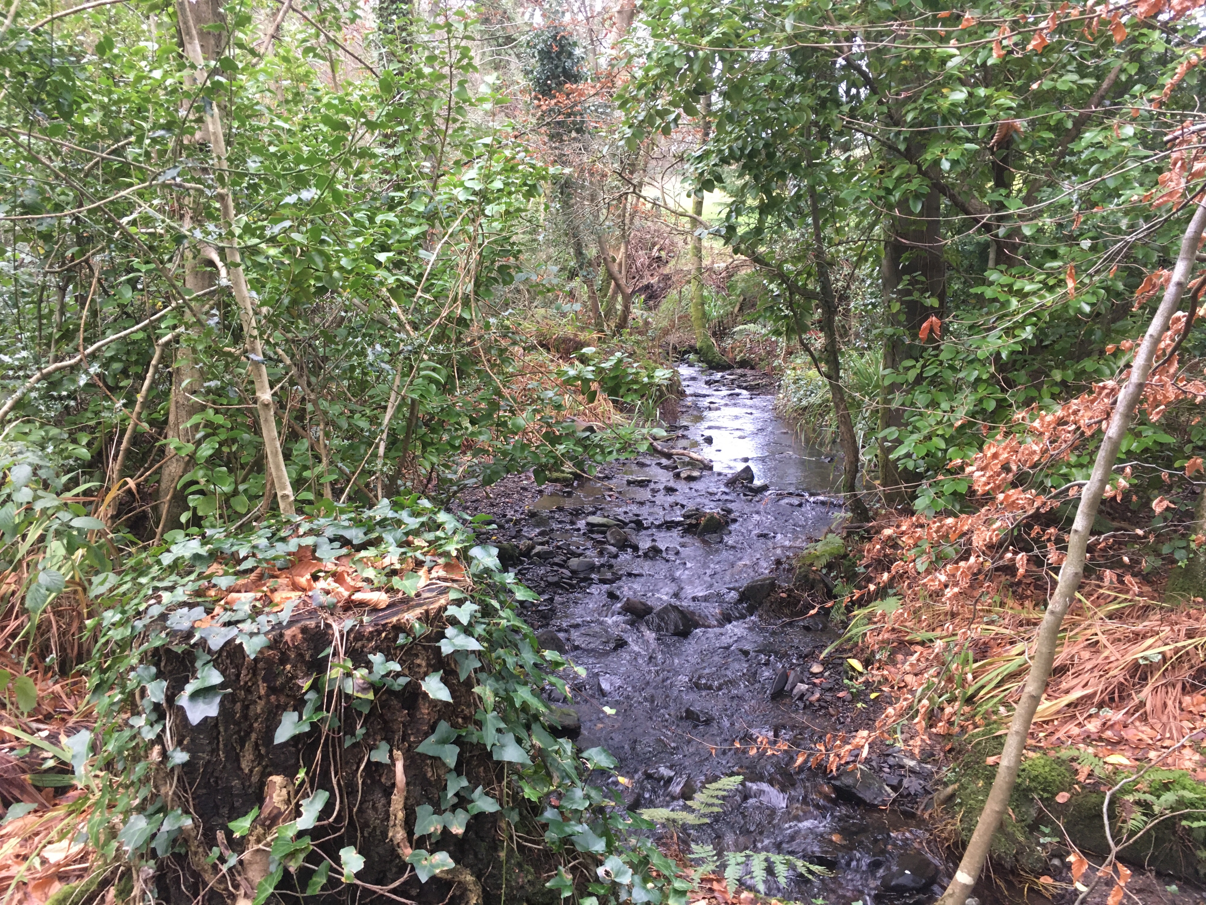
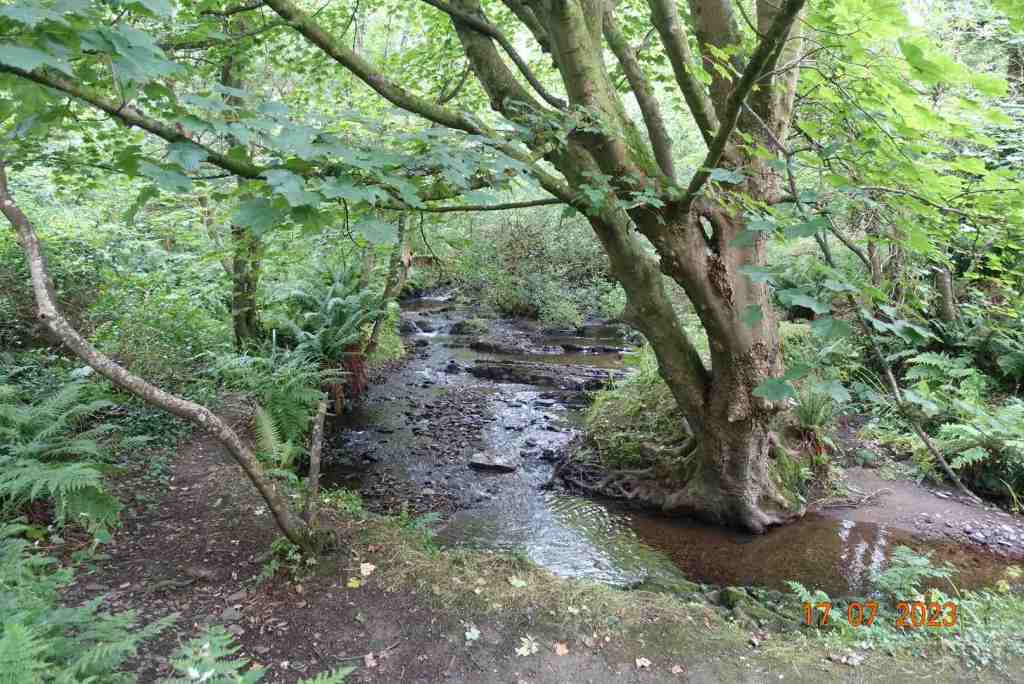
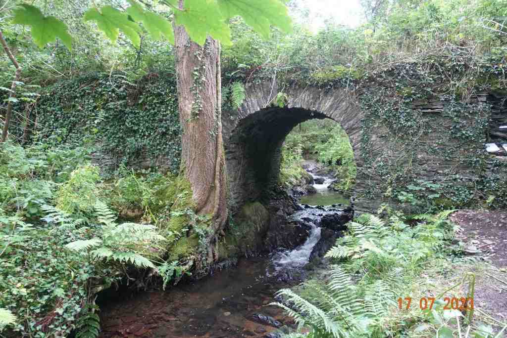
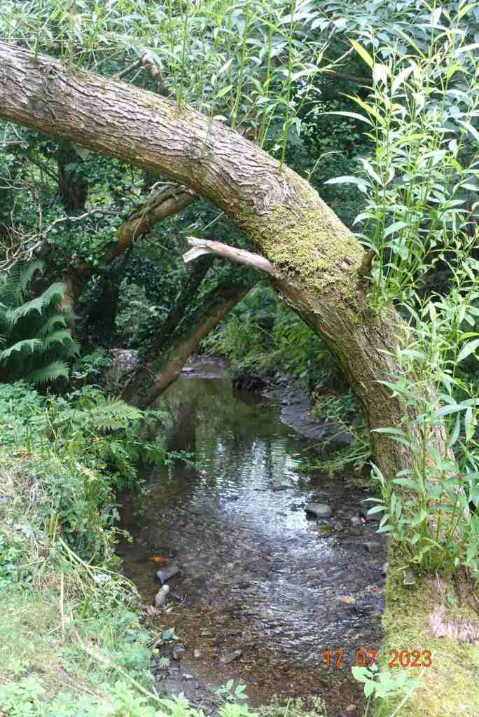
This path terminates at the old Castletown road, where we turn left and walk from a short distance a little uphill until we cross the road and take an unmarked footpath (it is on the map though) to another footpath junction. This is a delightful tree-lined path all the way downhill, and as you walk it you feel the centuries of feet that have trodden this route before. It leads to the real Fairy Bridge, which is slightly off the path. Once you have gone over the footbridge over the tiny ford, take a left immediately into the woods and follow the informal track and you will soon spot the bridge. But don’t stop there. It is interesting in itself, but take time to go over the top and down the other side. There is an area like a platform nestling beside the stream, which is relatively wide at this point, and you really do get a sense of fairies dancing in the shrubbery.

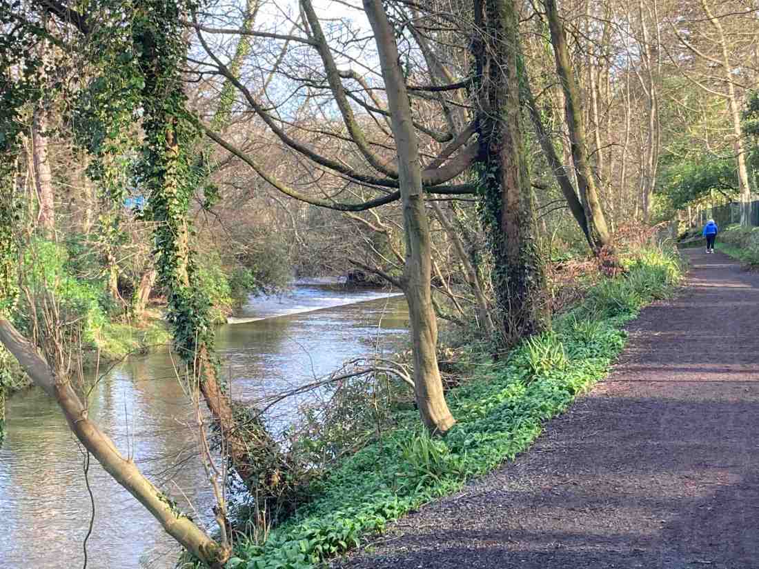
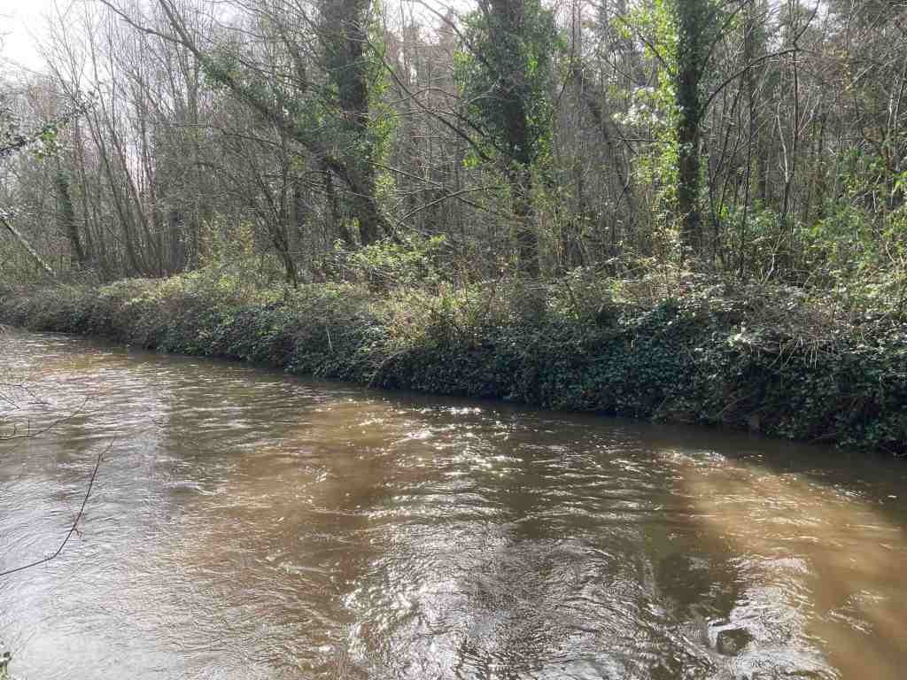
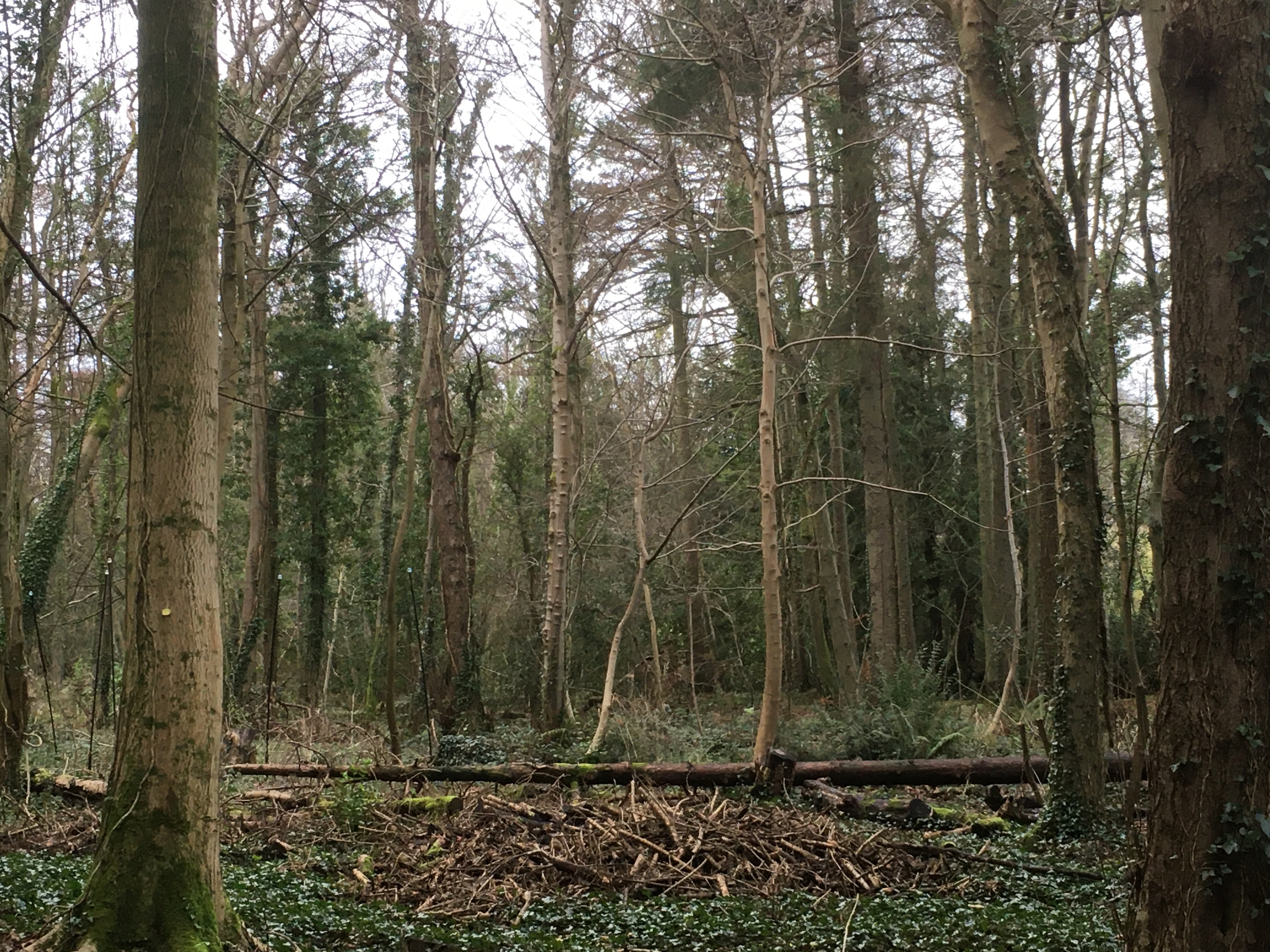
Back on the main track, this continues all the way to the main road. There is no way of avoiding this, but it is only necessary to walk on for a short distance before we turn off and walk alongside Middle river. I just love this tiny, unexpected area of wilderness. It is sandwiched between Pulrose Golf Club and a set of unattractive warehouses on an industrial estate, but these are totally masked by trees and shrubbery. At the end of this section, you do have to walk for about 50 yds through this industrial estate before turning right on the Nunnery footpath, another gem you don’t expect in an industrial setting. This follows beside the main Douglas river and you may be lucky enough to see a steam train go overhead or a kingfisher darting about the river.

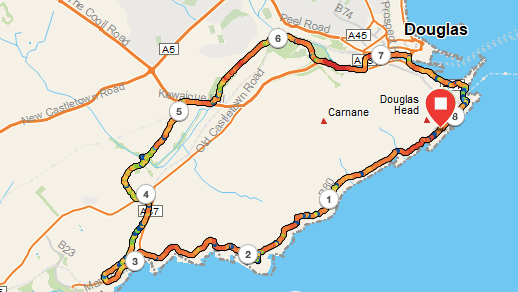
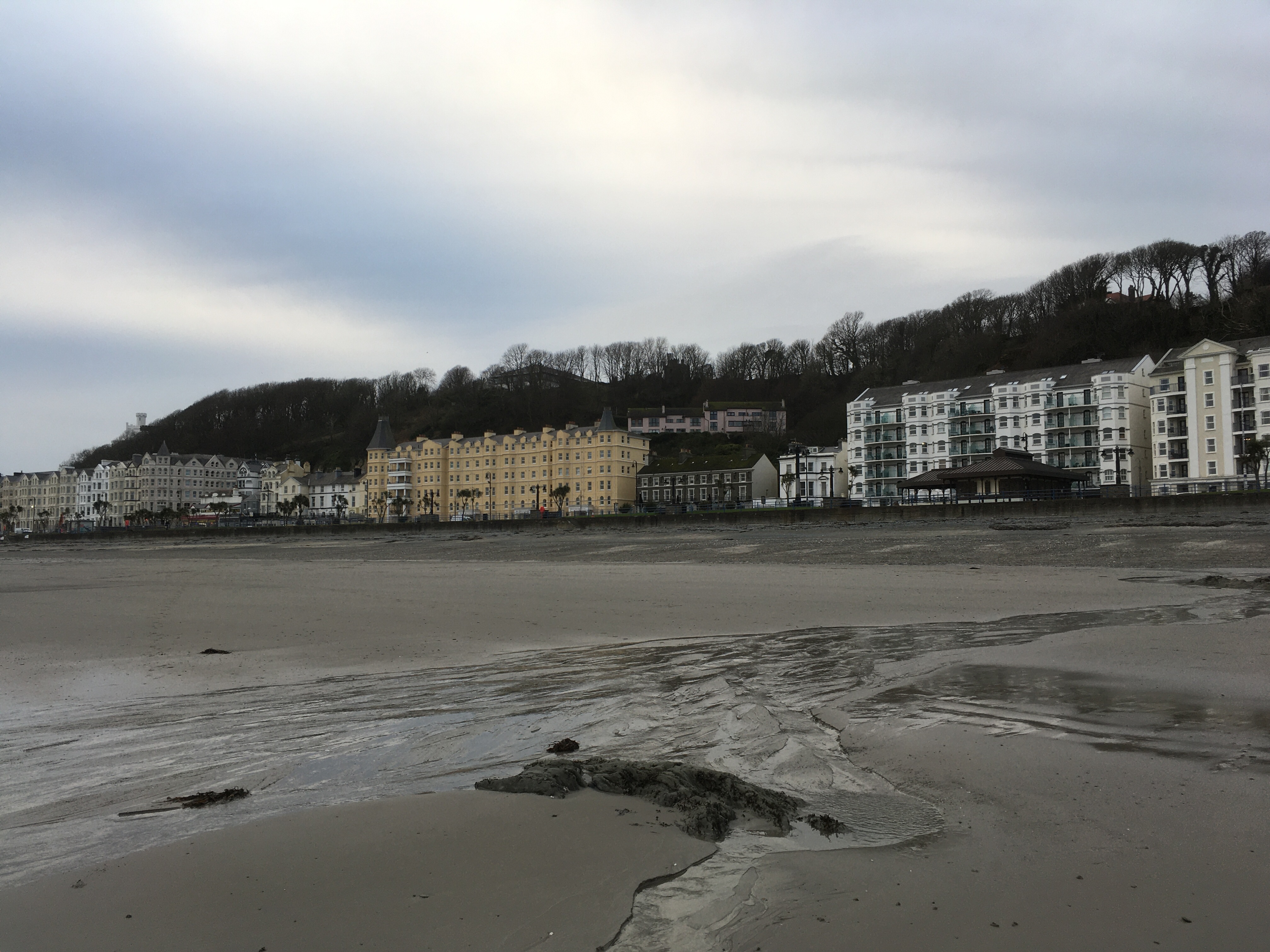
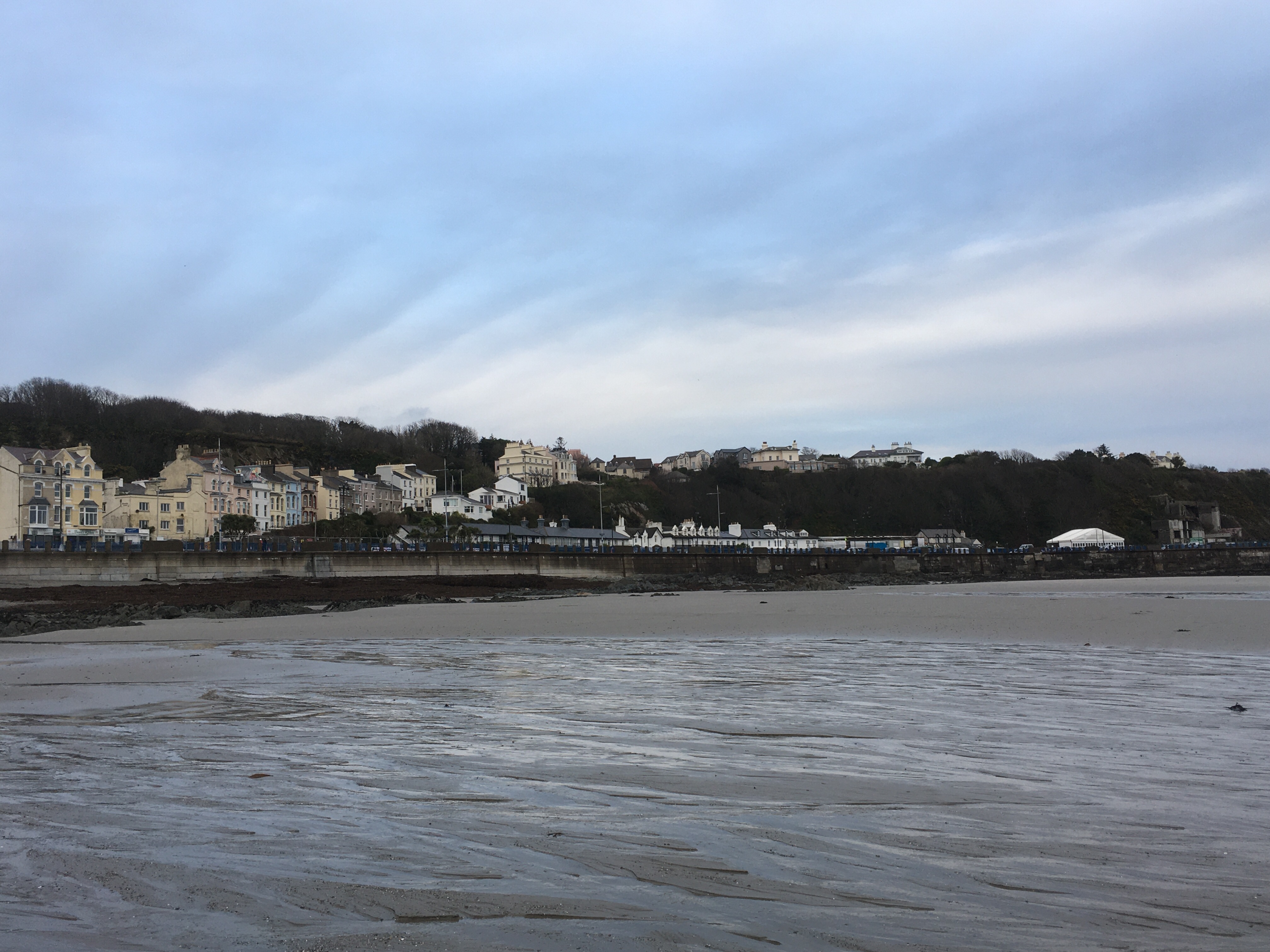
The last section is unavoidable road walking into Douglas, but it is not altogether unattractive, and just a little further along, you arrive at the Marina. There are plenty of cafes along the side of the marina where you can take a rest before the final short uphill section back to the car. This, too, has its rewards as Douglas Head has amazing views of Douglas and the northern hills. On the way there, you may be fortunate as I was today to see the new boat, the Manxman, in the harbour. I can’t wait to have a ride on that massive beast 🙂

Total distance: 8 miles, but with shorter options at various places. Total ascent: 564 ft; total descent 814 ft

Sweet surprises come unexpectedly

Just a short post today. Yesterday was table tennis day. My road was being resurfaced so I took the bus into Douglas. On the way I walked through Athol Glen, and how lovely it looked in the early morning light. I waited patiently for a bus that never came (this happens quite a lot right now), but we have plenty so I knew I wouldn’t have to wait long. It was busy and the driver seemed to have to stop at every single bus stop and I was actually late for my 9am start having left home at 7.40am.

Table tennis was its usual mix of good and bad shots but also excellent company and a lot of fun. After this I walked into Douglas along the Nunnery path. This woodland is always beautiful and we are so lucky to have this tucked away just behind the industrial areas. The river Douglas looked tantalisingly beautiful, although not obvious here, the river level is very low and at times as it reached the harbour it barely continued on its way. Along the Nunnery path is an area of grassland and there were large clumps of Willowherb looking as if they owned the field. They were lovely.

After a quick fling round Tesco, I waited for the steam train home. For the first time ever, I was in First Class, with three single seats on each side, each with soft cushioning, but also with very straight backs. One lady and her daughter from Ireland joined my carriage, followed by an elderly gent who relished in telling me stories about ‘before I was born’. I did try to tell him how old I am but he kept repeating this adage, so I assume he must be well into his 90’s. He was so interesting, as was the Irish lady and she renewed my interest in visiting Ireland, though I think I will need a month to do it justice. The old gent, let’s call him Joe (not his real name) and I were lamenting the ‘old’ days and discussing government policies just as you expect old people to do. “In my day…” springs to mind, though as far as the Isle of Man is concerned I can only talk about the last 25 years, as I had never even visited it before then.

You never know quite who you are going to meet, or when, or what joy brief conversations will bring and create lasting memories. Two days’ running in my case.

Braddan Bridge to Douglas 12th Mar 2022

I hadn’t intended to have any sort of walk today. I was supposed to be helping with the Manx Wildlife Trust’s ‘Watch’ group, only I discovered I had the wrong time down in my diary and I had missed the event. Only, I didn’t find out until I had arrived at Braddan Church when no-one turned up. So, there was nothing for it, but to get the bus home again!

The walk into Douglas from Braddan Bridge by the river is very pleasant. The birds were clearly delighted it is spring and were busy singing in the treetops and the sun had come out after a dull start to the day. I was also able to walk better than usual so I too was feeling quite chirpy 🙂

The route goes alongside the main road to Peel, but you could avoid this by taking the back road which brings you out at pretty much the same place on the Castletown road. Crossing over the main road, I took the cycle track that goes round the back of the NSC. The river is now on your left and it curves round towards the power station where the new Pulrose Bridge has been built. Looking at this, I wonder if it will cope with any massive swell or a flooding situation. The space under the bridge looks quite small.

From here, I crossed the bridge and took the first road left. This is not the most exciting part of the walk through the electricity complex (as you can see on the photo) but you are soon into the grounds of the Nunnery and once again following the river. The trees here are magnificent and this short walk along here is beautiful. When I play table tennis at the NSC on a Thursday I often take this route into Douglas. It is particularly useful if you want to get the steam train to Port Erin as it is very close to the end of this route.

I couldn’t renew my season ticket as I hadn’t got it with me, but the assistant let me on the train anyway. I was so delighted. I haven’t been on the steam train during the covid pandemic and I had forgotten how beautiful the route is, and how calming it is taking the train rather than the bus. So thank you for your kindness there.

The walk from Braddan Bridge to the railway station is barely 2 miles, but it is much better than getting the bus or driving and you spot things you have never spotted before, so give it a try sometime.

Chibbanagh Plantation – 2.5 miles

I had a renewed sense of freedom today as our rules were relaxed a little so that garden centres opened to the public, so I grabbed my car keys and set off for Douglas. As I was nearing Douglas on the wonderfully picturesque Foxdale to Douglas Road I passed the Chibbanagh Plantation on my right and promised myself a walk around this forest on the way home should time permit.

A couple of hours later I parked up and perused the view. I could see for miles towards the backbone off our island and way out to sea. It was a beautifully clear day with a strong wind. We had had sleet and snow overnight and the day was distinctly chilly. In the far distance the Lake District hills loomed out of the sea and in the near distance a boat was proudly moored in Douglas harbour. I say boat (right photo), but actually this is the largest sail-assisted motor yacht in the world, worth $400 million, owned by the Russian billionaire Andrey Melnichenko. The yacht is 142 metres in length and its tallest mast is 91 metres (higher than Big Ben!), and it can have up to 54 crew members. some ‘boat’!

It is an uphill start to the walk along a well-made regular track, but of course, I spotted a lesser track to the left following the eastern boundary of the plantation. This looked a lot more fun, being narrow and slightly undulating, or even massively undulating in places.

At a corner I was forced to turn right to join the main path and follow it again slightly uphill in a southerly direction. I soon spied another path through the undergrowth leading off to the right, so I headed downhill in a westerly direction, where every now and again South Barrule could be seen peeking out above the trees.

Meeting the western edge of the plantation gave me a dilemma. Do I turn right or left? Right would presumably take me back to the car (eventually) or left would take me where?? Who knows, but as I wanted to see if there were any views of the south of the island this is the direction I chose. This necessitated a muddy tread uphill and an even muddier trip downhill, and there was I wearing totally inappropriate footwear as I hadn’t been planning a walk. So, you can guess what happened next. Yep, a nice slippery and ungainly splat on all fours into the undergrowth. At least I had a soft landing (rather better than when I tripped on the stairs and crashed into the front door a month ago, providing me with a luscious black eye and affecting my upper jaw!).

A little further along, this makeshift path contoured around to the south along what I suspect was a former field boundary in the days before the plantation. It was like walking along a derelict wall (am I asking for more trouble you ask?) with sloping sides and narrow footholds. It was a lot of fun. There was more jeapardy than you can appreciate in this photo. It seems I need fun at the moment. Eventually it joined the main path where I did finally catch a glimpse of the sea to the south, but it wasn’t much of a view.

From there, it was another uphill climb on a more recognised path that leads to the highest point. This was very pleasant walking, and indeed the real, intended path is a mixture of grass and soil, or chippings, and it reminded me of a path in Northamptonshire I would regularly use for training for 10km runs. I followed this same path all the way back to the car. It was a truly delightful walk and all the better for being unplanned. It is a dog walker’s paradise and a great place to take a walk if you only have a short amount of time.

A Shapely Walk Around Douglas and Summerhill Glen- 4 miles

img_7881

The natural entrance to Summerhill Glen

Douglas is a surprisingly attractive town to walk around as long as you turn a blind eye to the less appealing aspects of its make-up and areas that look lost and forlorn or where some car park or development has emerged from nowhere and taken away all the character of the area. The Isle of Man does itself no favours by not caring enough about its heritage and there are too many derelict buildings or hideous erections that should never have seen the light of day, not even in an architect’s mind let alone in practice. It is too quick to destroy what history it has, as in the pending doom of the lone 18th century cottage which is being demolished to make way for a new ”by-pass” in Ballasalla, only approved by short-sighted politicians because Dandara promised to fund it as long as they could build xxx number of houses at the same time. But I digress…

You might say Douglas is much like any town. But look up, out, about and around the many old buildings  of the later 19th and early 20th centuries and you will see interesting shapes and objects that will surprise you. Roadnames with fingers pointing you in the right direction, canopies over shops that look as if they belong in Tunbridge Wells Pantiles area, attractive iron railings separating the Edwardian properties, squares of parkland and a crescent of housing reminiscent of Bath (though not as grand). Lots and lots of substantial Edwardian properties built to last, reminding us of the Isle of Man’s heyday when B &B’s sprung up in abundance to cater for the wild tourism that would swarm in on the ferry in the summer months.

I had been to the dentist on Woodburn Square and instead of walking back to the bus stop I went in the opposite direction, down roads I have never walked before, around the back of Nobles Park to the top of Summerhill Glen. The house styles are very varied and many are attractive with double fronts or bay windows, a row of chocolate box houses, one with a monkey puzzle tree in the front garden and sometimes very unusual houses. There were two houses side by side with windows in the upper elevations that looked as if they belonged in the 16th century as their small windows protruded out above the main house. There are many established trees in this area and it feels quite luxurious in places. There must have been a large country seat where Laureston Manor remains, now afflicted by the ever terminal illness of living apartments, but it still has its grounds and other houses have been built around the edge of its land, so the pathwork of land still retains its rich flavour.

I reached an area where most of the roads bear the name Victoria or similar, signs of anticipated grandeur and nobility – Victoria Road, Victoria Crescent, Victoria Avenue, Dukes Road, Upper Duke’s Road, Palace Road, Castle Hill – you get my drift, and here the roads are at the top of the wonderful cliff that skirts the whole of Douglas Bay and from where if you could only see through the trees there must be a wonderful view of the Bay. There are several very large buildings around here, many now converted for business use, again indicating that Douglas has at times been very wealthy.

All this was unexpected. This was not a planned trip but an idle walk through Douglas to get some fresh air with the idea of walking in daylight down Summerhill Glen. My first visit to this Glen was just two week’s ago when my son Matthew stayed with me for Christmas and we went to enjoy the illuminations which we did thoroughly enjoy in spite of the rain.

img_7885

Reaching the top of the Glen I followed the path down to discover a second more interesting path that enters the glen from the other side of the stream. I know most people are very happy with the modernisation of the paths in the glens but for me wide tarmac paths lose all the natural feel and magic of walking down a forested glen, so I was very happy to wander along the section that had not been tarmacked and watch the water meandering its way across the flat and boggy terrain, creating new rivulets here and there as it jumped over minor hazards on their way to join the main stream.

img_7883

The glen itself is very natural at the top and I found several interesting shapes in the stream and in the vegetation that sparked my interest. The stream is pretty with minor waterfalls along its ever downward and slightly winding trajectory. In the centre there is a flat area with wooden seats neatly positioned to enjoy the display the children (and adults) have created. It is not possible to follow the stream all the way to the sea as it goes underground whilst still quite elevated, but when I reached the shore to see where it finally entered the sea, I could hear a rush of water where it comes out behind the houses on Strathallan Crescent.

img_7899

img_7901

The tide was out so I walked out into the bay and again I looked up at the lovely aforementioned cliffs and noticed houses half way up holding tightly on to the side of the cliffs, a pink house I had never noticed before with a curtain of trees behind it. Looking in the other direction out to sea, I walked out as far as the sand would allow me and came across boulders and seaweed that were as tall as me. I walked the mile or so back into town, and if you wished you could make a full circle of this walk.

img_7906


img_7907

img_7905-1

img_7908

So, if you come to Douglas, take a bit of time to venture into those parts you don’t usually go and I’m sure you will find hidden treasures.

Below:  A slideshow of some shapes in Summerhill Glen

This slideshow requires JavaScript.

I regret to say I did not take photos of the interesting properties I saw, but I will retrace those steps another time when I am armed with my camera and not just my mobile phone.

img_7913

Douglas and Laxey Sat 22/9/18 – The Tourist Route

Autumn has definitely arrived, and I for one am grateful to be away from the blistering heat of the Mediterranean. This week’s windy and wet weather certainly is more typical of the Isle of Man than the sweltering two months we were treated to in June and July. Port Erin beach has a new shape to it, as the gale-force winds have created mini dune-like effects and swept the sand over the stones at the far end of the beach. Today, as I wandered around the bay, the same beach had changed again and the far end looked like the pebbly remains of a torrent of water that had gushed from a hillside dispelling its contents – not true of course, but it emphasises the power of the natural elements.

IMG_8760

On Thursday 20th September I played table tennis at the NSC (National Sports Centre for the uninitiated) in Douglas, and walked the short distance from there to M&S, following the river and walking alongside the Marina, about a mile and a half altogether. This is one of those walks that only odd people like me or locals will do as it does’t take you far and it is much easier to get a bus! I stand corrected – in fact, if you did the walk the other way round you could continue on a pretty track all the way to Port Soderick. I did think you might be interested in one small aspect of my town ‘walk’. It starts by Pulrose Power station with its ugly steel buildings, car parks and railings, but as soon as you turn a corner you are in a different world, one of trees and green and mystery. What struck me this day was the sweet smell coming from the trees and nuts only on the green side. Two contrasting worlds separated by a fence! The views below are literally fractions apart.

One one side of the hedge, grey steel and angular shapes; on the other side, soft green trees, leaves and nuts strewn across the footpath.

On Saturday, I went back in time. When I first visited the island in 1998, I didn’t have any transport of my own so used public transport for all my walks, no matter where they were on the island. This can make for long – but very enjoyable, days.

I got the 10am steam train at Port Erin, which left 15 minutes late as it had to wait for the incoming train before we could leave. No matter, I had plenty of time as I wasn’t due to be at Laxey for a Friends of Manx National Heritage event until 2pm. Arriving at the Douglas railway station I walked along the Marina up to the ferry port so that I could get a photo to show you to full extent of Douglas’s wonderful promenade, with its wide walkway and horse drawn tram (the longest running horse drawn tram in the world I believe). I was a bit ahead of time so popped into the shopping centre for a coffee, then walked up to the far end of the prom to catch the electric tram to Laxey. The prom was full of people, a chap on his bike, a lady and gent taking a stroll, another person doing their fitness routine and a lady with her children and pushchairs, and me walking very briskly as I had completely forgotten just how long the prom actually is – 2 miles end to end!! I needn’t have worried as the tram was late too. I thoroughly enjoyed this second journey by public transport, more so than the steam train. It goes along the coast to Ramsey and the views are tremendous. The further you go around the bay, the more it seems like a seaside resort and you can smell the air and see the views.  I could see Black Combe across the water in the Lake District and the many wind farms of Morecambe Bay.


Photo above: Spot the join; the two photos should overlap slightly.

I got to Laxey expecting to visit the Glen, but sadly the walk took us in the other direction down the old road to the Woollen Mills, through the beautiful old village to the beach. Our guide told us about the history of all the different mills, flax, paper, flour, and the pipe factory, although the only one of these historical buildings currently in use is the very large flour mill where we started at Laxey Glen. She also showed us secret waterfalls, leats and ponds (dips in the ground that you would walk past in an instant usually) that had been used in the processing of the various materials and an old delapidated brewery tucked away in a hidden spot. It was a very interesting tour. At the end I had to go in the opposite direction and explore the Laxey Glen itself. This is beautiful – one I had never visited – and a complete contrast to the main river valley leading down from Snaefell, with the famous Lady Isabella Laxey Wheel and the Washing Floors. Despite being heralded for its fame, I learnt that mining came late to Laxey but it was a thriving town long before that, mainly due to its plentiful mills. However, the number of lovely houses is thanks to the miners, not for their achievements in Laxey necessarily, but our guide told us that many people were sent to seek their fortunes in South Africa and they sent money back home that allowed them to extend their properties.

This is the only photo I managed to take of Laxey and is of the washing floors. Worth a visit in their own right. Laxey is a fascinating village with a lot of history. If you have never been here, it is well worth making a special visit and there are walks in all directions, which you can reach by the electric train , tram, bus, or walk. I am thinking of Dhoon Glen and Snaefell in particular.

Laxey Glen can be found to the west of the main road and is enclosed and very green with large trees. There is parking immediately on the bend by the mill. The river running through the glen is beautiful, with banks and groves on either side. As you climb higher into the plantation it becomes quite steep and muddy and as it was getting late and I didn’t know where it would come out or whether I would be able to find a new return route, I cut my losses first of all finding myself a sturdy stick to help me negotiate the steep downhill parts and I returned back by the route I had come. I hoped to reach the visitor centre to see if they had a map of the Glen but when I got there it was closed (4.45pm)

I had completely forgotten to charge my phone this time, so I will post photos of this area another time.

The walk around Laxey was a total of about 4.5 miles, and 2 miles altogether from one end of the prom to the other, although I managed 10 miles overall for the day one way of another. I shall revisit Laxey Glen as there look to be some interesting paths through and around it up to the mountain, some without the need to go to the very top and I should like to investigate.

IMG_5875.jpg