Pic Tor and High Tor, Matlock

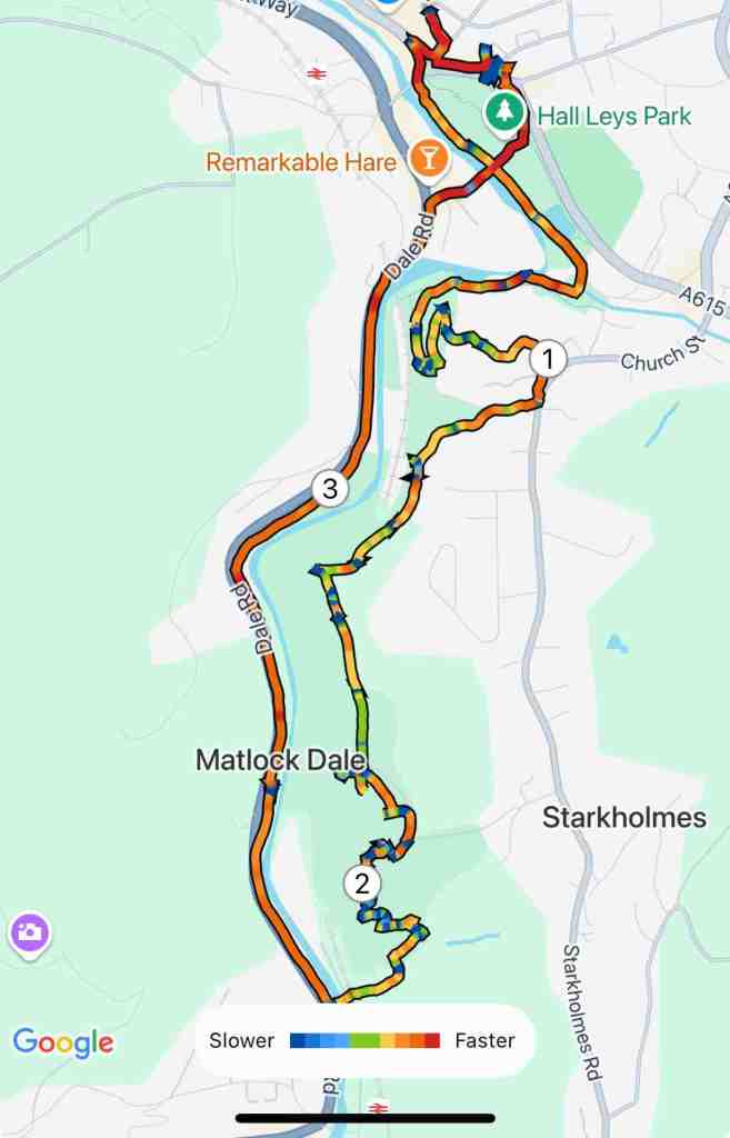
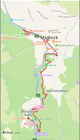
For a short walk, this has a lot of diversity: a river walk, a woodland walk, a war memorial, gripping drops and views in all directions, including downwards into the depths of the rocks.

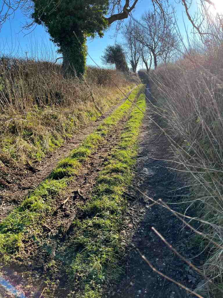
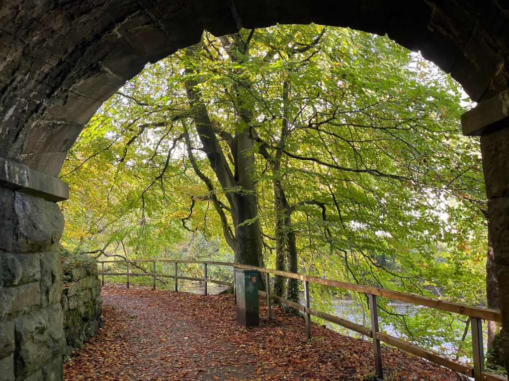
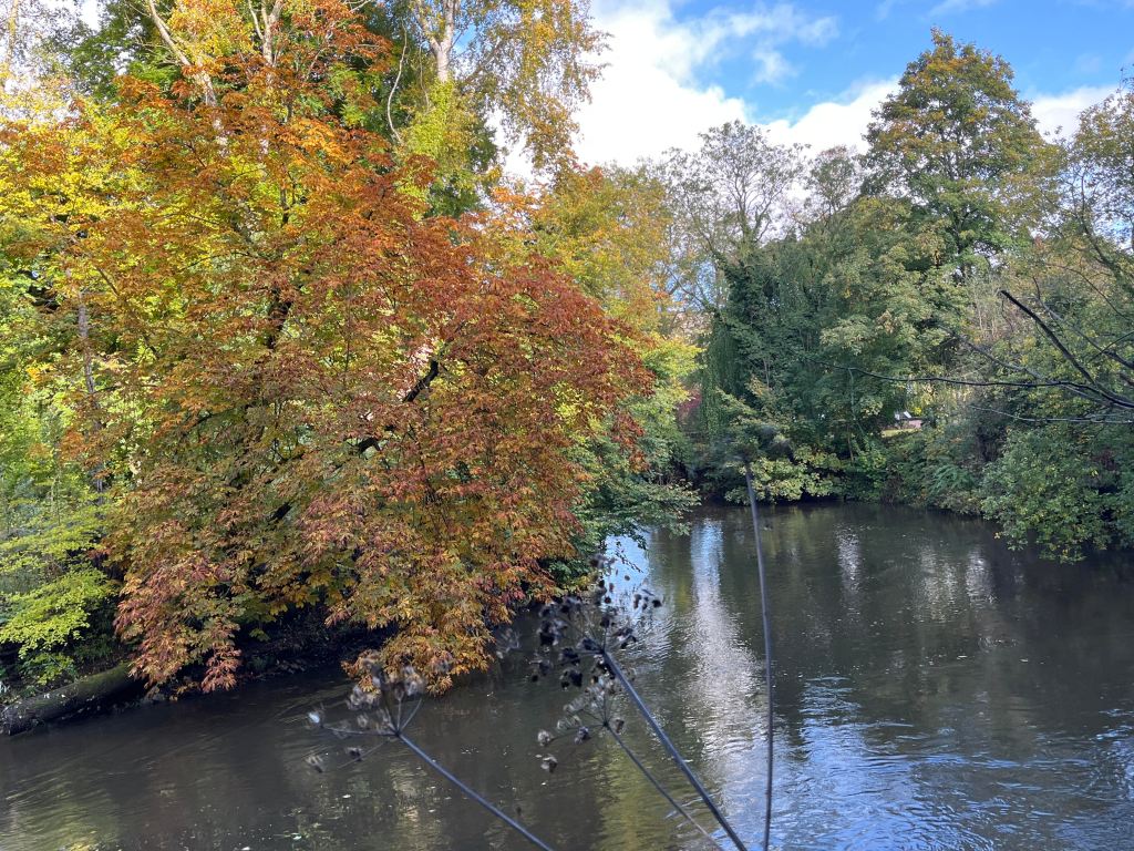
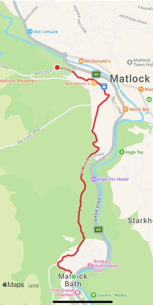
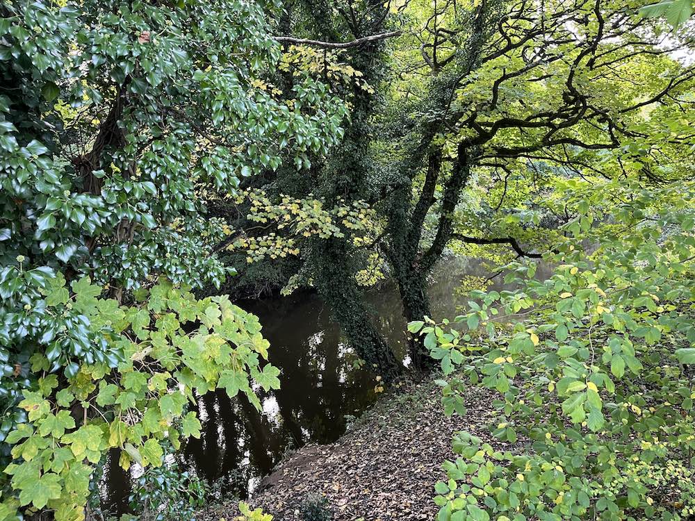
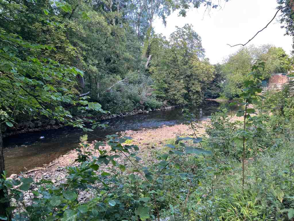
It had been a hot day, only one of many, many hots days over previous weeks. I can barely remember when it last rained before then, though as sod’s law would have it, as I write this there has just been a massive, but much welcome deluge. However, this was Monday and it was the end of the day and I needed some air. On the Isle of Man, this would have been one of my regular walks to the beaches of Port Erin and Port St. Mary. As yet, I haven’t found staple routes to walk when I am in need of air. I took the car to Matlock, walked through Hall Leys Park beside the river, crossed the river at Knowleston Gardens and walked along the river bank until taking a left fork uphill to Pic Tor. You can see how low the river is here, but as yet we don’t have a hosepipe ban in Matlock.

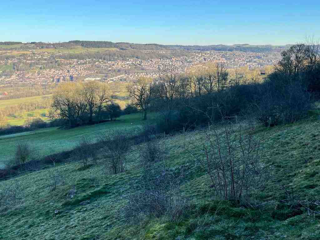
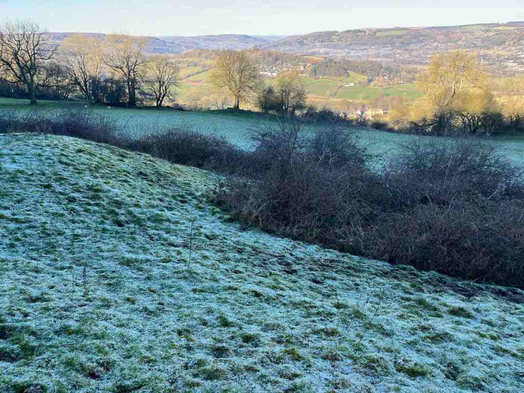
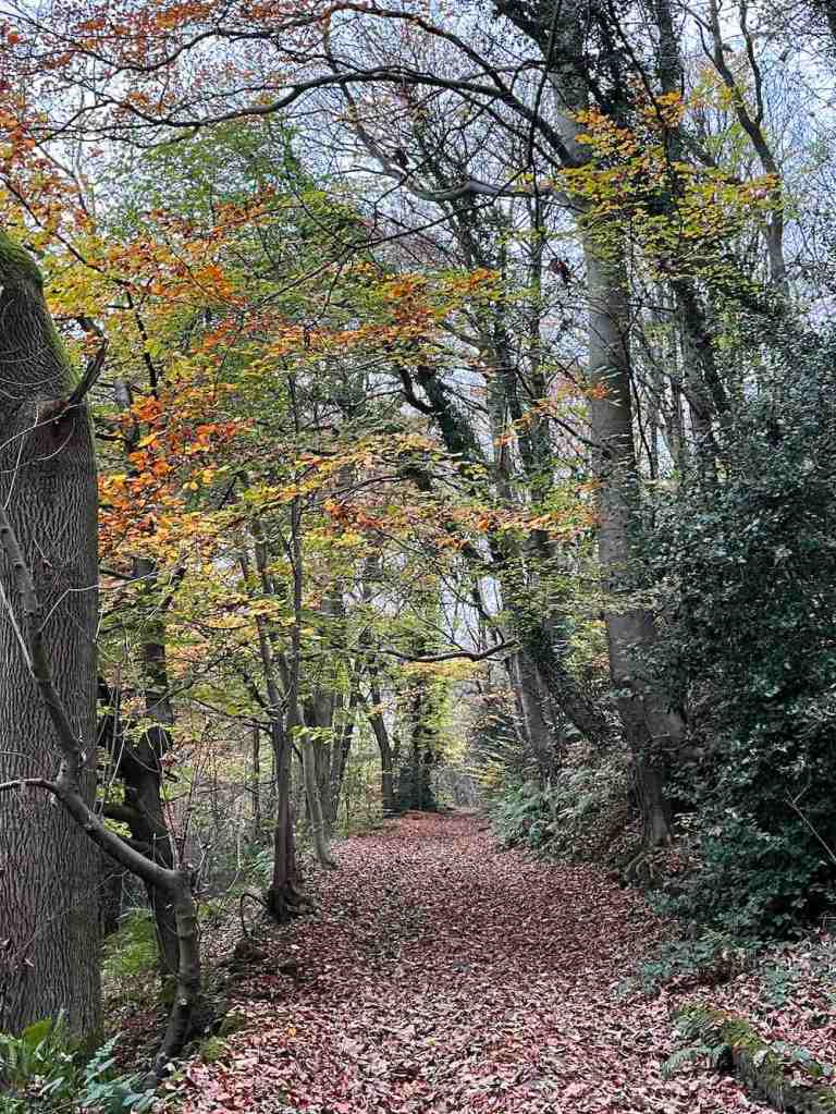
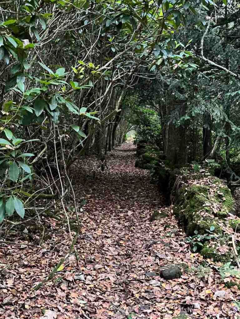
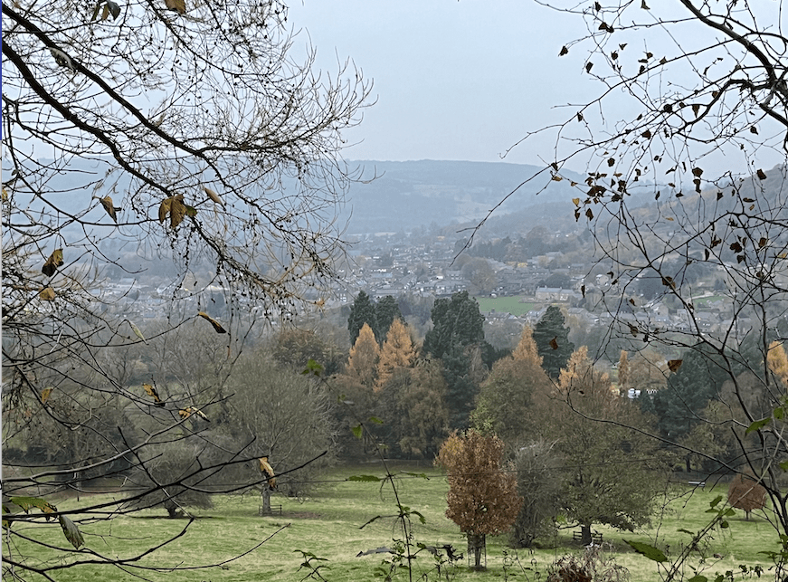
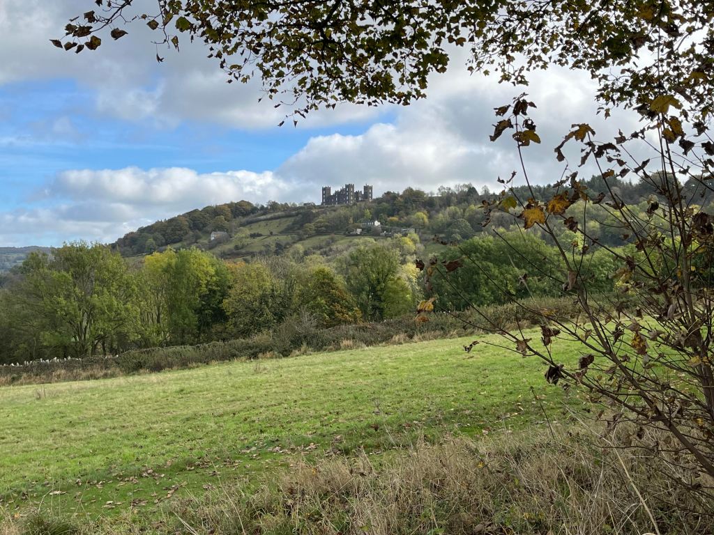
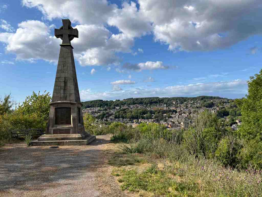
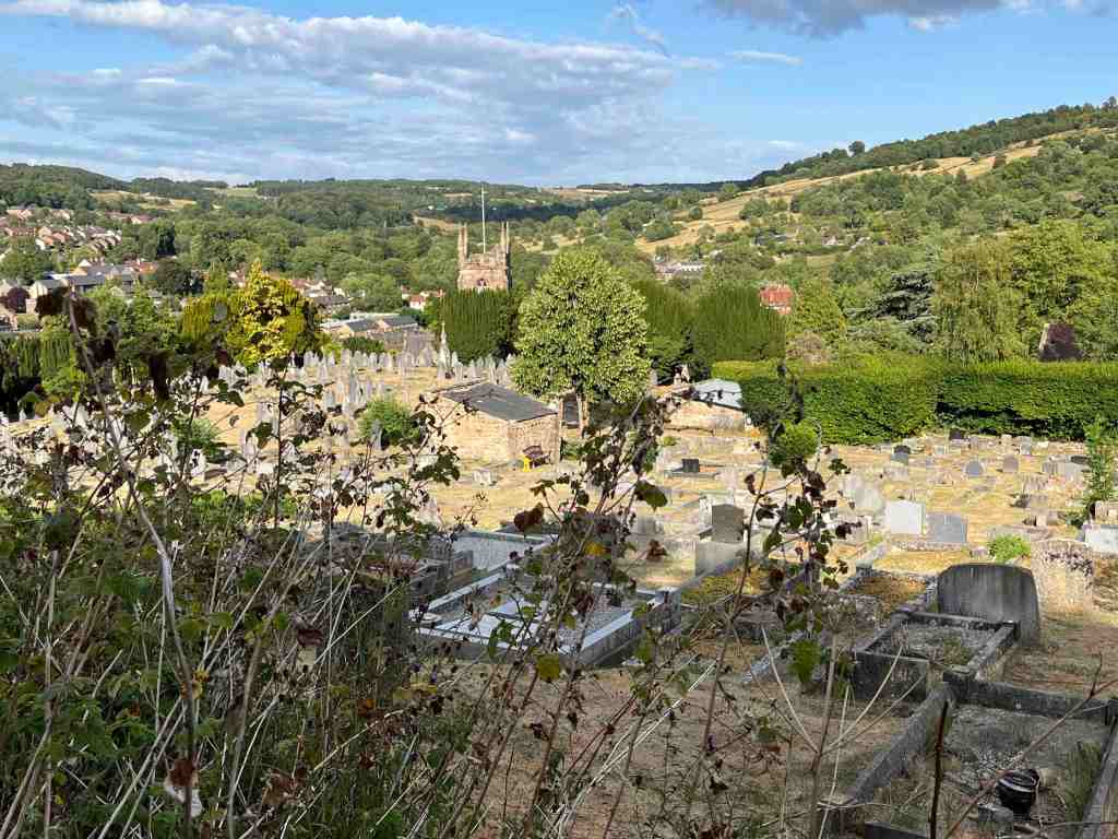
There is a fairly short, steep-ish climb through the woodland up to Pic Tor, where the war memorial stands majestically on the top of the hill, overlooking the church at Matlock Green and keeping an eye on the whole of the Darley Dale and Bentley Brook valleys. There is not a lot of choice as to the way down and then up to High Tor. I took the path that goes through the churchyard and up through what was originally old Matlock leading to Starkholmes, then took the track originally designed for carriages along the Grand Walk to High Tor. This is not a very inspiring footpath, that is, until one reaches the very top. There is a flat topped rock at this point, but care does need to be taken as one step in the wrong direction and you will take an unplanned dip in the river 300ft below! The views from here are terrific.

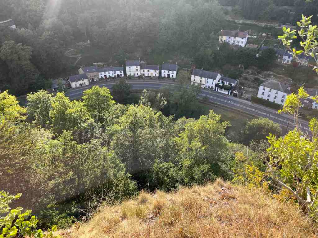
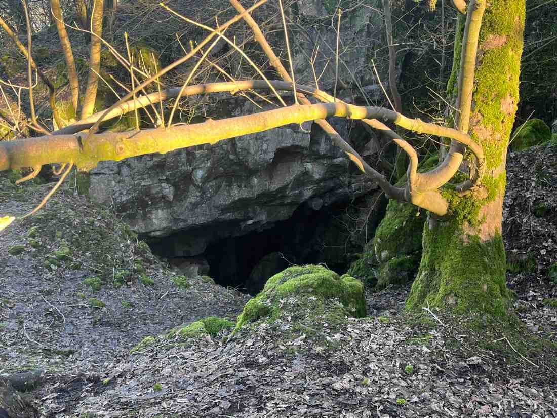
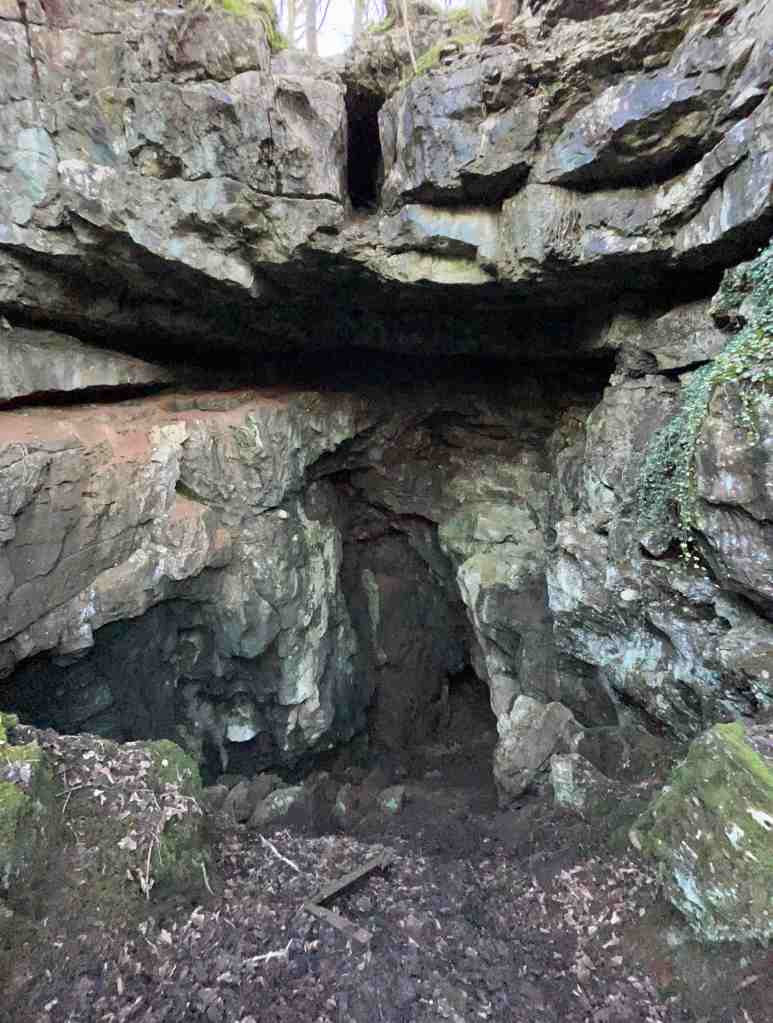
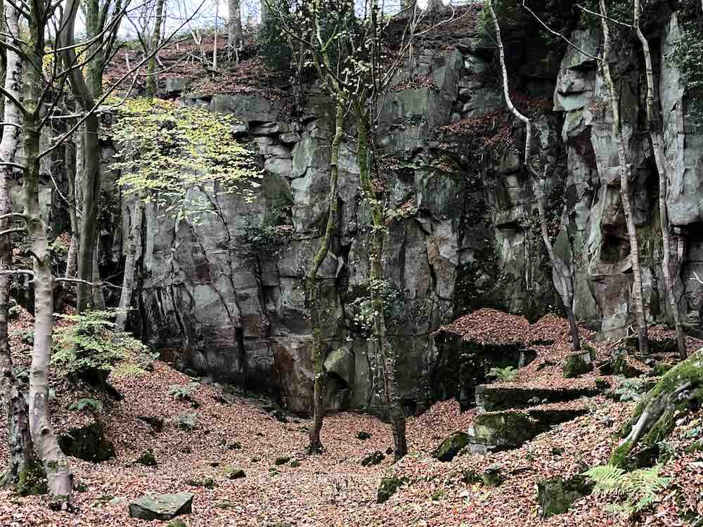
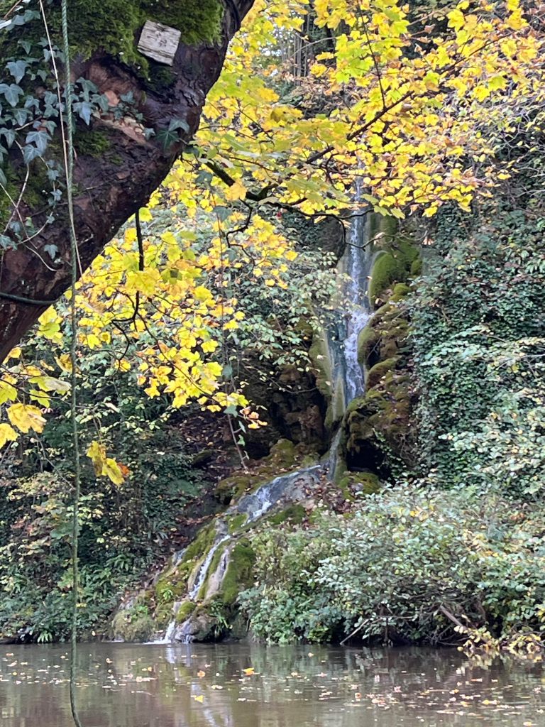
Returning off the mound, there are gulleys, caverns and footpaths that lead into the very rocks themselves. I didn’t investigate. These are mostly the result of a form of open mining in the limestone seams for lead, barite and fluorspar, that has possibly been going on since Roman times. These mine workings with their original tool marks are a scheduled ancient monument, and some exposed caverns can be as much as 20 metres deep – undisturbed local history. Indeed, there is evidence of one shaft arising at High Tor and finishing underneath the river 120 metres below. If you or your children are walking off track in these parts, you must be especially careful, as there are many hidden mine shafts just waiting for their victims.

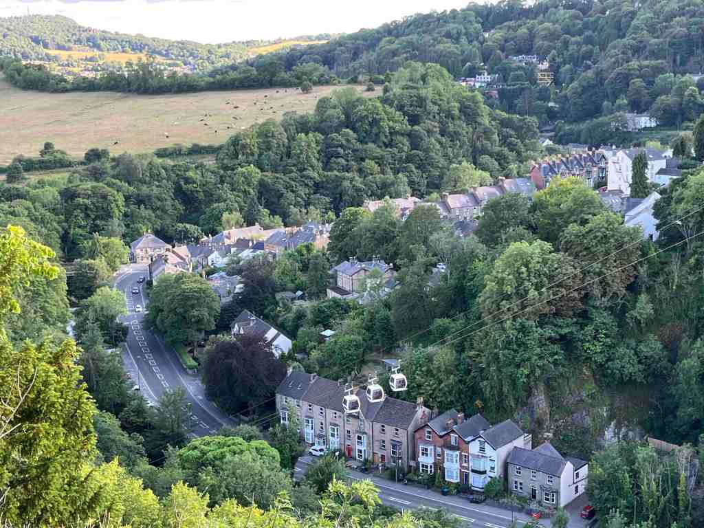
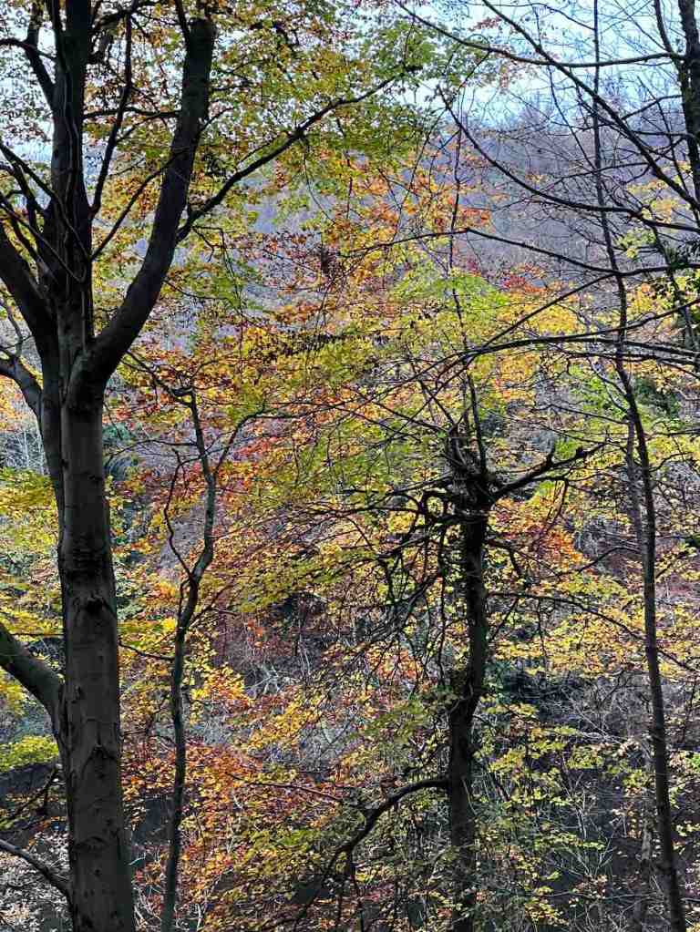
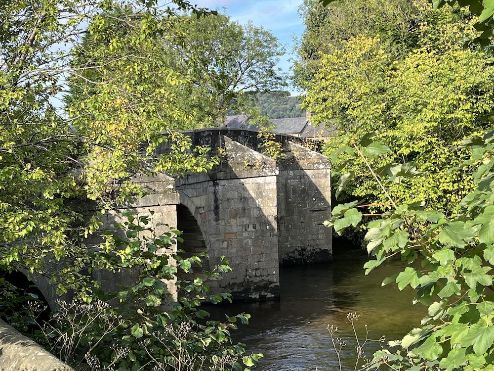
Incidentally, choose the western footpath off High Tor and you can take your chances around Giddy Edge, which again needs care and is dramatic, but it is not too daunting. It does have a rail you can hold on to, but I would probably advise against this path in strong winds! Since my hospitalization 6 weeks ago, I suffer with hypotension (must sort the drugs out), so this was not an option today. The walk off the hill is very attractive whichever path you take, continuing downhill through the trees and eventually coming out at the point where the Gulliver’s Kingdom cable car takes off. There is a bridge over the beautiful river, and you can go left into Matlock Bath with its cafes, restaurants, museums and entertainments – and lots of fish and chip shops, or you can turn right to walk alongside the river for about a mile back into Matlock.

Total distance: approx 4 miles; 500ft total ascent, 500ft total descent

Salters Lane to Bonsall over the fields

It is a while since I have been out for a ‘proper’ walk, and today, I wasn’t really in the mood for one either. I had just been asked to lead a walk for the U3A in February, so thought I would use the opportunity to spark myself into action. I had already been thinking of doing a walk from Salters Lane, as I shan’t be living in this particular location for much longer, so I donned by hats, boots, scarf and anything else to keep out the cold air and ventured out. I took the car to the top of the hill where there is some parking next to three or four footpath signs. Take care where you park up here, so as not to block farm vehicles.

I started up the road for a short distance before turning left onto a footpath. This was a perfectly good path, that joined another and went between the hedgerows, affording lovely views of the surrounding countryside. It continues for some distance before dropping down into Bonsall. On its descent is becomes less attractive, being muddy and also turning into a stream for about 500 metres. There are alternative paths you can take and remain higher up for longer if you so choose. My path joined a back street in Bonsall, and then diverged from this lane to go behind the Croft Farm – this is not well signposted, so you have to trust your map. It is also very muddy and wet on this section, not just around the farm but on the sloping fields, which have been churned up by the hooves of many cattle. You can expect to get very muddy boots and to do a bit of squelching here and there. At a certain point, there is a meeting of footpaths according to the map, but these are not apparent on the ground. There is a small stream to jump across before making your way back up the hill past the pond back onto Salters Lane. At this point, you will have walked barely 2 miles, but it will feel like more because of the conditions.

You can choose at this point whether to continue along the road back to the car, or to do as I did, and go into the woods on the other side of the road. There is a lot to gain by doing so, but keep in mind, that if you go downhill you will have to come back uphill again at some point. I really enjoyed the woods, and in particular all the different rock formations, presumably created by mining activity. I began by going fairly steeply downhill through Jughole Wood, with its attendant formations, then taking a left on the level towards Leaward Cottage, before returning uphill through Lea Wood. The views of the valley are tremendous from here.

I completed the short distance back to the car along the road. There are many different variations that you can do of this walk, and I am sure the different seasons will dictate which routes are best to do when. Needless to say, I do not think this is a particularly enjoyable walk for a group of older people at this time of year, but nice enough if walking on one’s own or with a friend.

Distance: 2.75 miles Total Ascent: 492 ft; Total Descent: 535 ft

Ladygrove Woods

As it was Friday, this is my day for walking from home to Whitworth Institute at Two Dales. Depending on the route I take this is a 2.5/3 mile walk. I like the views from the Snitterton Road, which takes me past a cottage that I would rather like should it come up for sale. I took this same road up to Oaker, then rather than go up and over the hill I took the lower route into Darley Bridge. After this, I played table tennis for an hour and then sought out a different route home.

I wanted to take a look at properties in Two Dales, thinking that may be a good area to live, as if just slightly up the hill, houses will catch the evening sun. So, after a quick shop to buy baked beans I crossed the road and walked through the village. I was slightly surprised that it quite flat, until it is no longer flat as it turns into Syndcope Hill, but I turned off before that point. I had spotted some reservoirs and some woodland that looked worth a visit and I was not disappointed.

Ladygrove woods are mostly beech and you can imagine the beautiful colours on the paths carpeted with leaves. The first ‘reservoir’ is visible, but the path thereafter goes high above other waterscapes, so the others are barely visible. The path is narrow and a little uneven and every now and again you have to jump over a small stream. There was a lot of water in these streams given that is hasn’t rained for some time. The other surprise were some boulders and cliffs, looking very similar to Charnwood Forest. Presumably, these have been quarried but I don’t know the history of this area.

I realised as I was travelling the kilometer or so up the valley that this may not have been the most sensible plan as the daylight was fading and I was on uneven ground and didn’t really know where I was going, so I increased my pace a little until I reached the furthest point and then I returned via a higher route, still lovely, but not quite as attractive as the lower route.

From this point, it was mostly road walking through Upper Hackney before taking a nice footpath downhill towards the back of the hospital. This area is still unspoilt and marks the edge of Matlock. The next path downhill that I took, beside an old woodland, was immediately adjacent to relatively new houses and ultimately led down to the main road beside Valley Lodge Care Home. The traffic into Matlock was completely blocked up from there, and that must be almost 1 kilometer to the roundabout. I think I’ll settle for my flat from which I can walk everywhere most of the time. It would drive my potty having to deal with traffic jams day after day.

Total distance: 7.5 miles; morning 3 miles; afternoon 4.5 miles. Total ascent (afternoon): 505 ft; descent 476ft; total time (afternoon) 1hr 45 mins; moving time 1hr 34 mins.

You could do the afternoon walk using buses to and from Two Dales into Matlock.

Matlock to Matlock Bath Circular

My intention was to have a gentle stroll in a southerly direction along the river Derwent as it was a lovely sunny day, with gloomy forecasts for the next few days. Those of you who know me won’t be surprised to learn that it became more of a hike, taking in paths I hadn’t been on before.

I began by walking down by the river into Matlock and doing a few chores. Then I had a pleasant stroll through Hall Leys Park and Knowleston Gardens. The autumn leaves are stunning right now and I stopped many times to admire the views. I couldn’t stop myself from trying out the odd footpath but these mostly ended at a dead end and a shaft entrance to the former lead workings. So, I carried on around the bends until I saw a footpath sign to High Tor. This hadn’t been on my agenda, but the thought of walking along the noisy A6 really was not appealing.

So, I headed off uphill towards Starkholmes and took a clear footpath to the right that I would follow all the way to High Tor, getting glimpses into the beautiful, if noisy valley every now and again. The views to the left of Riber Castle were excellent. Once at High Tor, I took a path marked ‘Caution’ and ‘Viewpoint’. The cautionary notice is that there is a significant drop off the cliff to the right and only a narrow path to walk along. Someone has very kindly fitted a handrail in certain parts to avoid obvious mishaps. This I realised is known as ‘Giddy Edge’. It is easily passable with care, but certainly care is needed for a short distance before the path enters the woods. From here, it is a steady descent all the way down to the cable car entrance for the Heights of Abraham.

I followed the path on the same side of the river as far as I could, as it petered out and I had to cross the bridge at the start of Matlock Bath and walk a little way down the awful A6 until I could cross back over. Unfortunately, Lover’s Walk was closed for tree repairs, so I went back on myself until I saw a notice saying the Nature Walks are taken at your own risk. The footpath lead upwards again right up to the very top of the woodland, providing wonderful views of the hills to the east and occasional snippets of views of Matlock Bath. I continued on this path as long as it would allow me to, but eventually I had to drop down into the woods and back to the river, where again access to the river is limited. I walked back to the Derwent Gardens bridge and through the gardens and up to the main road, intent on having a coffee and finding a bus back. So far, this was 4.5 miles.

Suitably refreshed after a bag of chips and a latte, I changed my mind and decided to walk back over the hills to Matlock. It is a stiff climb up a relentless hill until the point where the path goes underneath the cable cars. It is then a delightful walk, mostly contouring, all the way back to Matlock. Much of this is wooded until the final section where it enters fields where donkies and sheep munch side by side on the grass. A quick trip into Sainsbury’s and two ticks after that I was back at my apartment.

It was a really lovely walk, but it did tire me, more than I would expect of that kind of walk. Nevertheless, It is so good to make the most of the weather and to see the wonderful autumnal colours in all directions.

My stats are a bit different today as my Garmin battery had run out and I couldn’t find the charger, so I used Map My Walk to record the details of this walk.

Section A: 4.43 miles, with 435 ft ascent; walking time 2hr 11mins.

Section B: 2 miles, with 406 ft ascent, walking time, just under 1hr.

I’ve arrived..

My time up until now has largely been spent unpacking and carrying out the huge amount of admin involved with moving from one country to another. The Isle of Man, another country? Yes, it really is, and you really find out just what the differences are when you move back to England. For instance, I can’t drive the car until it is Mot’d (no Mot required on IOM) – done; then the car has to be re-registered with DVLA and Uk vehicle tax paid (pending); then I have to wait for the log book to be returned with the new registration number (pending); then I have reinsure the car (eventually) with new number plates (eventually); change IOM driving licence to UK driving licence (pending) – then I can finally drive my car. I am insured on my IOM insurance meanwhile, but technically it is illegal to drive until the process is complete.

Then there is the issue of getting a bank account – ideally, I wanted a bank with a branch in easy reach of Matlock and that means Nationwide, as everything else has either closed down or is about to close down. This seemed easy, until I tried to make my new current Nationwide account my nominated account for my NSandI account and my Skipton International account – and both refuse to verify Nationwide. NSandI can’t say why, or how long it might take for it to be verified. So, if IOM Bank decide to close my accounts, which they usually do when a person moves off-island, I shall have no direct access to the money in NSI or Skipton. And considering NSandI currently has my house sale money, this somewhat displeased me. The only way I could withdraw it in order to get a better interest rate in the short term was for them to send me a Banker’s Order, and indeed this is the only way I shall be able to withdraw money from NSandI until the Nationwide account is verified or I open a new (pointless) current account! If it’s good enough for the government to pay my pension into it, I can’t see what makes NSandI or Skipton any different.

Everything I have touched over the last two weeks seems to have had the same complications – and you can imagine the endless hours I have spent ‘on hold’ trying to sort out one issue or another.

BUT…. I am almost there, except this nagging nominated account problem. So, on Friday, on a lovely sunny afternoon, I put all this on one side and walked along the valley bottom to Darley Bridge and back along the other side of the river. It is taking time to get used to the noise of traffic, but it’s not as bad as I expected it to be. I really like Matlock, as a small town, with quaint shops and streets, and the river winding through it. And the countryside is just beautiful, in every direction. There are some wonderful footpaths not too far away from my apartment, including this one and just 5-10 mins in the car opens up a huge range of options for walking.

The valley walk was a good tonic. I know I shall be happy here, and there will so many footpaths to explore when I need some calm or a pick-me-up. Even better was a lovely walk I did yesterday around Elton, which I shall write up tomorrow.