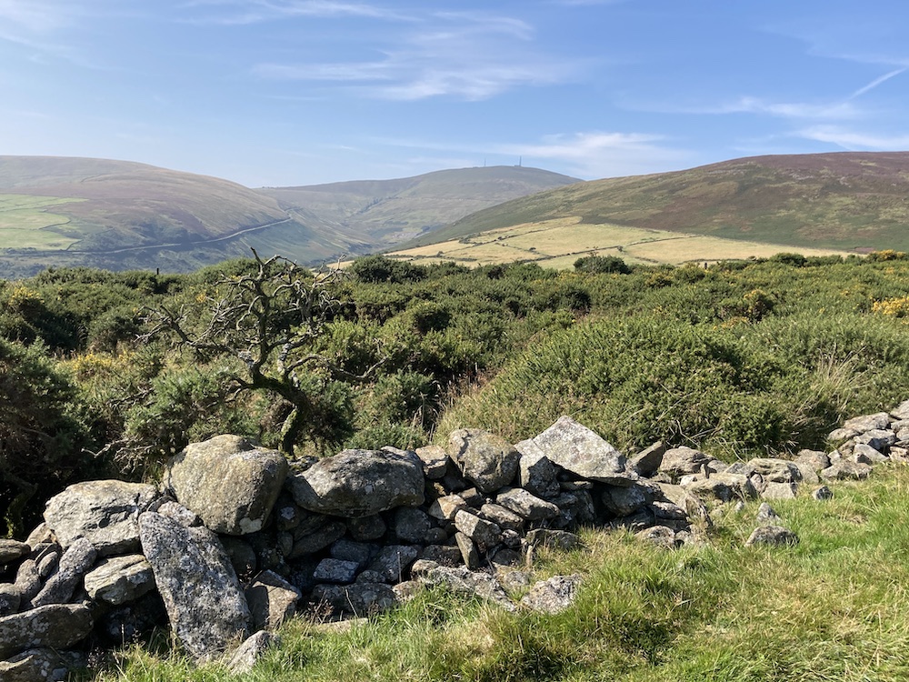
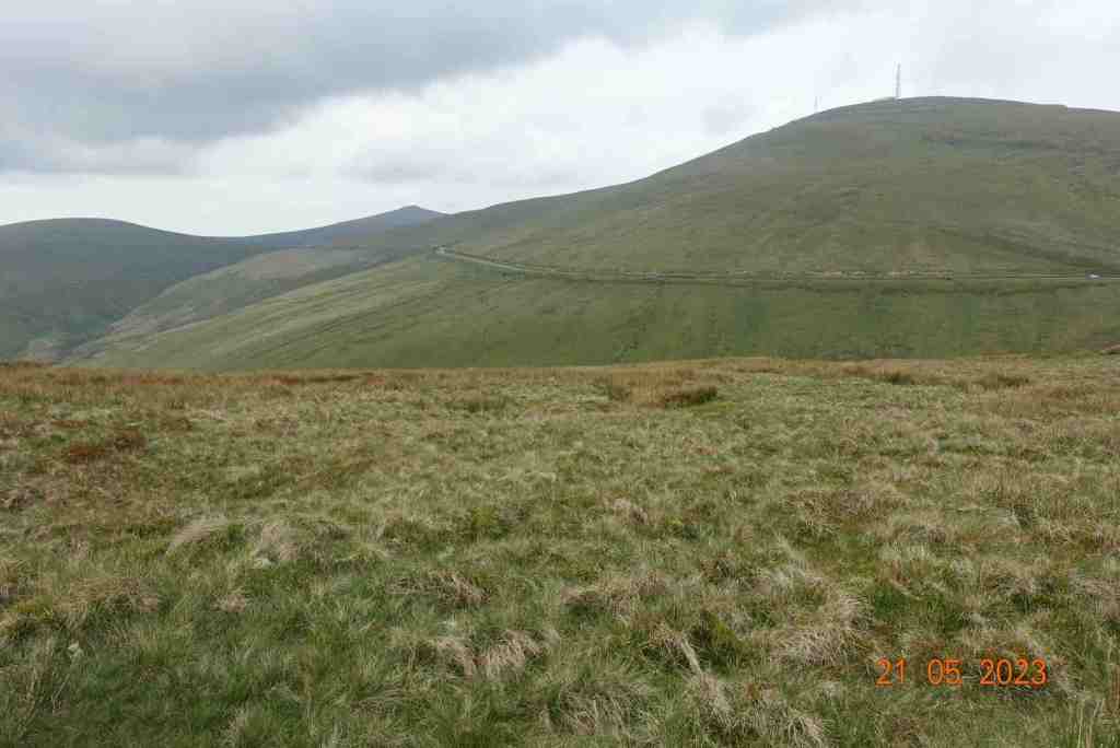
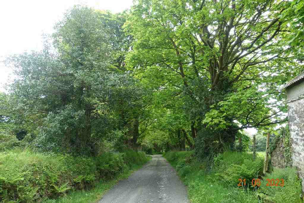
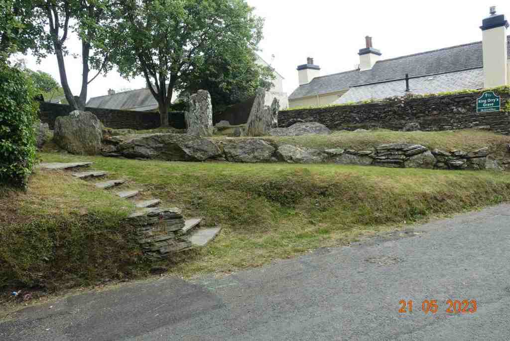
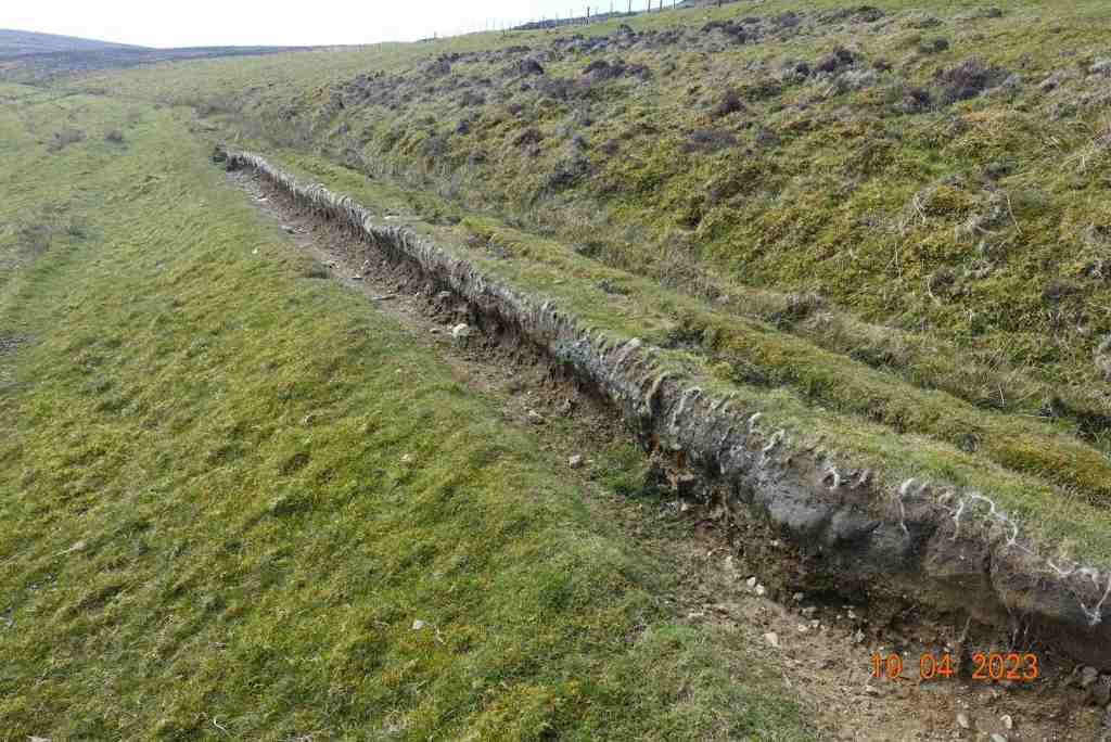
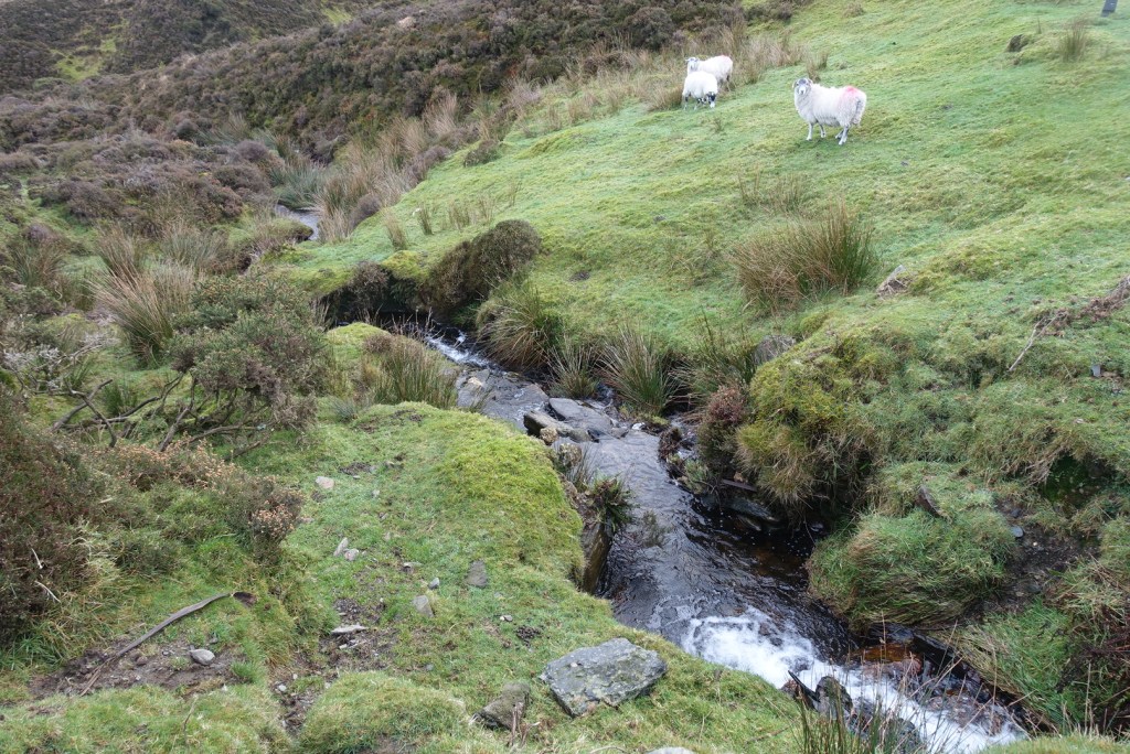
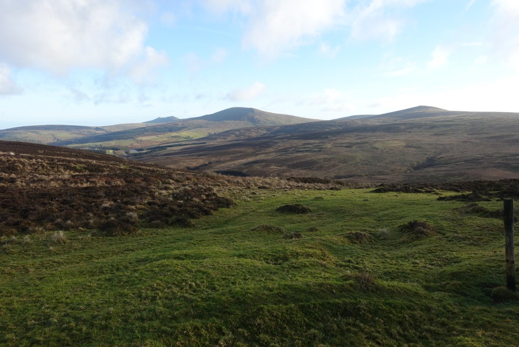
We could not have wished for better weather on our Saturday walk. It was warm and sunny, if a little misty. 11 of us set off on the tram up to the top of the mountain, where it was somewhat breezier than down below in Laxey. The moors were wetter than we were expecting and care was needed going down to Black Hut. Crossing the road a strong boardwalk has been created over the bog, one of the best I have ever seen. We paused momentarily to watch a female damselfly lay her eggs in the water. It was a short uphill walk and then we had the splendid views of the Conrhenny valley with North Barrule and its associate hills on our left (after moorland photos). It was beautiful. We decided not to do the higher ridge walk over heather, which in hindsight was a good thing as a few people were wearing shorts and one person’s shoes fell apart. Not that it was easy walking on the lower track as it is very stony and uneven. One of the party said that this had been a nice grass track in the past, but has been destroyed, I guess, by the motorbikes and cyclists that are allowed on this path. It was a steady walk down to Laxey, past King Orry’s graves and back to our starting point at Laxey railway station. A very memorable and happy day, with good friends, who I will dearly miss.
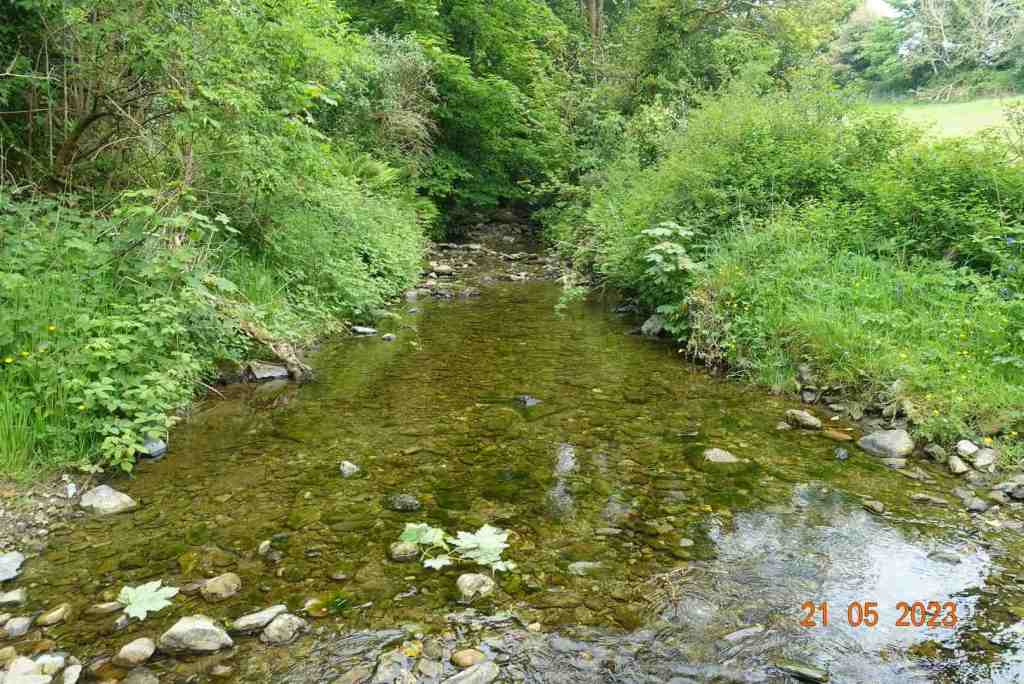
The Monday walk was a different affair altogether, with absolutely pouring rain. My camera and phone stayed firmly in my rucksack the whole way. Fortunately, it was only a short 3 mile walk, but even so, those of us who did venture out thoroughly enjoyed it. We looked at the different vegetation and vistas and we had a jolly good natter. The heritage trail from St Johns to Peel (it starts at Douglas) is of course flat and relatively wide, which makes it easy to communicate. The path is ‘wearing’ in well, after its overhaul a few years ago, when it was very hard underfoot. It is more pleasurable to walk on now, and of course, around the Raggatt is is beautiful.
As I had mis-guessed the length of the route, thinking it was 5 miles not 3 miles, we arrived early at Peel, which gave me time to say goodbye to Lara at the Manx Wildlife Trust and to get a coffee before the rest of the party arrived for lunch. Our small number of 4 then swelled to 10. They were certainly drier than we were, but everyone was very happy. We had a super meal at the Marine Hotel. Everything was cooked to perfection and served in good time.
This was a different, but just as enjoyable way of saying cheerio to yet more friends. I shall have some very fond memories of my last few days on the Isle of Man and I thank you all, and those who couldn’t attend, for making my life here on the island so happy.
So, this is me signing off from the Isle of Man. Once I am established in England I shall revamp the blog and have sections for different areas of the country and abroad. I was walking in the uplands of Norway recently and that was truly spectacular…
A free day, and one planned to do a recce before the madness of TT starts, with practice week next Saturday. I was up early, too early for the first train from Laxey to the summit of Snaefell. It wasn’t a great day, overcast and a little gloomy but it was possible to see the top of Snaefell, so it could have been worse.
As I entered Laxey station I immediately saw a walking colleague, Ken. He is a great leader and was taking a walking group from Orpington up Snaefell and on to Ramsey. The one-carriage train was almost full as we headed off up the valley, with the female voice-over telling us all the important points to look at on the way, such as the Laxey Wheel and the mines. Once at the top, the passengers spilled off the train onto the viewing platform. It certainly was hazy, and there was no question of seeing the Mountains of Mourne today, but it was calm and warm, and considering how often blows a hoolie up here, I settled for that.
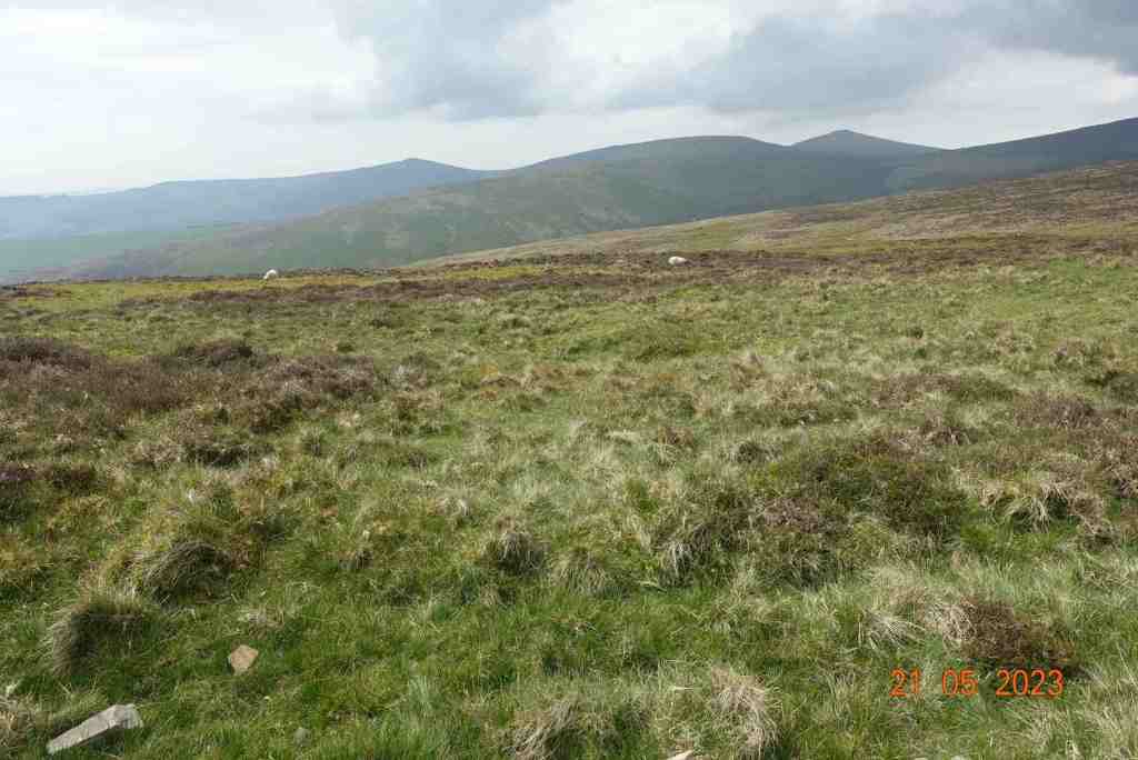
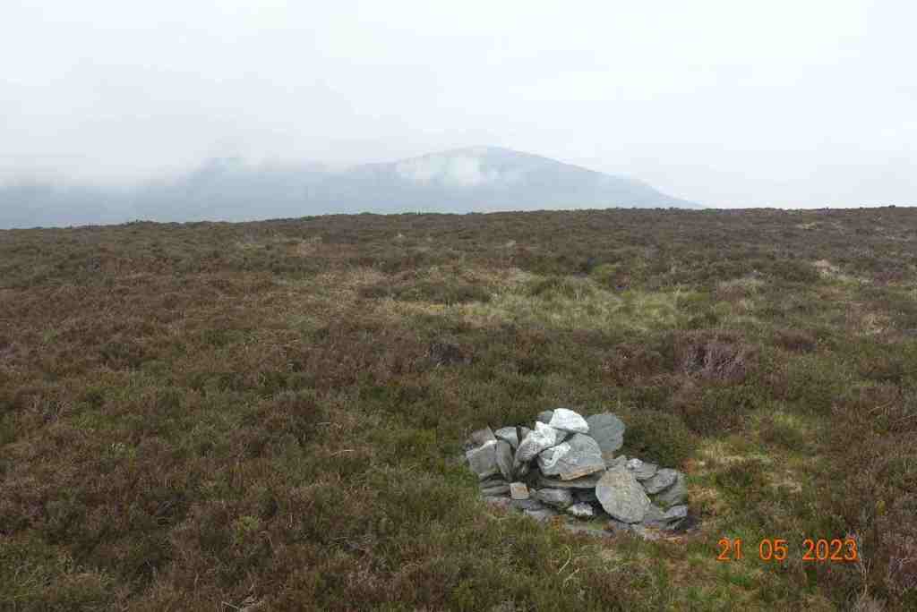
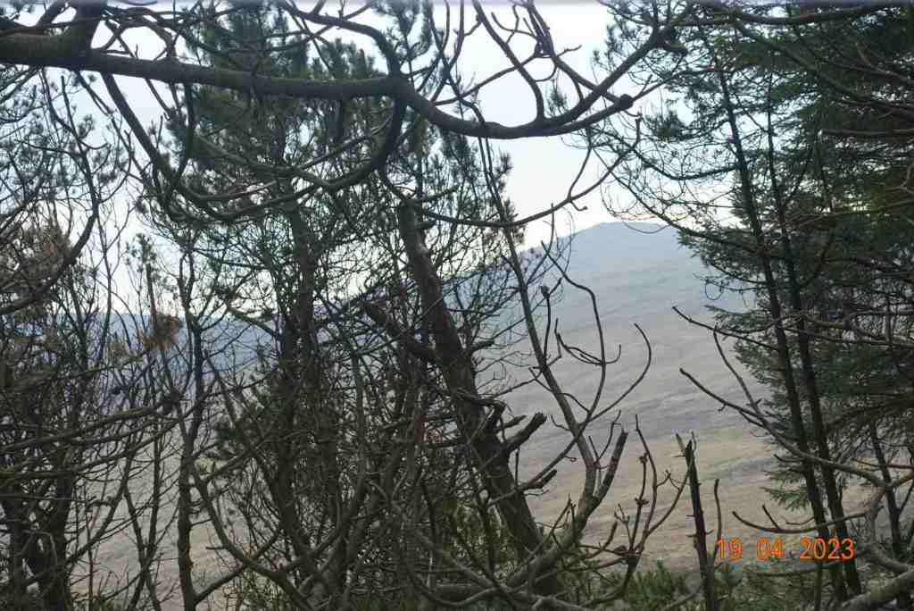
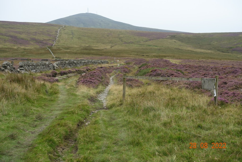
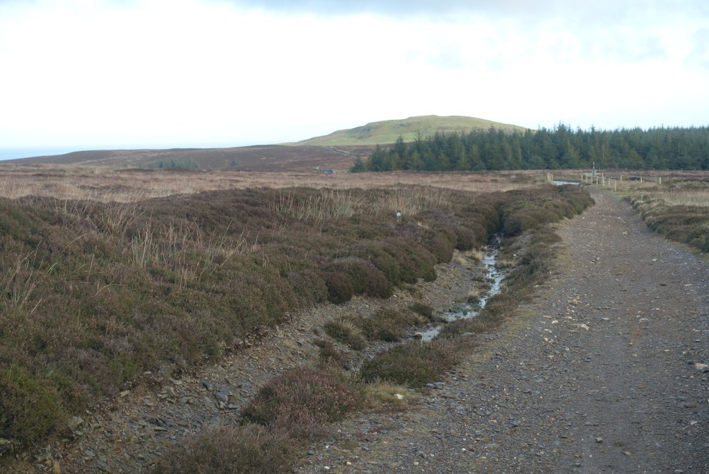
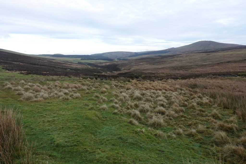
I tried to let Ken’s party lead off ahead of me, but my delaying tactics didn’t seem to work, so eventually I found myself at the tail end of his party, enjoying idle gossip as we went downhill to Black Hut. There, we parted company as their route would take them to the left and mine to the right. I only saw them briefly again as they reached their first summit of Clagh Ouyr. My route was a gentle climb up the flank of the hill, across heathery moorland and occasional shallow bogs until I reached a plateau that I walked on for about a mile. On a good day, the views would be fantastic on this section, and even today, they were still very good. The path is easy to follow and at the saddle between two hills there is a signpost where you can turn left and follow a track in a north-easterly direction to Glen Mona. That would be for another day. My path went around the southern side of the hill, turning into a stony track. This was all right for a while, but it gradually got wider and stonier and although relatively easy to walk on it did become a little tedious. I looked for a path, even a sheep path to take me to the top of the hill, but there seemed no easy way amongst the heather, so I refrained for the moment. Crossing a small bridge, it seemed as if there should be a path up between two hills, Slieay Lhean to the left and Slieau Ouyr to the right, but I couldn’t make one out from the track. I could see some grassy areas on a steeper section, so I made my way towards those on Slieau Ouyr and blazed my own trail up to the top of the hill. In reality this was only an ascent 322 ft but it felt more as it was straight up for 1/4 mile max!
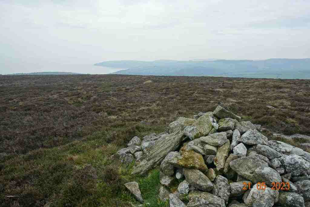
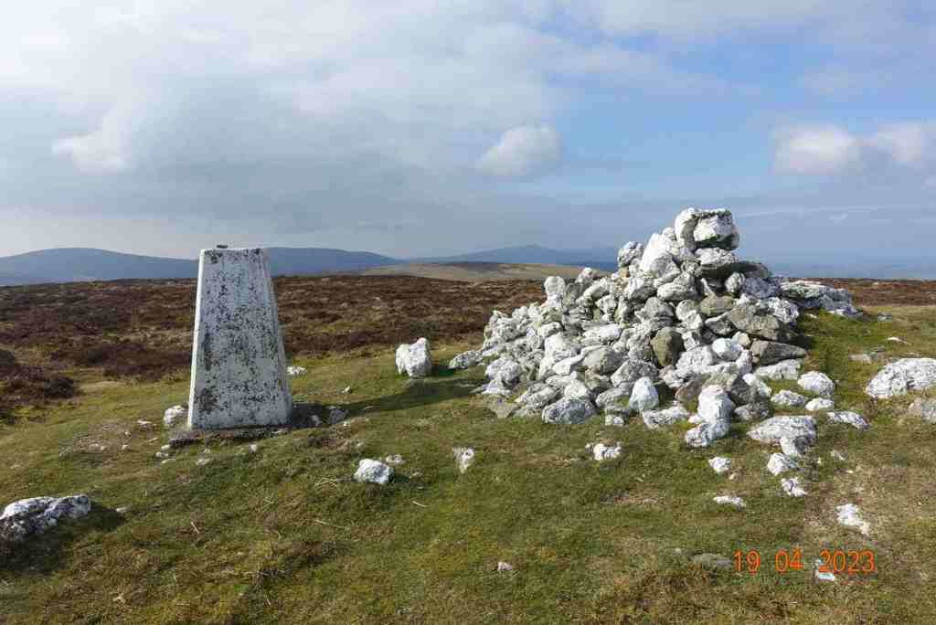
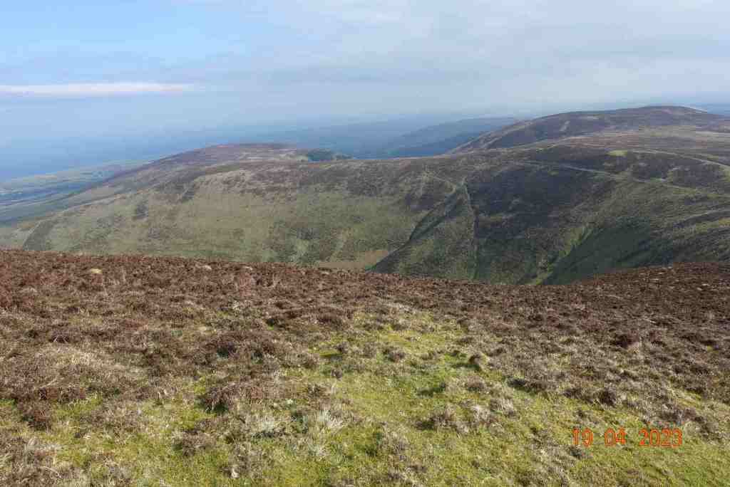
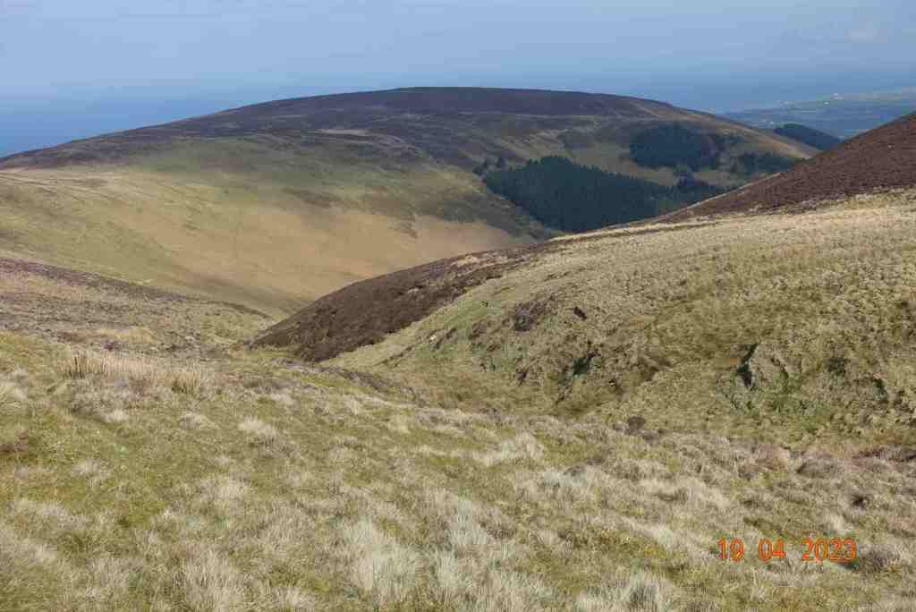
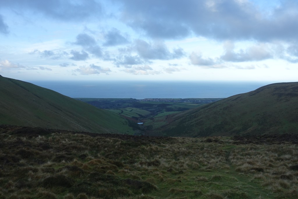
I was pleased I had chosen this route as it was far more pleasant higher up and I could see in all directions: North Barrule and eventually the coast up to the Ayres and all the hills around Snaefell. Not having done this route before I was surprised how much of an arc these hills make. From Laxey, they look as if they are in a straight line, but they are not. Having reached the final summit of Slieau Ruy, it was all downhill towards The Dreem, across sometimes difficult moorland. The path is narrow, barely visible sometimes, and you have to be careful where you put your feet as there can be sudden drops invisible because of the heather. It eventually joins the boring track I had been on before. The boring track is absolutely fine really and you still get good views of the southern part of the island, but of course, being lower, you can’t see over the mounds immediately adjacent to the path, so you cannot see the northern hills.
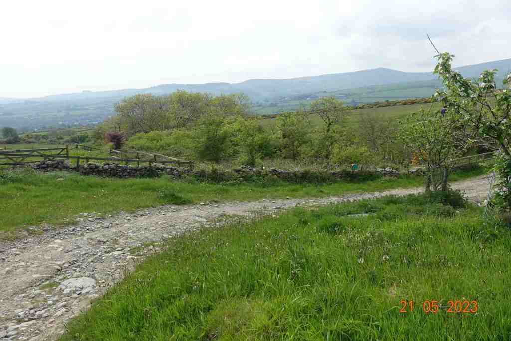
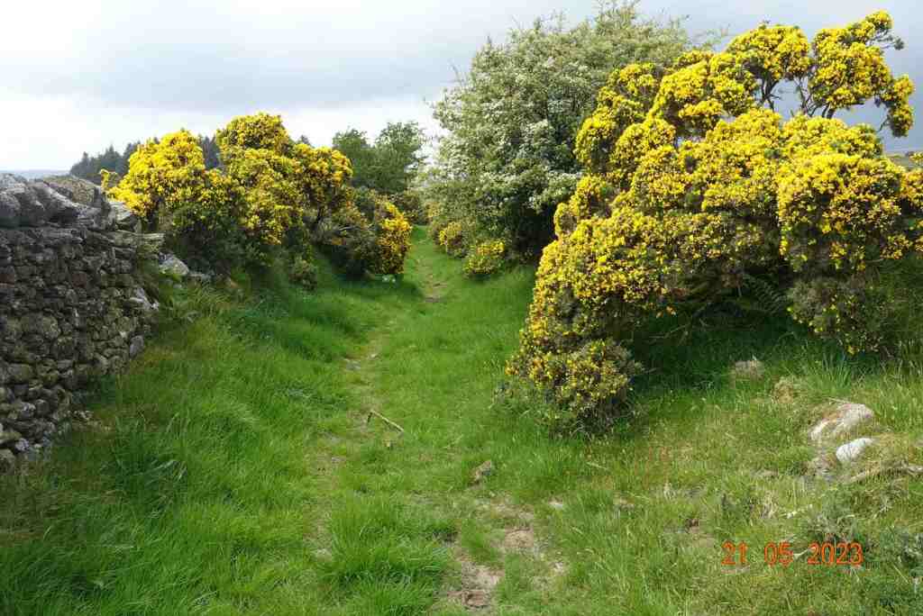
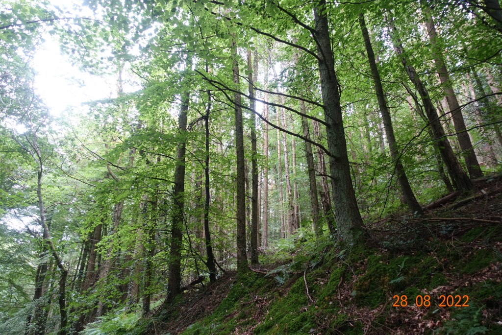
Once off the green track there is a choice of routes. Continue straight on and before long you join a minor road that you can follow back to the top of Laxey. I turned right. This next section was lovely; you are still reasonably high, so there are good views, and there were very green paths in between farmed land. The colours had changed from being purple and brown wherever you looked to being bright green wherever you looked. There is a great direction-finder for the next path, as there is a tall, fairly small wood, that you can see for miles, so you can just head for that, as the next path starts here and goes immediately south down into Laxey, or Minorca to be more accurate. As I neared habitation, the colours became even more dynamic and the trees looked magnificent and seemed to own the place. I wasn’t expecting a ford on this walk, but there it was, but with no water overlapping the road today. There must be deluges from time to time, as someone has constructed quite a strong footbridge for those very occasions.
It is now just a few more paces until you join the minor road where you will find King Orry’s Graves. I didn’t visit them on this occasion as I have done so many other times before. Instead, I continued to the main road and followed it along the top road into Laxey before dropping down a delightful path into Laxey village itself. It was then just another short climb up the road back to the station, and Laxey Glen where I had parked the car.
Distance 6.9miles; 614ft of ascent; and a whopping 2,516ft of descent. You won’t notice the descent. It is very gradual, and if you have good weather, this walk deserves the full day treatment. And of course, once you arrive in Laxey, you can spend time walking around the village or have an afternoon tea in a local cafe, or mooch along the beach. It is a lovely village, and you should allow yourself some time to enjoy it.
I have a new favourite walk, at least for the extensive views it provides in all directions. This is a ridge walk on the eastern side of Kirk Michael, and it is relatively short at just about 5 miles. You can choose how much ascent you do as well, so this walk caters for different kinds of walker.
It starts at the Sartfell car park on the Kirk Michael to Snaefell road just before the cattle grid. Today, the mountain road was closed, and I was up early, so I had the hills all to myself, something to be strongly recommended. My only companion was a very blustery wind, which I would have preferred to leave me alone, but it persisted for the whole walk. At least it was warm -ish, but it was also hazy, so this walk will be even better on a really clear day.
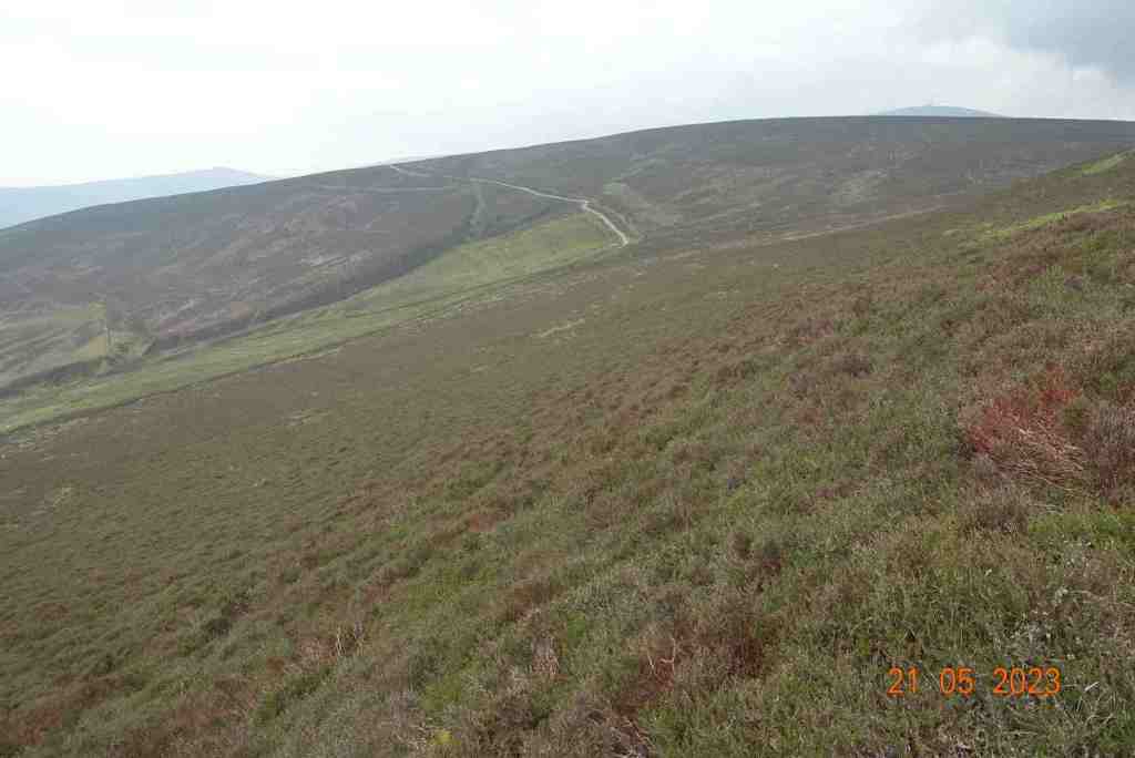
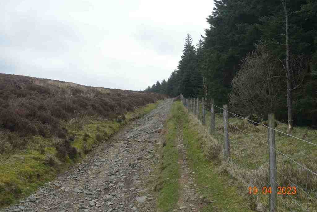
The walk follows a stony track gently and very gradually uphill contouring round the eastern side of Sartfell. There’s a deep plantation to the right to begin with prohibiting any distant views, but as you get a little higher, the trees become a little sparser and you get glimpses of a far distant land. Being so windy, the trees were making a heck of noise, sounding like gushing water or labourers felling trees, but no such thing was going on; it was just very windy.
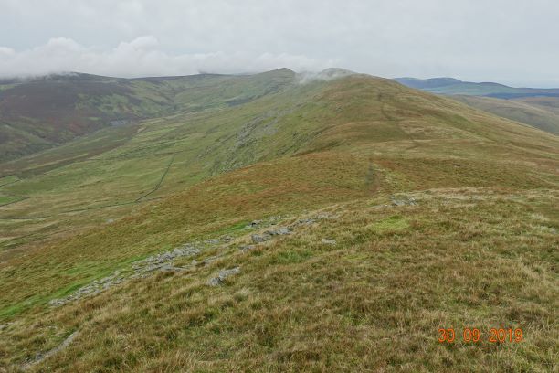
The gentle climb to the top of Freoaghane, with no hint of the superb views to be seen from the summit
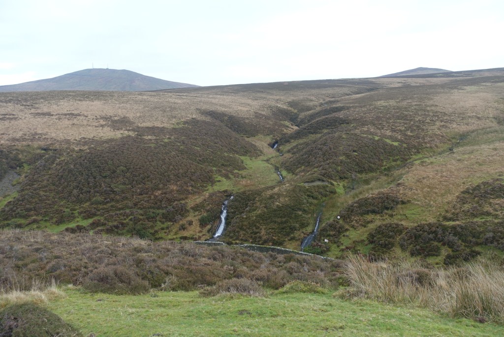
Once you leave the trees behind you are granted a full vista of the northern hills, with Sulby reservoir in the dip. It is still not possible to see over the hills to the east at this point. The stony track continues and becomes flatter. In the distance you can make out an old tumble-down wall on the right and that was where I was heading for. The map showed a foothpath up Slieau Freoaghane. It is a gentle hill climb from this starting point, on a well trodden path over mostly peat and heather. It is only when you reach the grassy top that you get the amazing views in all directions. At the trig point, there is a bell which I was very tempted to ring, but I managed to control myself, fearing that I might otherwise summon all the emergency services for no good reason. Reading someone else’s blog, this bell has not always been on the summit, but may have been linked to worker’s cottages lower down the hillside, and the bell was rung to signal the beginning and end of shifts – day and night. My walk was not going in this direction.
The path off Freoaghane is steeper than the climb up, but very friendly. It is a wide, grassy slope and a very enjoyable descent. As you walk down you can map out where you want to go next slightly off the beaten track, which is exactly what I did, as I wanted to avoid more stony tracks as much as possible. Eventually, it is necessary to meet the track again but only as far as the point where the path divides into two, one going to Kirk Michael, the other to Ballaugh.
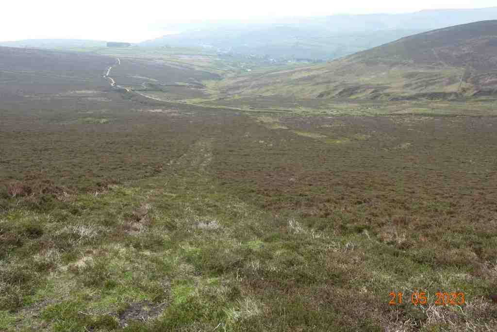
There is a very strange grid to walk over, which is semicircular with horizontal bars. Here there is a tremendous view of Glen Dhoo above Ballaugh. I then took a track leading up the delightful valley with Slieau Dhoo immediately opposite. This is a great lunch spot, with lots of grass and even a makeshift natural bench if everyone wants to sit in a row 🙂 There is small amount of ascent on this pleasant footpath which leads to over the brow of the hill and down to the yet another stony track. Don’t be put off by this path saying “road closed’ at either end. I am sure walkers are welcome, but the bikers are not. On some maps, there is a right of way immediately opposite leading down to Druidale, and another one a short distance to the right. In reality, these are in a bad state of repair and give the impression of being purposely neglected. About half a mile away, there is a new signpost, but it is not in the place shown on the map, although it does join up with another footpath that is in a slightly better state of repair.
Lunch stop overlooking Glen DhooThe natural bench
There is a choice at this point. This new track adjoins the former track we began walking on, so it is quite possible to simply walk along this back to the car. The views are stunning, so why not? Alternatively, you can take the track to the left which is about the 4 mile marker on my map, and follow the stream, again walking on heather and peat down to the Druidale Road. There is no alternative but to walk along the lane up the hill to the car, but it is a very quiet road and a pleasant walk. It does mean you do not have to retrace your steps for the last 3/4 mile. It will add on some uphill and probably another half mile.
The hill walks on this island are just beautiful, but they have to compete with our splendid coastline. Last week my son came over for the Good Friday 10km run in Port Erin. On the Saturday, we went to one of my other favourite places – the rocky outcrops at Langness. We were really spoiled, as not only were the seals in abundance, but we also saw a pod of Risso Dolphins in Castletown Bay, a I guess sheltering to some extent from the blustery seas – yes, it was windy then too.
I am leading the Freoaghane walk for the U3A on June 14th, so if you are a member or would like to become a member, get in touch and I will send you details of where and when to meet us. There is no charge for walks; you are entitled to two try-outs but after that you have to become a member of the U3A to participate in any further activities. They are a great bunch of people, and there many different kinds of groups, so if you have time on your hands and you like meeting people and sharing ideas, it’s a good organisation to become a part of.
Distance: 5 miles; total ascent /descent 1010ft/ 974ft
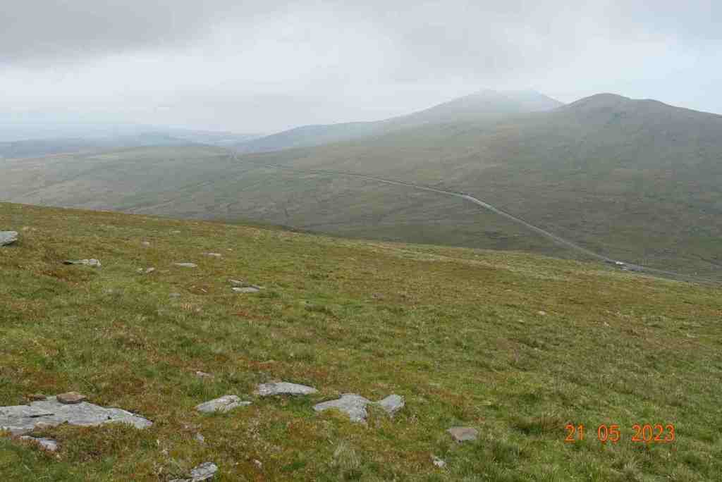
This walk did not quite go to plan. With all the uncertainty of road closures due to the Manx Grand Prix and not wanting a really, really long day of walking, I had decided to meet the pilgrims at their lunch spot at Sulby Reservoir at 1pm. I could get up at leisure, take my car to Laxey, as a permit holder have a free train ride up Snaefell, then casually make my way to Sulby Reservoir for lunchtime.
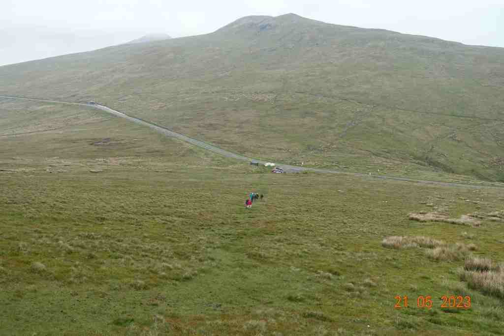
What could do wrong I hear you say. Well, nothing in theory. The first part worked a treat and I really enjoyed the train ride, only I was in a bit of a rush at the top if I were to meet them at 1pm. The queue in the Snaefell cafe was not long, but it was very slow as there was just one guy serving, and you know what coffee machines are like these days. Bring back the kettle and the instant coffee – instant is no longer a word associated with cafes. I decided to cut my losses and get the train back down to Bungalow. I had plenty of food and water anyway. This was another delightful journey, made even nicer by a very friendly and chatty conductor.
Reaching Bungalow I began the walk down the road. A family were walking in front and the dad stopped to walk with me and have a chat, which I thought was very nice of him. He had his wife, his daughter and his daughter’s boyfriend in tow. I did wonder if the young people knew what they were in for, as they definitely had an air of an afternoon stroll about them. Mr X rejoined his family and I messed about by the roadside, looking at little eddies of water and marvelling that there was a flowing stream at the top when we have had no significant rain of late (if you exclude the 4hr deluge last Monday). It just shows how good the peat is at retaining water. There was a fair amount of sphagnum moss clinging to the side of the road, which is good to see.
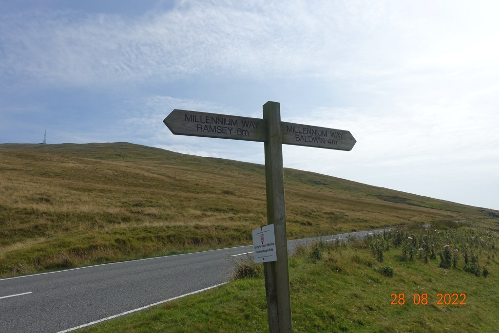
The family went off to Ramsey on the Millennium Way. I was a little early so decided to walk on a little and completed my descent at the Tholt-y-Will Iron Age Earthwork. This is a bank about 6ft wide, extending in both directions across the road for about 100 yards in each direction. It is thought to be a defensive rampart protecting the hill route between the two streams, but no-one really knows. At this point I had a call from Phil, the pilgrim, to say they were well behind and by the time they had had lunch it would be at least an hour. Big sigh, my end, but not surprised. I decided to start the walk without them, and if I walked slowly, they would eventually catch me up, so back up the road I went to join the Millenium Way. I was a little uncertain about doing this, as I have never been on this path, but hey ho, life is for living and having small challenges, so this was mine for the day.
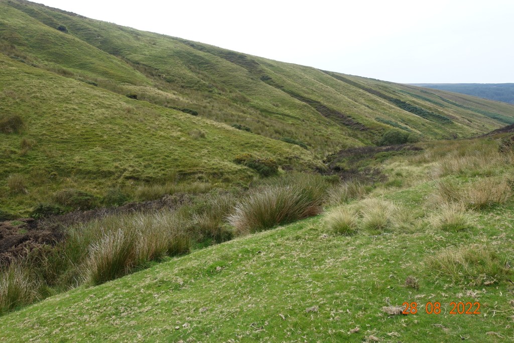
The first two miles of the Millennium Way are absolutely glorious. As well as being able to see distances, you can see into valleys that you never even knew existed, and there was a complete sense of isolation. Mr X and co had long gone as I must have waited for the group at least 40 mins before embarking on my Millennium walk. Birds of prey were hovering overhead adding to the atmosphere. The path begins as a stony track, but soon becomes a narrow earth track, and then the track pretty much disappears and you have to find your way over the moorland. There are signposts, some more useful than others, but you need a map to know where the crossing point is over the stream. You will have to navigate several bogs, none of which were very deep on this occasion, but in winter I could imagine this being much more hazardous. There is a steep descent to the stream, but the climb out is less strenuous uphill and you soon find yourself back on the top, so here was I peering into the distance for my fellow pilgrims but not once catching sight of them.
At this point, I decided I may as well walk at a reasonable pace as they were clearly not going to catch me up. When you leave the river, the map suggests you take the soily path through the gorse, but in fact you need to go the other side of the wall to the top of the hill. I didn’t, so had to scramble over the wall higher up. There is then a helpful signpost telling you to go left. This is flat easy walk through heather with great views. The path here is well defined as long as you don’t believe it all the time. I realised pretty quickly that it was bending the wrong way after about half a mile, so I did some trail blazing (not as grand as it sounds; it was easy walking) to rejoin it further east. You need to curve to the right away from the trees, so if you find yourself heading towards them higher up so have gone wrong. Maybe I missed a sign, I don’t know. Anyway, it is neither here nor there. It is easy to correct.
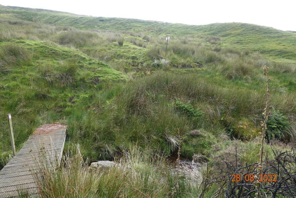
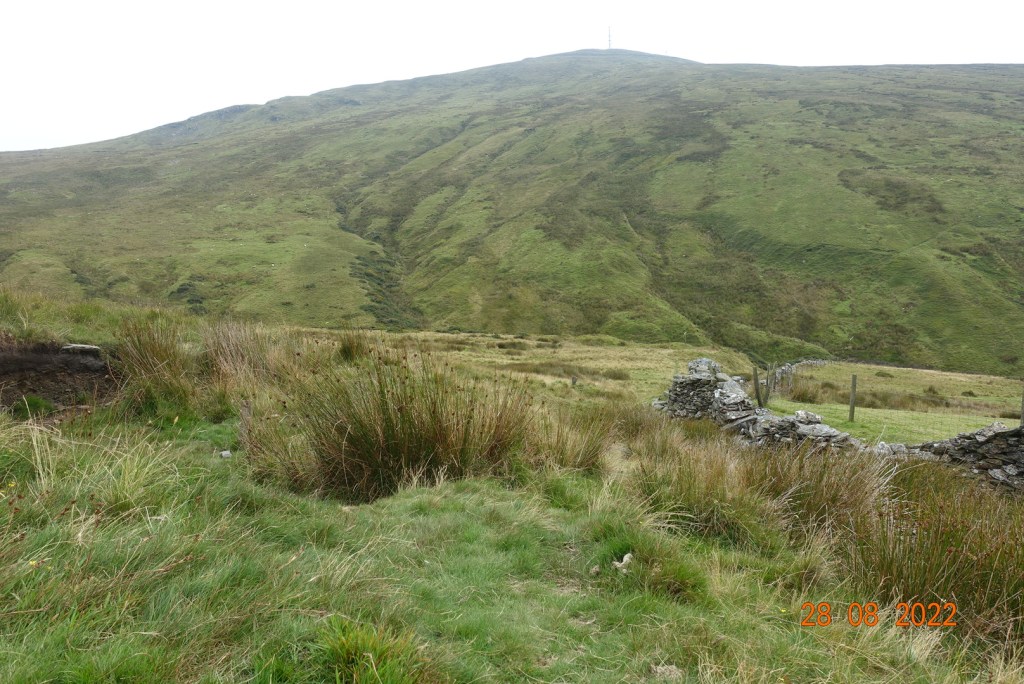
Once back on the track, I followed it to where it joins the path from the Mountain Hut. There is a large section of boardwalk here across the bogs. I had to wait for some very slow bikers to come over it before I could go. Nearing the far end, one of the boards gave way, which was a little alarming. Going through a gate, you then join a stony track that goes on and on and on for miles, all the way to Ramsey. It is uneven and as a descent, although not steep, it is tedious. The early part is fine and has lovely views to the north. Scotland was visible today. I had just joined this section when I saw a very colourful lone walker dressed in yellow coming towards me. As we converged, I was delighted to realise it was Paul the Pilgrim from Friday’s walk. He is such an interesting person and it was a delight to spent a further few minutes in conversation with him. He was intending to meet up with the group and walk with them for a while, but I had serious doubts whether he would succeed.
There is little to say about the rest of the walk. By this time, the battery on my phone had given up the ghost, and I had lost my map. I only realised this when I wanted to see if there was a more interesting route into Ramsey. It was a brand new map so I was cross with my carelessness. Consequently, I had no choice but to walk down the never-ending stony track down Sky Hill (very disappointing), and then back along the road into Ramsey. As I was nearing the traffic lights, I spotted another person I knew – Mr X again, but without his family!! They had hoped to have afternoon tea at Milntown, but it was closed, and they had cadged a lift back to Douglas or wherever, but there wasn’t room for Mr. X in the car – or something like that – I didn’t quite understand how he had got separated from his family.
I had almost an hour’s wait for a bus but eventually caught the 18.10 bus back to Laxey with a million other people, all tourists. There had been no actual racing that day, but I believe there had been some event on in Ramsey to entertain the crowds.
I know you are wondering what happened to the pilgrims. Did they ever arrive? Yes, they did, but not until 19.20 or so, very hungry and I guess tired with sore feet. They had walked a long way. I walked 9.5 miles altogether, but they had done another 5 miles, of which about 3 miles was a steep ascent. I was very sorry not to see them at all – I had enjoyed their company a couple of days previously, but I was also relieved that I had decided to carry on alone, so that I got home in reasonable time. I had to work the next morning, Bank Holiday Monday!! I do admire those who did all 4 days, and if they do it again next year, I will try and do the full 4 days myself and stay at the Retreat with them to get the full benefit of the experience.
Here is a link to a website that describes the Triskelion Way : Triskelion Way. If anyone is interested in joining our pilgrimage next year, send me a message and I’ll send you a email address for the organiser.
The walk from Bungalow to Ramsey (via the Earthwork and the Millennium Way) is about 9 1/4 miles and just under 600ft of ascent. The full walk from Kirk Michael to Ramsey is closer to 14 miles and a good 2000ft of ascent. What an achievement! Well done, all of you.
I was itching to get out in the hills. It is so long since I have walked anywhere but in the south, and this time I could leave my measuring stick behind me, ignore the peat and sphagnum moss and just appreciate our wonders scenery. Instead of including photos as I go along there is a slideshow at the bottom instead today.
I picked the day when the weather would be best ( both Monday and today being rainy days) and invited my friend Janet to join me on a walk I have never done, but have often looked at from afar. We took the road up from just outside Kirk Michael and parked on the grass at the start of the walk, just before the road to the right leading to Injebreck and the cattle grid leading onto the main Snaefell uplands. You can find this easily by looking for a triangular piece of woodland, called Sartfell plantation.
It was bright and sunny initially, though a little chilly. We followed the green lane gently upwards. Sartfell at 454 m is immediately to the left but there is no direct footpath to the top and there are signs discouraging people from going off the track, though I suspect this is mainly for the benefit of the bikers and possibly horse-riders who are allowed to use these green lanes. We continued north on the path skirting Slieau Freoaghane (488m). There is a choice of paths at this point and I wanted to go slightly westward so that we would get a view of the western slopes of the island, so we took the left fork temporarily to the saddle between the said previous hill and Slieau Dhoo (424m). We were not disappointed. The views down the valley to Kirk Michael were lovely and the hills around had satisfyingly geometric green slopes.
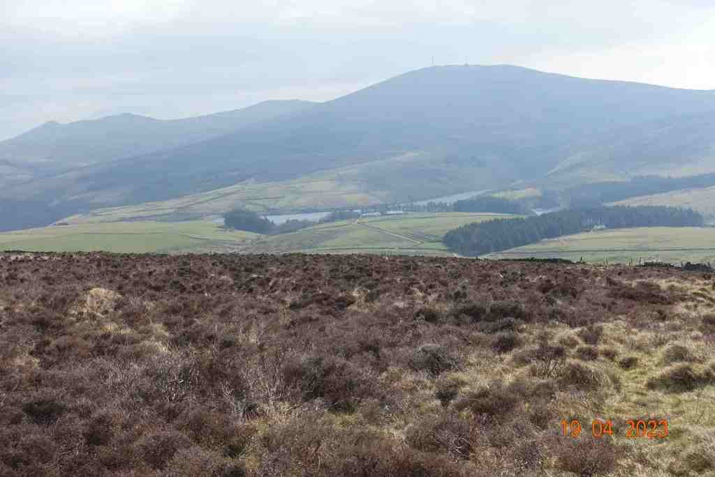
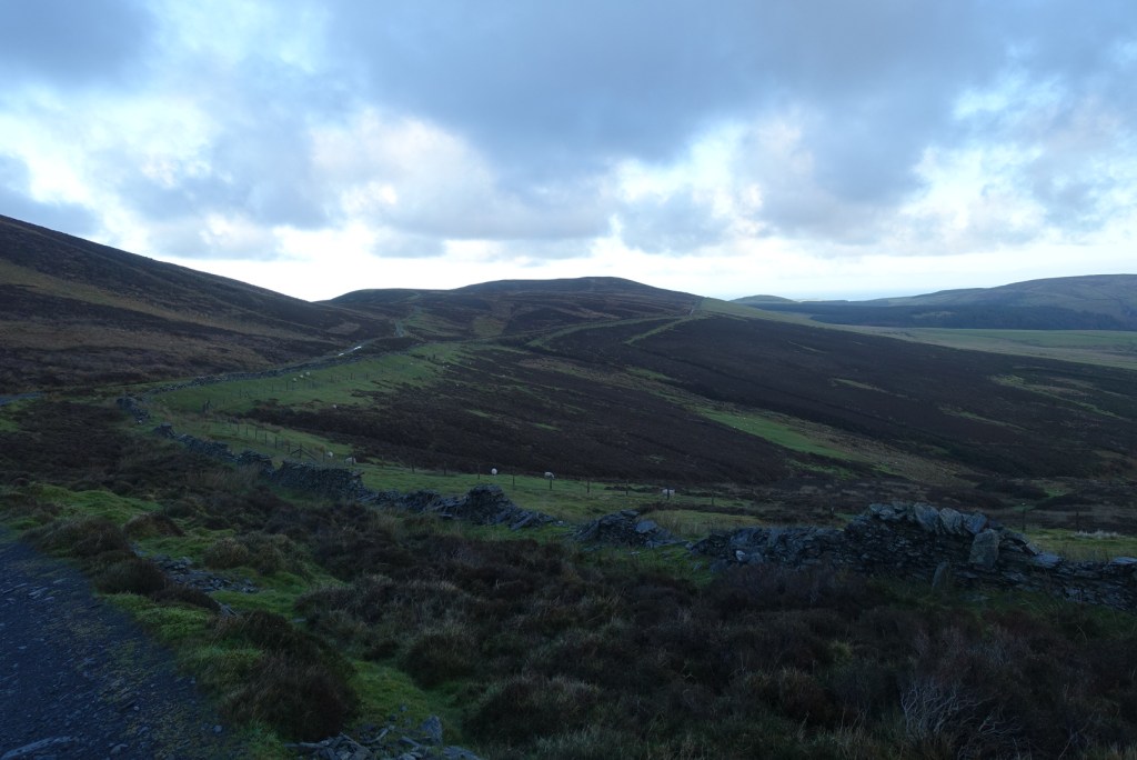
We retraced our steps a little to continue on the eastern side of the hills up to where the green road meets the ‘main’ Druidale Road that leads down to Ballaugh. Along the whole of this path we had had wonderful views of Snaefell and its neighbouring hills, with North Barrule tipping its head up so we could see it in the distance. The green road is not particularly pleasant to walk on being heavily rutted by the motorbikes, but there is room to walk on grassy ledges most of the time. There were quite a few puddles to negotiate as well.
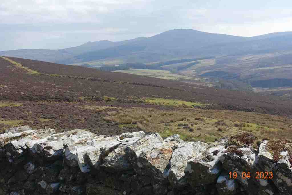
This was our midpoint at the head of the Tholt -e- Will plantation and there were excellent views down to the Sulby reservoir and at one point we could see the Ayers lighthouse far away in the north. We now turned south to walk along the road all the way back to the car. Usually I don’t like road walking but at this time of year when it has been so very wet it’s a good idea and in any case cars were few and far between and it is a most attractive road to walk along.
As we walked back and looked across to our left, we reflected on the fact that are no footpaths across most of the land we could see. A few sheep would venture over on to the moorland, and there are very very few buildings, so the area is quite unspoilt.
This walk was just under 7 miles, with about 810ft of ascent. However, it is easy walking with no really steep gradients and if you need to take a break at any point you can simply say you are admiring the view.
The slideshow starts with a view the hills of South Barrule and Cronk ny Array from the car park then a mix of locations on the walk itself.
My next planned walk in a very early morning (7am) walk to herald the New Year on January 1st!
This was a first, at least for me. For the last twenty years I have visited the Isle of Man and the last five years I have been living here, yet in all that time I had not done this spectacular ridge walk. We could have hoped for a sunny day, but this is the Isle of Man where we are more likely to encounter strong winds and rain or the dastardly Mananan’s cloak, but we could be lucky…
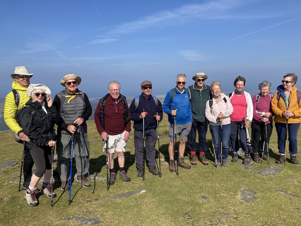
It all started out so promisingly as I drove to Laxey in bright sunshine, and the forecast promising not to disappoint until 4pm. The other walkers arrived at the station and it was still just about sunny as we hopped on the tram up to the top of Snaefell. As we reached Bungalow we realised the weather had other intentions as the top became swirled in mist. I could almost feel my fellow walkers psychologically putting on hats and wet-weather gear in anticipation. I did feel disappointed for the visitors to the island who might have hoped the see the seven kingdoms of Man, but it was not to be. However, you can see what a cheery lot we are as we set on down the mountain.
We reached the TT course and crossed over to start our ascent. Although classified as a strenuous route, this seemed a misnomer as we were starting at the highest point, with a few ups and downs but mostly downs until we reached the sea.
The ridge affords some wonderful views even in this semi-cloudy state. Every now and again clouds would swell up in the valleys and filter across the shoulders of the hills and engulf everything in their path; in between we had some fine glimpses into the distance and occasionally saw the Lake District and even less occasionally saw Scotland. I waved to my son, James, who is wild camping in Galloway though I couldn’t see Scotland at all at that moment, and instantly I received a video text from him waving to me and saying he couldn’t see the Isle of Man either. Talk about coincidences.
Our first hill was Clagh Ouyr (551 m), followed by two unnamed hills. I did think we should have given these demoted tops some appropriate names to identify them given them as they are still good heights for the Isle of Man, the first at 550 metres and the second 533 metres. The superior-minded North Barrule, which is only a matter of 565 metres seems to think it literally rules the place, which I guess it does. The pointy peak reminded me of Thorpe Cloud in Derbyshire. It’s not a difficult climb, being mostly on peat. It was rather boggy in places but easy walking along the ridge.
As lunch approached, so did the clouds and we sensed a change in the weather. Our guide, who for some reason I keep wanting to call Steven, but whose name is actually Ken, pointed out that the formation of clouds showed that the rain was just being held at bay, and we hoped long enough for us to make our descent.
Spirits were still high as you can see, though I did wonder who was challenging who to jump off first.
North Barrule itself is a lovely hill and its one of those where you feel you want to abandon your rucksack and run up it and be a child again for a moment, but this was not quite the day for such frivolities.
The route down is a little tedious as it is very uneven, wet and boggy and therefore a little slippery. Even so, we did have some splendid view of cloud formations over Ramsey Bay.
We eventually met a green road taking up to Ballure Reservoir and Glen. The reservoir was completely dry, which is ironic as at this point the heavens opened. It is only dry for maintenance and it was interesting to see it without any water. We proceeded down the glen amongst the trees and finished on the beach.
It was a really great walk and one that I can imagine I shall do many times in the future. Thanks to the Isle of Man Walks Festival for putting this on and many many other walks every day for a week. I look forward to seeing you again on Wednesday for Greeba Mountain if you will have me after I was telling what an unsociable walker I usually am!
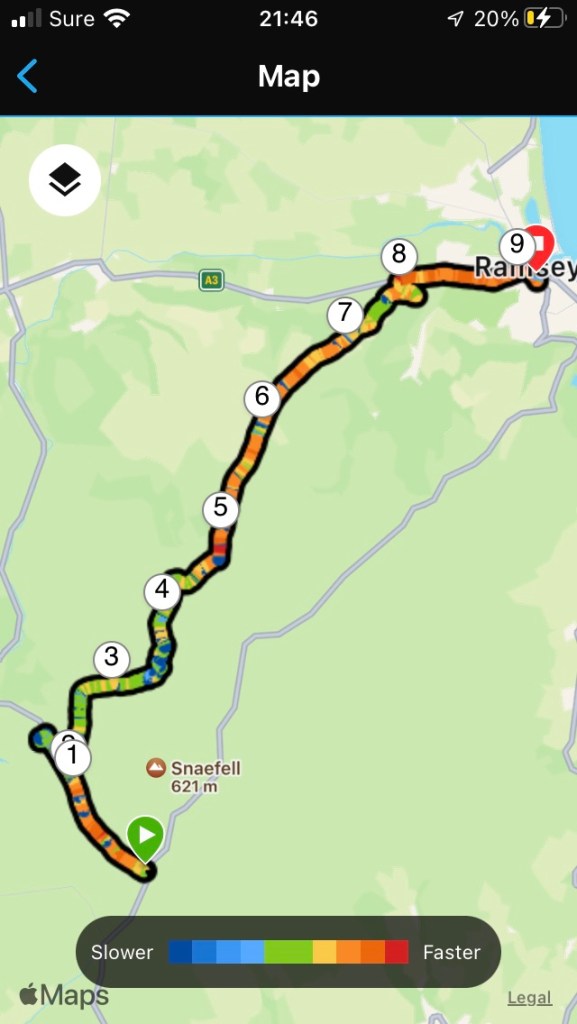
Distance 7.39 miles; Elevation 854 ft; Descent 2734 ft