Ever a favourite of mine, I never tire of walking up South Barrule. This is really my first venture out since Covid, and I am still struggling a little with chest and sinus problems but I am over the worst. This is a walk I am leading on November 6th for the IOM U3A and looking at the forecast for the next 10 days that expects nothing but rain every day I had to take advantage of a gloriously sunny and relatively warm day to get out and do my recce.


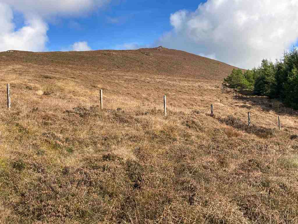
I parked at South Barrule plantation, by the Coffee Cottage, a cafe that is open every day. The car park was very busy with horses and trailers, but I managed to find a spot. The walk starts directly south from the car park. There are numerous tracks through the plantation, so it is important to start on the right one! At the start there is a junction of tracks and you need the track to the right leading uphill; it turns left after a short distance. From there, you follow your nose for some time, keeping right at any junctions, and not veering onto any lesser obvious paths at this stage. The track was quite wet in places, not surprising after all the heavy rain of late, but it is a good wide track, which means you can have a good natter as you are walking along. Continuing on, you will reach a point where the track goes clearly downhill. You can go this way, but I prefer to take the right fork, still a good track, that keeps you higher up and avoids going downhill to go back uphill again. From here you will contour round the southern edge of South Barrule with super views of the south as it all opens up and there are fewer trees. There is also a map board just where the land open up more, which will confirm you are on the right track.
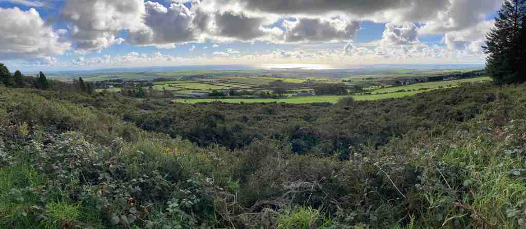

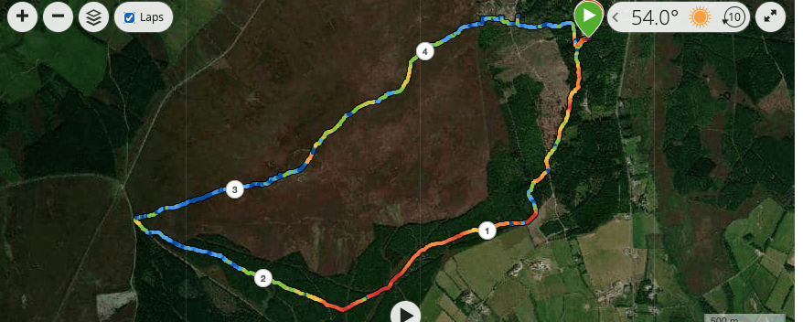
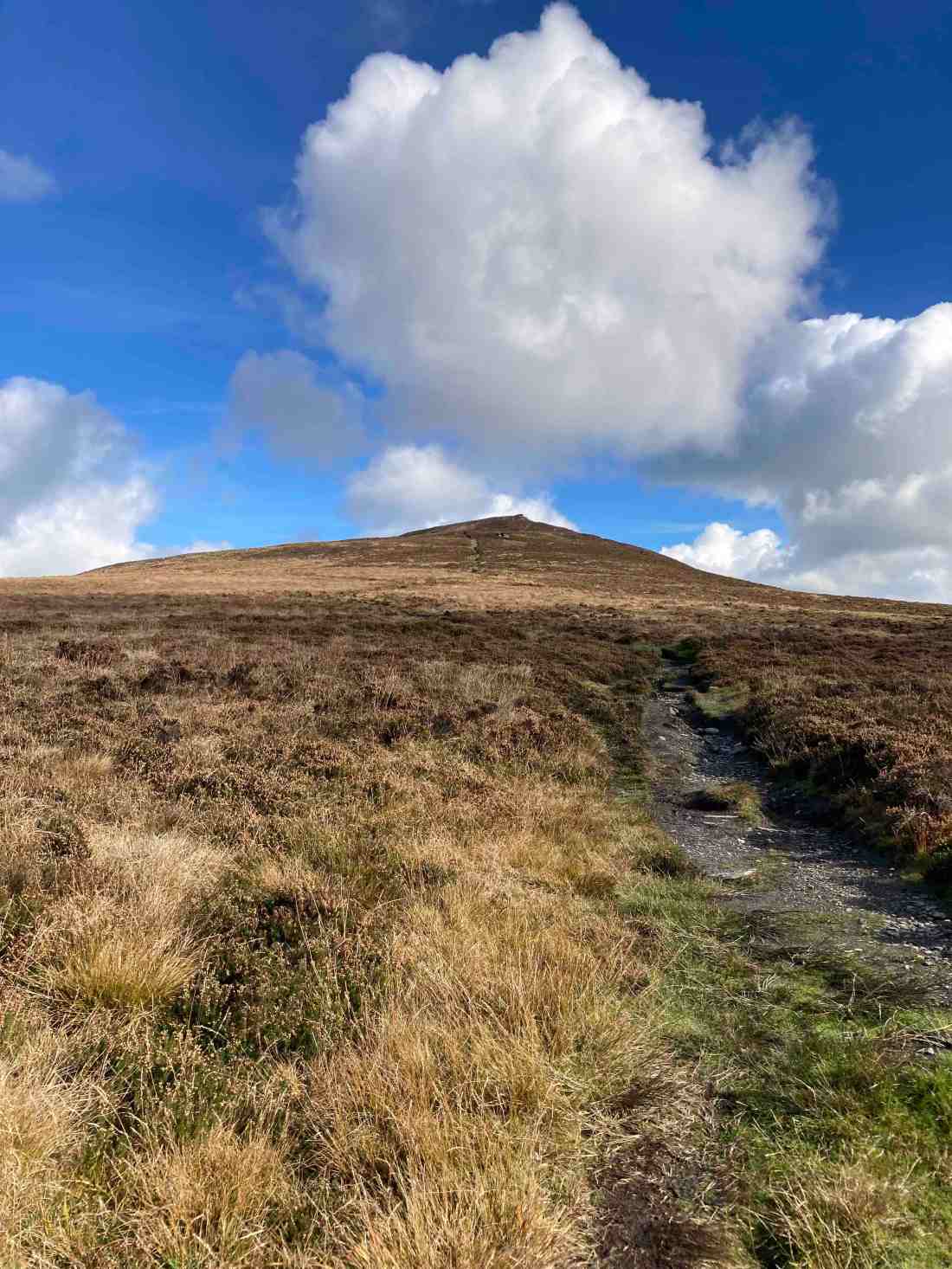
The main path continues on until you join the Bayr Nr Skeddan path. My walk eventally does go off on a side track which then turns into a footpath. This was very wet and muddy today, and if you prefer, you can stay on the main track until you hit the Whisky Run (Bayr ny Skeddan) lower down. My route is more interesting and you remain high up and come very close to where you start the ascent of South Barrule itself. I found that I soon forgot about all the mud as I entered the moorland. The views to the west and south are amazing; you can see the Langness, Castletown, Calf of Man, Cronk Ny Arrey Laa, the Rushen Valley (another of my favourites), Peel and further north all the time you climb up the mountain. I should know by now, having climbed this many, many times, that when you reach the top, you get another surprise as the northern hills come into sight in a spectacular and unexpected way. Maybe I forget because quite often the weather isn’t good enough to see them!


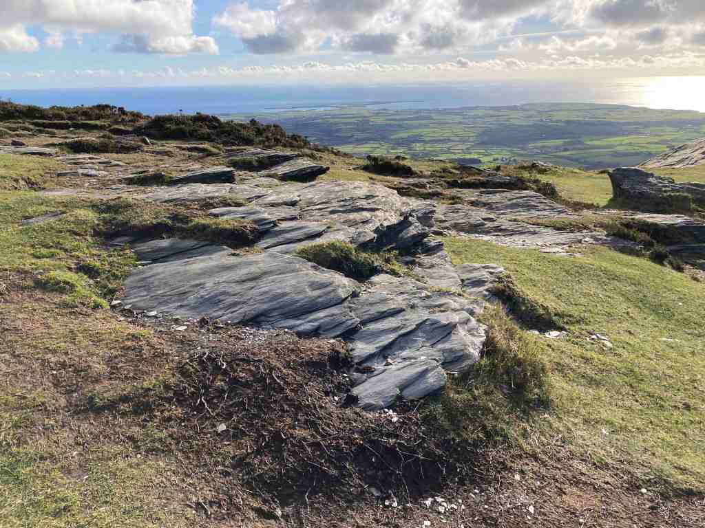
If you haven’t been up South Barrule before, it’s worth taking your time to look for the “Round Table” – nothing to do with King Arthur but a 3500 year old Bronze Age burial mound with its head chopped off. This is a heather covered mound to the left as you start up South Barrule. You can walk around the perimeter of the ancient iron age fort, 22000 sq ft in size, which contains many of the original stones – but imagine it considerably higher. How impressive would that have been. Equally, there are granite stones scattered around, which would have been brought here from one of few areas that contain granite on the island, probably Foxdale in this instance. There are also depressions in the ground, sometimes filled with water, the remnants of roundhouses, where people lived around 500BC. Culture Vannin has an aerial view of the top of the South Barrule, if you look here:
https://culturevannin.im/exploremore/places/south-barrule-hillfort-383989/


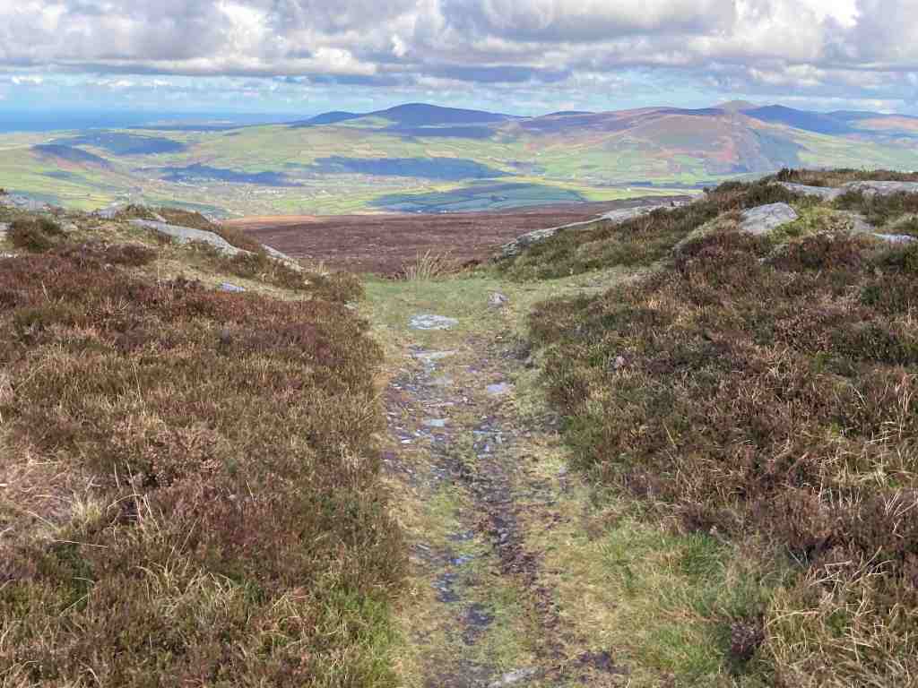
Having taken time to enjoy the view and take in its history, we now start the gentle descent, beginning on a clear path northwards. This gets narrower and narrower until eventually, as we have to negotiate a path back to South Barrule plantation, we will be walking on a map bearing and walking over peat, grass and heather (not much gorse here) for about 15 minutes until we reach the boundary fence of the plantation beside the quarry. If you are walking without a compass, you will need good visibility. There is a small mound beside the quarry on the left, and the trees begin just to the right. There is also a sign clearly visible, so head in that direction. There is a rickety stile just to the right of the quarry before the land rises to the right, and the lone tree is a good marker.
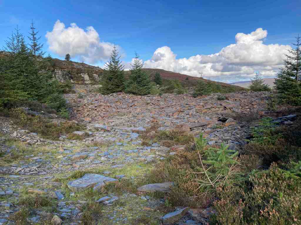


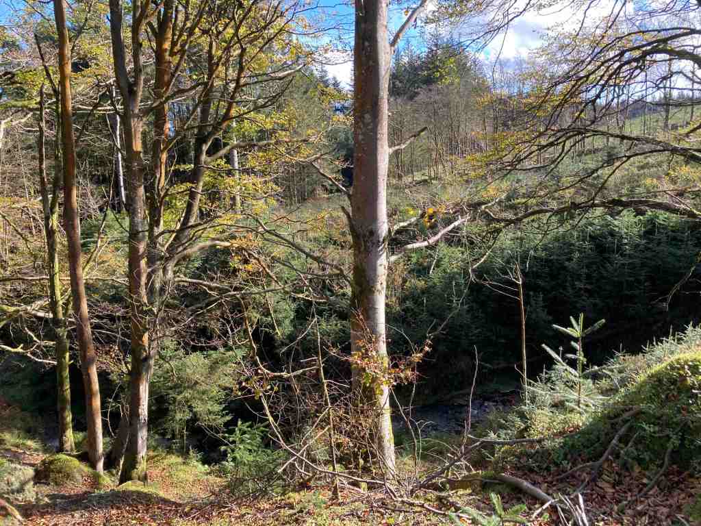

Crossing the stile, this leads to the quarry tracks. It is worth a quick detour to have a look at the quarry area itself to see how large it is, then returning to your path, you will see an imposing mound of logs, even larger than when I last went. There is a track leading from these to the right; start to take that track but turn immediately left down a grassy, stony and possibly wet track. Another path will come in from the left, which you ignore. Just a few yards down the track after this junction keep left on the high ground and you will see that a dry path then detours down into the plantation. This is a delightful little path and you can hear the water cascading down the hillside in a mini waterfall, and the area is green and pleasant. It finishes right in front of the Coffee Cottage, so why not stop and have a coffee? To get back to the car park, whilst still in the forest take the footpath on the right through ‘Go Ape” and it brings you out where you started (alternatively walk along the road).
This is a fairly gently walk. The early part through the plantation is mostly flat with a few yards of gentle uphill here and there. The bulk of the ascent is the climb of South Barrule itself, but it is not especially strenuous and it is a fairly short distance to the top; it will take you no more than 30 mins to reach the summit. It is grassy and there are no really steep parts.
Distance: about 5 miles; Ascent total 1040 ft; descent 1079 ft. If you take the lower track avoiding the muddy footpath, this will add another half mile or so on to the walk and about 100-200ft more ascent.