Moors and coast around Port Erin

It has been fine, sunny and warm weather for a couple of weeks now, with no rain, and here have I been, holed up in my office, looking after my exam students. I was determined to get out this weekend, but as it is TT fortnight, I thought I would wait until later in the day, when it might also be a little cooler.

At 5pm out I strode, up the Golden Road to Meayll Hill. The path was unusually overgrown, which is odd given the lack of rainfall. It is not yet golden and I saw few wildflowers on this section of the path. I stopped every now and again to look back and admire the view of Bradda Head and The Carnanes, catching the odd glimpse between the hills of Niarbyl in the far distance.

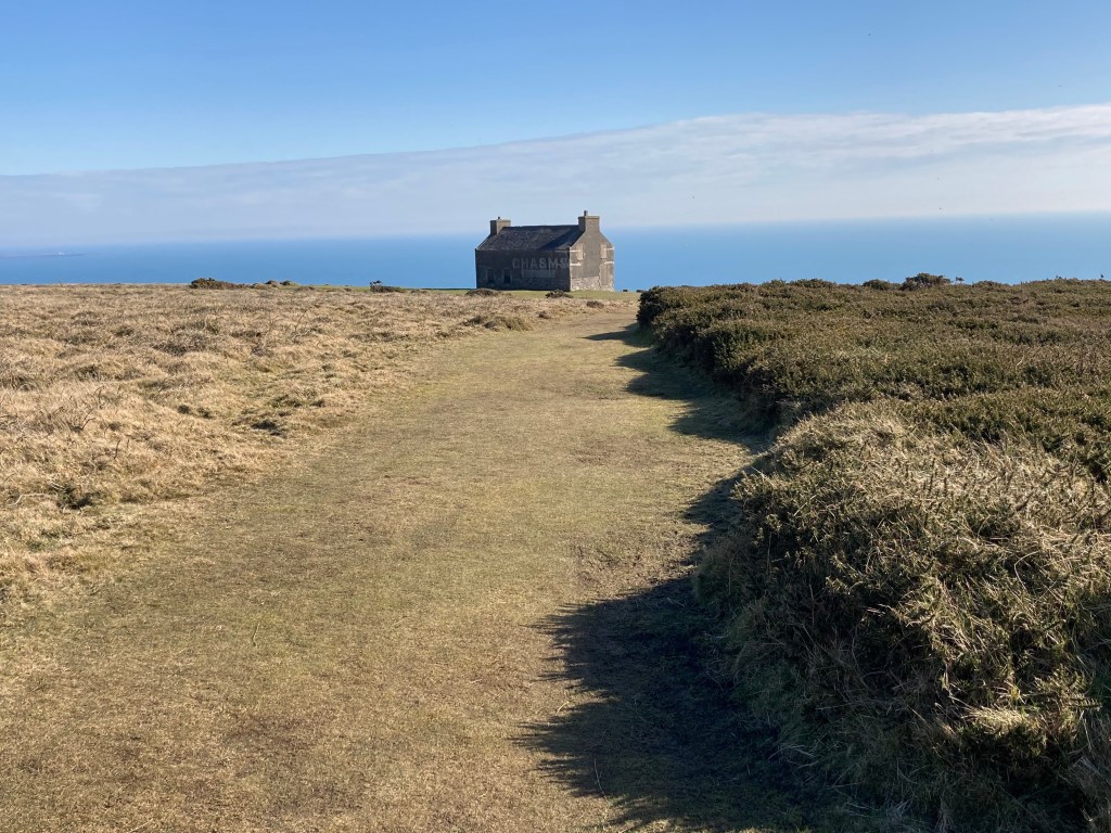
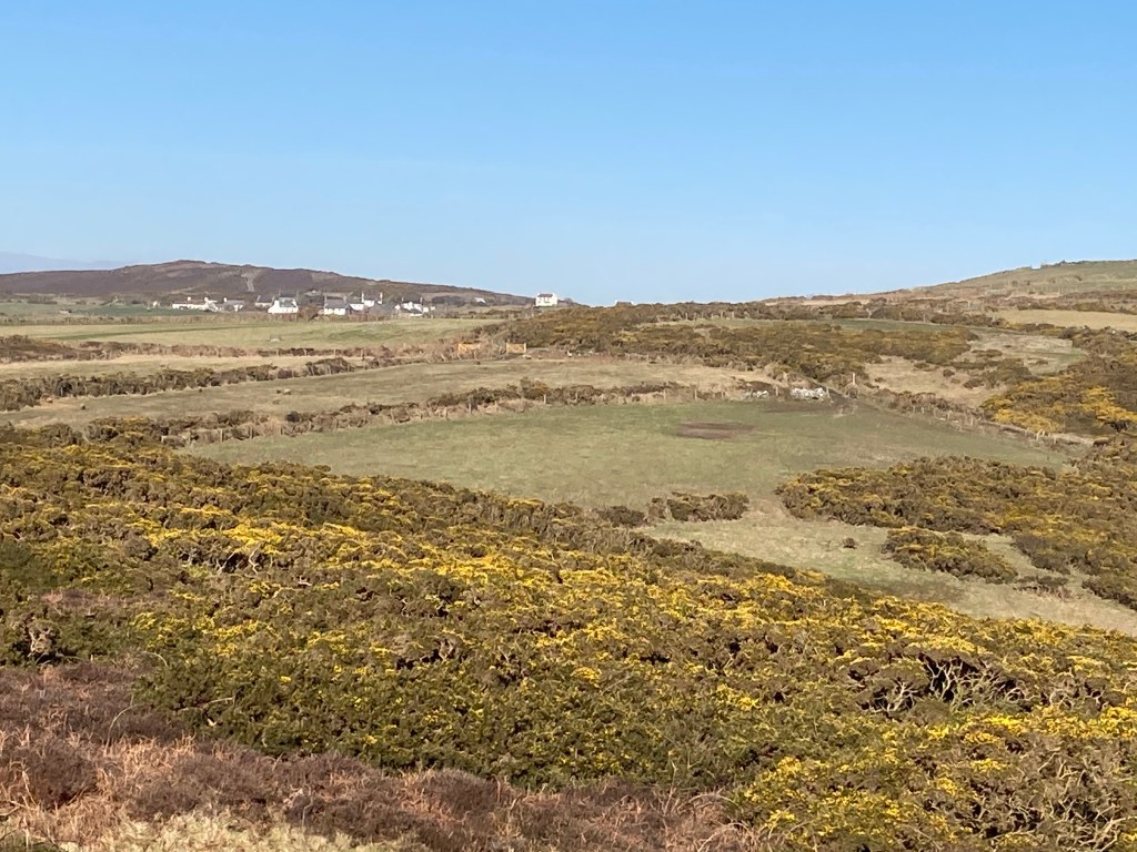
The first section is unavoidably uphill but it is not steep. It is mostly grassy until it reaches a track where there is a house. Just past this, I was treated to the most beautiful song of a linnet, merrily chirping away on a tree just feet from where I was standing. I am now wondering if this was a chaffinch – not the usual habitat of a chaffinch, but it could just be. I have just tried listenting to recording of both linnets and chaffinches and the song wasn’t like either! Any ornathologists out there can let me know. There is a junction of paths here. To the left, the path contours around Meayll Hill to the Howe. Straight on and the path leads over the moors to the stone circle, devoid of colour right now, but by August and September when Southport U3A visit these should be ablaze with colour. I should have expected to see some bikers exploring this ancient monument, so, as I have been there many times before I gave it a miss. Indeed, there were more bikers at the very top so I took a detour and came into Cregneash from the northeastern side.

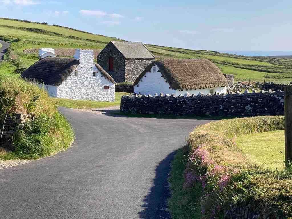
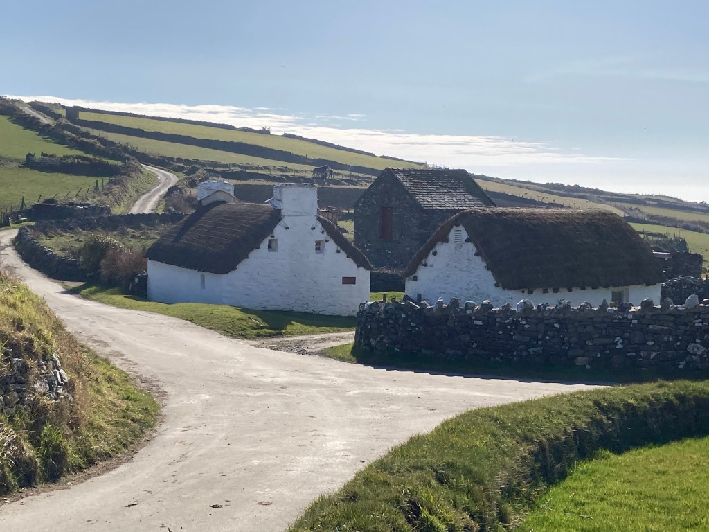
Cregneash looked very sleepy. The cafe and MWT trust shop were closed and there was no-one to be seen. I continued up the road that leads to the Chasms, one of my favourite views being from the vantage point at the top of the hill before the descent to the old cafe.

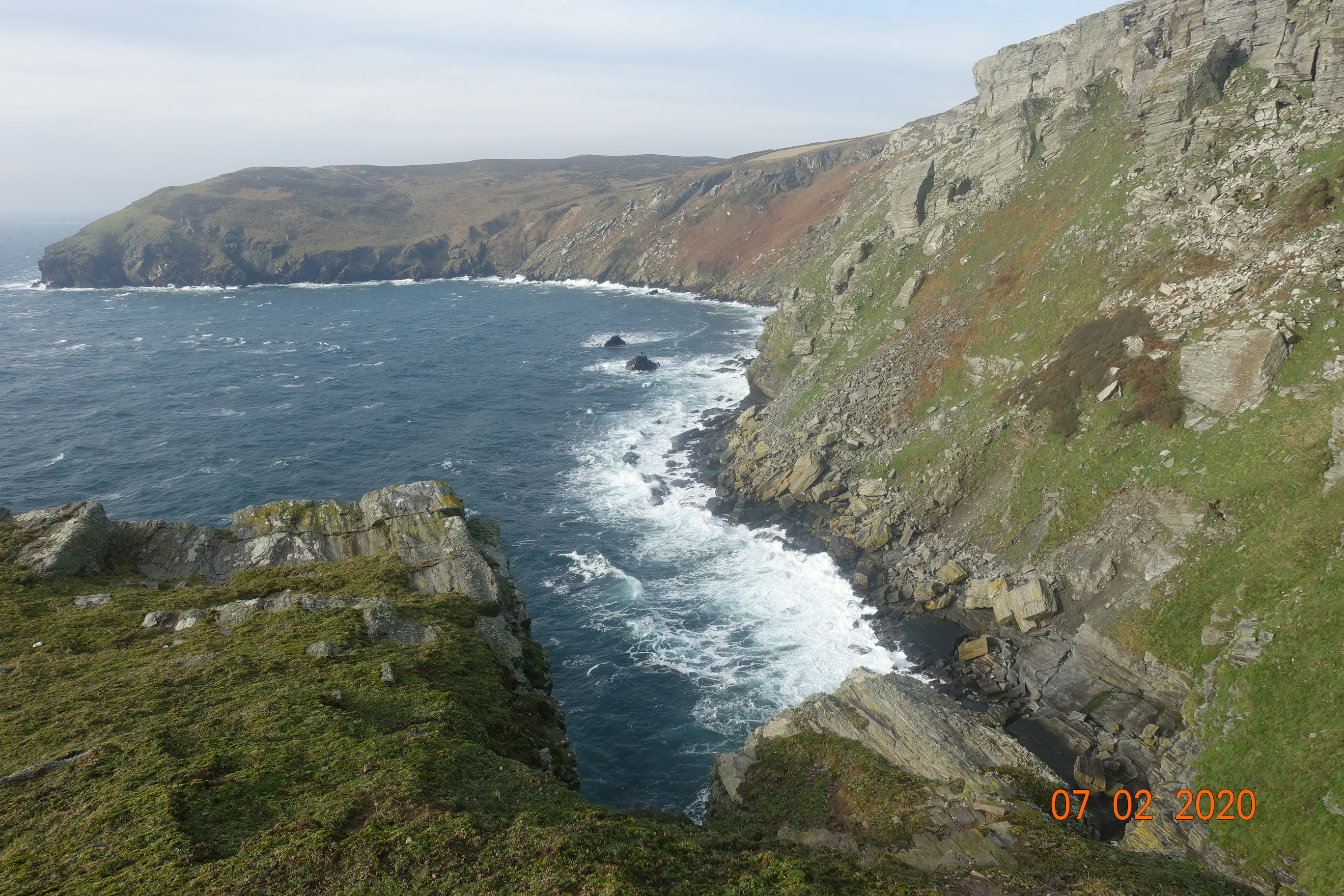
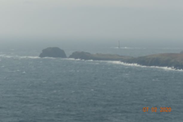
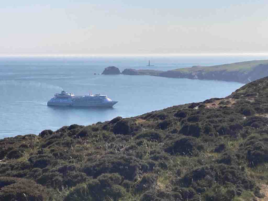
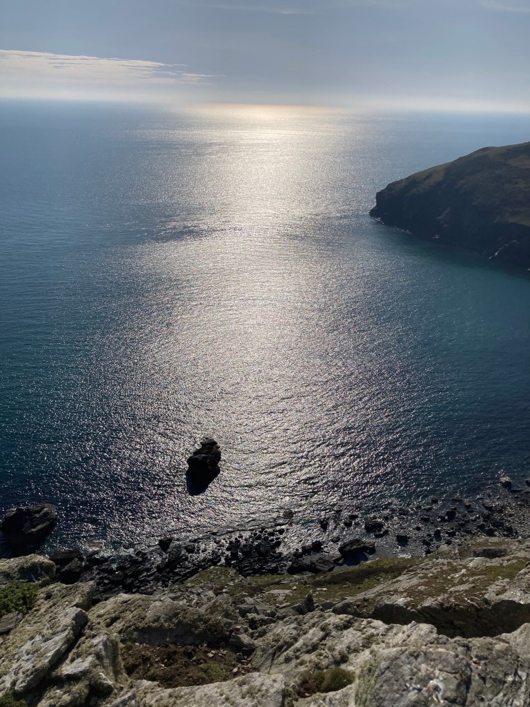
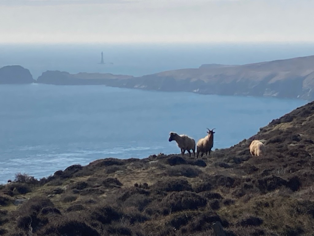
From here, I followed the cliff path to Spanish Head. As I reached the top of Black Head I was surprised to see a cruise ship sitting in the path of the Sound. Apart from a few sounds heralding from the ship, it was otherwise silent. The sun was glistening on the sea and there was a slight mist shrouding the Chicken rock and other distant views.

I was only going as far as the cairn in the next peak, that as far as I know has no name, as this was already about 3 miles. From here, I took a path over the moors back towards Cregneash. I have walked this many times before and usually it is very boggy where the path crosses a stream, but not today. The only muddy paths anywhere were on the farmer’s track leading back into Cregneash.

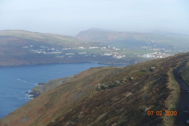
I followed the minor road back down to Port Erin and home. This is always a delightful road to walk down on a summer’s evening as the light falls on the village and makes it look even more attractive, showing off the beach in all its glory. However, I was surprised to see that a very small plantation has been planted half way down the road, just above the Ballaman mansion, which looks as if they are conifers. I am surprised the owners have been given permission to plant everygreens; I would have expected the commisioner to agree to only deciduous trees in that landscape, but what do I know. The trees were heavily covered up in wrapping so I may have been wrong.

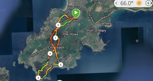
Distance 5.75 miles; just under 1000ft of ascent/descent and a beautifully warm summer evening. What’s not to like?

Cregneash and the Coast – March 7, 2021

At last! I had been waiting for a sunny day in order to take some supplementary photos for a watercolour I am planning to paint. For those who don’t know, the Isle of Man went back into lockdown again almost a week ago, following some unaccounted-for cases of Covid-19. Since then, we have an unusual amount of children and families with the virus and one of my cancer clients has family members affected by the recent outbreak, making it very real. Our 3 week lockdown looks like extending over Easter, but we are a robust island and we cope well with adversity, by and large.

It does make it hard to justify going out, even if we are allowed to go out for exercise for as long as we like. I took the car up to the Cregneash quarry and walked down into the village, where I wanted a particular shot of some of the cottages. There were several cars parked in the quarry so I knew to expect to see people on my walk. I secured my mask around my neck just in case and off I went. As I went through Cregneash I saw a few units of people, singles, family groups and couples all keeping strategically away from each other, or waiting for each other to pass on narrow sections. As I went up the hill towards the coast, the horses didn’t recognise social distancing and galloped from one fence to another to say hello to all and sundry.

At the top of the lane, again there were several cars parked, some of whom no doubt belonged to residents of the cottages, but again it indicated there would be people about, and indeed there were. However, this was my next photo point. One of my painting projects is a view from here looking down toward the Chasms cafe, and I needed to know the lie of the footpath in order to extend my painting. I also needed to know where the sea and sky meet behind it, if you know what I mean. My house faces south, and if I could make a direct path through the hills from my house to the sea this would be the view I would have, so I thought it would be nice to have a bright painting of this scene at midday on my stairwell. It would make me feel alive every time I walk down the stairs. Whether I can accomplish this is an entirely different matter. I only started painting at all in lockdown 1, but four watercolours on and I am doing ok, and they are all hanging on my walls in my house right now 🙂

It wasn’t a bright day and there was a very slight haze, but the sunlight was beautiful on the old Chasms cafe and as I walked along the coast line, I noticed things I don’t normally notice, such as the lichen growing on the rocks and the wave effect on some of the bigger slabs that I would walk over time after time. The light played beautifully on the sea too and I was so glad to be out in this sensational secenery. I paused for a while and watched the sea and listened to the many birds chattering on the Sugar Loaf. Can you spot the sheep grazing on Black Head? No, not the photo with the sheep posing in the middle but the photo next to it of the steep cliff. You may need to enlarge it. How they manage to make their way down there is remarkable.

I only walked as far as Spanish Head, via Black Head, where the Calf of Man looked more like one of the Canary Isles in the haze. From here I turned back returning to Cregneash through the farmers’ fields by a very muddy farm track but not before I snapped what I thought was a Chough, but looking at the wing span I now doubt my judgement.

This was only a short walk, only about 3.5 miles and only just about 500 ft of ascent. You could spend a whole afternoon wandering around these hills and never be bored.

Update: 11th April 2021. This is the painting I have done of this area, a watercolour on board. The wrong kind of material for watercolour. I was advised to score the board before applying the paint, which unfortunately didn’t work and has made the sky almost impossible to paint or cover the scouring marks. For the moorland I used a dabbing technique applying light colours first. This is only my fourth painting, having started during lockdown. The logo is a digital watermark so is not actually on the painting.

Port Erin Circular Coast route – 7th Feb – 10 miles, variable

With Storm Ciara threatening to curtail activities in the next few days and a free day, I decided to catch up on my old favourite and walk from home around the coast, taking in the Sound.

I started from the beach at Port Erin. It was not a particularly nice day, overcast and rather gloomy and a little chilly, but it is always good to get outside and dust off the old cobwebs.

DSC02620
Bradda Head and Milner tower from St Catherine’s Well

I walked up Ballfurt Lane to St Mary’s Lane and turned left to walk along the top road to Port St Mary. At this point I decided to call in home (!) and pick up a woolly hat, and as the day progressed I was so glad I did. The sun wanted to come out but it wasn’t trying very hard and it became very blowy, giving me a taster of what was the follow at the weekend.

DSC02639

When I reached Port St Mary I followed the Underway which is always spectacular when the tide is in as it was today. The seabirds were having a field day as the wind must have whipped up fish close to the shore and they were competing for the best catch.

DSC02638
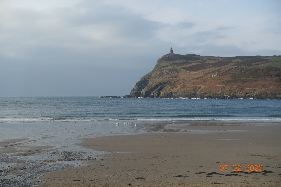
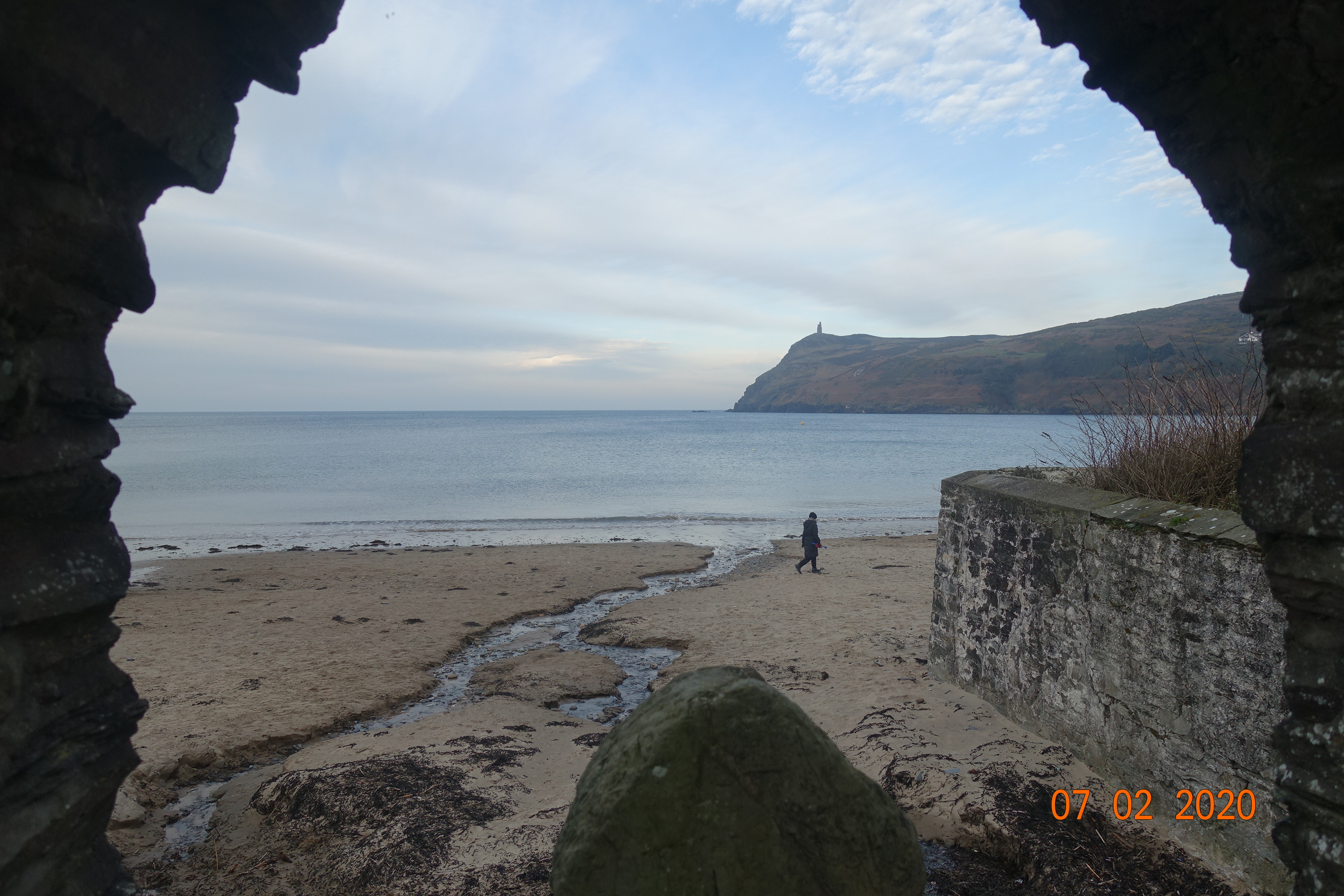
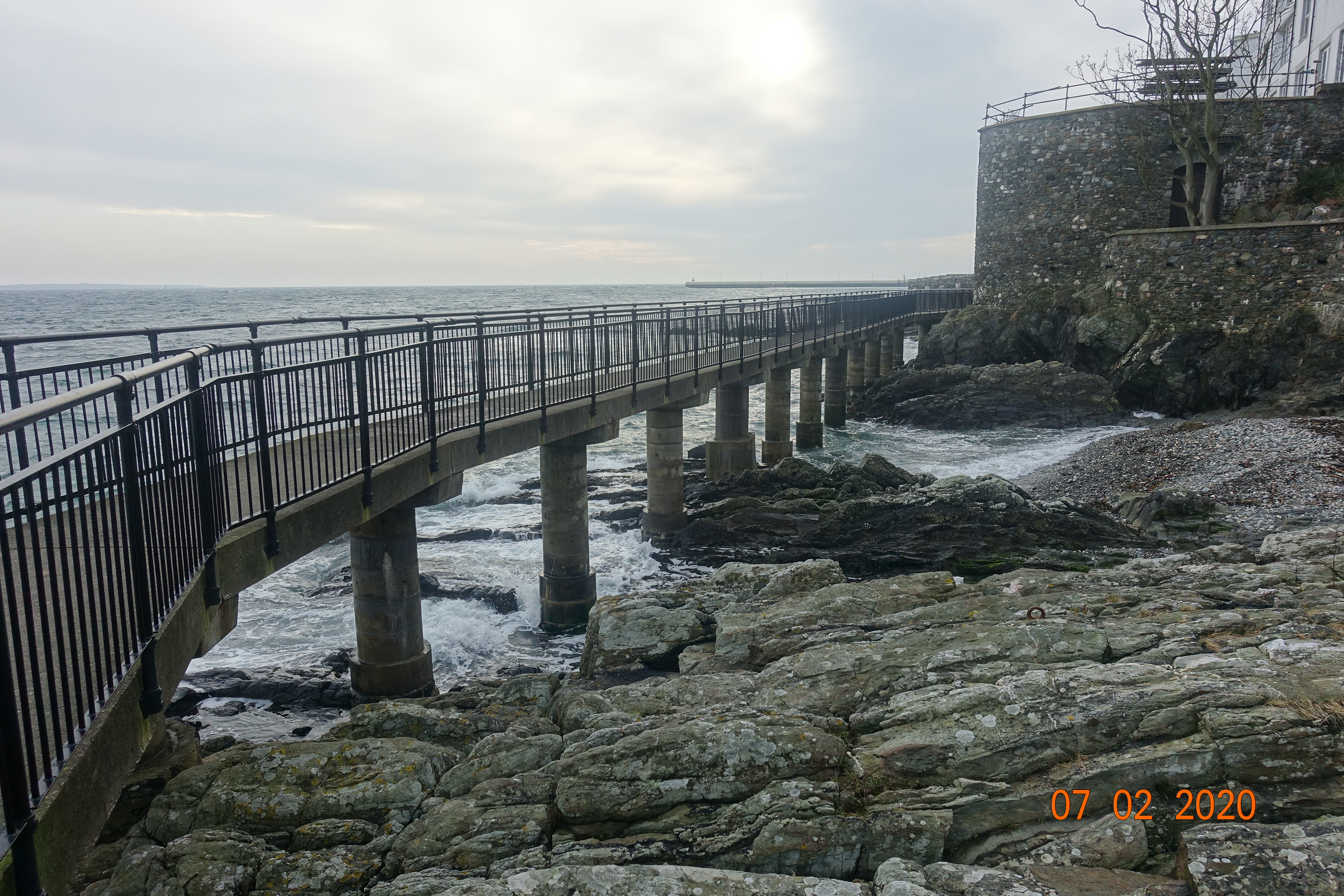
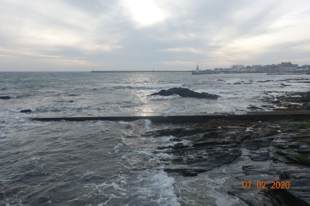
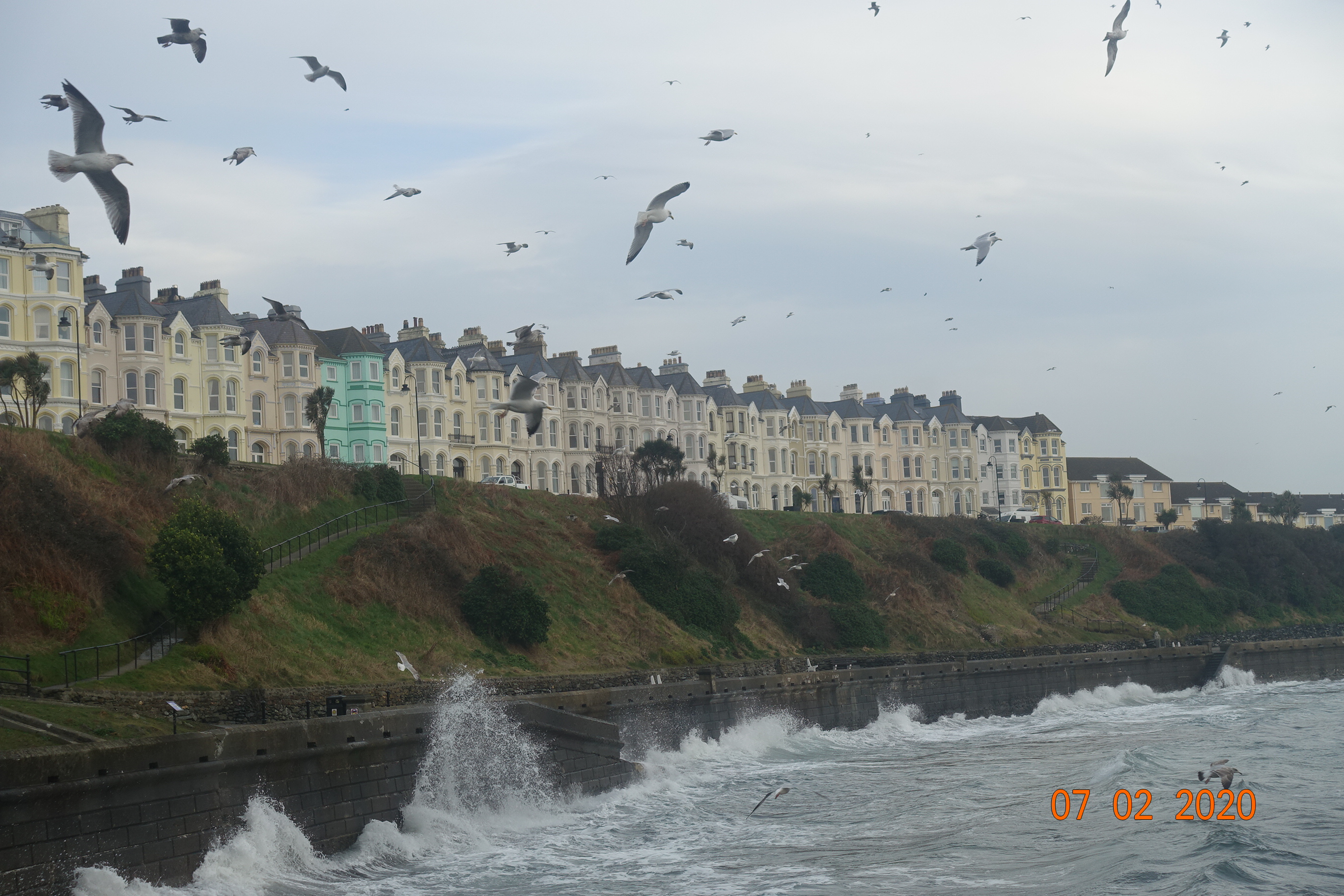
At the harbour where one is no longer protected from the southeasterly wind the seas were swelling, fast and furious. I had walked about 2.5 miles at this point and had planned to call in at the Golf Course cafe for a coffee, but this was closed for refurbishment so I carried out on the path.

Dappled light at PSM
The calm side of the harbour

PSM Lightbhouse

Going round Perwick Bay I bumped into a friend who was monitoring the birds for a survey, today mostly shelducks and oystercatchers on that bit of the coast. I followed the route down the road to Glen Chass which ultimately leads to the Raad Ny Fooillan and grassy footpaths, which one has to share with sheep. There is an alternative route that takes you up higher and on to the Chasms, but I always like the low route as it gives wonderful views of the rocks around the Sugar Loaf and the opportunity for a tiny bit of scrambling.

DSC02673
The steep cliffs of the Chasms

DSC02676
The coastline around the Chasms, looking towards Black Head

By this time, the wind had really got going and I didn’t want to venture too close to edge once I was past the Chasms on Spanish Head. It reminded me of a time several years when I was following this route and the wind was so powerful I had to give up at this point and head to Cregneash as I could barely stand upright. It wasn’t like that today.

Chasms
The deep chasms

The day might be dull but the mountain gorse brightened up the walk significantly. It truly was this yellow and it was delightful.

DSC02686

Ascending the slopes to Black Head I followed the deviating route that hugs the coast. This gives on the first look at the Calf of Man, the small island detached from the Sound. Chicken Rock lighthouse looked cold and forbidding today.  I am including a photo to give you a flavour but it’s not one of my best as it is out of focus though it does create a chilling mystical feel. Even the Drinking Dragon’s head is right down.

Chicken Rock
Chicken Rock Lighthouse on a cold, windy day


DSC02706
Resting places at the Sound, with the Calf of Man in the background and Kitterlands in between. The cafe (and bus stop) is to the right, out of shot.

7 miles and it was lunchtime when I reached the Sound Cafe. It was reasonably busy. It is always a welcome sight on rough days, knowing that however cold or wet you might be, a warm coffee and hot food awaits (as well as toilets). For those not wanting to continue on, it is possible to catch a bus back to Port Erin, but they are not especially frequent.

For those of you who are new to my blog and I have quite a few new followers recently, thank you, I have a chronic condition which leaves me depleted of energy, and breathing and moving my legs can be a little tricky right now. The sensible part of me considered stopping here, but the outdoor and nature lover in me won the day and I carried on, it has to be said with some considerable difficulty along the cliffs to Port Erin. The weather perked up at this point, and although still windy the sun managed to creep through the clouds occasionally and I was well rewarded for my efforts.

CoastlineKamikaze sheep

Notice the Kamikaze sheep on the photo above. You feel if the first one jumps the rest would follow… like sheep! Quite why or how they had got themselves in that position I will never know. It wouldn’t be the most sheltered position.

t

Looking Back
The view back. The Calf is the final cliff in the distance.

Port Erin in the mist
Port Erin emerging from the mist.

Once back at Port Erin I went to the Health Food shop and had a pot of camomile tea before walking home. I was back at 2.15pm having had fish and chips at the Sound as well! The full distance was 10 miles, but that includes lots of ins and outs that you don’t need to do, such as calling in at my house. 8-9 miles is more common for this route. You can also get the bus or train to Port St Mary, which avoids almost all the walking through villages and allows you to concentrate on the footpaths. And you can escape off the cliffs at the Chasms and go to the lovely hamlet of Cregneash where you can get a bus back, or follow a shorter walk over Meayll Hill/The Howe to Port Erin. So, there are lots of options if you want shorter walks.

Port Erin Circular

Distance: 10 miles

Ascent: 1732 ft

Descent: 1572 ft

Maximum elevation 1,028ft.

Saturday’s ‘walk’ (yesterday) was a wander over the Snaefell Hills taking measurements of the peat. I am just awaiting some photos then I will tell you about that. Meanwhile, keep safe and warm and well away from Storm Ciara.